Signs Tagged With Big Green Sign
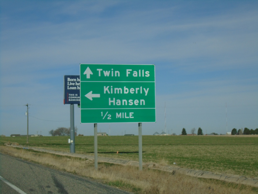
End ID-50 South at US-30
End ID-50 South at US-30. Turn left on US-30 east for Kimberly and Hansen. Continue on US-30 west for Twin Falls.
Taken 04-04-2020

 Kimberly
Twin Falls County
Idaho
United States
Kimberly
Twin Falls County
Idaho
United States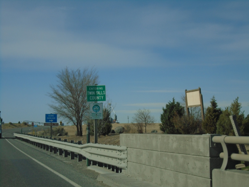
ID-50 South - Twin Falls County
Entering Twin Falls County on ID-50 south.
Taken 04-04-2020
Hansen
Twin Falls County
Idaho
United States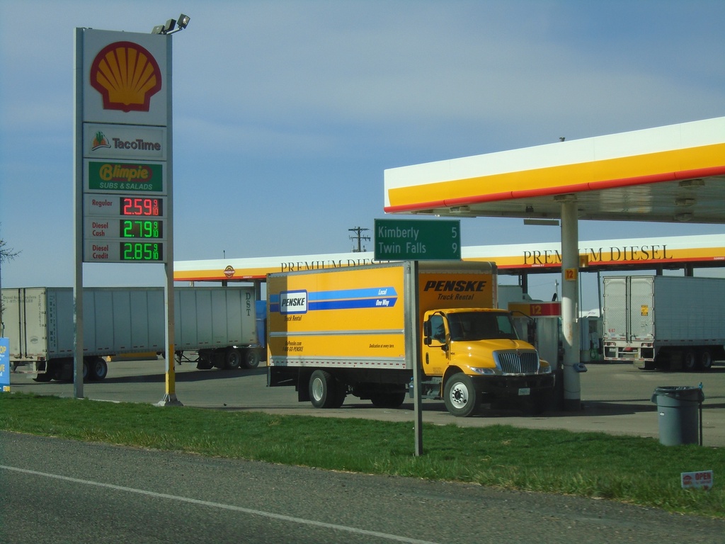
ID-50 South - Distance Marker
Distance marker on ID-50 south. Distance to Kimberly and Twin Falls.
Taken 04-04-2020
Eden
Jerome County
Idaho
United States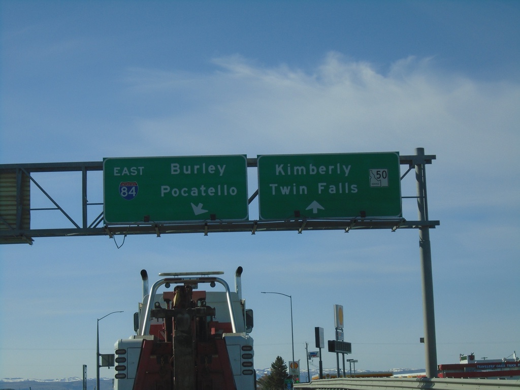
ID-50 South at I-84 East
ID-50 south at I-84 east to Burley and Pocatello. Continue on ID-50 for Kimberly and Twin Falls.
Taken 04-04-2020
 Eden
Jerome County
Idaho
United States
Eden
Jerome County
Idaho
United States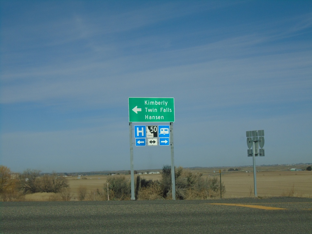
I-84 West - Exit 182 Offramp at ID-50
I-84 West - Exit 182 offramp at ID-50. Turn left for ID-50 west to Kimberly, Hansen, and Twin Falls.
Taken 04-04-2020
Tipperary Corner
Jerome County
Idaho
United States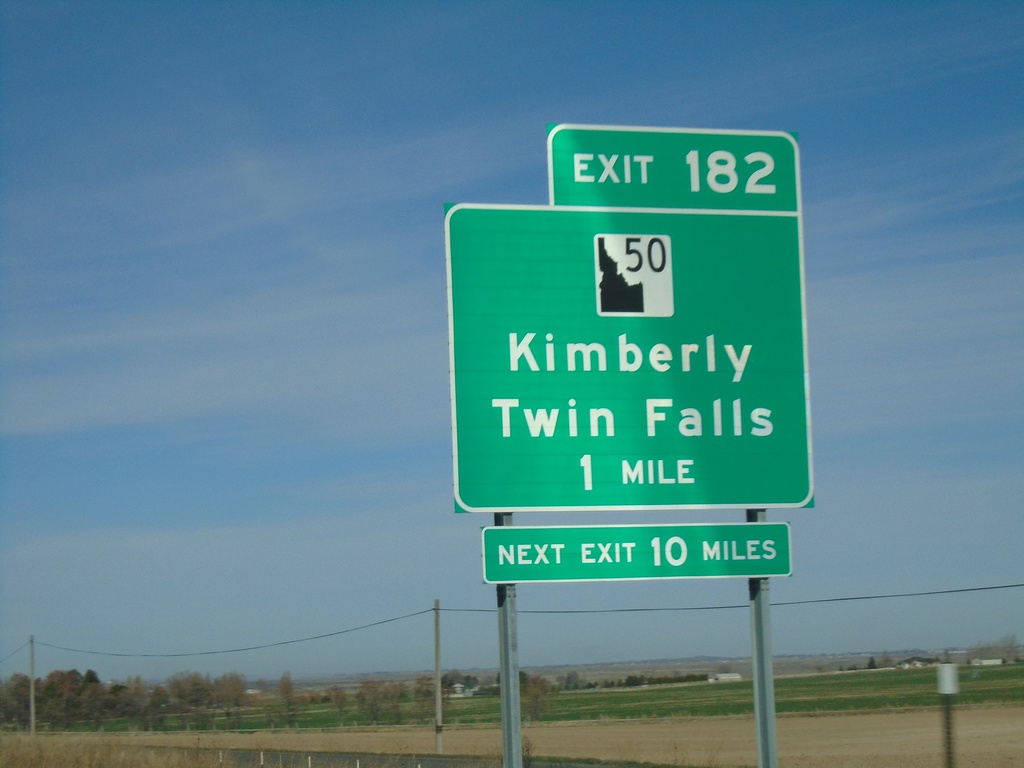
I-84 West - Exit 182
I-84 West approaching Exit 182 - ID-50/Kimberly/Twin Falls.
Taken 04-04-2020
Eden
Jerome County
Idaho
United States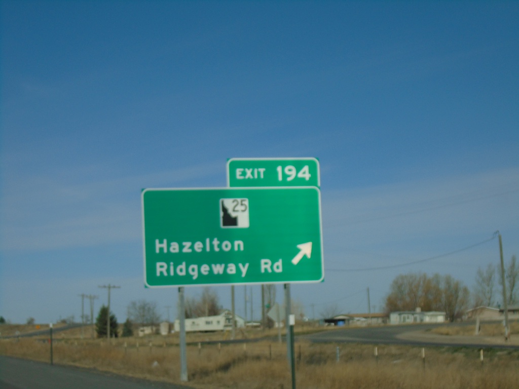
I-84 West - Exit 194
I-84 west at Exit 194 - ID-25/Ridgeway Road/Hazelton. ID-25 west leaves I-84 westbound here. The ID-25 shield is a newer style that has been appearing on guide signs recently.
Taken 04-04-2020
 Hazelton
Jerome County
Idaho
United States
Hazelton
Jerome County
Idaho
United States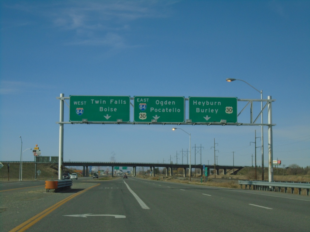
ID-24 West at I-84/US-30
End ID-24 west at I-84/US-30 junction (Exit 211). Use US-30 west for Heyburn and Burley; I-84/US-30 East for Pocatello and Ogden (Utah); I-84 West for Twin Falls and Boise.
Taken 04-04-2020

 Heyburn
Minidoka County
Idaho
United States
Heyburn
Minidoka County
Idaho
United States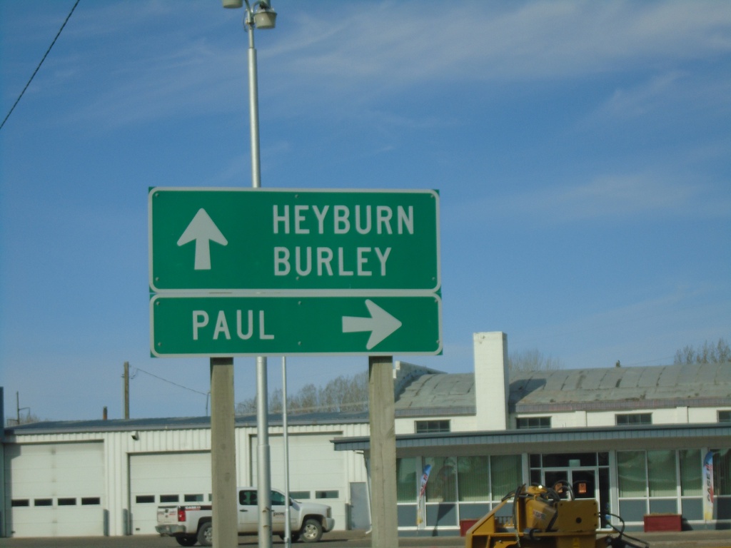
ID-24 East/ID-25 West Split in Rupert
ID-24 East/ID-25 West split in Rupert. Turn right for ID-25 to Paul; continue straight on ID-24 for Heyburn and Burley.
Taken 04-04-2020
Rupert
Minidoka County
Idaho
United States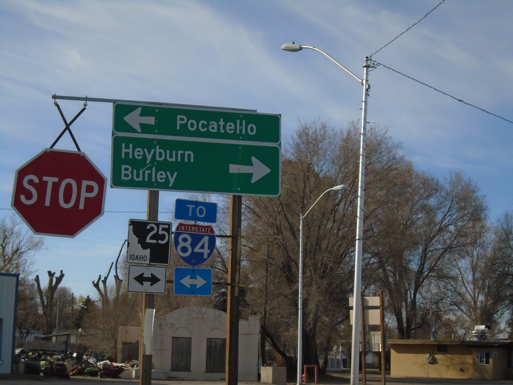
ID-24 East at ID-25 - Rupert
ID-24 East at ID-25 in Rupert. Turn left for ID-25 east to Pocatello; right for ID-24 East /ID-25 West to Burley and Heyburn. Use either direction for I-84. ID-25 joins ID-24 east through Rupert.
Taken 04-04-2020
Rupert
Minidoka County
Idaho
United States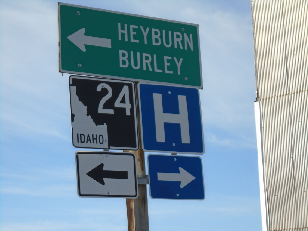
ID-24 - Rupert
ID-24 (Meridian Road) at Baseline Road in Rupert. Turn left on Baseline Road to continue east on ID-24 for Heyburn and Burley.
Taken 04-04-2020
Rupert
Minidoka County
Idaho
United States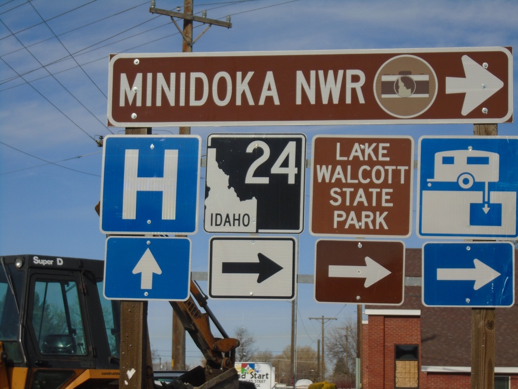
ID-24 - Rupert
ID-24 (Baseline Road) at Meridian Road in Rupert. Turn right on Meridian Road to continue on ID-24 to Minidoka NWR.
Taken 04-04-2020
Rupert
Minidoka County
Idaho
United States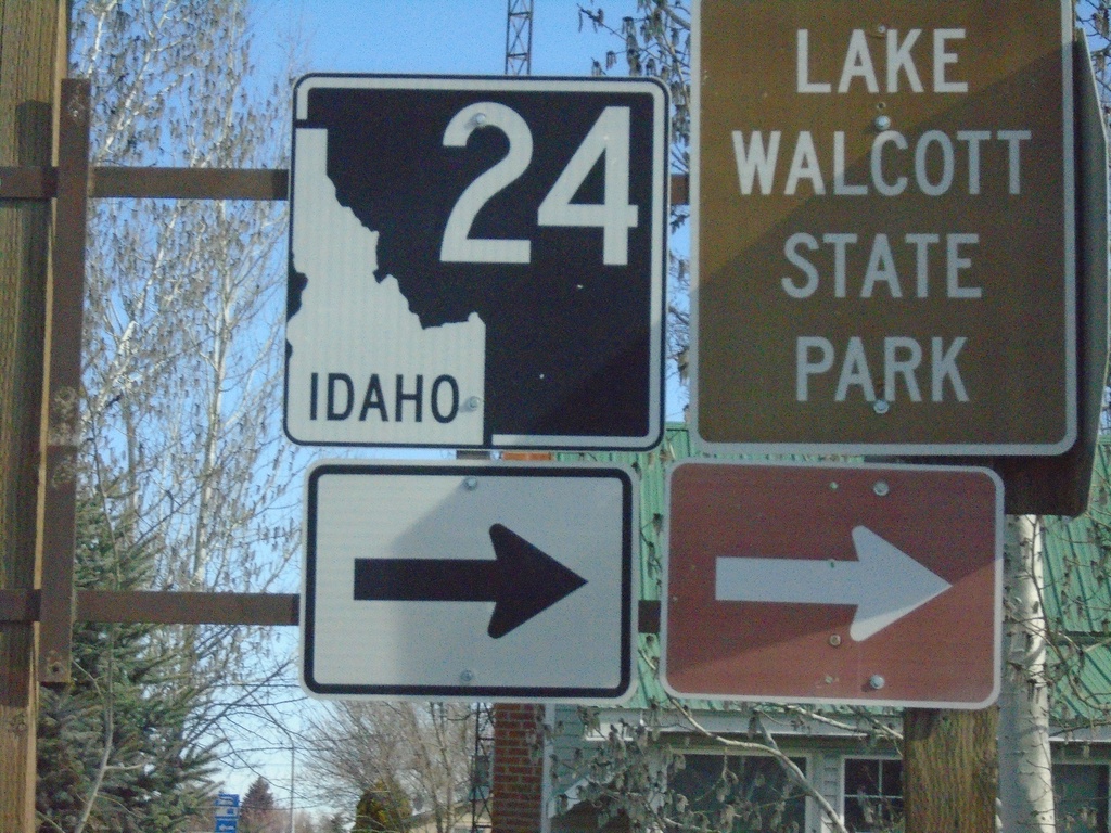
N Meridian Road at ID-24
N Meridian Road at ID-24 west to Lake Walcott State Park
Taken 04-04-2020
Rupert
Minidoka County
Idaho
United States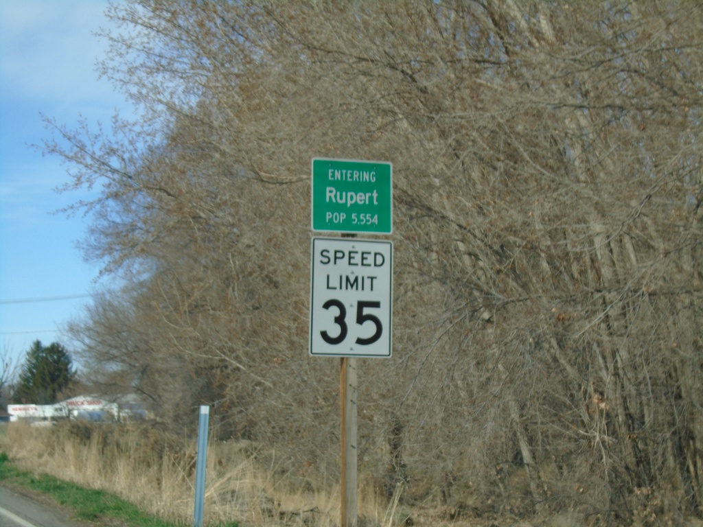
ID-24 East - Rupert
Entering Rupert on ID-24 south. Speed Limit 35 MPH. Rupert is the county seat of Minidoka County.
Taken 04-04-2020
Rupert
Minidoka County
Idaho
United States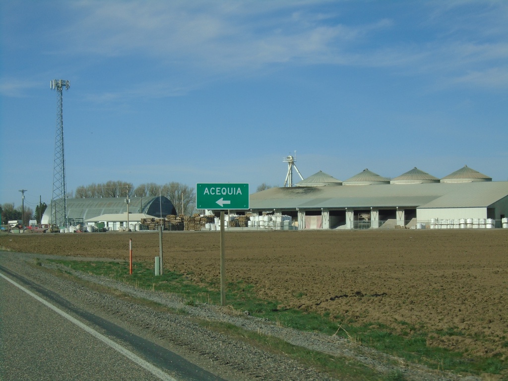
ID-24 East - Acequia
ID-24 east at Acequia junction
Taken 04-04-2020
Rupert
Minidoka County
Idaho
United States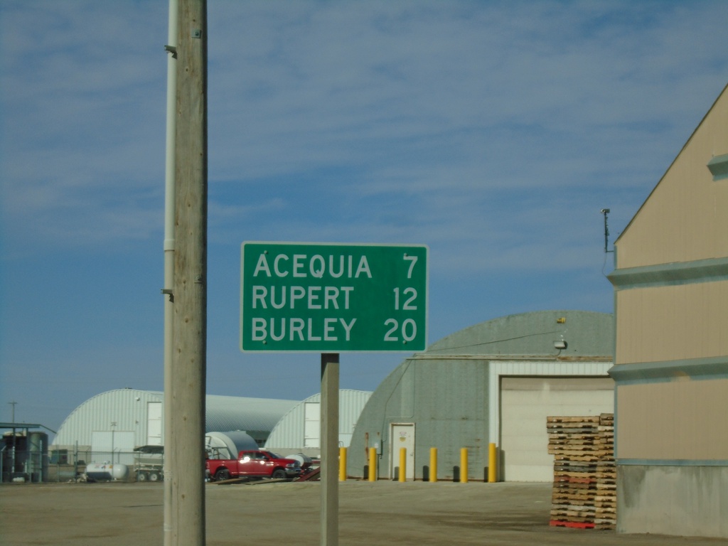
ID-24 East - Distance Marker
Distance market on ID-24 east. Distance to Acequia, Rupert, and Burley.
Taken 04-04-2020
Minidoka
Minidoka County
Idaho
United States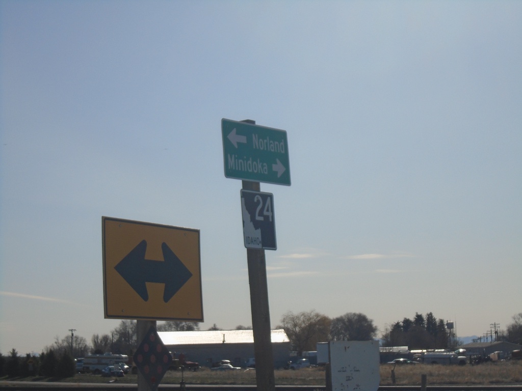
ID-24 West at Minidoka Jct.
ID-24 West at Minidoka Jct. Turn right for Minidoka; left to continue east on ID-24 to Norland.
Taken 04-04-2020
Rupert
Minidoka County
Idaho
United States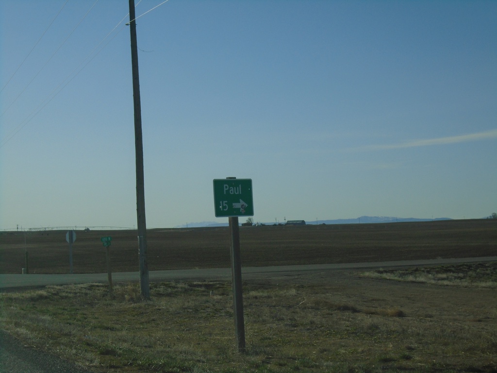
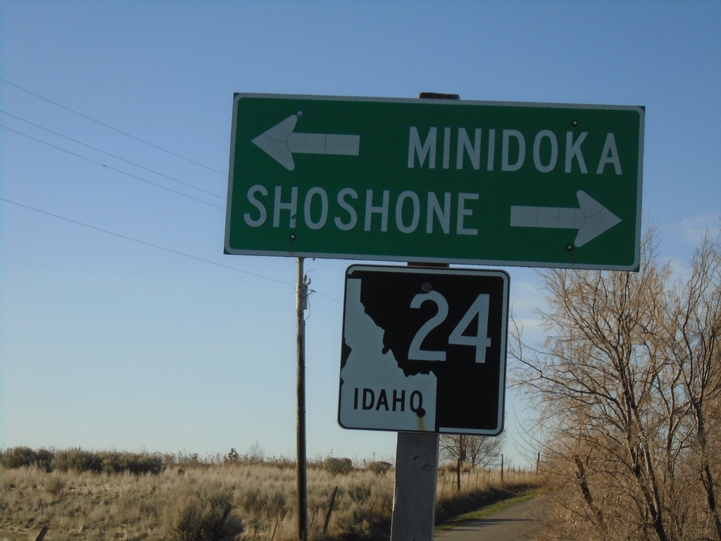
S 700 E at ID-24
S 700 E at ID-24 near Dietrich. Use ID-24 west for Shoshone; ID-24 east for Minidoka.
Taken 04-04-2020
Dietrich
Lincoln County
Idaho
United States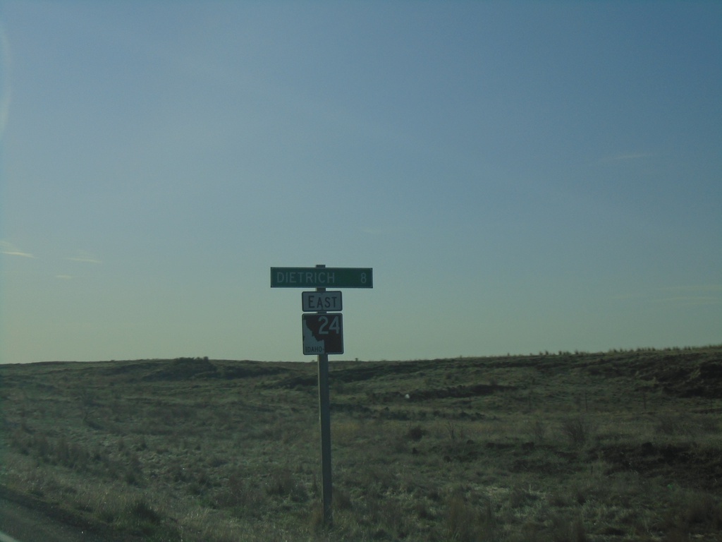
ID-24 East - Distance Marker
Distance marker on ID-24 east. Distance to Dietrich.
Taken 04-04-2020
Shoshone
Lincoln County
Idaho
United States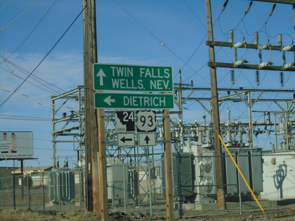
US-93 South at ID-24
US-93 South at ID-24 in Shoshone. Turn left on ID-24 for Dietrich. Continue south on US-93 for Twin Falls and Wells, Nev.
Taken 04-04-2020
 Shoshone
Lincoln County
Idaho
United States
Shoshone
Lincoln County
Idaho
United States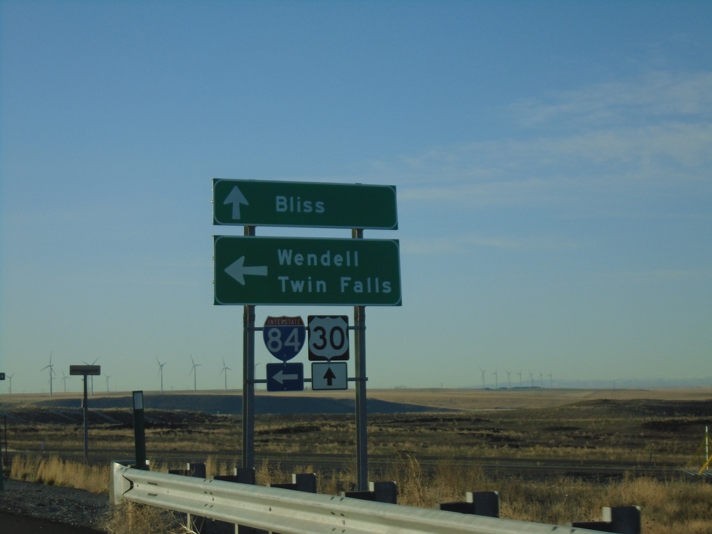
Pioneer Road at I-84/US-30/BL-84
Pioneer Road at I-84/US-30/BL-84 (Exit 137). Turn left for I-84 East to Wendell and Twin Falls; continue straight for US-30/BL-84 to Bliss.
Taken 04-04-2020
 Bliss
Gooding County
Idaho
United States
Bliss
Gooding County
Idaho
United States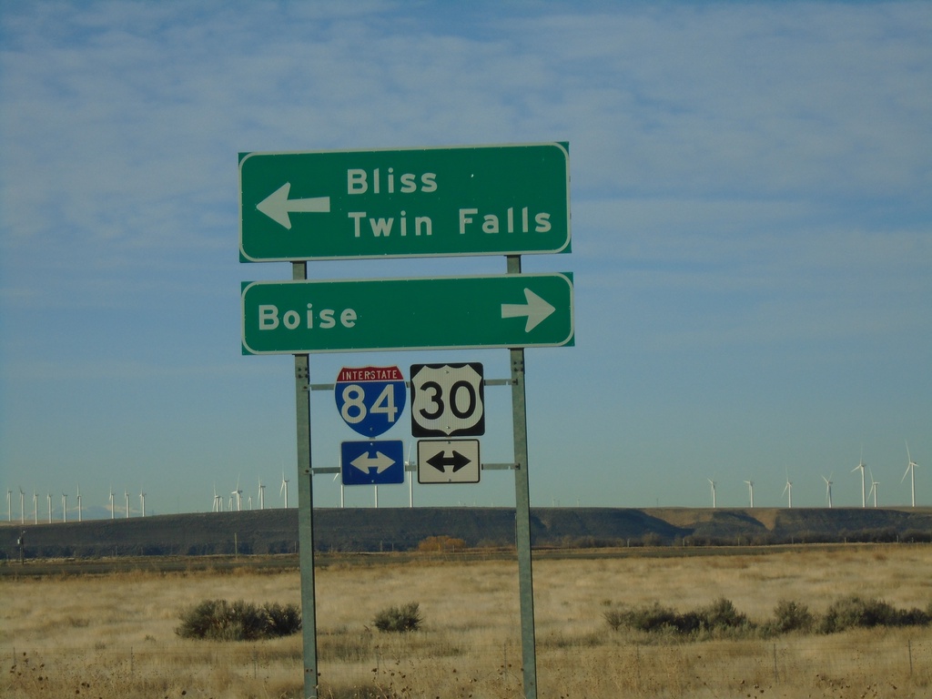
End Pioneer Road (Old US-30) at I-84
End Pioneer Road (Old US-30) at I-84 onramp. Turn right for I-84/US-26/US-30 West to Boise; turn left for I-84/US-26(East) to Twin Falls and US-30 East to Bliss.
Taken 04-04-2020
Bliss
Gooding County
Idaho
United States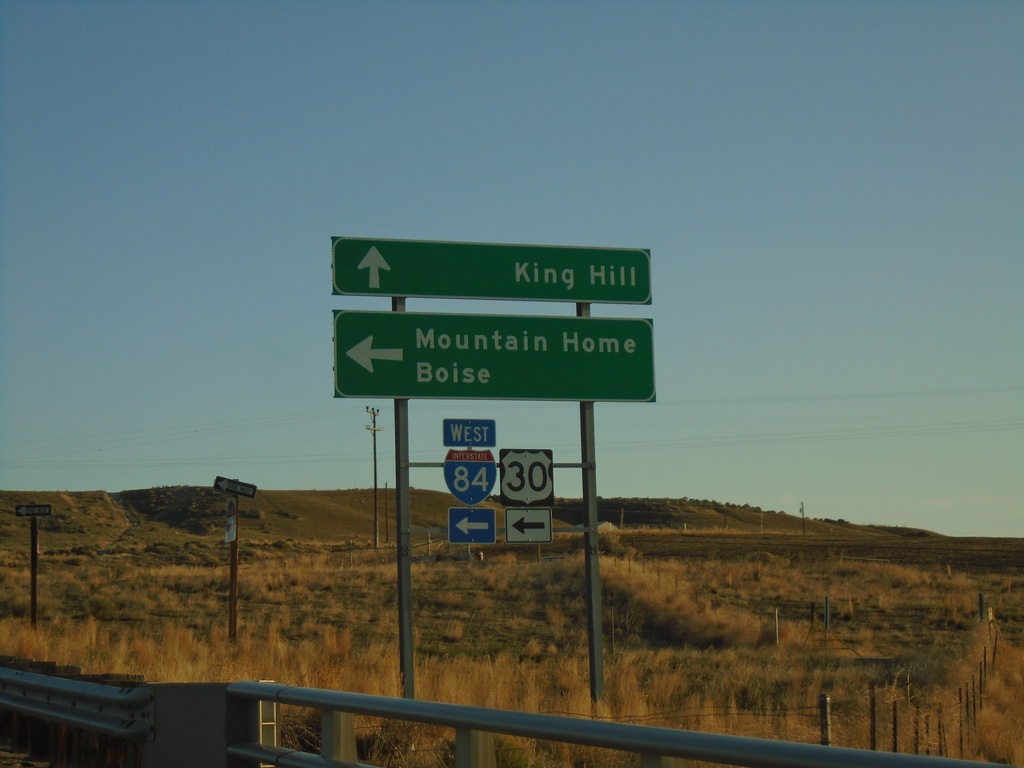
End BL-84 East at I-84/US-30
End BL-84 East at I-84/US-30 junction. Turn left on I-84/US-30 west towards Boise and Mountain Home. Continue straight ahead for Old US-30 towards King Hill.
Taken 04-04-2020
Glenns Ferry
Elmore County
Idaho
United States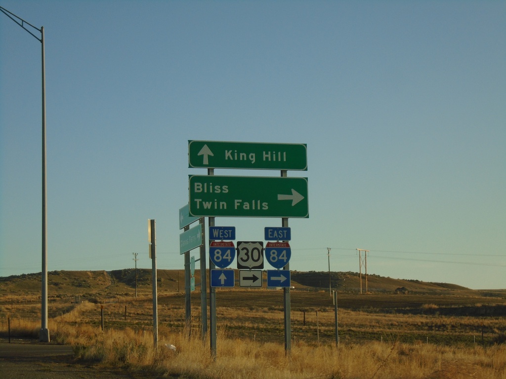
End BL-84 East at I-84
End BL-84 East at I-84/US-30 junction (Exit 121). Turn right for I-84/US-30 East to Bliss and Twin Falls. Roadway continues as Old US-30 to King Hill.
Taken 04-04-2020
Glenns Ferry
Elmore County
Idaho
United States