Signs Tagged With Big Green Sign
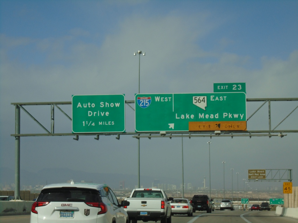
I-11 North - Exits 22 and Exit 62
I-11 north approaching Exit 22 - I-215 West/NV-564/Lake Mead Parkway. Approaching I-515 Exit 62 - Auto Show Drive. This is the north end of I-11. US-93 and US-95 join I-515 northbound. I-515 begins here northbound.
Taken 11-27-2019


 Henderson
Clark County
Nevada
United States
Henderson
Clark County
Nevada
United States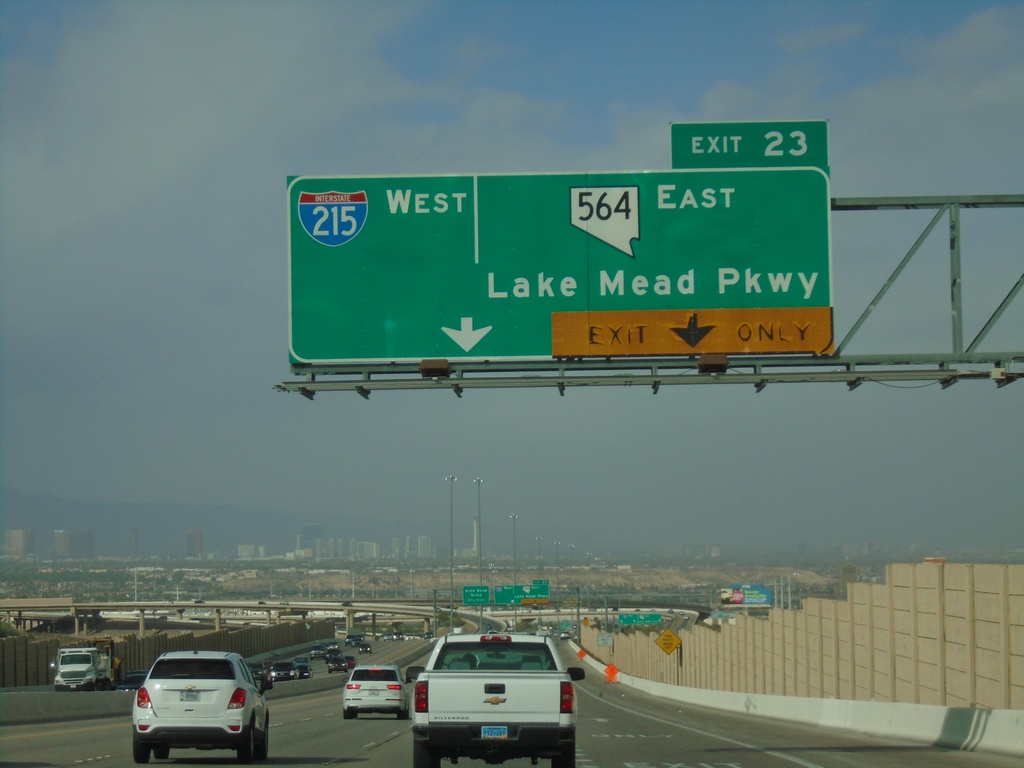
I-11 North - Exit 22
I-11 North approaching Exit 23 - I-215 West/NV-564 East/Lake Mead Parkway
Taken 11-27-2019
Henderson
Clark County
Nevada
United States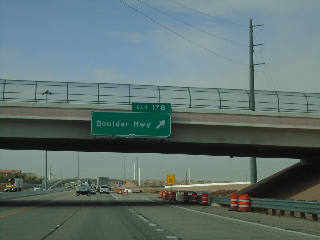
I-11 North - Exit 17B
I-11 north at Exit 17B - Boulder Highway (NV-582)
Taken 11-27-2019
 Henderson
Clark County
Nevada
United States
Henderson
Clark County
Nevada
United States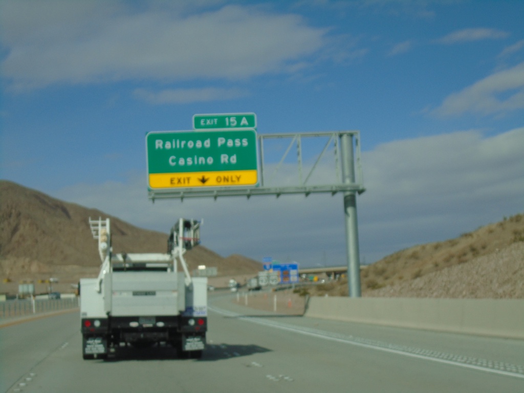
I-11 North - Exit 15A
I-11 north at Exit 15A - Railroad Pass Casino Road
Taken 11-27-2019
Boulder City
Clark County
Nevada
United States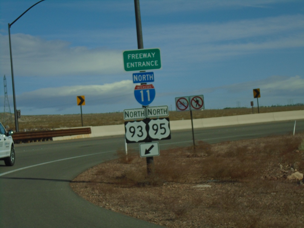
US-95 North at I-11/US-93
US-95 North at I-11/US-93 (Exit 14) in Boulder City. Merge right for I-11/US-93/US-95 north onramp. US-95 joins US-93 north to I-15 in Las Vegas.
Taken 11-27-2019
 Boulder City
Clark County
Nevada
United States
Boulder City
Clark County
Nevada
United States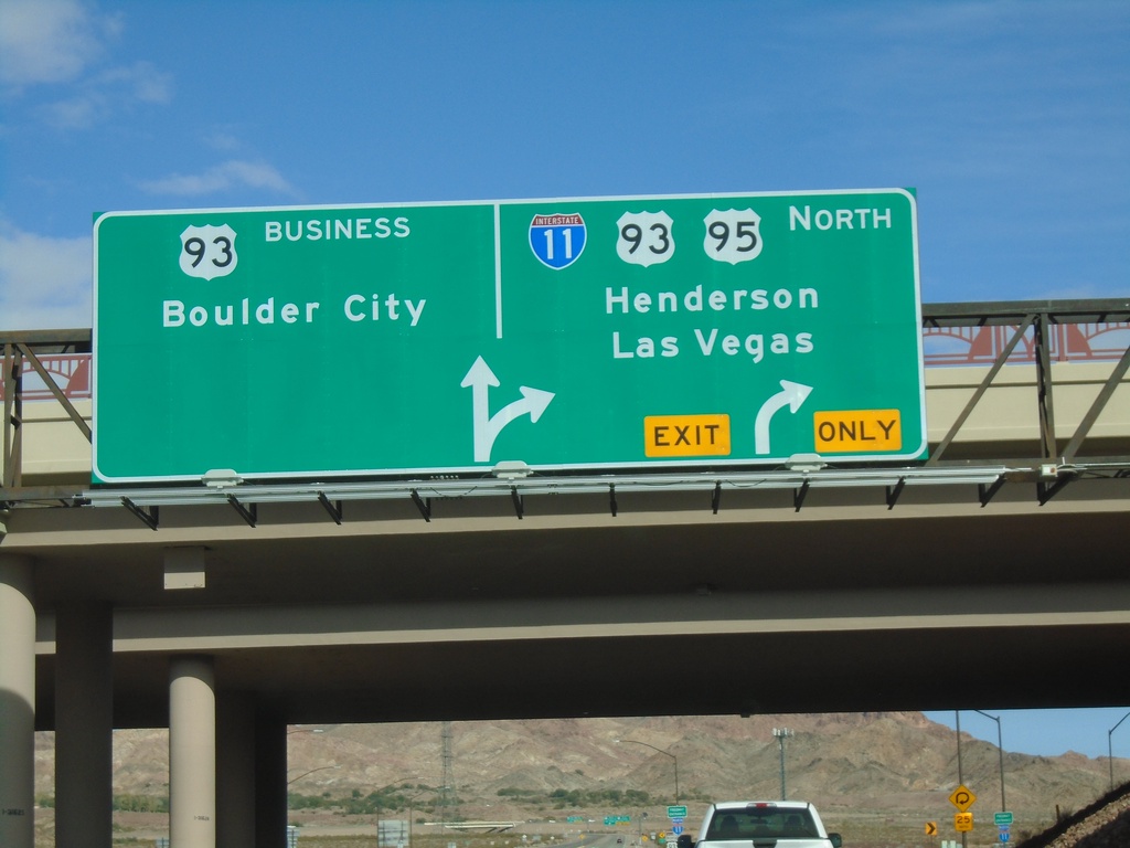
US-95 North at I-11/US-93/NV-173
US-95 North at I-11/US-93/US-95 North/Henderson/Las Vegas. Continue north for NV-173 to Bus. US-93/Boulder City.
Taken 11-27-2019
 Boulder City
Clark County
Nevada
United States
Boulder City
Clark County
Nevada
United States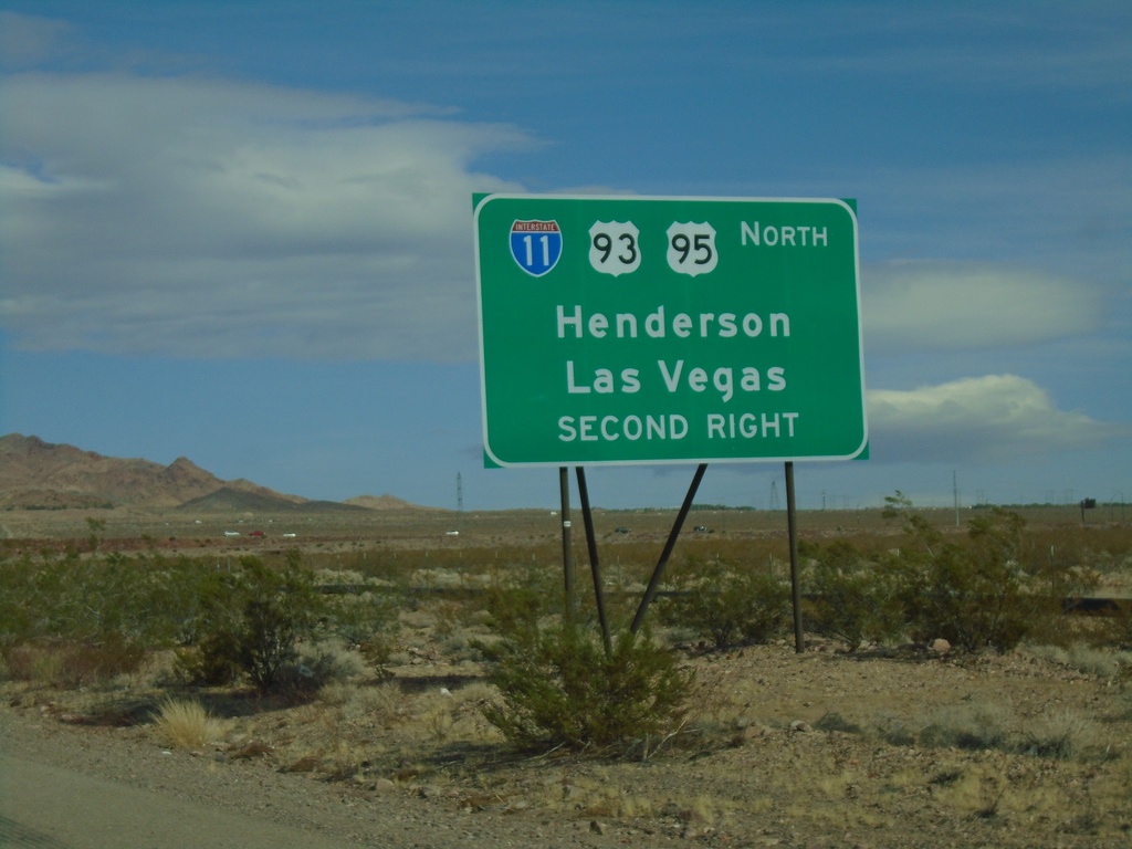
US-95 North Approaching I-11/US-93 North
US-95 North approaching I-11/US-93 North to Henderson and Las Vegas (Exit 14).
Taken 11-27-2019
Boulder City
Clark County
Nevada
United States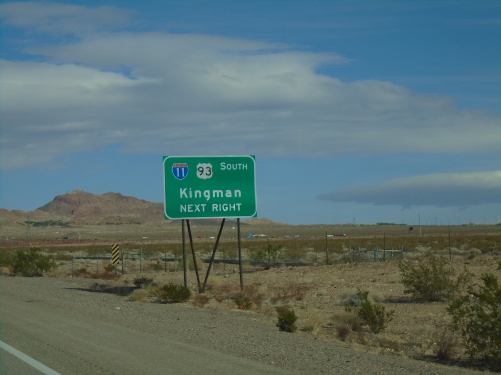
US-95 North Approaching I-11/US-93 South
US-95 North approaching I-11/US-93 South (Exit 14) to Kingman (Arizona)
Taken 11-27-2019
Boulder City
Clark County
Nevada
United States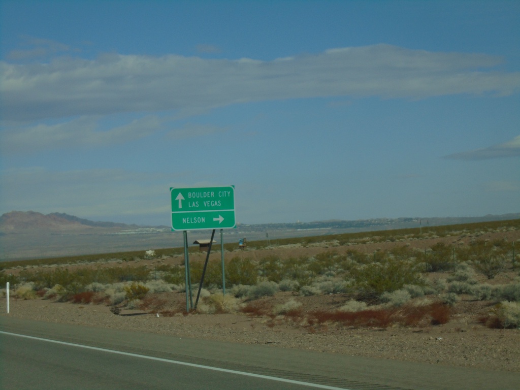
US-95 North Approaching NV-165
US-95 North approaching NV-165 east to Nelson. Continue north on US-95 for Boulder City and Las Vegas.
Taken 11-27-2019
 Boulder City
Clark County
Nevada
United States
Boulder City
Clark County
Nevada
United States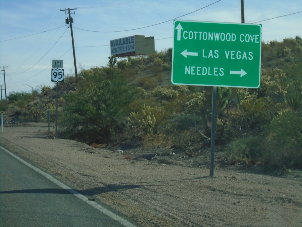
End NV-164 East at US-95
End NV-164 East at US-95 in Searchlight. Turn right for US-95 south to Needles (CA); left for US-95 north to Las Vegas. Continue straight for Cottonwood Cove Road to Cottonwood Cove.
Taken 11-27-2019
 Searchlight
Clark County
Nevada
United States
Searchlight
Clark County
Nevada
United States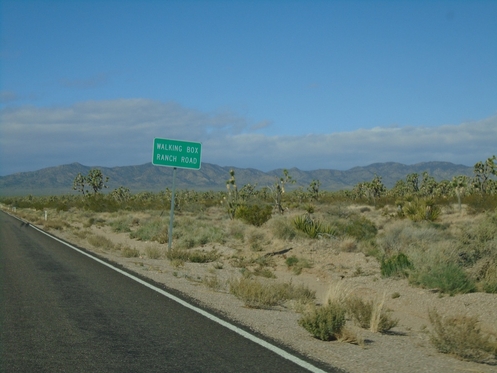
NV-164 West - Walking Box Ranch Road
NV-164 West at Walking Box Ranch Road
Taken 11-27-2019
Searchlight
Clark County
Nevada
United States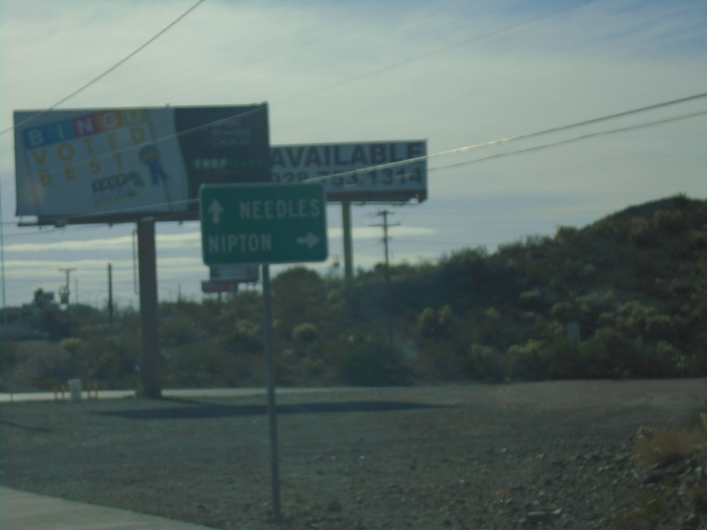
US-95 South at NV-164 West
US-95 South at NV-164 West to Nipton (California). Continue south on US-95 for Needles (California).
Taken 11-27-2019
Searchlight
Clark County
Nevada
United States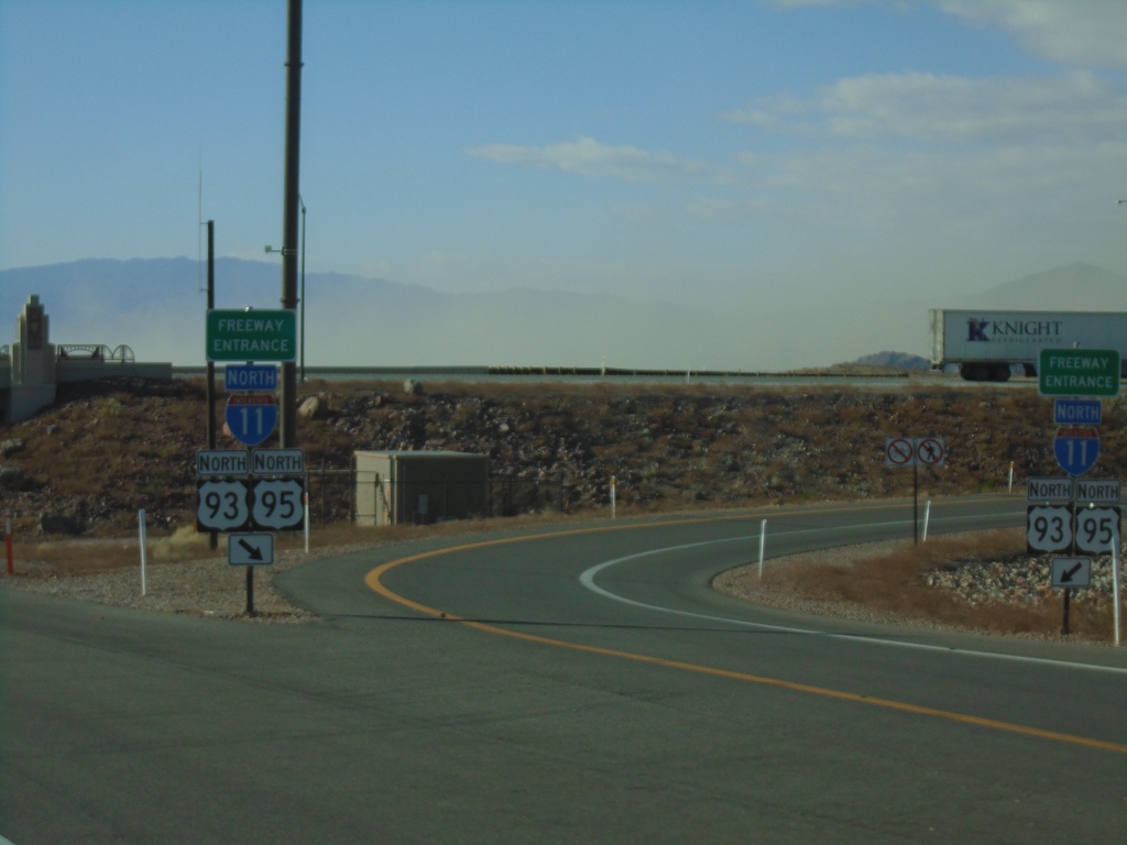
End NV-173 South at I-11/US-93/US-95 North
End NV-173 South at I-11/US-93/US-95 North (Exit 14) onramp. Roadway turns into US-95 southbound.
Taken 11-27-2019
Boulder City
Clark County
Nevada
United States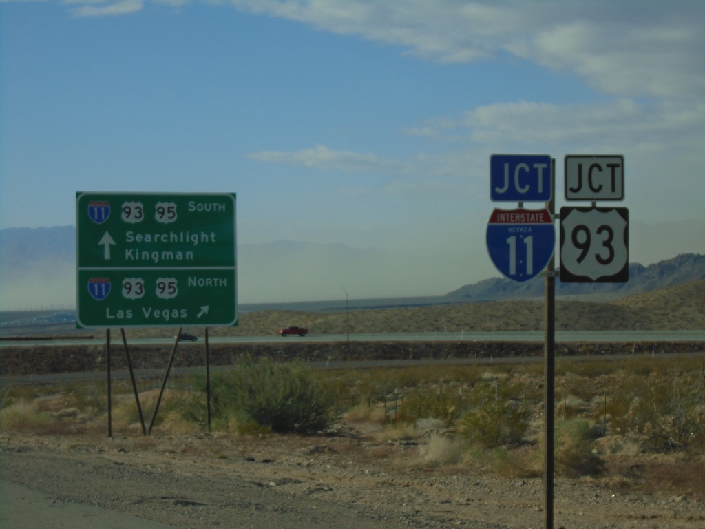
End NV-173 South at I-11/US-93/US-95
End NV-173 South at I-11/US-93/US-95 in Boulder City. Use I-11/US-93/US-95 north for Las Vegas; use I-11/US-93 South for Kingman (Arizona); use US-95 south for Searchlight.
Taken 11-27-2019
Boulder City
Clark County
Nevada
United States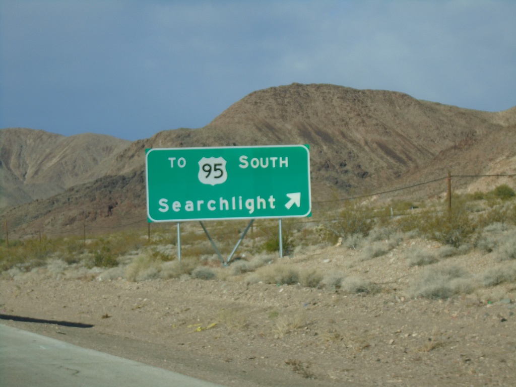
Bus. US-93 North at NV-173
Bus. US-93 North at NV-173 in Boulder City. Use exit for TO US-95 South/Searchlight. This was the former intersection of US-93 and US-95, which was moved south a short distance with the construction of I-11. A short connector highway, NV-173, connects this intersection with US-95 at I-11.
Taken 11-27-2019
Boulder City
Clark County
Nevada
United States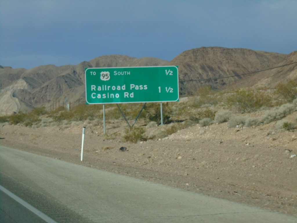
Bus. US-93 North - Distance Marker
Distance marker on Bus. US-93 north in Boulder City. Distance to US-95 South and Railroad Pass Casino Road
Taken 11-27-2019
Boulder City
Clark County
Nevada
United States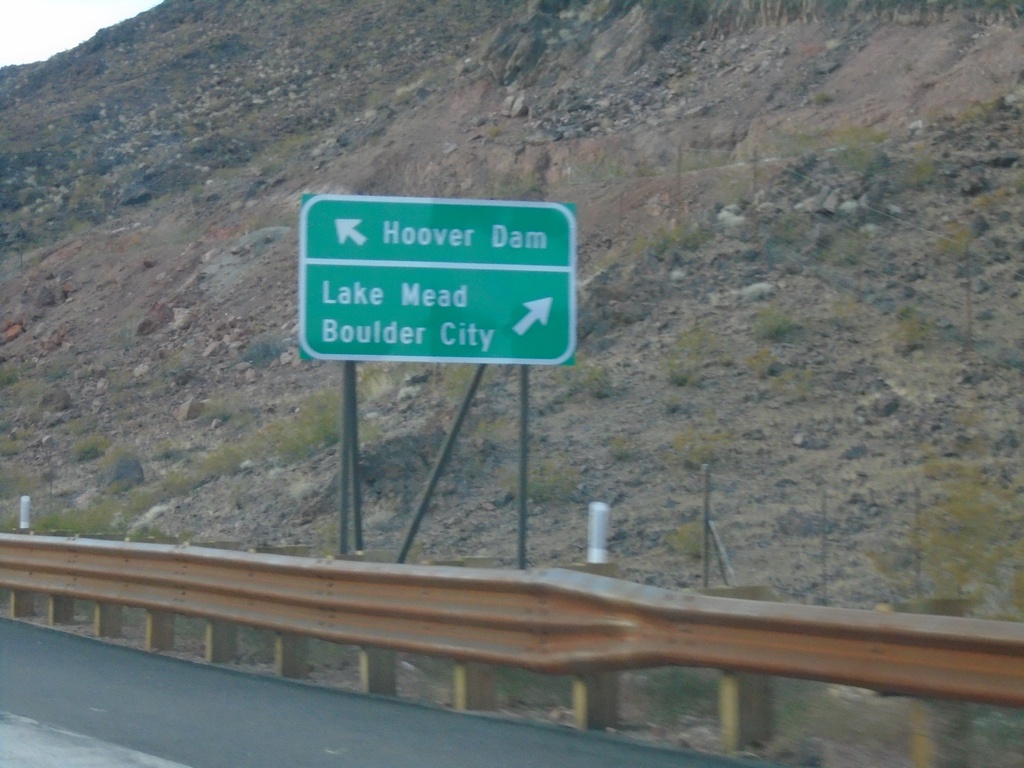
I-11 North - Exit 2 Offramp
I-11 north at Exit 2 offramp. Merge left for NV-172 to Hoover Dam. Merge right for Bus. US-93 North to Boulder City and Lake Mead.
Taken 11-26-2019
 Boulder City
Clark County
Nevada
United States
Boulder City
Clark County
Nevada
United States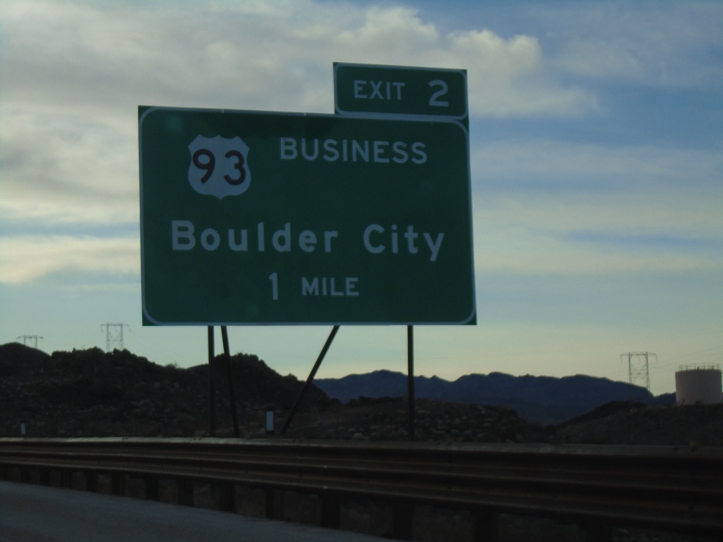
I-11 North - Exit 2
I-11 north approaching Exit 2 - Bus. US-93/Boulder City
Taken 11-26-2019
Boulder City
Clark County
Nevada
United States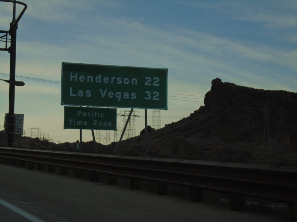
I-11 North - Distance Marker / Pacific Time
First distance marker on I-11 north in Nevada. Distance to Henderson and Las Vegas. Entering Pacific Time Zone.
Taken 11-26-2019
Boulder City
Clark County
Nevada
United States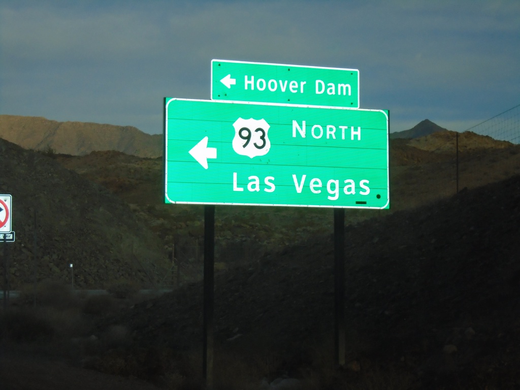
Kingman Wash Access Road at US-93 North
Kingman Wash Access Road at US-93 North to Las Vegas (Nevada) and Hoover Dam.
Taken 11-26-2019
Willow Beach
Mohave County
Arizona
United States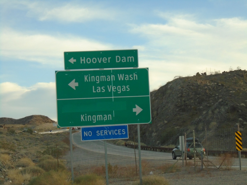
US-93 South - Exit 2 Offramp at Kingman Wash Road
US-93 South - Exit 2 offramp at Kingman Wash Road. Turn left for Kingman Wash, Hoover Dam, and Las Vegas (NV). Turn right for Kingman (via US-93 south). Access to Hoover Dam involves crossing back into Nevada to Exit 2, and then returning back to the dam.
Taken 11-26-2019
Willow Beach
Mohave County
Arizona
United States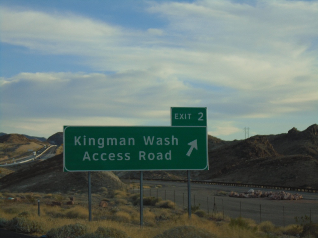
US-93 South - Exit 2
US-93 south at Exit 2 - Kingman Wash Access Road. Kingman Wash Access Road is the former route of US-93 across the Hoover Dam.
Taken 11-26-2019
Temple Bar Marina
Mohave County
Arizona
United States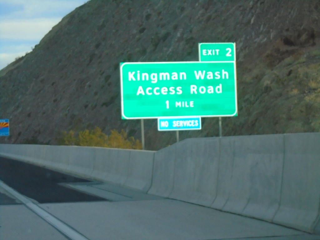
US-93 South - Exit 2
US-93 south approaching Exit 2 - Kingman Wash Access Road. Kingman Wash Access Road is the former routing of US-93. The Arizona welcome sign is partially visible in the background of the photo.
Taken 11-26-2019
Kingman
Mohave County
Arizona
United States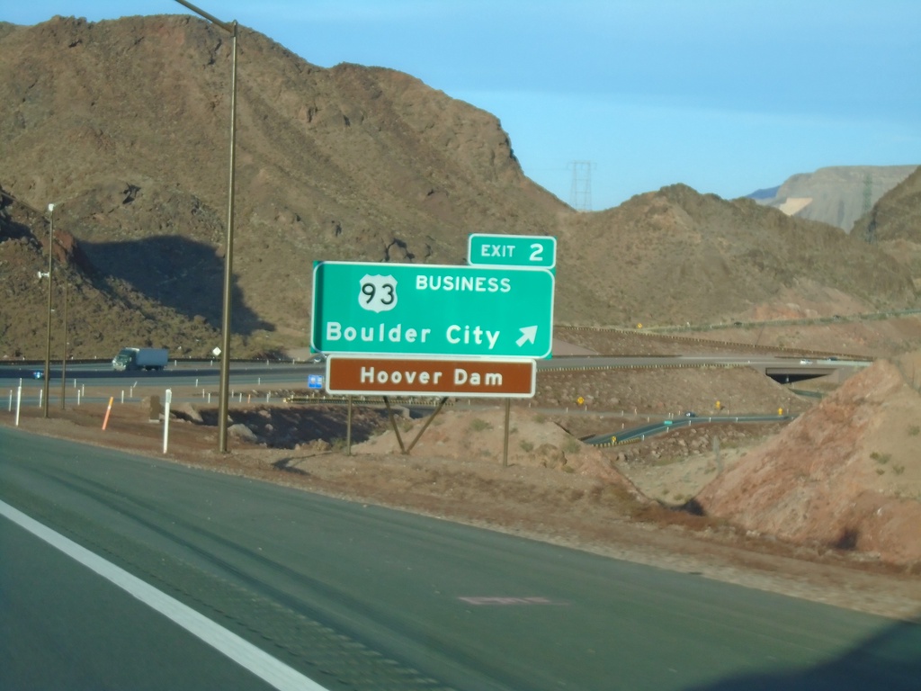
I-11 South - Exit 2
I-11 south at Exit 2 - US-93 Business/Boulder City. Access to Hoover Dam. This is the last exit on I-11 southbound in Nevada.
Taken 11-26-2019
Boulder City
Clark County
Nevada
United States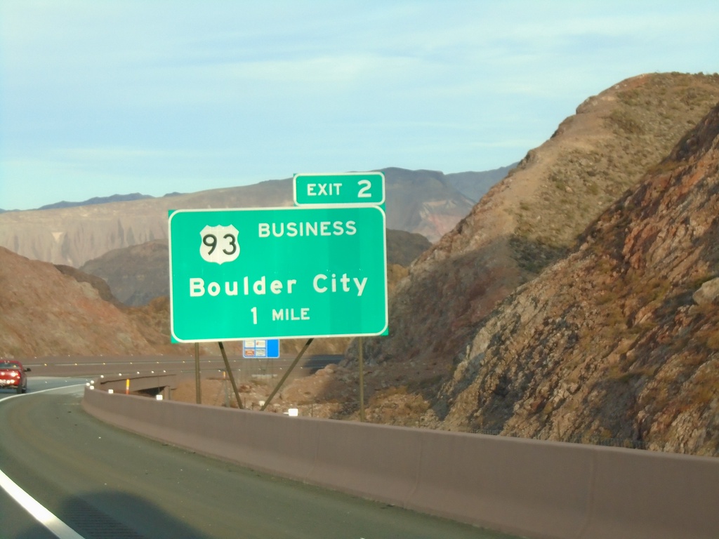
I-11 South - Exit 2
I-11 south approaching Exit 2 - Bus. US-93/Boulder City
Taken 11-26-2019
Boulder City
Clark County
Nevada
United States