Signs Tagged With Big Green Sign
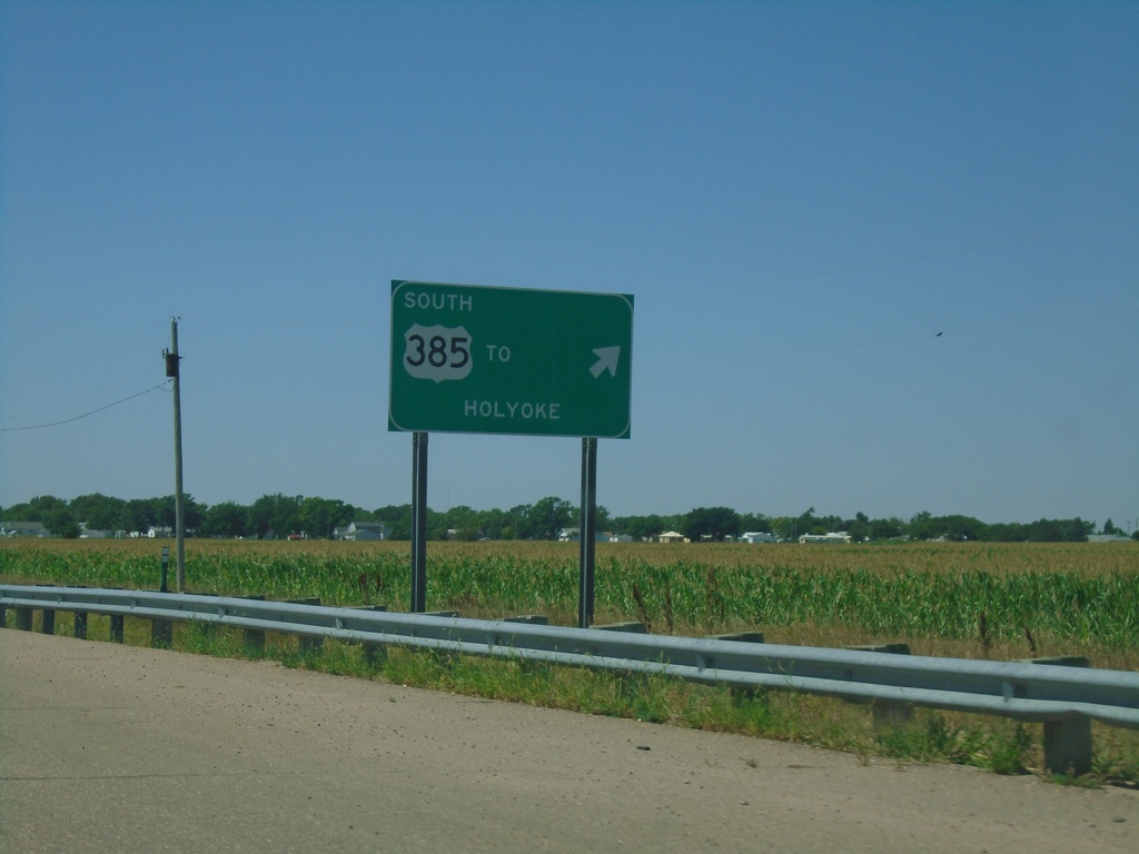
US-138 West at US-385
US-138 West at US-385 interchange. Exit for US-385 south to Holyoke. Continue straight for US-385 North/US-138 West.
Taken 08-14-2020

 Julesburg
Sedgwick County
Colorado
United States
Julesburg
Sedgwick County
Colorado
United States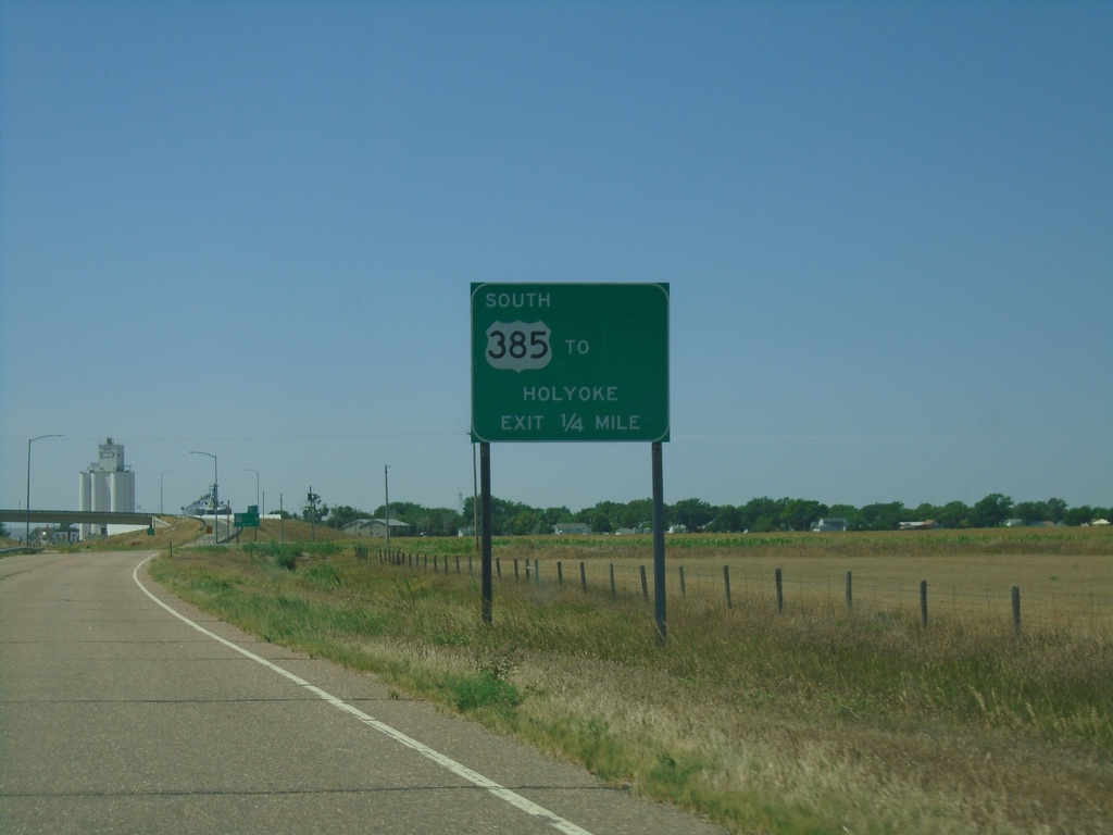
US-138 West Approaching US-385
US-138 West approaching US-385 in Julesburg. Use US-385 South for Holyoke. US-385 North joins US-138 West through Julesburg.
Taken 08-14-2020
Julesburg
Sedgwick County
Colorado
United States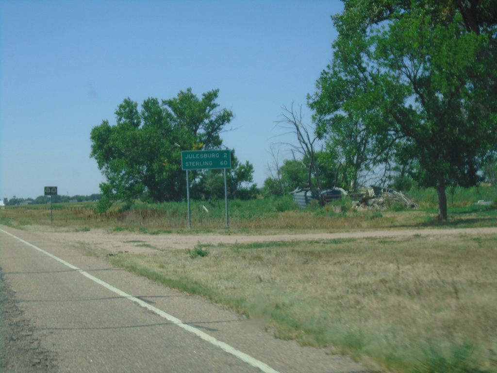
US-138 West - Distance Marker
Distance marker on US-138 west. Distance to Julesburg and Sterling.
Taken 08-14-2020
Julesburg
Sedgwick County
Colorado
United States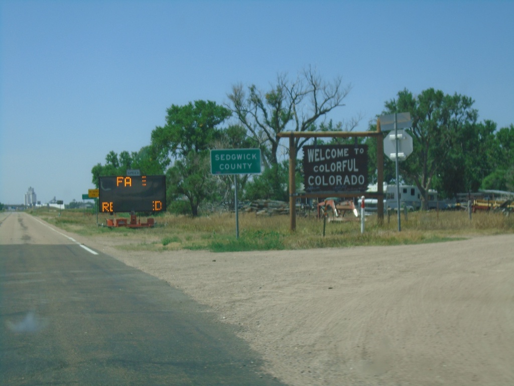
US-138 West - Entering Colorado
Welcome to Colorful Colorado - Sedgwick County on US-138 west. The electronic message board reads “Face Masks Required” (this being the COVID-19 summer of 2020).
Taken 08-14-2020
Julesburg
Sedgwick County
Colorado
United States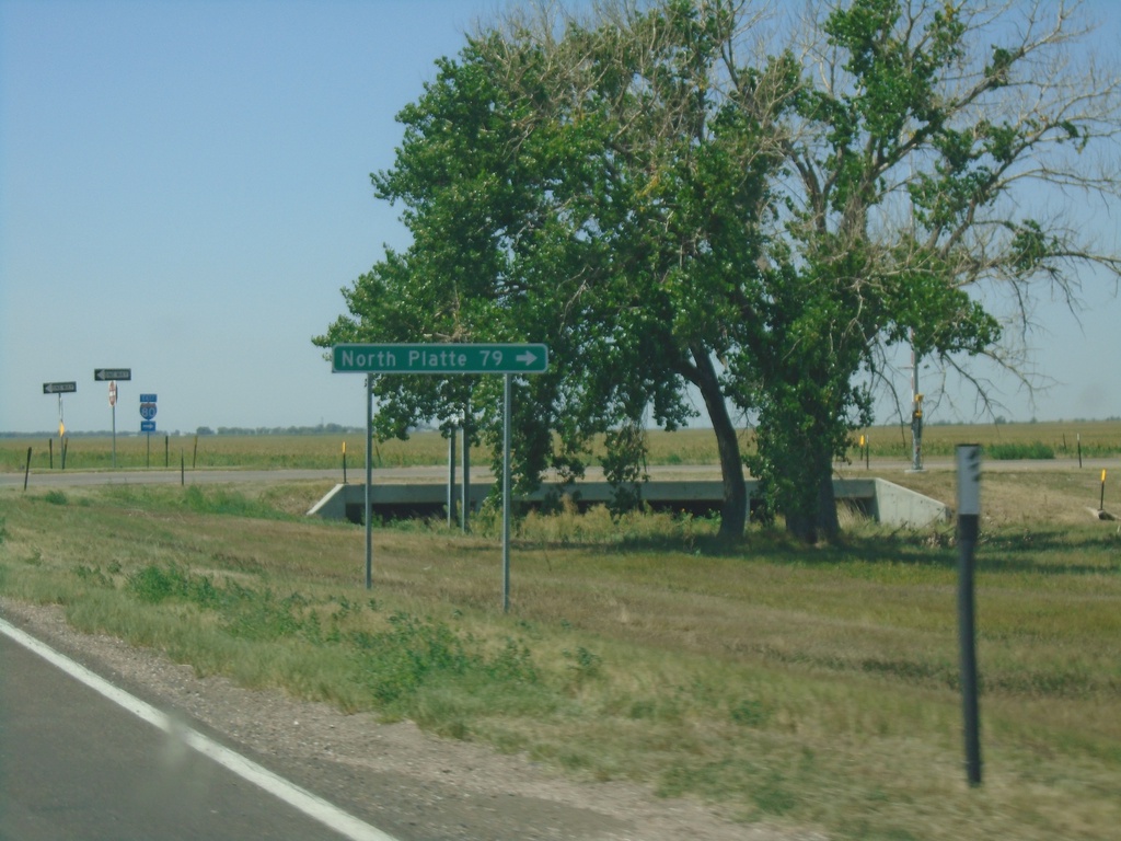
US-138 West at I-80 East (Exit 101)
US-138 West at I-80 East (Exit 101) to North Platte.
Taken 08-14-2020
 Big Springs
Deuel County
Nebraska
United States
Big Springs
Deuel County
Nebraska
United States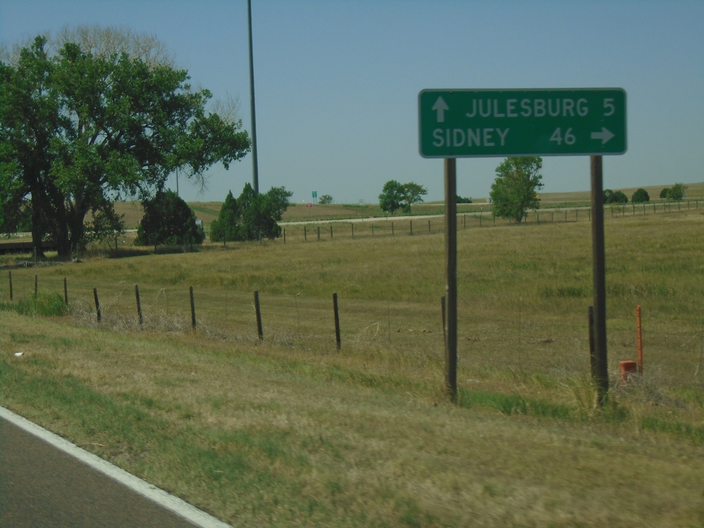
US-138 West at I-80 West (Exit 101)
US-138 West at I-80 West (Exit 101) to Sidney. Continue west on US-138 for Julesburg (CO).
Taken 08-14-2020
Big Springs
Deuel County
Nebraska
United States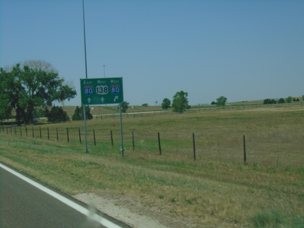
US-138 West Approaching I-80 (Exit 101)
US-138 West Approaching I-80 (Exit 101) in Deuel County.
Taken 08-14-2020
Big Springs
Deuel County
Nebraska
United States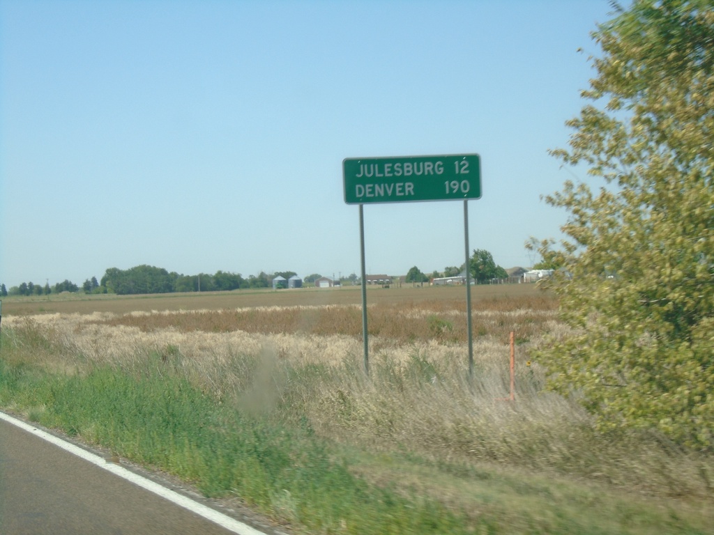
US-138 West - Distance Marker
Distance marker on US-138 west. Distance to Julesburg and Denver (both in Colorado).
Taken 08-14-2020
Big Springs
Deuel County
Nebraska
United States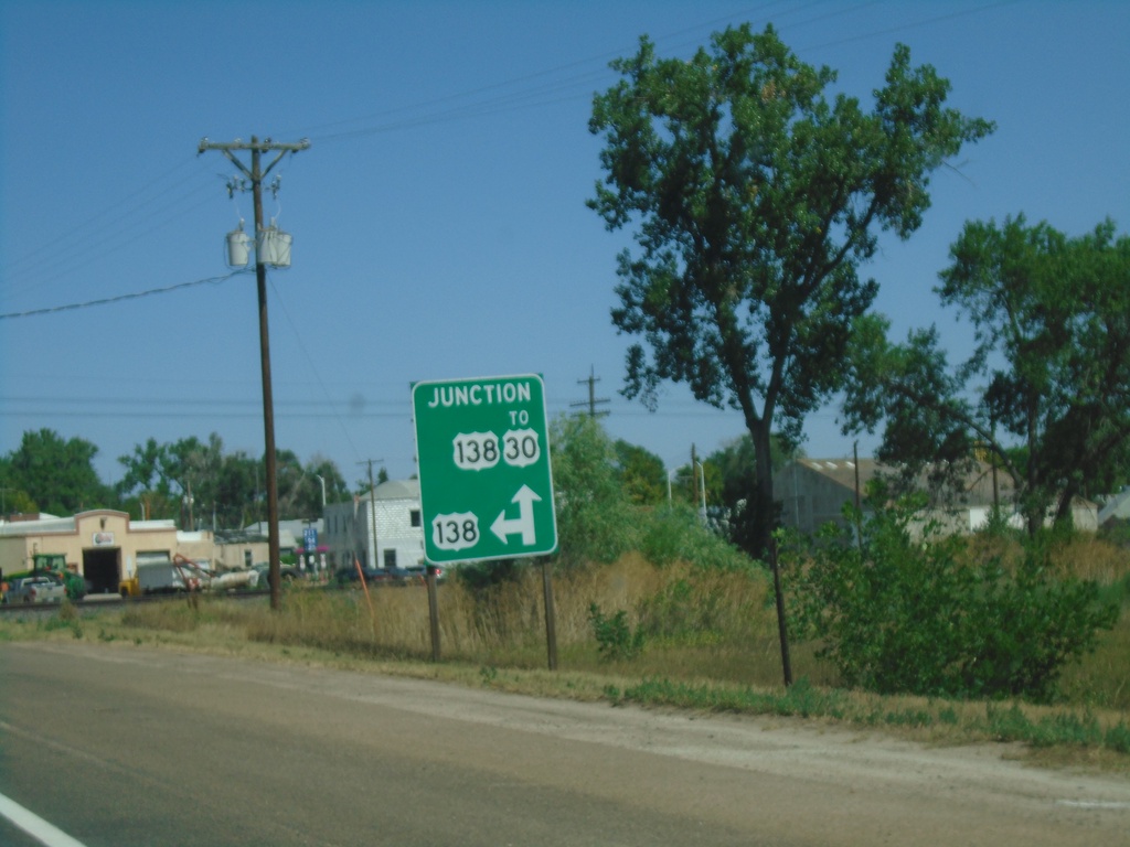
End NE-25B Link North at US-138
End NE-25B Link North at US-138 in Big Springs. Continue straight for US-138 East to US-30; turn left for US-138 West.
Taken 08-14-2020

 Big Springs
Deuel County
Nebraska
United States
Big Springs
Deuel County
Nebraska
United States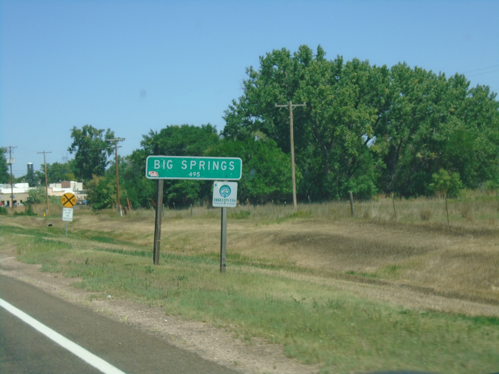
NE-25B Link North - Big Springs
Entering Big Springs on NE-25B Link North. Population 495.
Taken 08-14-2020
Big Springs
Deuel County
Nebraska
United States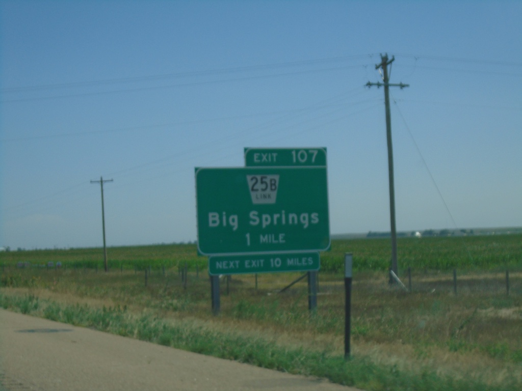
I-80 East - Exit 107
I-80 east approaching Exit 107 - NE-25B Link/Big Springs. Next exit eastbound on I-80 is 10 miles.
Taken 08-14-2020
Big Springs
Deuel County
Nebraska
United States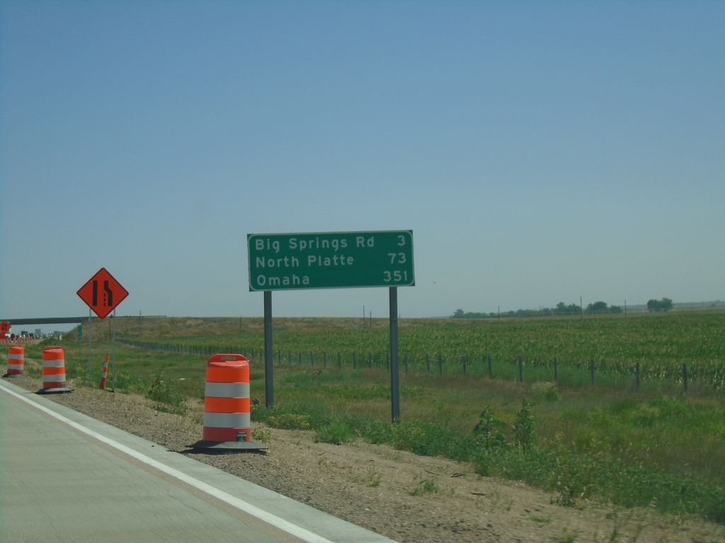
I-80 East - Distance Marker
Distance marker on I-80 east. Distance to Big Springs Road, North Platte, and Omaha.
Taken 08-14-2020
Big Springs
Deuel County
Nebraska
United States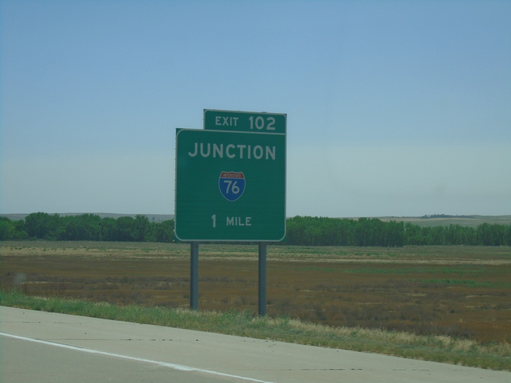
I-80 East - Exit 102
I-80 east approaching Exit 102 - I-76 East. This is the eastern end of I-76.
Taken 08-14-2020
 Big Springs
Deuel County
Nebraska
United States
Big Springs
Deuel County
Nebraska
United States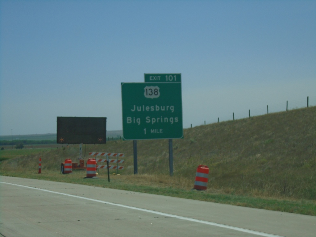
I-80 East - Exit 101
I-80 east approaching Exit 101 - US-138/Big Springs/Julesburg (Colorado).
Taken 08-14-2020
Big Springs
Deuel County
Nebraska
United States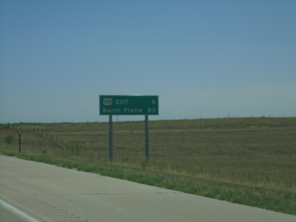
I-80 East - Distance Marker
Distance marker on I-80 east. Distance to US-138 Exit and North Platte.
Taken 08-14-2020
Julesburg
Deuel County
Nebraska
United States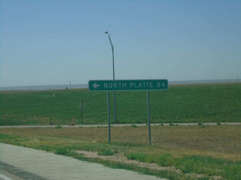
End NE-27 South at I-80
End NE-27 South at I-80 (Exit 95). Use I-80 east to North Platte.
Taken 08-14-2020
 Chappell
Deuel County
Nebraska
United States
Chappell
Deuel County
Nebraska
United States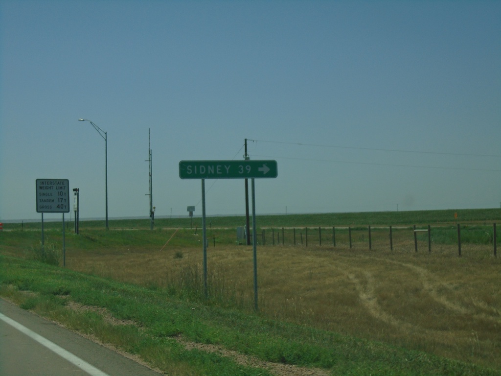
End NE-27 South at I-80 West
End NE-27 South at I-80. Use I-80 West to Sidney.
Taken 08-14-2020
Chappell
Deuel County
Nebraska
United States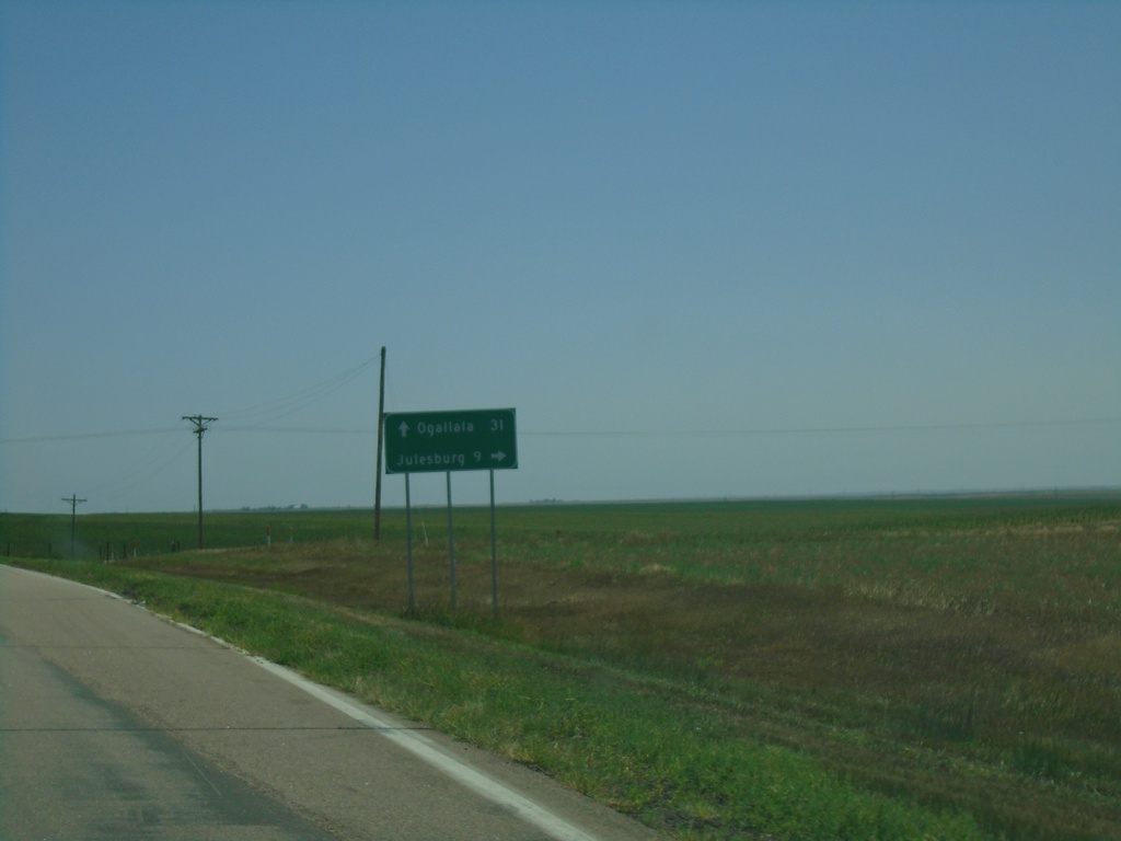
US-30 East/NE-27 South at US-30/NE-27 Split
US-30 East/NE-27 South at US-30/NE-27 split in Deuel County. Turn right for NE-27 south to Julesburg (Colorado). Continue east on US-30 for Ogallala.
Taken 08-14-2020
Chappell
Deuel County
Nebraska
United States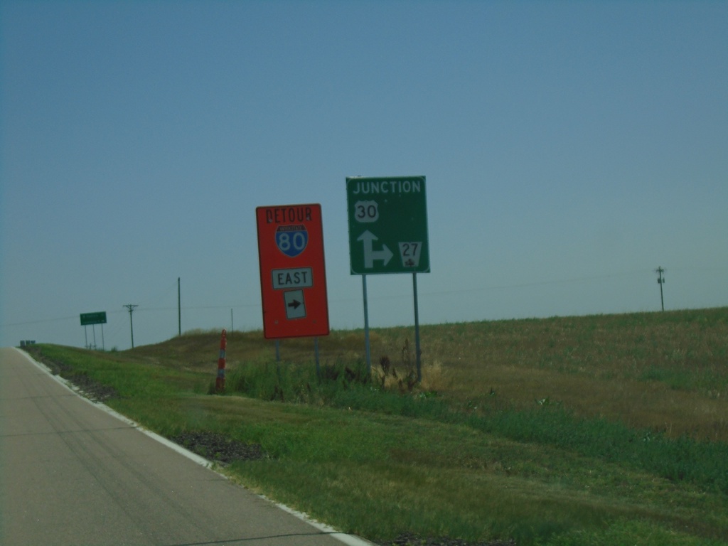
US-30 East/NE-27 South at US-30/NE-27 Split
US-30 East/NE-27 South at US-30/NE-27 split in Deuel County. Turn right for NE-27 south and for I-80 east detour. At the time this photo was taken there was construction on the I-80/I-76 interchange with a truck detour.
Taken 08-14-2020
Chappell
Deuel County
Nebraska
United States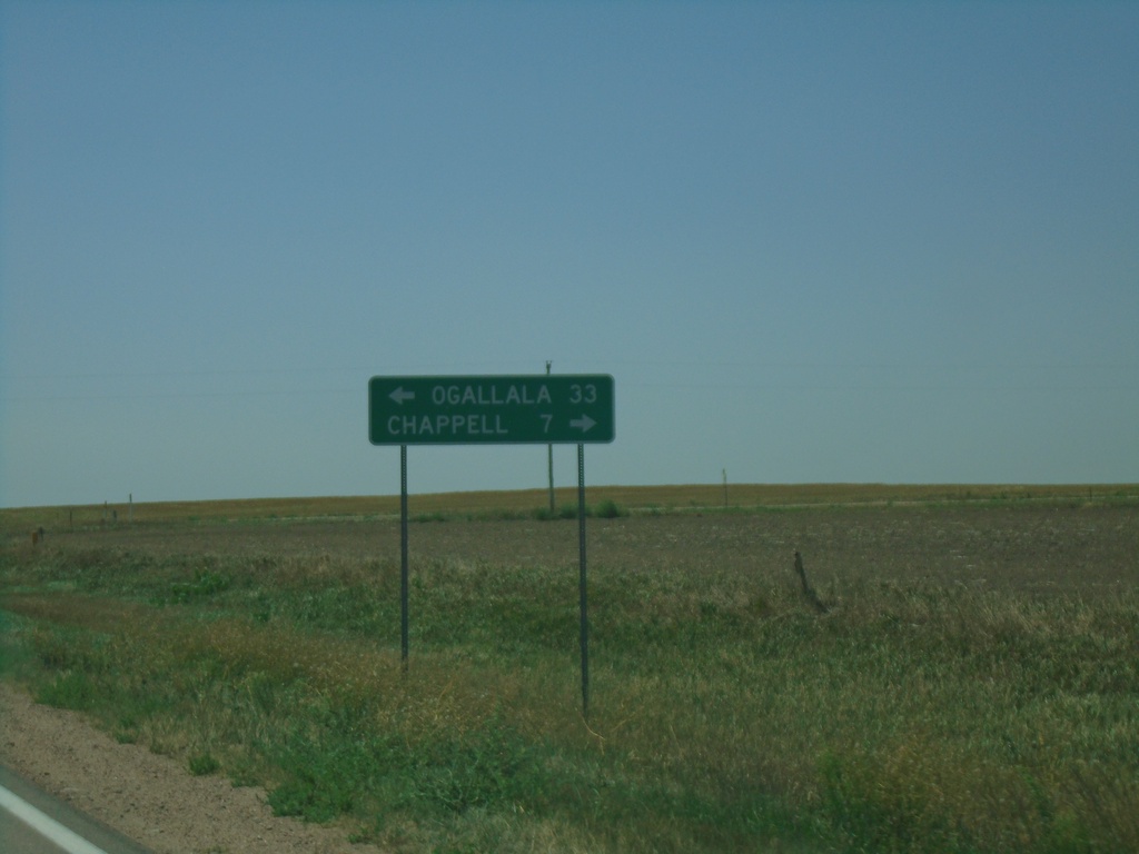
NE-27 South at US-30
NE-27 South at US-30 in Deuel County. Turn right for US-30 west to Chappell; left for US-30 east/NE-92 south to Ogallala.
Taken 08-14-2020
Chappell
Deuel County
Nebraska
United States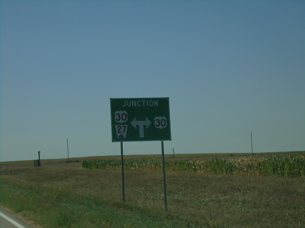
NE-27 South Approaching US-30
NE-27 South approaching US-30 in Deuel County. NE-27 south follows US-30 east briefly.
Taken 08-14-2020
Chappell
Deuel County
Nebraska
United States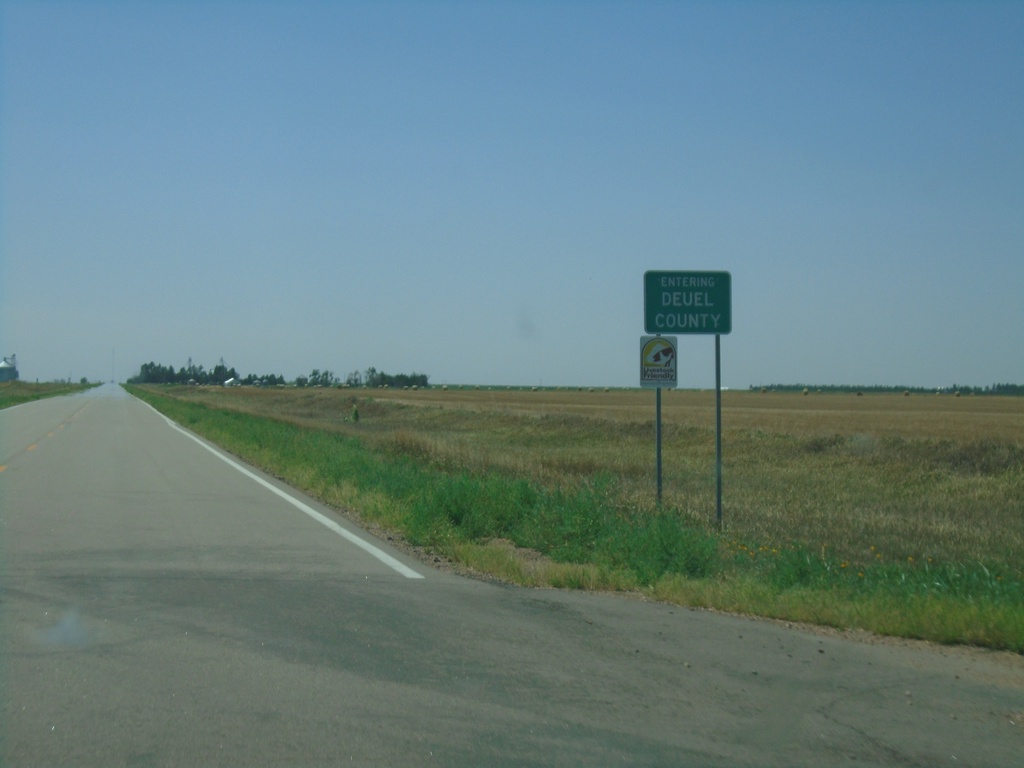
NE-27 South - Deuel County
Entering Deuel County on NE-27 south.
Taken 08-14-2020
Chappell
Deuel County
Nebraska
United States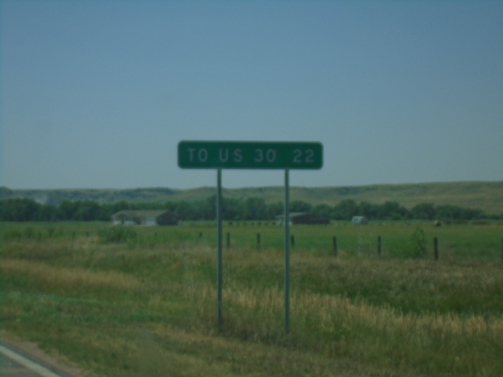
NE-27 South - Distance Marker
Distance marker on NE-27 south. Distance to US-30 Junction.
Taken 08-14-2020
Oshkosh
Garden County
Nebraska
United States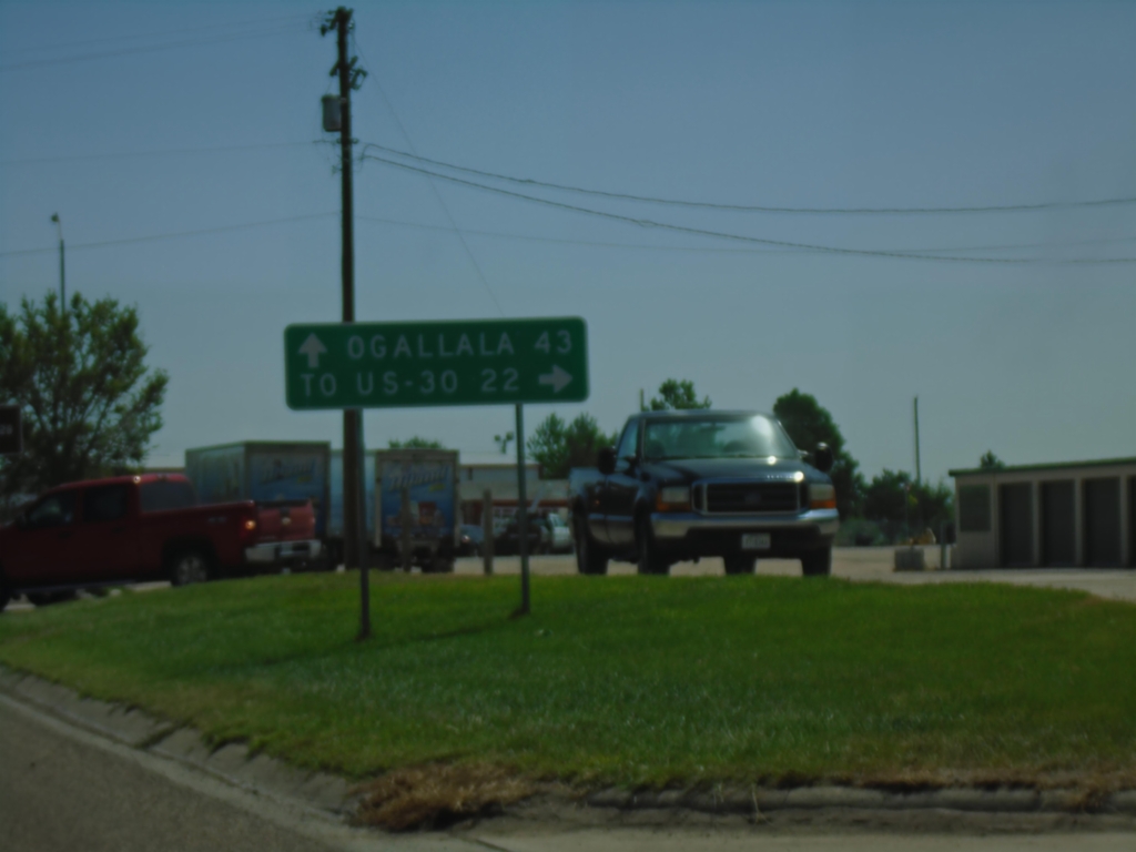
US-26 East/NE-92 East At NE-27
US-26 East/NE-92 East at NE-27 South in Oshkosh. Turn right for NE-27 to US-30 Jct; continue straight on US-26 East/NE-92 East for Ogallala.
Taken 08-14-2020

 Oshkosh
Garden County
Nebraska
United States
Oshkosh
Garden County
Nebraska
United States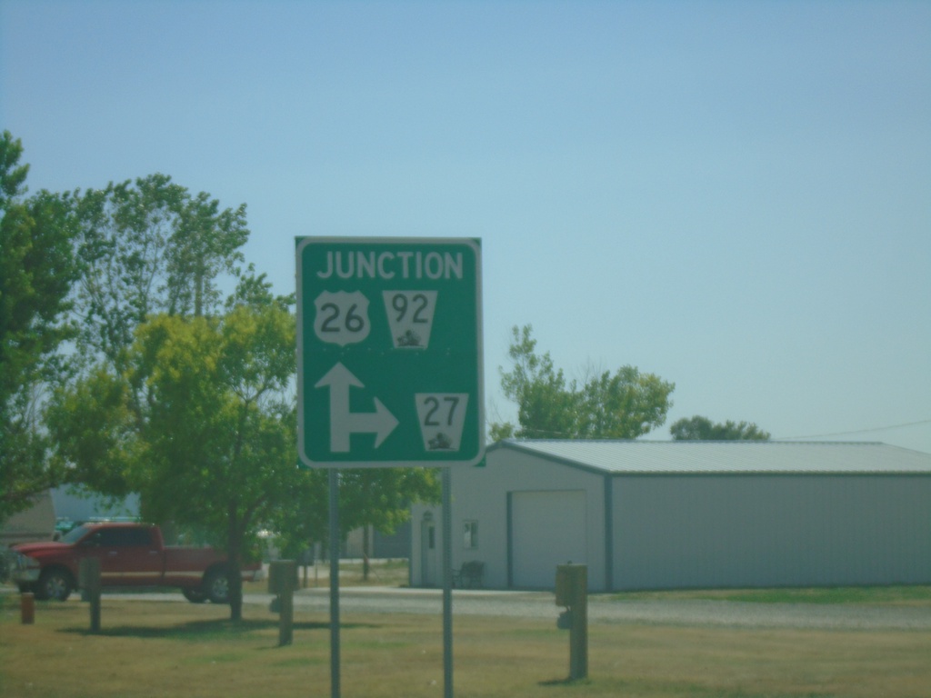
US-26 East/NE-92 East approaching NE-27
US-26 East/NE-92 East approaching NE-27 south in Oshkosh.
Taken 08-14-2020
Oshkosh
Garden County
Nebraska
United States