Signs Tagged With Big Green Sign
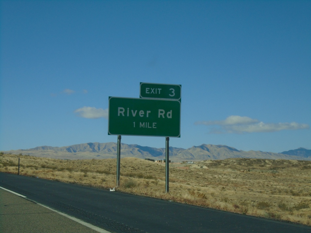
UT-7 West - Exit 3
UT-7 west approaching Exit 3 - River Road
Taken 11-26-2019
 St. George
Washington County
Utah
United States
St. George
Washington County
Utah
United States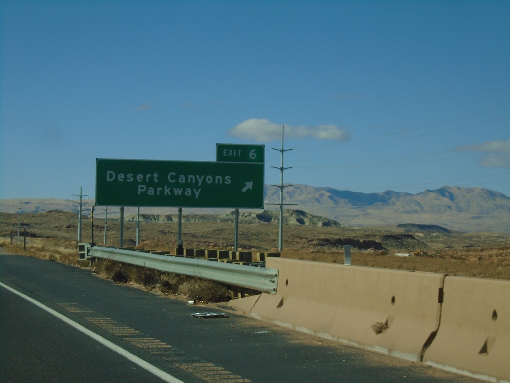
UT-7 West - Exit 6
UT-7 west at Exit 6 - Desert Canyons Parkway. UT-7 becomes a 4 lane freeway after this interchange westbound.
Taken 11-26-2019
St. George
Washington County
Utah
United States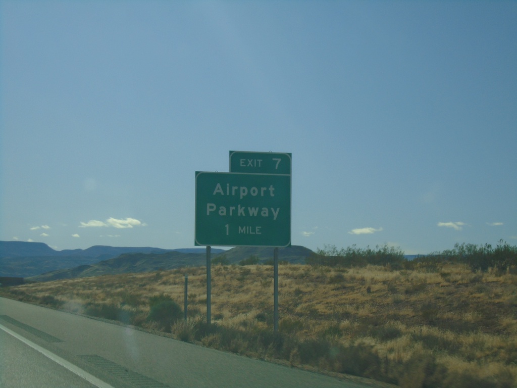
UT-7 West - Exit 7
UT-7 west approaching Exit 7 - Airport Parkway
Taken 11-26-2019
St. George
Washington County
Utah
United States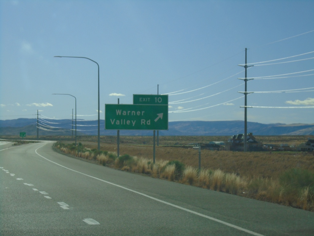
UT-7 West - Exit 10
UT-7 west at Exit 10 - Warner Valley Road.
Taken 11-26-2019
Washington
Washington County
Utah
United States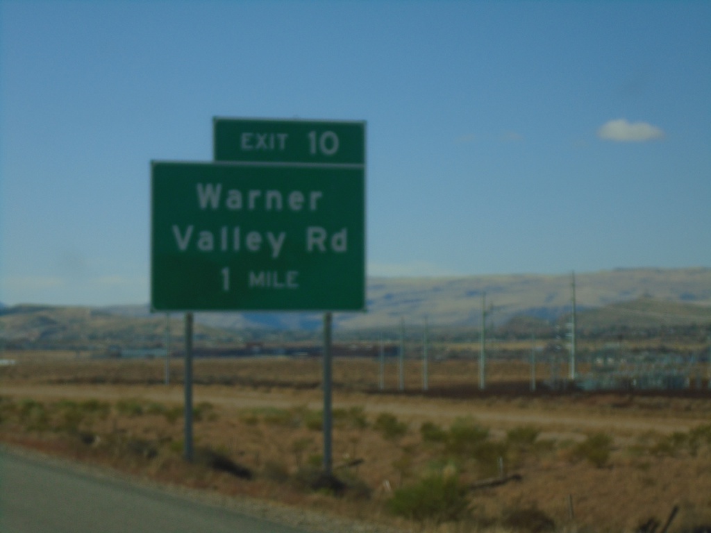
UT-7 West - Exit 10
UT-7 west approaching Exit 10 - Warner Valley Road
Taken 11-26-2019
Washington
Washington County
Utah
United States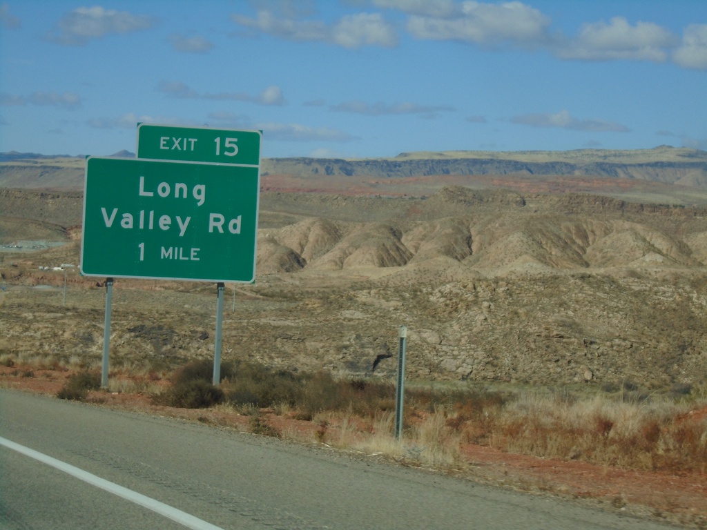
UT-7 West - Exit 15
UT-7 west approaching Exit 15 - Long Valley Road
Taken 11-26-2019
Hurricane
Washington County
Utah
United States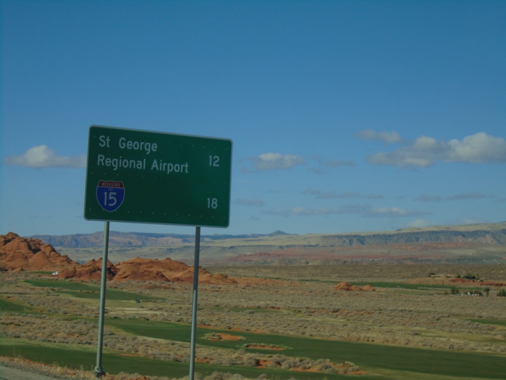
UT-7 West - Distance Marker
Distance marker on UT-7 west. Distance to St. George Regional Airport and I-15.
Taken 11-26-2019
 Hurricane
Washington County
Utah
United States
Hurricane
Washington County
Utah
United States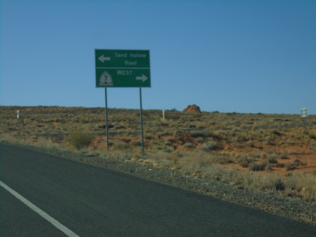
Sand Hollow Road at UT-7 West
Sand Hollow Road at UT-7 west. Turn right for UT-7 west; left to continue on Sand Hollow Road.
Taken 11-26-2019
Hurricane
Washington County
Utah
United States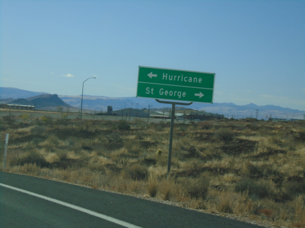
End UT-318 South at UT-9
End UT-318 South at UT-9. Turn left for UT-9 east to Hurricane; right for UT-9 west to St. George (via I-15).
Taken 11-26-2019

 Hurricane
Washington County
Utah
United States
Hurricane
Washington County
Utah
United States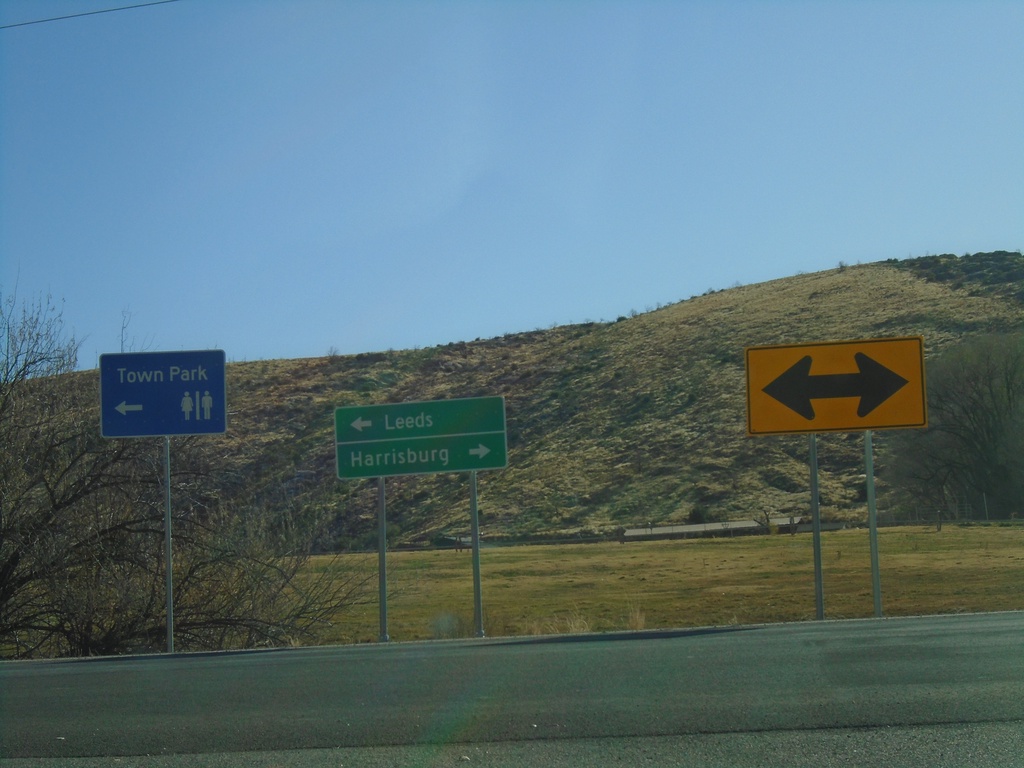
I-15 North Exit 22 at UT-228
I-15 North Exit 22 at UT-228 in Leeds. Turn left for UT-228 north to Leeds; turn right for county road south to Harrisburg.
Taken 11-26-2019
 Leeds
Washington County
Utah
United States
Leeds
Washington County
Utah
United States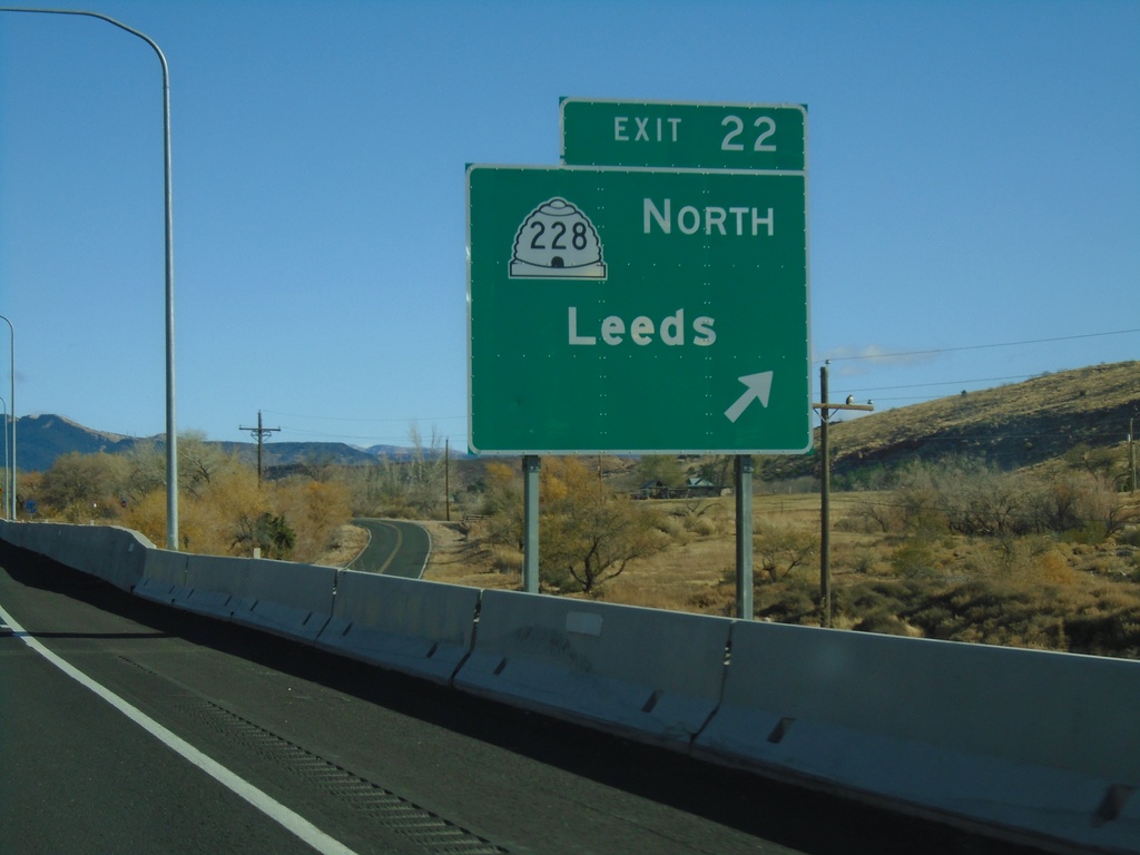
I-15 North - Exit 22
I-15 north at Exit 22 - UT-228 North/Leeds
Taken 11-26-2019
Hurricane
Washington County
Utah
United States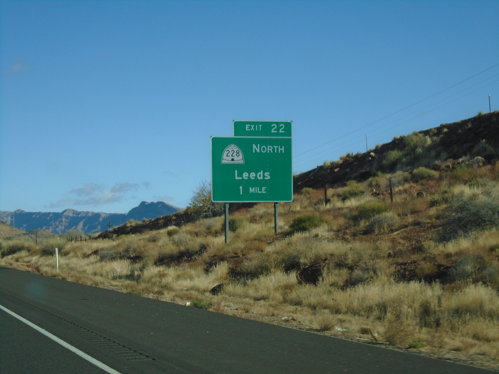
I-15 North - Exit 22
I-15 north approaching Exit 22 - UT-228 North/Leeds.
Taken 11-26-2019
Leeds
Washington County
Utah
United States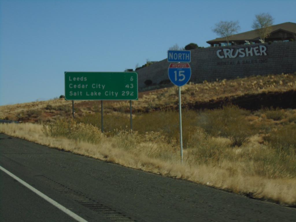
I-15 North - Distance Marker
Distance marker and I-15 shield on I-15 North. Distance to Leeds, Cedar City, and Salt Lake City.
Taken 11-26-2019
Hurricane
Washington County
Utah
United States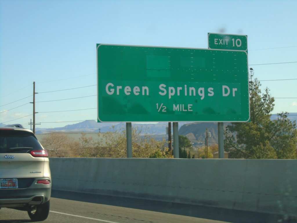
I-15 North - Exit 10
I-15 north approaching Exit 10 - Green Springs Drive
Taken 11-26-2019
St. George
Washington County
Utah
United States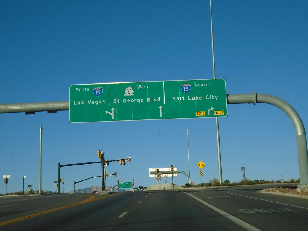
UT-34 West at I-15
UT-34 West at I-15 (Exit 8) in St. George. Turn right for I-15 North/Salt Lake City; continue west on UT-34 for St. George Blvd. Use I-15 south for Las Vegas (NV). This is a diverging diamond interchange.
Taken 11-26-2019

 St. George
Washington County
Utah
United States
St. George
Washington County
Utah
United States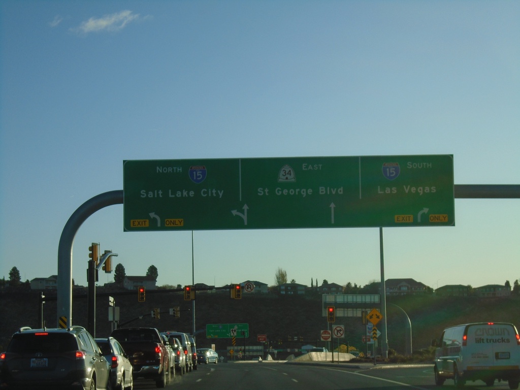
UT-34 East at I-15 (Exit 8)
UT-34 East at I-15 (Exit 8) in St. George. Use I-15 South for Las Vegas (NV), I-15 North for Salt Lake City. Continue east on UT-34 for St. George Blvd. This intersection at I-15 and UT is a diverging diamond type of interchange.
Taken 11-26-2019
St. George
Washington County
Utah
United States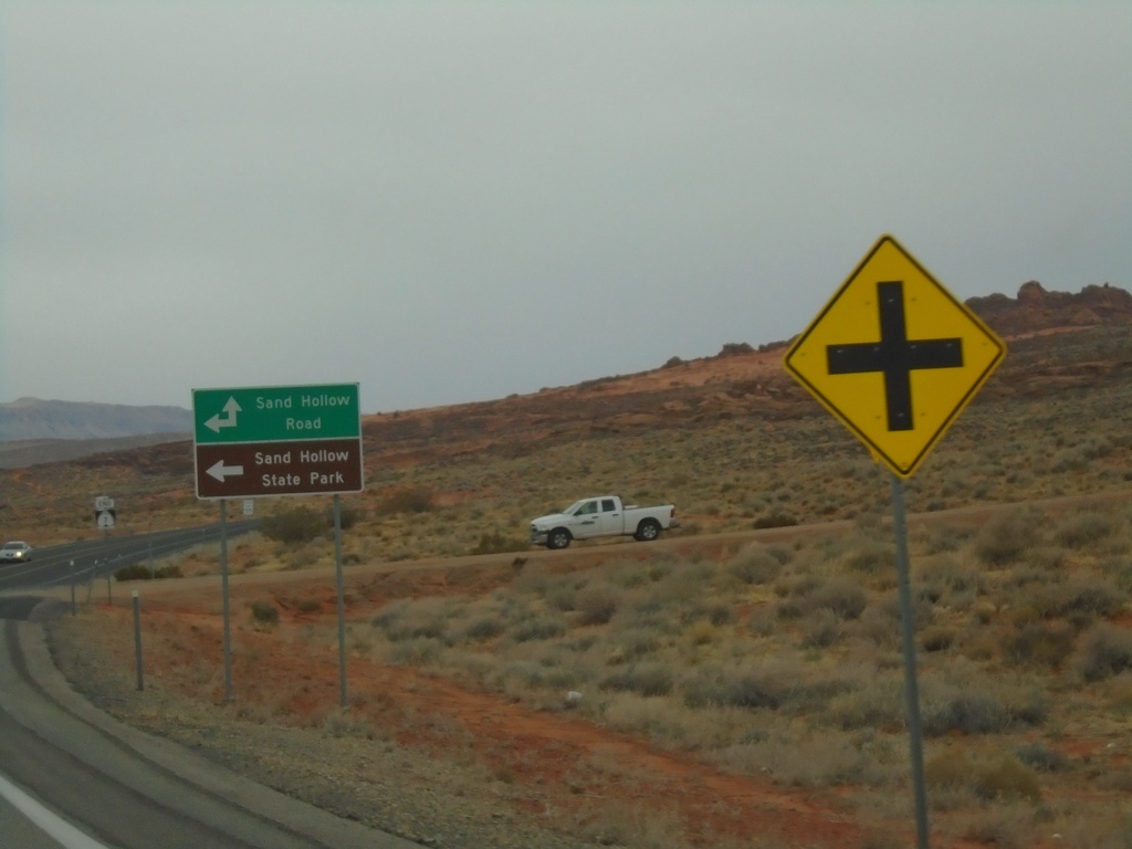
End UT-7 at Sand Hollow Road
End UT-7 (Southern Parkway) at Sand Hollow Road. Turn left on Sand Hollow Road for Sand Hollow State Park.
Taken 11-25-2019
Hurricane
Washington County
Utah
United States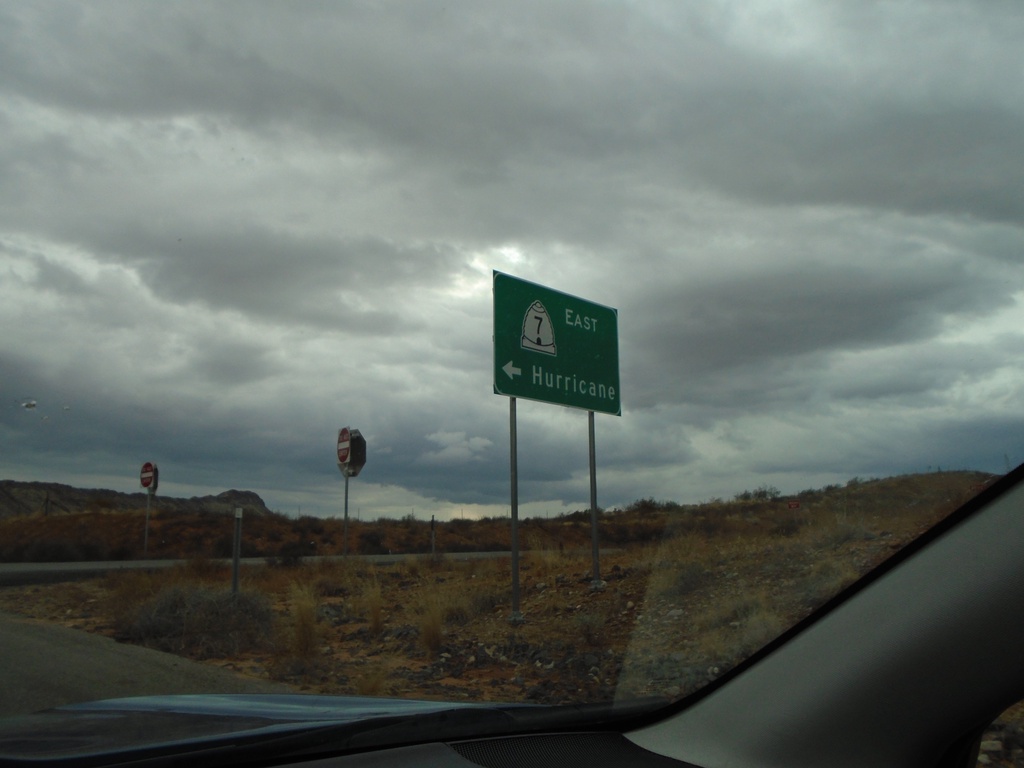
Long Valley Road at UT-7 East
Long Valley Road (Exit 15) at UT-7 East to Hurricane.
Taken 11-25-2019
Washington
Washington County
Utah
United States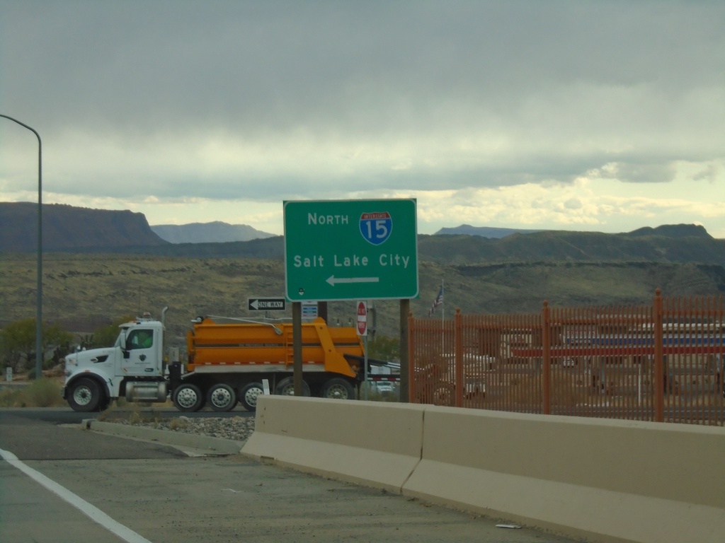
Washington Parkway at I-15 North
Washington Parkway at I-15 North (Exit 13) to Salt Lake City.
Taken 11-25-2019
Washington
Washington County
Utah
United States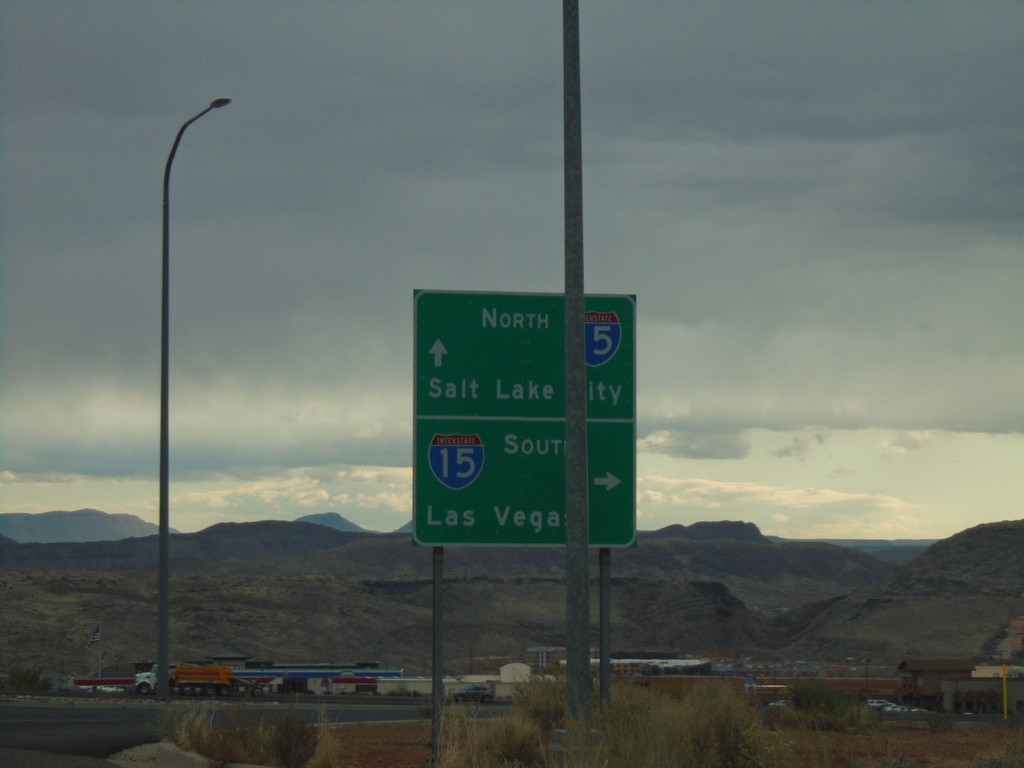
Washington Parkway at I-15
Washington Parkway at I-15 (Exit 13). Use I-15 south for Las Vegas (Nevada); I-15 north for Salt Lake City.
Taken 11-25-2019
Washington
Washington County
Utah
United States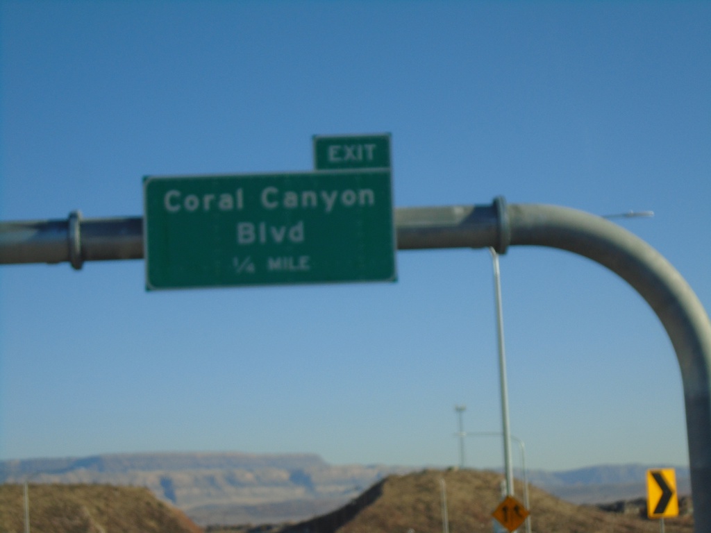
UT-9 East Approaching Coral Canyon Blvd
UT-9 East Approaching Coral Canyon Blvd interchange.
Taken 11-24-2019
Washington
Washington County
Utah
United States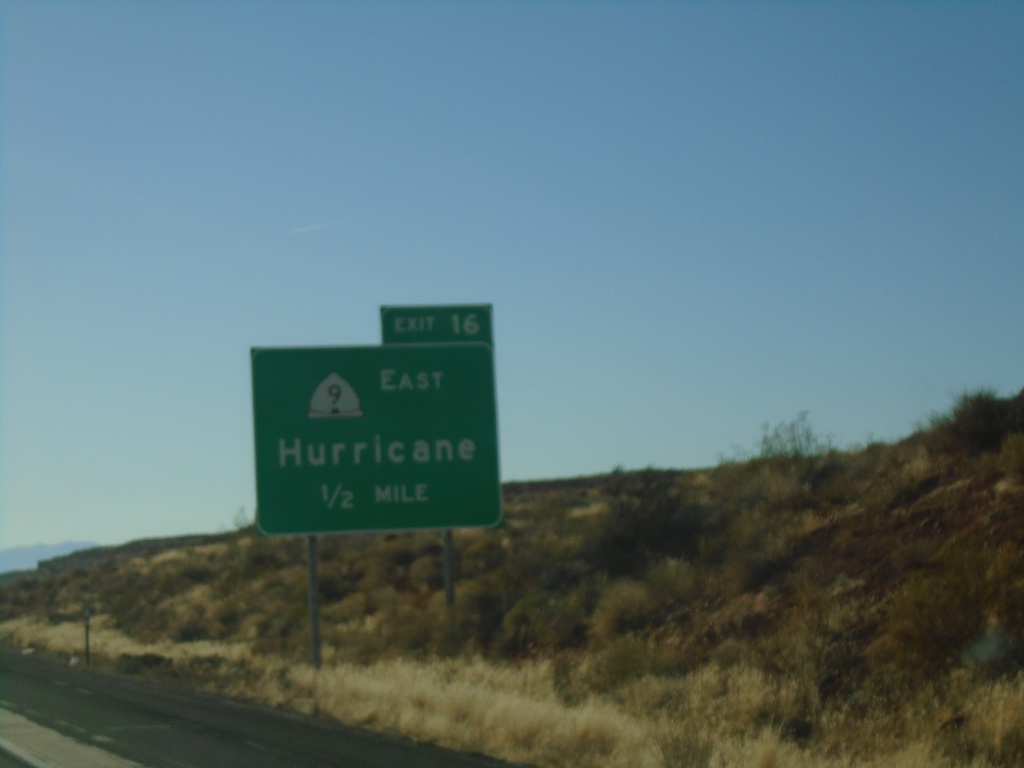
I-15 South - Exit 16
I-15 south approaching Exit 16 - UT-9 East/Hurricane
Taken 11-24-2019
Washington
Washington County
Utah
United States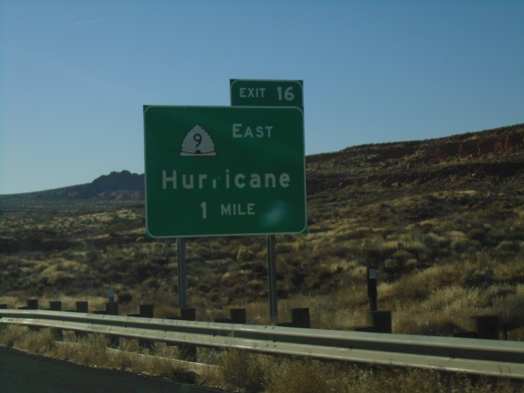
I-15 South - Exit 16
I-15 south approaching Exit 16 - UT-9 East/Hurricane.
Taken 11-24-2019
Washington
Washington County
Utah
United States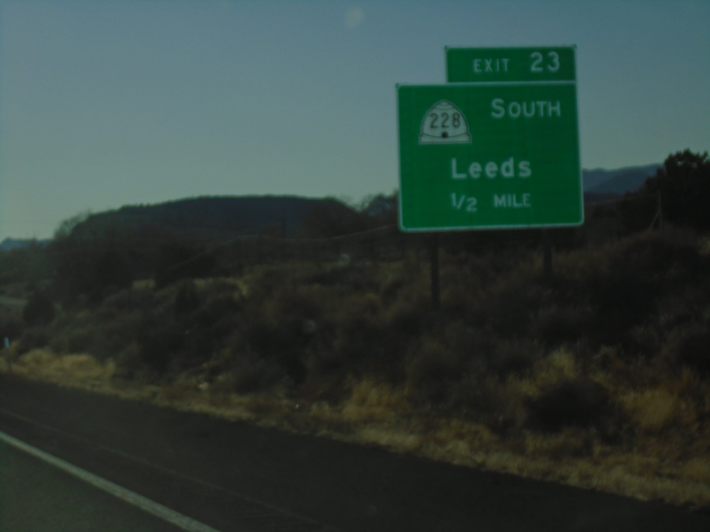
I-15 South - Exit 23
I-15 south approaching Exit 23 - UT-228 South/Leeds
Taken 11-24-2019
Leeds
Washington County
Utah
United States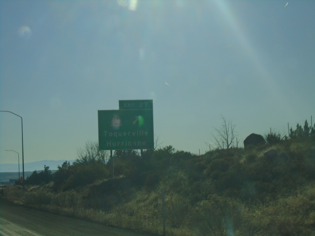
I-15 South - Exit 27
I-15 south at Exit 27 - UT-17/Toquerville/Hurricane
Taken 11-24-2019
 Toquerville
Washington County
Utah
United States
Toquerville
Washington County
Utah
United States