Signs Tagged With Big Green Sign
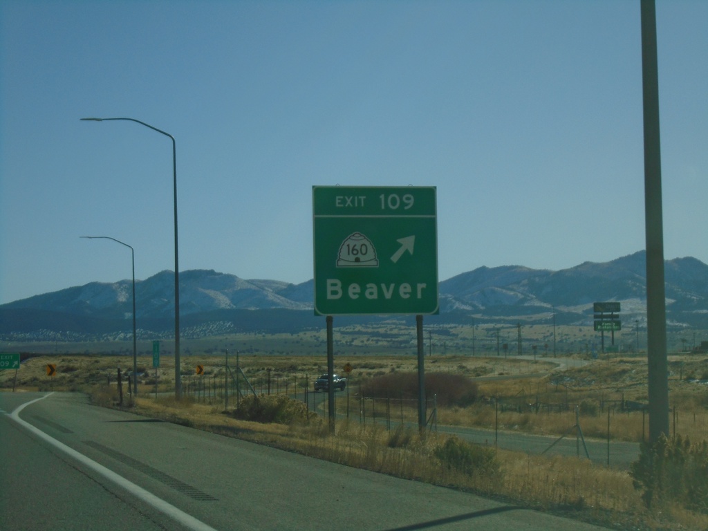
I-15 South - Exit 109
I-15 south at Exit 109 - UT-160/Beaver. This is the south end of the Beaver business loop.
Taken 11-24-2019


 Beaver
 County
Utah
United States
Beaver
Beaver County
Utah
United States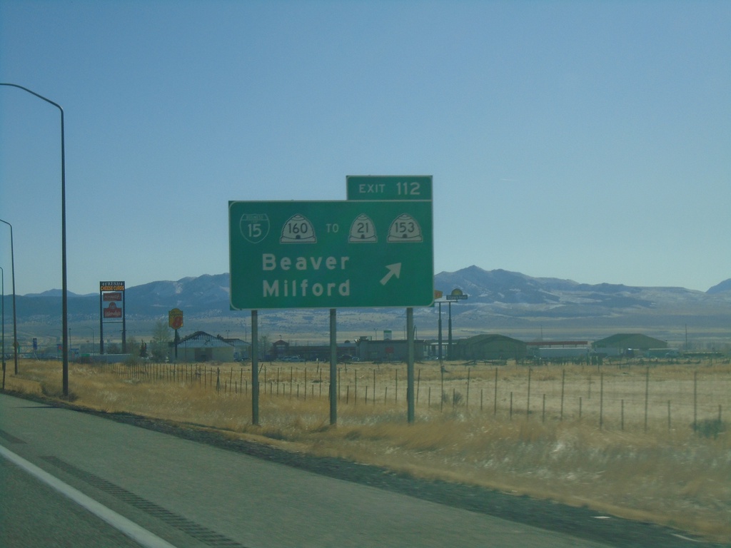
I-15 South - Exit 112
I-15 south at Exit 112 - BL-15/UT-160/To UT-21/To UT-153/Beaver/Milford. This is the northern end of the Beaver business loop.
Taken 11-24-2019

 Beaver
 County
Utah
United States
Beaver
Beaver County
Utah
United States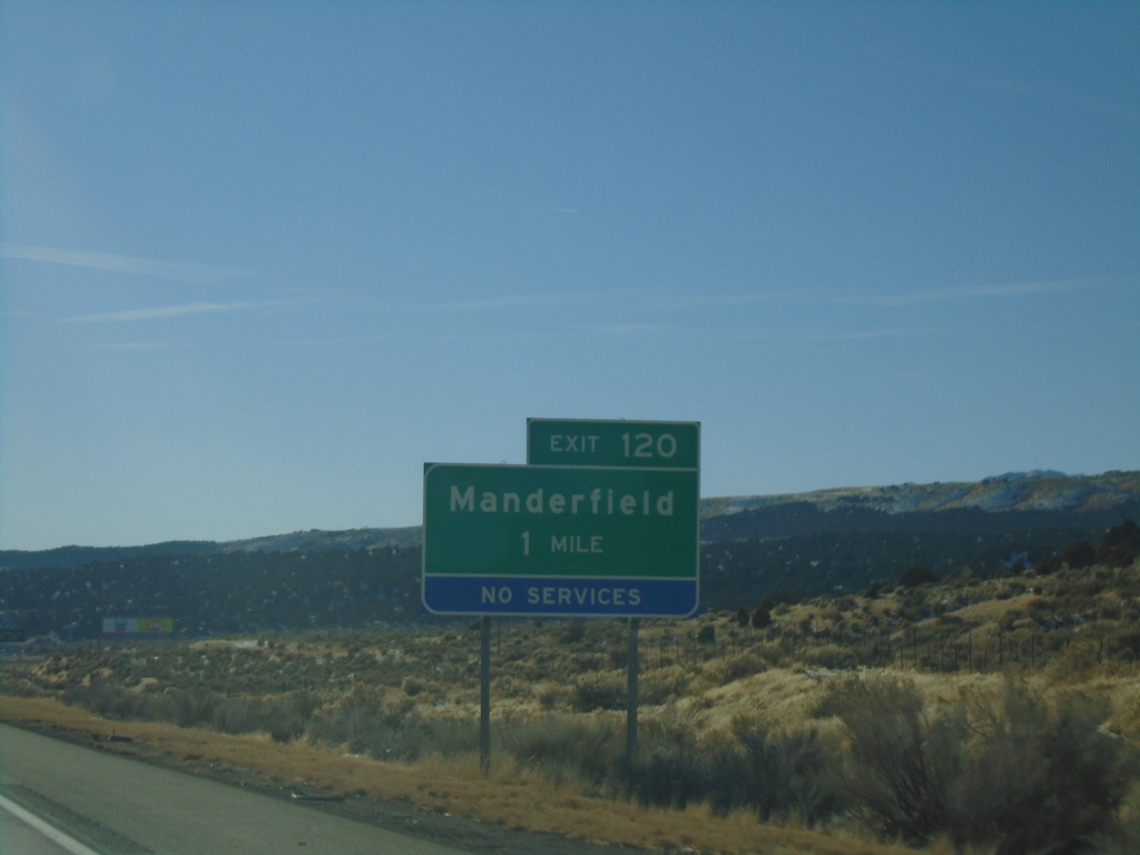
I-15 South - Exit 120
I-15 south approaching Exit 120 - Manderfield
Taken 11-24-2019
Beaver
Beaver County
Utah
United States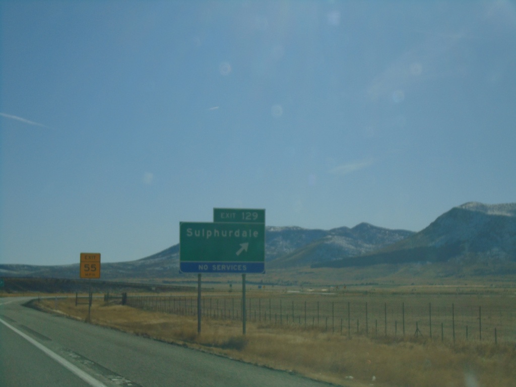
I-15 South - Exit 129
I-15 south at Exit 129 - Sulphurdale
Taken 11-24-2019
Sulphurdale
Beaver County
Utah
United States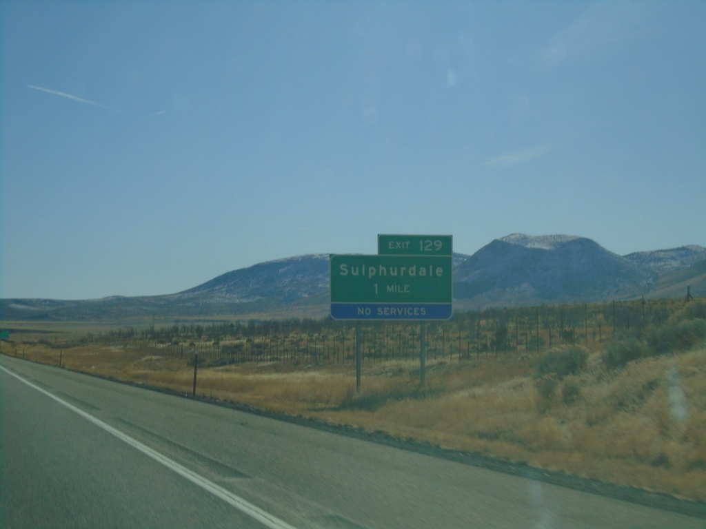
I-15 South - Exit 129
I-15 south approaching Exit 129 - Sulphurdale
Taken 11-24-2019
Beaver
Beaver County
Utah
United States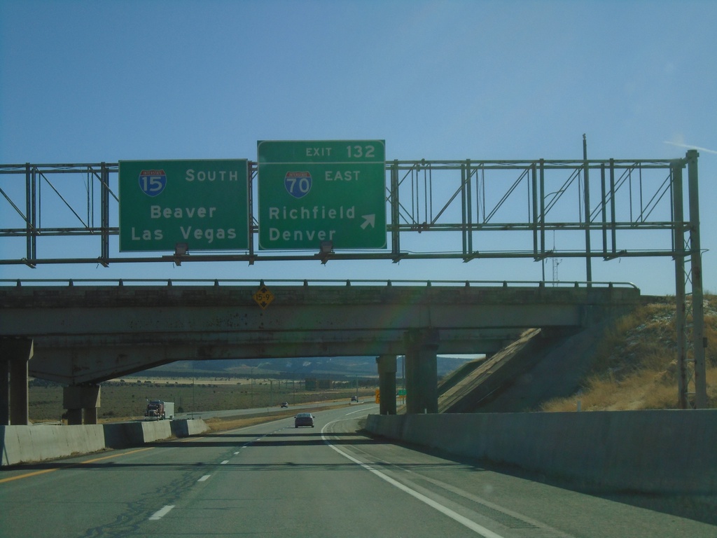
I-15 South - Exit 132
I-15 south at Exit 132 - I-70 East/Richfield/Denver(Colorado) . I-15 continues south to Beaver and Las Vegas (Nevada). This is the western end of I-70.
Taken 11-24-2019
 Sulphurdale
Beaver County
Utah
United States
Sulphurdale
Beaver County
Utah
United States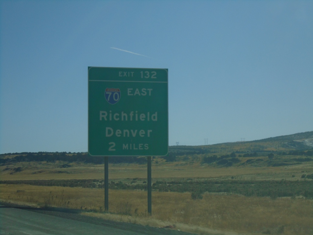
I-15 South - Exit 132
I-15 south approaching Exit 132 - I-70 East/Richfield/Denver (Colorado). This is the western terminus of I-70.
Taken 11-24-2019
Kanosh
Millard County
Utah
United States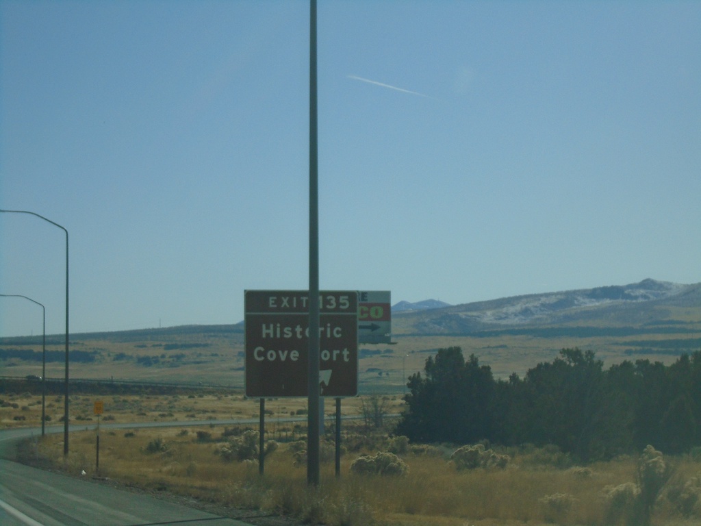
I-15 South - Exit 135
I-15 south at Exit 135 - Historic Cove Fort
Taken 11-24-2019
 Cove Fort
Millard County
Utah
United States
Cove Fort
Millard County
Utah
United States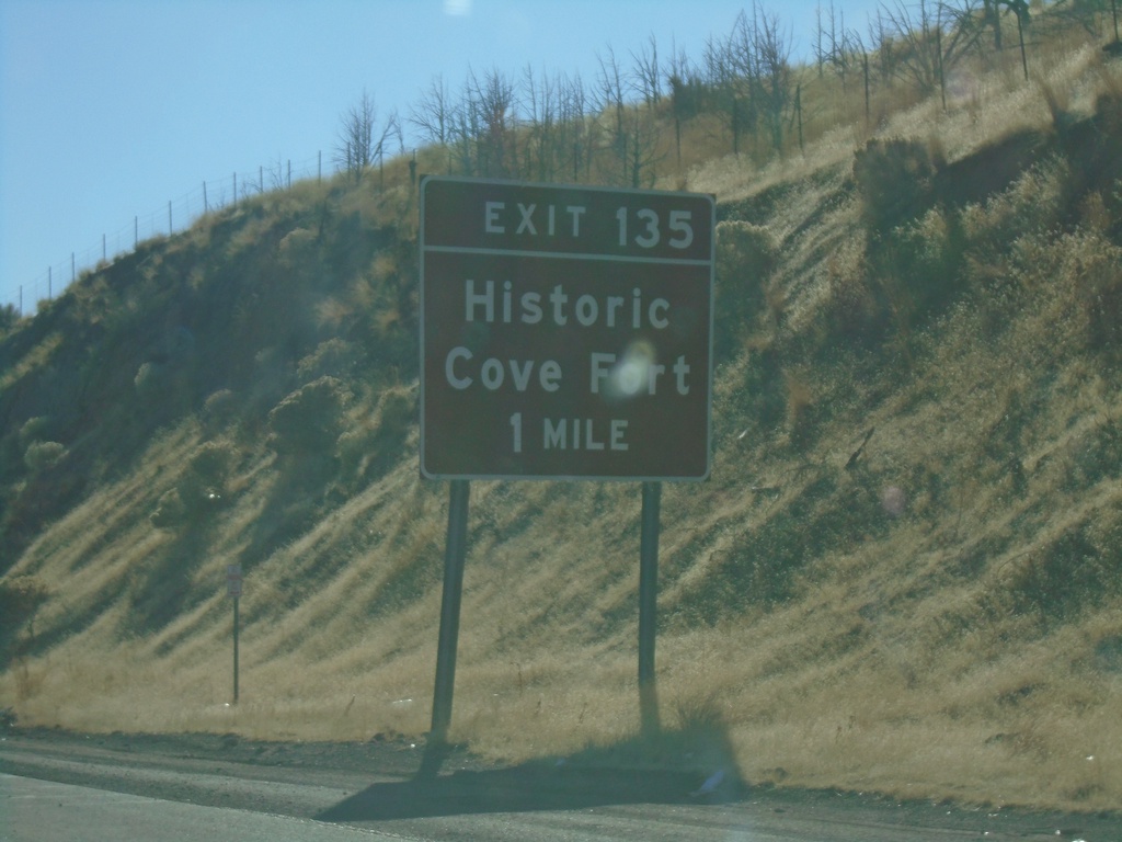
I-15 South - Exit 135
I-15 south approaching Exit 135 - Historic Cove Fort
Taken 11-24-2019
Kanosh
Millard County
Utah
United States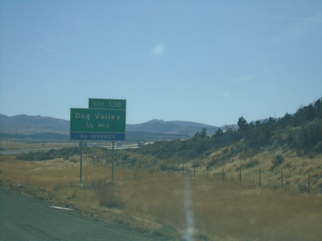
I-15 South - Exit 138
I-15 south approaching Exit 138 - Dog Valley
Taken 11-24-2019
Kanosh
Millard County
Utah
United States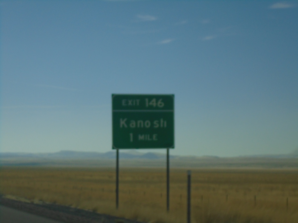
I-15 South - Exit 146
I-15 south approaching Exit 146 - Kanosh.
Taken 11-24-2019
Kanosh
Millard County
Utah
United States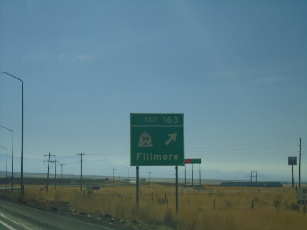
I-15 South - Exit 163
I-15 south at Exit 163 - UT-99/Fillmore
Taken 11-24-2019
 Fillmore
Millard County
Utah
United States
Fillmore
Millard County
Utah
United States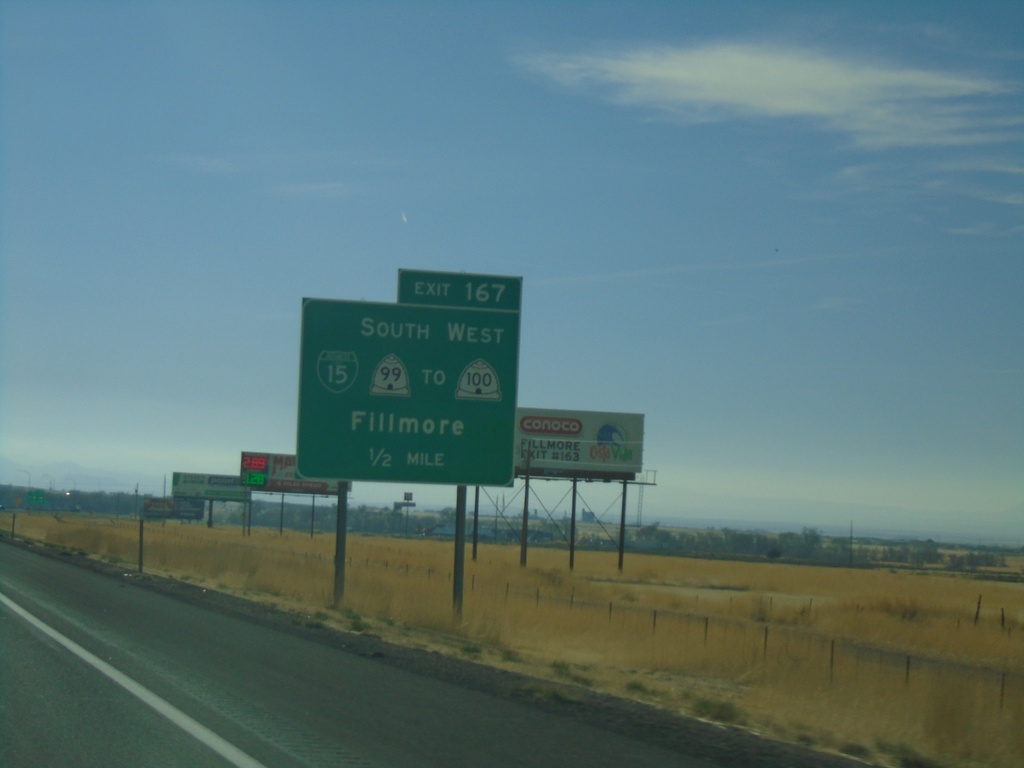
I-15 South - Exit 167
I-15 south approaching Exit 167 - Bus. I-15/UT-99 South/To UT-100 West/Fillmore
Taken 11-24-2019
 Fillmore
Millard County
Utah
United States
Fillmore
Millard County
Utah
United States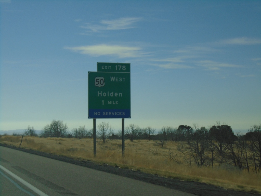
I-15 South - Exit 178
I-15 south approaching Exit 178 - US-50 West/Holden. US-50 leaves I-15 southbound here.
Taken 11-24-2019
 Holden
Millard County
Utah
United States
Holden
Millard County
Utah
United States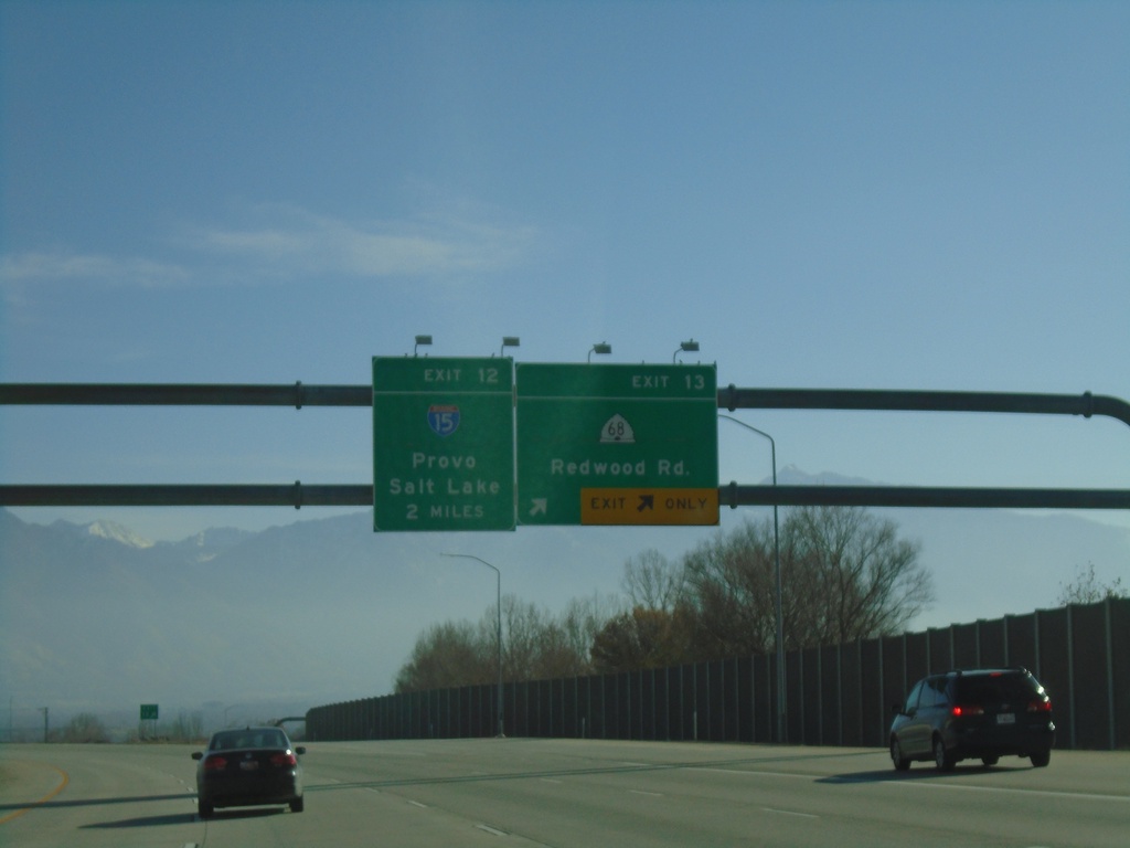
I-215 South - Exits 13 and 12
I-215 south at Exit 13 - UT-68/Redwood Road. Approaching Exit 12 - I-15/Salt Lake/Provo.
Taken 11-24-2019

 Taylorsville
Salt Lake County
Utah
United States
Taylorsville
Salt Lake County
Utah
United States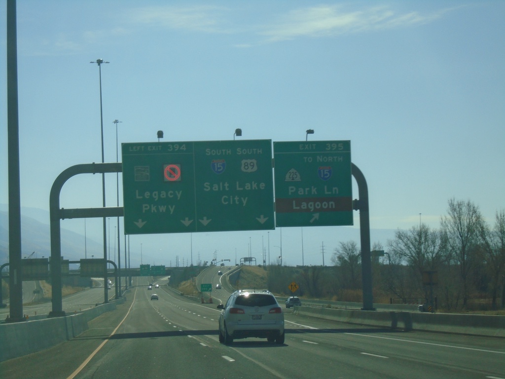
US-89 South - Exits 395 and 394 - Approaching I-15
US-89 South at Exit 395 - UT-225/To I-15 North/Park Lane/Lagoon. Approaching Exit 394 - (UT-67)/Legacy Parkway. US-89 joins I-15 southbound for Salt Lake City. Use Exit 395 for access to Lagoon Amusement Park.
Taken 11-24-2019


 Farmington
Davis County
Utah
United States
Farmington
Davis County
Utah
United States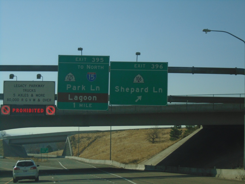
US-89 South - Exits 396 and 395
US-89 south at Exit 396 - UT-106/Shepard Lane. Approaching Exit 395 - UT-225/To I-15 North/Park Lane/Lagoon. On the left is a sign showing that trucks are prohibited on Legacy Parkway.
Taken 11-24-2019
 Farmington
Davis County
Utah
United States
Farmington
Davis County
Utah
United States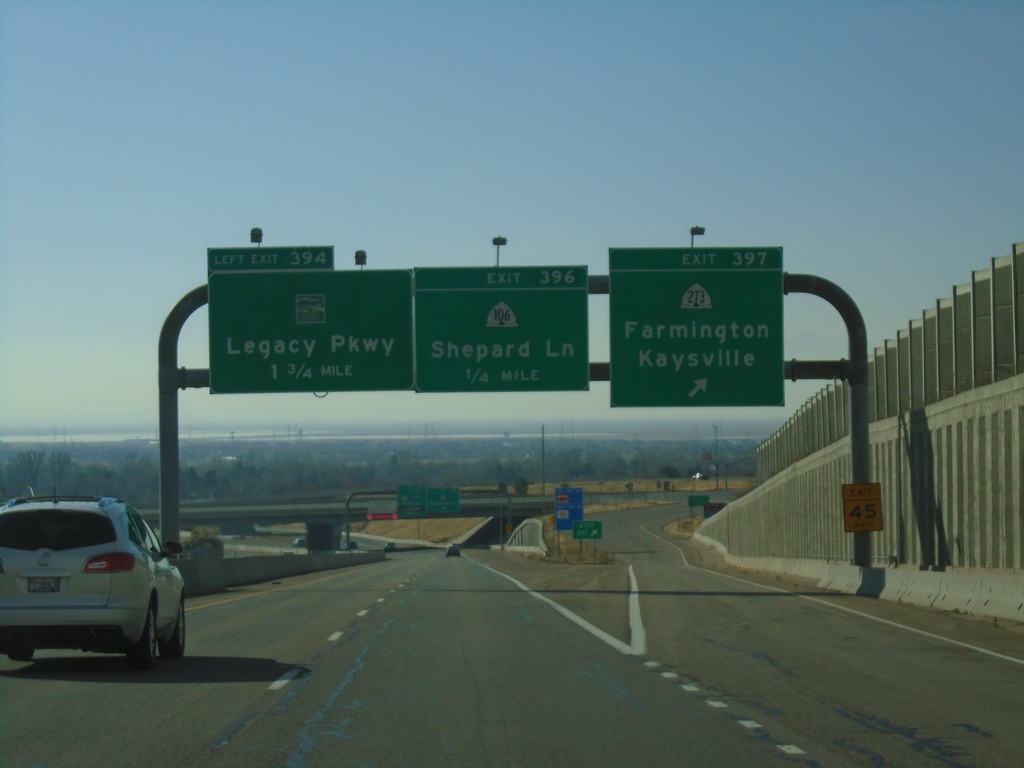
US-89 South - Exits 397, 396, and 394
US-89 South at Exit 397 - UT-273/Farmington/Kaysville. Approaching Exit 396 - UT-106/Shepard Lane. Approaching Exit 394 - (UT-67)/Legacy Parkway.
Taken 11-24-2019
 Fruit Heights
Davis County
Utah
United States
Fruit Heights
Davis County
Utah
United States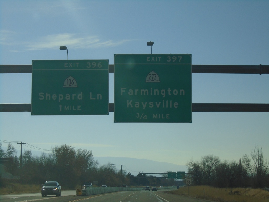
US-89 South - Exits 397 and 396
US-89 south approaching Exit 397 - UT-273/Farmington/Kaysville. Approaching Exit 396 - UT-106/Shepard Lane.
Taken 11-24-2019
Fruit Heights
Davis County
Utah
United States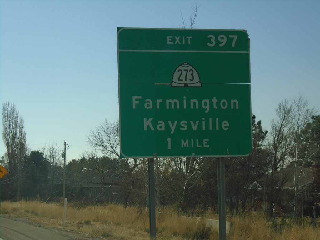
US-89 South - Exit 397
US-89 south approaching Exit 387 - UT-273/Farmington/Kaysville.
Taken 11-24-2019
Fruit Heights
Davis County
Utah
United States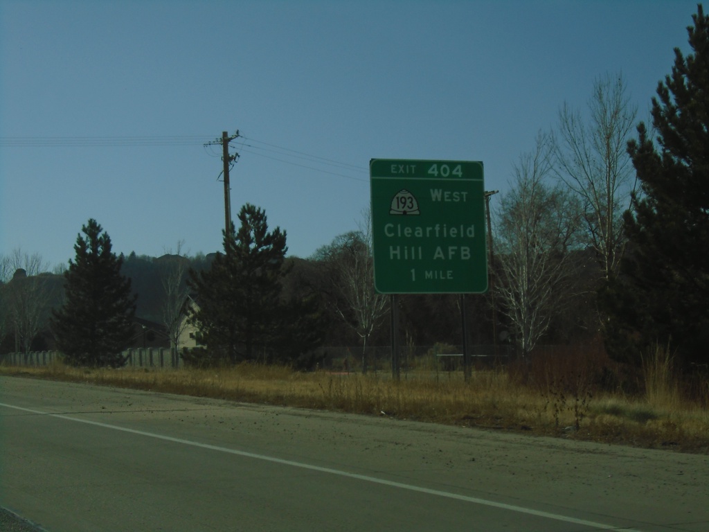
US-89 South - Exit 404
US-89 south approaching Exit 404 - UT-193/Clearfield/Hill AFB
Taken 11-24-2019
 South Weber
Davis County
Utah
United States
South Weber
Davis County
Utah
United States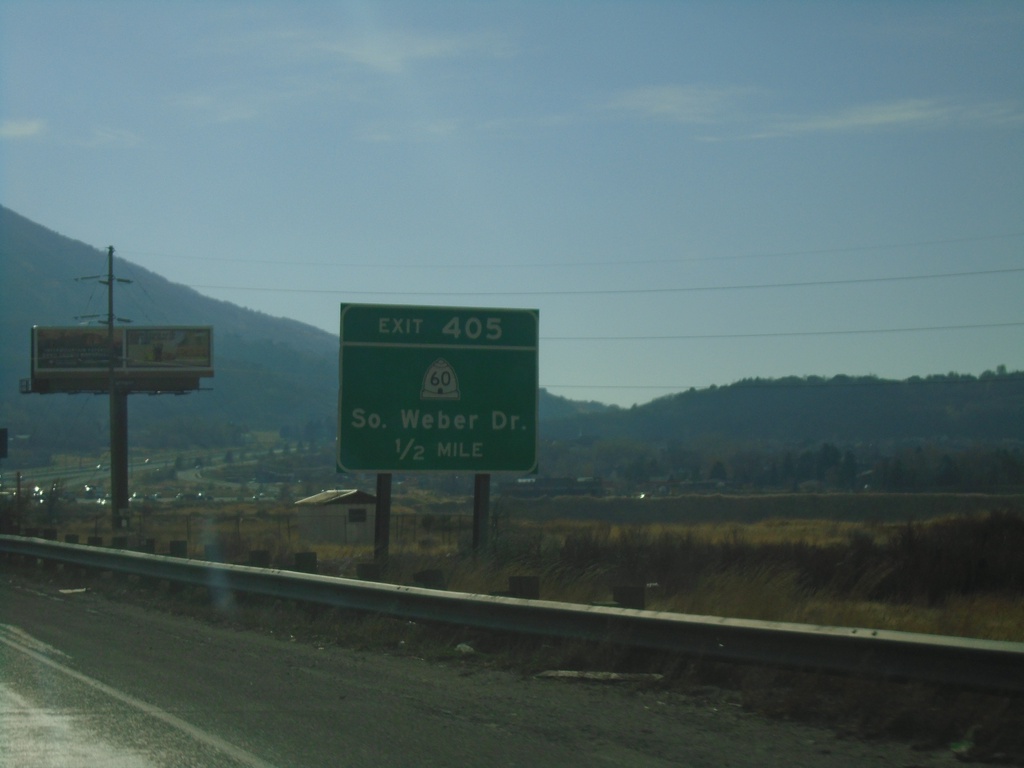
US-89 South - Exit 405
US-89 south approaching Exit 405 - UT-60/South Weber Drive
Taken 11-24-2019
 South Weber
Davis County
Utah
United States
South Weber
Davis County
Utah
United States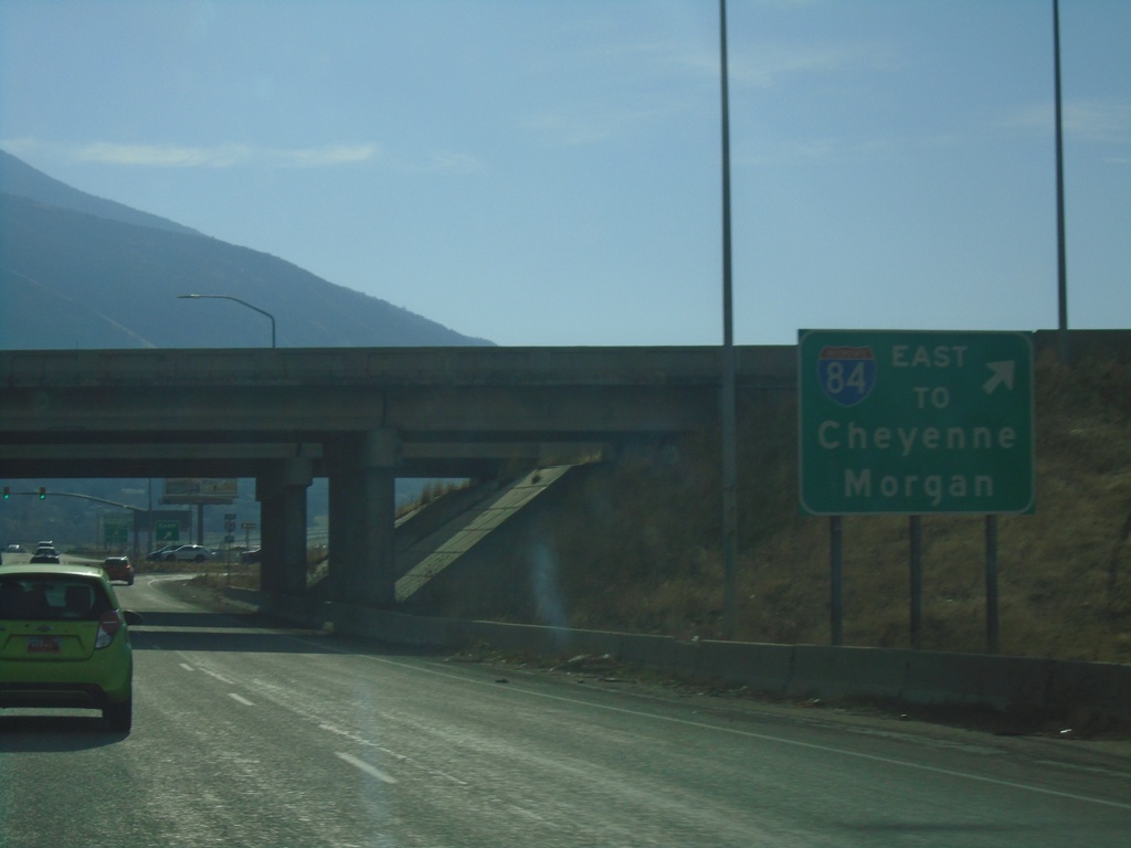
US-89 South at I-84 East
US-89 South at I-84 East onramp (Exit 87). Use I-84 west for Morgan and Cheyenne (Wyoming).
Taken 11-24-2019
 Uintah
Weber County
Utah
United States
Uintah
Weber County
Utah
United States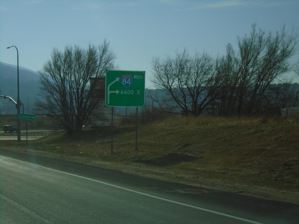
US-89 South Approaching I-84
US-89 South approaching I-84 and 6600 South in Uintah.
Taken 11-24-2019
Ogden
Weber County
Utah
United States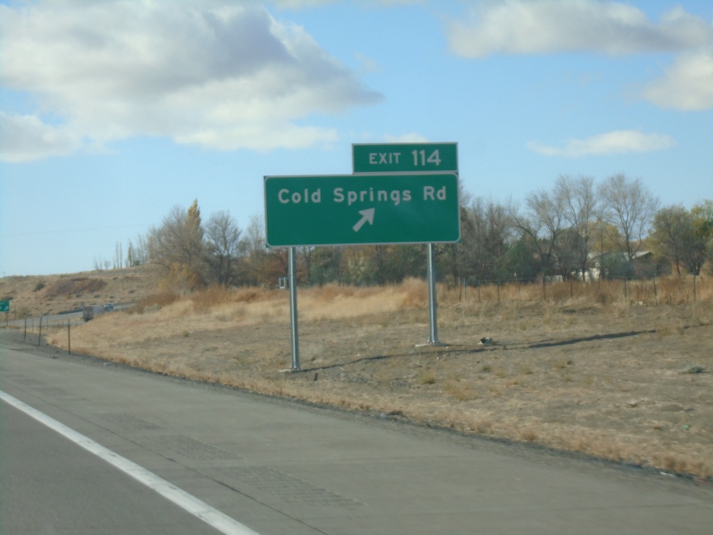
I-84 West - Exit 114
I-84 west at Exit 114 - Cold Springs Road
Taken 10-27-2019


 Hammett
Elmore County
Idaho
United States
Hammett
Elmore County
Idaho
United States