Signs Tagged With Big Green Sign
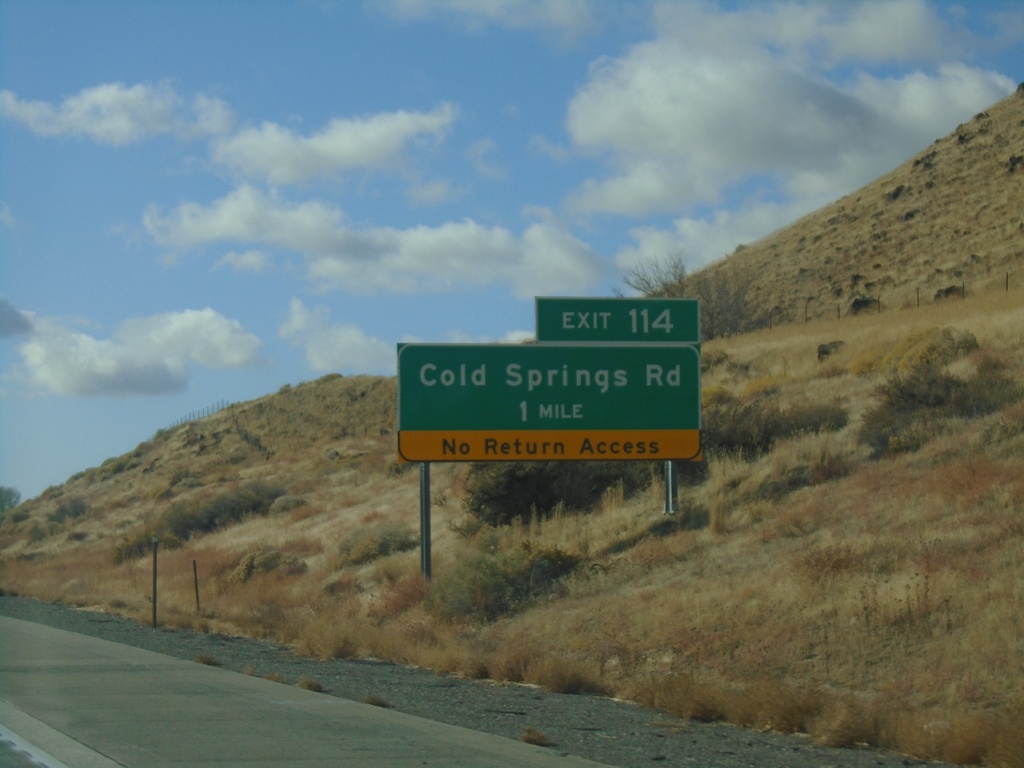
I-84 West - Exit 114
I-84 west approaching Exit 114 - Cold Springs Road.
Taken 10-27-2019


 Hammett
Elmore County
Idaho
United States
Hammett
Elmore County
Idaho
United States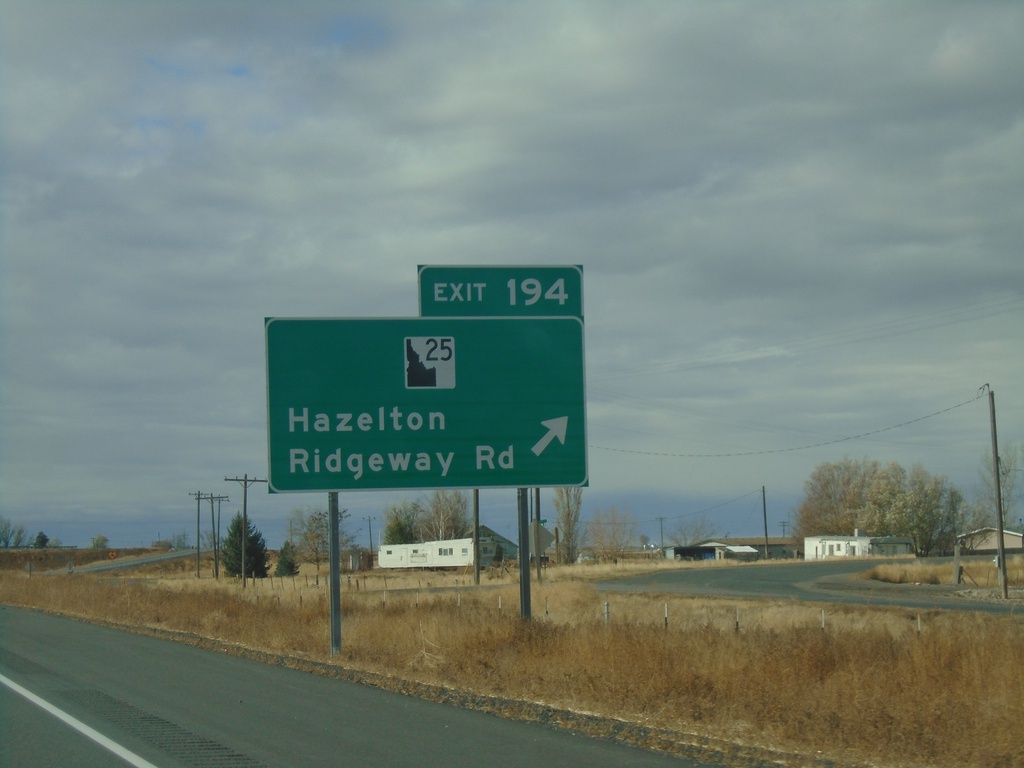
I-84 West - Exit 194
I-84 west at Exit 194 - ID-25/Ridgeway Road/Hazelton. ID-25 west leaves I-84 westbound here. The ID-25 shield is a newer style that has been appearing on guide signs recently.
Taken 10-27-2019
 Hazelton
Jerome County
Idaho
United States
Hazelton
Jerome County
Idaho
United States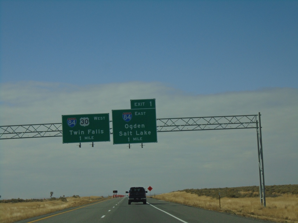
I-86 West at I-84
I-86 west at Exit 1 - I-84 East/Ogden/Salt Lake and I-84 West/US-30 West/Twin Falls. I-86 ends at I-84.
Taken 10-27-2019
 Declo
Cassia County
Idaho
United States
Declo
Cassia County
Idaho
United States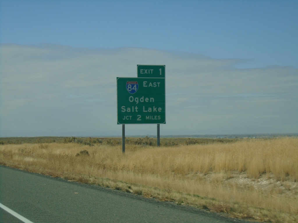
I-86 West Approaching I-84
I-86 west approaching Exit 1 - I-84 West/Ogden (Utah)/Salt Lake (Utah). This is the west end of I-86.
Taken 10-27-2019
Cotterel
Cassia County
Idaho
United States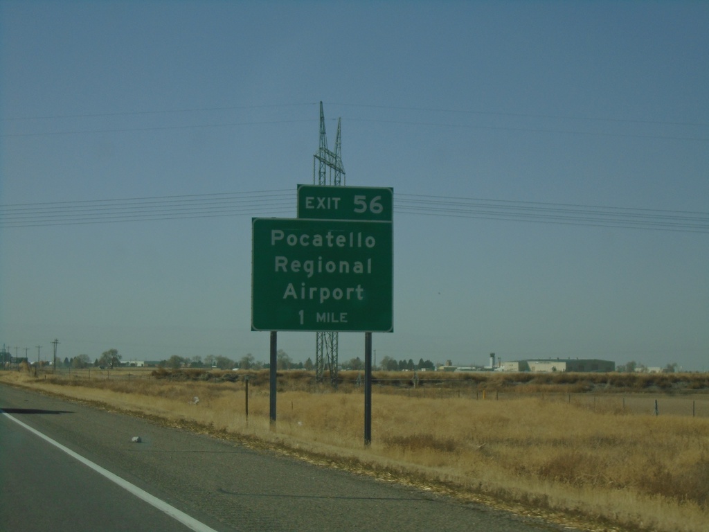
I-86 West - Exit 56
I-86 west approaching Exit 56 - Pocatello Regional Airport.
Taken 10-27-2019
Pocatello
Power County
Idaho
United States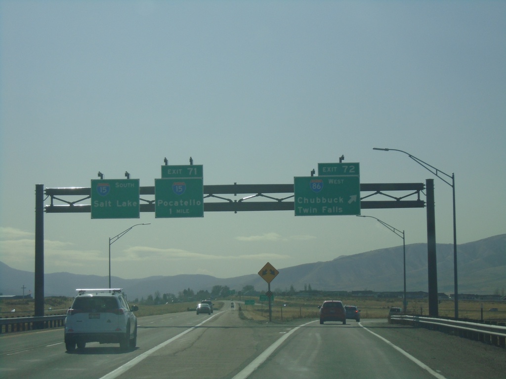
I-15 South - Exit 72 and 71
I-15 south at Exit 72 - I-86 West/Twin Falls/Chubbuck. Approaching Exit 71 - BL-15/Pocatello. Continue south on I-15 for Salt Lake. The BL-15 shield on Exit 71 is incorrectly labeled as I-15.
Taken 10-27-2019

 Pocatello
Bannock County
Idaho
United States
Pocatello
Bannock County
Idaho
United States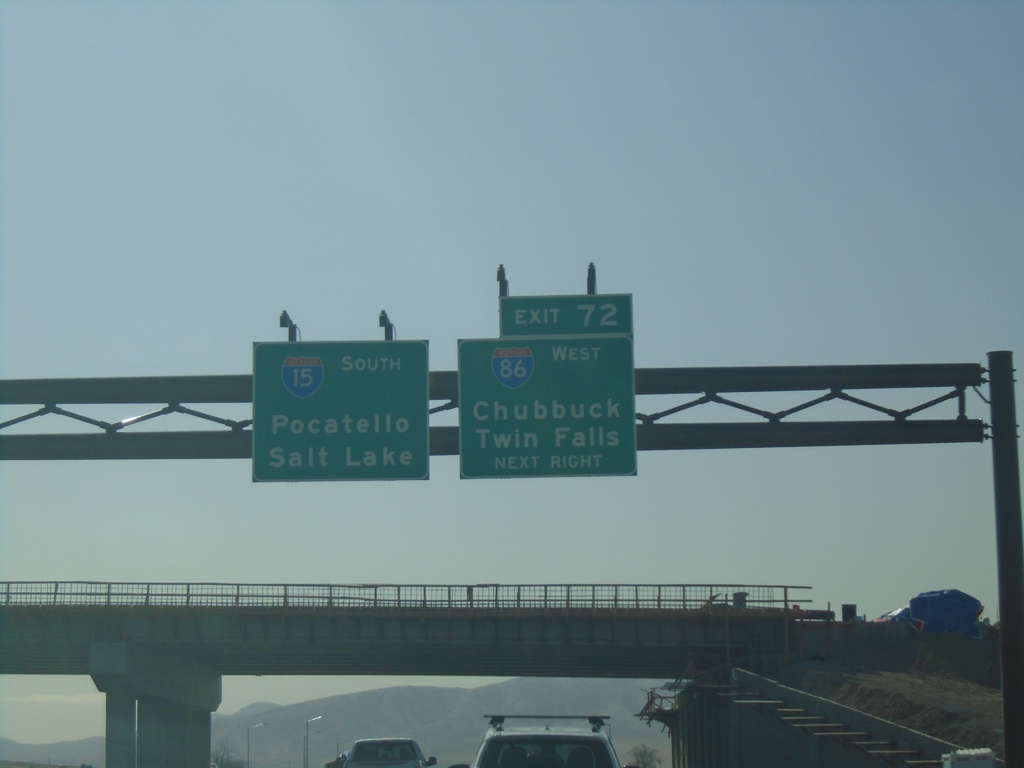
I-15 South - Exit 72
I-15 south approaching Exit 72 - I-86 West/Chubbuck/Twin Falls. Continue south on I-15 for Pocatello and Salt Lake (Utah).
Taken 10-27-2019
Chubbuck
Bannock County
Idaho
United States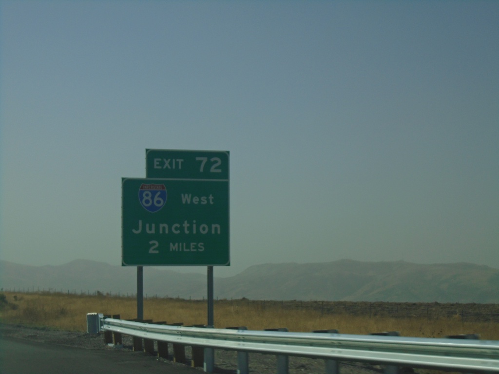
I-15 South - Exit 72
I-15 south approaching Exit 72 - I-86 West Junction.
Taken 10-27-2019
Chubbuck
Bannock County
Idaho
United States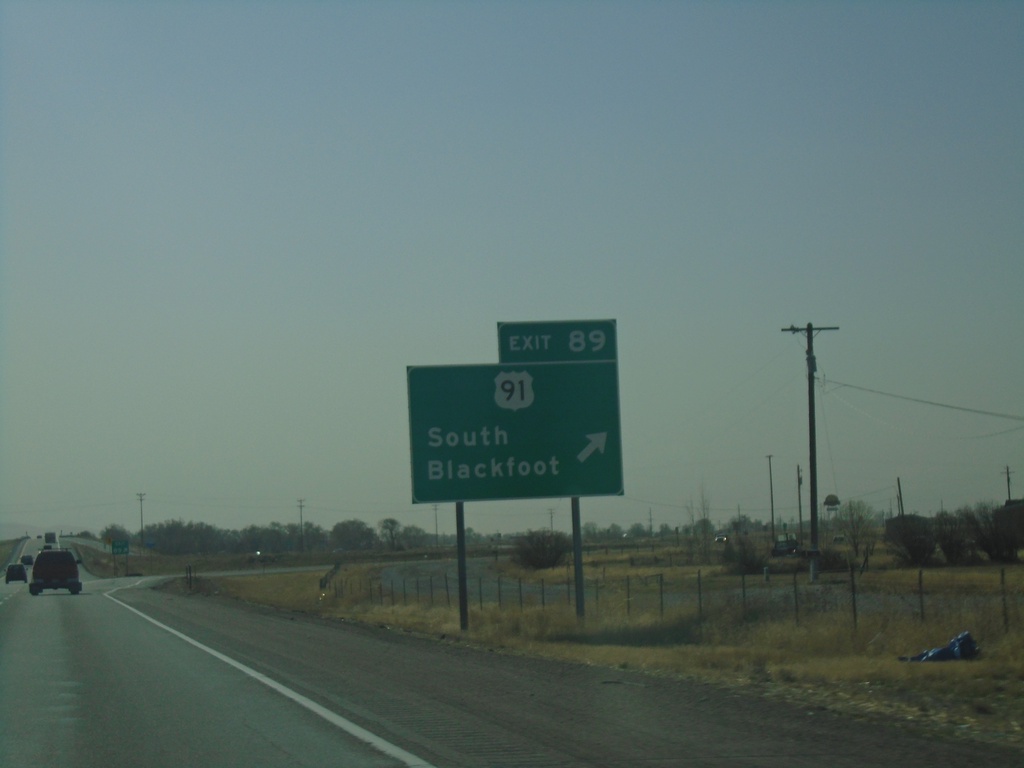
I-15 South - Exit 89
I-15 south at Exit 89 - US-91/South Blackfoot.
Taken 10-27-2019
 Blackfoot
Bingham County
Idaho
United States
Blackfoot
Bingham County
Idaho
United States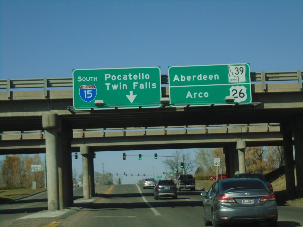
Emd BL-15 North at I-15 South/US-26 West
End BL-15 North at I-15 South (Exit 93)/US-26 West and approaching ID-39 in Blackfoot. Turn left for I-15 South to Pocatello and Twin Falls (via I-86). Continue straight for US-26 West to Arco and ID-39/Aberdeen Jct.
Taken 10-27-2019
 Blackfoot
Bingham County
Idaho
United States
Blackfoot
Bingham County
Idaho
United States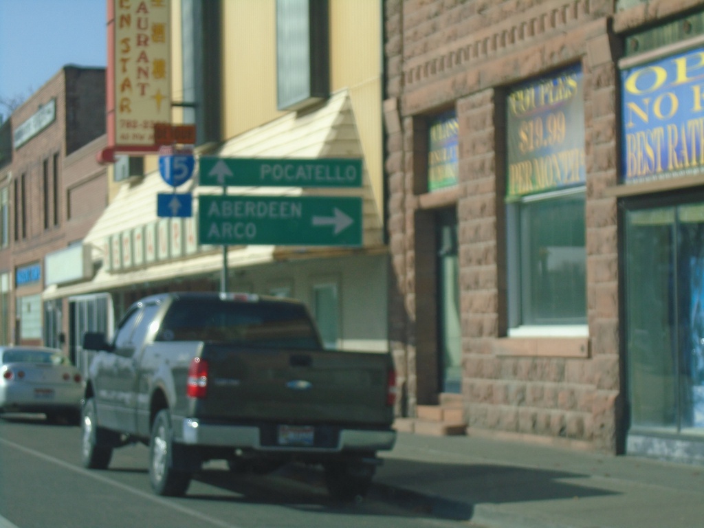
US-91 South at BL-15 - Blackfoot
US-91 South at BL-15 in Blackfoot. Turn right for BL-15 North to Aberdeen (via ID-39) and Arco (via US-26). Continue straight on US-91 South/BL-15 South for Pocatello and I-15.
Taken 10-27-2019
Blackfoot
Bingham County
Idaho
United States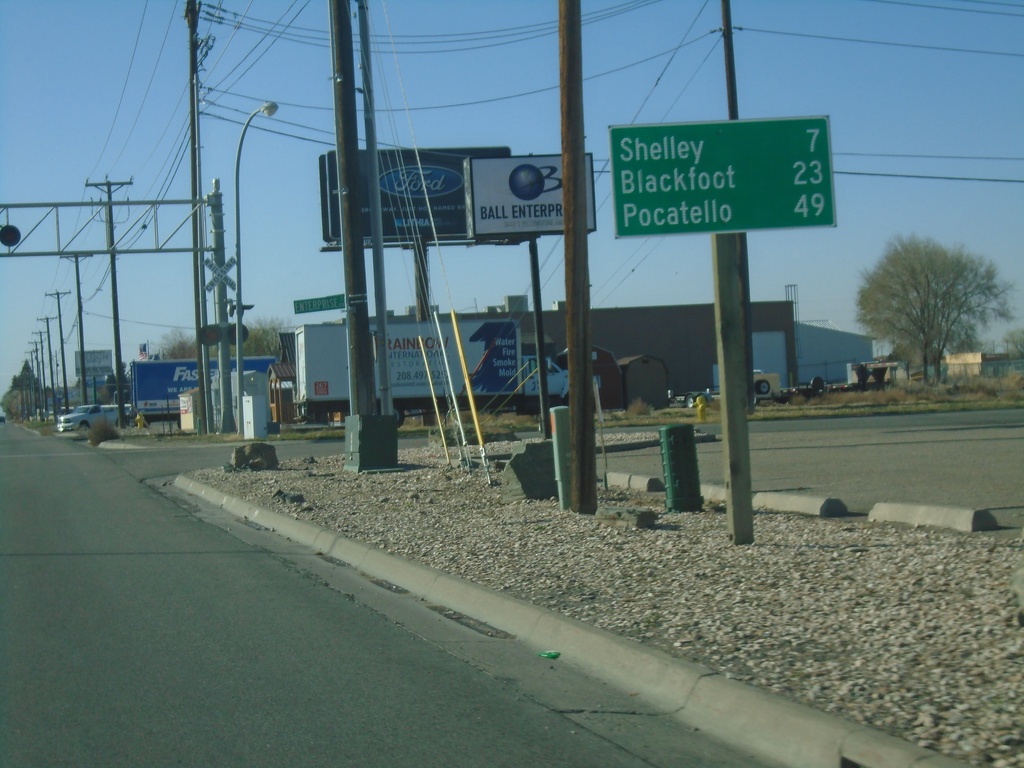
Bus. BL-15 South/US-26 West - Distance Marker
Distance marker on Bus. BL-15 South/US-26 West. Distance to Shelley (via US-91), Blackfoot, and Pocatello.
Taken 10-27-2019
Idaho Falls
Bonneville County
Idaho
United States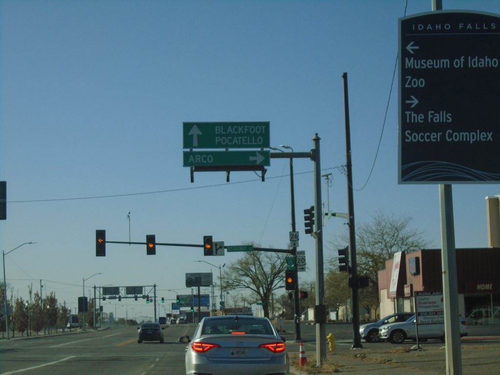
US-26 West/Bus. US-20 West at BL-15
US-26 West/Bus. US-20 West at BL-15/Bus. US-20 (Broadway) in Idaho Falls. Turn right for Bus. US-20 West/BL-15 North - Arco (via US-20). Continue straight for US-26 West/BL-15 South/Blackfoot/Pocatello.
Taken 10-27-2019
 Idaho Falls
Bonneville County
Idaho
United States
Idaho Falls
Bonneville County
Idaho
United States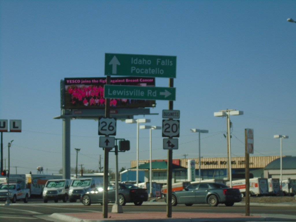
US-26 West at Bus. US-20
US-26 west at Bus. US-20 in Idaho Falls. Turn right for Bus. US-20 East/Lewisville Road. Continue straight for US-20 West/Bus. US-20 West/Idaho Falls/Pocatello.
Taken 10-27-2019
Idaho Falls
Bonneville County
Idaho
United States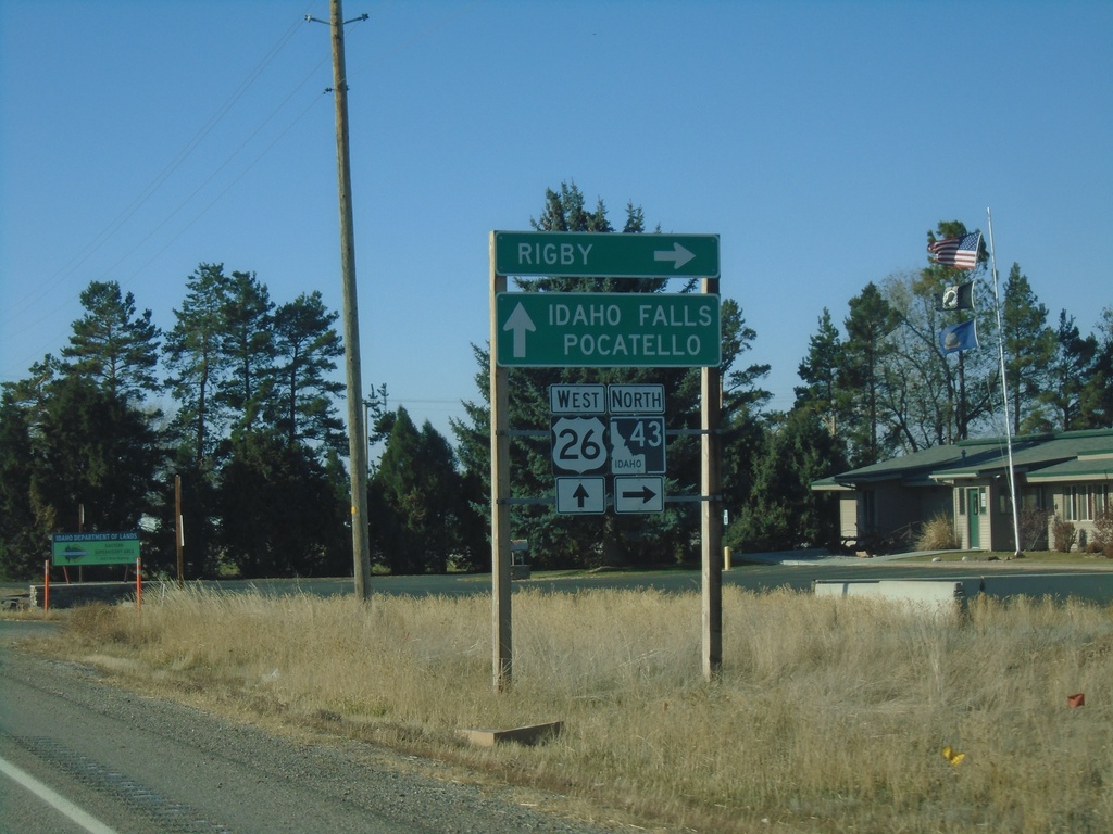
US-26 West at ID-43 North
US-26 West at ID-43 North to Rigby. Continue west on US-26 for Idaho Falls and Pocatello.
Taken 10-27-2019
 Idaho Falls
Bonneville County
Idaho
United States
Idaho Falls
Bonneville County
Idaho
United States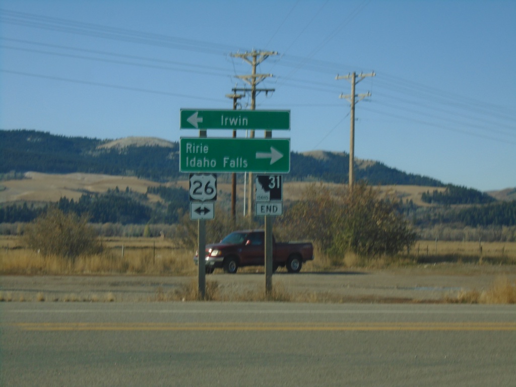
End ID-31 South at US-26
End ID-31 South at US-26 in Swan Valley. Turn left for US-26 East to Irwin; right for US-26 west to Ririe and Idaho Falls.
Taken 10-27-2019
 Swan Valley
Bonneville County
Idaho
United States
Swan Valley
Bonneville County
Idaho
United States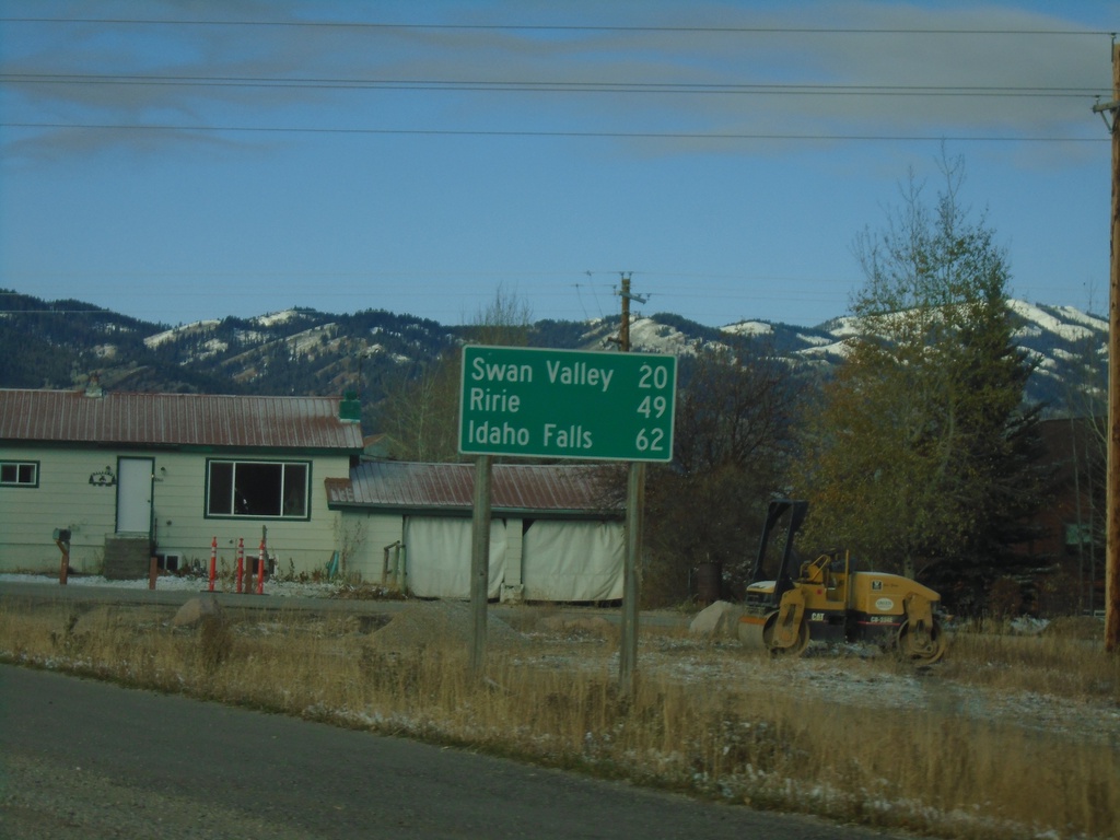
ID-31 South - Distance Marker
Distance marker on ID-31 south. Distance to Swan Valley, Ririe, and Idaho Falls.
Taken 10-27-2019
Victor
Teton County
Idaho
United States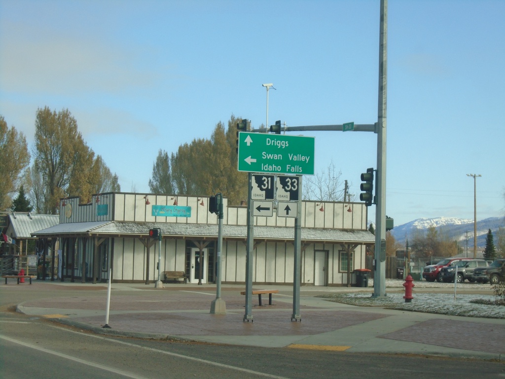
ID-33 West at ID-31 - Victor
ID-31 west at ID-31 in Victor. Turn left for ID-31 to Swan Valley and Idaho Falls (via US-26). Continue on ID-33 for Driggs.
Taken 10-27-2019
 Victor
Teton County
Idaho
United States
Victor
Teton County
Idaho
United States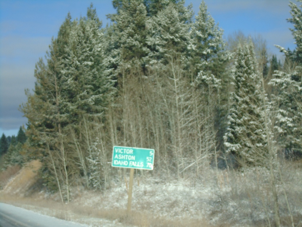
ID-33 West - Distance Marker
Distance marker on ID-33 west. Distance to Victor, Ashton, and Idaho Falls.
Taken 10-27-2019
Victor
Teton County
Idaho
United States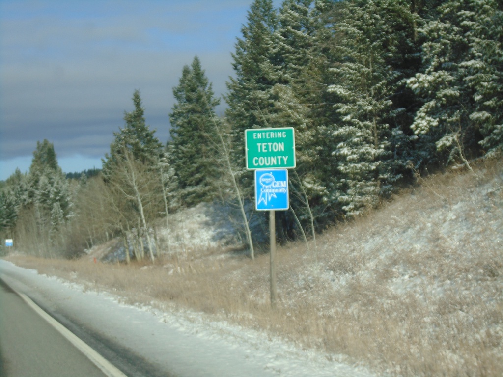
ID-33 West - Teton County
Entering Teton County on ID-33 west.
Taken 10-27-2019
Victor
Teton County
Idaho
United States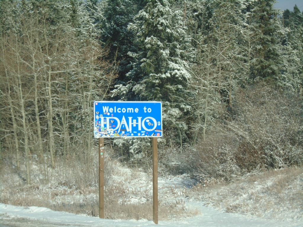
Welcome To Idaho - ID-33 West
Welcome To Idaho on ID-33 West
Taken 10-27-2019
Victor
Teton County
Idaho
United States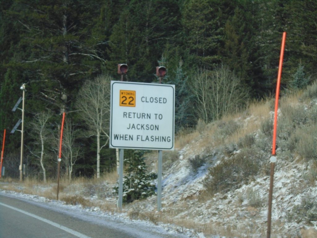
WY-22 West - Return To Jackson When Flashing
WY-22 west at the base of Teton Pass. Return to Jackson When Flashing.
Taken 10-27-2019
 Wilson
Teton County
Wyoming
United States
Wilson
Teton County
Wyoming
United States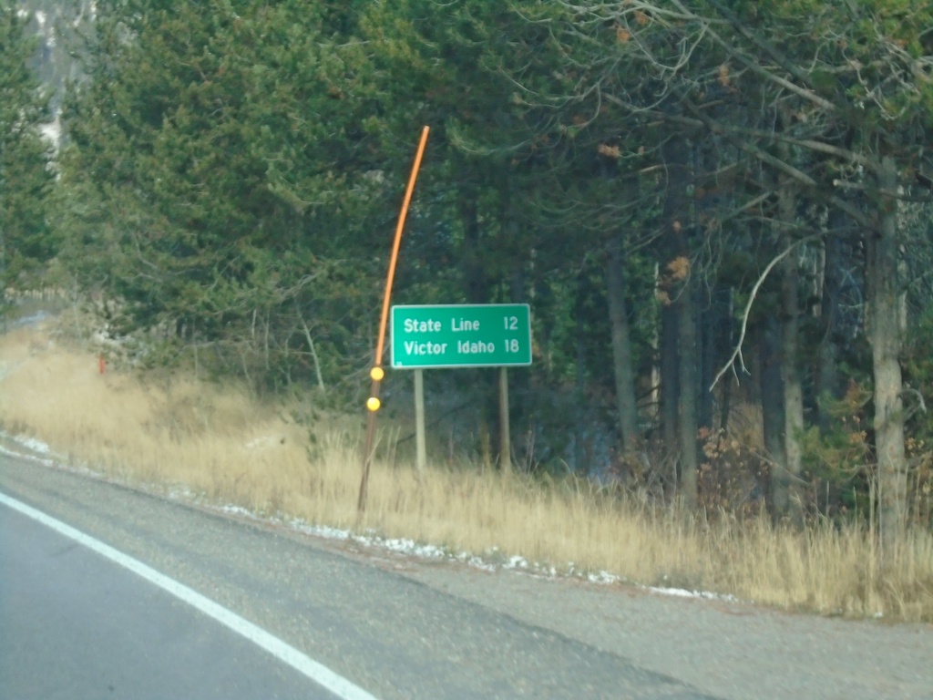
WY-22 West - Distance Marker
Distance marker on WY-22 west. Distance to (Idaho-Wyoming) State Line and Victor Idaho.
Taken 10-27-2019
Wilson
Teton County
Wyoming
United States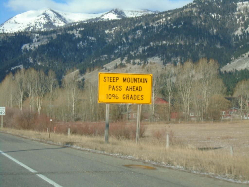
WY-22 West Approaching Teton Pass
WY-22 west approaching Teton Pass. Steep Mountain Pass Ahead - 10% Grades.
Taken 10-27-2019
Wilson
Teton County
Wyoming
United States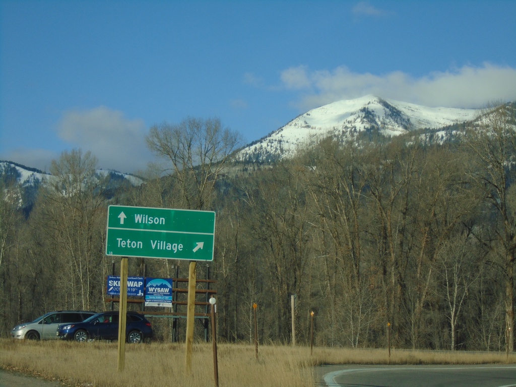
WY-22 West at WY-390 North
WY-22 West at WY-390 North. Turn right for WY-390 north to Teton Village; straight on WY-22 west for Wilson.
Taken 10-27-2019
 Wilson
Teton County
Wyoming
United States
Wilson
Teton County
Wyoming
United States