Signs Tagged With Big Green Sign
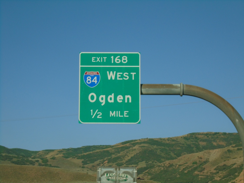
I-80 West - Exit 168
I-80 west approaching Exit 168 - I-84 West/Ogden. This is the eastern end of I-84.
Taken 07-18-2020


 Coalville
Summit County
Utah
United States
Coalville
Summit County
Utah
United States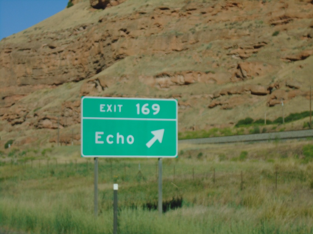
I-80 West - Exit 169
I-80 west at Exit 169 - Echo.
Taken 07-18-2020
Echo
Summit County
Utah
United States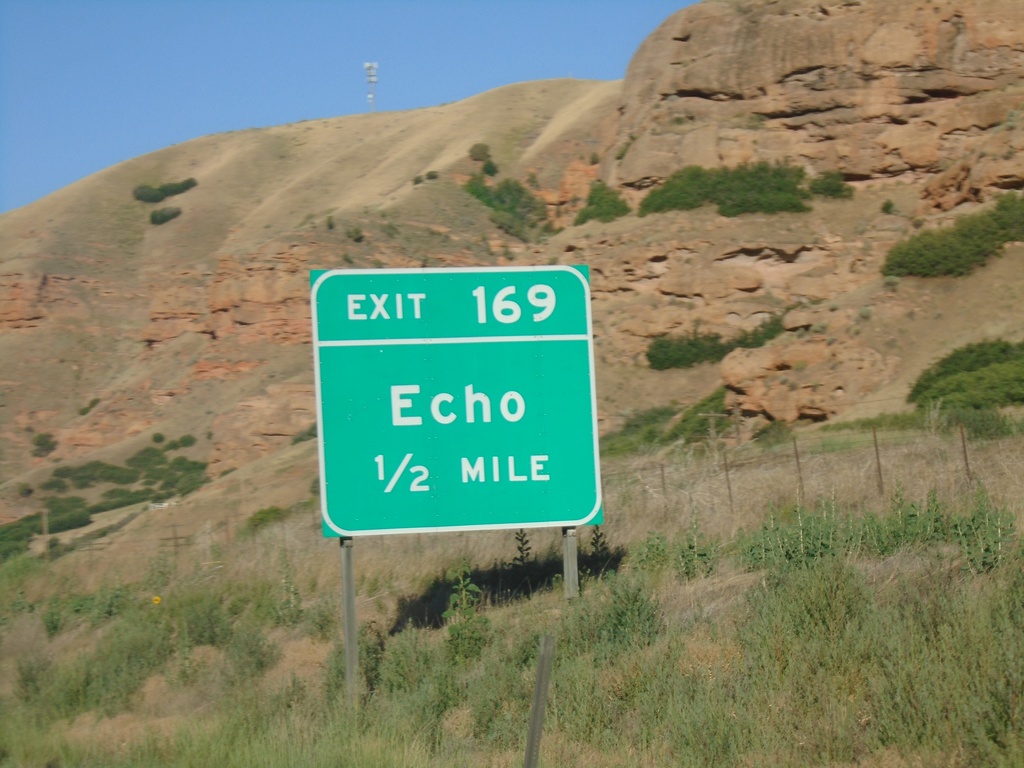
I-80 West - Exit 169
I-80 west approaching Exit 169 - Echo.
Taken 07-18-2020
Echo
Summit County
Utah
United States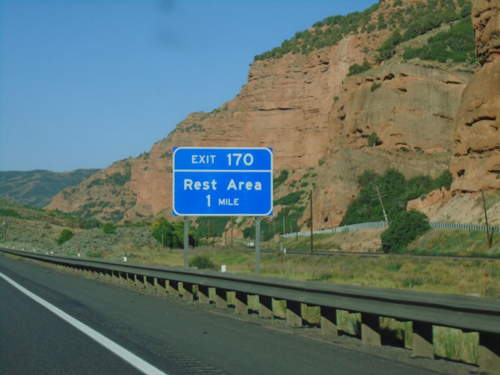
I-80 West - Exit 170
I-80 west approaching Exit 170 - Rest Area.
Taken 07-18-2020
Echo
Summit County
Utah
United States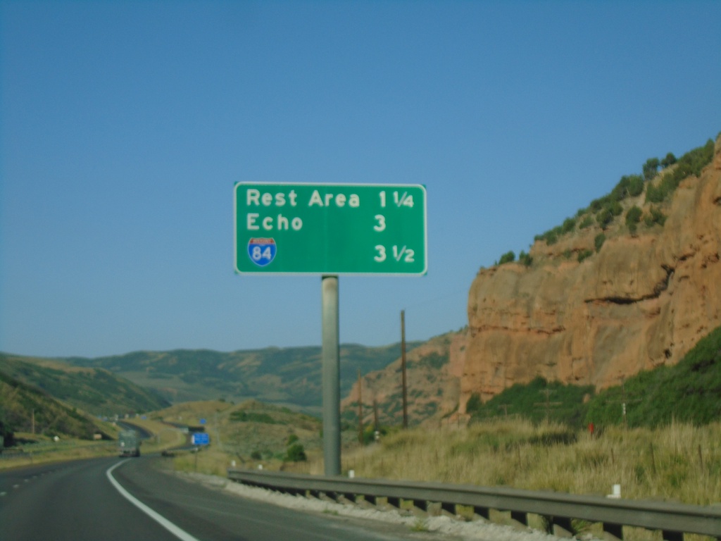
I-80 West - Distance Marker
Distance marker on I-80 west for next three exits - Rest Area, Echo, and I-84.
Taken 07-18-2020
Echo
Summit County
Utah
United States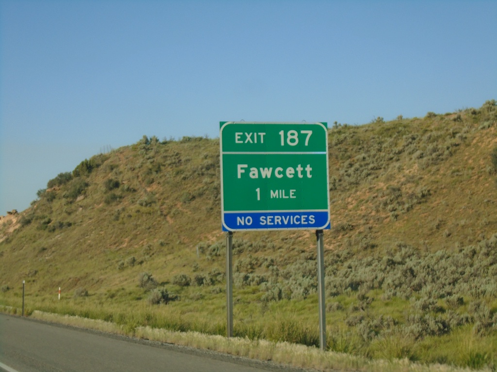
I-80 West - Exit 187
I-80 west approaching Exit 187 - Fawcett. This exit was renamed from Ranch Exit in the last few years.
Taken 07-18-2020
Coalville
Summit County
Utah
United States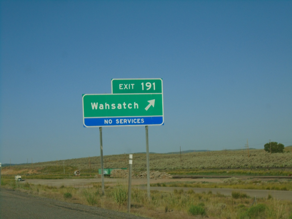
I-80 West - Exit 191
I-80 west at Exit 191 - Wahsatch.
Taken 07-18-2020
Coalville
Summit County
Utah
United States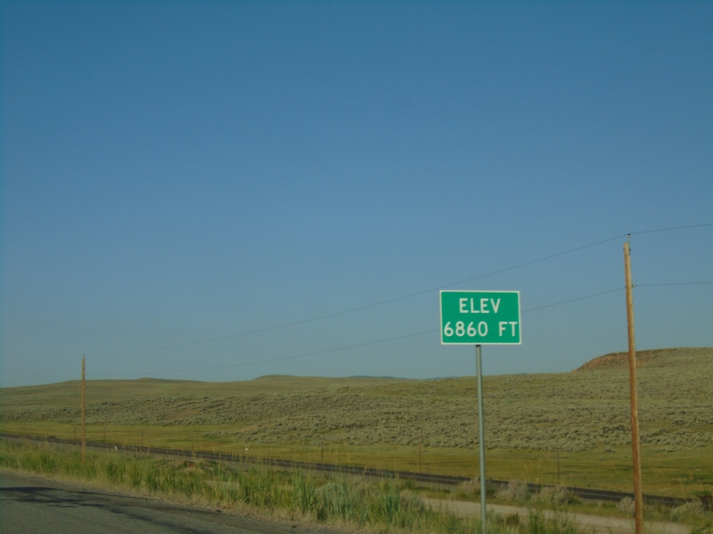
I-80 West - Elevation 6860 Feet
I-80 west Elevation 6860 Feet. Many highways entering Utah have the elevation listed at or near the state line.
Taken 07-18-2020
Wahsatch
Summit County
Utah
United States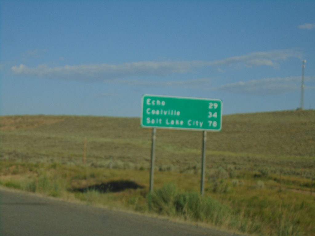
I-80 West - Distance Marker
Distance marker on I-80 west. Distance to Echo, Coalville, and Salt Lake City. This is the first distance marker on I-80 westbound in Utah.
Taken 07-18-2020
Wahsatch
Summit County
Utah
United States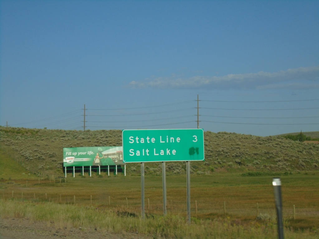
I-80 West - Distance Marker
Last distance marker on I-80 westbound in Wyoming. Distance to (Utah) State Line and Salt Lake (Utah).
Taken 07-18-2020
Evanston
Uinta County
Wyoming
United States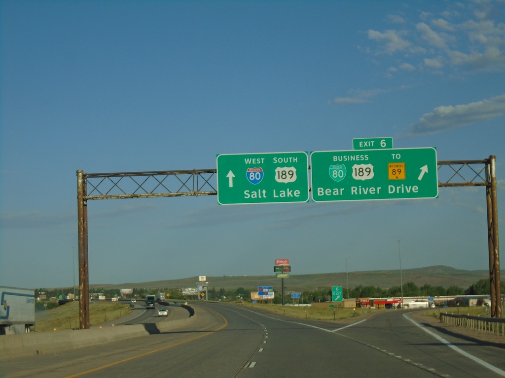
I-80 West - Exit 6
I-80 west at Exit 6 - BL-80/Business US-189/To WY-89/Bear River Drive. I-80 West/US-189 South continues towards Salt Lake (Utah). This is the eastern end of the Evanston business loop. Evanston is the last city in Wyoming along I-80 west.
Taken 07-18-2020


 Evanston
Uinta County
Wyoming
United States
Evanston
Uinta County
Wyoming
United States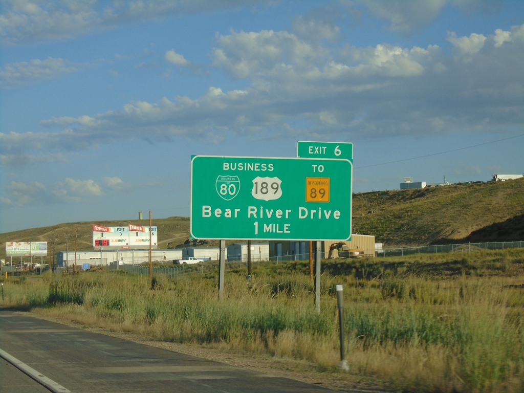
I-80 West - Exit 6
I-80 west approaching Exit 6 - BL-80/Bus. US-189/To WY-89/Bear River Drive.
Taken 07-18-2020
Evanston
Uinta County
Wyoming
United States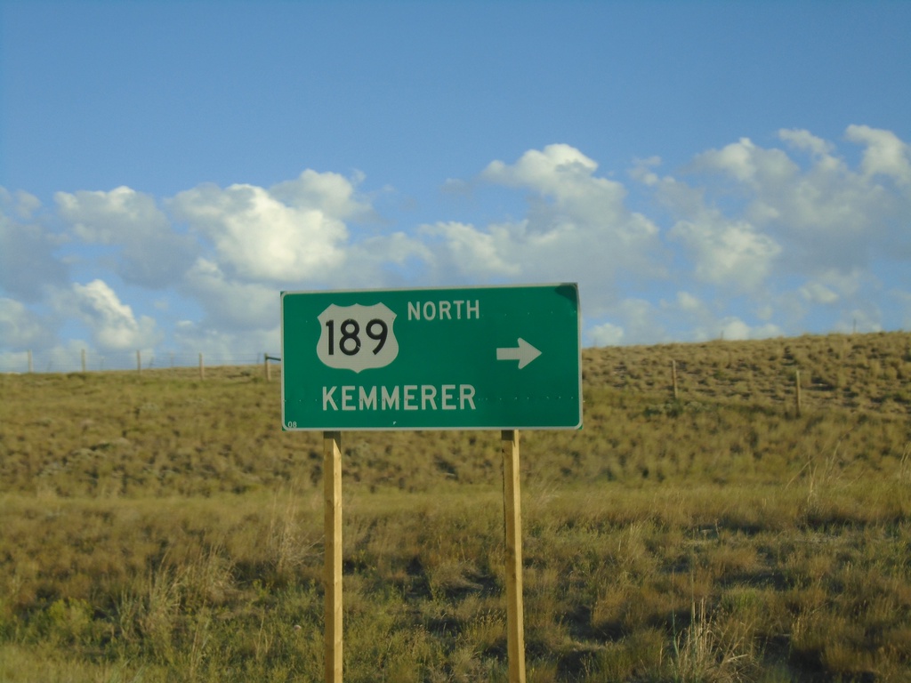
I-80 West - Exit 18 Offramp at US-189
I-80 West (Exit 18) offramp at US-189. Turn right for US-189 north to Kemmerer.
Taken 07-18-2020
Evanston
Uinta County
Wyoming
United States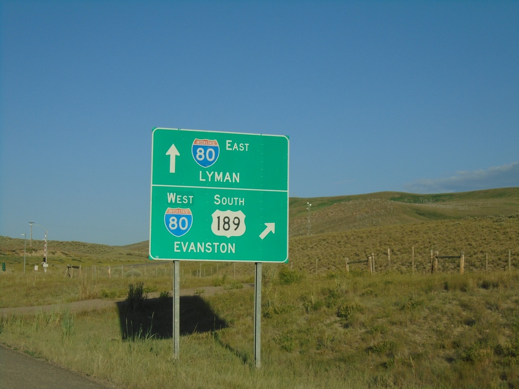
US-189 South at I-80
US-189 South at I-80 (Exit 18). Use I-80 east to Lyman; use I-80 West/US-189 South to Evanston. US-189 South joins I-80 westbound.
Taken 07-18-2020
Evanston
Uinta County
Wyoming
United States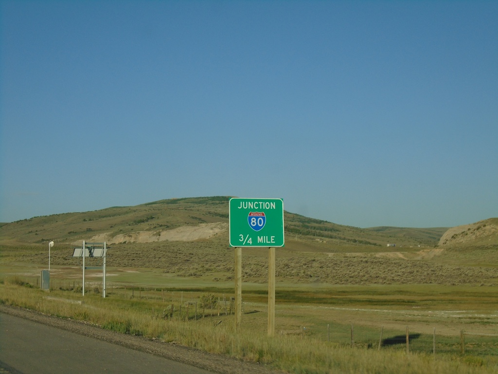
US-189 South Approaching I-80
US-189 South approaching I-80 in Uinta County.
Taken 07-18-2020
Evanston
Uinta County
Wyoming
United States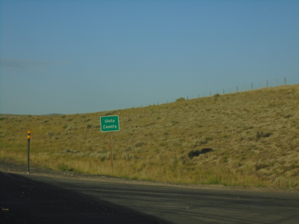
US-189 South - Uinta County
Entering Uinta County on US-189 south.
Taken 07-18-2020
Kemmerer
Uinta County
Wyoming
United States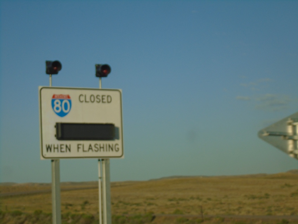
US-189 South - I-80 Closed When Flashing
I-80 Closed When Flashing on US-189 South.
Taken 07-18-2020
Kemmerer
Lincoln County
Wyoming
United States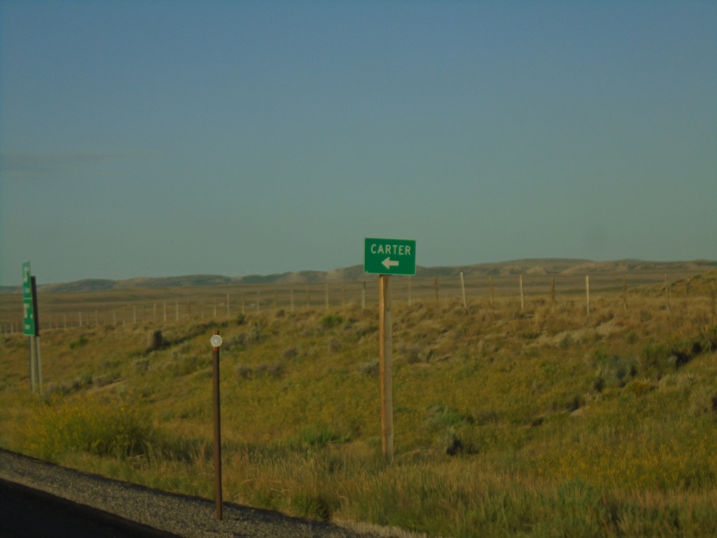
US-189 South at WY-412
US-189 South at WY-412 to Carter.
Taken 07-18-2020
 Kemmerer
Lincoln County
Wyoming
United States
Kemmerer
Lincoln County
Wyoming
United States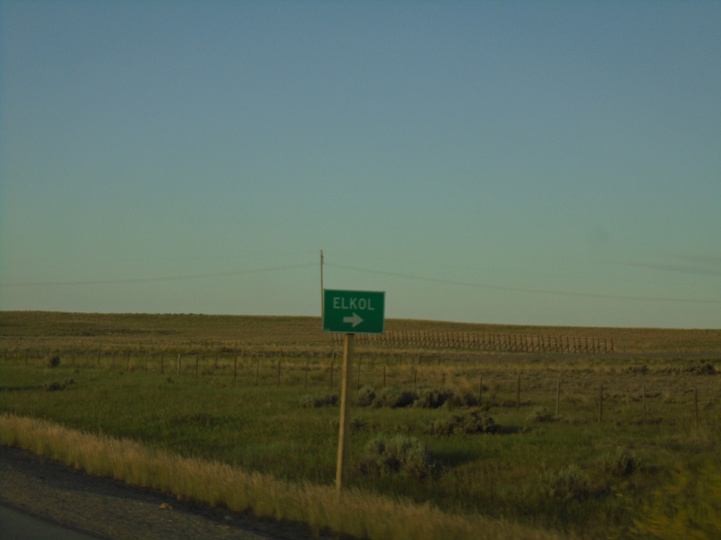
US-189 South - Elkol
US-189 south at Elkol Junction.
Taken 07-18-2020
Kemmerer
Lincoln County
Wyoming
United States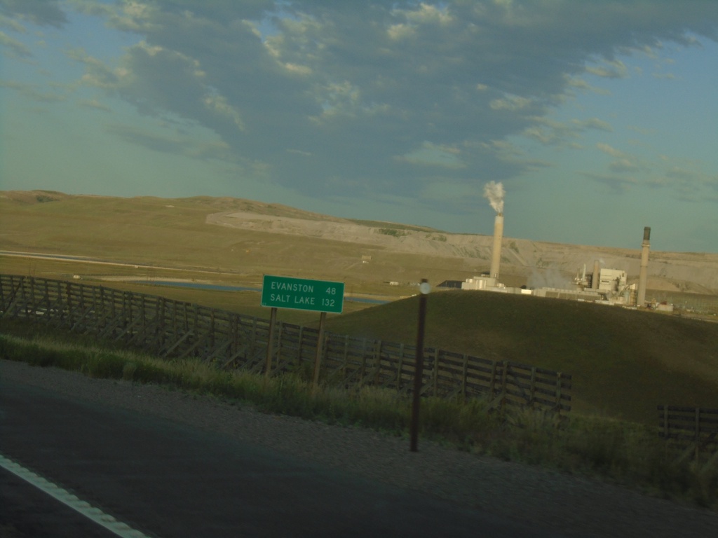
US-189 South - Distance Marker
Distance marker on US-189 south. Distance to Evanston and Salt Lake (Utah). Both destinations are via I-80 west.
Taken 07-18-2020
Kemmerer
Lincoln County
Wyoming
United States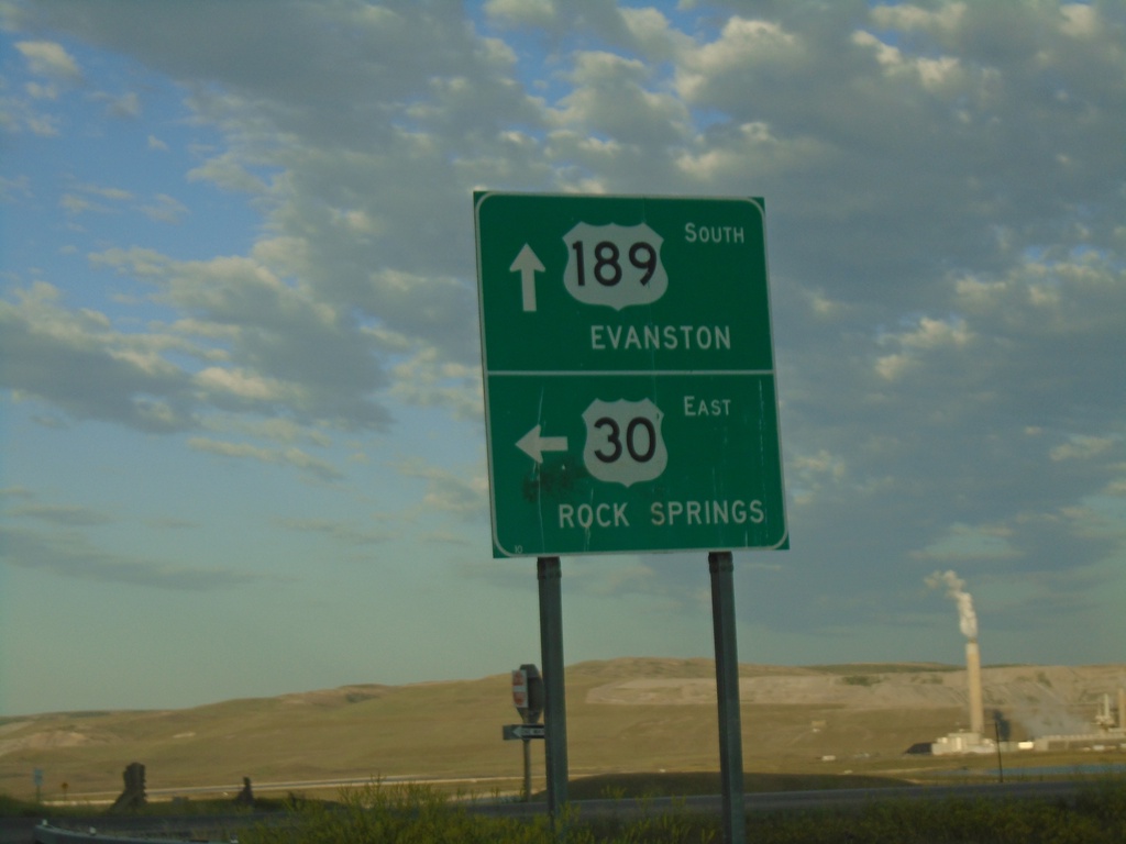
US-189 South/US-30 East at US-189/US-30 Split
US-189 South/US-30 East at US-189/US-30 Split. Turn left for US-30 East onramp to Rock Springs. Continue south on US-189 for Evanston. This is the east end of the Kemmerer US-30 Bypass.
Taken 07-18-2020

 Kemmerer
Lincoln County
Wyoming
United States
Kemmerer
Lincoln County
Wyoming
United States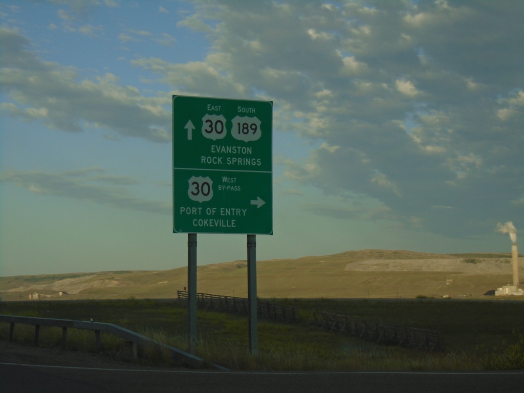
US-30 East/US-189 South at Split
US-30 East/US-189 South at US-30 By-Pass and US-30 ramps. Use US-189 South/US-30 East for Evanston. Turn right for the US-30 By-Pass West onramp for Port of Entry and Cokeville.
Taken 07-18-2020
Kemmerer
Lincoln County
Wyoming
United States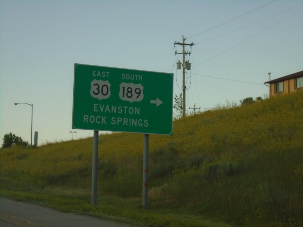
US-30 East/US-189 South - Diamondville
US-30 East/US-189 south in Diamondville. Turn right to continue on US-30 East/US-189 South. Use US-30 East/US-189 south for Evanston and Rock Springs.
Taken 07-18-2020
Kemmerer
Lincoln County
Wyoming
United States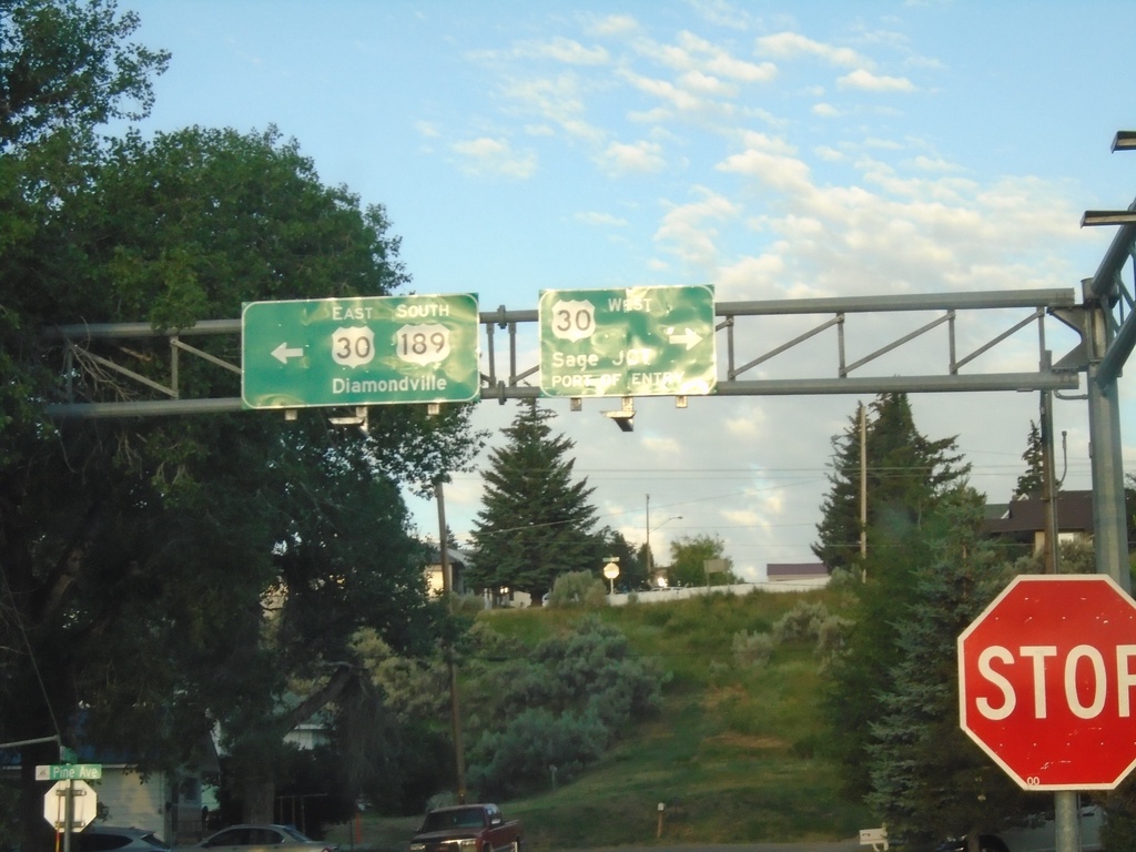
US-189 South at US-30
US-189 South at US-30 in Kemmerer. Turn right for US-30 west to Sage Junction and Port of Entry. Turn left for US-30 East/US-189 south to Diamondville. US-30 east joins US-189 south through Kemmerer and Diamondville.
Taken 07-18-2020
Kemmerer
Lincoln County
Wyoming
United States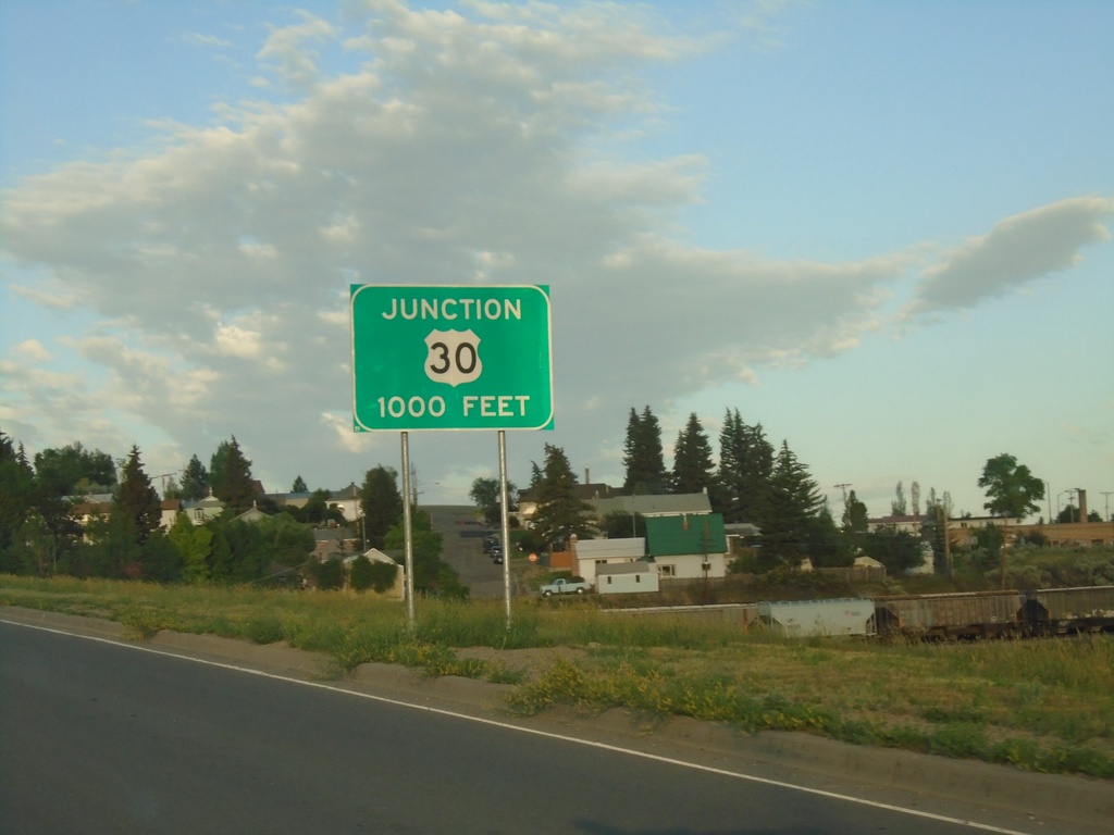
US-189 South approaching US-30
US-189 south approaching US-30 in Kemmerer.
Taken 07-18-2020
Kemmerer
Lincoln County
Wyoming
United States