Signs Tagged With Big Green Sign
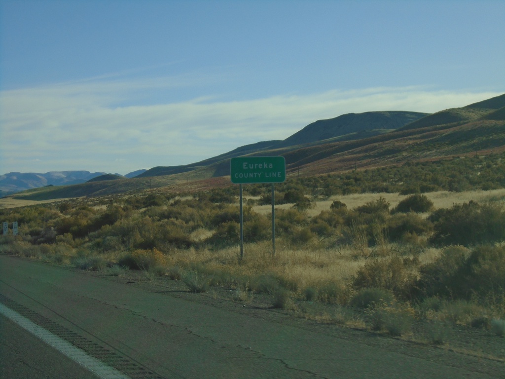
I-80 East - Eureka County Line
I-80 east at Eureka County Line.
Taken 10-20-2019
 Battle Mountain
Eureka County
Nevada
United States
Battle Mountain
Eureka County
Nevada
United States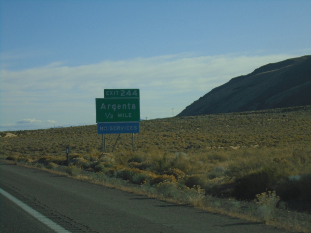
I-80 East - Exit 244
I-80 east approaching Exit 244 - Argenta
Taken 10-20-2019
Argenta
Lander County
Nevada
United States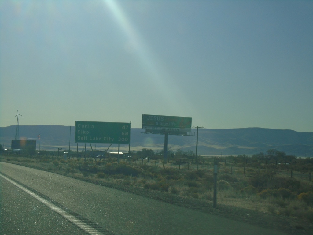
I-80 East - Distance Marker
Distance marker on I-80 east. Distance to Carlin, Elko, and Salt Lake City. This is the first appearance of Salt Lake City as a control city along I-80 east in Nevada.
Taken 10-20-2019
Battle Mountain
Lander County
Nevada
United States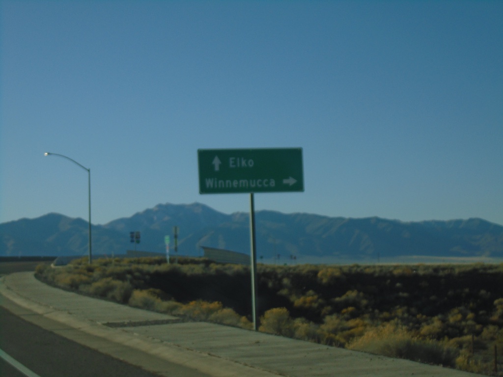
BL-80/NV-304 East at I-80 West
BL-80/NV-304 East at I-80 West to Winnemucca. Use I-80 east for Elko.
Taken 10-20-2019

 Battle Mountain
Lander County
Nevada
United States
Battle Mountain
Lander County
Nevada
United States
End NV-305 North at BL-80/NV-304
End of NV-305 at BL-80/NV-304. Turn right on BL-80/NV-304 for Elko; turn left on BL-80/NV-304 for Winnemucca.
Taken 10-20-2019
 Battle Mountain
Lander County
Nevada
United States
Battle Mountain
Lander County
Nevada
United States
NV-305 North - Postmile 88
NV-305 North - Lander County Postmile 88
Taken 10-20-2019
Battle Mountain
Lander County
Nevada
United States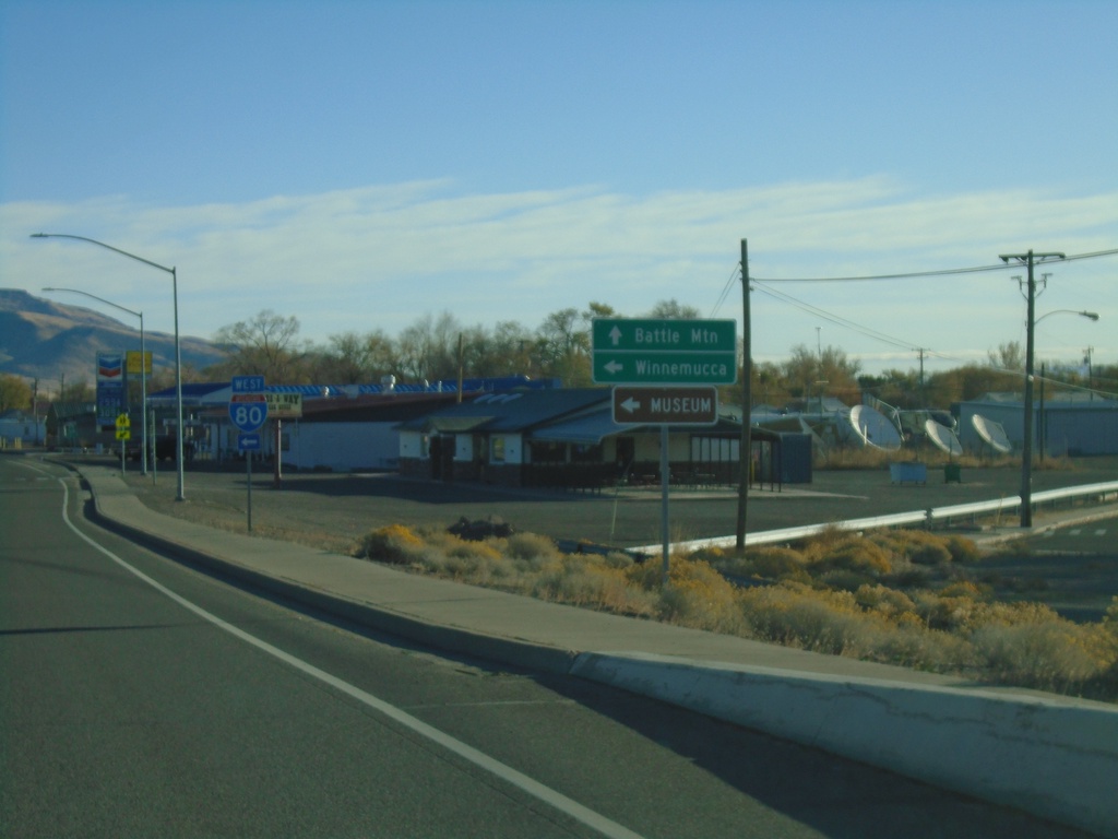
NV-305 North at I-80 West
NV-305 North at I-80 West (Exit 231). Use I-80 west for Winnemucca. Continue north on NV-305 for Battle Mountain.
Taken 10-20-2019
Battle Mountain
Lander County
Nevada
United States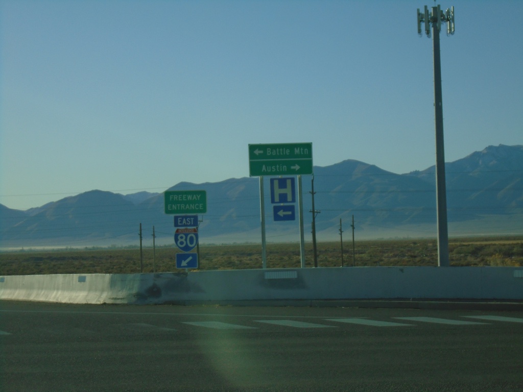
I-80 East Exit 231 Offramp at NV-305
I-80 East Exit 231 Offramp at NV-305 in Battle Mountain. Use NV-305 North for Battle Mountain; NV-305 South for Austin.
Taken 10-20-2019
Battle Mountain
Lander County
Nevada
United States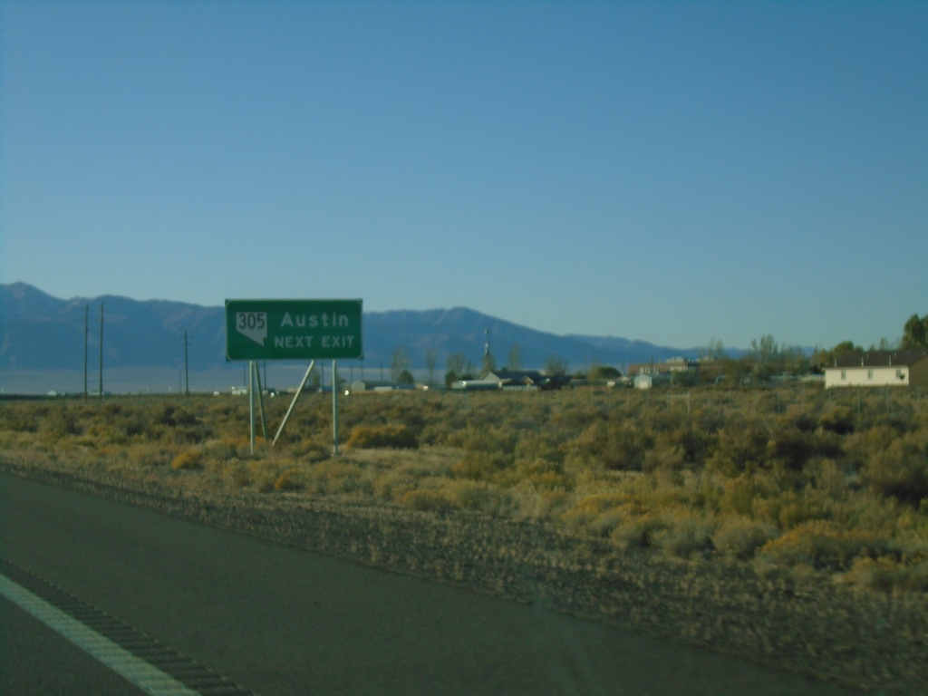
I-80 East Exit 231 - Use NV-305 For Austin
I-80 east approaching Exit 231. Use NV-305 South for Austin.
Taken 10-20-2019
Battle Mountain
Lander County
Nevada
United States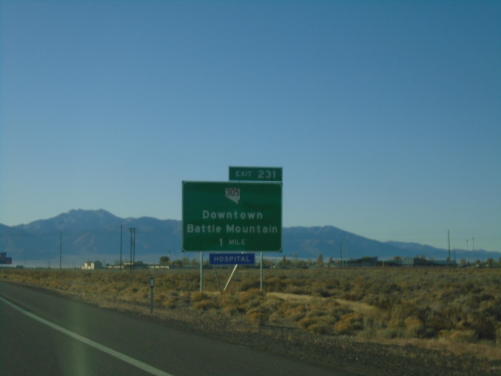
I-80 East - Exit 231
I-80 east approaching Exit 231 - NV-305/Downtown Battle Mountain
Taken 10-20-2019
Battle Mountain
Lander County
Nevada
United States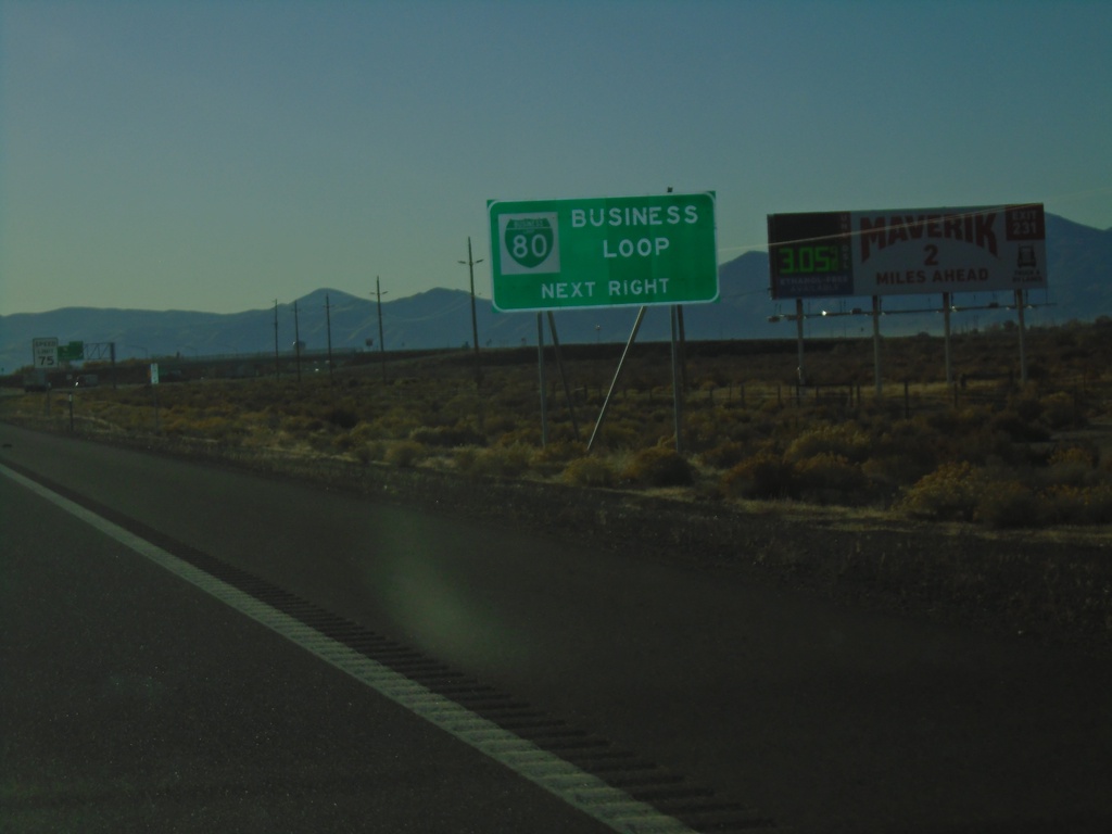
I-80 East Approaching Business Loop I-80
I-80 East approaching Business Loop I-80 in Battle Mountain.
Taken 10-20-2019
Battle Mountain
Lander County
Nevada
United States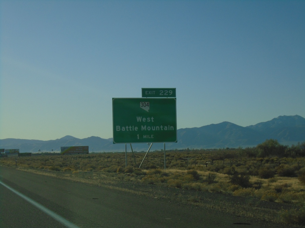
I-80 East - Exit 229
I-80 east approaching Exit 229 - NV-304/West Battle Mountain.
Taken 10-20-2019
Battle Mountain
Lander County
Nevada
United States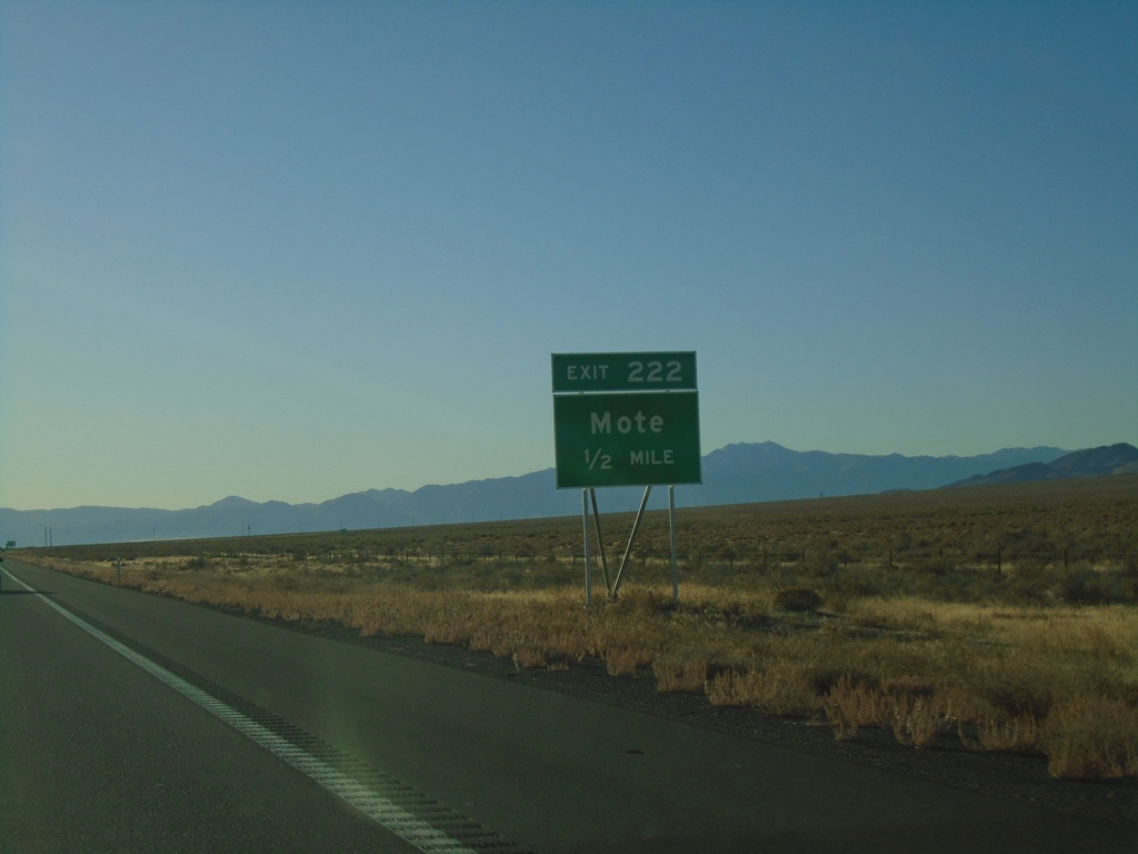
I-80 East - Exit 222
I-80 east approaching Exit 222 - Mote
Taken 10-20-2019
Valmy
Humboldt County
Nevada
United States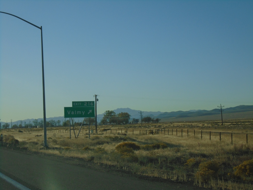
I-80 East - Exit 216
I-80 east at Exit 216 - Valmy
Taken 10-20-2019
Valmy
Humboldt County
Nevada
United States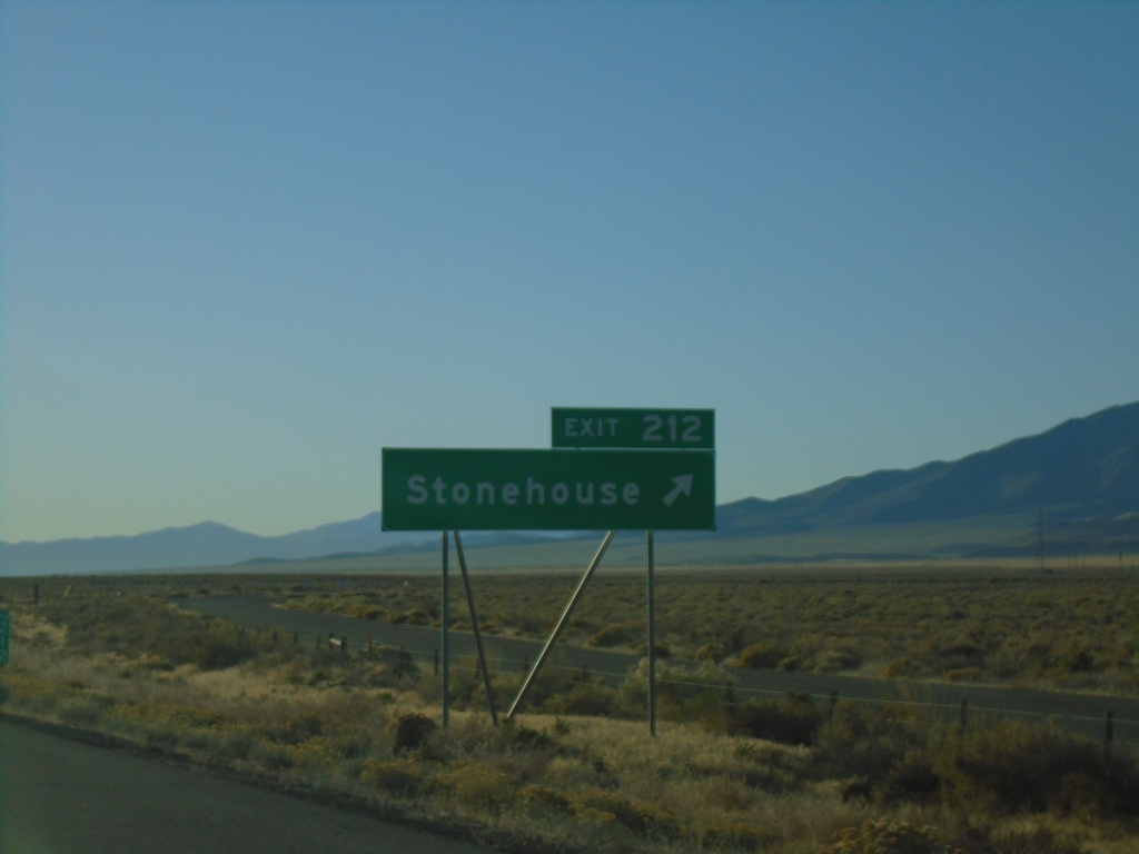
I-80 East - Exit 212
I-80 east at Exit 212 - Stonehouse.
Taken 10-20-2019
Valmy
Humboldt County
Nevada
United States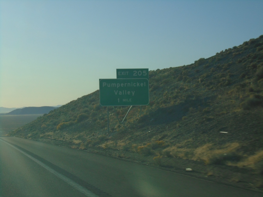
I-80 East - Exit 205
I-80 east approaching Exit 205 - Pumpernickel Valley
Taken 10-20-2019
Golconda
Humboldt County
Nevada
United States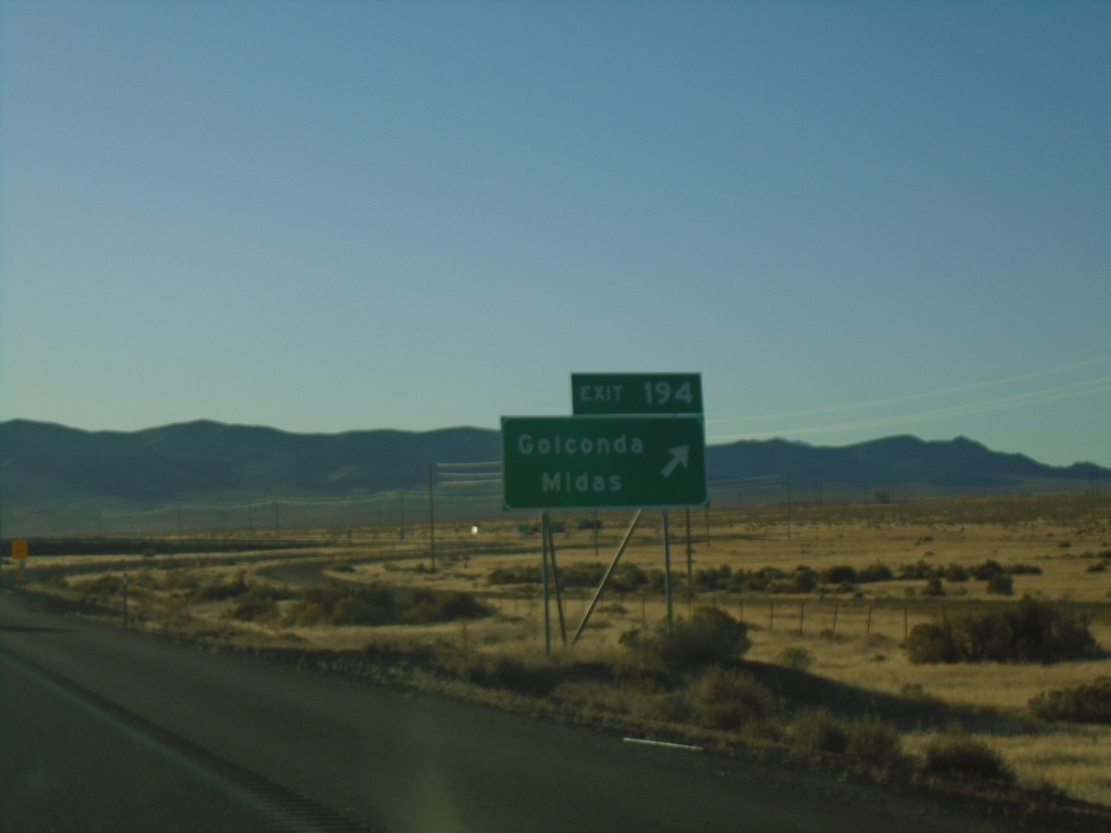
I-80 East - Exit 194
I-80 east at Exit 194 - Golconda/Midas
Taken 10-20-2019
 Golconda
Humboldt County
Nevada
United States
Golconda
Humboldt County
Nevada
United States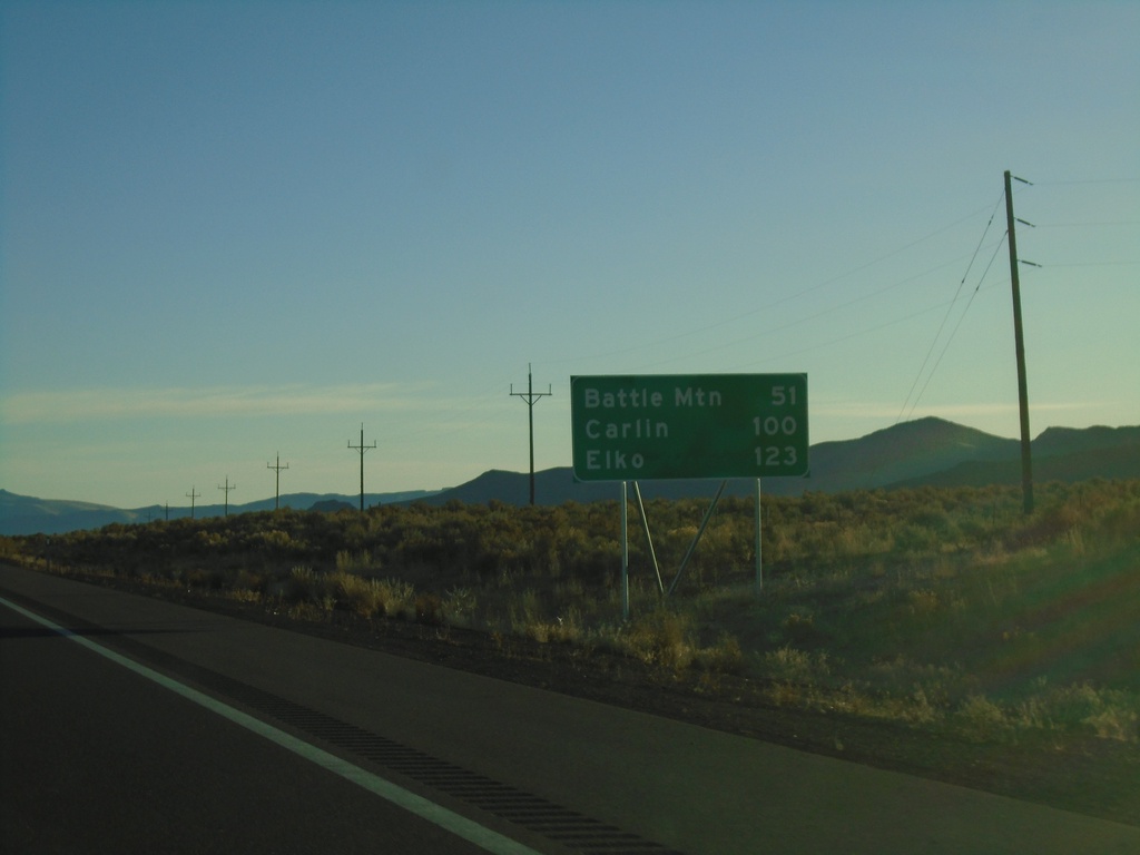
I-80 East - Distance Marker
Distance marker on I-80 west. Distance to Battle Mountain, Carlin, and Elko.
Taken 10-20-2019
Winnemucca
Humboldt County
Nevada
United States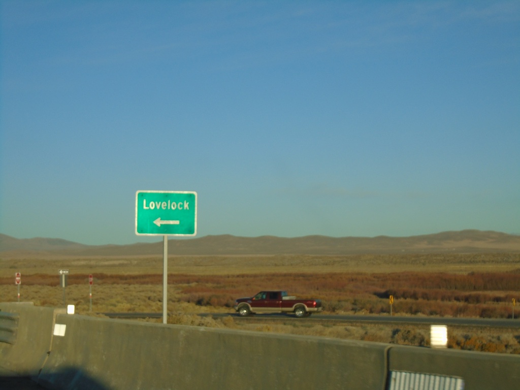
Winnemucca Blvd. at I-80 West
Winnemucca Blvd. at I-80 West to Lovelock (Exit 173).
Taken 10-20-2019
Winnemucca
Humboldt County
Nevada
United States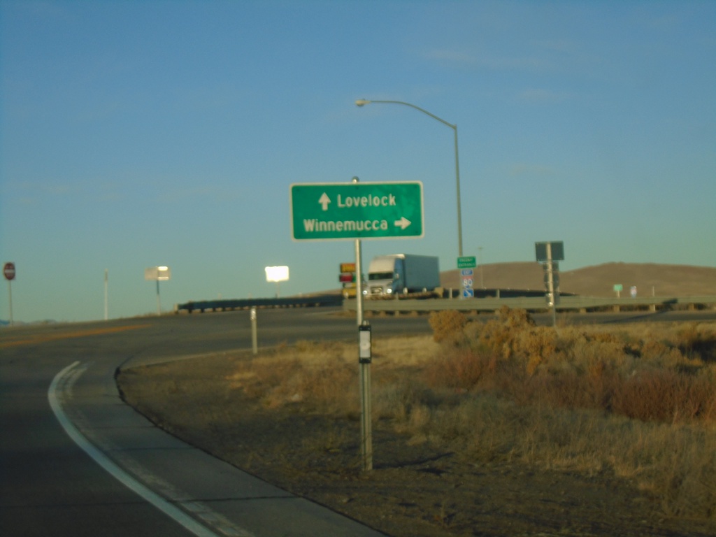
Winnemucca Blvd. West at I-80 (Exit 173)
Winnemucca Blvd. West at I-80 (Exit 173). Use I-80 West for Lovelock; I-80 East for Winnemucca.
Taken 10-20-2019
Winnemucca
Humboldt County
Nevada
United States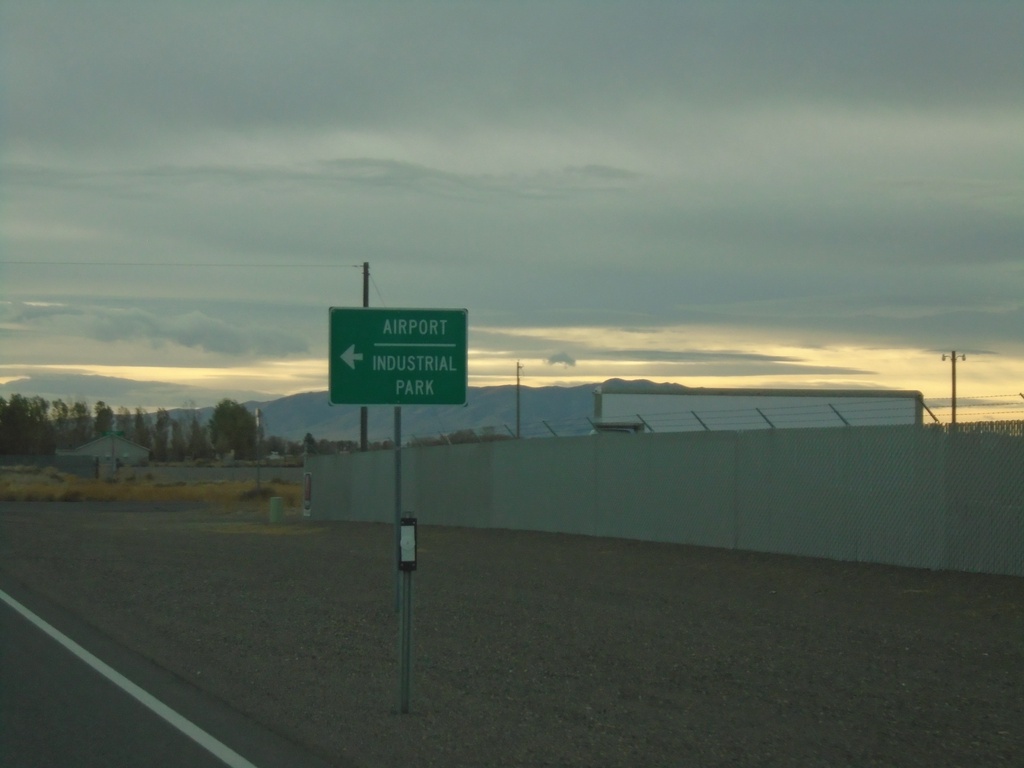
Rose Creek Road West at NV-796
Rose Creek Road West at NV-796 to Airport and Industrial Park.
Taken 10-19-2019
 Winnemucca
Humboldt County
Nevada
United States
Winnemucca
Humboldt County
Nevada
United States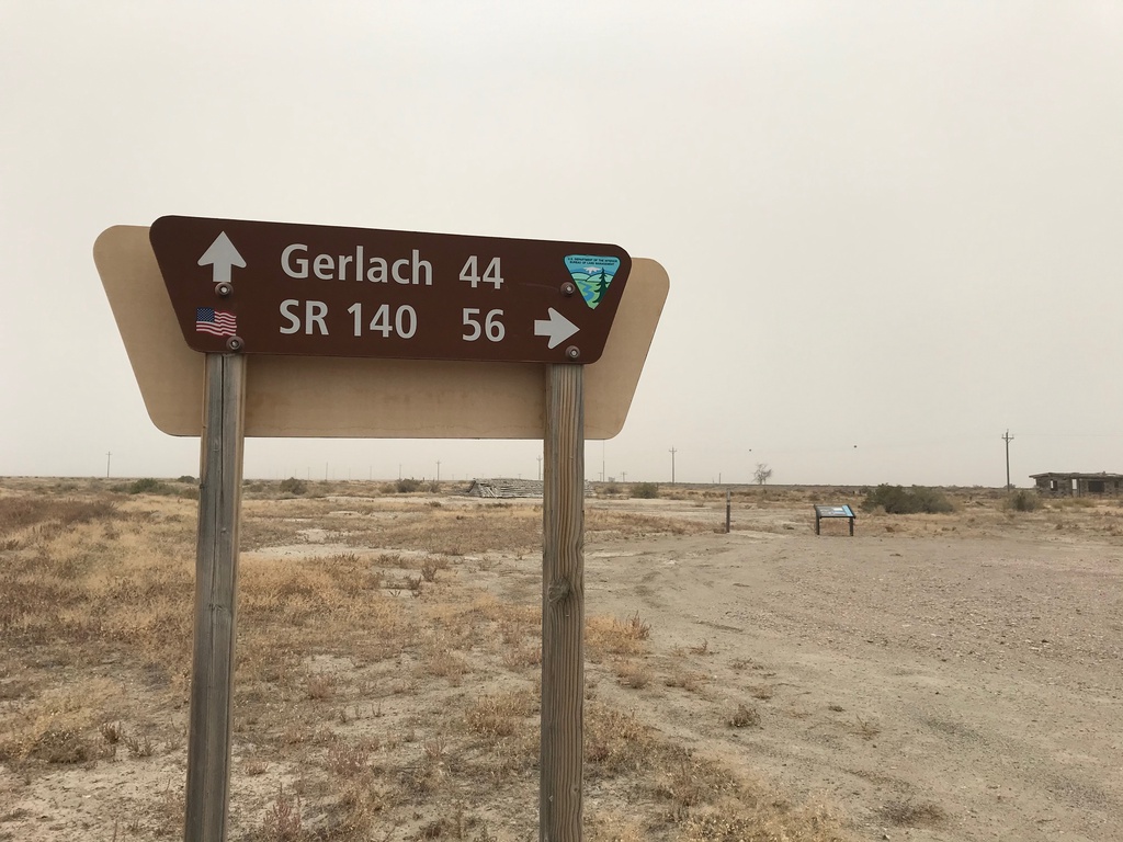
Jungo Road at Jackson Creek Ranch Road
Jungo Road West at Jackson Creek Ranch Road. Use Jackson Creek Ranch Road north for NV-140; continue on Jungo Road west for Gerlach.
Taken 10-19-2019
Sulphur Humboldt County Nevada United States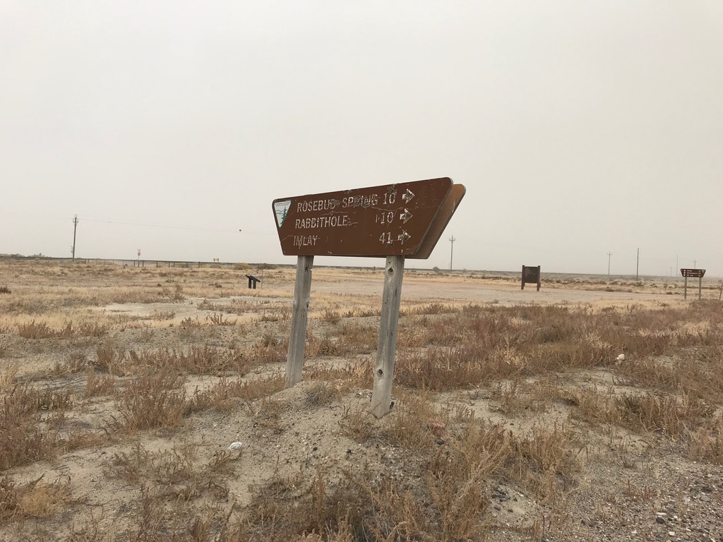
Jungo Road at County Road
Jungo Road at County Road south to Imlay, Rabbithole, and Rosebud Spring. Taken in the ghost town of Sulphur.
Taken 10-19-2019
Winnemucca Humboldt County Nevada United States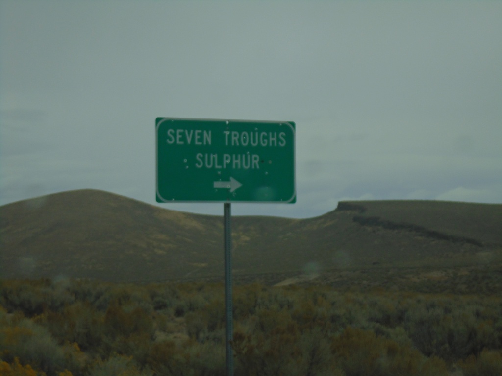
NV-399 West at Seven Troughs Road
NV-399 West at Seven Troughs Road to Seven Troughs and Sulphur
Taken 10-19-2019
 Pershing County
Nevada
United States
Pershing County
Nevada
United States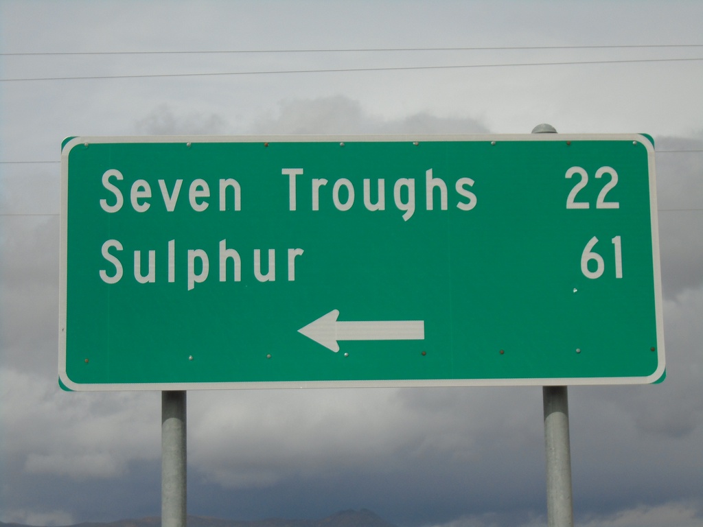
End NV-854 at NV-399
End NV-854 at NV-399 in Pershing County. Use NV-399 west for Seven Troughs and Sulphur.
Taken 10-19-2019
 Lovelock
Pershing County
Nevada
United States
Lovelock
Pershing County
Nevada
United States