Signs Tagged With Big Green Sign
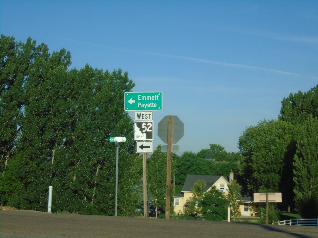
ID-52 West at Van Deusen Road
ID-52 West (Black Canyon Highway) at Van Deusen Road junction. Turn left to continue west on ID-52 to Emmett and Payette.
Taken 06-19-2020
 Emmett
Gem County
Idaho
United States
Emmett
Gem County
Idaho
United States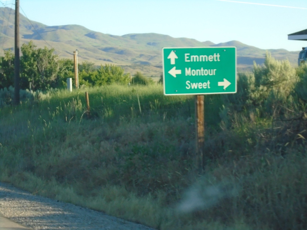
ID-52 West - Montour/Sweet Jct.
ID-52 West at Sweet/Ola Highway north to Sweet and Montour Road south to Montour. Continue west on ID-52 to Emmett.
Taken 06-19-2020
Sweet
Gem County
Idaho
United States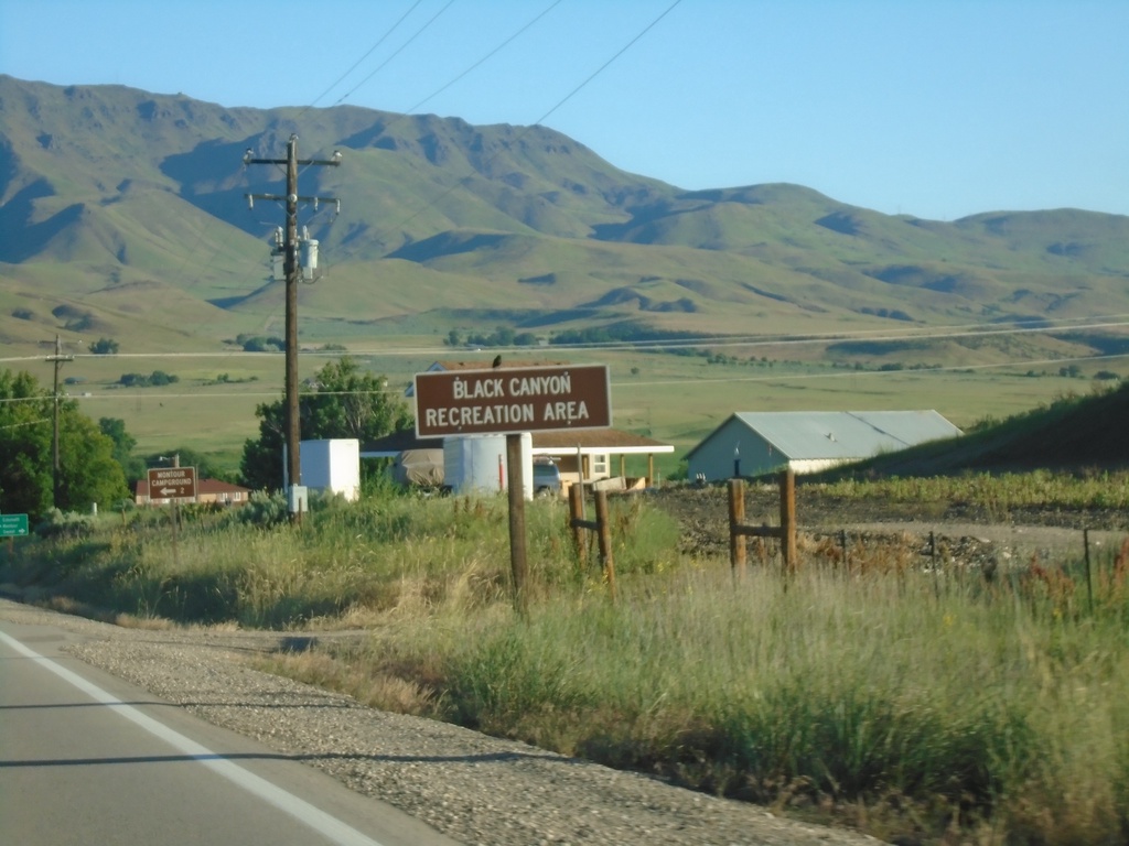
ID-52 West - Black Canyon Recreation Area
Entering Black Canyon Recreation Area on ID-52 west.
Taken 06-19-2020
Horseshoe Bend
Gem County
Idaho
United States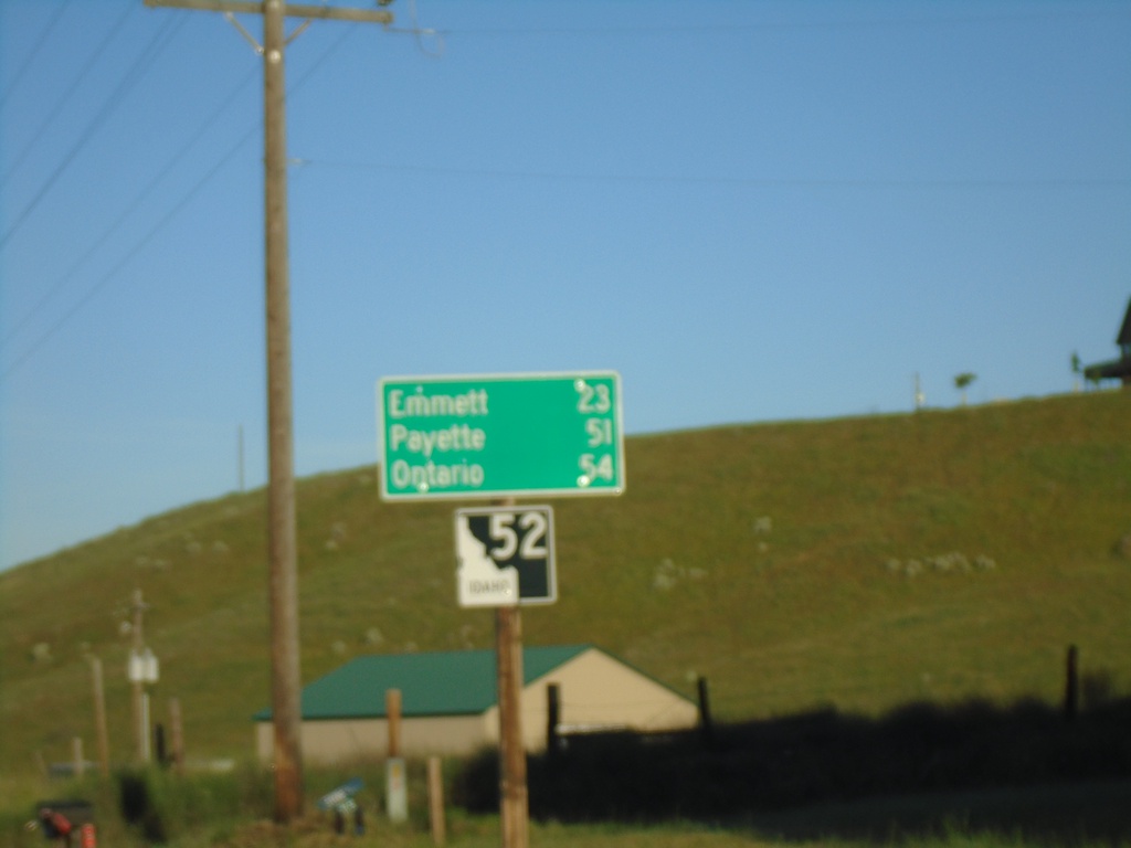
ID-52 West - Distance Marker
Distance marker on ID-52 west. Distance to Emmett, Payette, and Ontario.
Taken 06-19-2020
Horseshoe Bend
Boise County
Idaho
United States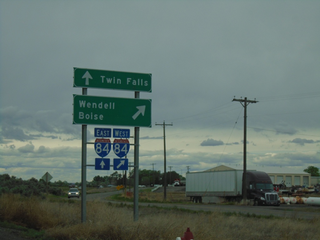
End ID-25 West at I-84
End ID-25 West at I-84 in Jerome. Use I-84 west to Wendell and Boise; use I-84 east to Twin Falls.
Taken 05-22-2020

 Jerome
 County
Idaho
United States
Jerome
Jerome County
Idaho
United States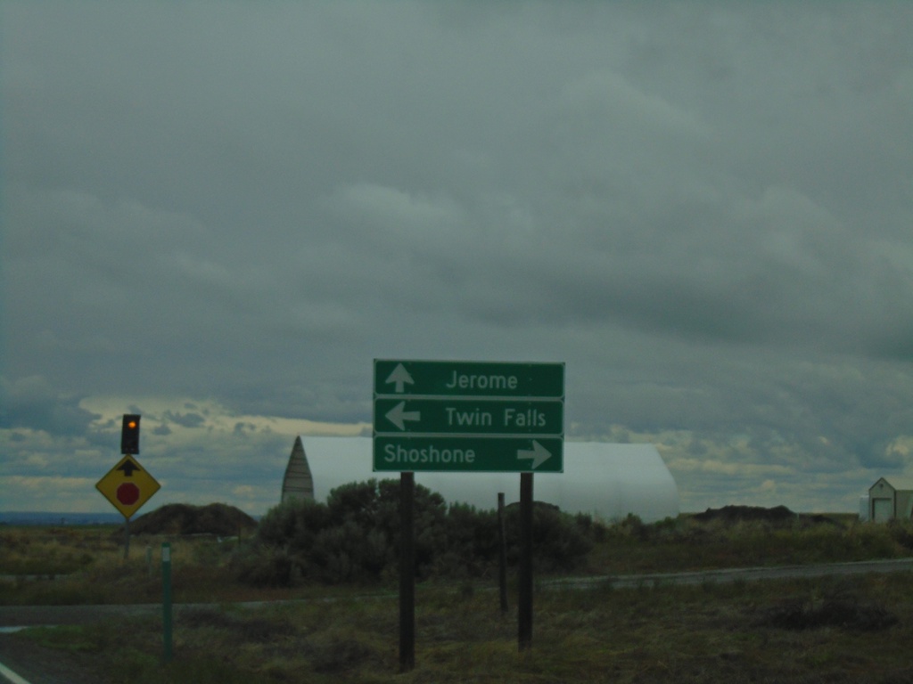
ID-25 West at US-93
ID-25 West at US-93 in Jerome County. Turn right for US-93 north to Shoshone; left for US-93 south to Twin Falls. Continue straight for ID-25 west to Jerome.
Taken 05-22-2020
 Jerome
 County
Idaho
United States
Jerome
Jerome County
Idaho
United States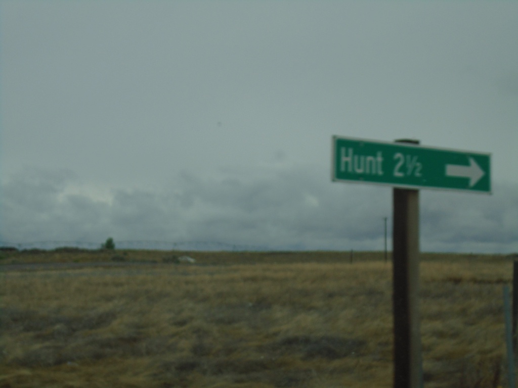
ID-25 West - Hunt Jct.
ID-25 west at Hunt Jct. Hunt is the site of the Minidoka War Relocation Center, a Japanese Internment Camp during World War 2.
Taken 05-22-2020
Jerome
Jerome County
Idaho
United States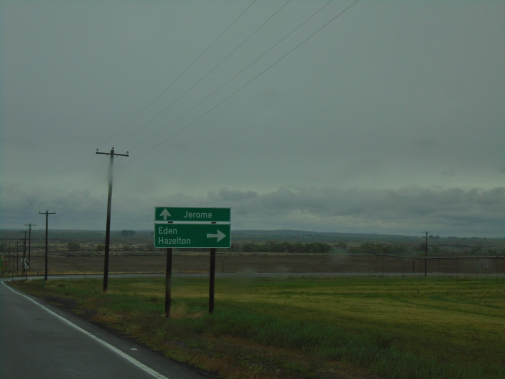
End ID-50 East at ID-25
End ID-50 East at ID-25. Turn right for ID-25 east to Eden and Hazelton. Continue straight for ID-25 west to Jerome.
Taken 05-22-2020
 Eden
Jerome County
Idaho
United States
Eden
Jerome County
Idaho
United States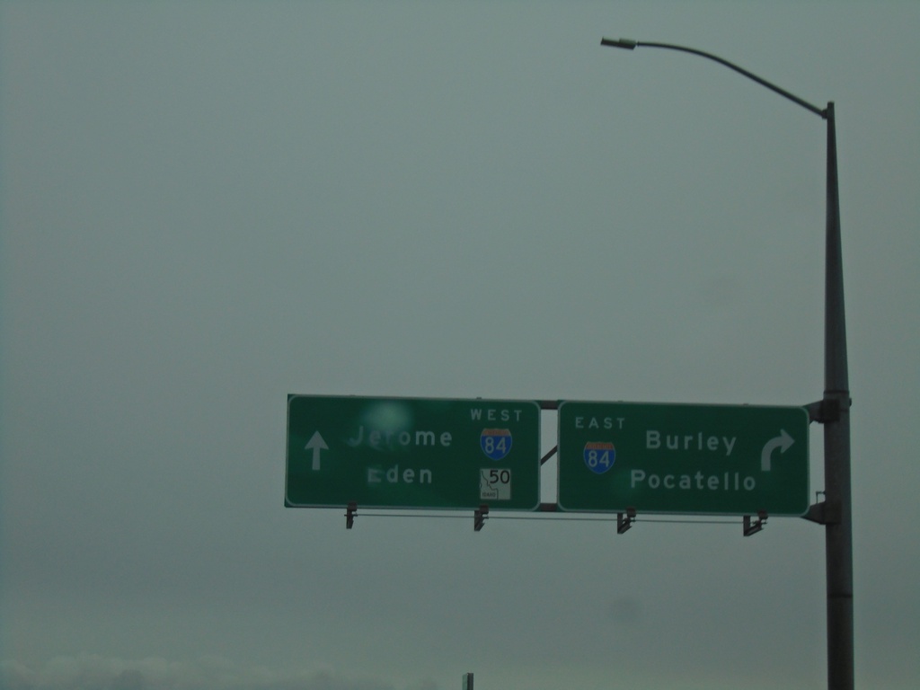
ID-50 East at I-84 (Exit 182)
ID-50 East at I-84 (Exit 182). Turn right for I-84 East to Burley and Pocatello; continue over freeway for I-84 West to Jerome. Continue on ID-50 east for Eden.
Taken 05-22-2020
Eden
Jerome County
Idaho
United States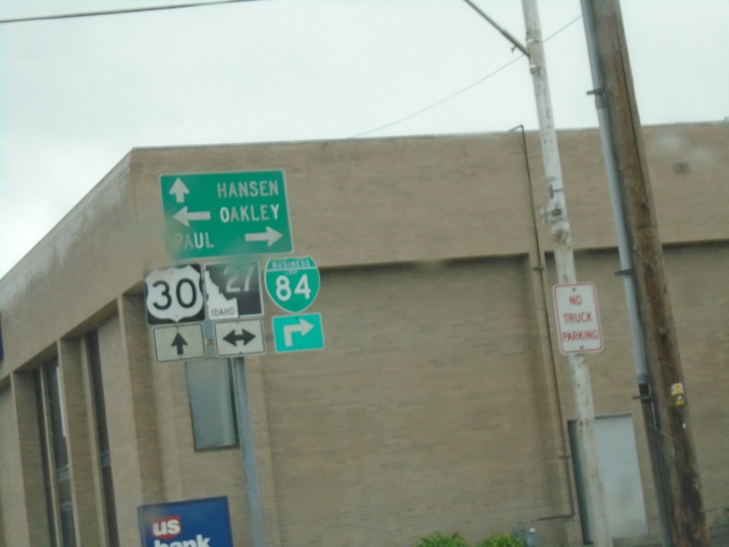
US-30 West/BL-84 West at BL-84/ID-27
US-30 West/BL-84 West (Main St.) at BL-84/ID-27 (Overland Ave.). Turn right for ID-27 North/BL-84 West to Paul; left for ID-27 south to Oakley. Continue straight on US-30 west for Hansen.
Taken 05-22-2020

 Burley
Cassia County
Idaho
United States
Burley
Cassia County
Idaho
United States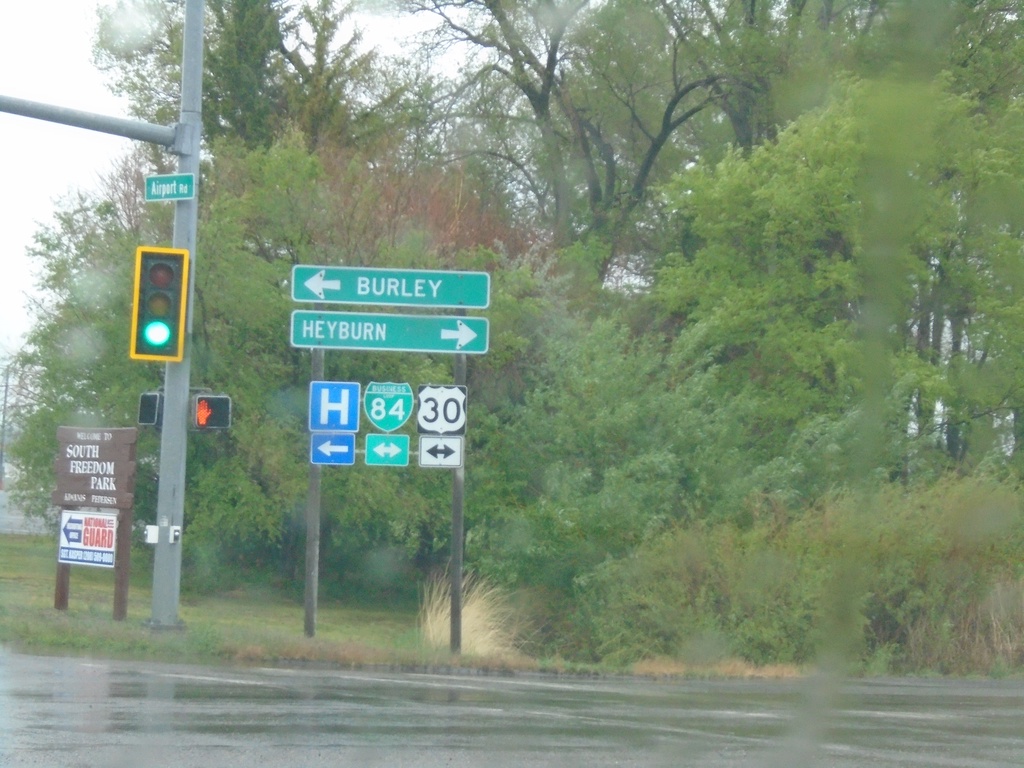
End ID-81 North at US-30/BL-84
End ID-81 North at US-30/BL-84 in Burley. Use US-30 East/BL-84 East for Heyburn; US-30 West/BL-84 West for Burley.
Taken 05-22-2020
 Burley
Cassia County
Idaho
United States
Burley
Cassia County
Idaho
United States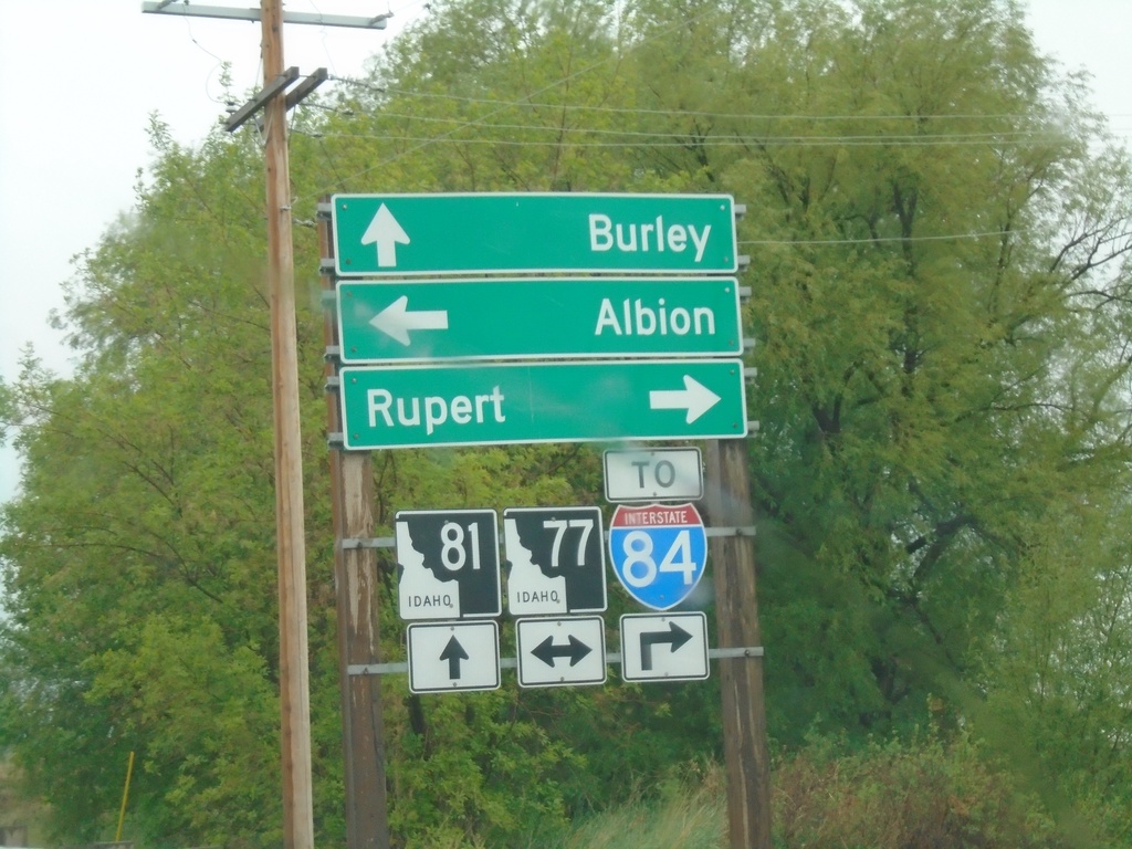
ID-81 North at ID-77
ID-81 north at ID-71 (To I-84) in Declo. Turn right for ID-77 North/To I-84 to Rupert; turn left for ID-77 south to Albion. Continue north on ID-81 for Burley.
Taken 05-22-2020
 Declo
Cassia County
Idaho
United States
Declo
Cassia County
Idaho
United States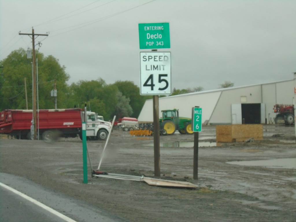
ID-81 North - Declo
Entering Declo - Population 343 on ID-81 North. Speed Limit 45 MPH. Milepost 26.
Taken 05-22-2020
Declo
Cassia County
Idaho
United States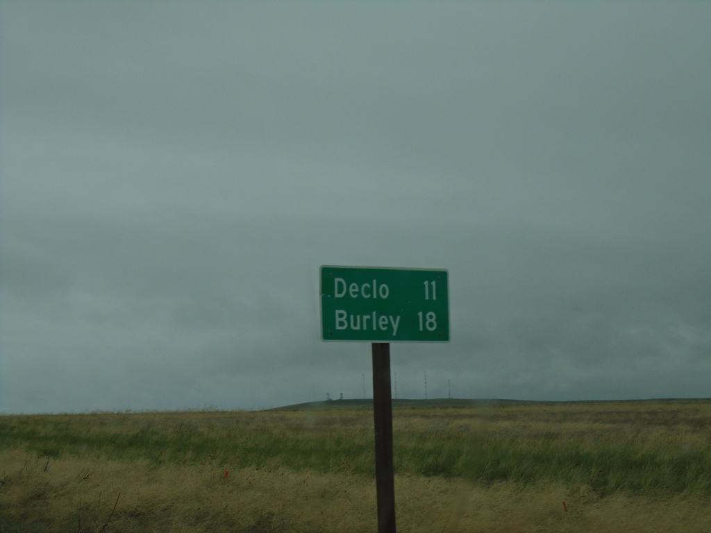
ID-81 North - Distance Marker
Distance marker on ID-81 north. Distance to Declo and Burley.
Taken 05-22-2020
Declo
Cassia County
Idaho
United States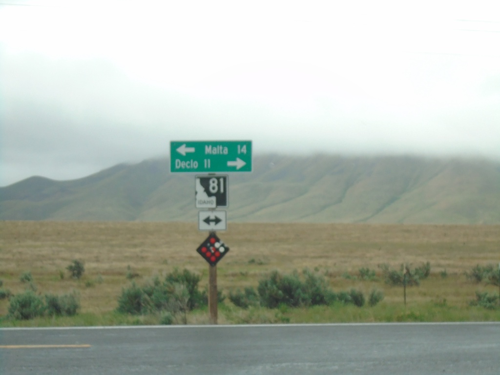
End Yale Road at ID-81
End Yale Road at ID-81. Turn left for ID-81 south to Malta; right for ID-81 north to Declo.
Taken 05-22-2020
Declo
Cassia County
Idaho
United States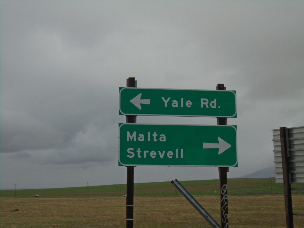
I-84 East - Exit 228 Offramp at Yale Road
I-84 East - Exit 228 offramp at Yale Road. Turn right for Malta and Strevell (and ID-81). Turn left for Yale Road.
Taken 05-22-2020
Declo
Cassia County
Idaho
United States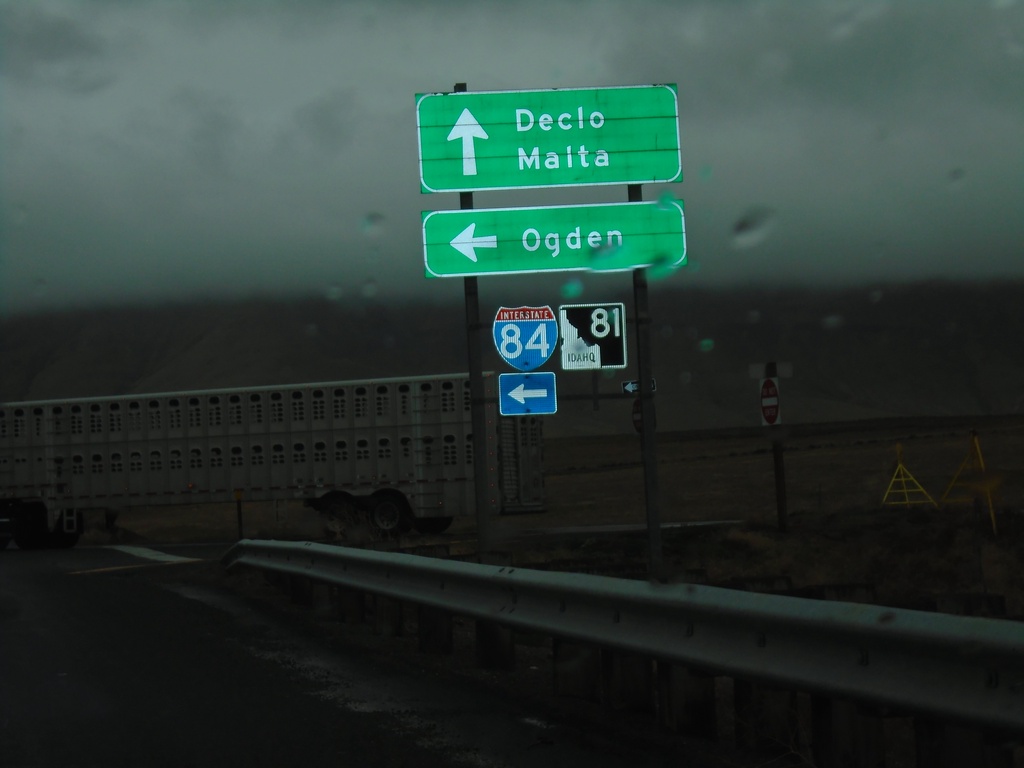
Yale Road West at I-84 East
Yale Road West at I-84 East (Exit 228) to Ogden (Utah). Continue on Yale Road for ID-81 to Declo and Malta.
Taken 05-22-2020
Cotterel
Cassia County
Idaho
United States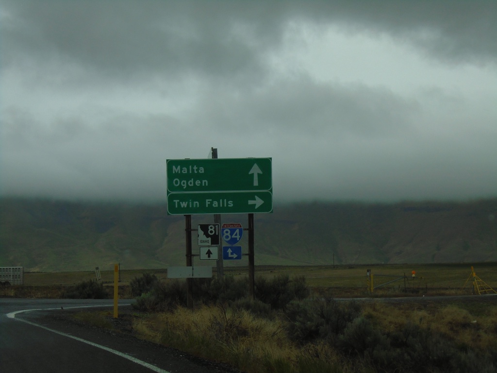
Yale Road West at I-84
Yale Road West at I-84 (Exit 228). Turn right for I-84 West to Twin Falls. Continue over freeway for I-84 East to Ogden (Utah) and for ID-81 to Malta.
Taken 05-22-2020
Declo
Cassia County
Idaho
United States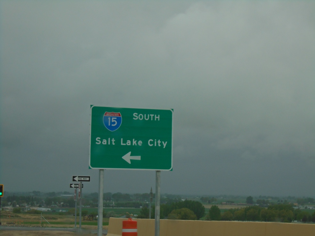
Northgate Parkway West at I-15 South
Northgate Parkway West at I-15 South to Salt Lake City (Utah).
Taken 05-22-2020
 Chubbuck
Bannock County
Idaho
United States
Chubbuck
Bannock County
Idaho
United States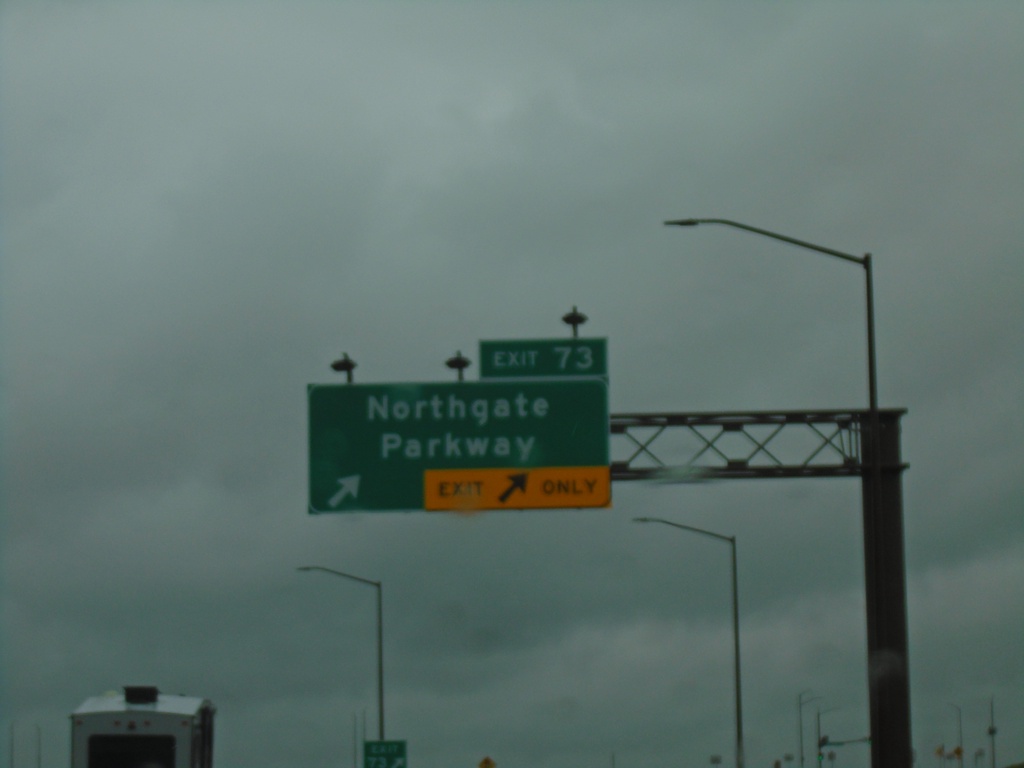
I-15 North - Exit 73
I-15 north at Exit 73 - Northgate Parkway.
Taken 05-22-2020
Pocatello
Bannock County
Idaho
United States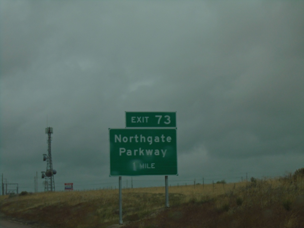
I-15 North - Exit 73
I-15 north approaching Exit 73 - Northgate Parkway.
Taken 05-22-2020
Chubbuck
Bannock County
Idaho
United States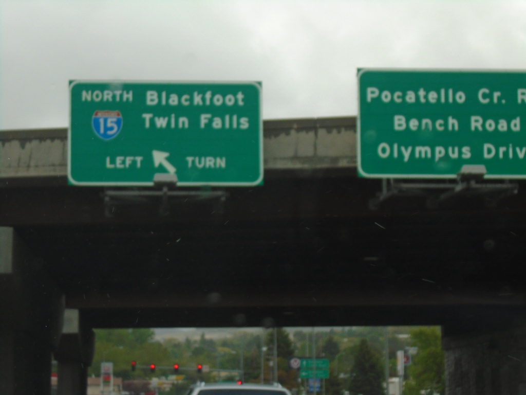
End BL-15 North at I-15 (Exit 71)
End BL-15 North at I-15 (Exit 71) in Pocatello. Use I-15 north for Blackfoot and Twin Falls. Continue straight for Pocatello Creek Road, Bench Road, and Olympus Drive.
Taken 05-22-2020
 Pocatello
Bannock County
Idaho
United States
Pocatello
Bannock County
Idaho
United States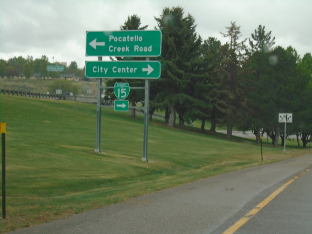
I-15 South - Exit 71 Offramp
I-15 South - Exit 71 offramp at Pocatello Creek Road. Turn right for (Pocatello Creek Road) to (Pocatello) City Center and BL-15. Turn left for Pocatello Creek Road.
Taken 05-22-2020
Pocatello
Bannock County
Idaho
United States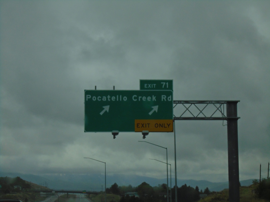
I-15 South - Exit 71
I-15 south at Exit 71 - Pocatello Creek Road
Taken 05-22-2020
Pocatello
Bannock County
Idaho
United States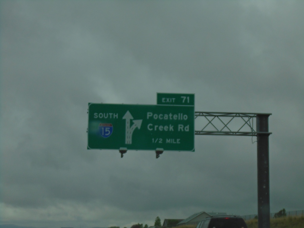
I-15 South - Exit 71
I-15 south approaching Exit 71 - Pocatello Creek Road.
Taken 05-22-2020
Pocatello
Bannock County
Idaho
United States