Signs Tagged With Big Green Sign
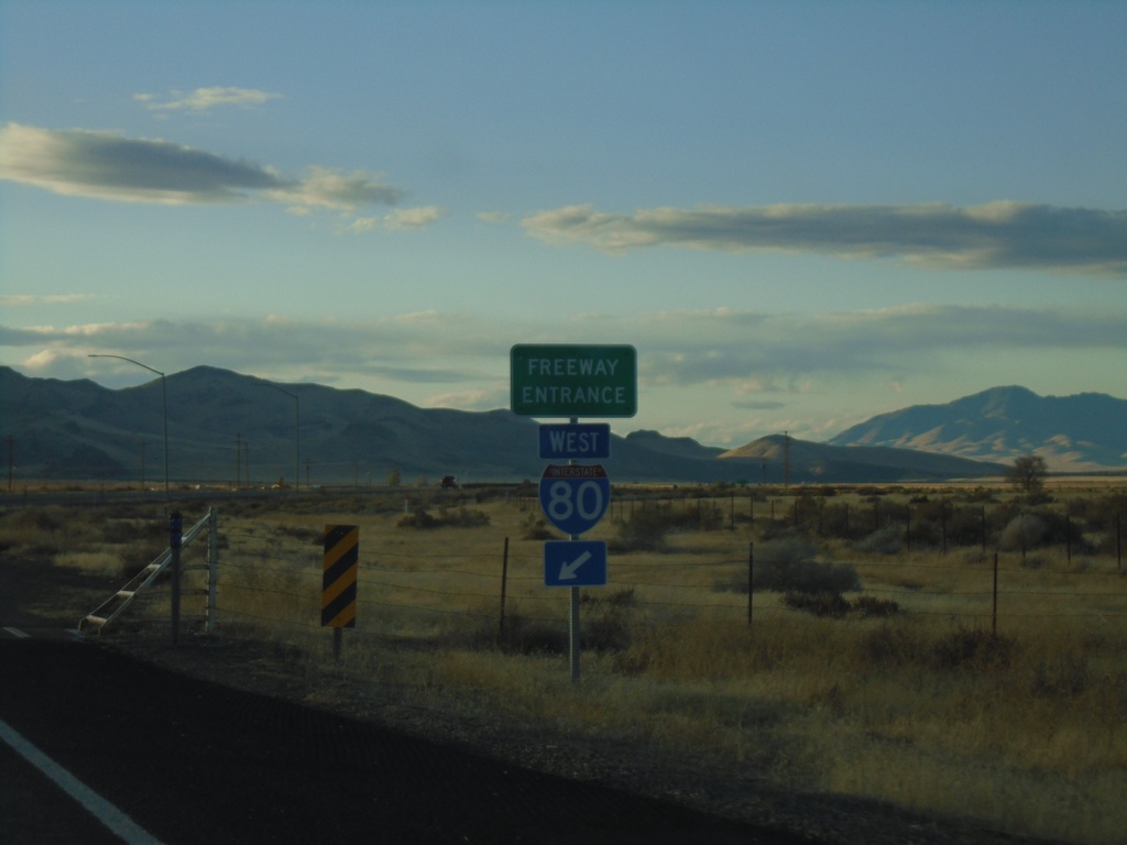
End NV-789 South at I-80 West
End NV-789 South at I-80 West (Exit 194).
Taken 10-18-2019

 Golconda
Humboldt County
Nevada
United States
Golconda
Humboldt County
Nevada
United States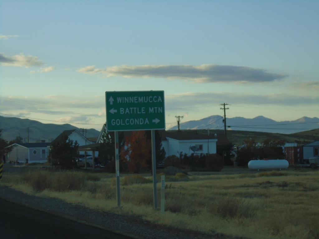
NV-789 North Approaching I-80 East
NV-789 North approaching I-80 East to Battle Mountain. Continue on NV-789 for I-80 West to Winnemucca; turn right for Golconda.
Taken 10-18-2019
Golconda
Humboldt County
Nevada
United States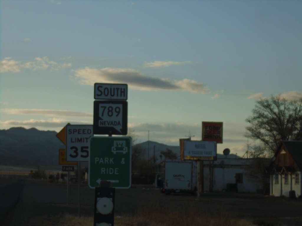
NV-789 South - Golconda
NV-789 South in Golconda
Taken 10-18-2019
Golconda
Humboldt County
Nevada
United States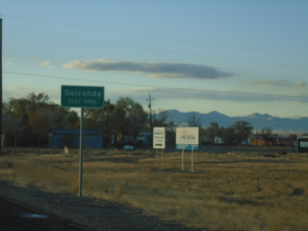
NV-789 South - Entering Golconda
Entering Golconda on NV-789 South. Elevation 4400 Feet.
Taken 10-18-2019
Golconda
Humboldt County
Nevada
United States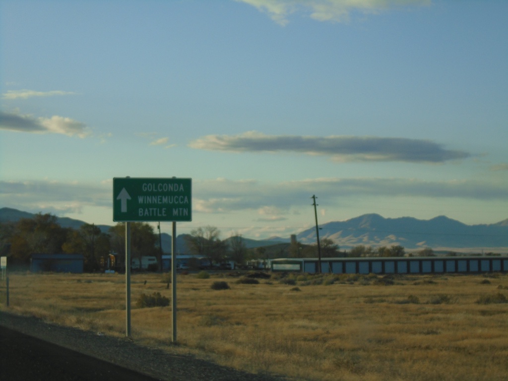
NV-789 - Golconda
NV-789 approaching Golconda. Continue straight for Golconda, Winnemucca (via I-80 west) and Battle Mountain (via I-80 east).
Taken 10-18-2019
Golconda
Humboldt County
Nevada
United States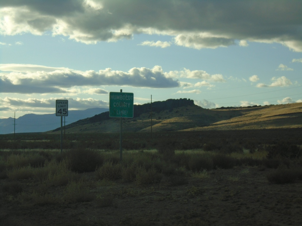
Midas Road - Humboldt County
Entering Humboldt County on Midas Road.
Taken 10-18-2019
Golconda Humboldt County Nevada United States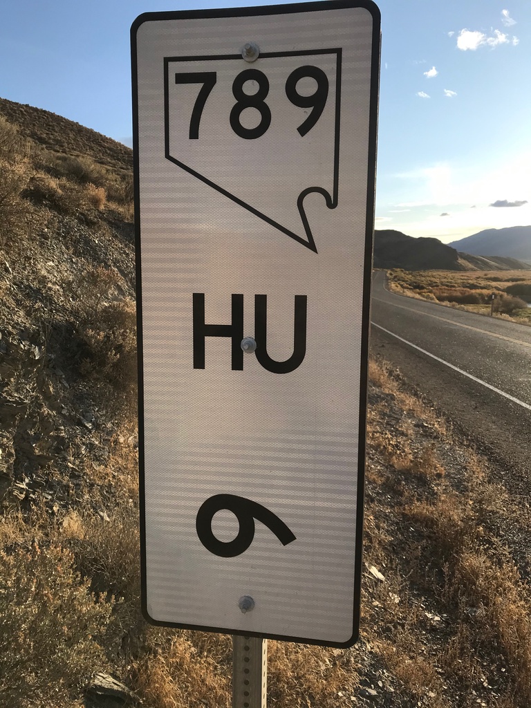
NV-789 - Postmile 6
NV-789 - Humboldt County Postmile 6
Taken 10-18-2019
Golconda
Humboldt County
Nevada
United States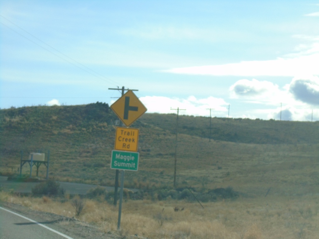
NV-225 South - Trail Creek Road
NV-225 south at Trail Creek Road to Maggie Summit
Taken 10-18-2019
 Mountain City
Elko County
Nevada
United States
Mountain City
Elko County
Nevada
United States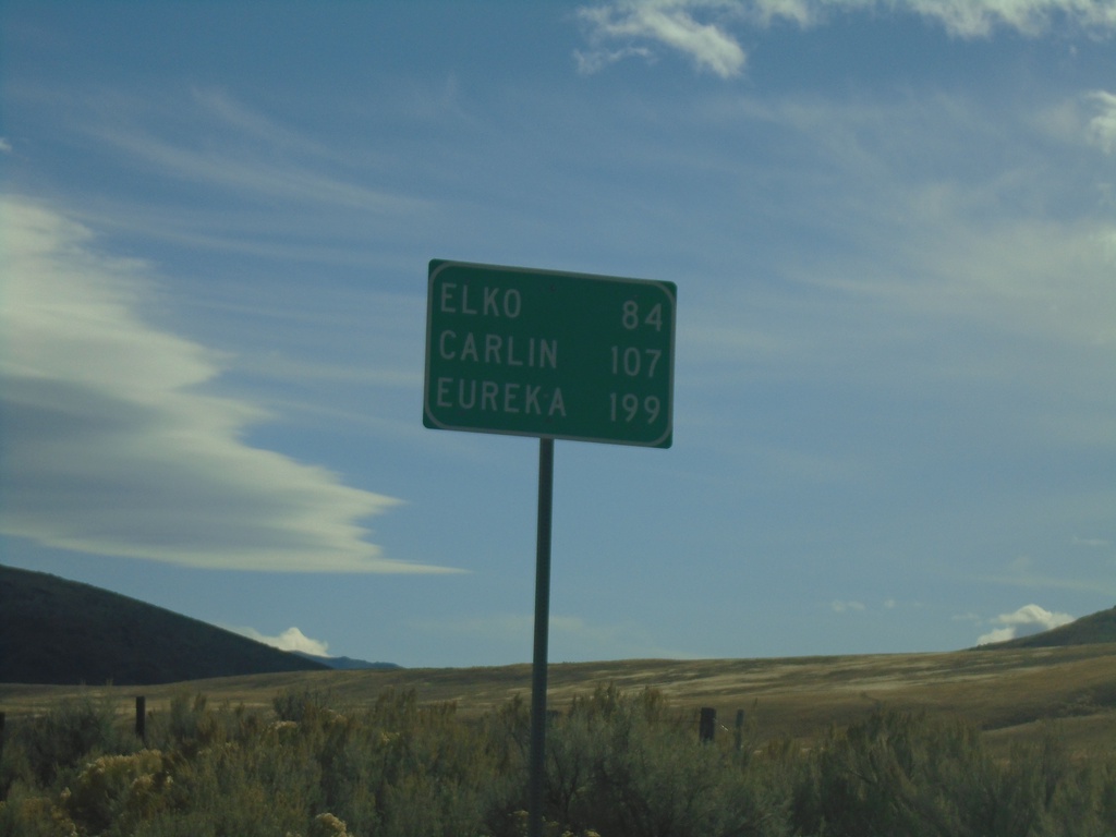
NV-225 South - Distance Marker
Distance marker on NV-225 south. Distance to Elko, Carlin (via I-80), and Eureka (via I-80 and NV-278).
Taken 10-18-2019
Mountain City
Elko County
Nevada
United States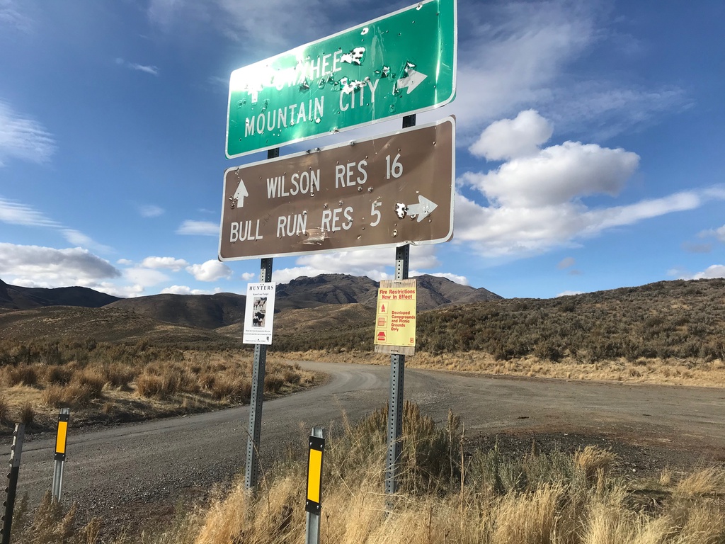
End NV-226 North
End NV-226 North in Elko County. Turn left for Owyhee and Wilson Reservoir; turn right for Mountain City and Bull Run Reservoir. Either road is unpaved.
Taken 10-18-2019
 Mountain City
Elko County
Nevada
United States
Mountain City
Elko County
Nevada
United States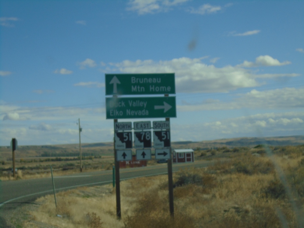
ID-78 East at ID-51
ID-78 East at ID-51 junction in Owyhee County. Continue on ID-78 East/ID-51 North for Bruneau and Mountain Home. Use ID-51 South for Duck Valley and Elko, Nevada.
Taken 10-18-2019

 Bruneau
Owyhee County
Idaho
United States
Bruneau
Owyhee County
Idaho
United States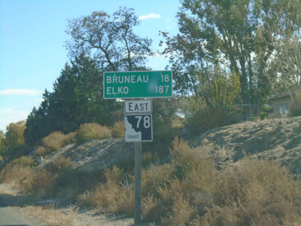
ID-78 East - Distance Marker
Distance marker on ID-78 east. Distance to Bruneau and Elko (Nevada).
Taken 10-18-2019
Grand View
Owyhee County
Idaho
United States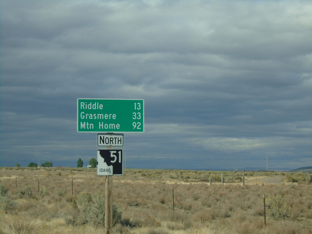
ID-51 North - Distance Marker
Distance marker on ID-51 north. Distance to Riddle, Grasmere, and Mountain Home. This is the first shield and distance marker along ID-51 after the stateline.
Taken 09-28-2019
Owyhee
Owyhee County
Idaho
United States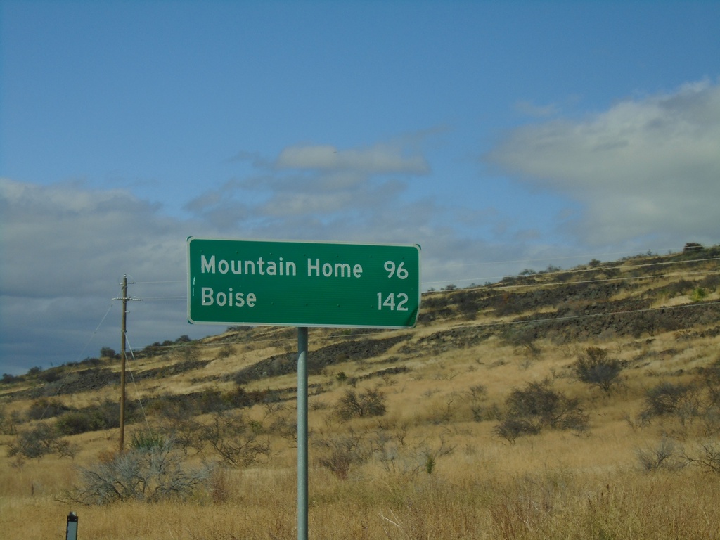
NV-225 North - Distance Marker
Distance marker on NV-225 north. Distance to Mountain Home (Idaho) and Boise (Idaho). This is the last distance marker northbound on NV-225 in Nevada.
Taken 09-28-2019
Owyhee
Elko County
Nevada
United States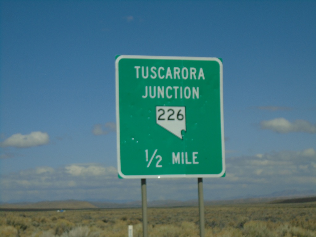
NV-225 North Approaching NV-226
NV-225 North approaching NV-226 - Tuscarora Junction.
Taken 09-28-2019
Elko
Elko County
Nevada
United States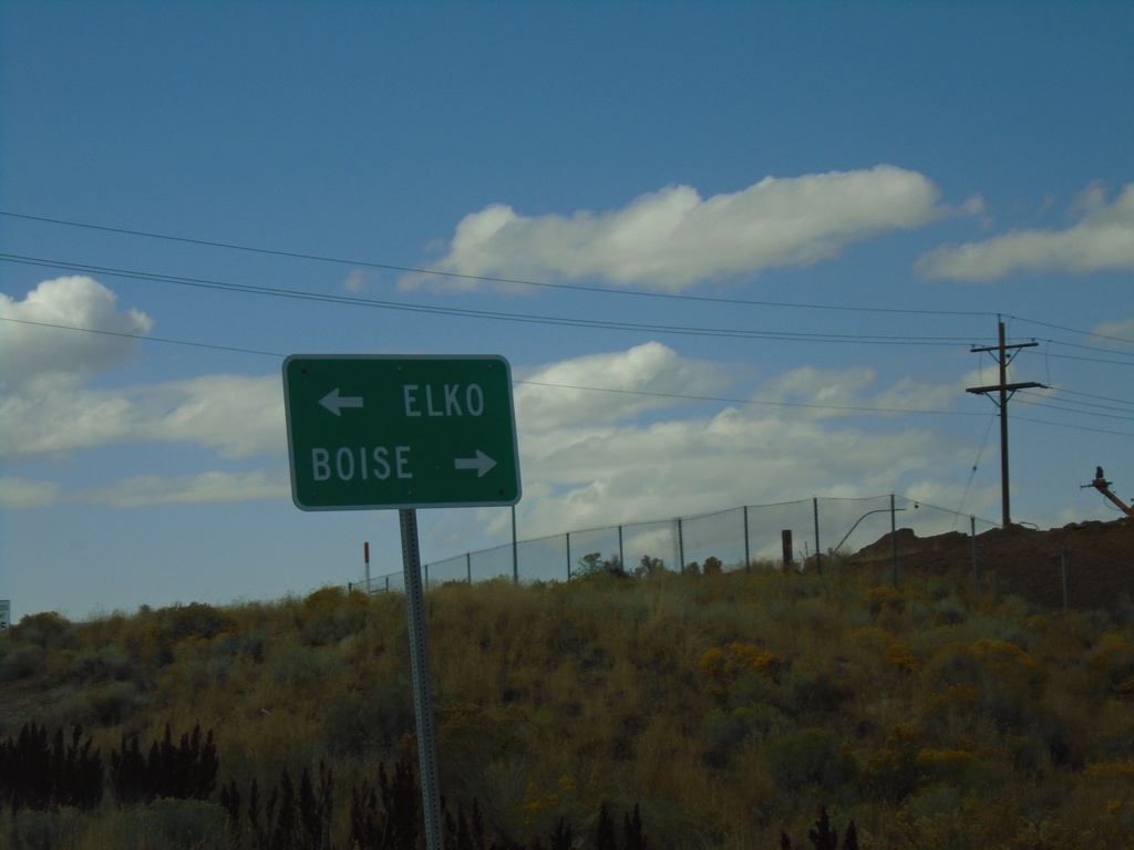
I-80 West - Exit 301 Offramp
I-80 West Exit 301 offramp at NV-225. Turn left for NV-225 North to Boise (Idaho); left for NV-225 South to Elko.
Taken 09-28-2019
Elko
Elko County
Nevada
United States
BL-80 East at I-80 West
BL-80 East at I-80 West (Exit 303). Turn left for I-80 west to Reno.
Taken 09-28-2019
 Elko
Elko County
Nevada
United States
Elko
Elko County
Nevada
United States
BL-80 East at I-80 (Exit 303)
BL-80 East at I-80 (Exit 303) in Elko. Turn right for I-80 east to Salt Lake City (UT); continue under freeway for I-80 west to Reno.
Taken 09-28-2019
Elko
Elko County
Nevada
United States
BL-80 East (Idaho St.) at Jennings Way to I-80
BL-80 East (Idaho St.) at Jennings Way to I-80. Turn left for Jennings Way and I-80 onramps.
Taken 09-28-2019
Elko
Elko County
Nevada
United States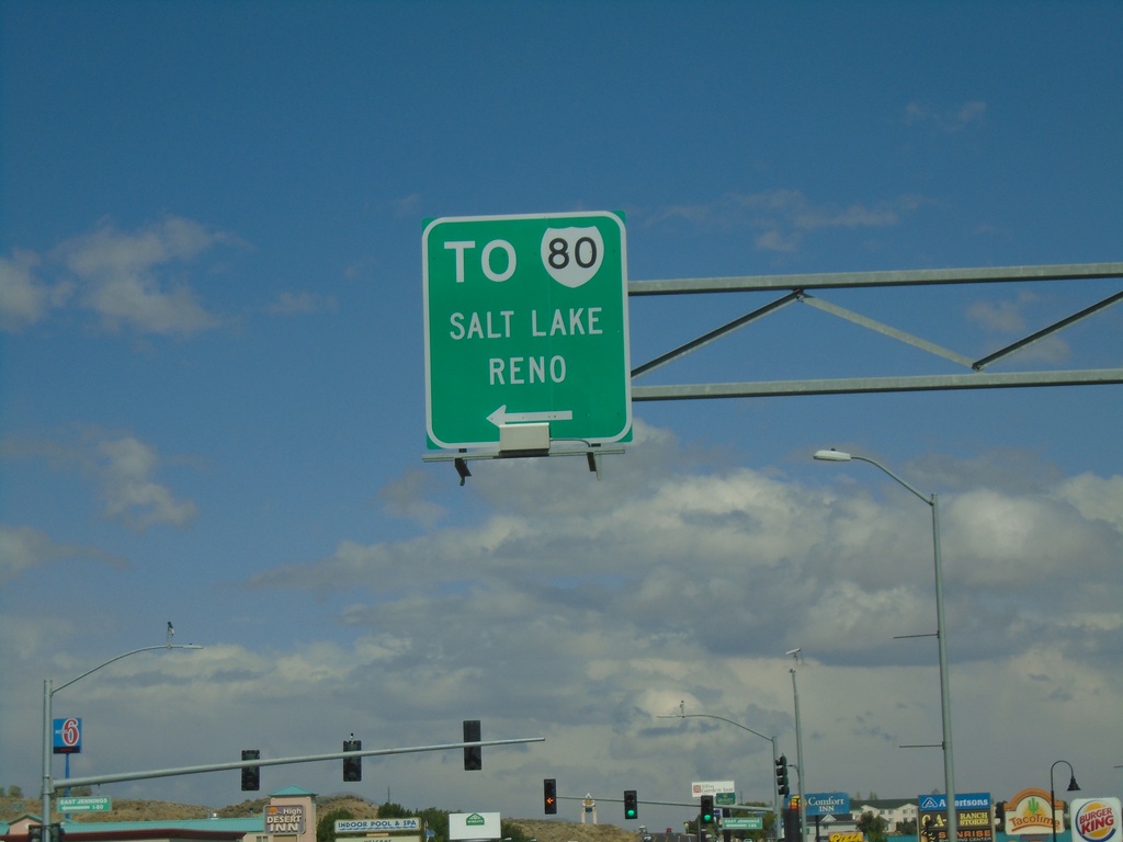
BL-80 East (Idaho St.) Approaching I-80
BL-80 East (Idaho St.) approaching I-80 to Salt Lake (UT) and Reno.
Taken 09-28-2019
Elko
Elko County
Nevada
United States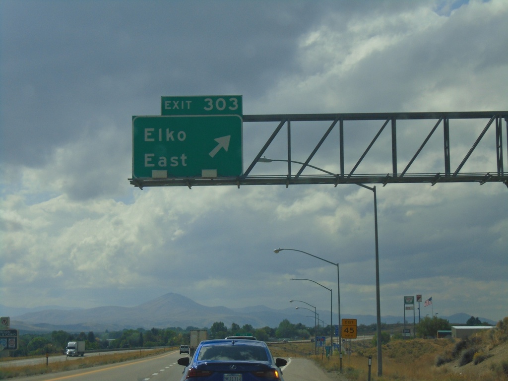
I-80 West - Exit 303
I-80 west at Exit 303 - Elko East.
Taken 09-28-2019
Elko
Elko County
Nevada
United States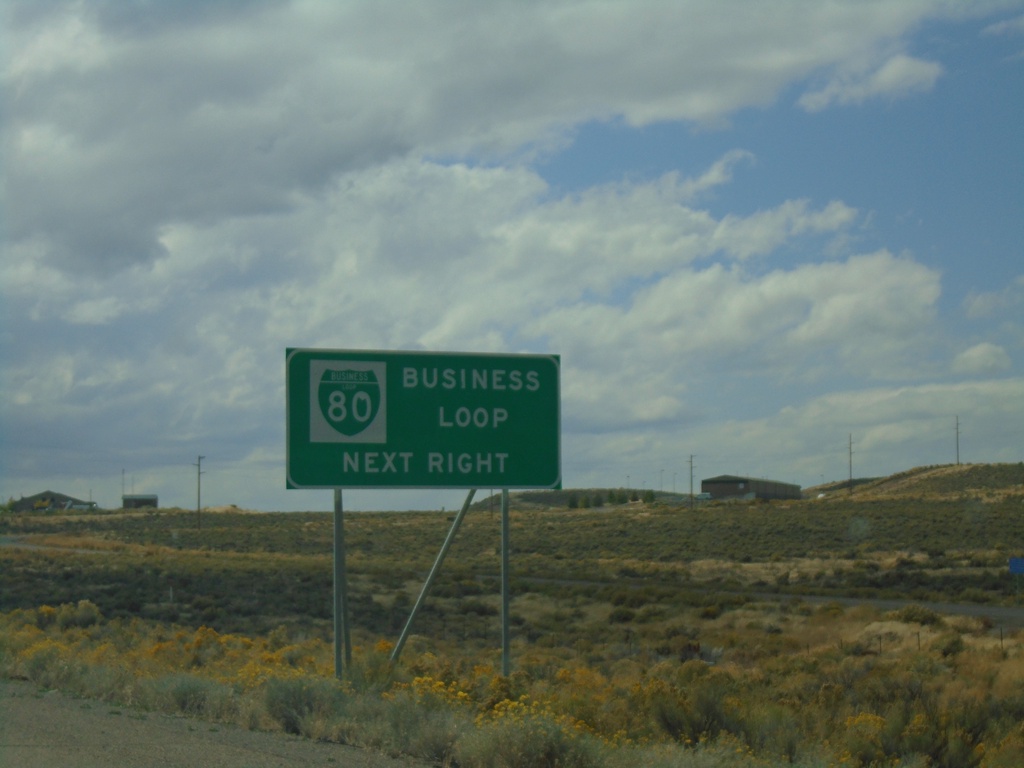
I-80 West - Business Loop
I-80 west approaching Exit 303. Use Exit 303 for BL-80 Business Loop.
Taken 09-28-2019
Elko
Elko County
Nevada
United States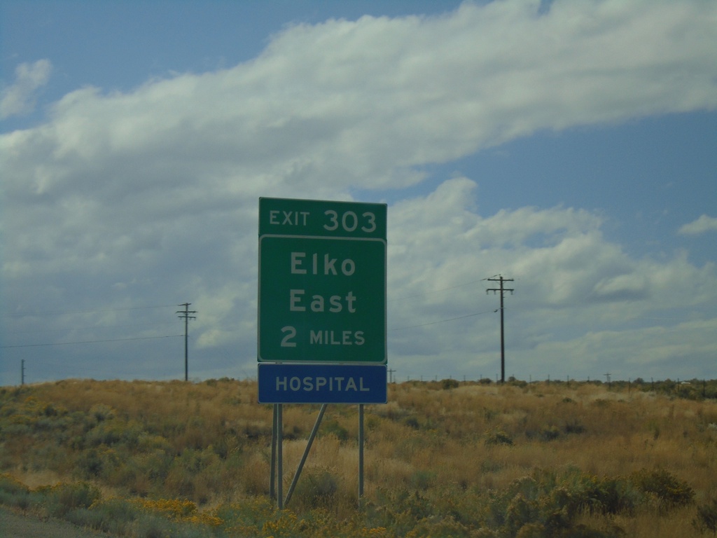
I-80 West - Exit 303
I-80 west approaching Exit 303 - Elko East.
Taken 09-28-2019
Elko
Elko County
Nevada
United States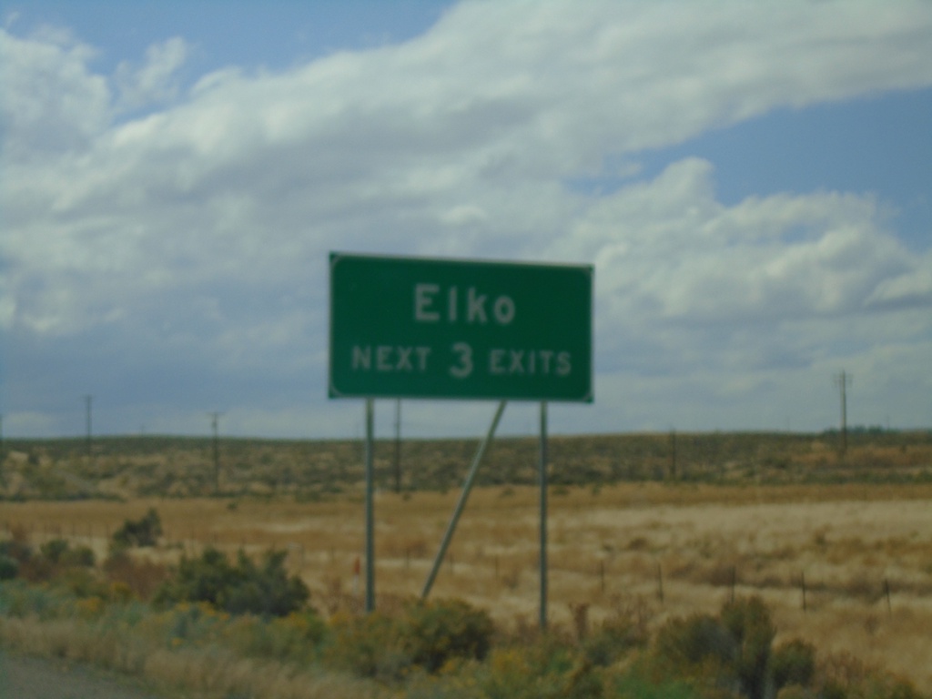
I-80 West - Elko Exits
Elko - Next 3 Exits on I-80 west.
Taken 09-28-2019
Elko
Elko County
Nevada
United States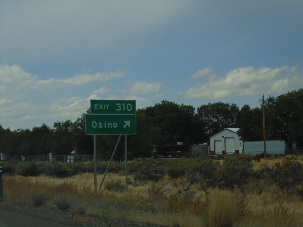
I-80 West - Exit 310
I-80 west at Exit 310 - Osino.
Taken 09-28-2019
Elko
Elko County
Nevada
United States