Signs Tagged With Big Green Sign
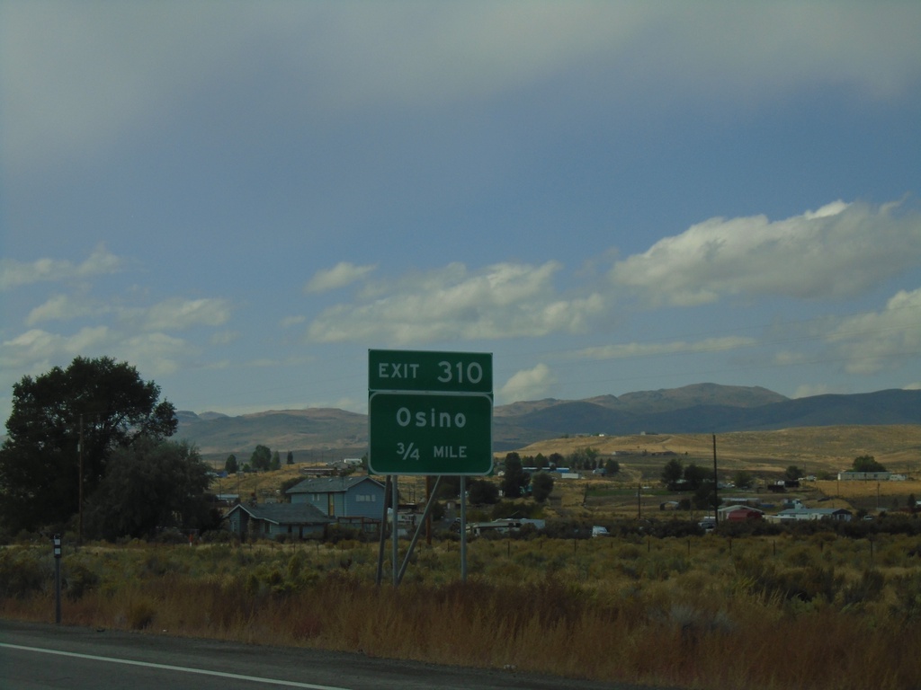
I-80 West - Exit 310
I-80 west approaching Exit 310 - Osino.
Taken 09-28-2019
 Elko
Elko County
Nevada
United States
Elko
Elko County
Nevada
United States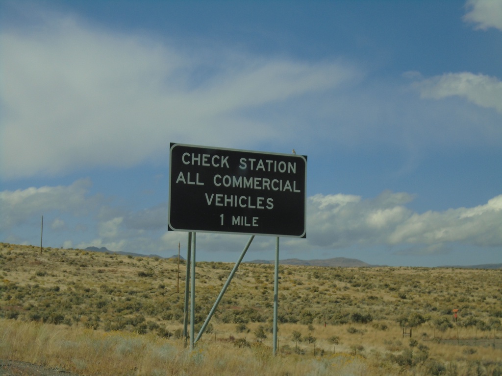
I-80 West - Check Station
I-80 west approaching Check Station. All Commercial Vehicles Must Exit.
Taken 09-28-2019
Elko
Elko County
Nevada
United States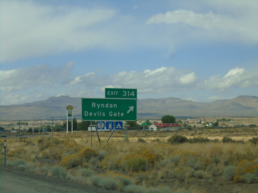
I-80 West - Exit 314
i-80 west at Exit 314 - Ryndon/Devils Gate.
Taken 09-28-2019
Ryndon
Elko County
Nevada
United States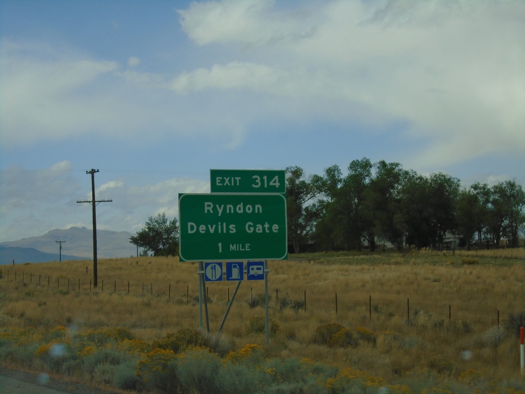
I-80 West - Exit 314
I-80 west approaching Exit 314 - Ryndon/Devils Gate
Taken 09-28-2019
Elko
Elko County
Nevada
United States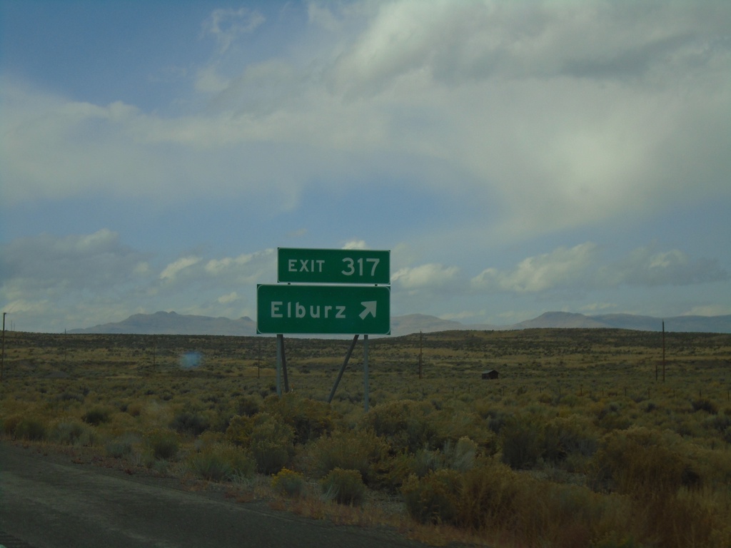
I-80 West - Exit 317
I-80 west at Exit 317 - Elburz
Taken 09-28-2019
Elburz
Elko County
Nevada
United States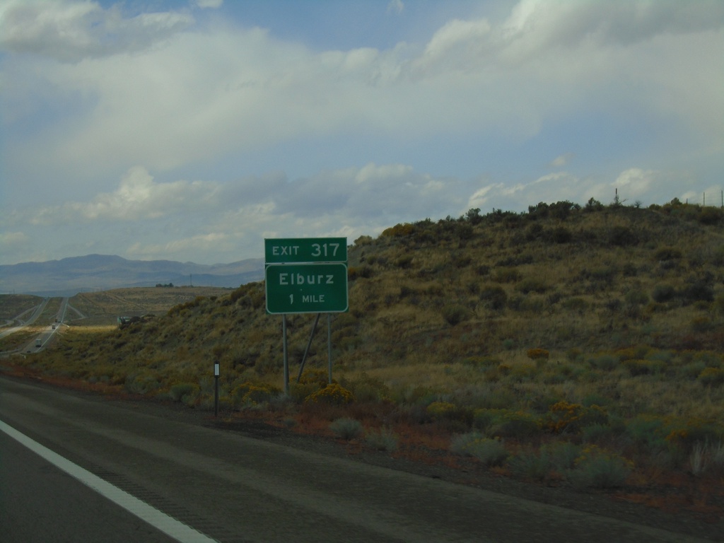
I-80 West Exit 317
I-80 West approaching Exit 317 - Elburz
Taken 09-28-2019
Elburz
Elko County
Nevada
United States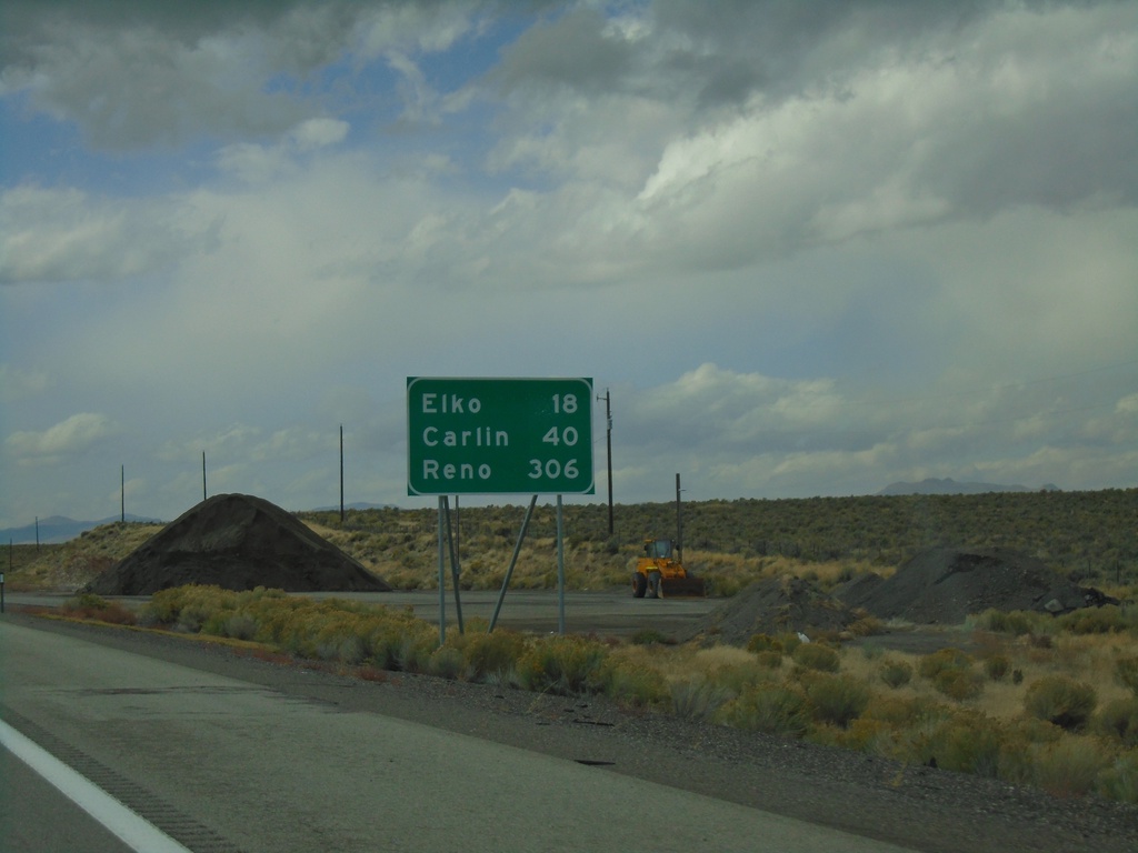
I-80 West - Distance Marker
Distance marker on I-80 west. Distance to Elko, Carlin, and Reno.
Taken 09-28-2019
Elko
Elko County
Nevada
United States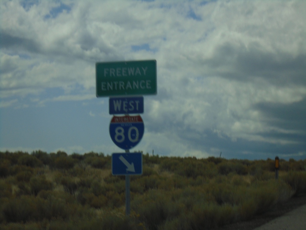
End NV-229 North at I-80 West
End NV-229 North at I-80 West (Exit 321).
Taken 09-28-2019
 Elko
Elko County
Nevada
United States
Elko
Elko County
Nevada
United States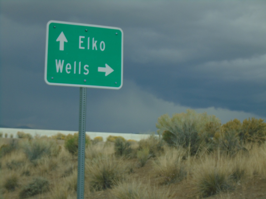
End NV-229 North at I-80 (Exit 321)
End NV-229 North at I-80 (Exit 321). Use I-80 east for Wells; I-80 west for Elko.
Taken 09-28-2019
Halleck
Elko County
Nevada
United States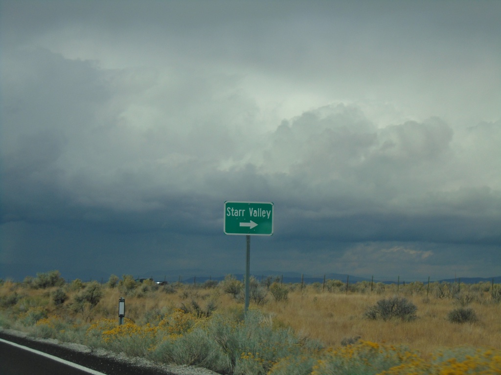
NV-229 North - Starr Valley Junction
NV-229 north at Starr Valley junction
Taken 09-28-2019
Halleck
Elko County
Nevada
United States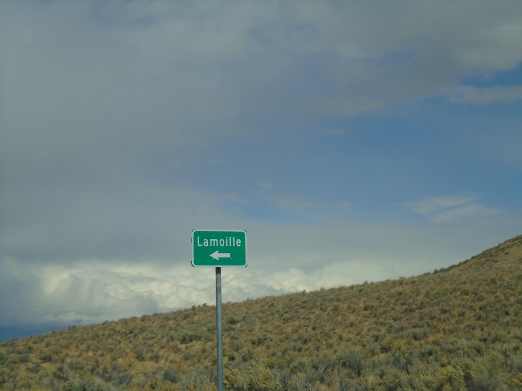
NV-229 North at Lamoille Jct.
NV-229 North at Fort Halleck Road to Lamoille
Taken 09-28-2019
Lamoille
Elko County
Nevada
United States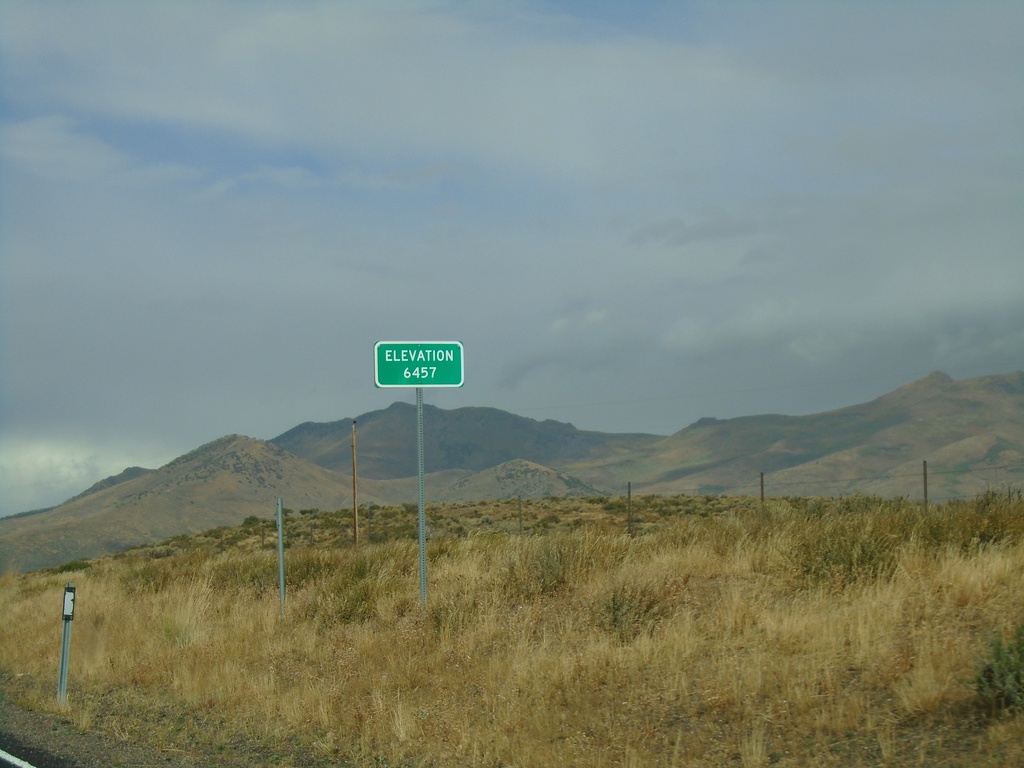
NV-229 North - Secret Pass
NV-229 North at Secret Pass - Elevation 6457 Feet.
Taken 09-28-2019
Arthur
Elko County
Nevada
United States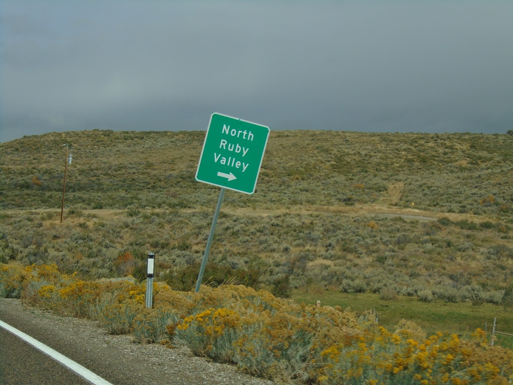
NV-229 North - North Ruby Valley Jct.
NV-229 North at North Ruby Valley junction.
Taken 09-28-2019
Ruby Valley
Elko County
Nevada
United States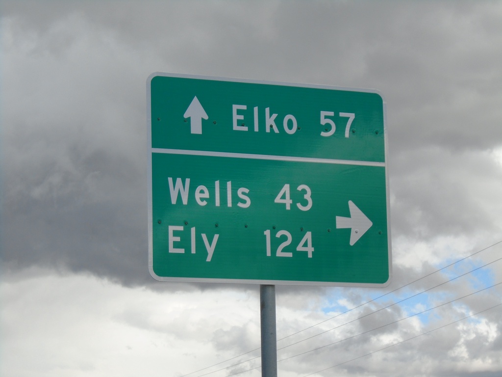
End NV-767 North at NV-229
End NV-767 North at NV-229. Turn right for NV-229 South to Ely (via US-93 South) and Wells (via US-93 North). Continue straight for NV-229 North to Elko (via I-80 West).
Taken 09-28-2019
 Ruby Valley
Elko County
Nevada
United States
Ruby Valley
Elko County
Nevada
United States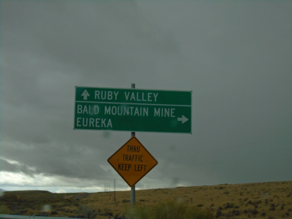
Harrison Pass Road South at County Road
Harrison Pass Road South at County Road to Eureka and Bald Mountain Mine. Continue east for Ruby Valley.
Taken 09-28-2019
Jiggs Elko County Nevada United States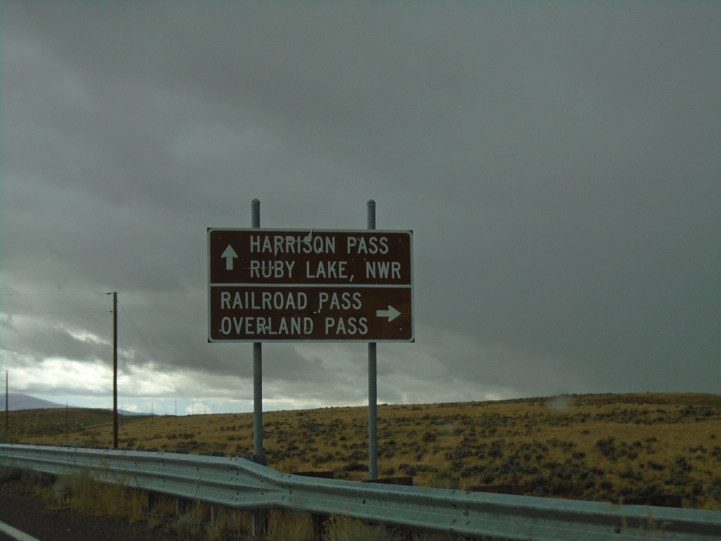
Harrison Pass Road at Railroad Pass Jct.
Harrison Pass Road at county road to Railroad Pass and Overland Pass. Use Harrison Pass Road for Harrison Pass and Ruby Valley NWR.
Taken 09-28-2019
Jiggs Elko County Nevada United States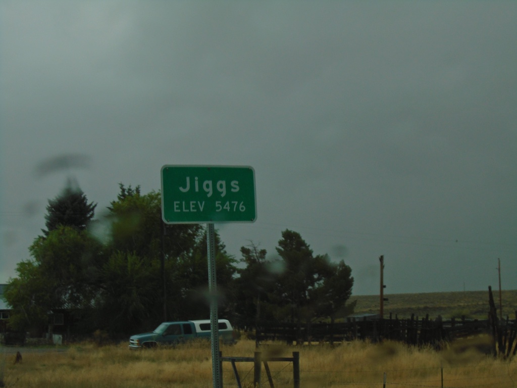
NV-228 South - Jiggs
Entering Jiggs on NV-228 south. Elevation 5476 Feet.
Taken 09-28-2019
 Spring Creek
Elko County
Nevada
United States
Spring Creek
Elko County
Nevada
United States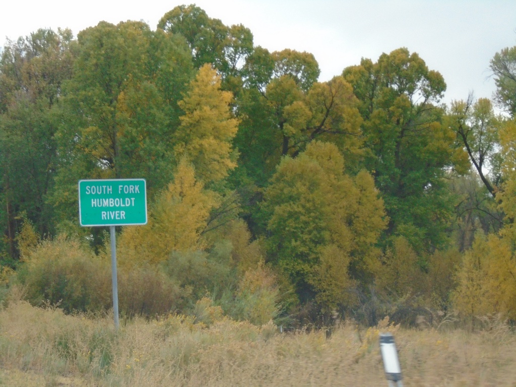
NV-228 South - South Fork Humboldt River
South Fork of the Humboldt River on NV-228 South.
Taken 09-28-2019
South Fork
Elko County
Nevada
United States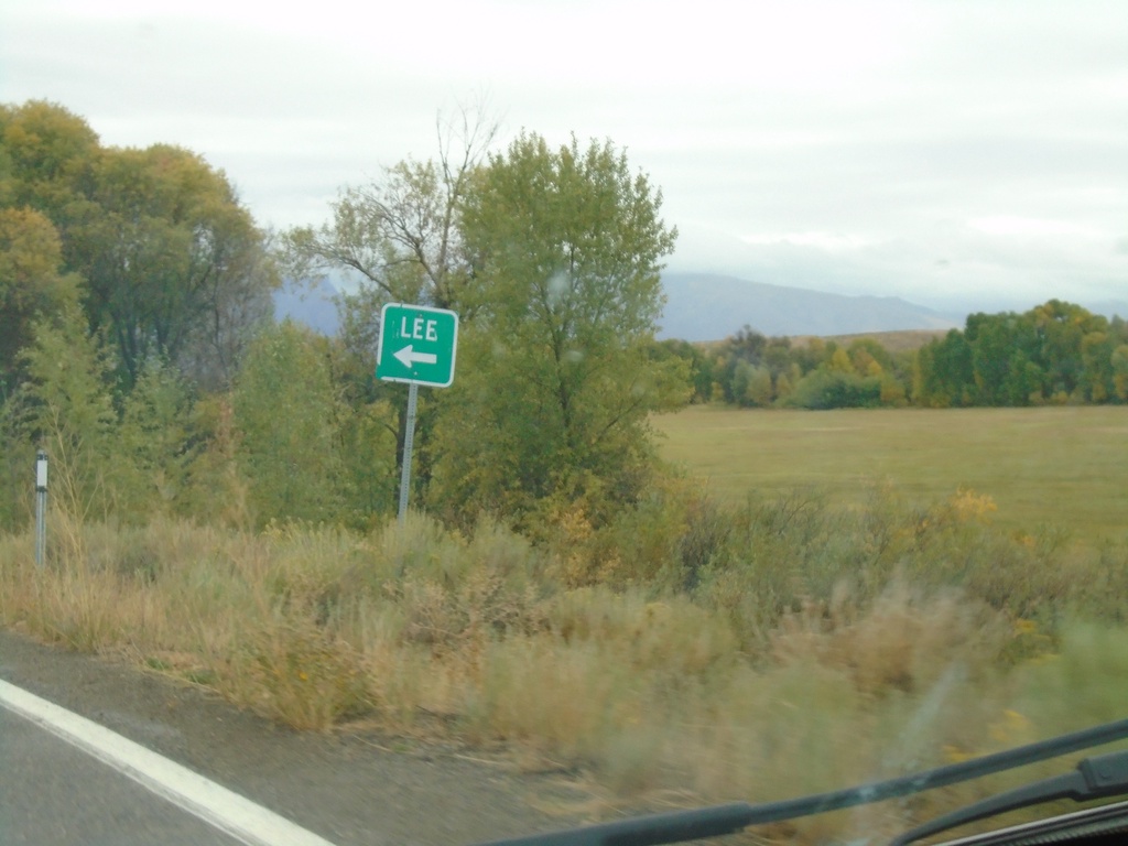
NV-228 South - Lee Jct.
NV-228 South at Lee Jct.
Taken 09-28-2019
Spring Creek
Elko County
Nevada
United States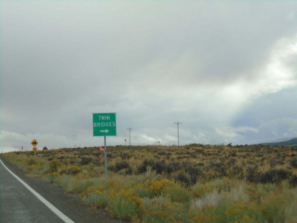
NV-228 South at Twin Bridges Jct.
NV-228 South at Twin Bridges junction
Taken 09-28-2019
Spring Creek
Elko County
Nevada
United States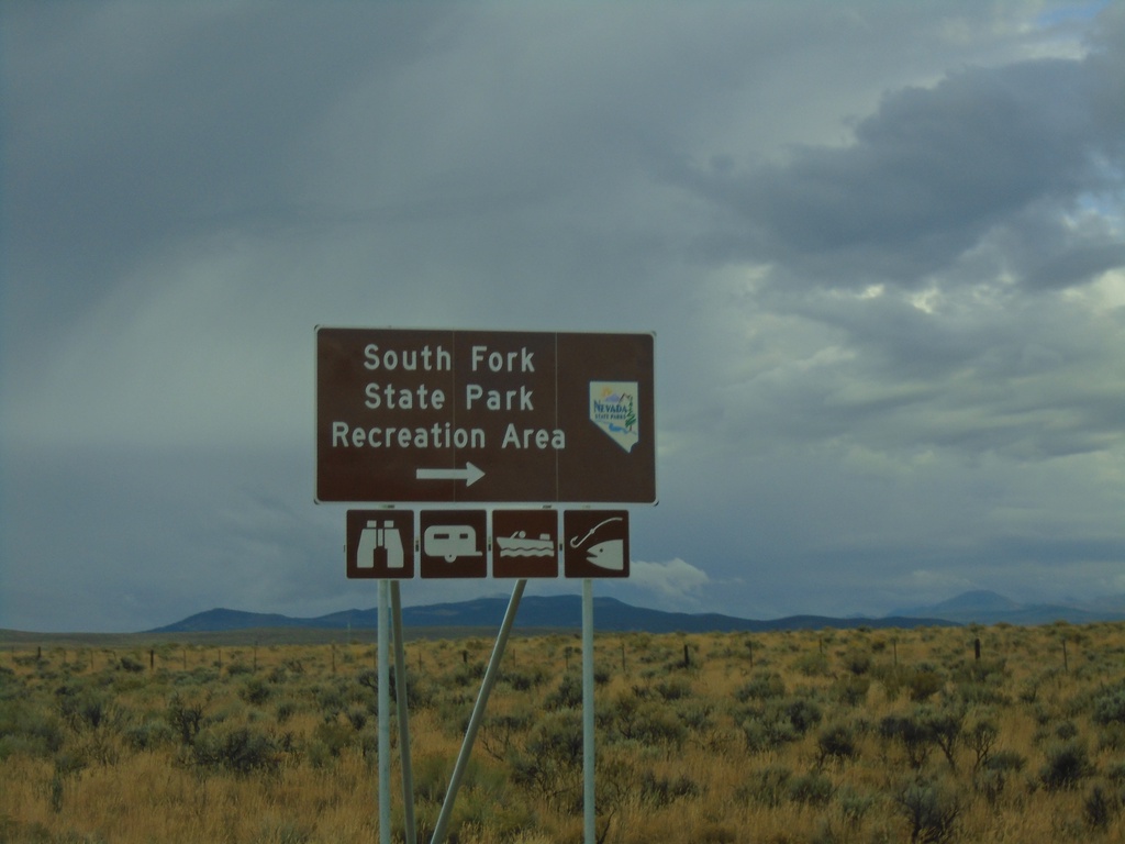
NV-228 South at South Fork State Park Recreation Area
NV-228 South at South Fork State Park Recreation Area.
Taken 09-28-2019
Spring Creek
Elko County
Nevada
United States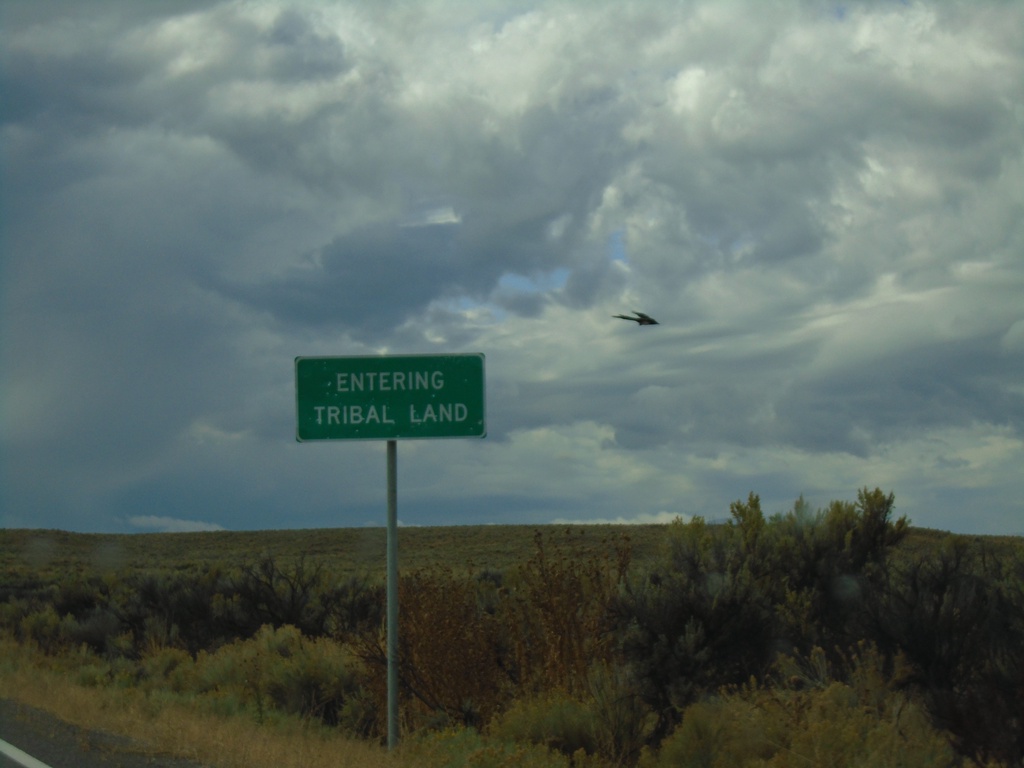
NV-228 South - South Fork Indian Reservation
NV-228 - Entering Tribal Land - South Fork Indian Reservation
Taken 09-28-2019
Spring Creek
Elko County
Nevada
United States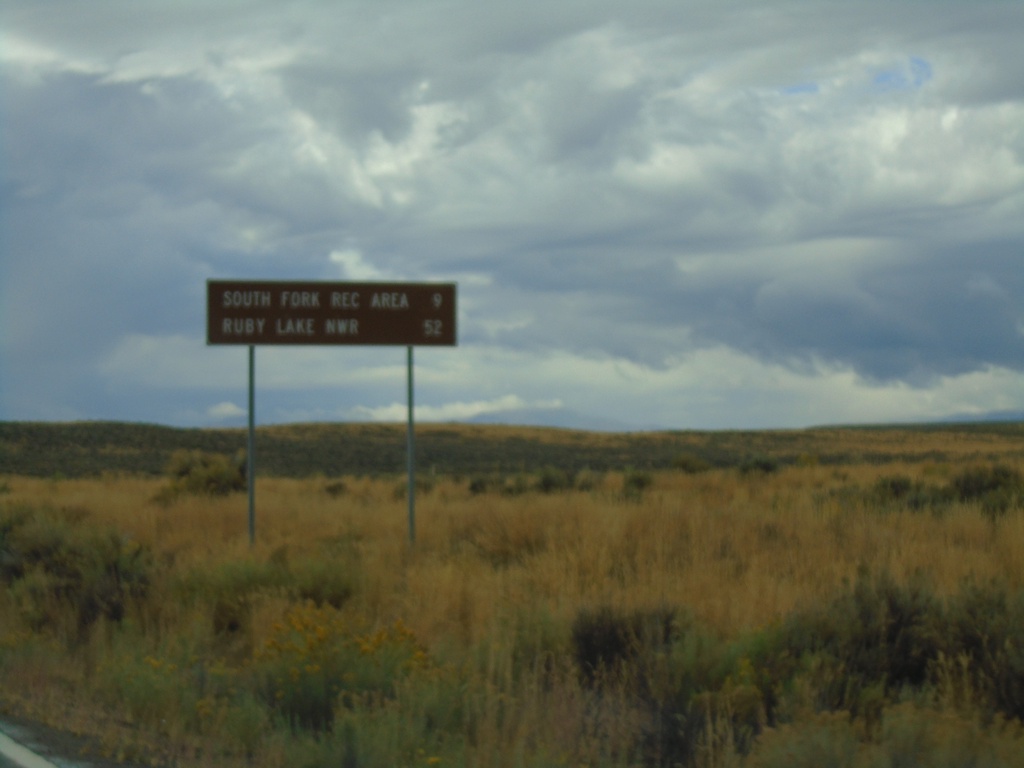
NV-228 South - Distance Marker
Distance marker on NV-228 south. Distance to South Fork Recreation Area and Ruby Lake NWR.
Taken 09-28-2019
Spring Creek
Elko County
Nevada
United States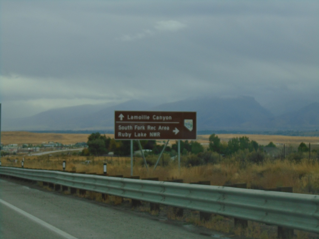
NV-227 East Approaching NV-228 South
NV-227 East Approaching NV-228 South to South Fork Recreation Area and Ruby Lake NWR. Continue east on NV-226 for Lamoille Canyon.
Taken 09-28-2019
 Spring Creek
Elko County
Nevada
United States
Spring Creek
Elko County
Nevada
United States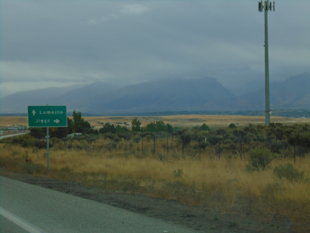
NV-227 East Approaching NV-228
NV-227 east approaching NV-228 south to Jiggs. Continue east on NV-227 for Lamoille.
Taken 09-28-2019
Spring Creek
Elko County
Nevada
United States