Signs Tagged With Big Green Sign
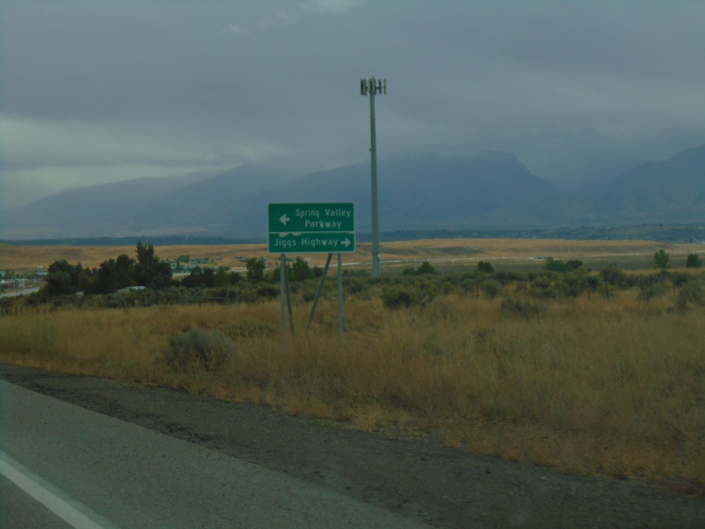
NV-227 East Approaching NV-228
NV-227 East approaching NV-228 in Spring Creek. Turn right for NV-228 South/Jiggs Highway; turn left for Spring Valley Parkway.
Taken 09-28-2019

 Spring Creek
Elko County
Nevada
United States
Spring Creek
Elko County
Nevada
United States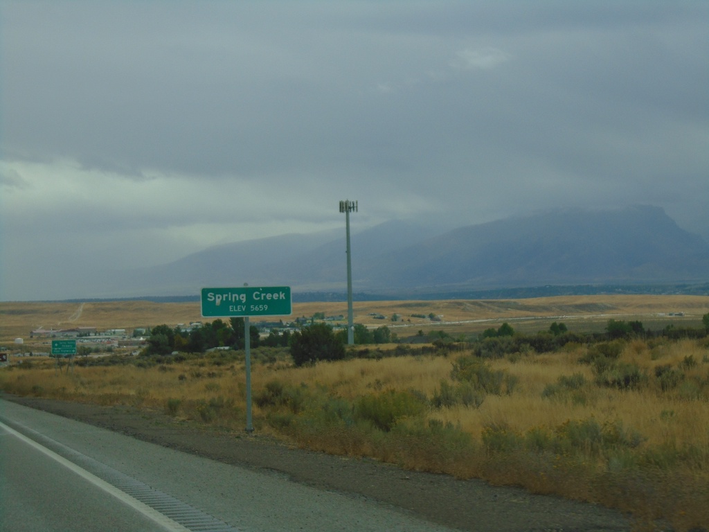
NV-227 East - Spring Creek
Entering Spring Creek - Elevation 5659 Feet on NV-227 East.
Taken 09-28-2019
Spring Creek
Elko County
Nevada
United States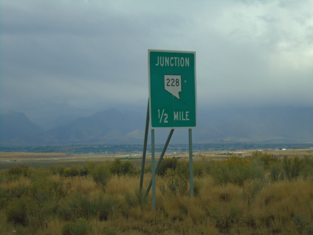
NV-227 South Approaching NV-228
NV-227 South approaching NV-228 in Spring Creek.
Taken 09-28-2019
Spring Creek
Elko County
Nevada
United States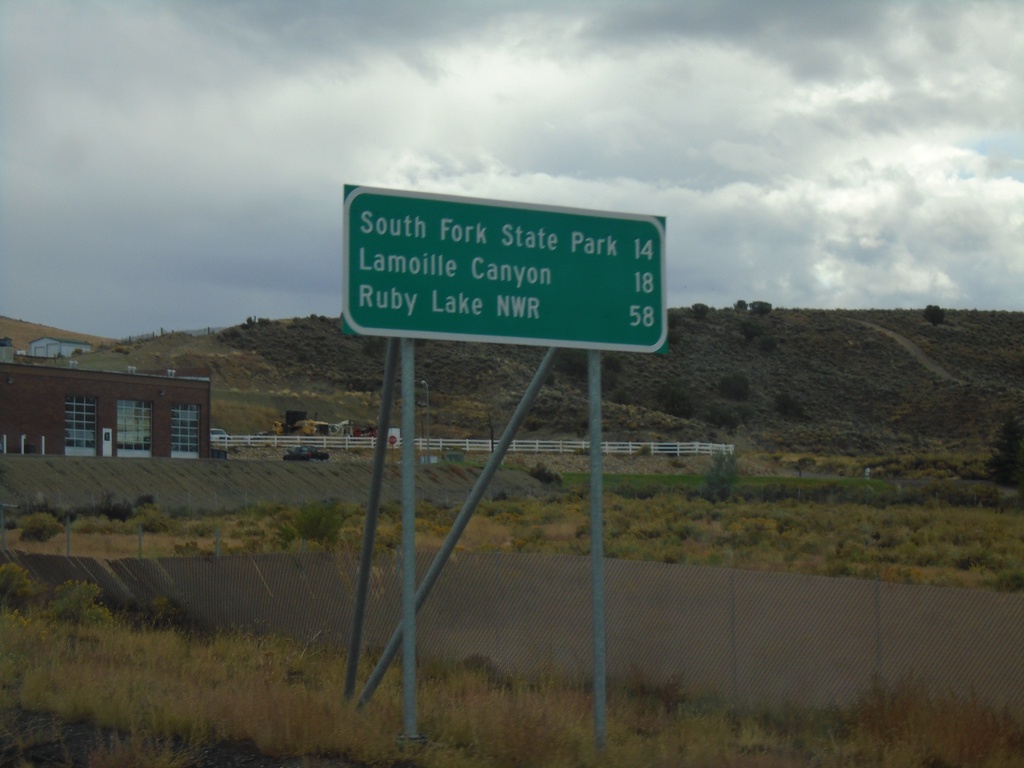
NV-227 South - Distance Marker
Distance marker on NV-227 south. Distance to South Fork State Park (via NV-228), Lamoille, and Ruby Lake NWR (via NV-228).
Taken 09-28-2019
Elko
Elko County
Nevada
United States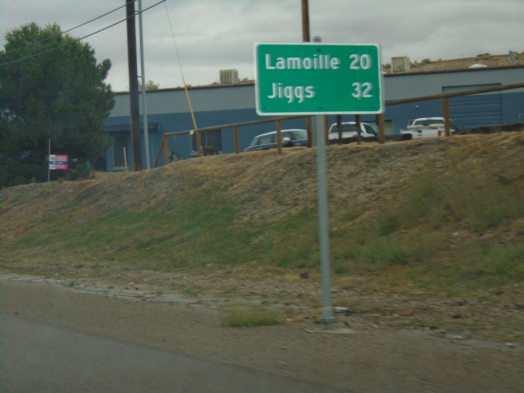
NV-227 South - Distance Marker
Distance marker on NV-227. Distance to Lamoille and Jiggs (via NV-228).
Taken 09-28-2019
Elko
Elko County
Nevada
United States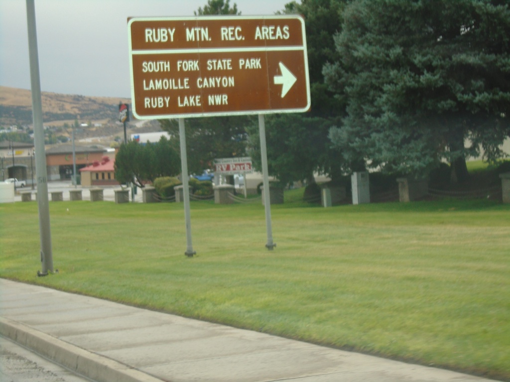
BL-80 West (Jennings Way) at Idaho St.
BL-80 West (Jennings Way) at Idaho St. Turn right to continue west on BL-80 and for Ruby Mountain Recreation Areas: Lamoille Canyon, South Fork State Park, and Ruby Valley NWR.
Taken 09-28-2019
 Elko
Elko County
Nevada
United States
Elko
Elko County
Nevada
United States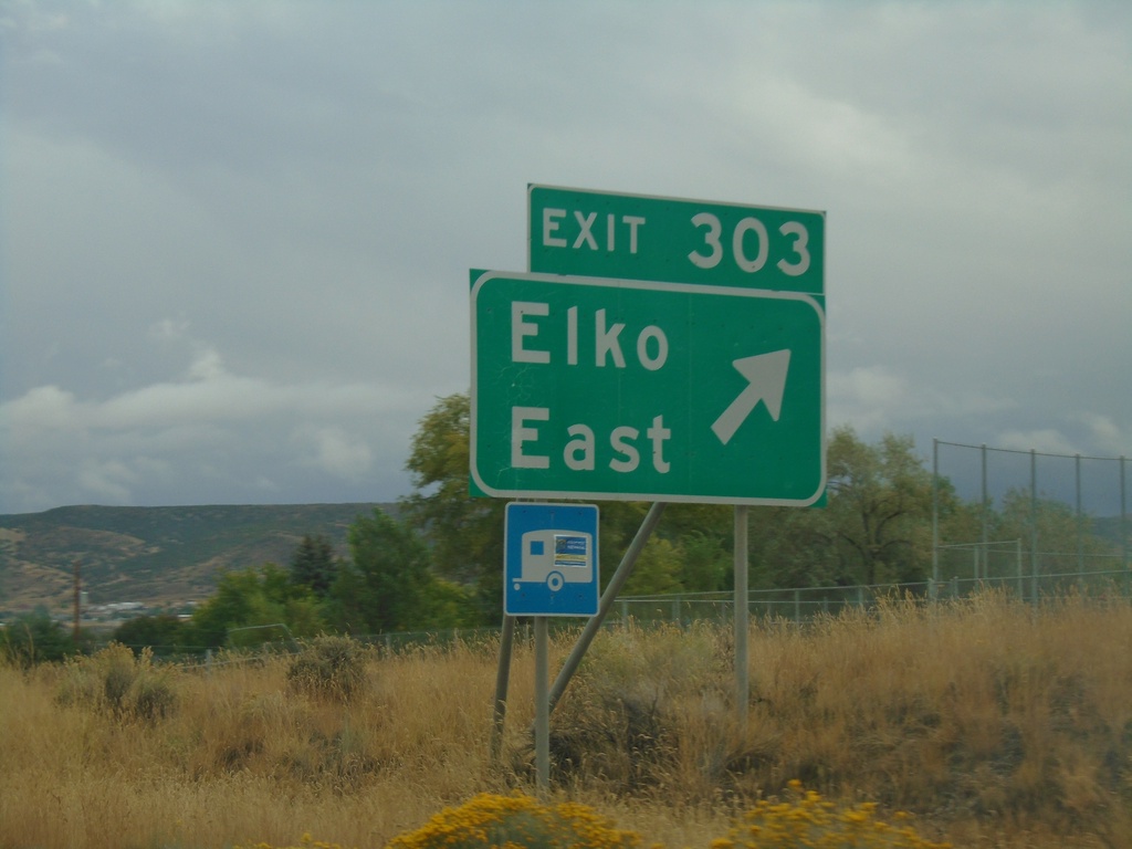
I-80 East - Exit 303
I-80 east at Exit 303 - Elko East.
Taken 09-28-2019
 Elko
Elko County
Nevada
United States
Elko
Elko County
Nevada
United States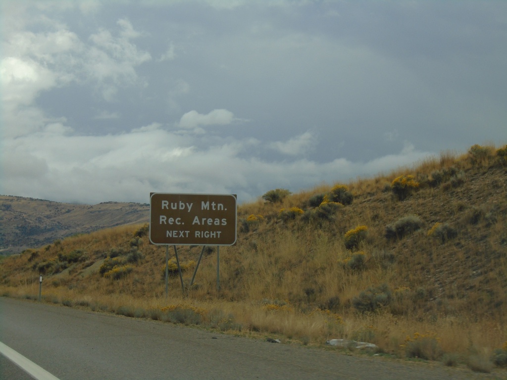
I-80 East - Exit 303
I-80 east approaching Exit 303. Use Exit 303 for Ruby Mountain Recreation Areas.
Taken 09-28-2019
Elko
Elko County
Nevada
United States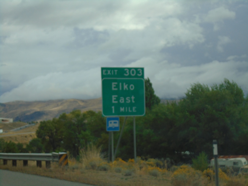
I-80 East - Exit 303
I-80 east approaching Exit 303 - Elko East.
Taken 09-28-2019
Elko
Elko County
Nevada
United States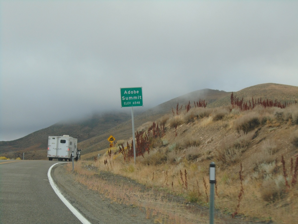
NV-225 South - Adobe Summit
Adobe Summit - Elevation 6548 Feet on NV-225 south.
Taken 09-28-2019
 Elko
Elko County
Nevada
United States
Elko
Elko County
Nevada
United States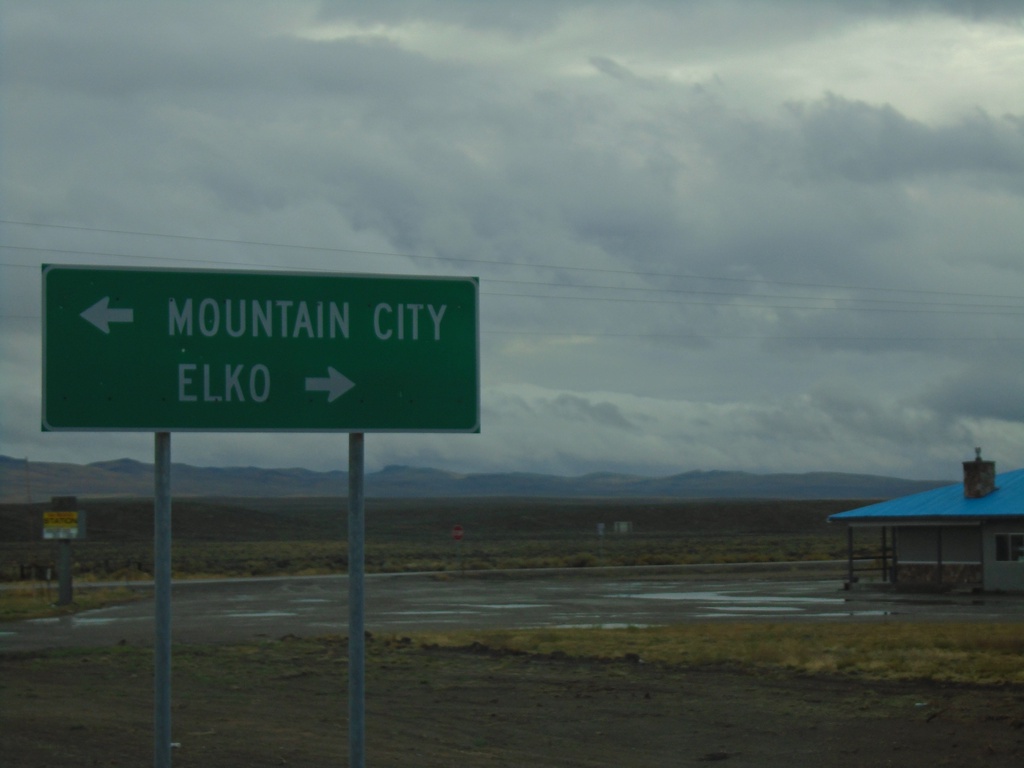
End NV-226 South at NV-225
End NV-226 South at NV-225. Turn left on NV-225 north for Mountain City; left on NV-225 south for Elko.
Taken 09-28-2019
 Elko
Elko County
Nevada
United States
Elko
Elko County
Nevada
United States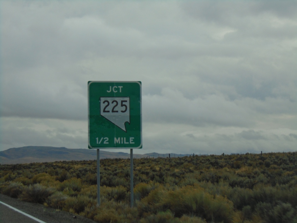
NV-226 East Approaching NV-225
NV-226 East approaching NV-225 at Tuscarora Junction.
Taken 09-28-2019
Elko
Elko County
Nevada
United States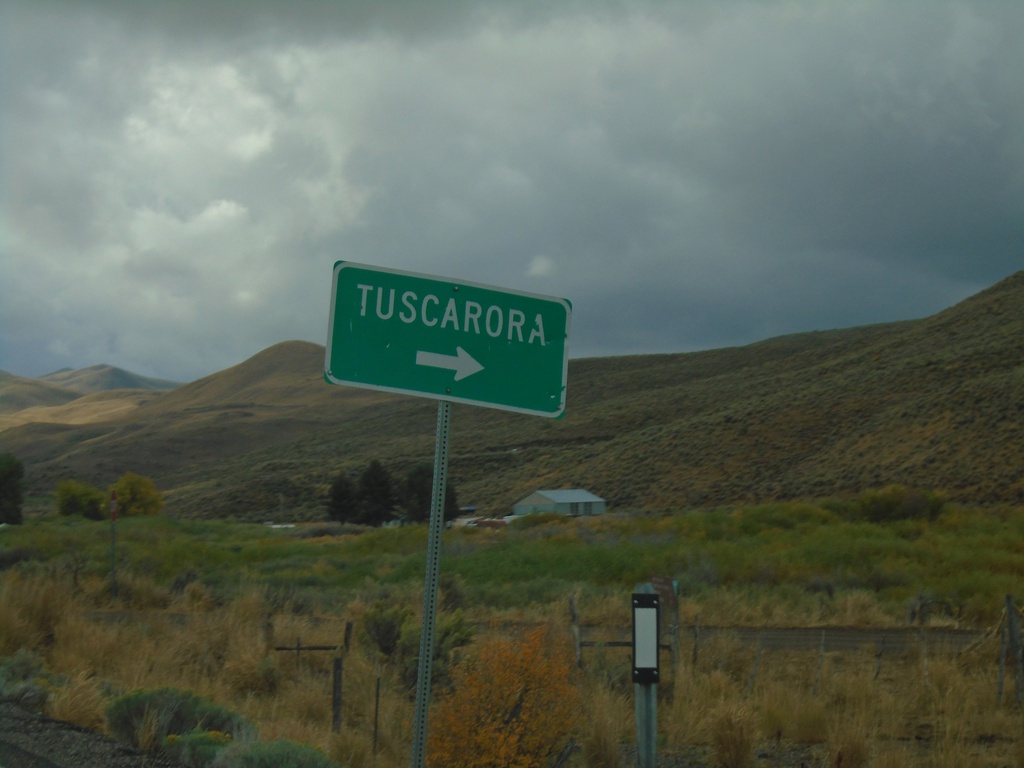
NV-226 South - Tuscarora
NV-226 south at Tuscarora junction.
Taken 09-28-2019
Tuscarora
Elko County
Nevada
United States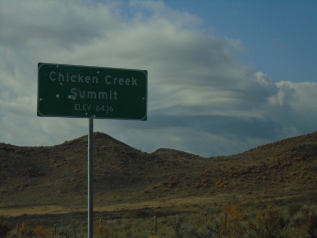
NV-226 South - Chicken Creek Summit
Chicken Creek Summit on NV-226 South. Elevation 6436 Feet.
Taken 09-28-2019
Tuscarora
Elko County
Nevada
United States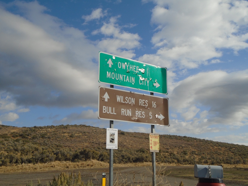
End NV-226 North
End NV-226 North in Elko County. Turn left for Owyhee and Wilson Reservoir; turn right for Mountain City and Bull Run Reservoir. Either road is unpaved.
Taken 09-28-2019
Mountain City
Elko County
Nevada
United States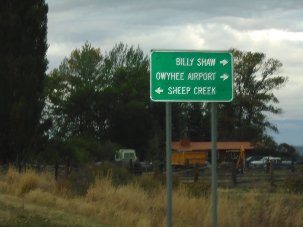
Owyhee Road at Airport Road - Duck Valley Indian Reservation
Owyhee Road at Airport Road in the Duck Valley Indian Reservation. Merge left to continue on Owyhee Road towards Sheep Creek (Reservoir). Use Airport Road for Owyhee Airport and Billy Shaw (Reservoir).
Taken 09-28-2019
Owyhee Elko County Nevada United States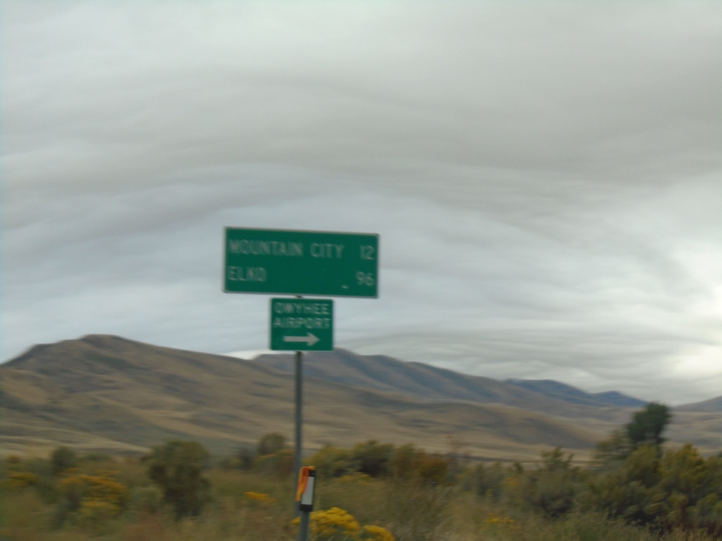
NV-225 South - Owyhee Road
NV-225 south at Owyhee Road to Owyhee Airport. Continue on NV-225 for Mountain City and Elko.
Taken 09-28-2019
Owyhee
Elko County
Nevada
United States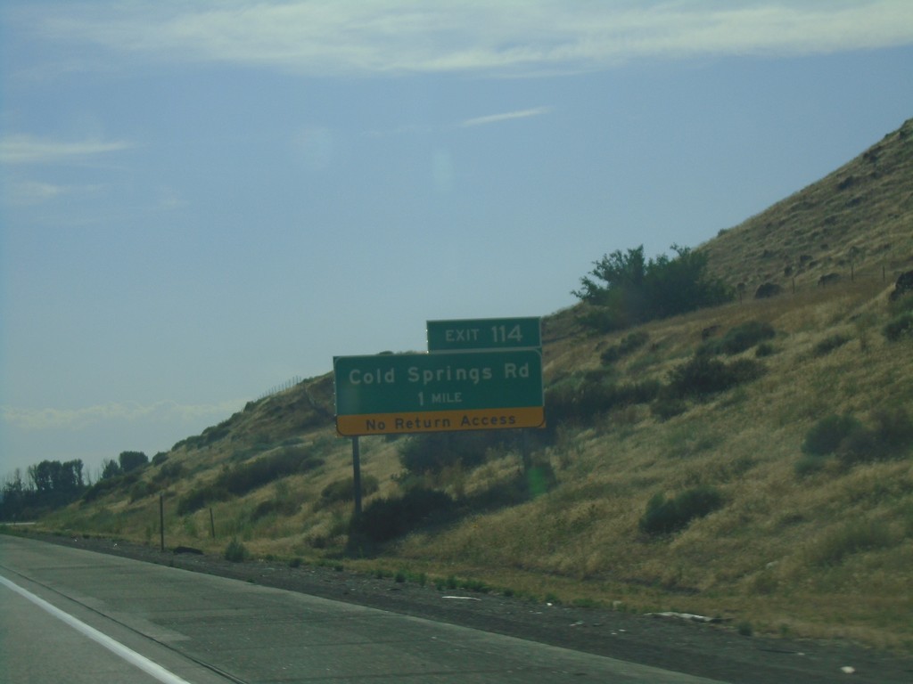
I-84 West - Exit 114
I-84 west approaching Exit 114 - Cold Springs Road.
Taken 08-03-2019


 Hammett
Elmore County
Idaho
United States
Hammett
Elmore County
Idaho
United States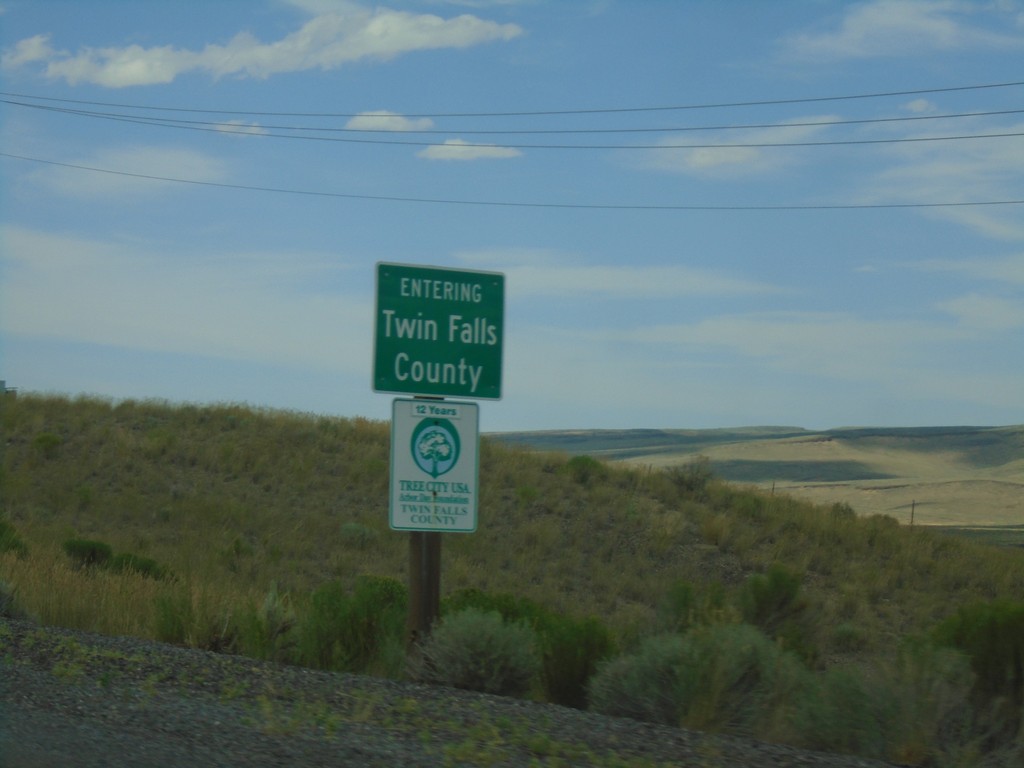
US-93 North - Entering Twin Falls County
Entering Twin Falls County on US-93 north. Taken just north of the Idaho-Nevada line.
Taken 08-03-2019
 Idavada
Twin Falls County
Idaho
United States
Idavada
Twin Falls County
Idaho
United States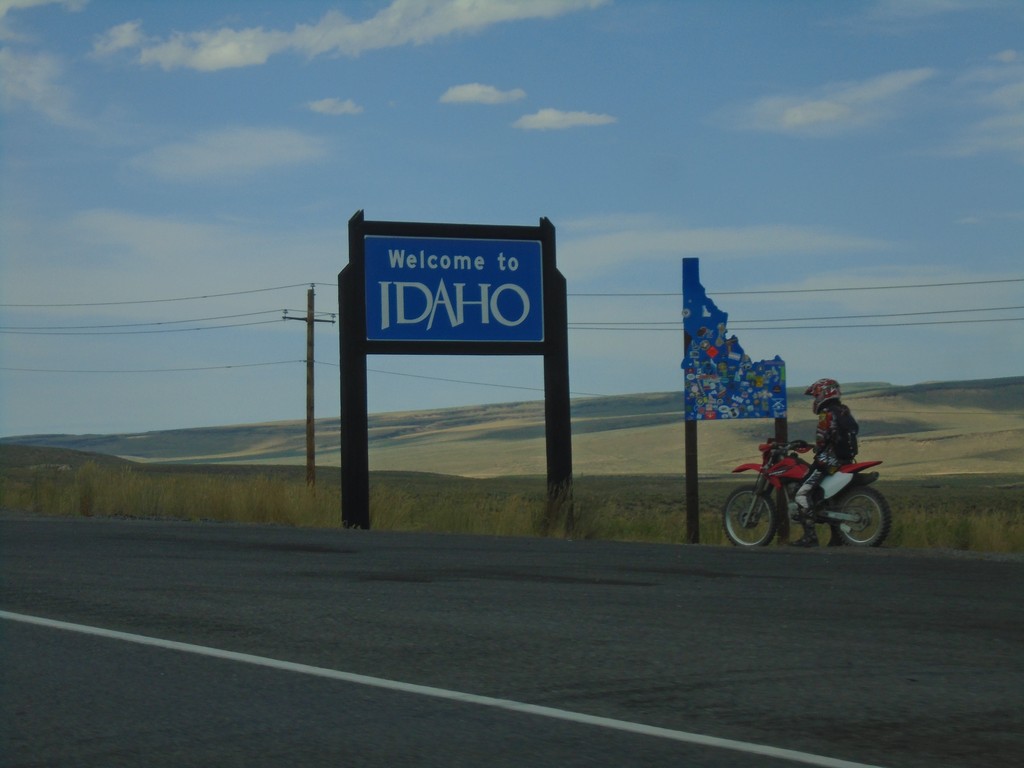
US-93 North - Welcome To Idaho
Welcome to Idaho on US-93 north.
Taken 08-03-2019
Idavada
Twin Falls County
Idaho
United States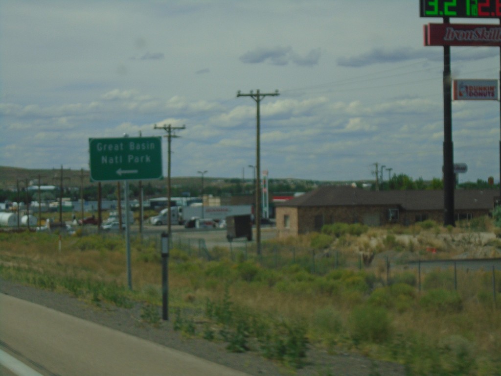
I-80 West - Exit 352A Offramp
I-80 West - Exit 352A Offramp. Turn right on US-93 South for Great Basin National Park.
Taken 08-03-2019
 Wells
Elko County
Nevada
United States
Wells
Elko County
Nevada
United States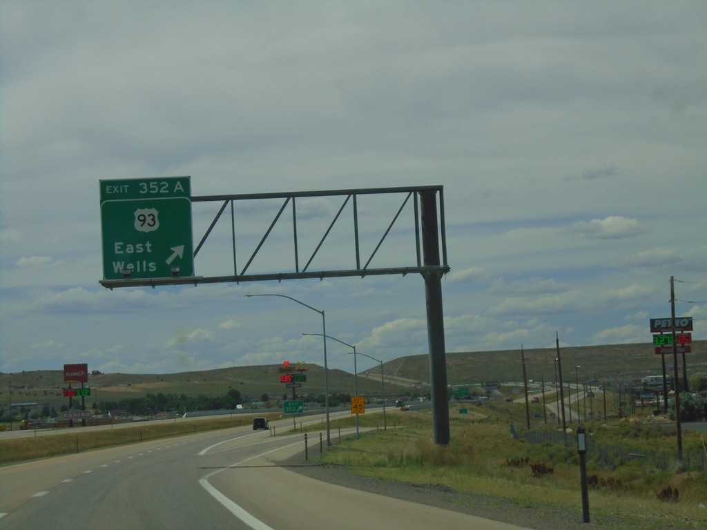
I-80 West - Exit 352A
I-80 west at Exit 352A - US-93/East Wells.
Taken 08-03-2019
Wells
Elko County
Nevada
United States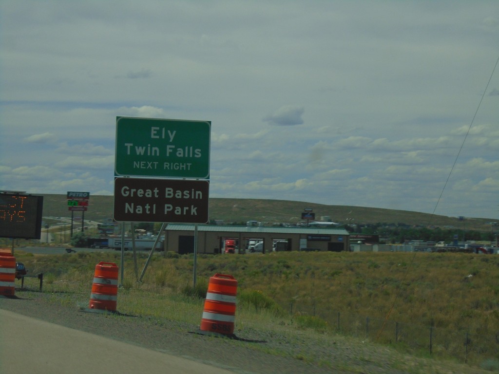
I-80 West - Exit 352A
I-80 west approaching Exit 352A. Use Exit 352A (US-93) for Ely, Twin Falls (Idaho), and Great Basin National Park.
Taken 08-03-2019
Wells
Elko County
Nevada
United States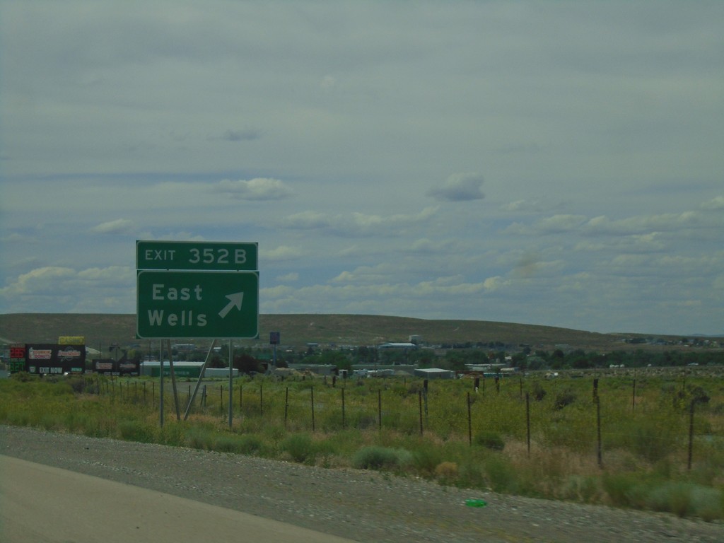
I-80 West - Exit 352B
I-80 west at Exit 352B - East Wells.
Taken 08-03-2019
Wells
Elko County
Nevada
United States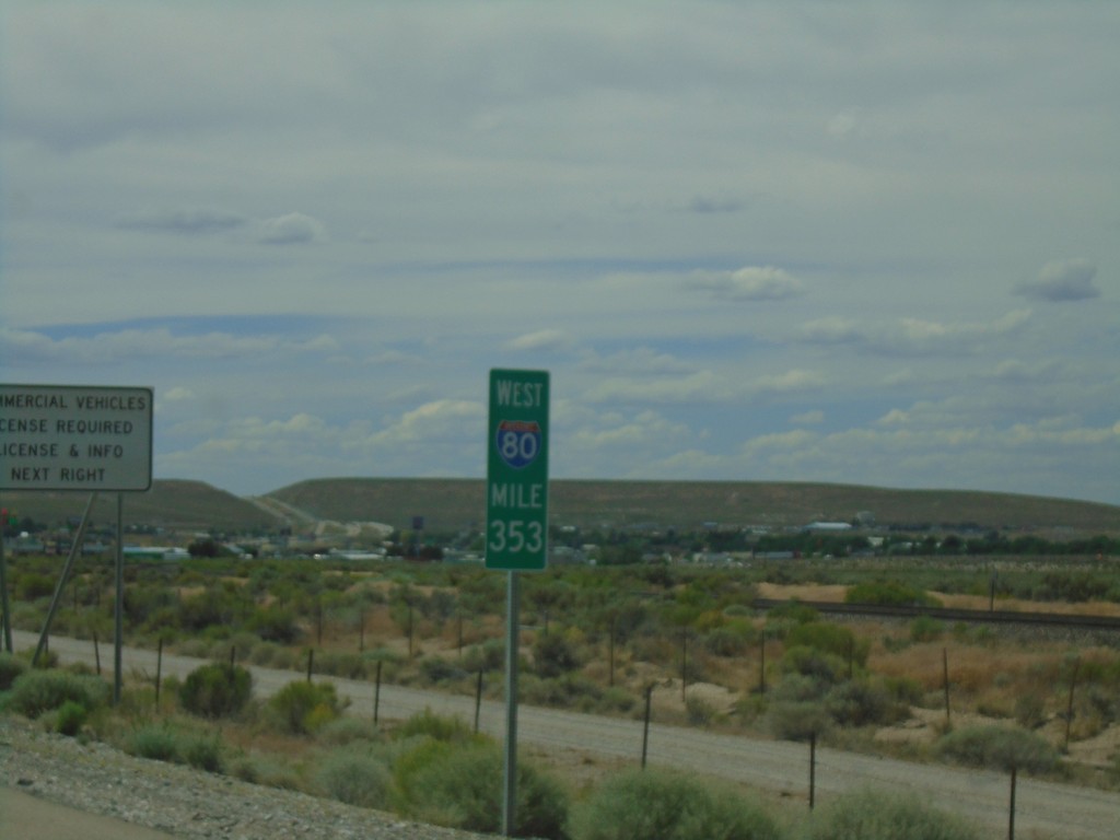
I-80 West - Mile 353
I-80 West - Mile 353. These types of mileposts with the route shield have been showing up more and more in Nevada recently.
Taken 08-03-2019
Wells
Elko County
Nevada
United States