Signs Tagged With Big Green Sign
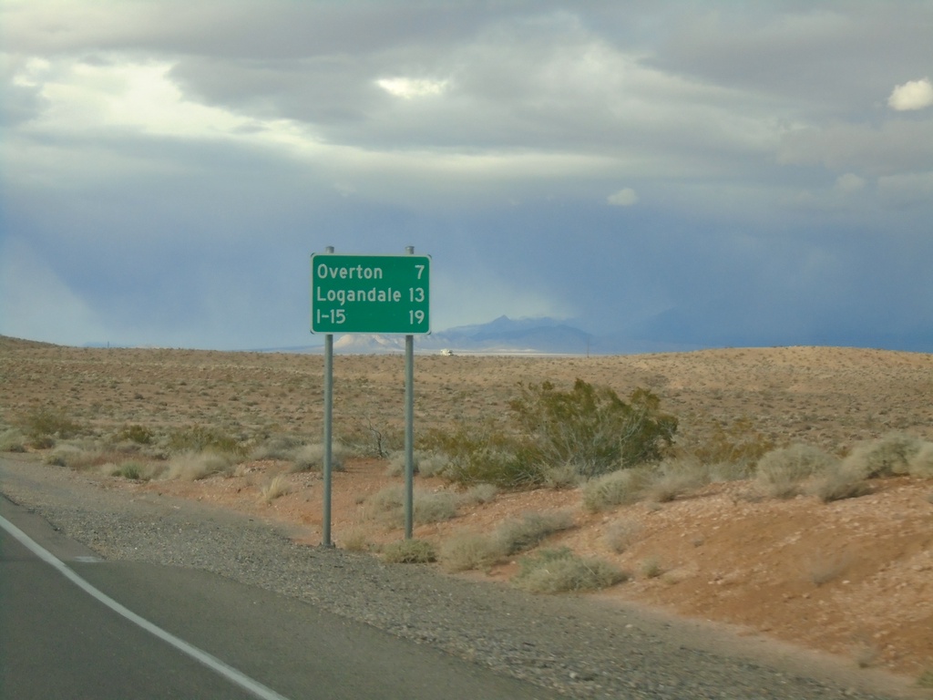
Begin NV-169 Northbound
Distance marker at beginning of NV-169 northbound. Distance to Overton, Logandale, and I-15.
Taken 11-29-2019
 Moapa Valley
Clark County
Nevada
United States
Moapa Valley
Clark County
Nevada
United States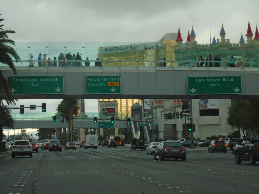
Las Vegas Blvd. South at Tropicana Ave.
Las Vegas Blvd. South at Tropicana Ave (NV-593). Use left lane for Tropicana Ave. east. Use middle lane for McCarran International Airport. Use right lanes to continue south on Las Vegas Blvd.
Taken 11-28-2019
 Las Vegas
Clark County
Nevada
United States
Las Vegas
Clark County
Nevada
United States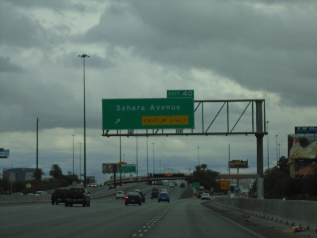
I-15 North - Exit 40
I-15 north at Exit 40 - Sahara Ave
Taken 11-28-2019
 Las Vegas
Clark County
Nevada
United States
Las Vegas
Clark County
Nevada
United States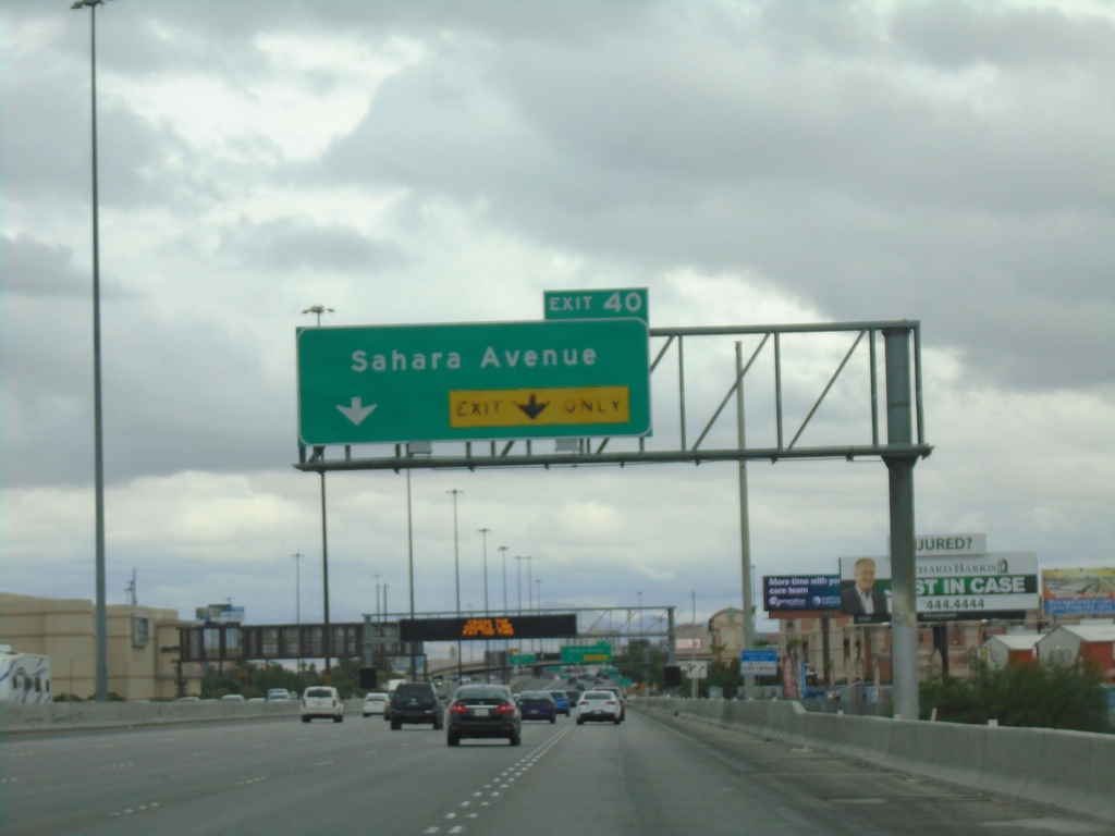
I-15 North - Exit 40
I-15 north approaching Exit 40 - Sahara Ave.
Taken 11-28-2019
Las Vegas
Clark County
Nevada
United States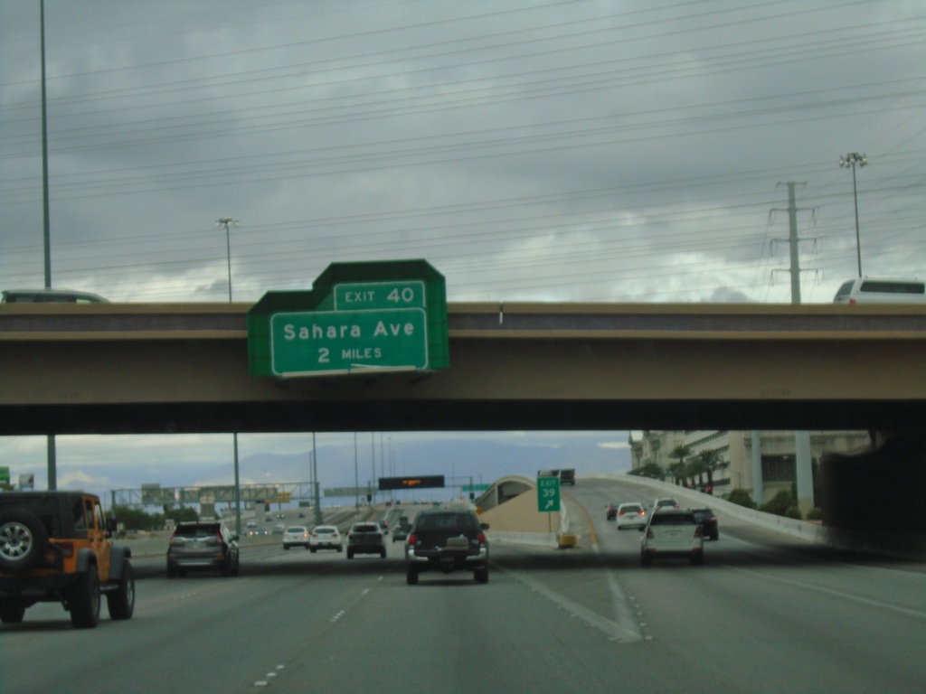
I-15 North - Exit 40
I-15 north approaching Exit 40 - Sahara Ave
Taken 11-28-2019
Las Vegas
Clark County
Nevada
United States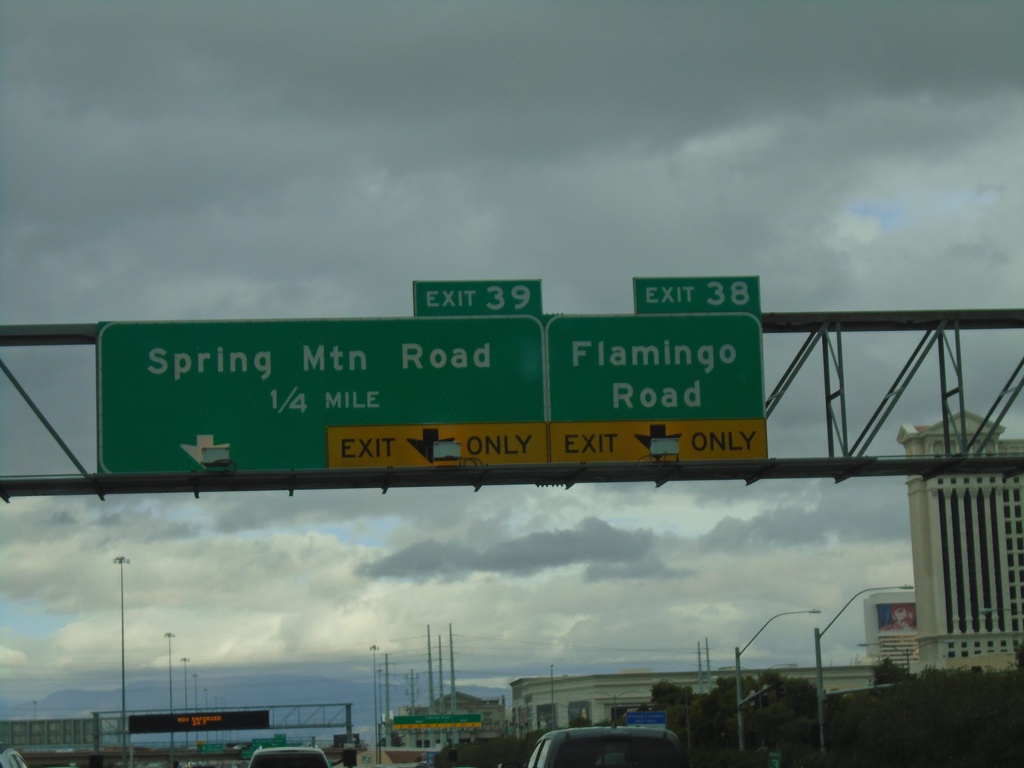
I-15 North - Exits 38 and 39
I-15 north approaching Exit 38 - Flamingo Road. Approaching Exit 39 - Spring Mountain Road.
Taken 11-28-2019
 Las Vegas
Clark County
Nevada
United States
Las Vegas
Clark County
Nevada
United States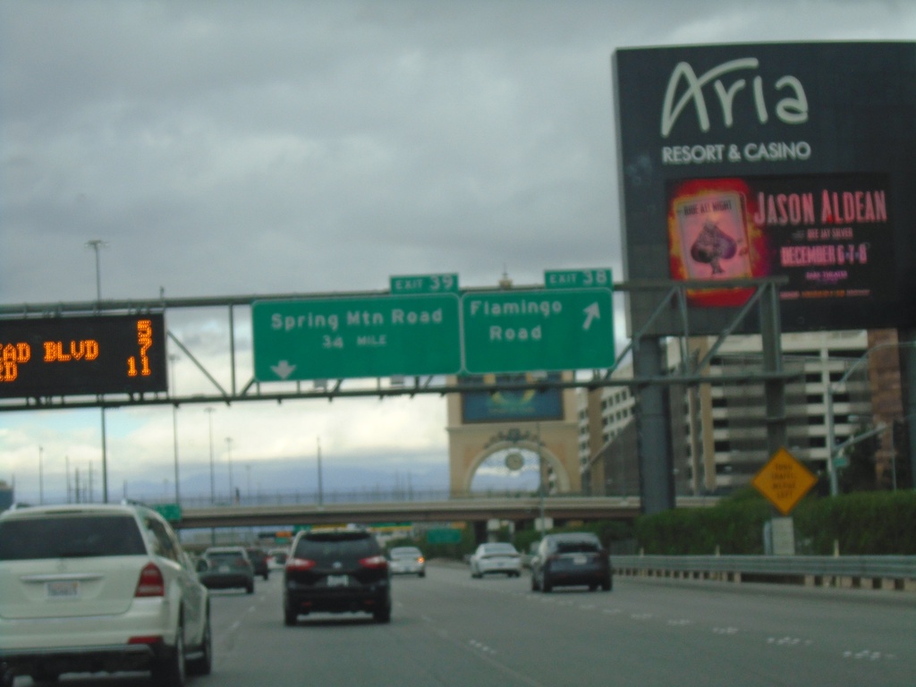
I-15 North - Exits 38 and 39
I-15 north at Exit 38 - Flamingo Road. Approaching Exit 39 - Spring Mountain Road.
Taken 11-28-2019
Las Vegas
Clark County
Nevada
United States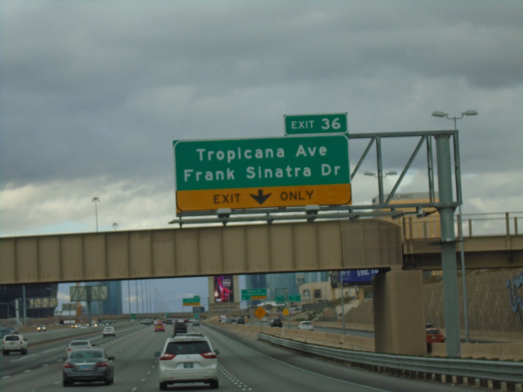
I-15 North - Exit 36
I-15 north approaching Exit 36 - Tropicana Ave/Frank Sinatra Dr
Taken 11-28-2019
Las Vegas
Clark County
Nevada
United States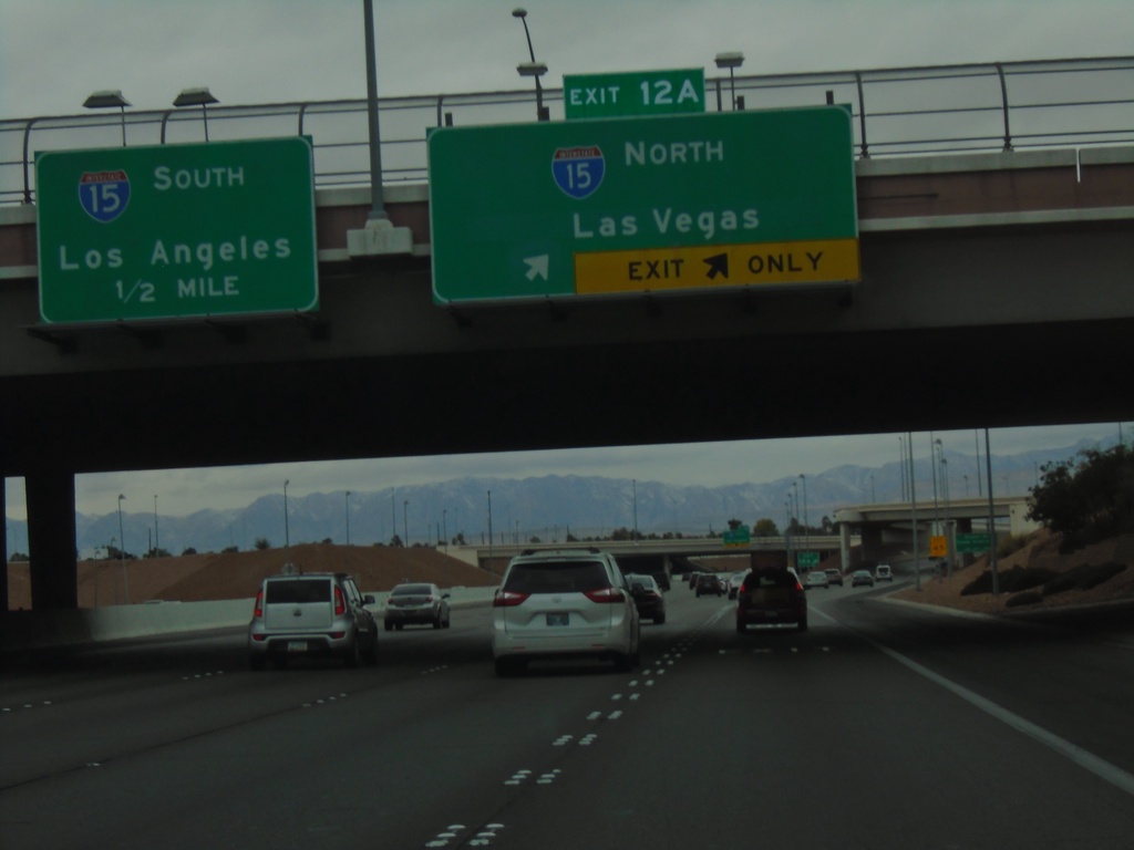
I-215 West Approaching I-15
I-215 West approaching I-15. Use Exit 12A for I-15 North/Las Vegas. Approaching I-15 South/Los Angeles (California).
Taken 11-28-2019
 Las Vegas
Clark County
Nevada
United States
Las Vegas
Clark County
Nevada
United States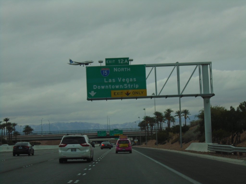
I-215 West - Exit 12A
I-215 west approaching Exit 12A - I-15 North/Las Vegas/Downtown/Strip.
Taken 11-28-2019
 Las Vegas
Clark County
Nevada
United States
Las Vegas
Clark County
Nevada
United States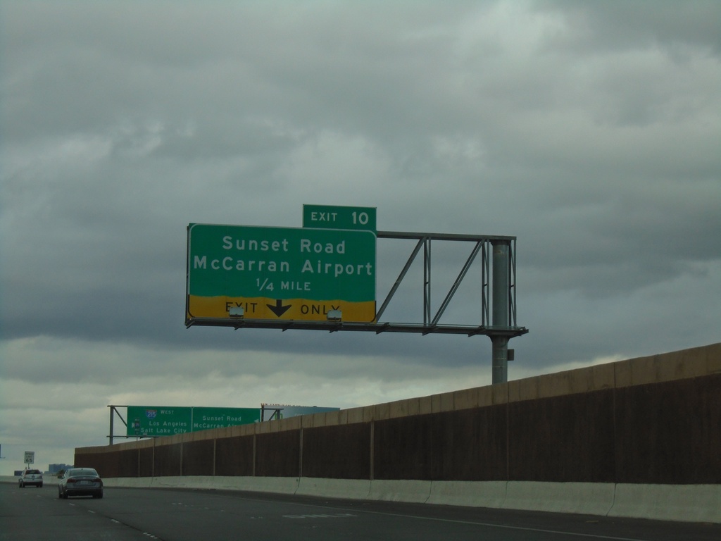
I-215 West - Exit 10
I-215 west approaching Exit 10 - Sunset Road/McCarran Airport
Taken 11-28-2019
Paradise
Clark County
Nevada
United States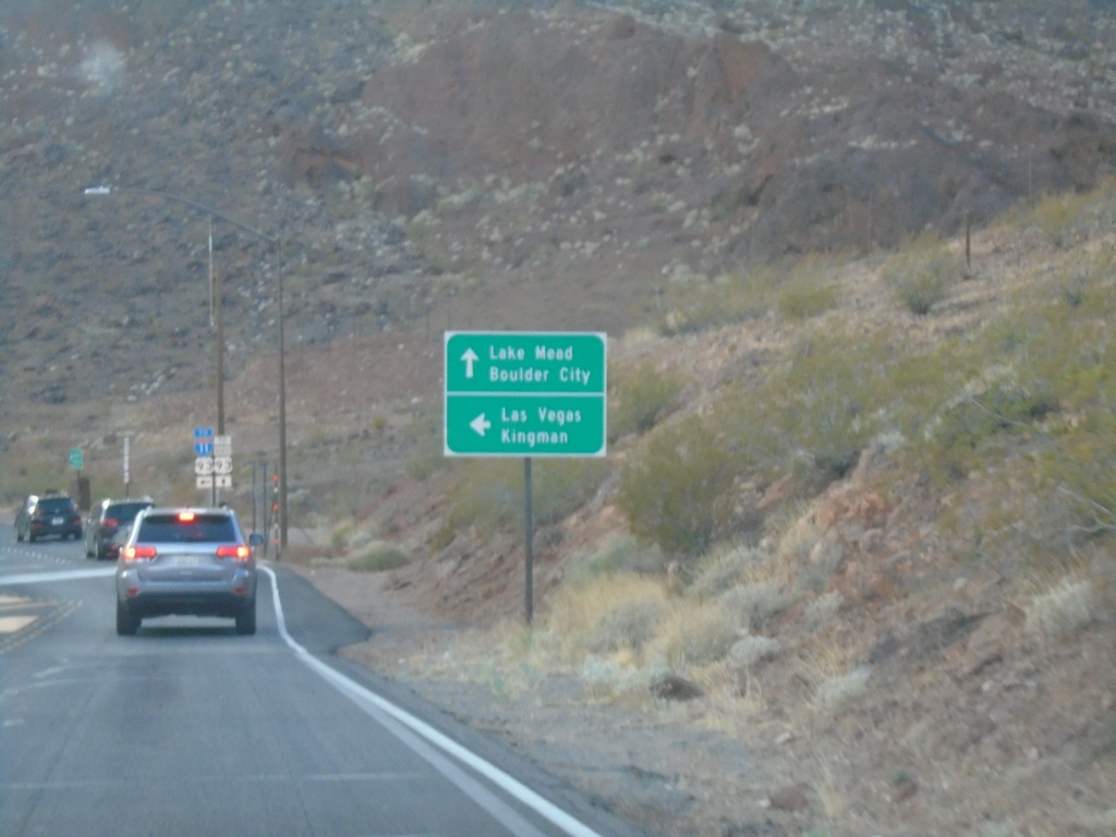
End NV-172 West at I-11/US-93/Bus. US-93
End NV-172 West at I-11/US-93/Bus. US-93. Continue straight for Bus. US-93 to Lake Mead and Boulder City. Turn left for I-11/US-93 for Las Vegas and Kingman (Arizona).
Taken 11-27-2019


 Boulder City
Clark County
Nevada
United States
Boulder City
Clark County
Nevada
United States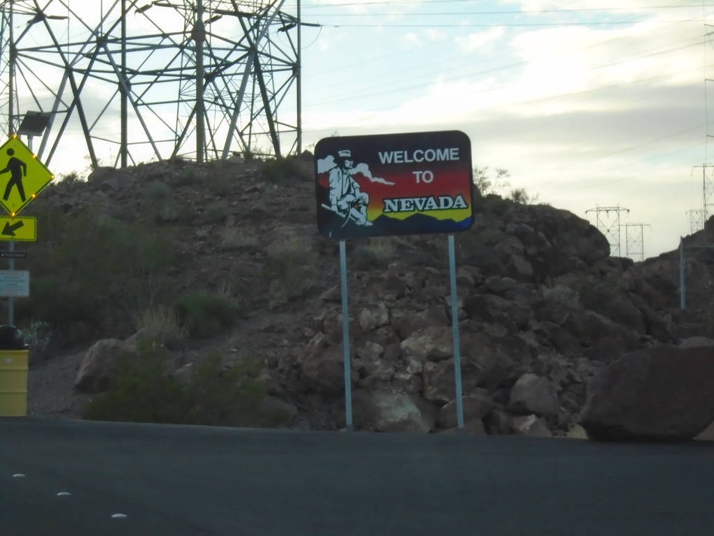
NV-172 West - Welcome To Nevada
Welcome to Nevada on NV-172 west (Hoover Dam access road).
Taken 11-27-2019
Boulder City
Clark County
Nevada
United States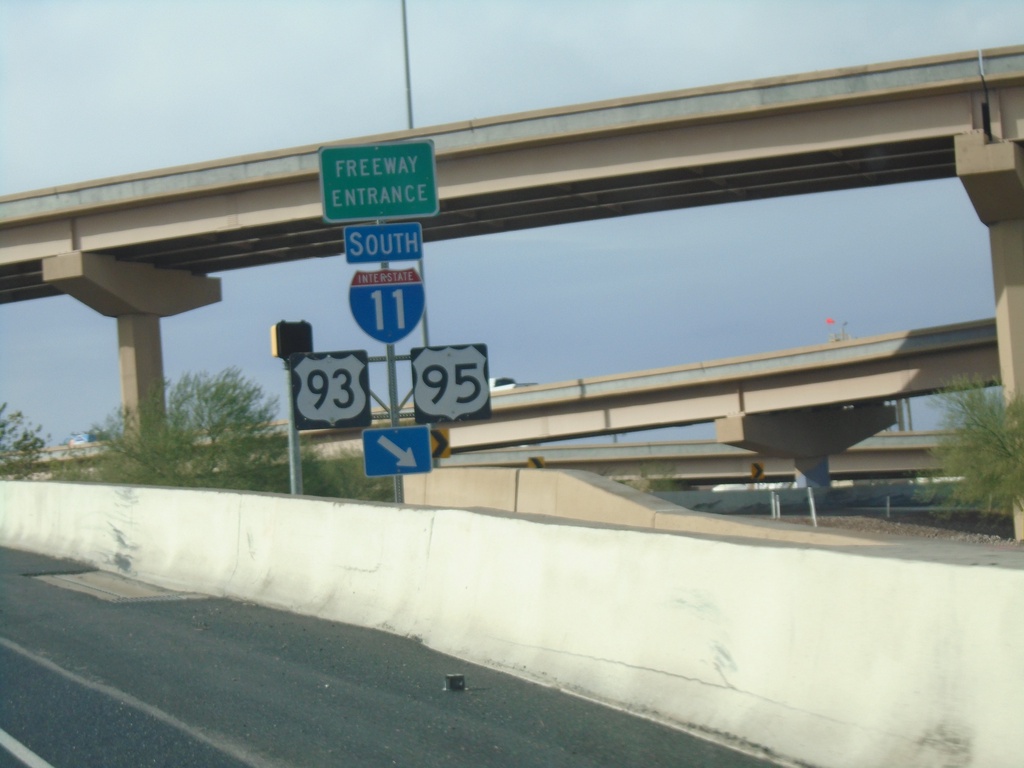
End NV-564 West at I-11/I-215
End NV-564 West at I-11/I-215 junction. Merge right for I-11/US-93/US-95 south. Continue west for I-215 west.
Taken 11-27-2019

 Henderson
Clark County
Nevada
United States
Henderson
Clark County
Nevada
United States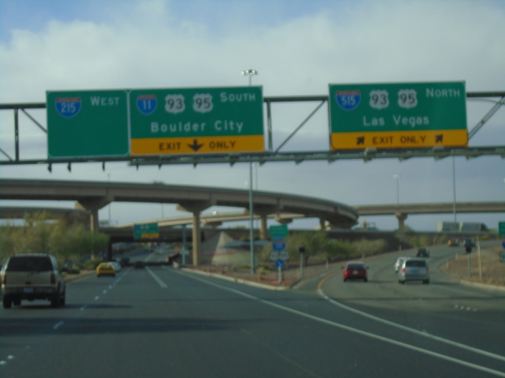
NV-564 West at I-11/I-215/I-515
Entrance ramp to I-515/US-93/US-95 North to Las Vegas and I-11/US-93/US-95 South to Boulder City. End of NV-564 (Lake Mead Pkwy) west and begin of I-215 westbound.
Taken 11-27-2019
 Henderson
Clark County
Nevada
United States
Henderson
Clark County
Nevada
United States
NV-564 West Approaching I-515/US-93/US-95 North
NV-564 West Approaching I-515/US-93/US-95 North to Las Vegas
Taken 11-27-2019
Henderson
Clark County
Nevada
United States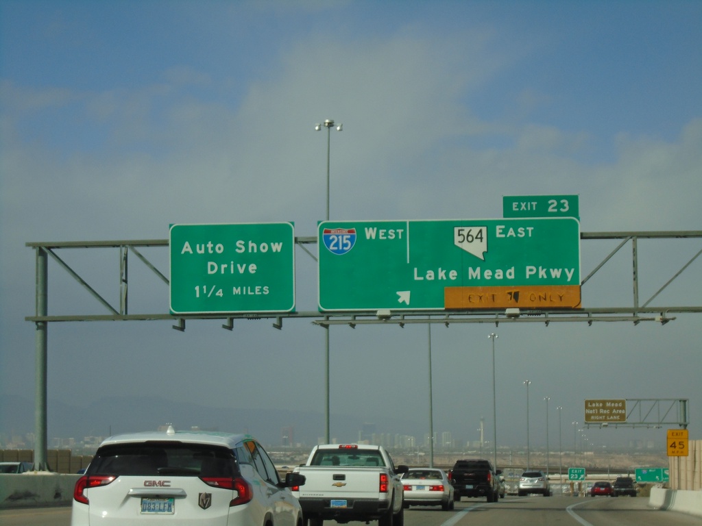
I-11 North - Exits 22 and Exit 62
I-11 north approaching Exit 22 - I-215 West/NV-564/Lake Mead Parkway. Approaching I-515 Exit 62 - Auto Show Drive. This is the north end of I-11. US-93 and US-95 join I-515 northbound. I-515 begins here northbound.
Taken 11-27-2019
Henderson
Clark County
Nevada
United States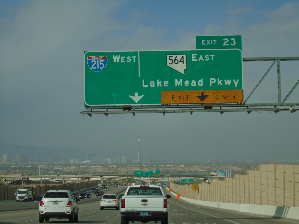
I-11 North - Exit 22
I-11 North approaching Exit 23 - I-215 West/NV-564 East/Lake Mead Parkway
Taken 11-27-2019
Henderson
Clark County
Nevada
United States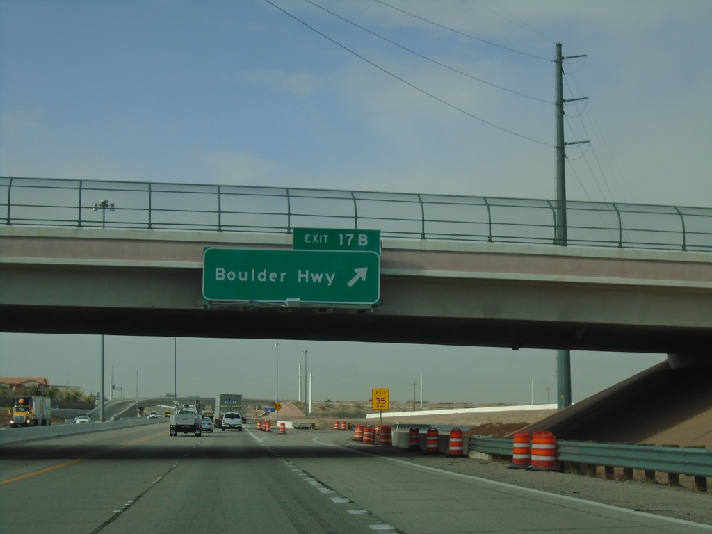
I-11 North - Exit 17B
I-11 north at Exit 17B - Boulder Highway (NV-582)
Taken 11-27-2019
 Henderson
Clark County
Nevada
United States
Henderson
Clark County
Nevada
United States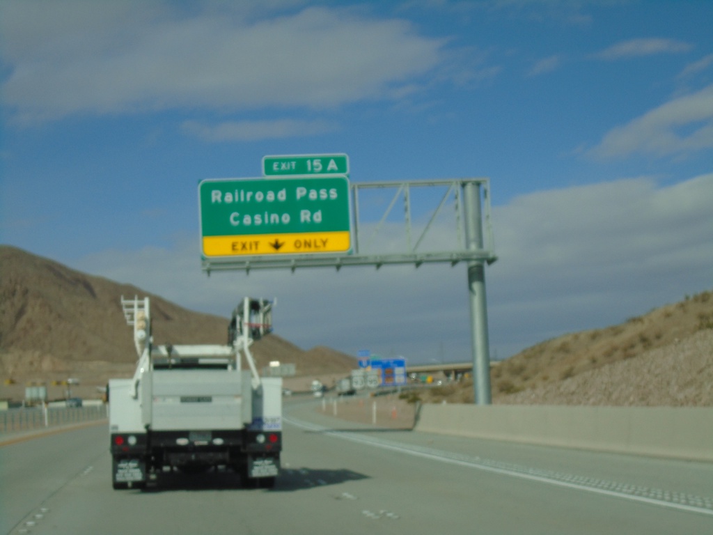
I-11 North - Exit 15A
I-11 north at Exit 15A - Railroad Pass Casino Road
Taken 11-27-2019
Boulder City
Clark County
Nevada
United States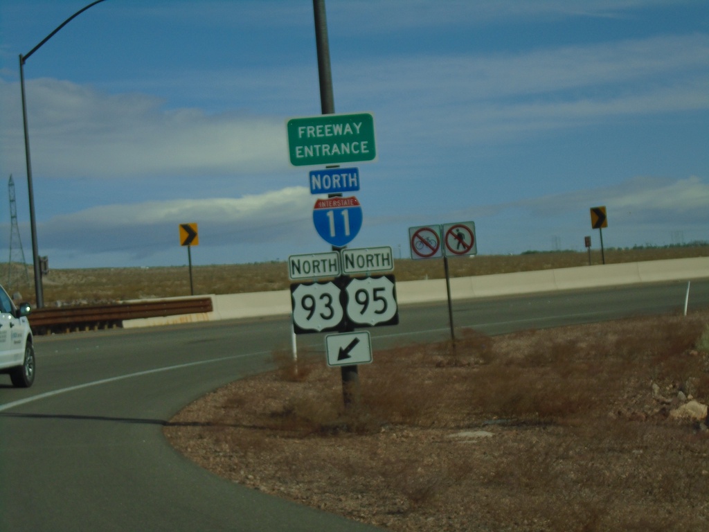
US-95 North at I-11/US-93
US-95 North at I-11/US-93 (Exit 14) in Boulder City. Merge right for I-11/US-93/US-95 north onramp. US-95 joins US-93 north to I-15 in Las Vegas.
Taken 11-27-2019
 Boulder City
Clark County
Nevada
United States
Boulder City
Clark County
Nevada
United States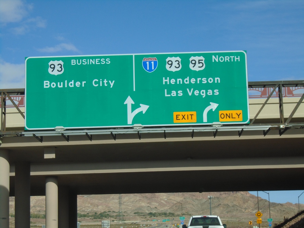
US-95 North at I-11/US-93/NV-173
US-95 North at I-11/US-93/US-95 North/Henderson/Las Vegas. Continue north for NV-173 to Bus. US-93/Boulder City.
Taken 11-27-2019
Boulder City
Clark County
Nevada
United States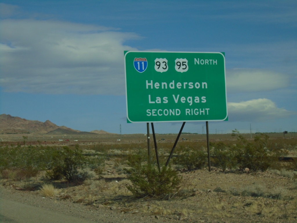
US-95 North Approaching I-11/US-93 North
US-95 North approaching I-11/US-93 North to Henderson and Las Vegas (Exit 14).
Taken 11-27-2019
Boulder City
Clark County
Nevada
United States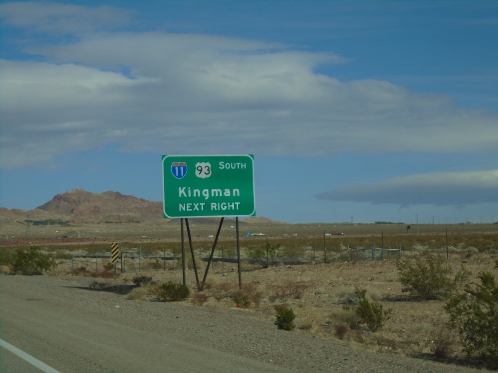
US-95 North Approaching I-11/US-93 South
US-95 North approaching I-11/US-93 South (Exit 14) to Kingman (Arizona)
Taken 11-27-2019
Boulder City
Clark County
Nevada
United States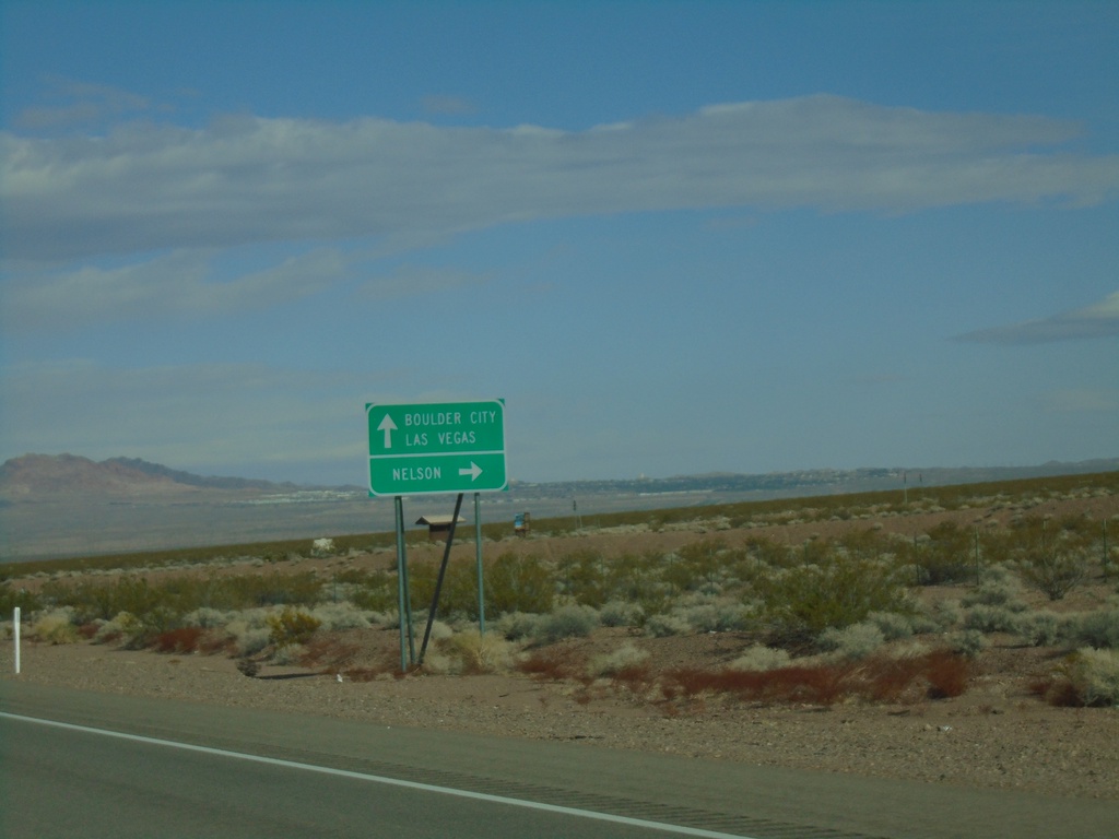
US-95 North Approaching NV-165
US-95 North approaching NV-165 east to Nelson. Continue north on US-95 for Boulder City and Las Vegas.
Taken 11-27-2019
 Boulder City
Clark County
Nevada
United States
Boulder City
Clark County
Nevada
United States