Signs Tagged With Big Green Sign
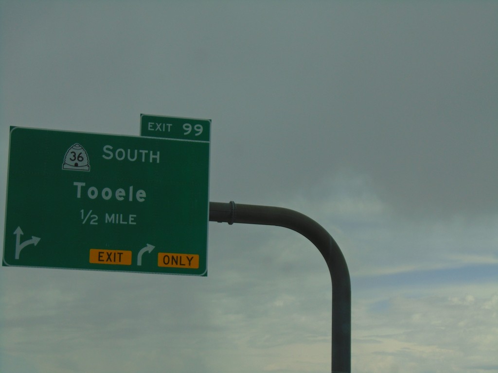
I-80 West - Exit 99
I-80 west approaching Exit 99 - UT-36 South/Tooele.
Taken 08-03-2019

 Lake Point
Tooele County
Utah
United States
Lake Point
Tooele County
Utah
United States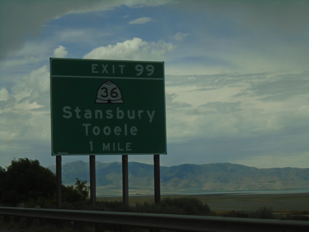
I-80 West - Exit 99
I-80 west approaching Exit 99 - UT-36/Grantsville/Tooele.
Taken 08-03-2019
Tooele
Tooele County
Utah
United States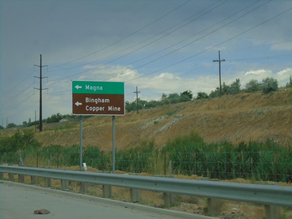
UT-201 West at UT-111 South
UT-201 West at UT-111 South to Bingham Copper Mine and Magna.
Taken 08-03-2019

 Magna
Salt Lake County
Utah
United States
Magna
Salt Lake County
Utah
United States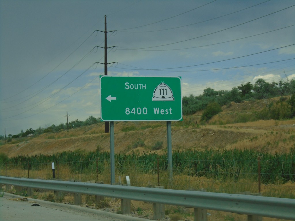
UT-201 West Approaching UT-111
UT-201 West approaching UT-111 South/8400 West.
Taken 08-03-2019
Magna
Salt Lake County
Utah
United States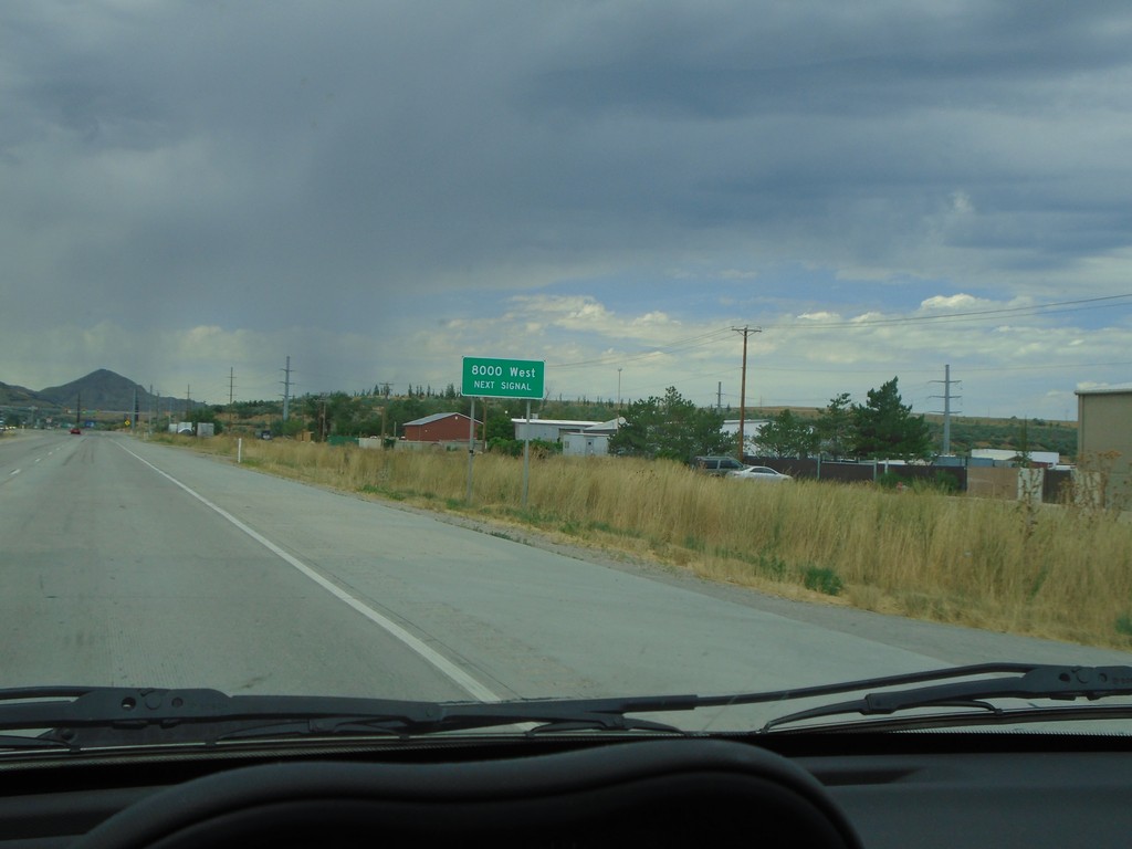
UT-201 West - 8000 West
UT-201 West approaching 8000 West
Taken 08-03-2019
Magna
Salt Lake County
Utah
United States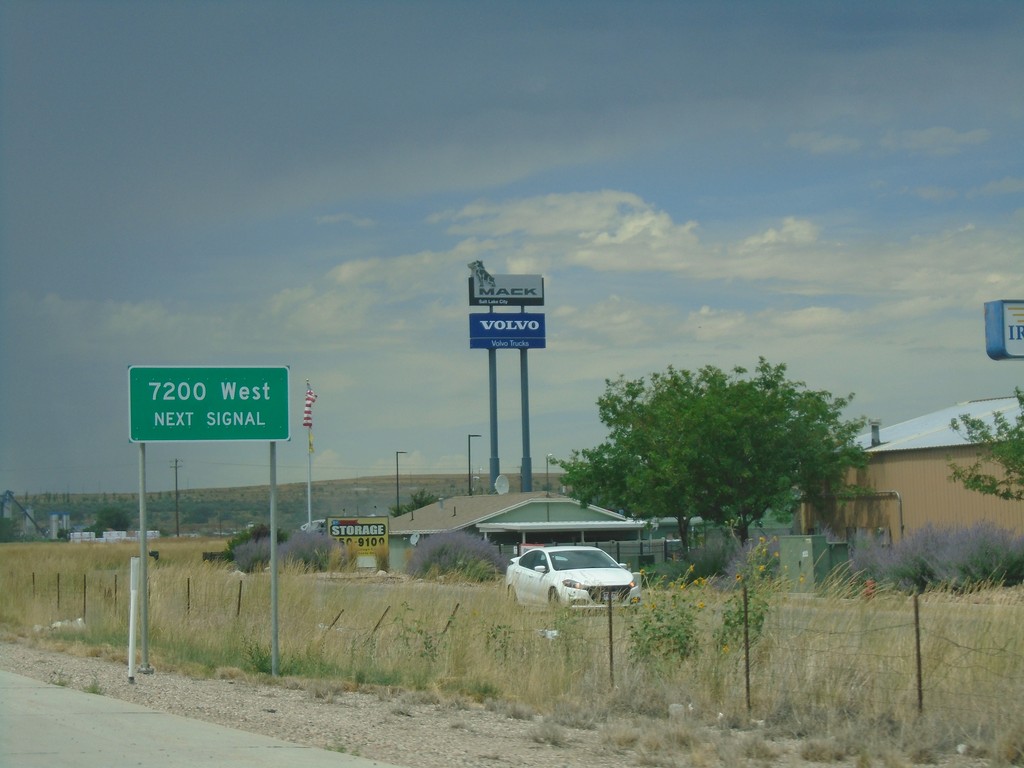
UT-201 West - 7200 West
UT-201 west approaching 7200 West.
Taken 08-03-2019
Salt Lake City
Salt Lake County
Utah
United States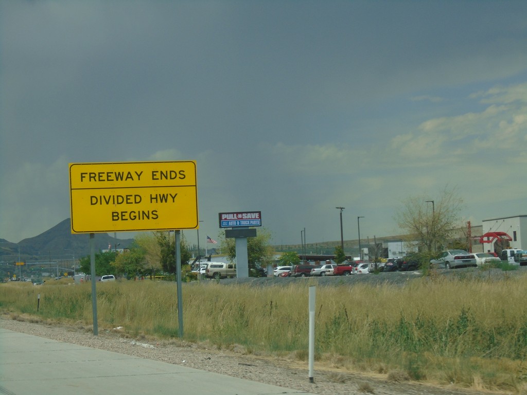
UT-201 West - End Freeway
Freeway Ends/Divided Highway Begins on UT-201 west.
Taken 08-03-2019
Magna
Salt Lake County
Utah
United States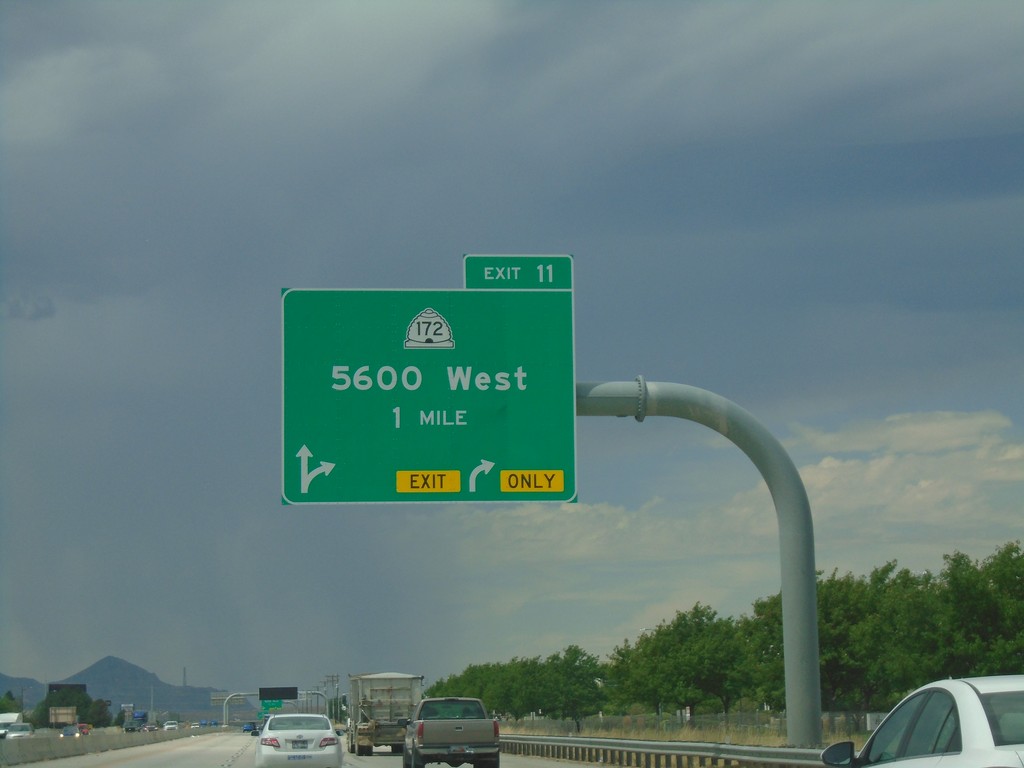
UT-201 West - Exit 12
UT-201 west approaching Exit 12 - UT-172/5600 West.
Taken 08-03-2019
 West Valley City
Salt Lake County
Utah
United States
West Valley City
Salt Lake County
Utah
United States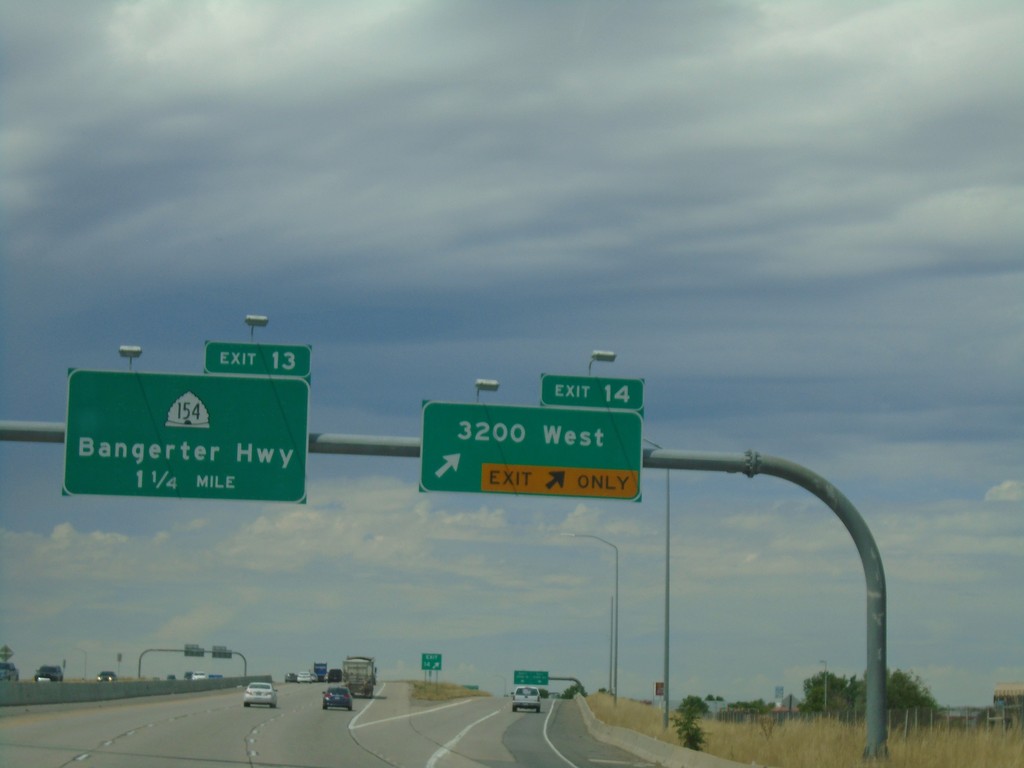
UT-201 West - Exits 14 and 13
UT-201 west at Exit 14 - 3200 West. Approaching Exit 13 - UT-154/Bangerter Highway.
Taken 08-03-2019
 West Valley City
Salt Lake County
Utah
United States
West Valley City
Salt Lake County
Utah
United States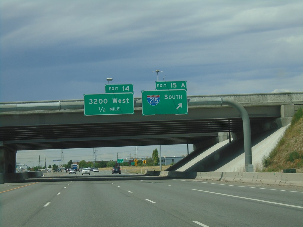
UT-201 West - Exits 15A and 14
UT-201 west at Exit 15A - I-215 South. Approaching Exit 14 - 3200 West.
Taken 08-03-2019
 West Valley City
Salt Lake County
Utah
United States
West Valley City
Salt Lake County
Utah
United States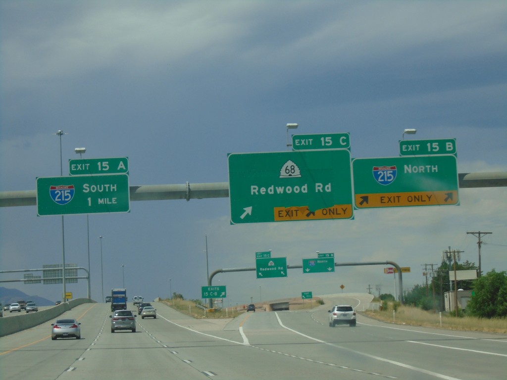
UT-201 West - Exits 15C-A
UT-201 west at Exit 15C - UT-68/Redwood Road and Exit 15B - I-215 North. Approaching Exit 15A - I-215 South.
Taken 08-03-2019
 Salt Lake City
Salt Lake County
Utah
United States
Salt Lake City
Salt Lake County
Utah
United States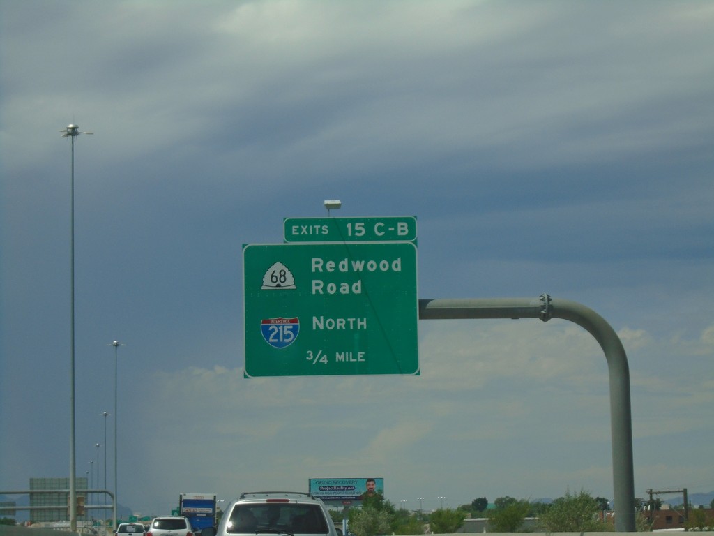
UT-201 West - Exits 15 C-B
UT-201 west approaching Exits 15 C-B - I-215 North/UT-68/Redwood Road.
Taken 08-03-2019
Salt Lake City
Salt Lake County
Utah
United States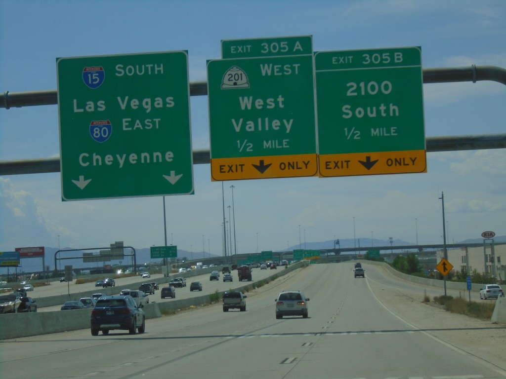
I-15 South/I-80 East Ramps at Exit 305A-B
I-15 South/I-80 East Exit 305 A-C ramps at Exit 305A-B. Use Exit 305B - 2100 South; Exit 305A - UT-201 West/West Valley. Use left lanes for I-80 East/Cheyenne(WY)/I-15 South/Las Vegas(NV).
Taken 08-03-2019
 Salt Lake City
Salt Lake County
Utah
United States
Salt Lake City
Salt Lake County
Utah
United States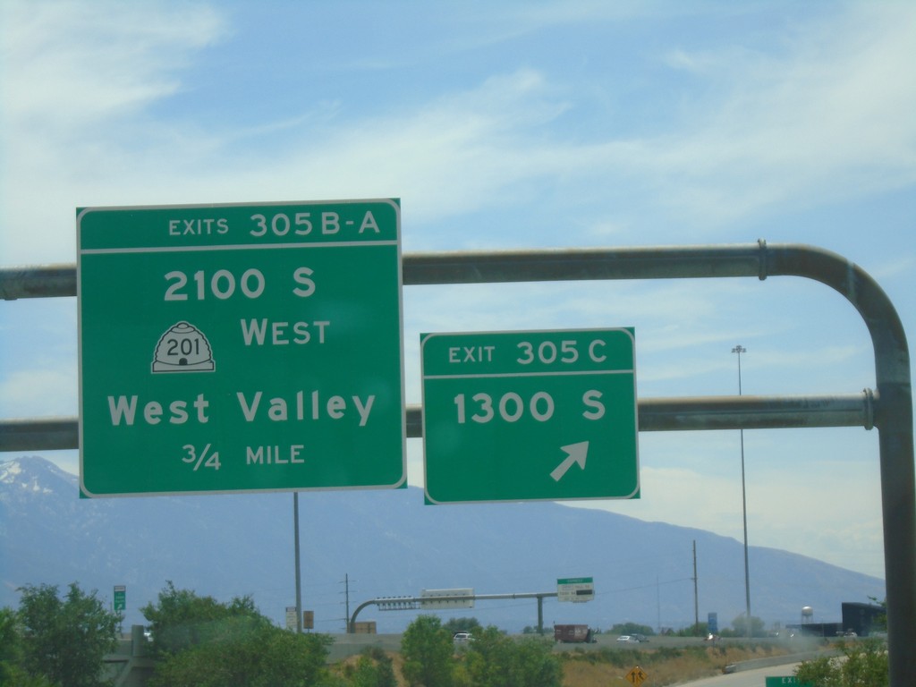
I-80 East/I-15 South - Exits 305 A-C
I-80 East/I-15 South Exits 305 A-C ramps at Exit 305C - 1300 South. Continue on ramp for Exits 305B-A - UT-201 West/2100 S/West Valley.
Taken 08-03-2019
Salt Lake City
Salt Lake County
Utah
United States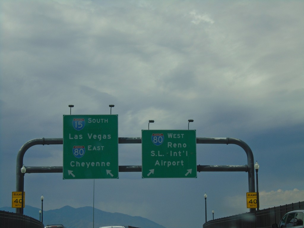
End UT-269 at I-15/I-80
End UT-269 (W 600 S) at I-15/I-80 onramp. Merge right for I-80 West/S.L. Intl. Airport/Reno (NV); merge left for I-15 South/Las Vegas(NV)/I-80 East/Cheyenne(WY).
Taken 08-03-2019
 Salt Lake City
Salt Lake County
Utah
United States
Salt Lake City
Salt Lake County
Utah
United States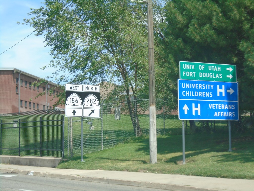
UT-186 West (Foothill Drive) at UT-282
UT-186 West (Foothill Drive) at UT-282 to University of Utah, Fort Douglas, and the University Childrens Hospital. Continue on Foothill Drive for the Veterans Administration Hospital.
Taken 08-03-2019

 Salt Lake City
Salt Lake County
Utah
United States
Salt Lake City
Salt Lake County
Utah
United States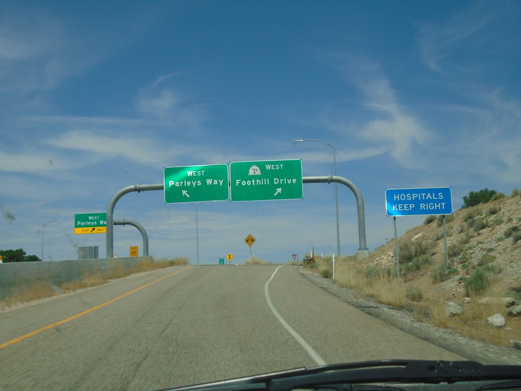
I-80 West Exit 129 Offramp
I-80 West Exit 129 offramp at UT-186. Use right lane for UT-186 West/Foothill Rive. Use left lane for West Parleys Way.
Taken 08-03-2019
Salt Lake City
Salt Lake County
Utah
United States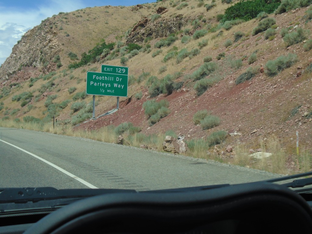
I-80 West - Exit 129
I-80 West approaching Exit 129 - Foothill Drive/Parleys Way.
Taken 08-03-2019
Salt Lake City
Salt Lake County
Utah
United States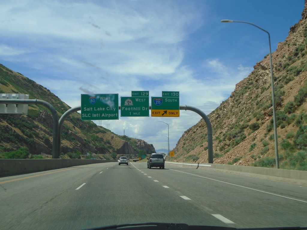
I-80 West - Exits 130 and 129
I-80 west at Exit 130 - I-215 South. Approaching Exit 129 - UT-186/Foothill Drive. Continue west on I-80 for Salt Lake City/SLC International Airport.
Taken 08-03-2019
Salt Lake City
Salt Lake County
Utah
United States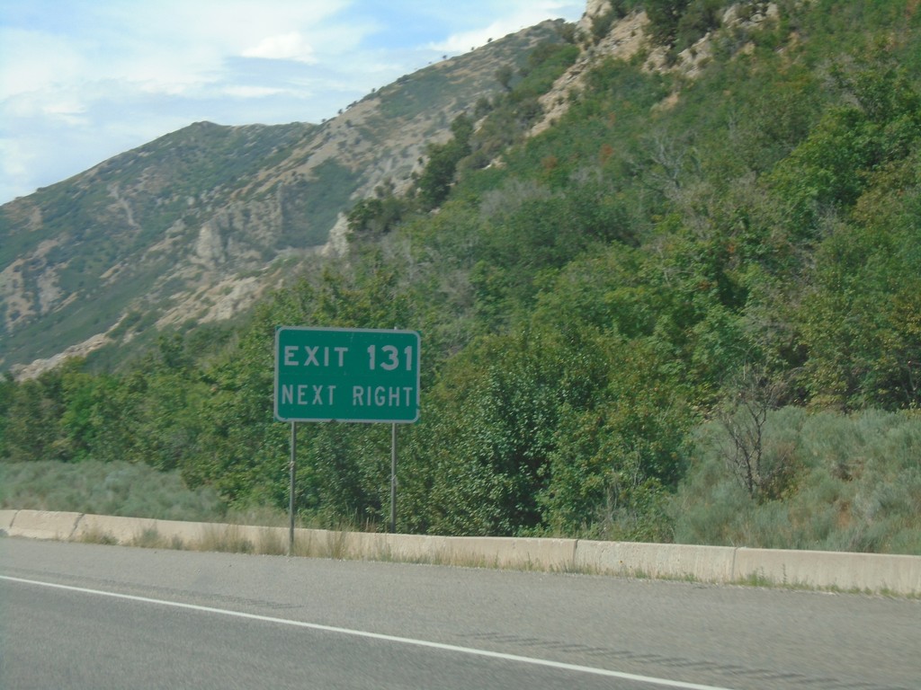
I-80 West - Exit 131
I-80 west approaching Exit 131.
Taken 08-03-2019
Salt Lake City
Salt Lake County
Utah
United States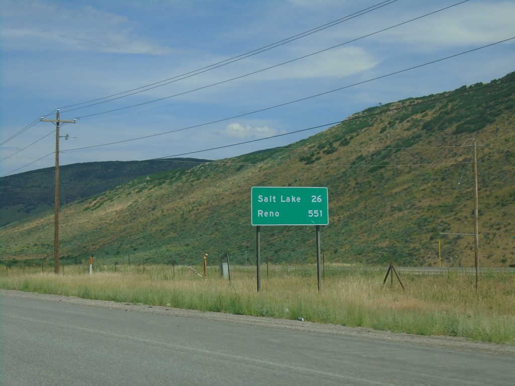
I-80 West - Distance Marker
Distance marker on I-80 west. Distance to Salt Lake and Reno (Nevada).
Taken 08-03-2019
Park City
Summit County
Utah
United States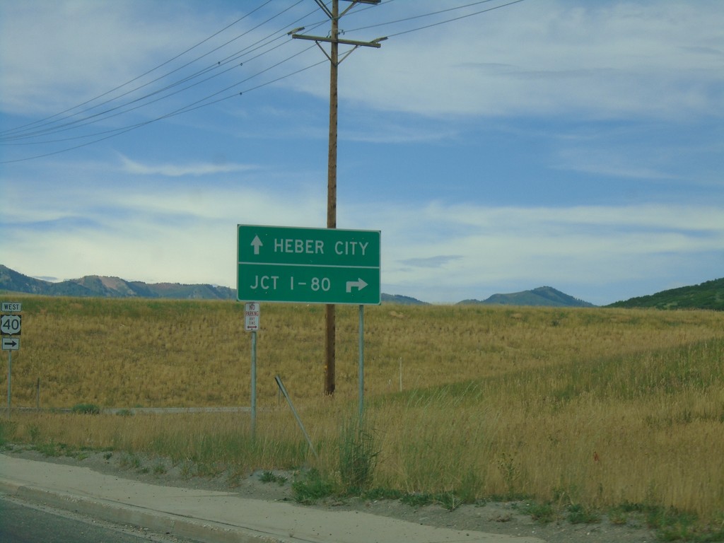
UT-248 West at US-40
UT-248 West at US-40 in Summit County. Use US-40 west for Jct. I-80; US-40 east for Heber City.
Taken 08-03-2019

 Park City
Summit County
Utah
United States
Park City
Summit County
Utah
United States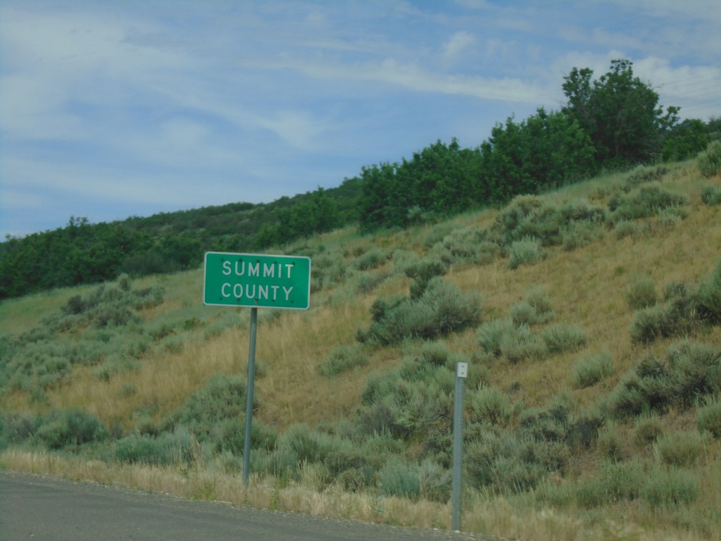
UT-248 West - Summit County
Summit County on UT-248 west.
Taken 08-03-2019
Snyderville
Summit County
Utah
United States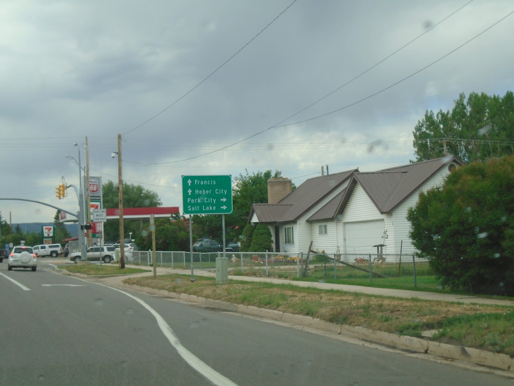
UT-32 East Approaching UT-248 South
UT-32 south approaching UT-248. Use UT-248 for Park City and Salt Lake. Continue south on UT-32 for Heber City and Francis.
Taken 08-03-2019
 Kamas
Summit County
Utah
United States
Kamas
Summit County
Utah
United States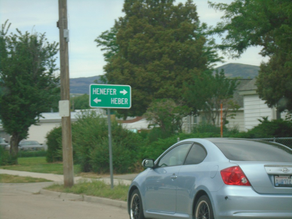
End UT-150 West at UT-32
End UT-150 West at UT-32 in Kamas. Use UT-32 north for Henefer; UT-32 south for Heber.
Taken 08-03-2019
 Kamas
Summit County
Utah
United States
Kamas
Summit County
Utah
United States