Signs Tagged With Big Green Sign
End I-215 East - Exit 1
I-215 east approaching Exit 1 - I-515/US-93/US-95/Las Vegas and I-11/US-93/US-95/Boulder City. This is the east end of I-215. The roadway continues as Lake Mead Parkway/NV-564.
Taken 11-26-2019


 Henderson
Clark County
Nevada
United States
Henderson
Clark County
Nevada
United States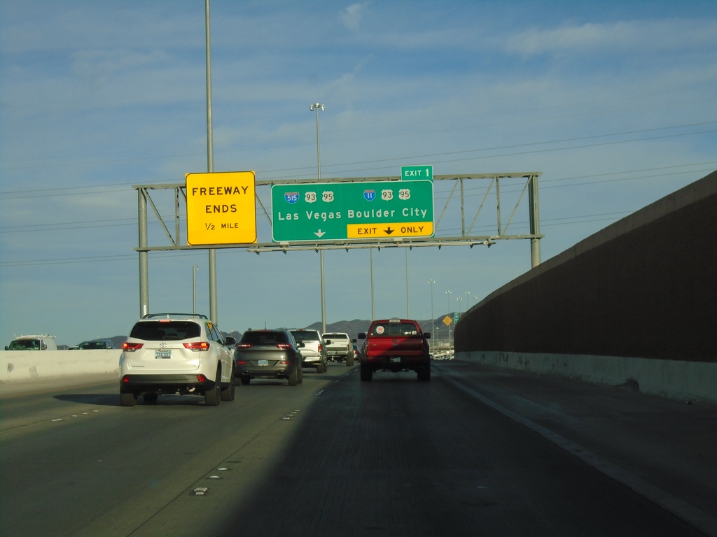
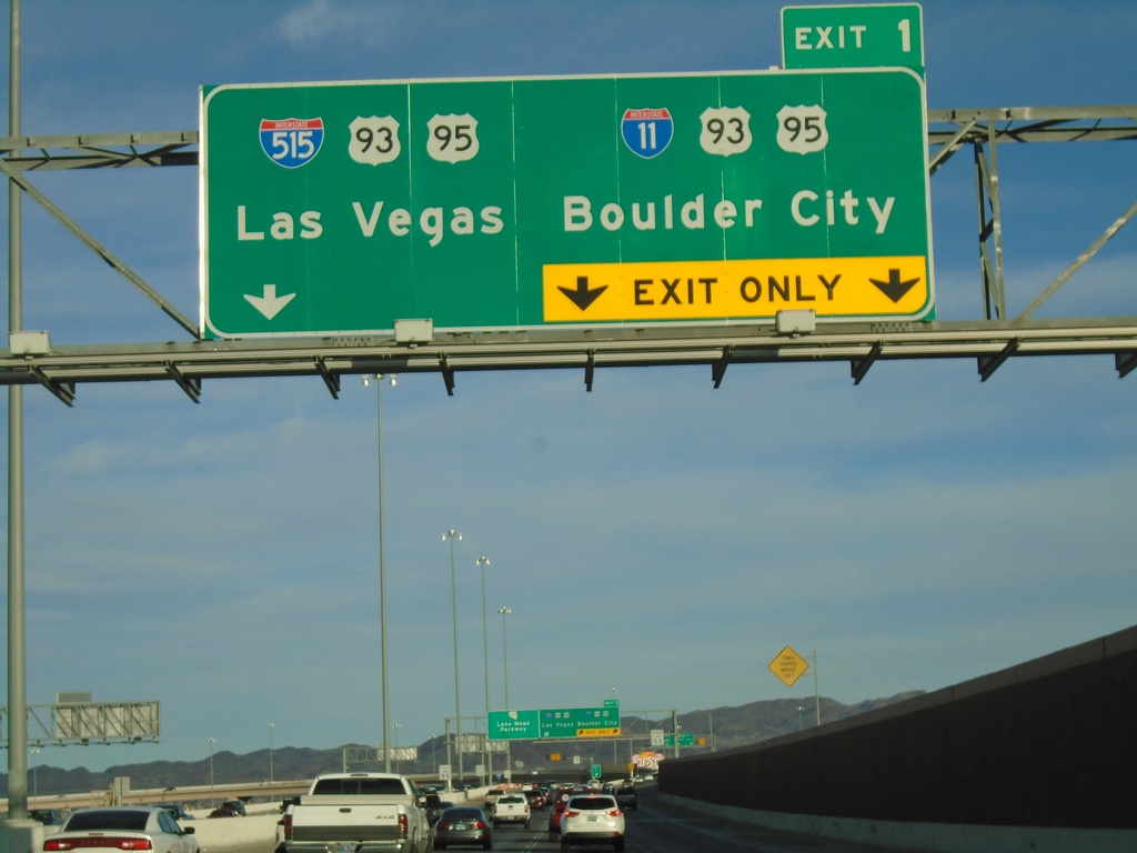
I-215 East Approaching Exit 1
I-215 east approaching Exit 1 - I-11/US-93/US-95 South/Boulder City and I-515/US-93/US-95 North/Las Vegas. Freeway ends after Exit 1 and roadway becomes NV-564/Lake Mead Parkway
Taken 11-26-2019
Henderson
Clark County
Nevada
United States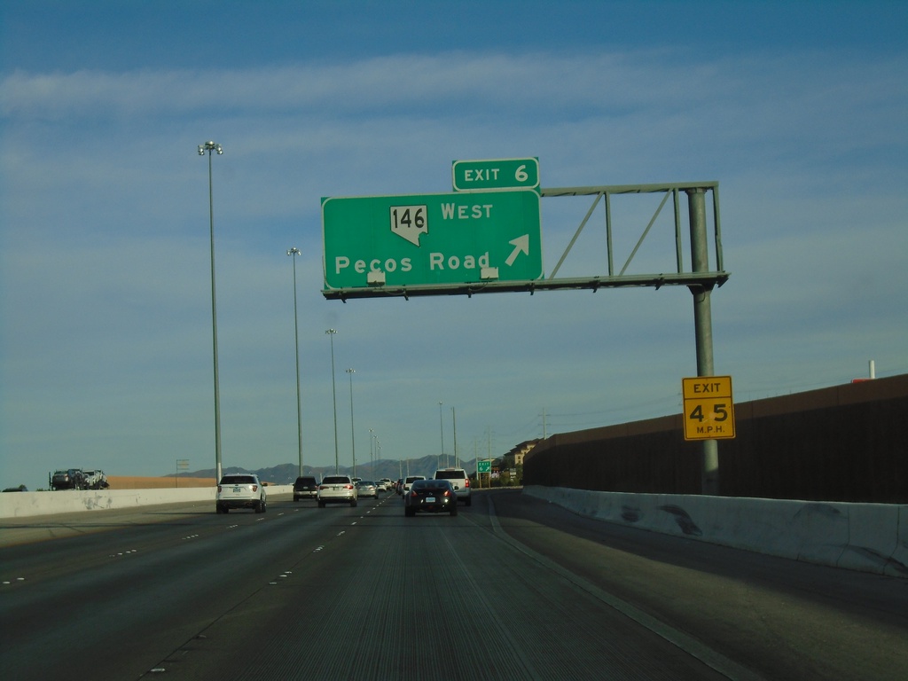
I-215 East - Exit 6
I-215 east at Exit 6 - NV-146/Pecos Road
Taken 11-26-2019
 Henderson
Clark County
Nevada
United States
Henderson
Clark County
Nevada
United States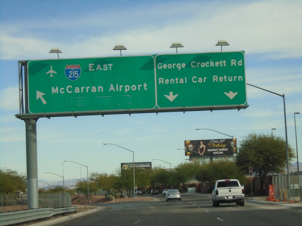
George Crockett Road East at I-215
George Crockett Road East at I-215 onramp. Use I-215 East for McCarran Airport. Continue east on George Crockett Road for Rental Car Return.
Taken 11-26-2019
Las Vegas
Clark County
Nevada
United States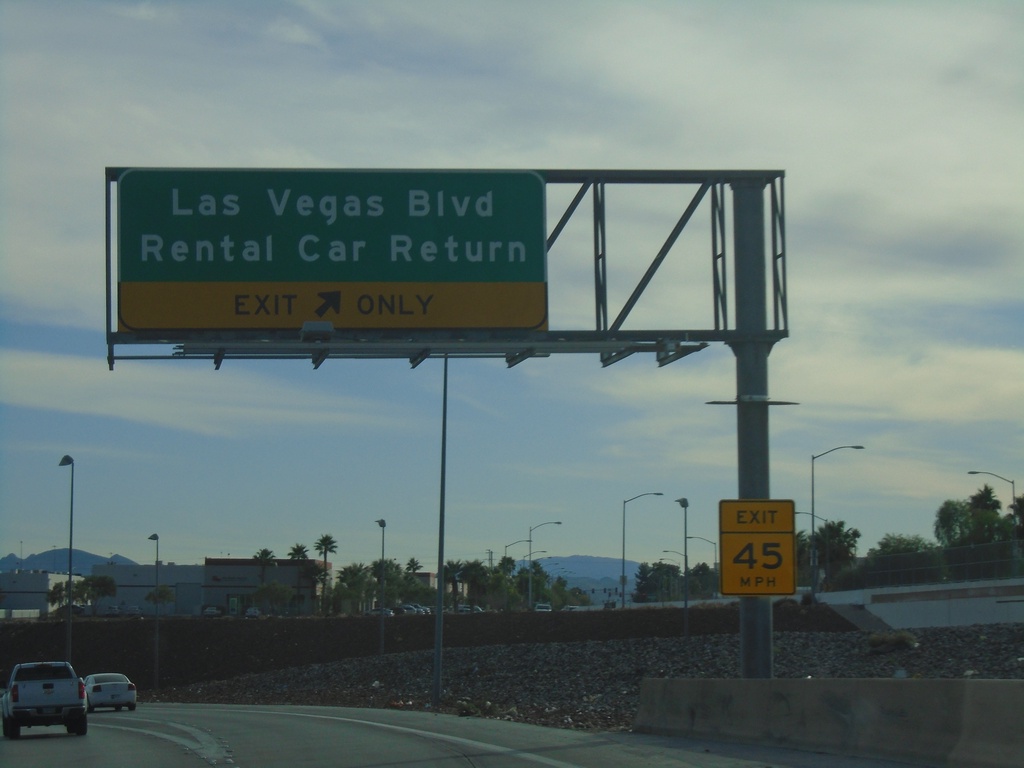
I-15 South/I-215 Ramp at Las Vegas Blvd.
I-15 South/I-215 Ramp at Las Vegas Blvd./Rental Car Return.
Taken 11-26-2019
 Enterprise
Clark County
Nevada
United States
Enterprise
Clark County
Nevada
United States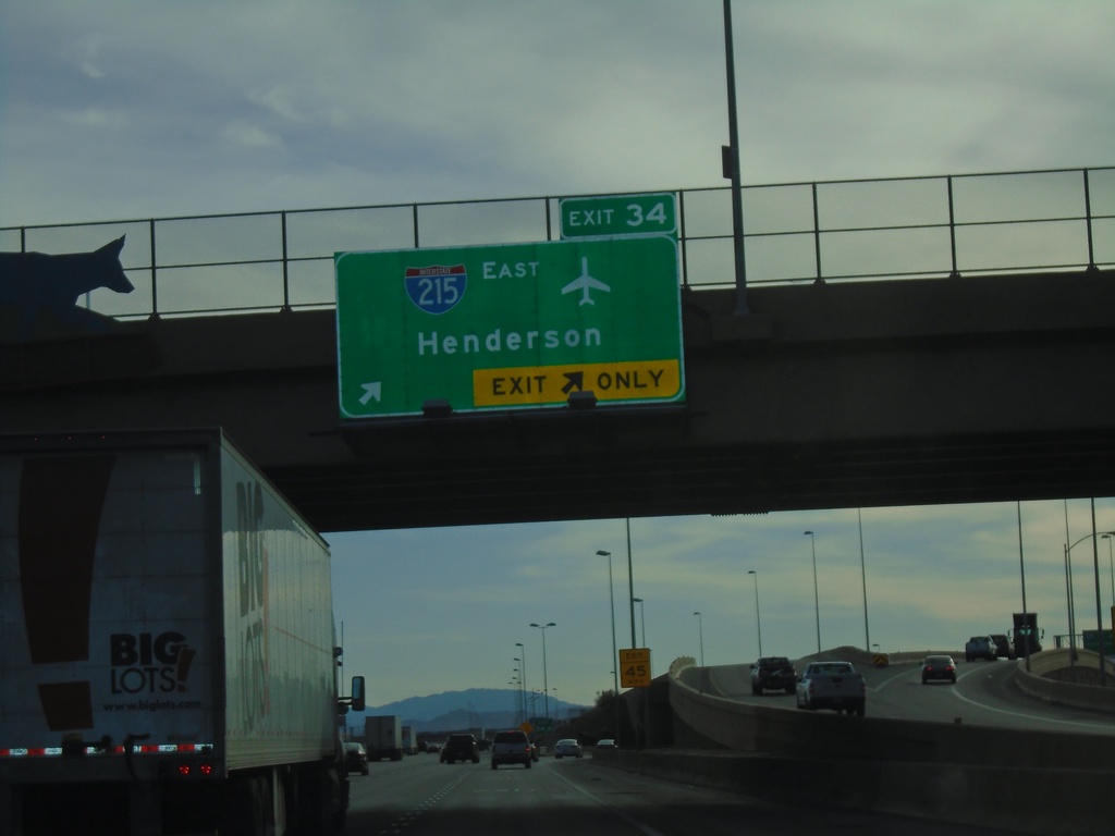
I-15 South - Exit 34
I-15 south at Exit 34 - I-215 East/Henderson. Use I-215 east for McCarran International Airport.
Taken 11-26-2019
Enterprise
Clark County
Nevada
United States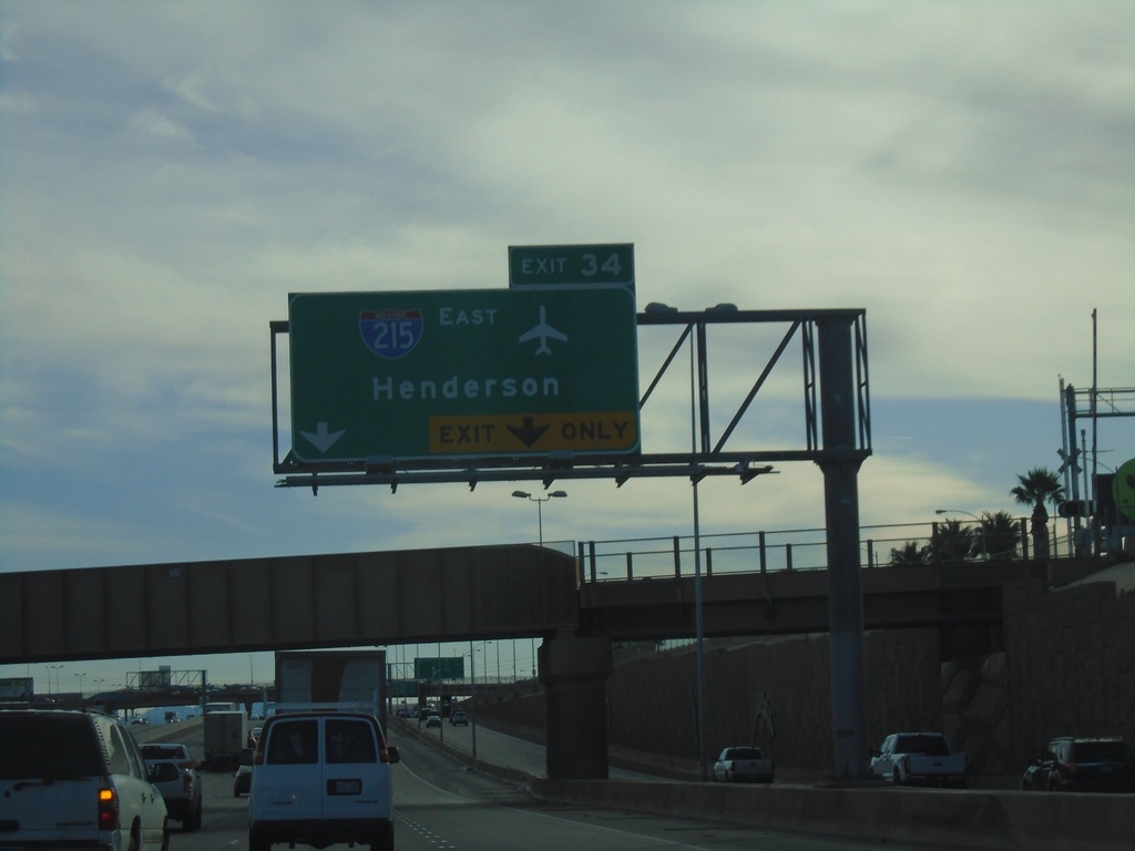
I-15 South - Exit 34
I-15 south approaching Exit 34 - I-215 East/Henderson. Use Exit 34 for the McCarran International Airport.
Taken 11-26-2019
Las Vegas
Clark County
Nevada
United States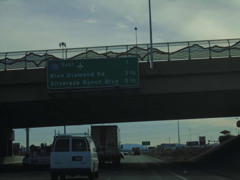
I-15 South - Next 3 Exits
Next 3 exits on I-15 south in Las Vegas area. I-215 East, Blue Diamond Road, Silverado Ranch Road
Taken 11-26-2019
Las Vegas
Clark County
Nevada
United States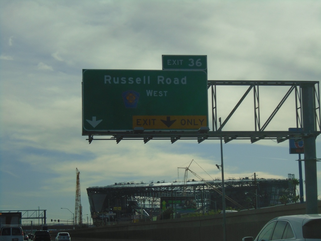
I-15 South - Exit 36
I-15 south approaching Exit 36 - CR-215 West/Russell Road.
Taken 11-26-2019
 Las Vegas
Clark County
Nevada
United States
Las Vegas
Clark County
Nevada
United States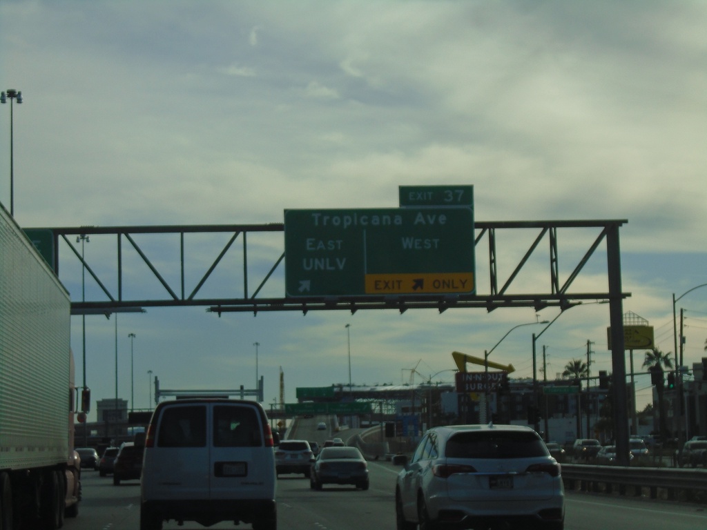
I-15 South - Exit 37
I-15 south at Exit 37 - Tropicana Ave East/UNLV and Tropicana Ave. West
Taken 11-26-2019
 Las Vegas
Clark County
Nevada
United States
Las Vegas
Clark County
Nevada
United States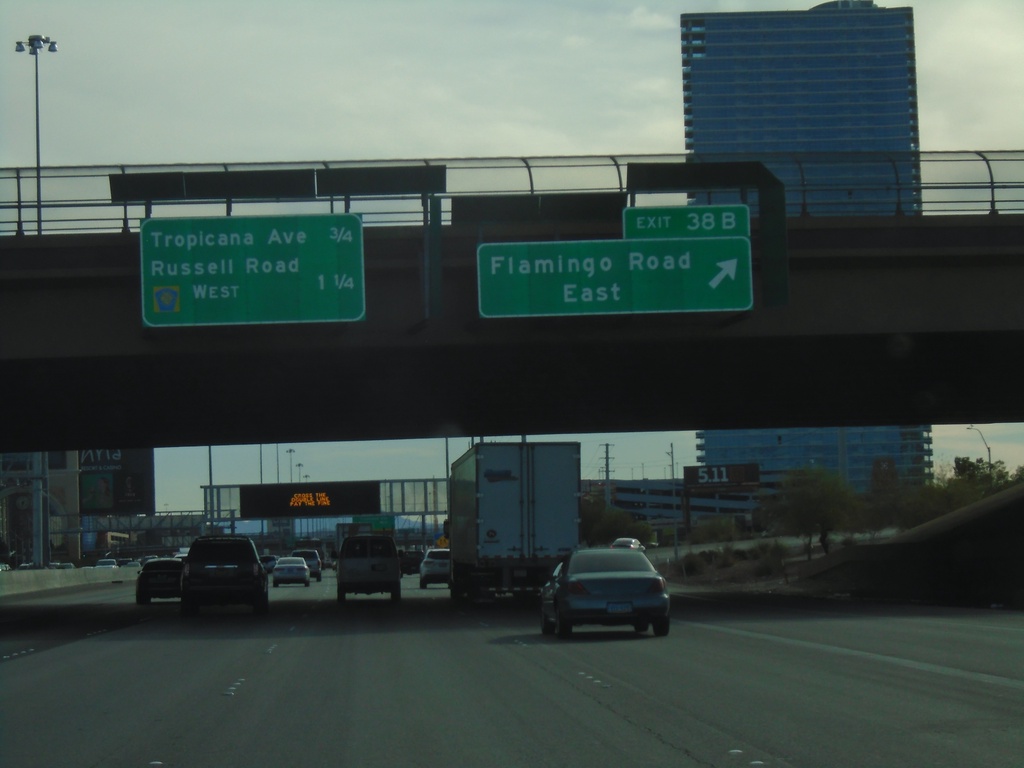
I-15 South - Exit 38B
I-15 south at Exit 38B - Flamingo Road East. Approaching Tropicana Ave., and Russell Road/CR-215 West.
Taken 11-26-2019
 Las Vegas
Clark County
Nevada
United States
Las Vegas
Clark County
Nevada
United States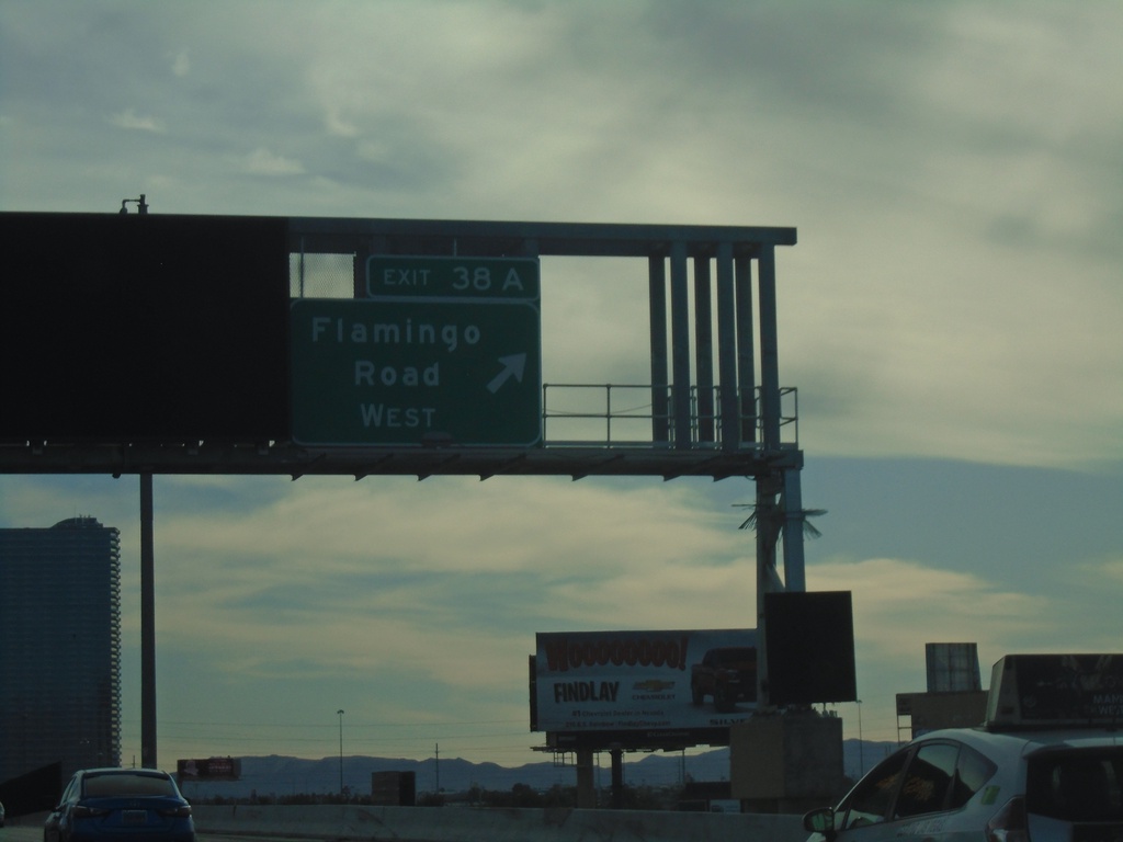
I-15 South - Exit 38A
I-15 south at Exit 38A - Flamingo Road West
Taken 11-26-2019
Las Vegas
Clark County
Nevada
United States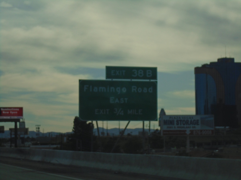
I-15 South - Exit 38B
I-15 south approaching Exit 38B - Flamingo Road East
Taken 11-26-2019
Las Vegas
Clark County
Nevada
United States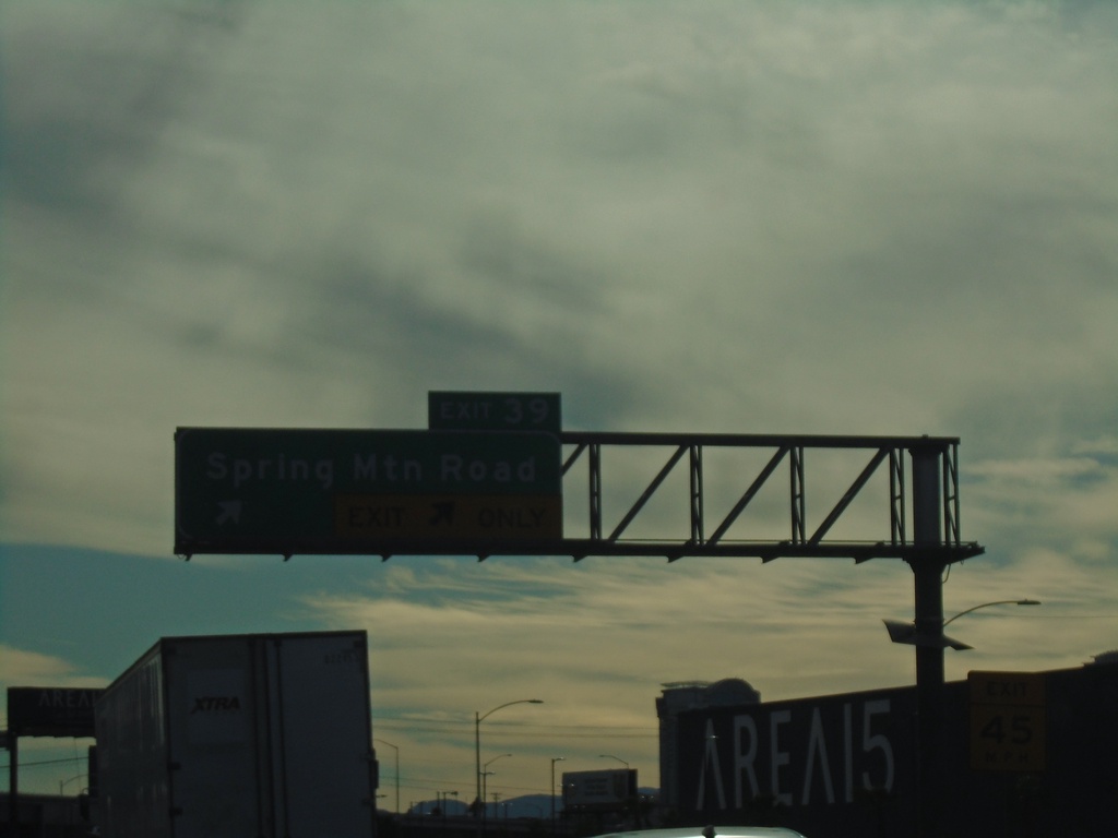
I-15 South - Exit 39
I-15 south at Exit 39 - Spring Mountain Road
Taken 11-26-2019
Las Vegas
Clark County
Nevada
United States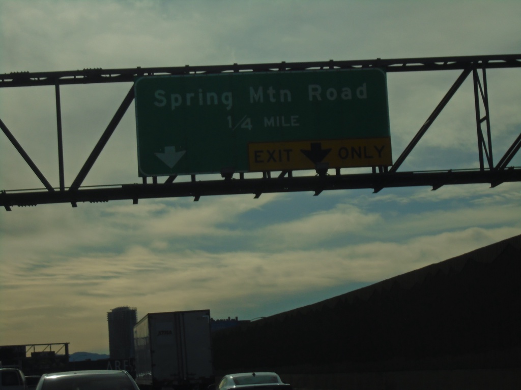
I-15 South - Exit 39
I-15 south approaching Exit 39 - Spring Mountain Road
Taken 11-26-2019
Las Vegas
Clark County
Nevada
United States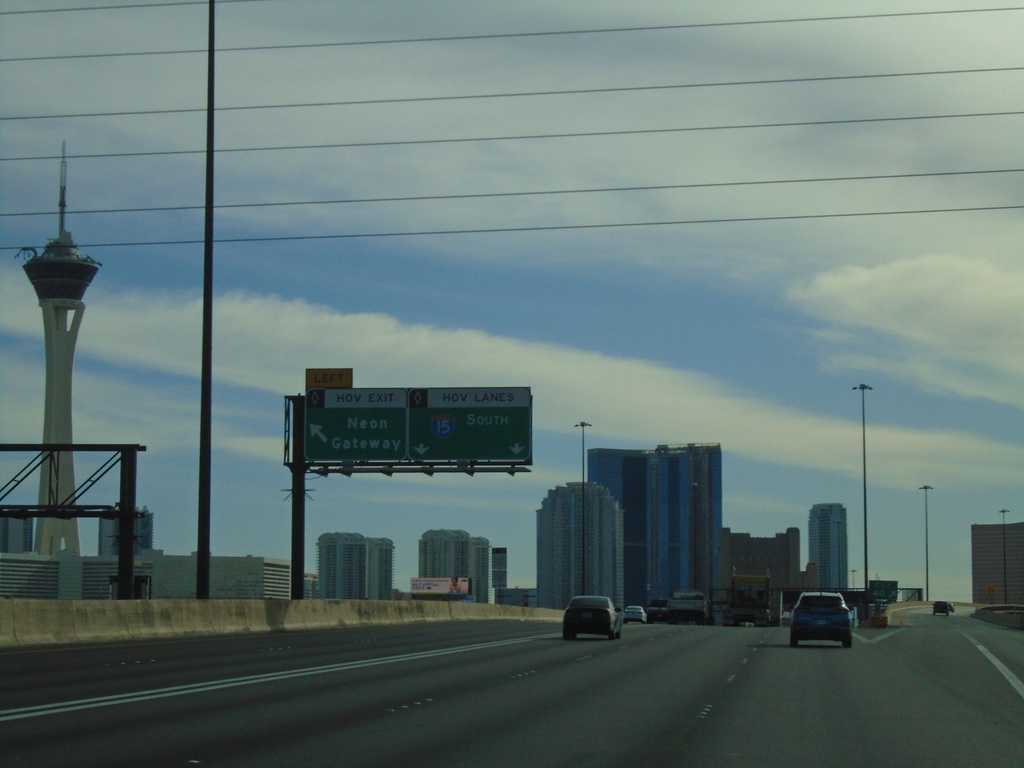
I-15 South - Neon Gateway
I-15 south at Neon Gateway HOV interchange.
Taken 11-26-2019
Las Vegas
Clark County
Nevada
United States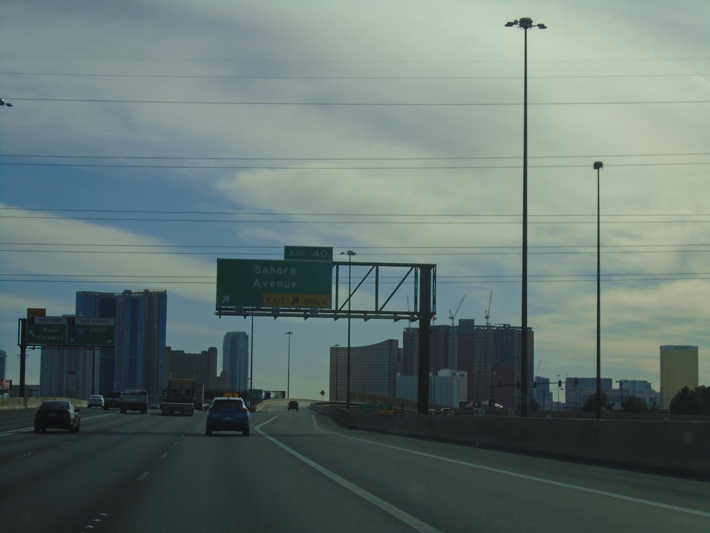
I-15 South - Exit 40
I-15 south at Exit 40 - Sahara Ave.
Taken 11-26-2019
Las Vegas
Clark County
Nevada
United States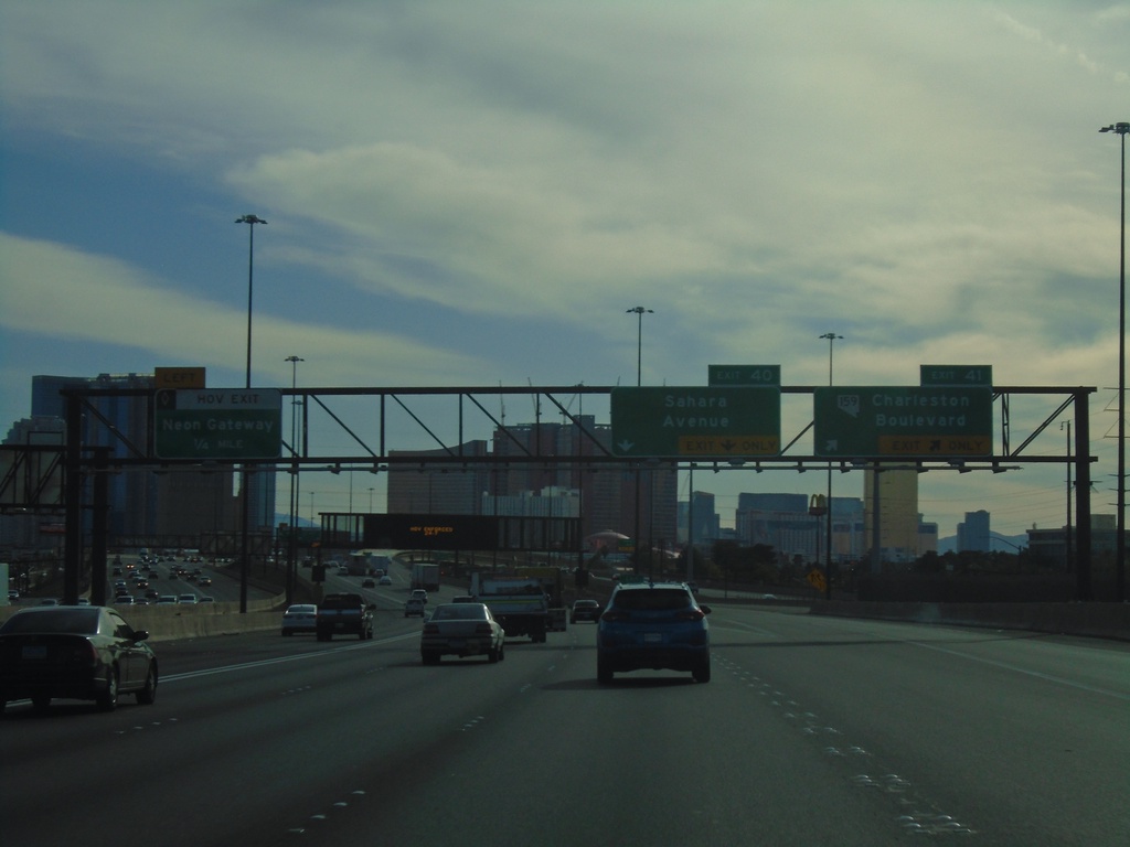
I-15 South - Exits 41, 40, and Neon Gateway
I-15 South at Exits 41 - NV-159/Charleston Blvd. Approaching Exit 40 - Sahara Ave. Approaching Neon Gateway (left HOV exit).
Taken 11-26-2019
 Las Vegas
Clark County
Nevada
United States
Las Vegas
Clark County
Nevada
United States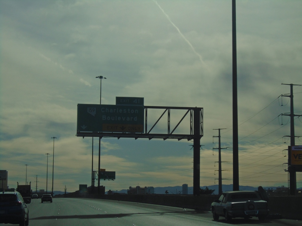
I-15 South - Exit 41
I-15 south approaching Exit 41 - NV-159/Charleston Blvd
Taken 11-26-2019
Las Vegas
Clark County
Nevada
United States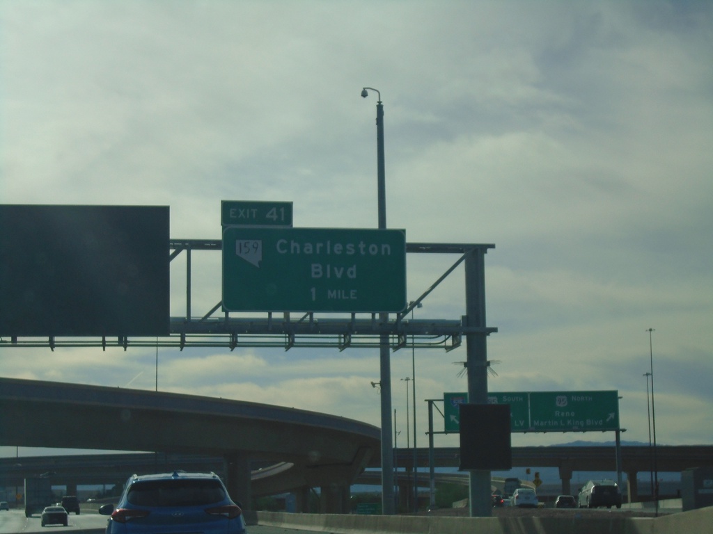
I-15 South - Exit 41
I-15 south approaching Exit 41 - NV-159/Charleston Blvd.
Taken 11-26-2019
Las Vegas
Clark County
Nevada
United States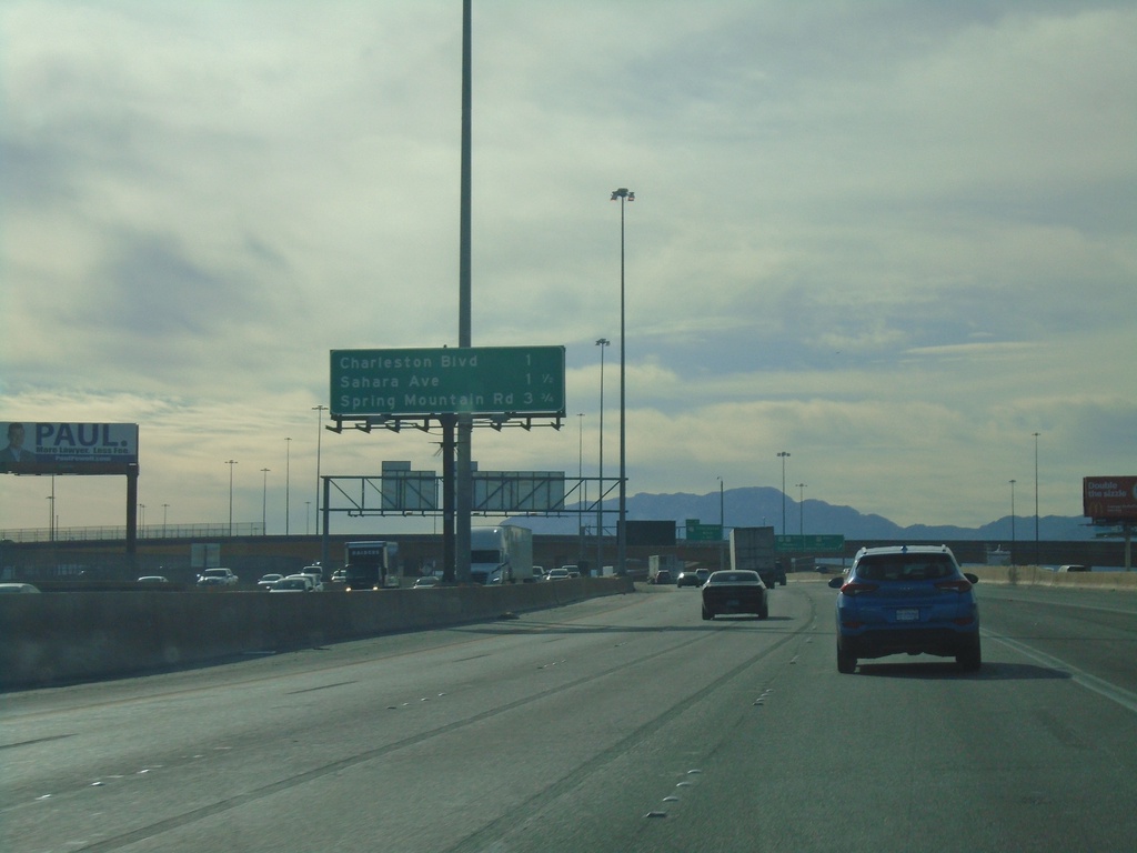
I-15 South - Las Vegas Exits
Las Vegas exits on I-15 south. Next 3 exits - Charleston Ave., Sahara Ave., Spring Mountain Road.
Taken 11-26-2019
Las Vegas
Clark County
Nevada
United States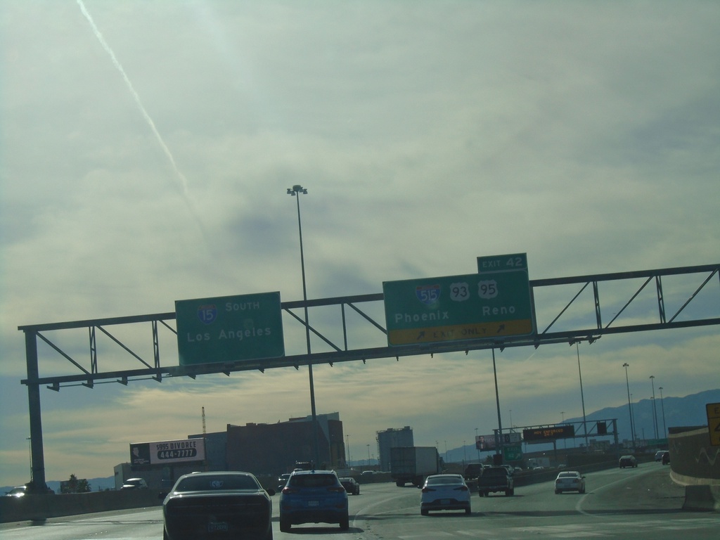
I-15 South - Exit 42
I-15 south at Exit 42 - I-515/US-93/US-95/Phoenix (AZ)/Reno. US-93 leaves I-15 southbound here. I-15 continues south to Los Angeles (CA).
Taken 11-26-2019
Las Vegas
Clark County
Nevada
United States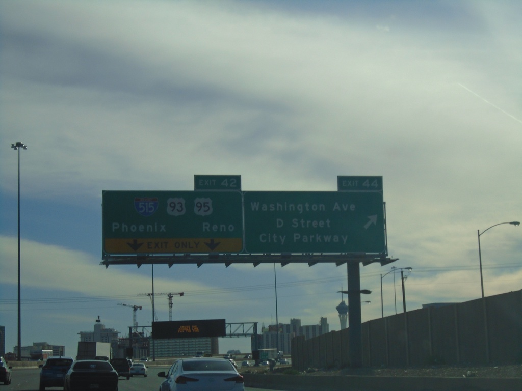
I-15 South - Exits 44 and 42
I-15 south at Exit 44 - Washington Ave./D St./City Parkway. Approaching Exit 42 - I-515/US-93/US-95.
Taken 11-26-2019
Las Vegas
Clark County
Nevada
United States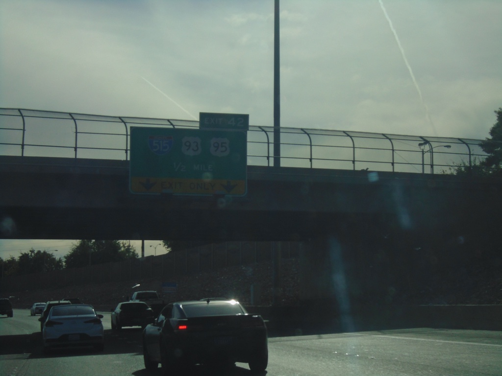
I-15 South - Exit 42
I-15 south approaching Exit 42 - I-515/US-93/US-95
Taken 11-26-2019
North Las Vegas
Clark County
Nevada
United States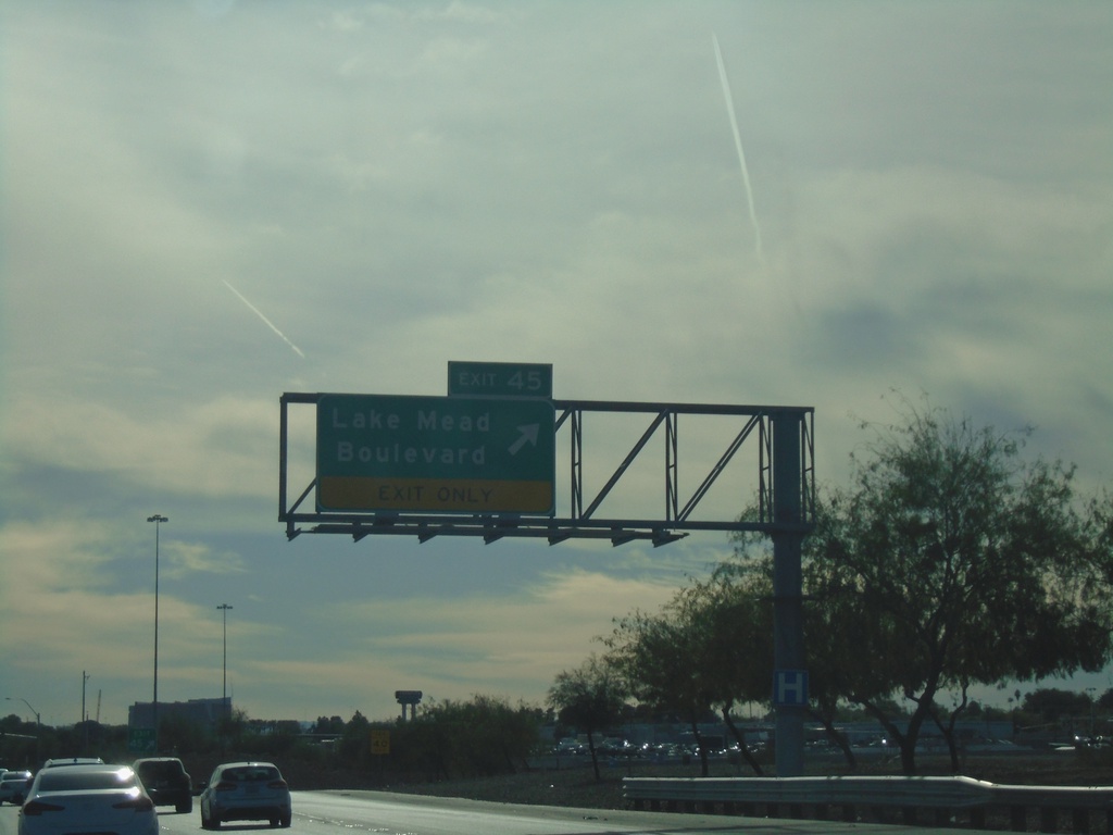
I-15 South - Exit 45
I-15 south at Exit 45 - Lake Mead Blvd
Taken 11-26-2019
 North Las Vegas
Clark County
Nevada
United States
North Las Vegas
Clark County
Nevada
United States