Signs Tagged With Big Green Sign
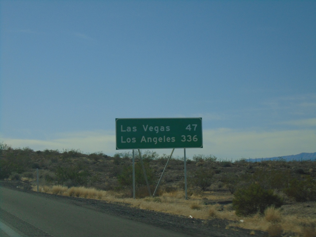
I-15 South - Distance Marker
Distance marker on I-15 south. Distance to Las Vegas and Los Angeles (CA). This is the first appearance of Los Angeles on a distance marker on I-15 southbound.
Taken 11-26-2019
 Moapa
Clark County
Nevada
United States
Moapa
Clark County
Nevada
United States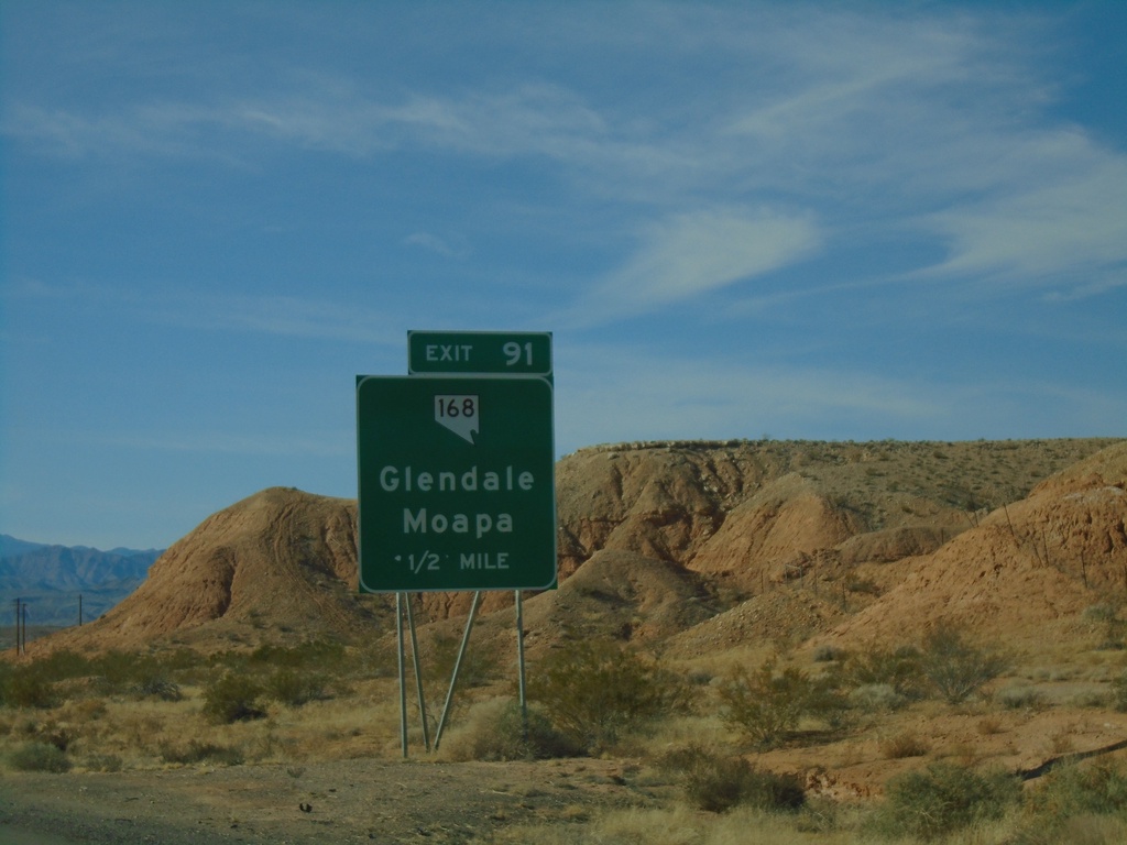
I-15 South - Exit 91
I-15 south approaching Exit 91 - NV-168/Glendale/Moapa
Taken 11-26-2019
 Moapa
Clark County
Nevada
United States
Moapa
Clark County
Nevada
United States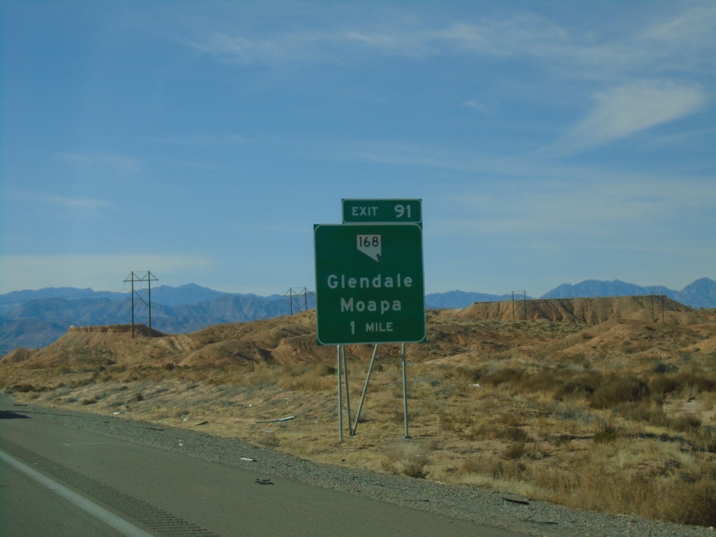
I-15 South - Exit 91
I-15 south approaching Exit 91 - NV-168/Glendale/Moapa
Taken 11-26-2019
Moapa
Clark County
Nevada
United States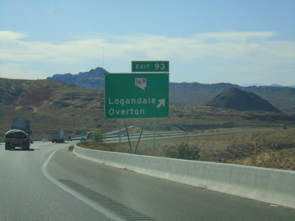
I-15 South - Exit 93
I-15 south at Exit 93 - NV-169/Logandale/Overton
Taken 11-26-2019
 Moapa Valley
Clark County
Nevada
United States
Moapa Valley
Clark County
Nevada
United States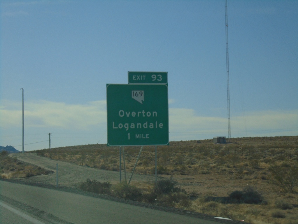
I-15 South - Exit 93
I-15 south approaching Exit 93 - NV-169/Overton/Logandale
Taken 11-26-2019
Moapa Valley
Clark County
Nevada
United States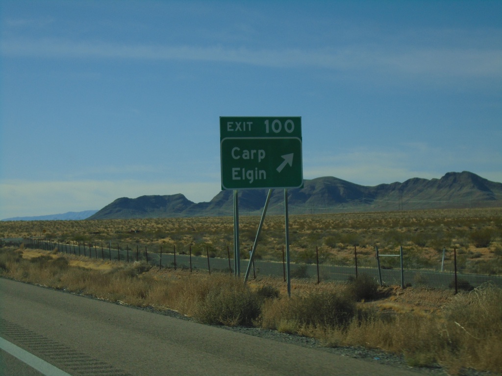
I-15 South - Exit 100
I-15 south at Exit 100 - Carp/Elgin
Taken 11-26-2019
Bunkerville
Clark County
Nevada
United States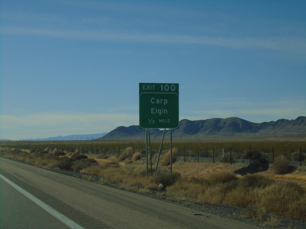
I-15 South - Exit 100
I-15 south approaching Exit 100 - Carp/Elgin
Taken 11-26-2019
Bunkerville
Clark County
Nevada
United States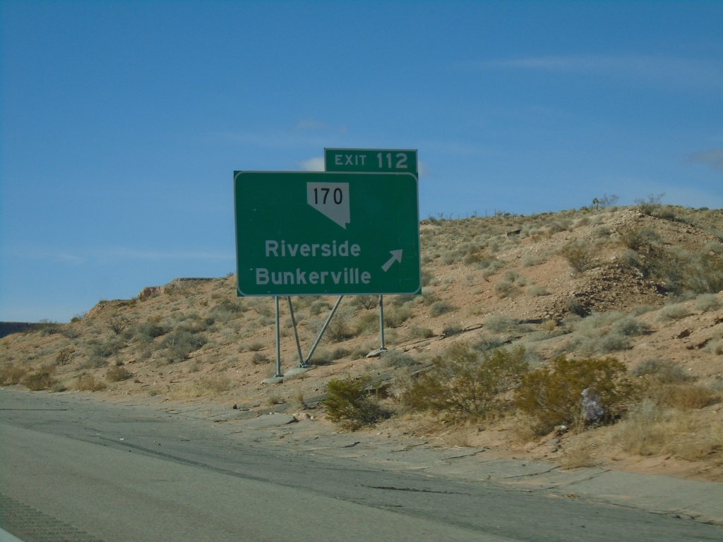
I-15 South - Exit 112
I-15 south at Exit 112 - NV-170/Riverside/Bunkerville.
Taken 11-26-2019
 Mesquite
Clark County
Nevada
United States
Mesquite
Clark County
Nevada
United States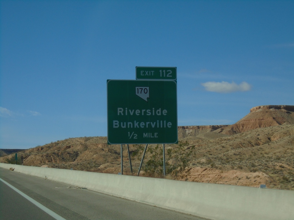
I-15 South - Exit 112
I-15 south approaching Exit 112 - NV-170/Riverside/Bunkerville
Taken 11-26-2019
Mesquite
Clark County
Nevada
United States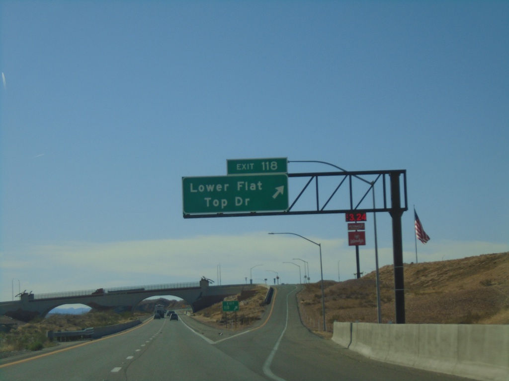
I-15 South - Exit 118
I-15 south at Exit 118 - Lower Flat Top Drive.
Taken 11-26-2019
Mesquite
Clark County
Nevada
United States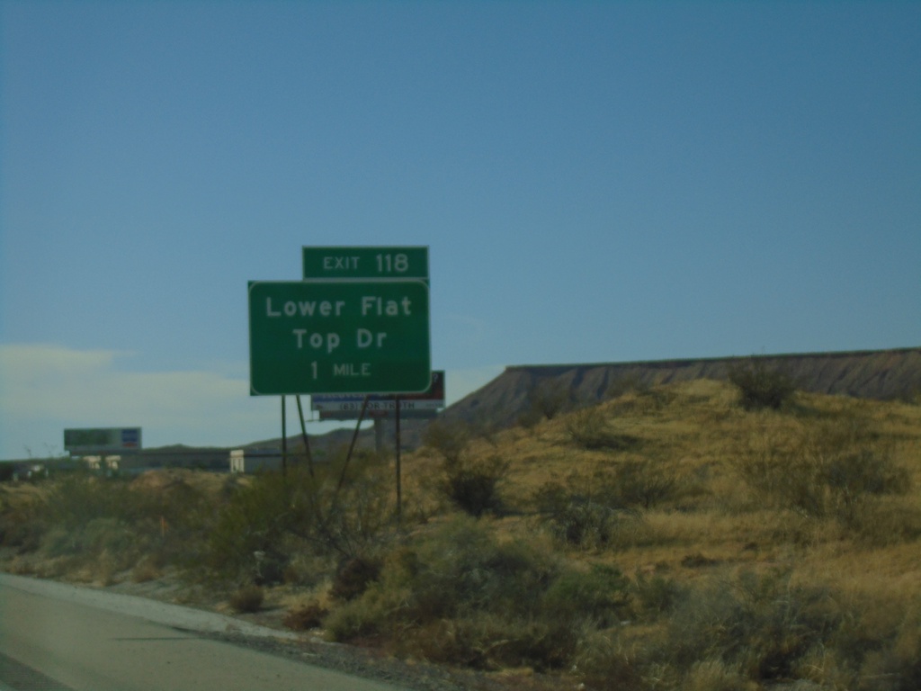
I-15 South - Exit 118
I-15 south approaching Exit 118 - Lower Flat Top Drive
Taken 11-26-2019
Mesquite
Clark County
Nevada
United States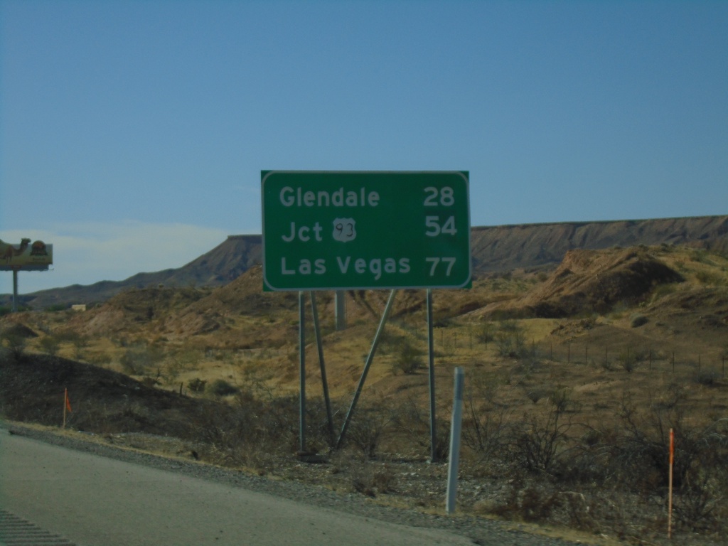
I-15 South - Distance Marker
Distance marker on I-15 south. Distance to Glendale, Jct. US-93, and Las Vegas.
Taken 11-26-2019
 Mesquite
Clark County
Nevada
United States
Mesquite
Clark County
Nevada
United States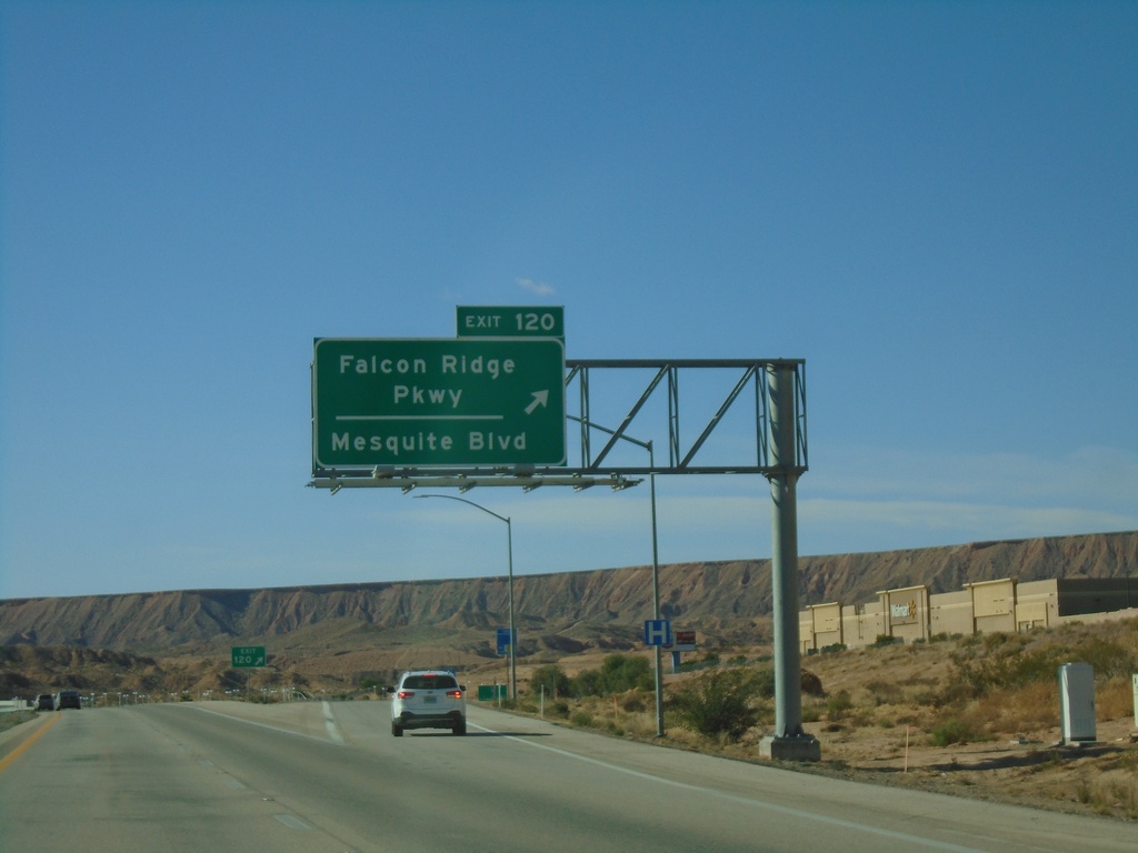
I-15 South - Exit 120
I-15 south at Exit 120 - Falcon Ridge Parkway/Mesquite Blvd. This is the southern end of the Mesquite business loop.
Taken 11-26-2019
 Mesquite
Clark County
Nevada
United States
Mesquite
Clark County
Nevada
United States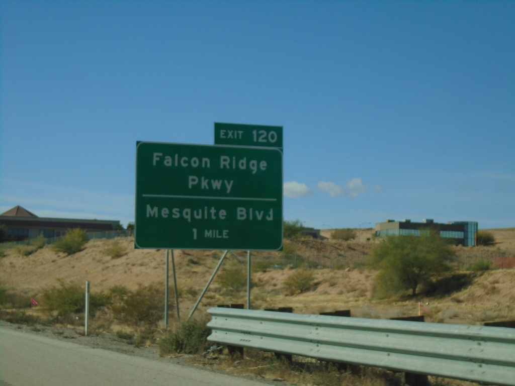
I-15 South - Exit 120
I-15 south approaching Exit 120 - Falcon Ridge Parkway/Mesquite Blvd. This is the south end of the Mesquite business loop.
Taken 11-26-2019
Mesquite
Clark County
Nevada
United States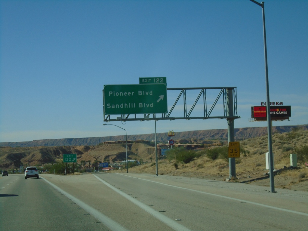
I-15 South - Exit 122
I-15 south at Exit 122 - Pioneer Blvd./Sandhill Blvd. This is the first exit in Nevada on I-15 southbound. This is also the northern end of the Mesquite Business Loop.
Taken 11-26-2019
Mesquite
Clark County
Nevada
United States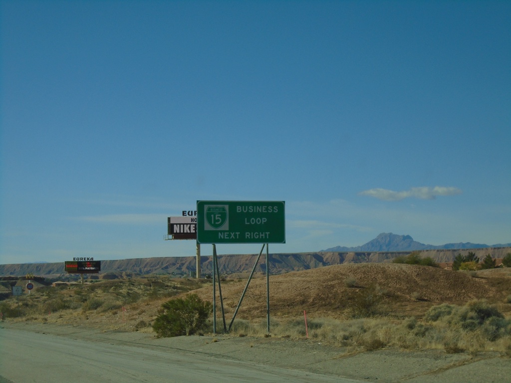
I-15 South - BL-15 Next Right
I-15 south approaching Exit 122. Use Exit 122 for BL-15 and Nevada Welcome Center. This is the north end of the Mesquite Business Loop.
Taken 11-26-2019
Mesquite
Clark County
Nevada
United States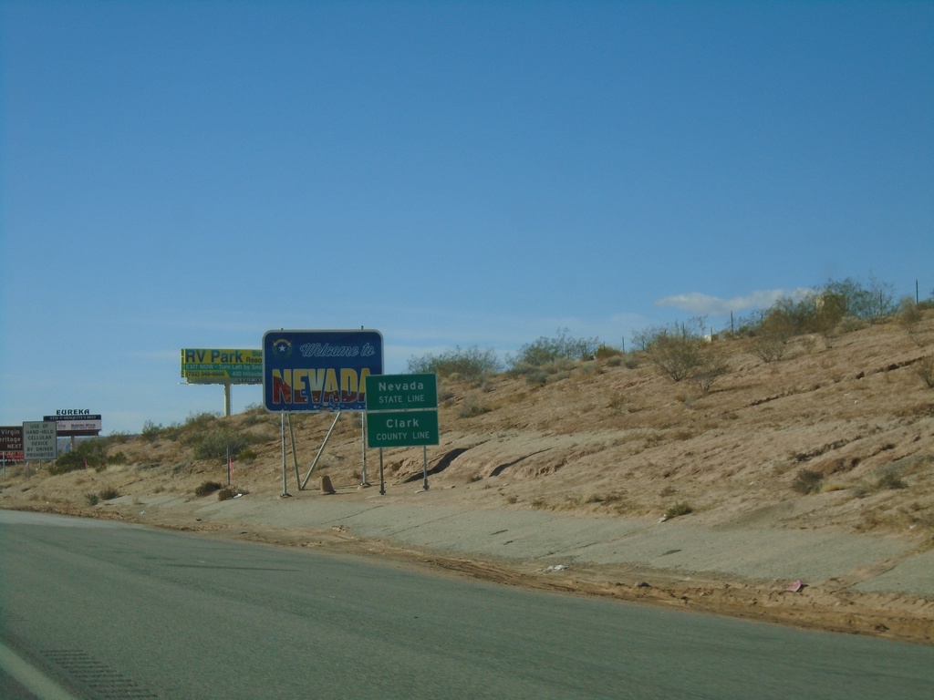
I-15 South - Welcome To Nevada
Welcome To Nevada on I-15 south. Taken at the Nevada-Arizona State Line. The green Nevada State Line sign in the foreground was placed by the Arizona DOT.
Taken 11-26-2019
Mesquite
Clark County
Nevada
United States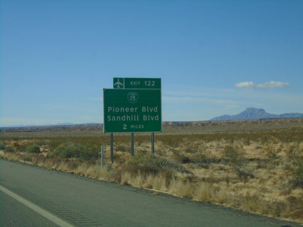
I-15 South Approaching Exit 122
I-15 south approaching Exit 122 (Nevada) - BL-15/Pioneer Blvd/Sandhill Blvd. BL-15 is not signed on the actual interchange within Nevada.
Taken 11-26-2019
Littlefield
Mohave County
Arizona
United States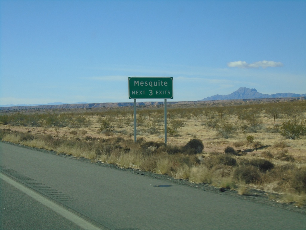
I-15 South - Mesquite Next Three Exits
Mesquite (Nevada) Next Three Exits on I-15 south. This was taken on the Arizona side of the border.
Taken 11-26-2019
Littlefield
Mohave County
Arizona
United States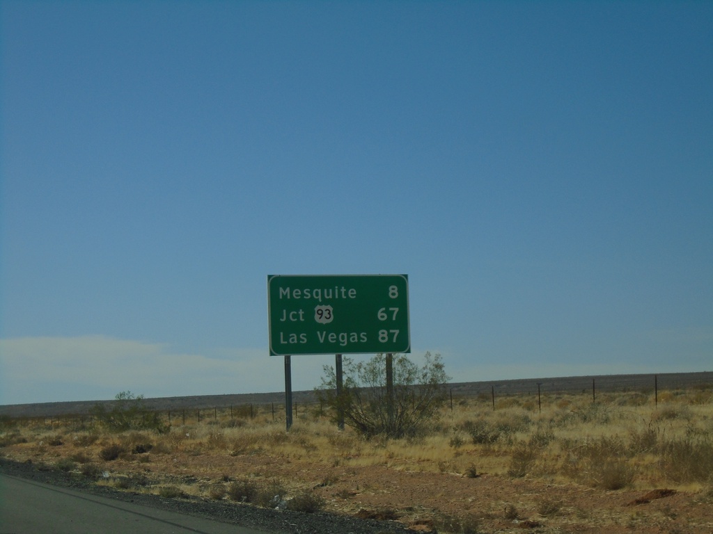
I-15 South - Distance Marker
Distance marker on I-15 south. Distance to Mesquite, Jct. US-93, and Las Vegas. All destinations are in Nevada. This is the last distance marker southbound on I-15 in Arizona.
Taken 11-26-2019
Littlefield
Mohave County
Arizona
United States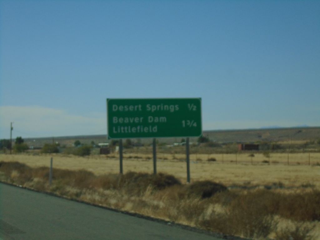
I-15 South Approaching Exits 9 and 8
I-15 south approaching Exit 9 - Desert Springs and approaching Exit 8 - Littlefield/Beaver Dam.
Taken 11-26-2019
Littlefield
Mohave County
Arizona
United States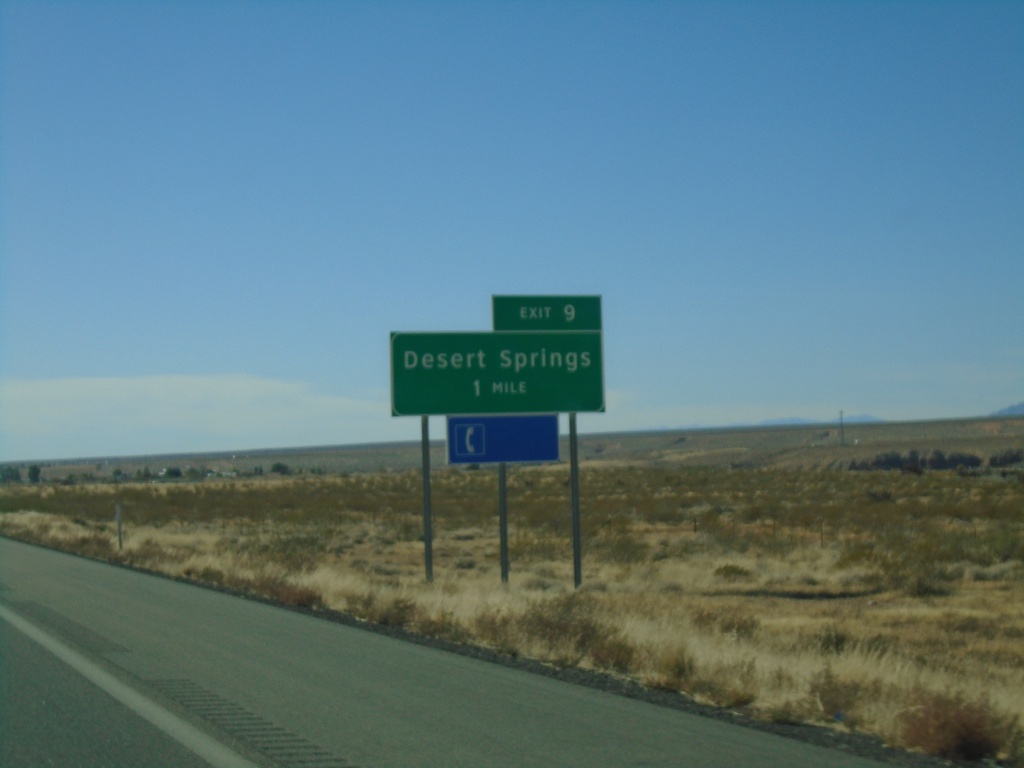
I-15 South - Exit 9
I-15 south approaching Exit 9 - Desert Springs
Taken 11-26-2019
Littlefield
Mohave County
Arizona
United States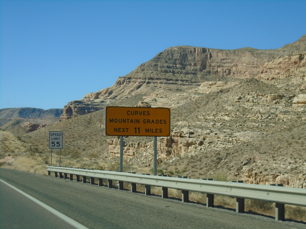
I-15 South - Curves/Mountain Grades
Entering Virgin River Gorge on I-15 south. Curves/Mountain Grades Next 11 Miles.
Taken 11-26-2019
Littlefield
Mohave County
Arizona
United States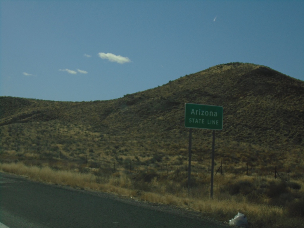
I-15 South - Arizona State Line
I-15 south - Arizona State Line. Taken at the Arizona-Utah state line.
Taken 11-26-2019
Littlefield
Mohave County
Arizona
United States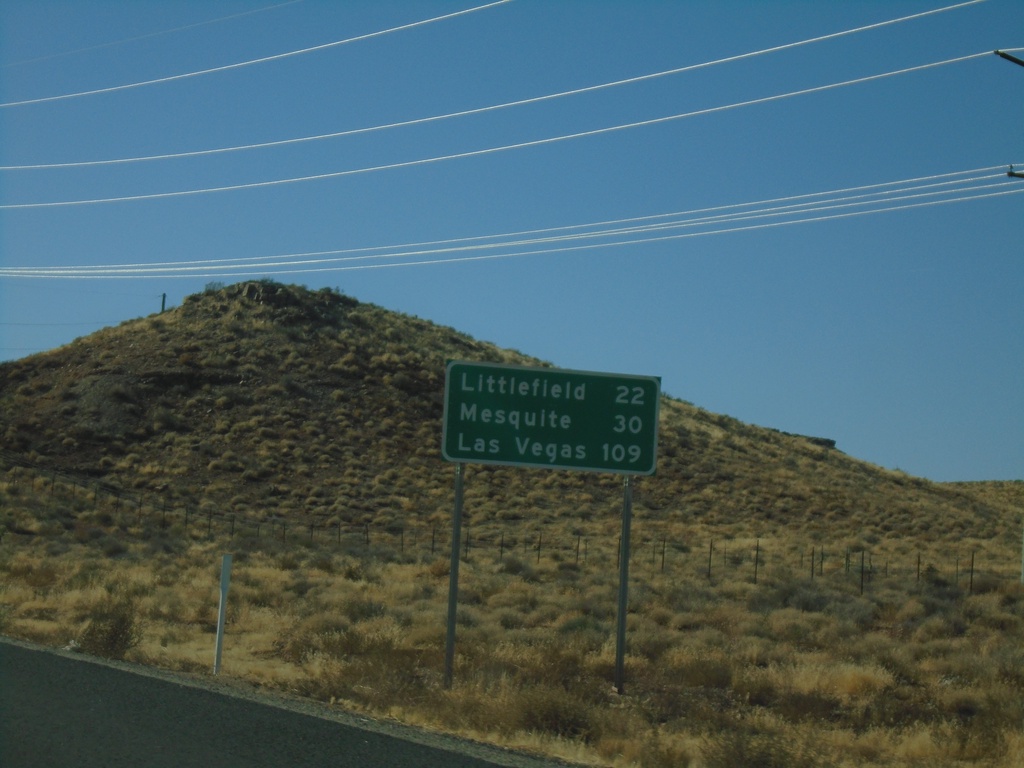
I-15 South - Distance Marker
Distance marker on I-15 south. Distance to Littlefield, Mesquite (Nevada), Las Vegas (Nevada). This is the first distance marker southbound along I-15 in Arizona.
Taken 11-26-2019
Littlefield
Mohave County
Arizona
United States