Signs Tagged With Big Green Sign
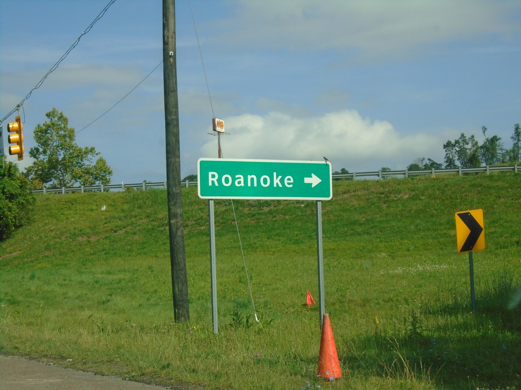
US-58 West/US-11 South at I-81
US-58 West/US-11 South at I-81 North to Roanoke.
Taken 06-24-2019


 Abingdon
Washington County
Virginia
United States
Abingdon
Washington County
Virginia
United States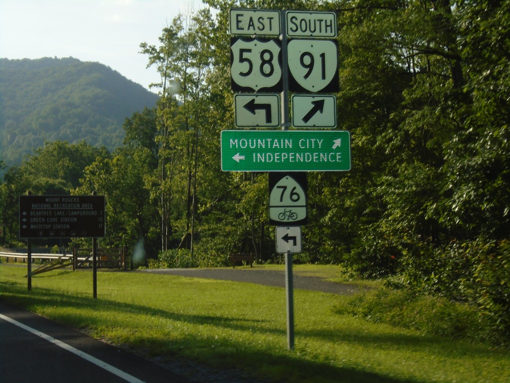
US-58 East/VA-91 South at US-58/VA-91 Split
US-58 East/VA-91 South at US-58/VA-91 split. Merge right for VA-91 South to Mountain City (TN). Turn left for US-58 east to Independence and bike route 76.
Taken 06-24-2019
 Damascus
Washington County
Virginia
United States
Damascus
Washington County
Virginia
United States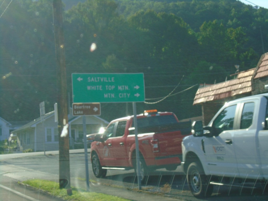
US-58 East at VA-91 - Damascus
US-58 East at VA-91 in Damascus. Turn left for VA-91 north to Saltville; turn right for US-58 East/VA-91 South to White Top Mountain and Mountain City (via VA-91).
Taken 06-24-2019
Damascus
Washington County
Virginia
United States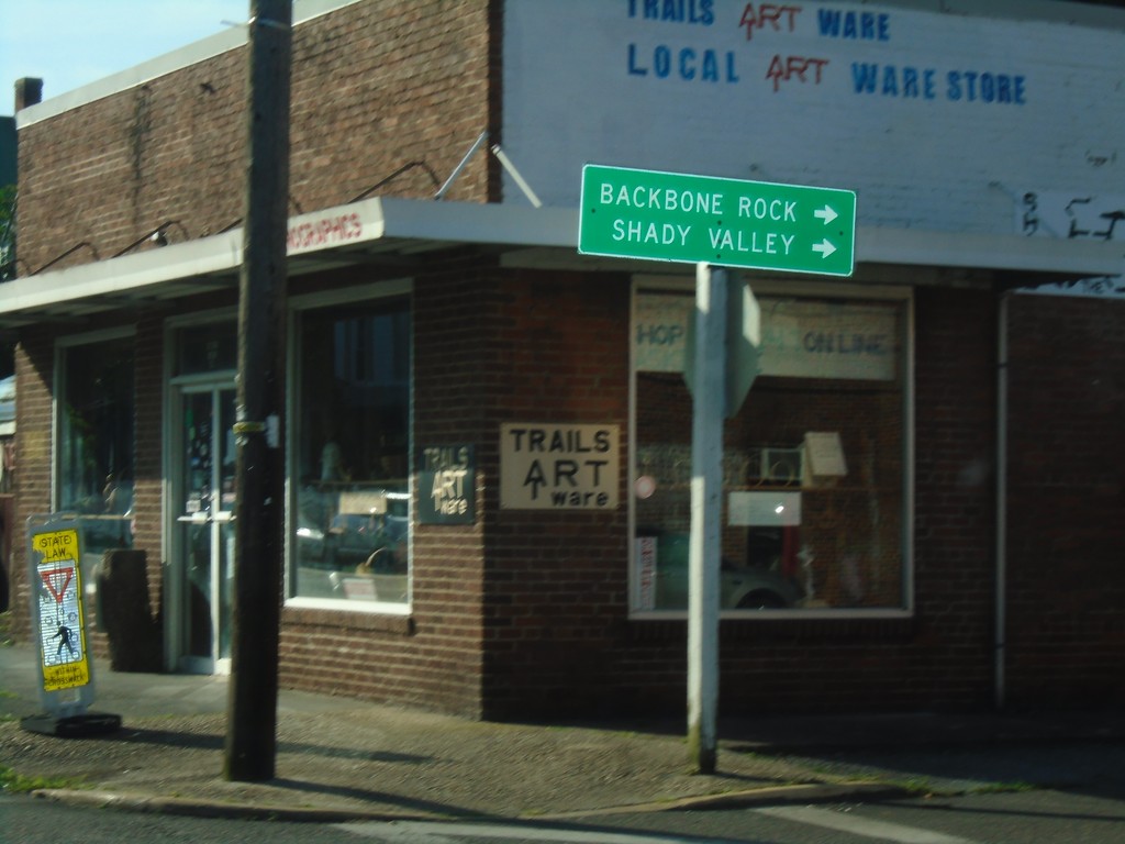
US-58 East at VAS-716
US-58 East at VAS-716 south to Backbone Rock (TN) and Shady Valley (TN).
Taken 06-24-2019
 Damascus
Washington County
Virginia
United States
Damascus
Washington County
Virginia
United States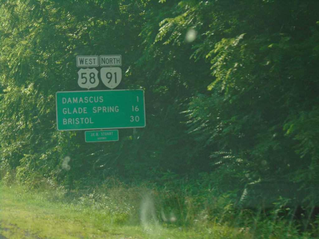
US-58 West/VA-91 North - Distance Marker
Distance Marker on US-58 West/VA-91 North. Distance to Damascus, Glade Spring, and Bristol. US-58 is the Jeb Stewart Highway.
Taken 06-23-2019
Damascus
Washington County
Virginia
United States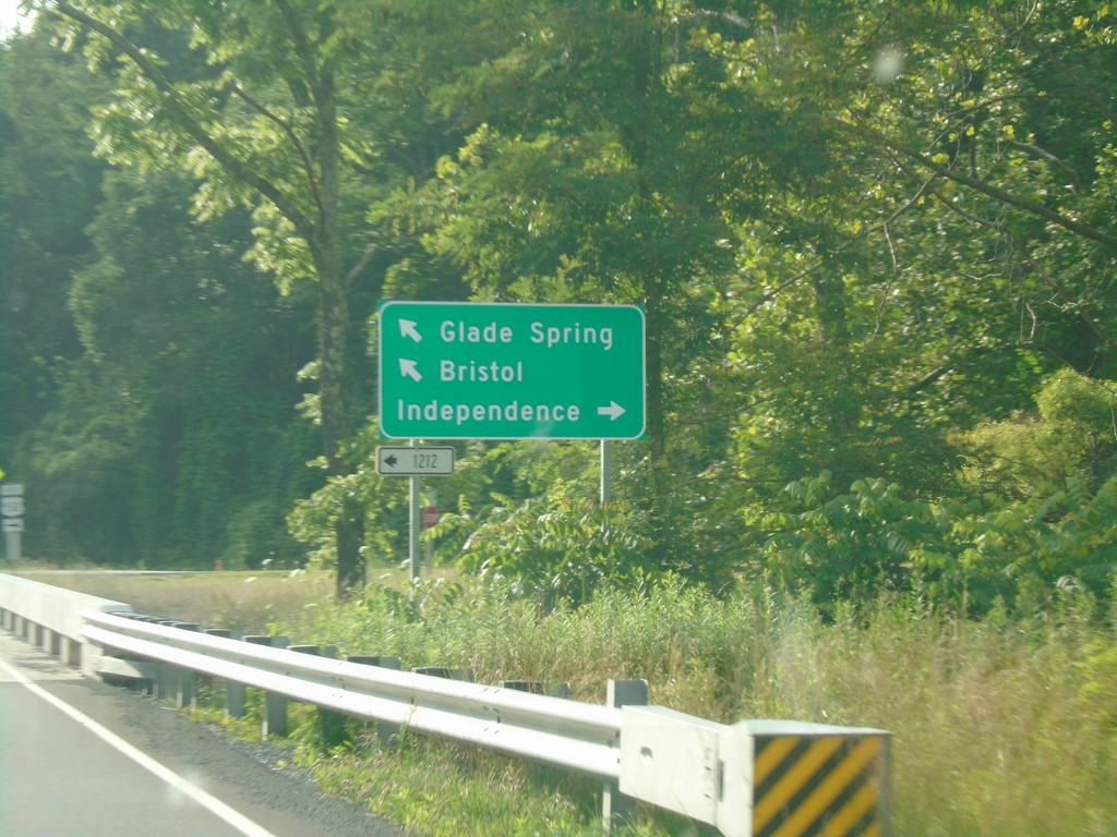
VA-91 North at VAS-1212; Approaching US-58
VA-91 north at VAS-1212. VA-91 north approaching US-58. Turn right for US-58 East to Independence; turn left for US-58 West/VA-91 North to Bristol and Glade Spring.
Taken 06-23-2019
 Damascus
Washington County
Virginia
United States
Damascus
Washington County
Virginia
United States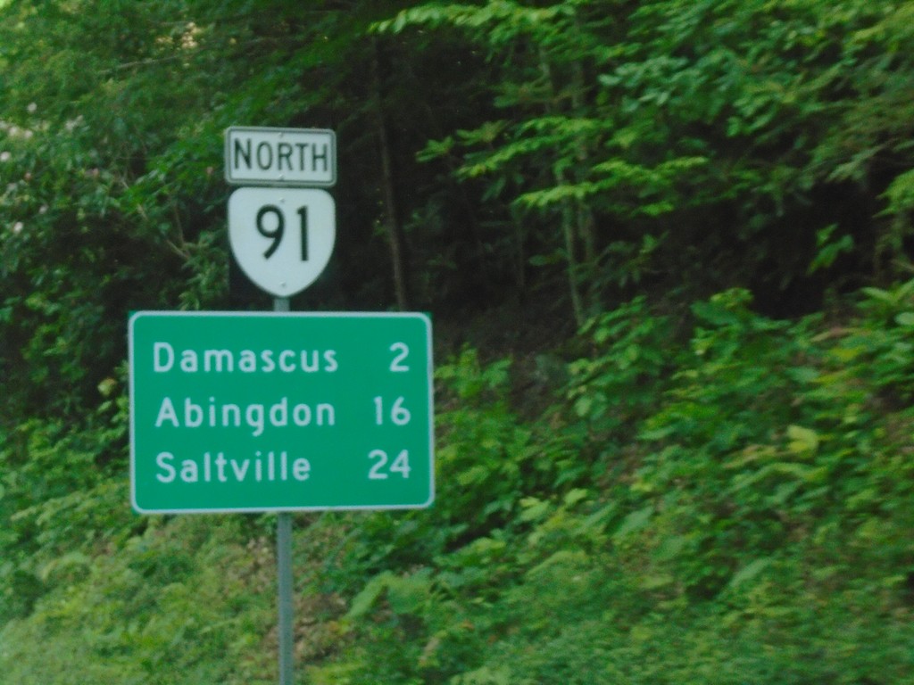
VA-91 North - Distance Marker
Distance marker on VA-91 north. Distance to Damascus, Abingdon, and Saltville.
Taken 06-23-2019
Damascus
Washington County
Virginia
United States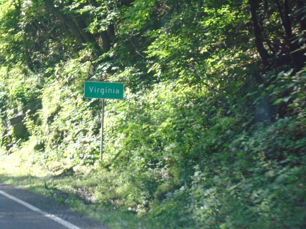
Entering Virginia on VA-91 North
Virginia on VA-91 north. Taken at the Tennessee-Virginia State Line.
Taken 06-23-2019
Damascus
Washington County
Virginia
United States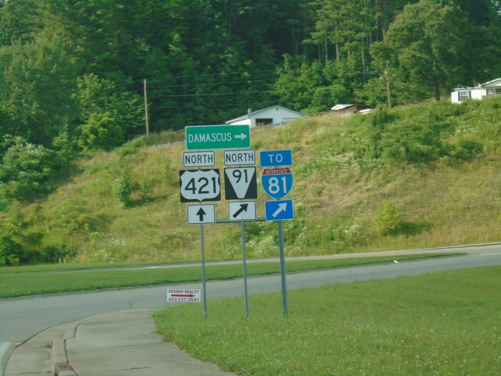
US-421 North at TNS-91 North/To I-81
US-421 North at TNS-91 North/To I-81. Use TNS-91 north for Damascus (VA).
Taken 06-23-2019

 Mountain City
Johnson County
Tennessee
United States
Mountain City
Johnson County
Tennessee
United States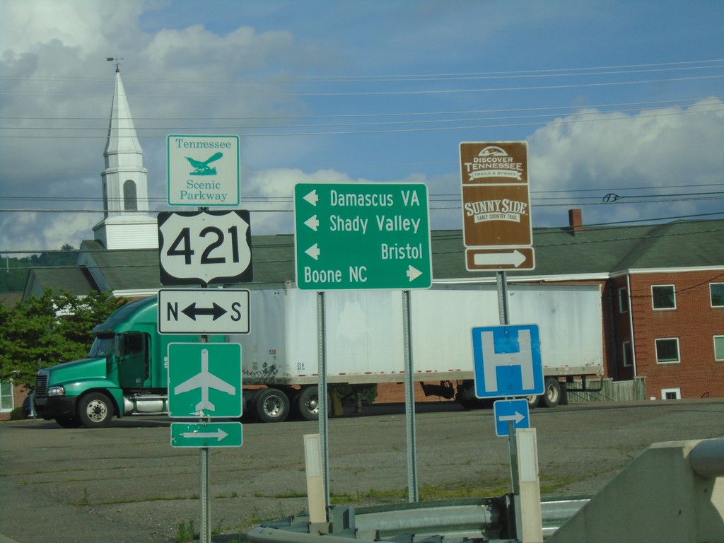
TN-67 East at US-412/TNS-418
TN-67 East at US-412/TNS-418 in Mountain City. Use US-412 South/TN-67 East to Boone, NC. Use US-412 North to Damascus (VA), Bristol, and Shady Valley.
Taken 06-23-2019


 Mountain City
Johnson County
Tennessee
United States
Mountain City
Johnson County
Tennessee
United States
TN-67 East - Johnson County
Entering Johnson County on TN-67 east.
Taken 06-23-2019
Butler
Johnson County
Tennessee
United States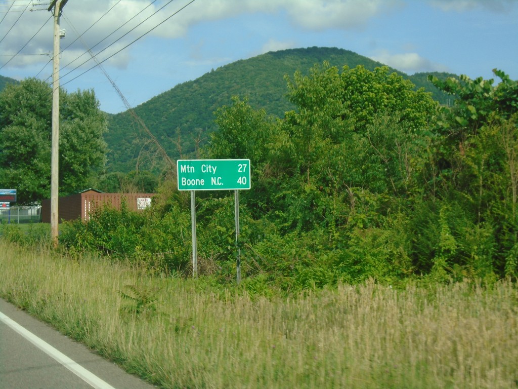
US-321 South/TN-67 - Distance Marker
Distance Marker on US-321 South/TN-67 East. Distance to Mountain City and Boone, NC.
Taken 06-23-2019
 Hampton
Carter County
Tennessee
United States
Hampton
Carter County
Tennessee
United States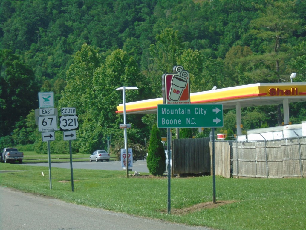
US-19E North at US-321/TN-67 - Hampton
US-19E North at US-321/TN-67 in Hampton. Turn right for US-321 South/TN-67 East to Mountain City and Boone NC. Continue straight for US-19E/US-321 North/TN-67 West.
Taken 06-23-2019
 Hampton
Carter County
Tennessee
United States
Hampton
Carter County
Tennessee
United States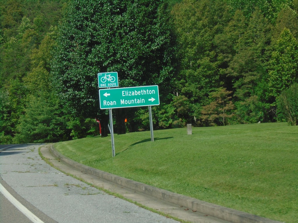
End TNS-173 North at US-19E
End TNS-173 North at US-19E. Use US-19E south for Roan Mountain; US-19E north for Elizabethton.
Taken 06-23-2019
 Hampton
Carter County
Tennessee
United States
Hampton
Carter County
Tennessee
United States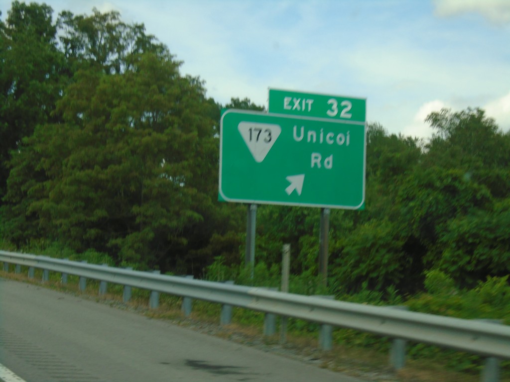
I-26 West - Exit 32
I-26 west at Exit 32 - TNS-173/Unicoi Road.
Taken 06-23-2019

 Unicoi
 County
Tennessee
United States
Unicoi
Unicoi County
Tennessee
United States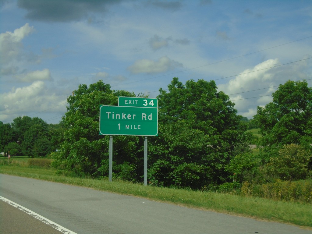
I-26 West - Exit 34
I-26 west approaching Exit 34 - Tinker Road
Taken 06-23-2019
Erwin
Unicoi County
Tennessee
United States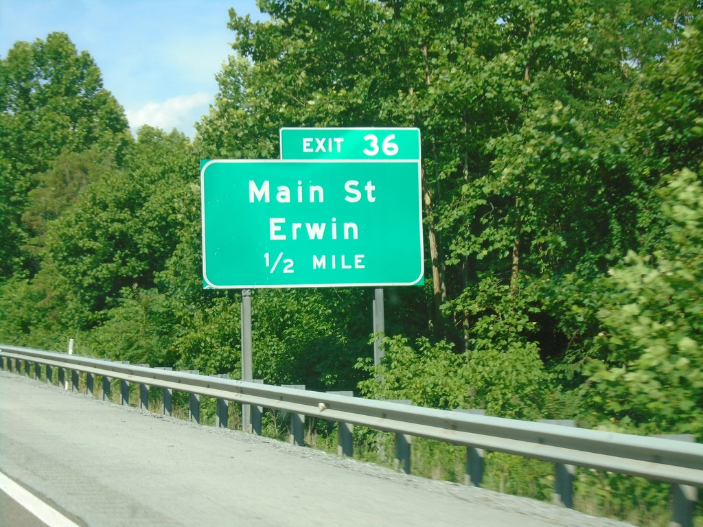
I-26 West - Exit 36
I-26 west approaching Exit 36 - Main St./Erwin.
Taken 06-23-2019
Erwin
Unicoi County
Tennessee
United States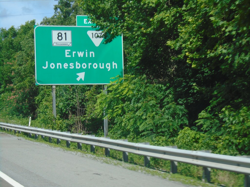
I-26 West - Exit 37
I-26 west at Exit 37 - TN-81/TNS-107/Erwin/Jonesborough.
Taken 06-23-2019

 Erwin
Unicoi County
Tennessee
United States
Erwin
Unicoi County
Tennessee
United States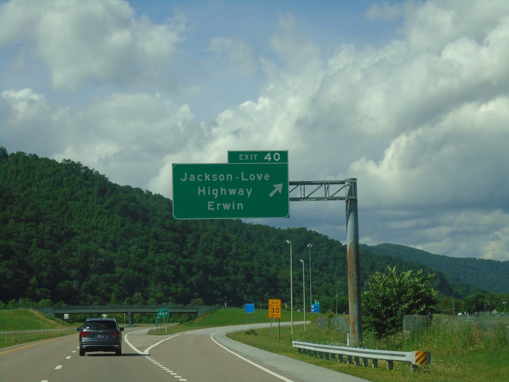
I-26 West - Exit 40
I-26 west at Exit 40 Jackson-Love Highway/Erwin.
Taken 06-23-2019
Erwin
Unicoi County
Tennessee
United States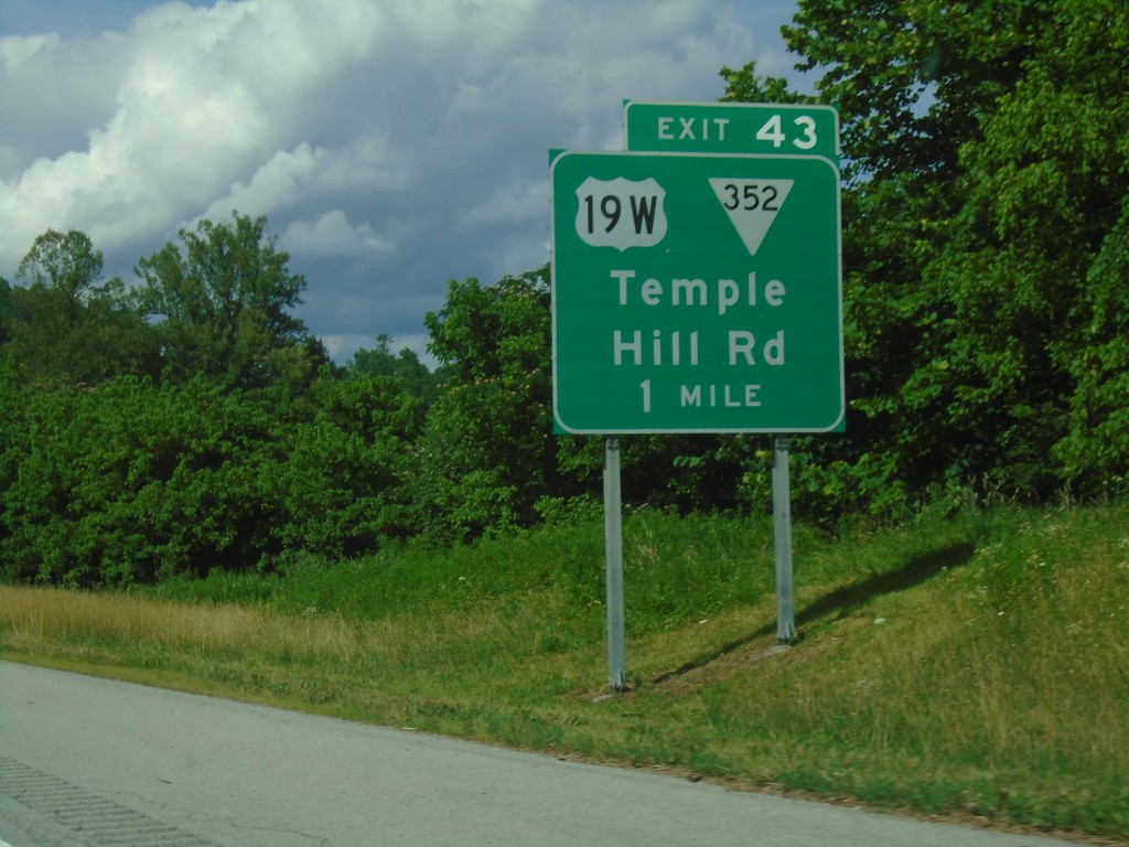
I-26 West - Exit 43
I-26 west approaching Exit 43 - US-19W/TNS-352/Temple Hill Road
Taken 06-23-2019

 Erwin
Unicoi County
Tennessee
United States
Erwin
Unicoi County
Tennessee
United States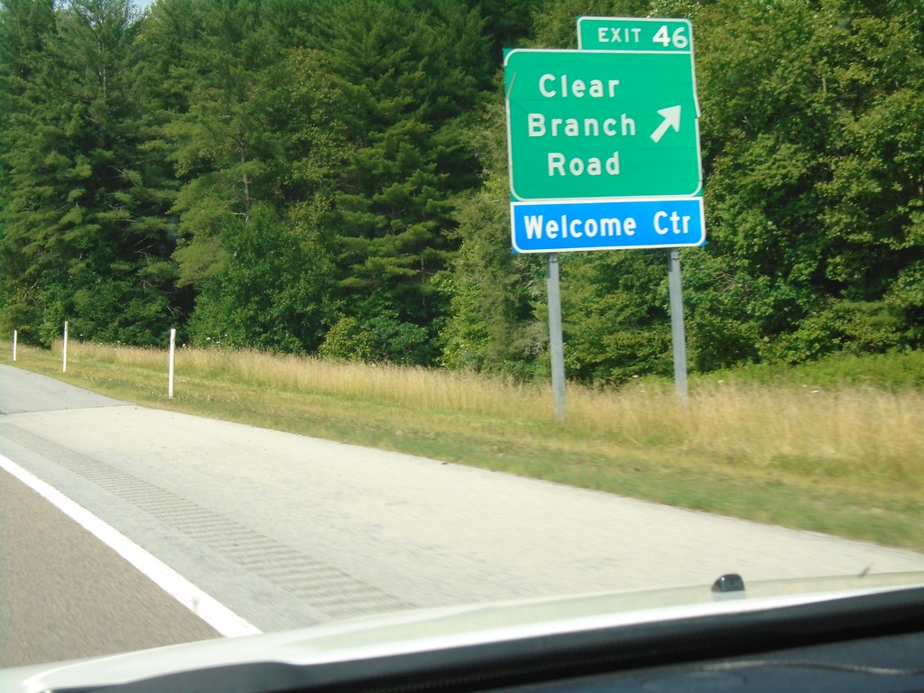
I-26 West - Exit 46
I-26 west at Exit 46 - Clear Branch Road. Use Exit 46 for the Tennessee Welcome Center.
Taken 06-23-2019
Erwin
Unicoi County
Tennessee
United States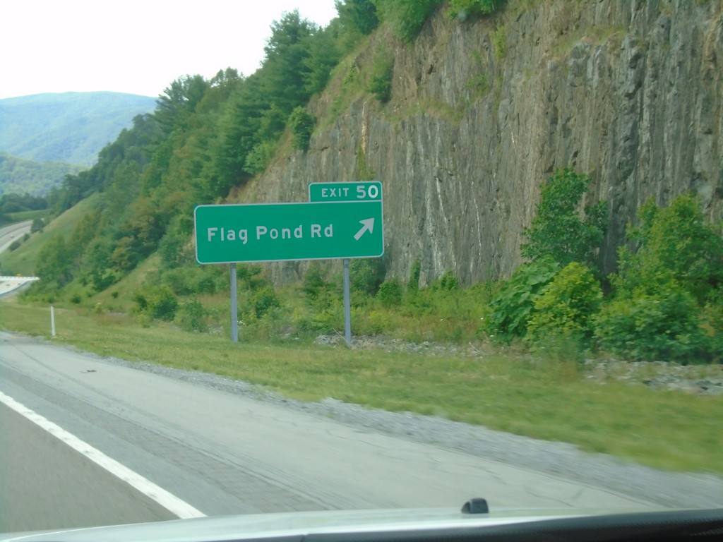
I-26 West - Exit 50
I-26 west at Exit 50 - Flag Pond Road.
Taken 06-23-2019
Flag Pond
Unicoi County
Tennessee
United States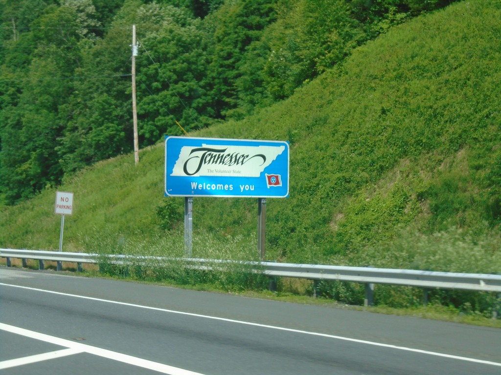
I-26 West - Welcome To Tennessee
Welcome to Tennessee on I-26 west.
Taken 06-23-2019
Flag Pond
Unicoi County
Tennessee
United States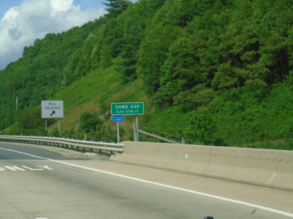
I-26 West - Sams Gap
I-26 west at Sams Gap at the North Carolina - Tennessee state line.
Taken 06-23-2019
Flag Pond
Unicoi County
Tennessee
United States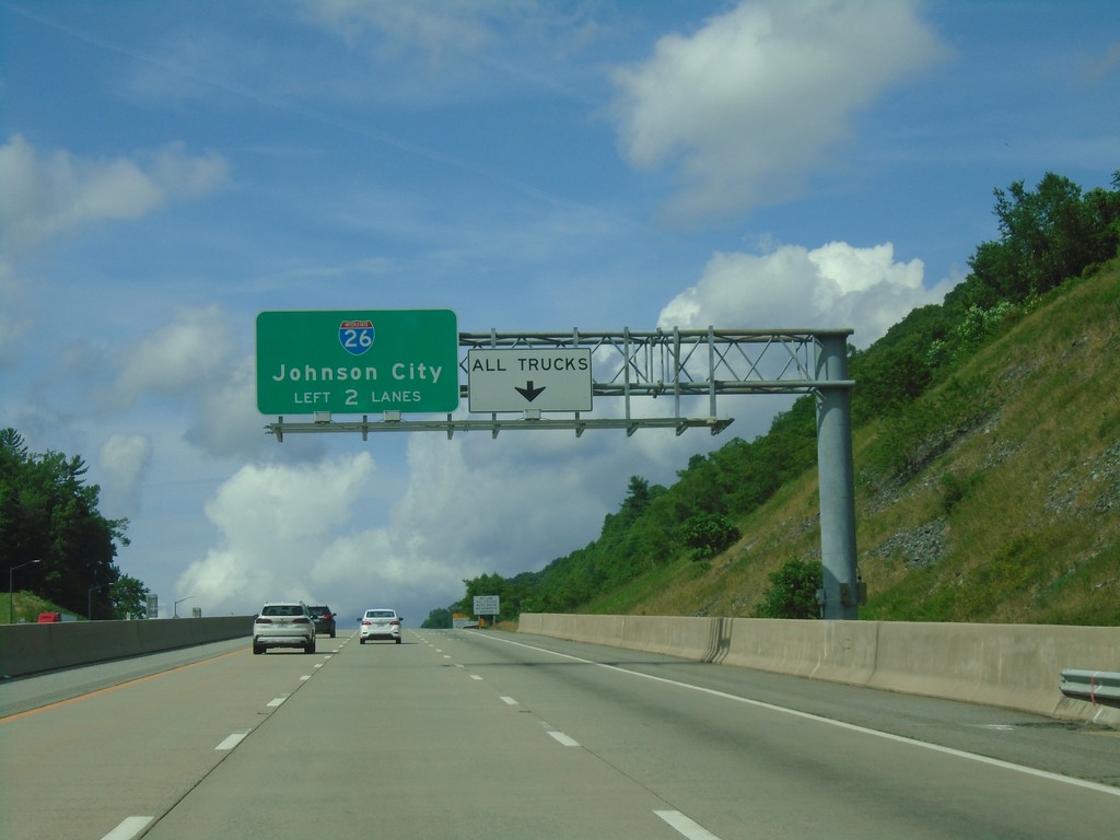
I-26 West Approaching Sams Gap
I-26 west approaching Sams Gap. Use left two lanes for I-26 West/Johnson City. Trucks use right lane for brake check area.
Taken 06-23-2019
Mars Hill
Madison County
North Carolina
United States