Signs Tagged With Big Green Sign
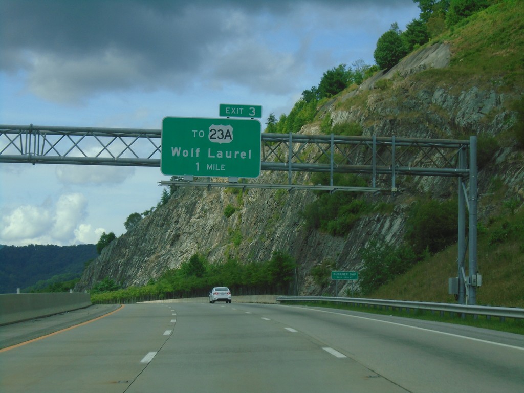
I-26 West - Exit 3
I-26 west approaching Exit 3 - To US-23A/Wolf Laurel.
Taken 06-23-2019


 Mars Hill
Madison County
North Carolina
United States
Mars Hill
Madison County
North Carolina
United States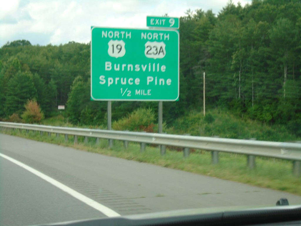
I-26 West - Exit 9
I-26 west approaching Exit 9 - US-19 North/US-23A North/Burnsville/Spruce Pine.
Taken 06-23-2019
 Mars Hill
Madison County
North Carolina
United States
Mars Hill
Madison County
North Carolina
United States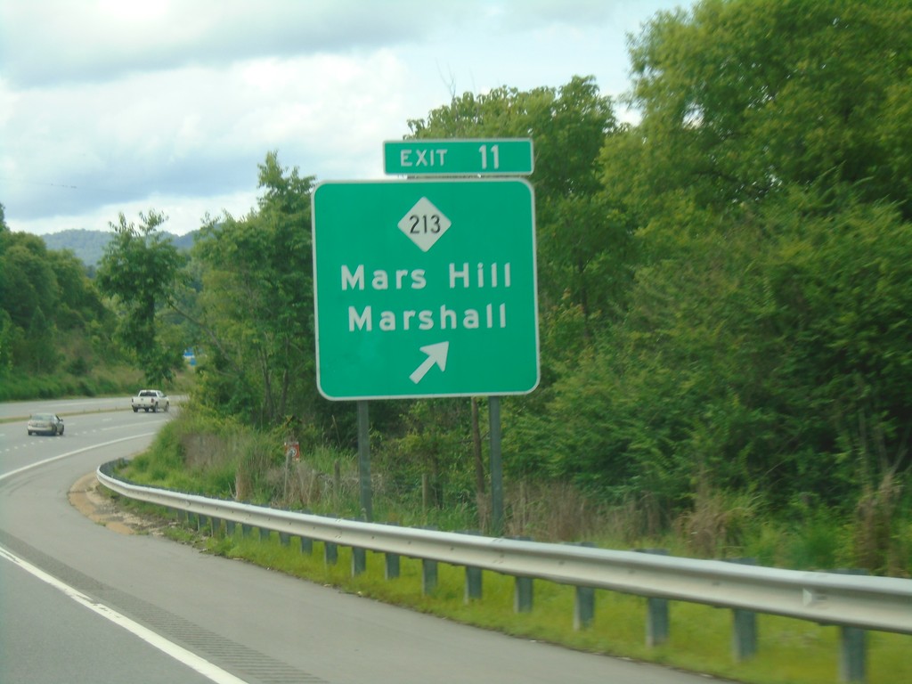
I-26 West - Exit 11
I-26 west approaching Exit 11 - NC-213/Mars Hill/Marshall.
Taken 06-23-2019
Mars Hill
Madison County
North Carolina
United States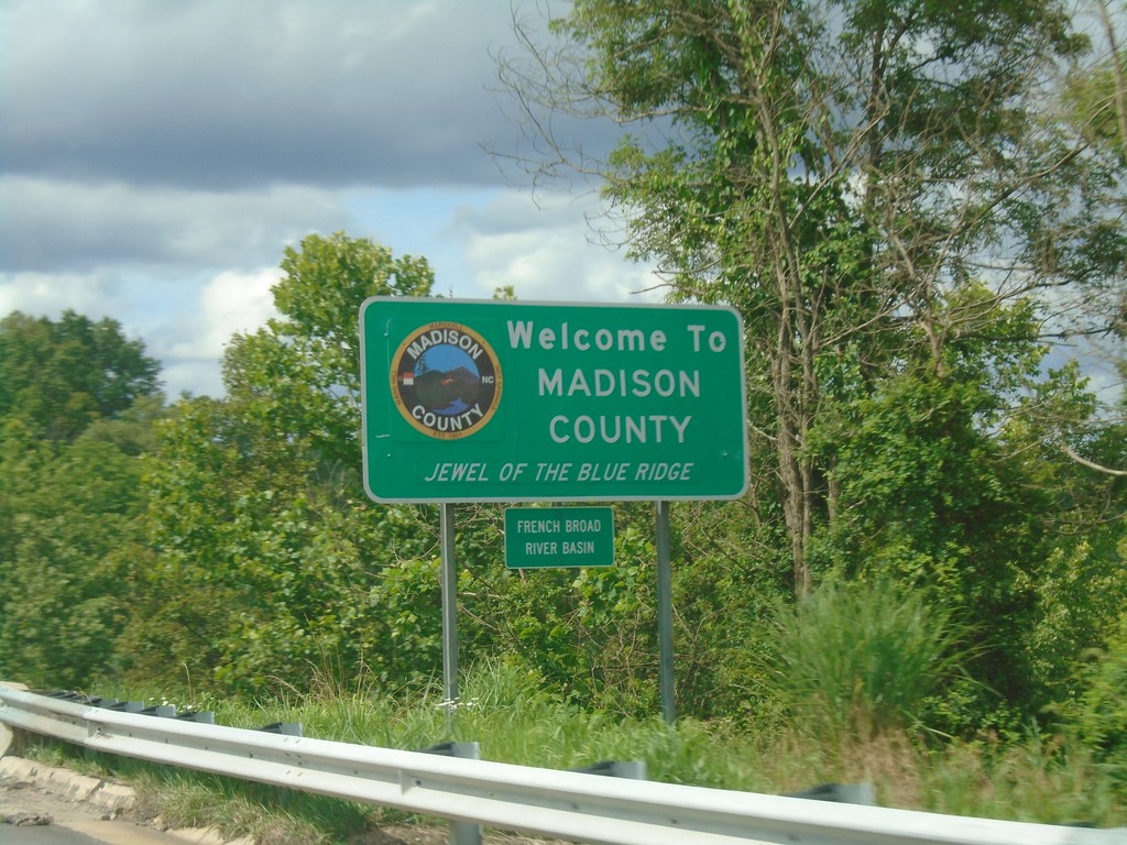
Future I-26 West - Madison County
Entering Madison County on Future I-26 West crossing Ivy Creek. Ivy Creek is part of the French Broad River Basin.
Taken 06-23-2019
 Weaverville
Madison County
North Carolina
United States
Weaverville
Madison County
North Carolina
United States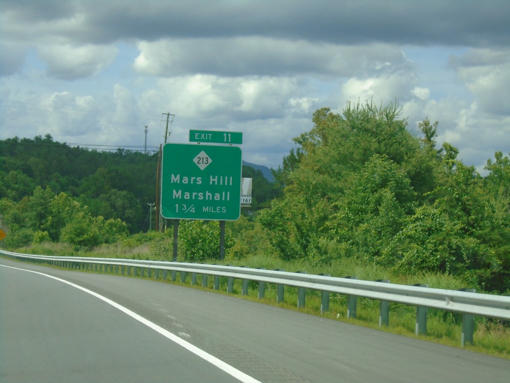
Future I-26 West - Exit 11
Future I-26 west approaching Exit 11 - NC-213/Mars Hill/Marshall.
Taken 06-23-2019
 Weaverville
Madison County
North Carolina
United States
Weaverville
Madison County
North Carolina
United States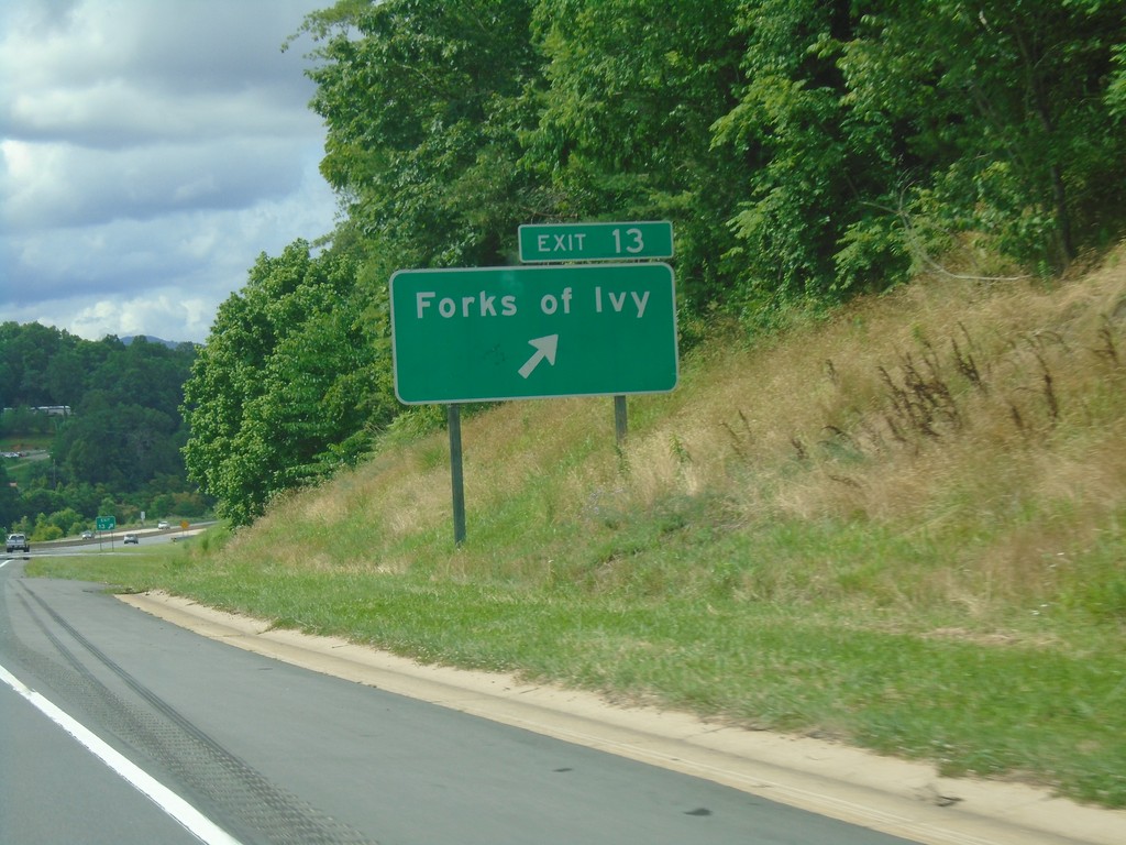
Future I-26 West - Exit 13
Future I-26 West at Exit 13 - Forks of Ivy.
Taken 06-23-2019
Weaverville
Buncombe County
North Carolina
United States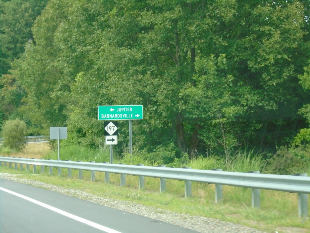
Future I-26 Exit 15 Offramp at NC-197
Future I-26 Exit 15 Offramp at NC-197. Turn right for NC-197 to Barnardsville; left for Jupiter.
Taken 06-23-2019
 Weaverville
Buncombe County
North Carolina
United States
Weaverville
Buncombe County
North Carolina
United States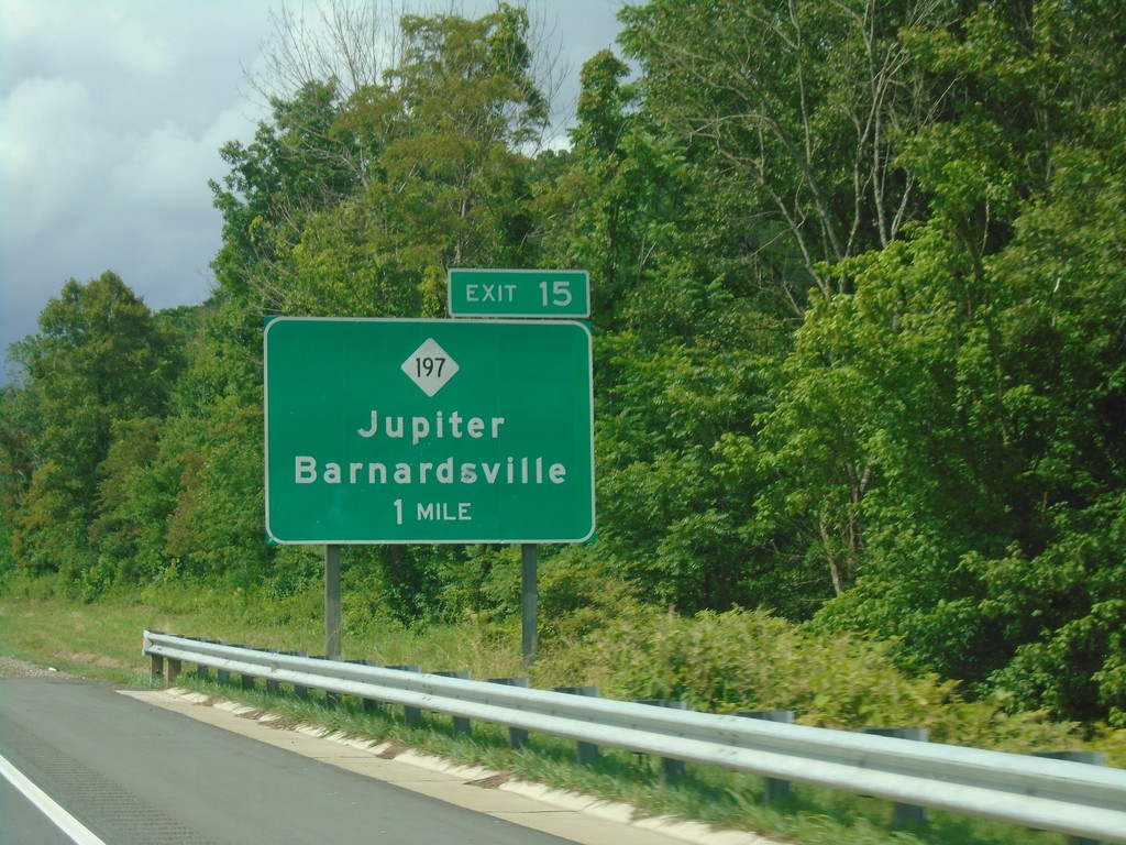
Future I-26 West - Exit 15
Future I-26 West approaching Exit 15 - NC-197/Jupiter/Barnardsville.
Taken 06-23-2019
Stocksville
Buncombe County
North Carolina
United States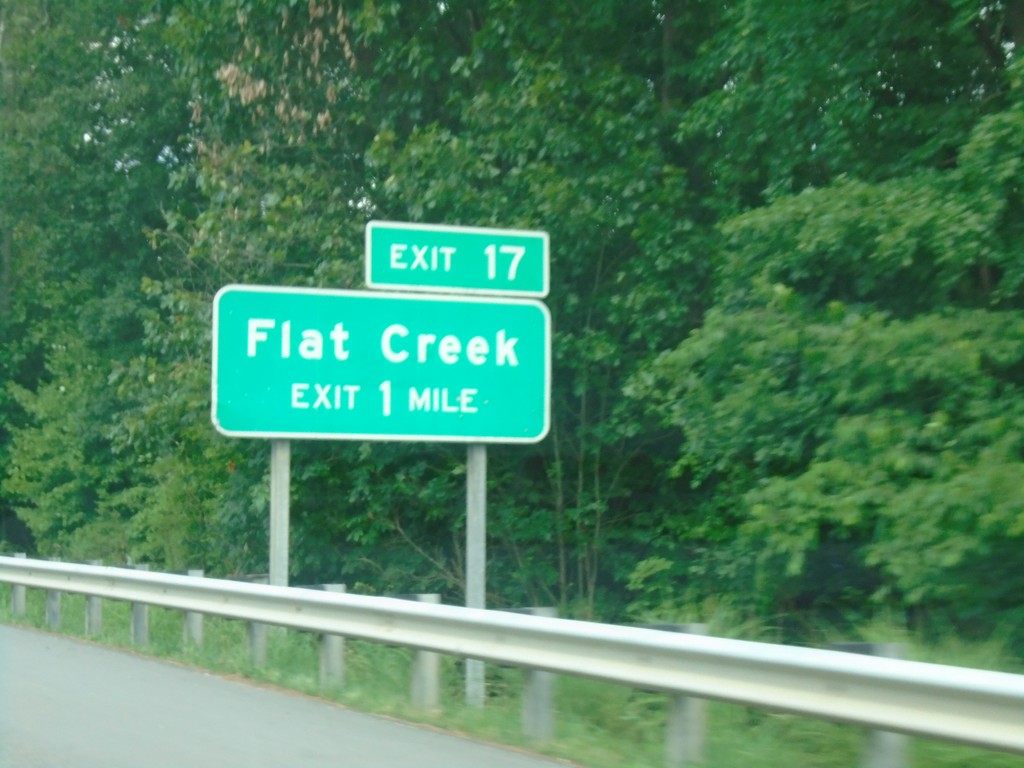
Future I-26 West - Exit 17
Future I-26 West approaching Exit 17 - Flat Creek
Taken 06-23-2019
Weaverville
Buncombe County
North Carolina
United States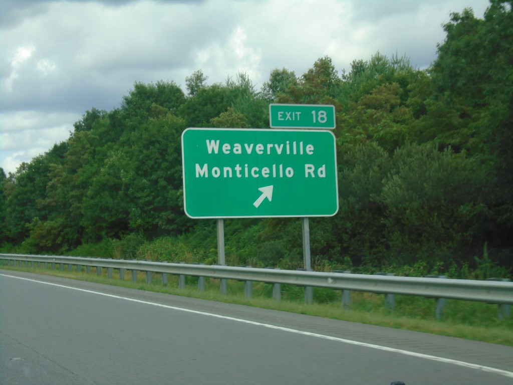
Future I-26 West - Exit 18
Future I-26 West at Exit 18 - Weaverville/Monticello Road.
Taken 06-23-2019
Weaverville
Buncombe County
North Carolina
United States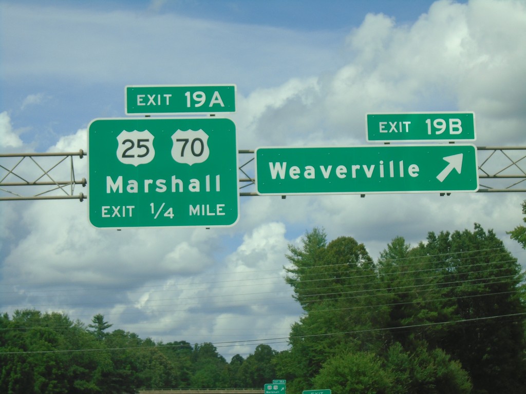
Future I-26 West - Exits 19B-A
Future I-26 west at Exit 19B - Weaverville. Approaching Exit 19A - US-25/US-70/Marshall.
Taken 06-23-2019

 Weaverville
Buncombe County
North Carolina
United States
Weaverville
Buncombe County
North Carolina
United States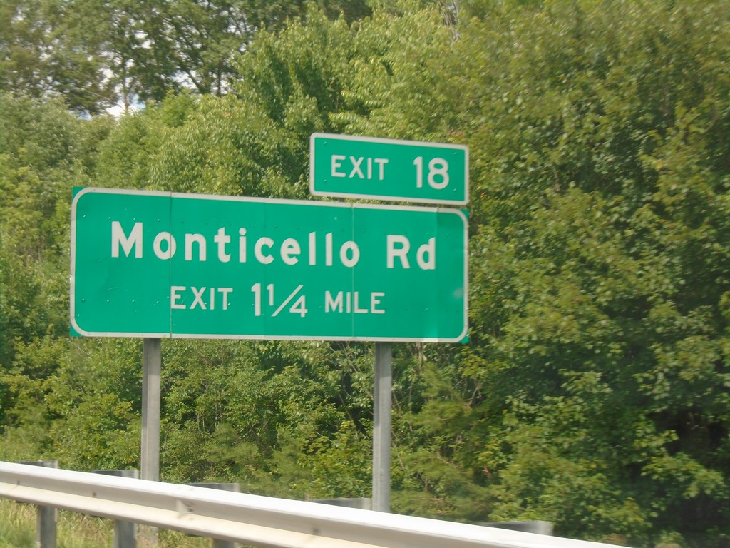
Future I-26 West - Exit 18
Future I-26 west approaching Exit 18 - Monticello Road.
Taken 06-23-2019
Weaverville
Buncombe County
North Carolina
United States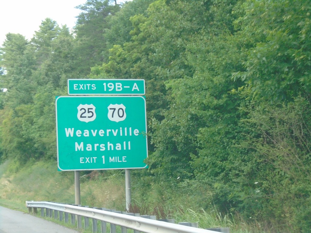
Future I-26 West - Exit 19B-A
Future I-26 West approaching Exit 19B-A - US-25/US-70/Weaverville/Marshall. US-70 west leaves Future I-26 West here.
Taken 06-23-2019
Weaverville
Buncombe County
North Carolina
United States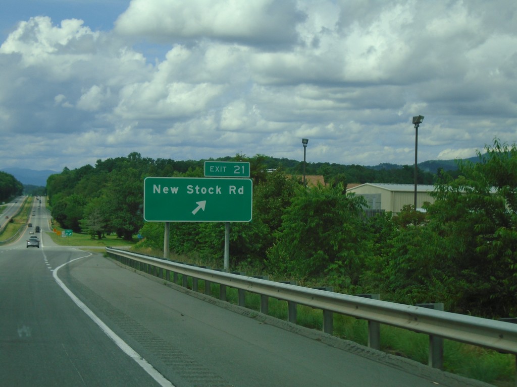
Future I-26 West - Exit 21
Future I-26 West at Exit 21 - New Stock Road
Taken 06-23-2019
Woodfin
Buncombe County
North Carolina
United States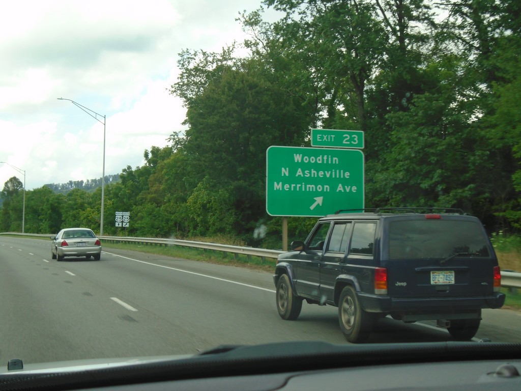
Future I-26 West - Exit 23
Future I-26 West at Exit 33 - Woodfin/North Asheville/Merrimon Ave.
Taken 06-23-2019
Woodfin
Buncombe County
North Carolina
United States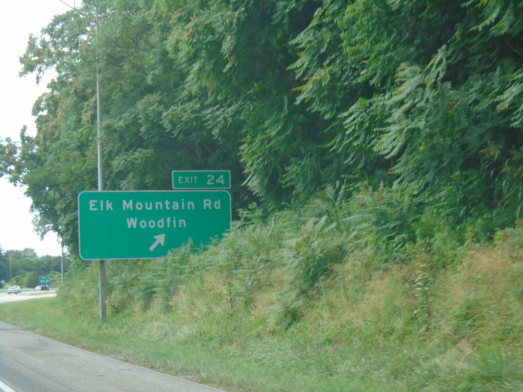
Future I-26 West - Exit 24
Future I-26 west at Exit 24 - Elk Mountain Road/Woodfin.
Taken 06-23-2019
Asheville
Buncombe County
North Carolina
United States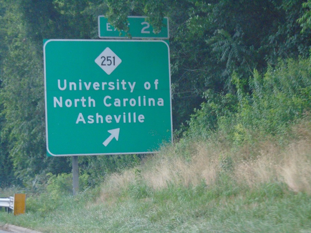
Future I-26 West - Exit 25
Future I-26 west at Exit 25 - NC-251/University of North Carolina Asheville
Taken 06-23-2019
 Asheville
Buncombe County
North Carolina
United States
Asheville
Buncombe County
North Carolina
United States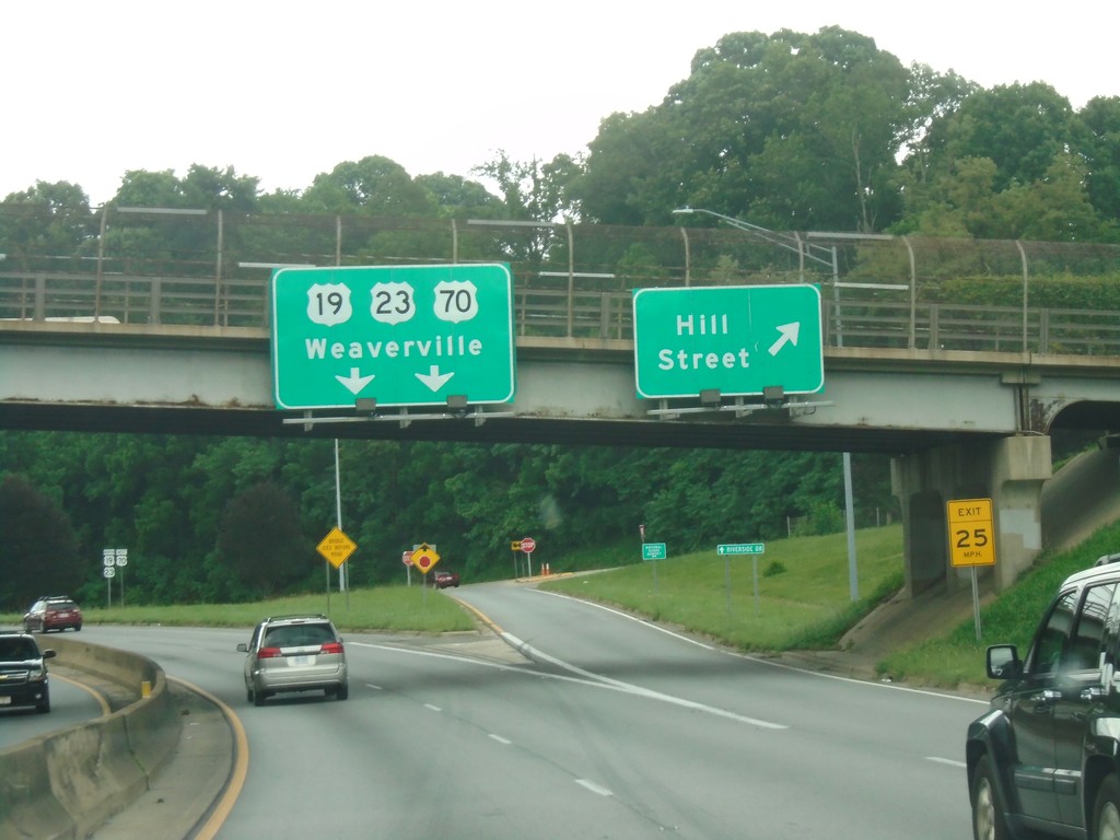
Future I-26/US-19/US-23/US-70 - Hill St. Interchange
Future I-26/US-19/US-23/US-70 at Hill St. Interchange. Continue on freeway for Weaverville.
Taken 06-23-2019
Asheville
Buncombe County
North Carolina
United States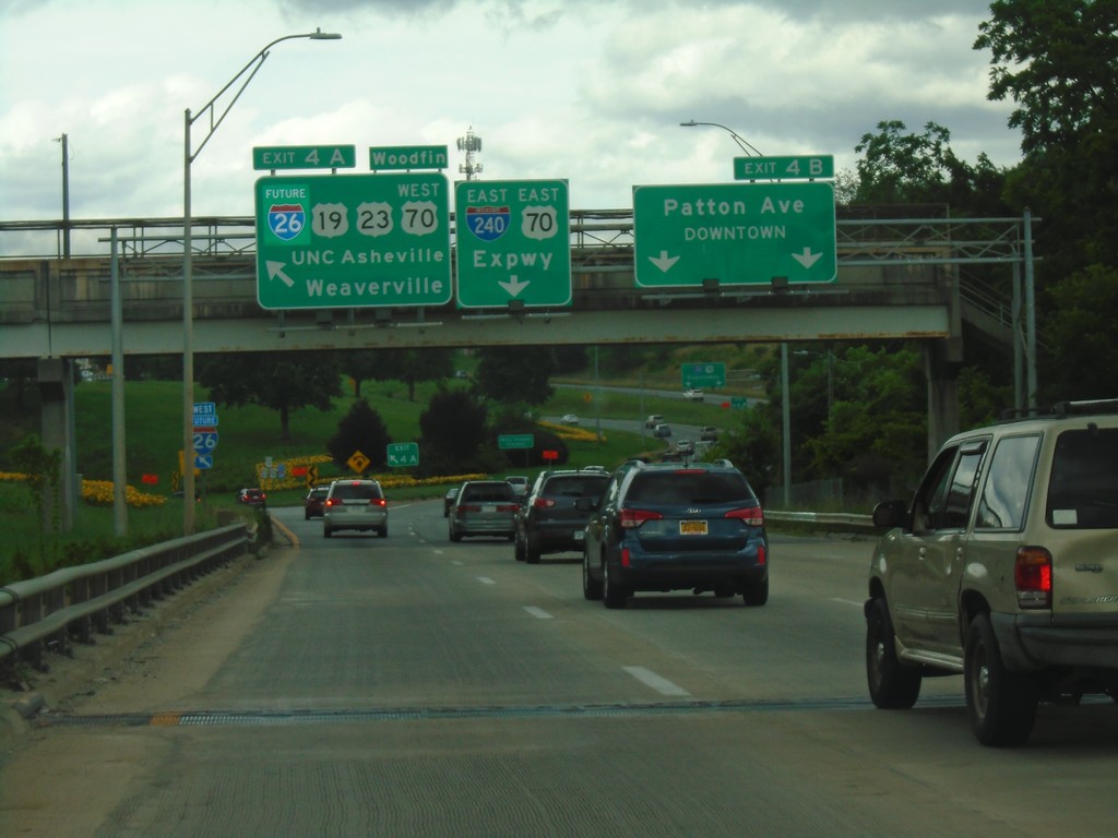
I-240 East/US-70 East at Exits 4A and 4B
I-240 East/US-70 East at Exits 4A and 4B. Exit 4A (Left) - Future I-26 West/US-19/US-23/US-70 West/UNC Asheville/Weaverville/Woodfin. Exit 4B - Patton Ave./Downtown. Continue ahead for I-240 East/US-70 East/ Expressway. I-26 becomes Future I-26 before this intersection because parts of the highway are not up to interstate standards.
Taken 06-23-2019
 Asheville
Buncombe County
North Carolina
United States
Asheville
Buncombe County
North Carolina
United States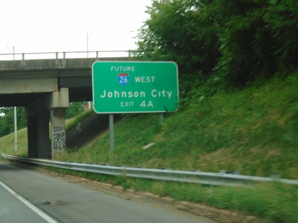
I-26 West/I-240 East - Approaching Exit 4A
I-26 West/I-240 East approaching Exit 4A - Future I-26 West/Johnson City (TN).
Taken 06-23-2019
Asheville
Buncombe County
North Carolina
United States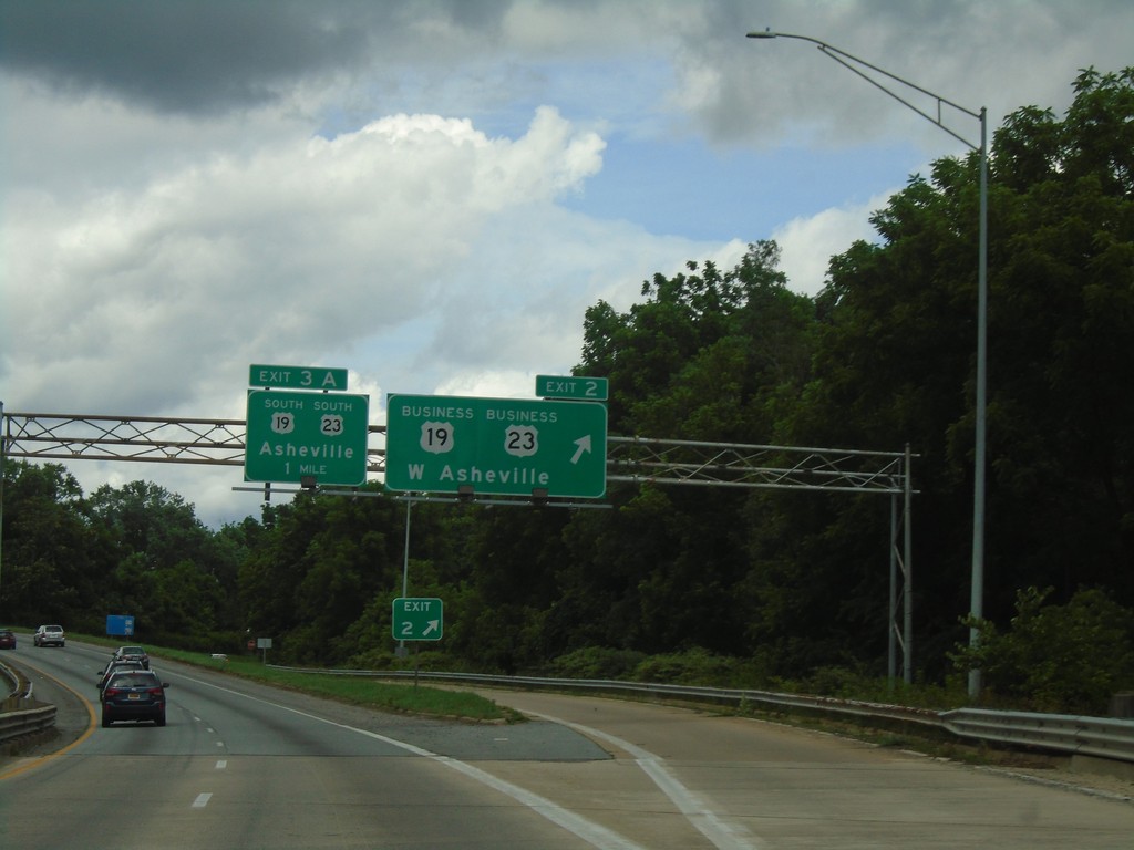
I-26 West/I-240 East - Exits 2 and 3A
I-26 West/I-240 East at Exit 2 - Bus. US-19/Bus. US-23/West Asheville. Approaching Exit 3A - US-19 South/US-23 South/Asheville.
Taken 06-23-2019

 Asheville
Buncombe County
North Carolina
United States
Asheville
Buncombe County
North Carolina
United States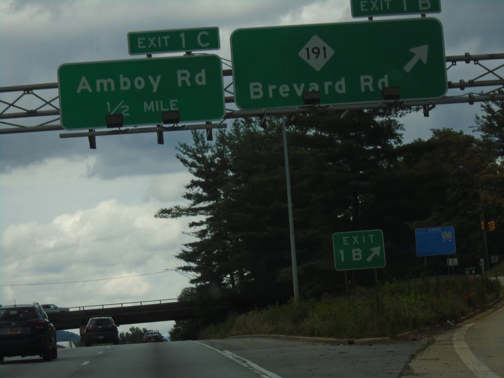
I-26 West/I-240 East - Exits 1B and 1C
I-26 West/I-240 East at Exit 1B - NC-191/Brevard Road. Approaching Exit 1C - Amboy Road.
Taken 06-23-2019
 West
Buncombe County
North Carolina
United States
West
Buncombe County
North Carolina
United States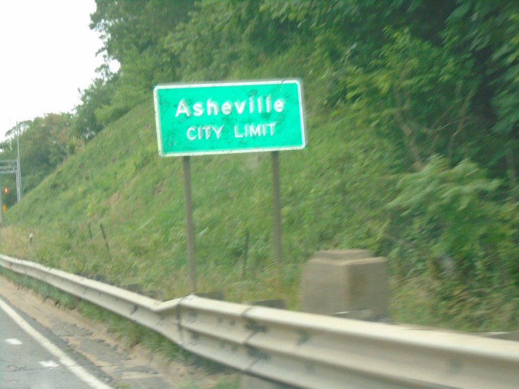
I-26 West/I-240 East - Asheville
Asheville City Limit on I-26 West/I-240 East.
Taken 06-23-2019
West
Buncombe County
North Carolina
United States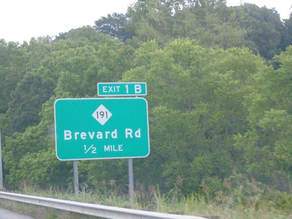
I-26 West/I-240 East - Exit 1B
I-26 West/I-240 East approaching Exit 1B - NC-191/Brevard Road. The mileposts along the I-26/I-240 overlap in Asheville use the distance from I-240. This is not usual for a primary route to use the mileposts for a loop route. However, I-26 becomes Future I-26 north of I-240.
Taken 06-23-2019
West
Buncombe County
North Carolina
United States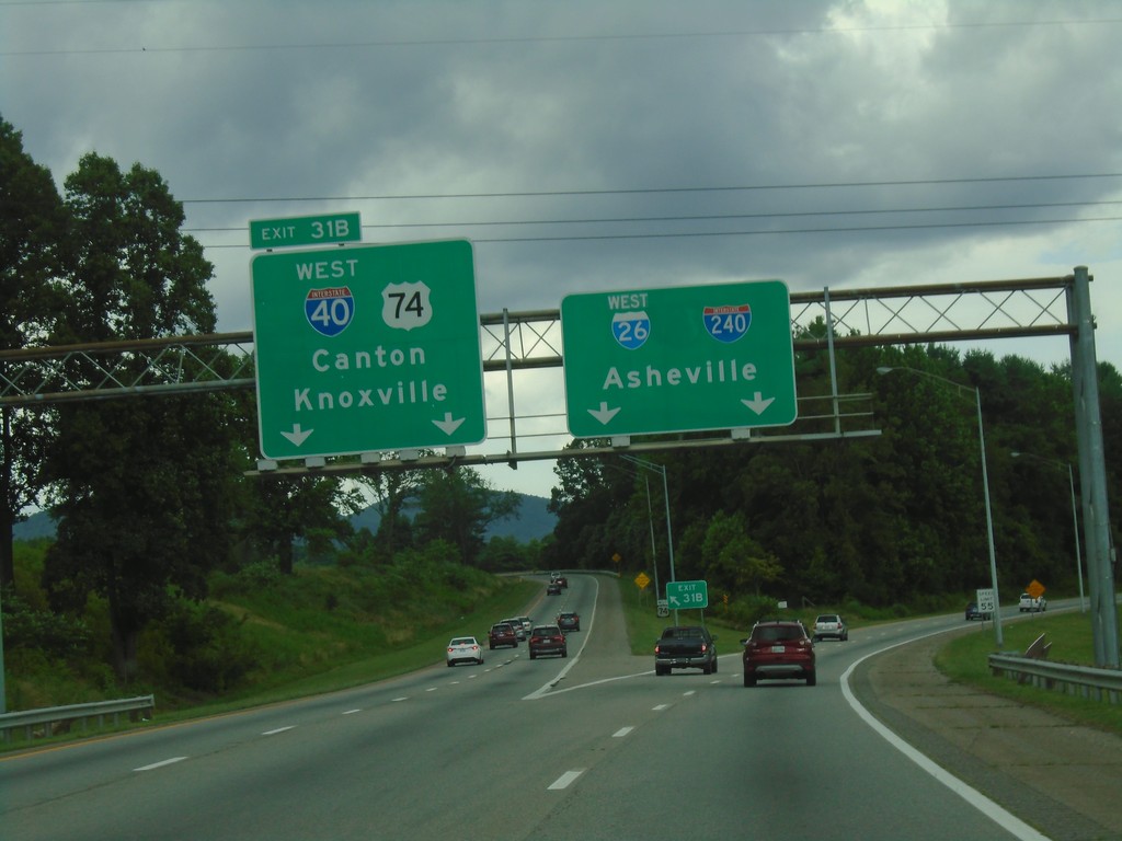
I-26 West - Exit 31B
I-26 west at Exit 31B (Left Exit) - I-40 West/US-74 West/Canton/Knoxville (TN). Continue straight for I-26 West/I-240 East/Asheville.
Taken 06-23-2019

 Asheville
Buncombe County
North Carolina
United States
Asheville
Buncombe County
North Carolina
United States