Signs Tagged With Big Green Sign
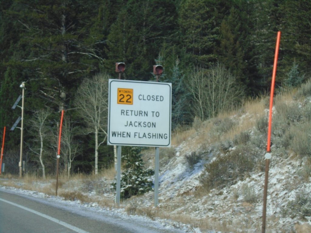
WY-22 West - Return To Jackson When Flashing
WY-22 west at the base of Teton Pass. Return to Jackson When Flashing.
Taken 10-27-2019
 Wilson
Teton County
Wyoming
United States
Wilson
Teton County
Wyoming
United States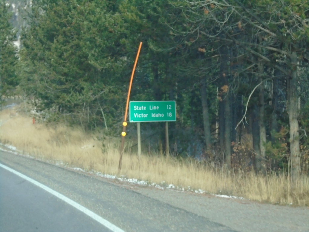
WY-22 West - Distance Marker
Distance marker on WY-22 west. Distance to (Idaho-Wyoming) State Line and Victor Idaho.
Taken 10-27-2019
Wilson
Teton County
Wyoming
United States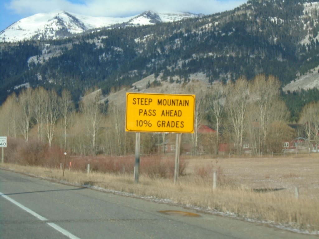
WY-22 West Approaching Teton Pass
WY-22 west approaching Teton Pass. Steep Mountain Pass Ahead - 10% Grades.
Taken 10-27-2019
Wilson
Teton County
Wyoming
United States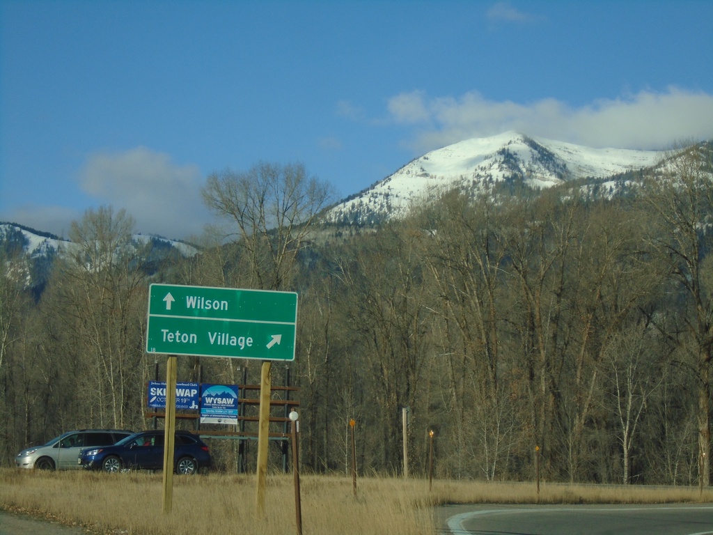
WY-22 West at WY-390 North
WY-22 West at WY-390 North. Turn right for WY-390 north to Teton Village; straight on WY-22 west for Wilson.
Taken 10-27-2019
 Wilson
Teton County
Wyoming
United States
Wilson
Teton County
Wyoming
United States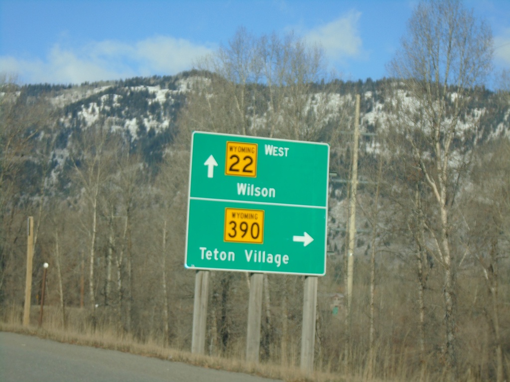
WY-22 West at WY-390
WY-22 West at WY-390 North to Teton Village. Continue west on WY-22 for Wilson.
Taken 10-27-2019
Wilson
Teton County
Wyoming
United States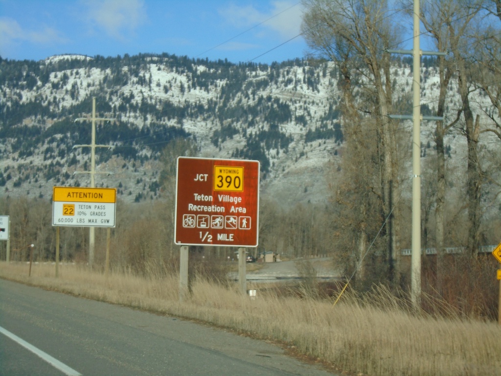
WY-22 West Approaching WY-390
WY-22 West approaching WY-390 in Wilson. Use WY-390 north for Teton Village Recreation Area.
Taken 10-27-2019
Jackson
Teton County
Wyoming
United States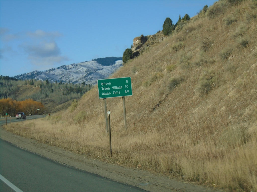
WY-22 West - Distance Marker
Distance marker on WY-22 west. Distance to Wilson, Teton Village (via WY-390) and Idaho Falls (Idaho).
Taken 10-27-2019
Jackson
Teton County
Wyoming
United States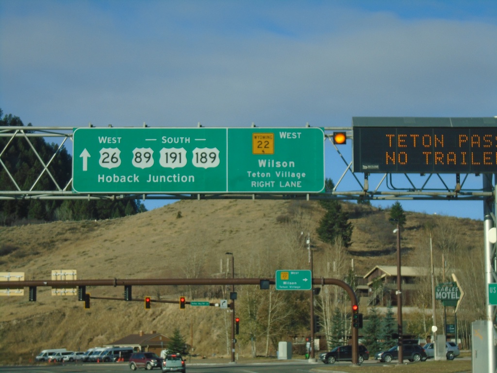
US-89/US-191/US-26/US-189 South At WY-22
US-89/US-191/US-26/US-189 South At WY-22 West to Wilson and Teton Village. Continue on US-89/US-191/US-189 South/US-26 West to Hoback Junction.
Taken 10-27-2019


 Jackson
Teton County
Wyoming
United States
Jackson
Teton County
Wyoming
United States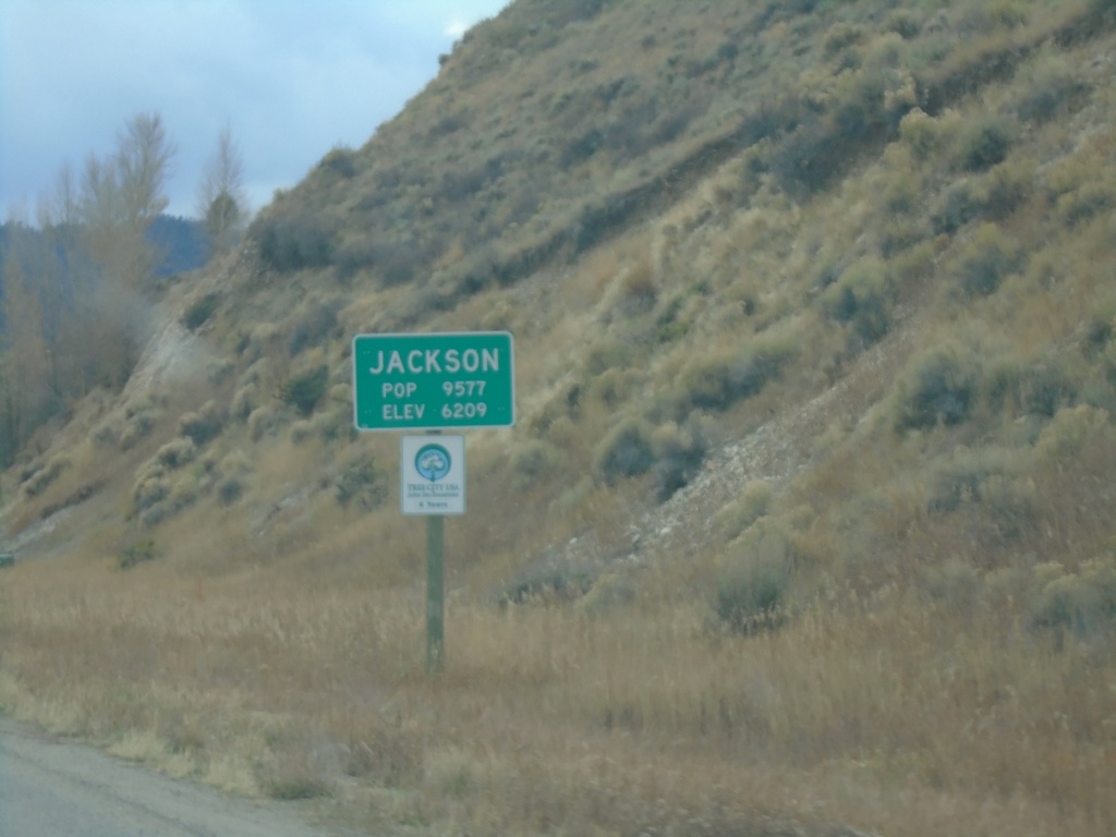
US-26 West/US-89/US-191 South - Jackson
Entering Jackson on US-26 West/US-89/US-191 South. Jackson is the seat of Teton County. Elevation 6209 - Population 9577.
Taken 10-26-2019
Jackson
Teton County
Wyoming
United States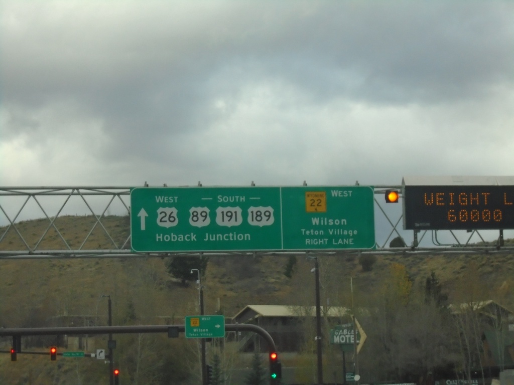
US-89/US-191/US-26/US-189 South At WY-22
US-89/US-191/US-26/US-189 South At WY-22 West to Wilson and Teton Village. Continue on US-89/US-191/US-189 South/US-26 West to Hoback Junction.
Taken 10-26-2019
Jackson
Teton County
Wyoming
United States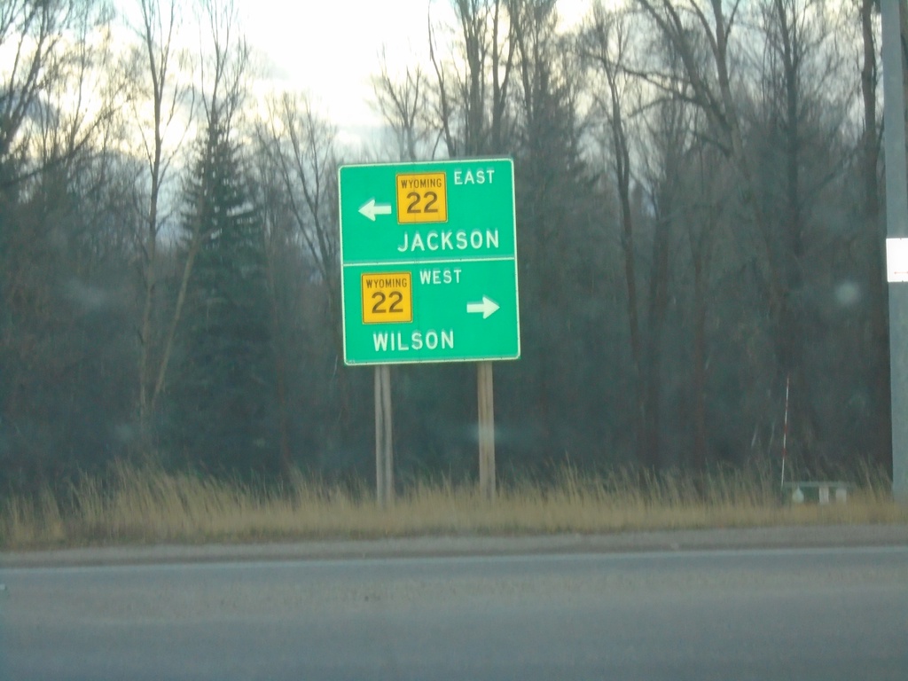
End WY-390 South at WY-22
End WY-390 south at WY-22. Turn left on WY-22 east for Jackson; left on WY-22 west for Wilson.
Taken 10-26-2019
Wilson
Teton County
Wyoming
United States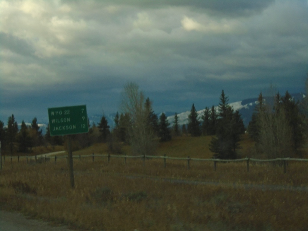
WY-390 South - Distance Marker
Distance marker on WY-390 south. Distance to WYO-22, Wilson, and Jackson.
Taken 10-26-2019
Wilson
Teton County
Wyoming
United States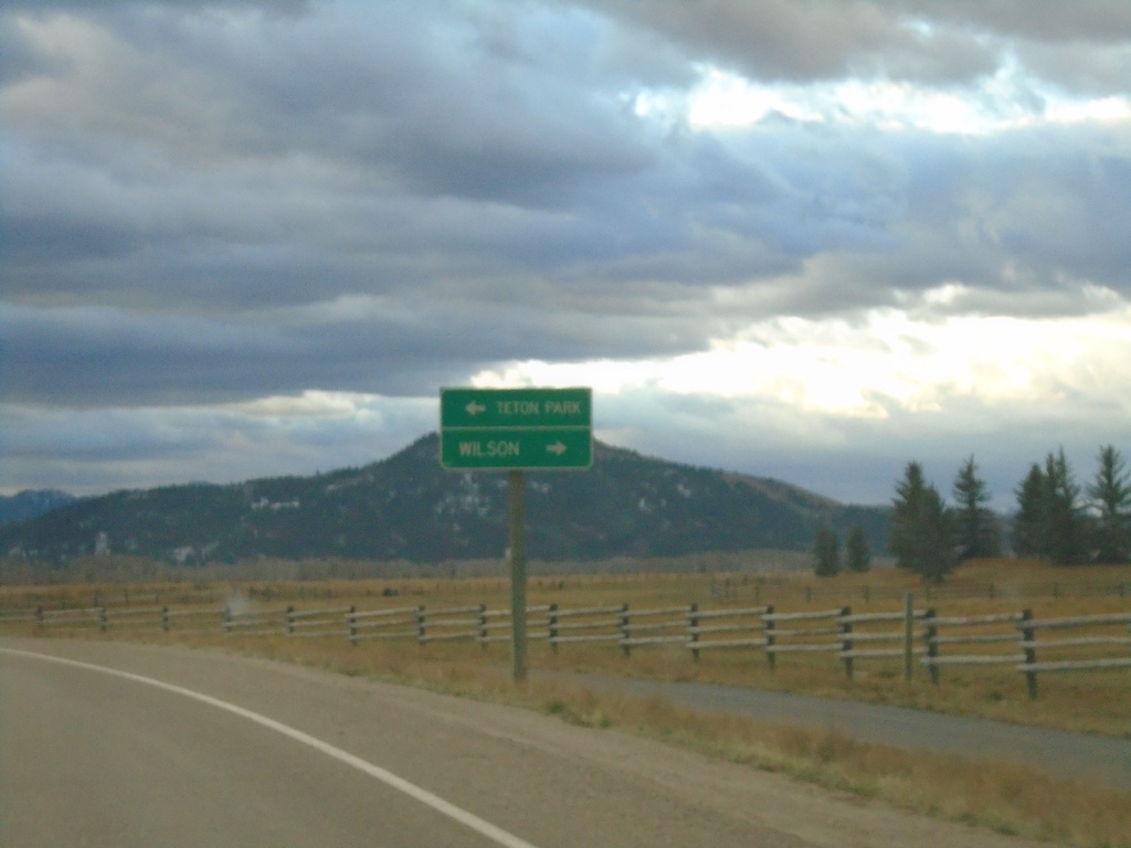
Teton Village Road Approaching WY-390
Teton Village Road approaching WY-390. Turn left for Teton (National) Park; right for Wilson.
Taken 10-26-2019
Teton Village
Teton County
Wyoming
United States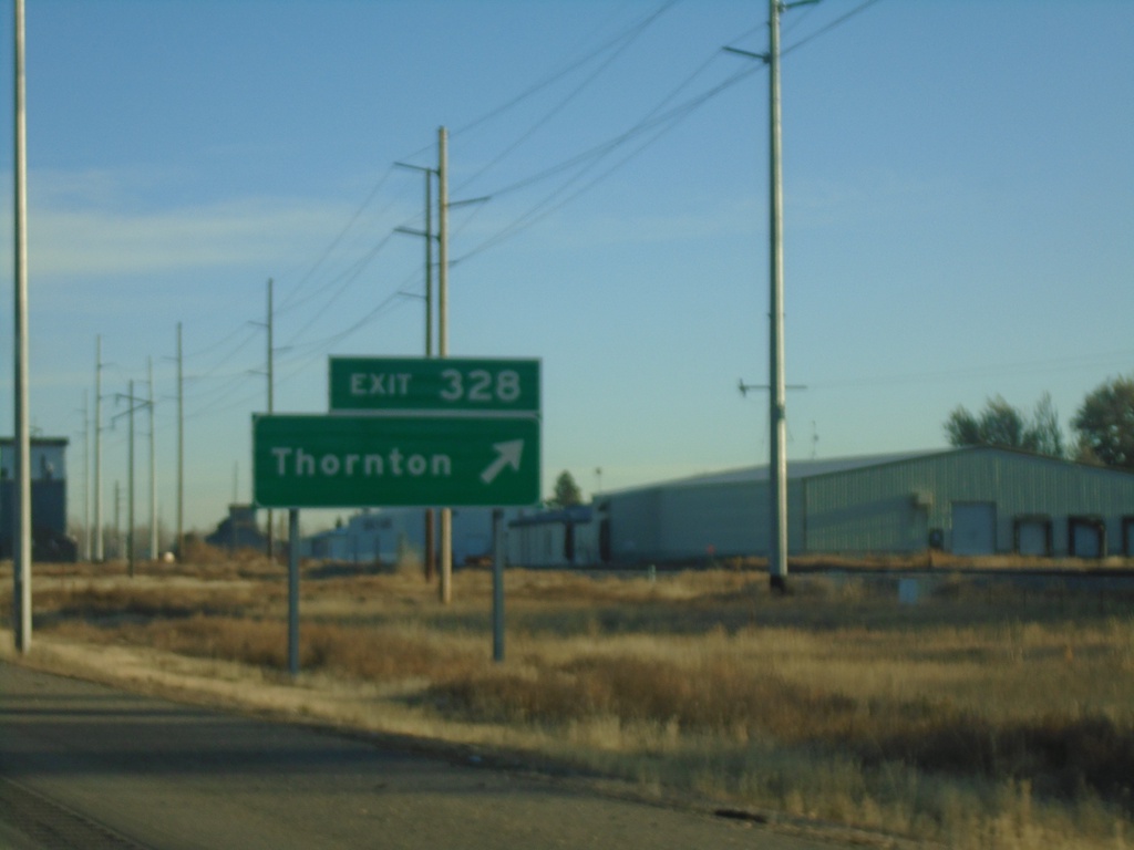
US-20 East - Exit 328
US-20 east at Exit 328 - Thornton.
Taken 10-25-2019
 Rexburg
Madison County
Idaho
United States
Rexburg
Madison County
Idaho
United States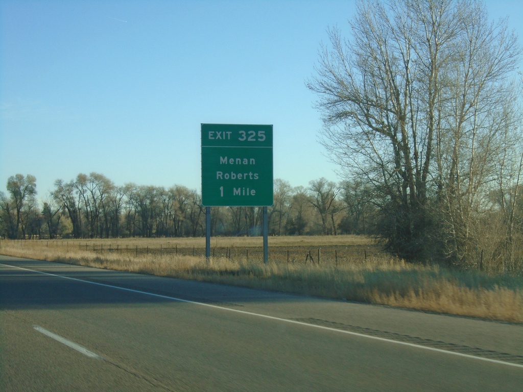
US-20 East - Exit 325
US-20 east approaching Exit 325 - Menan/Roberts.
Taken 10-25-2019
Rigby
Jefferson County
Idaho
United States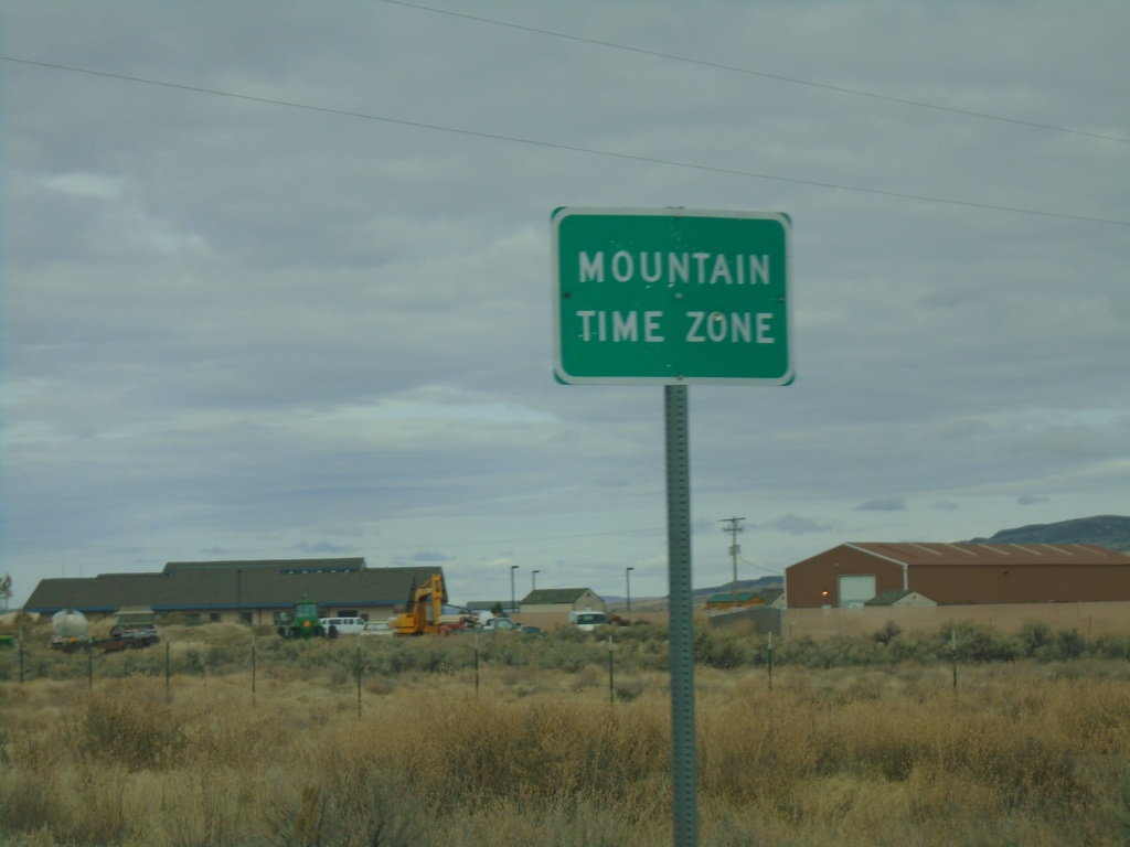
NV-225 North - Mountain Time
Entering Mountain Time Zone on NV-225 north, approaching the Idaho state line. The official time zone boundary is the Nevada-Idaho state line, but the towns of Owyhee and Mountain City, NV both observe Mountain Time.
Taken 10-20-2019
 Owyhee
Elko County
Nevada
United States
Owyhee
Elko County
Nevada
United States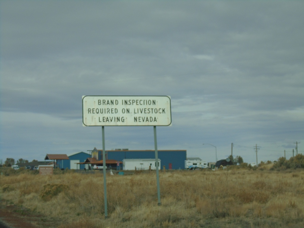
NV-225 North - Brand Inspection Required
Brand Inspection Required on Livestock Leaving Nevada on NV-225 north.
Taken 10-20-2019
Owyhee
Elko County
Nevada
United States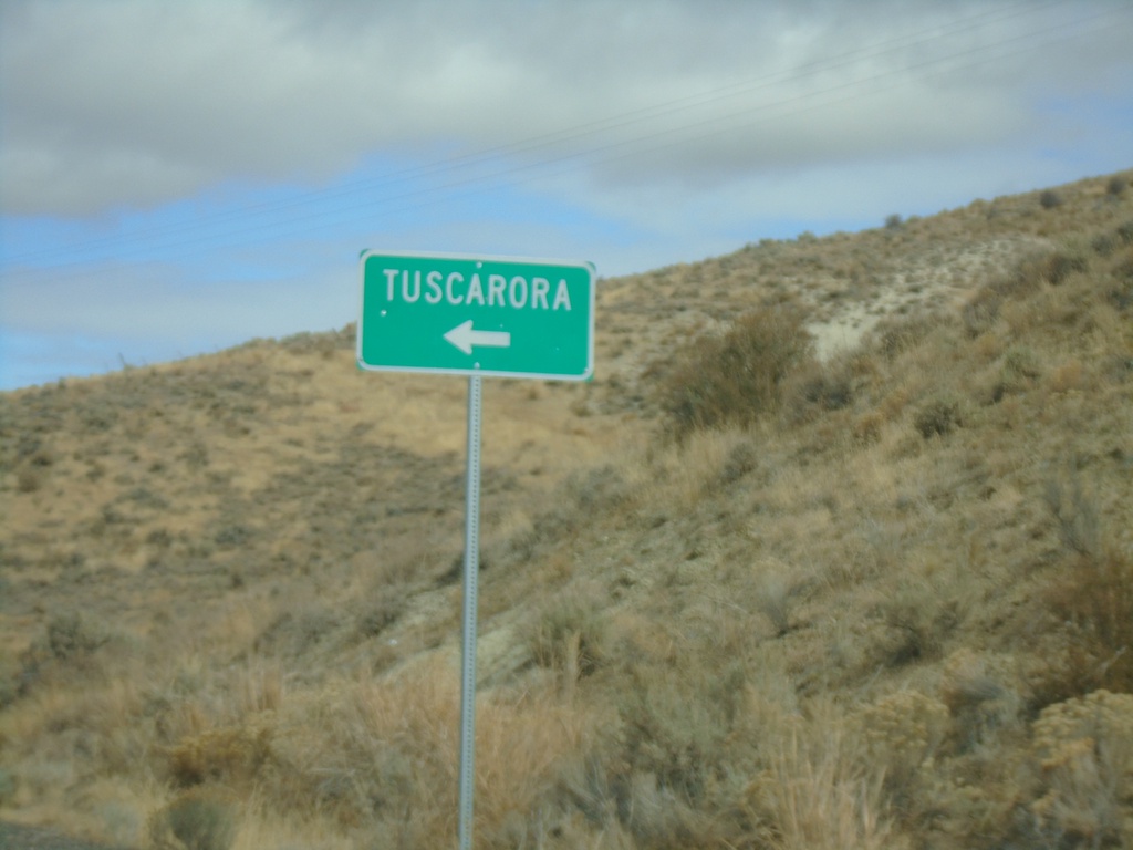
NV-226 North - Tuscarora Junction
NV-226 North at Tuscarora junction
Taken 10-20-2019
 Tuscarora
Elko County
Nevada
United States
Tuscarora
Elko County
Nevada
United States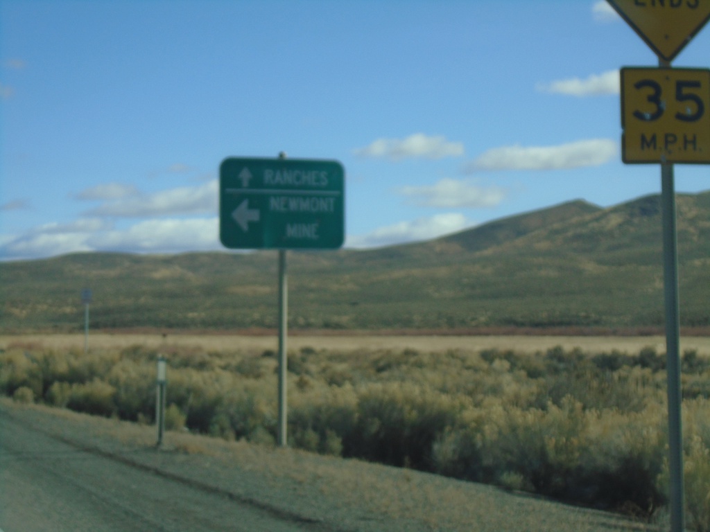
End NV-766 North
End NV-766 North in Eureka County. Turn left for Newmont Mine; continue straight for Ranches (Maggie Creek Road).
Taken 10-20-2019
 Carlin
Eureka County
Nevada
United States
Carlin
Eureka County
Nevada
United States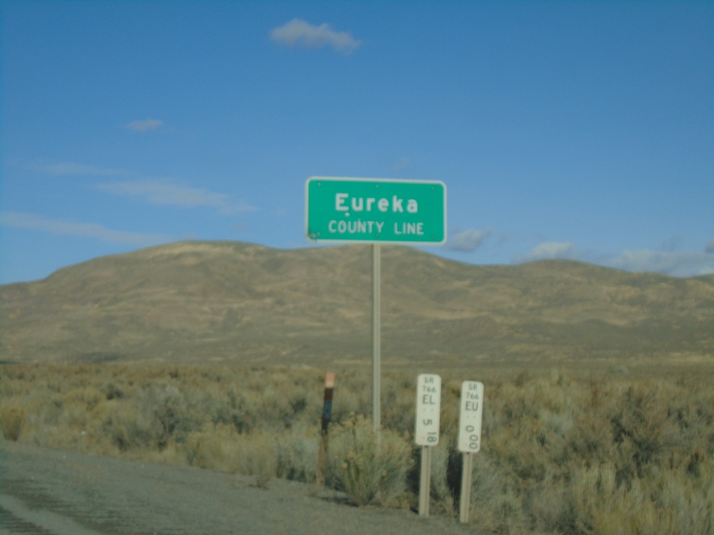
I-80 East - Eureka County Line
I-80 east at Eureka County Line.
Taken 10-20-2019
 Battle Mountain
Eureka County
Nevada
United States
Battle Mountain
Eureka County
Nevada
United States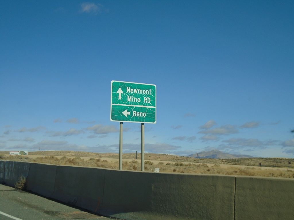
NV-766 North at I-80 West
NV-766 North at I-80 West to Reno. Continue north for NV-766/Newmont Mine Road.
Taken 10-20-2019
Carlin
Elko County
Nevada
United States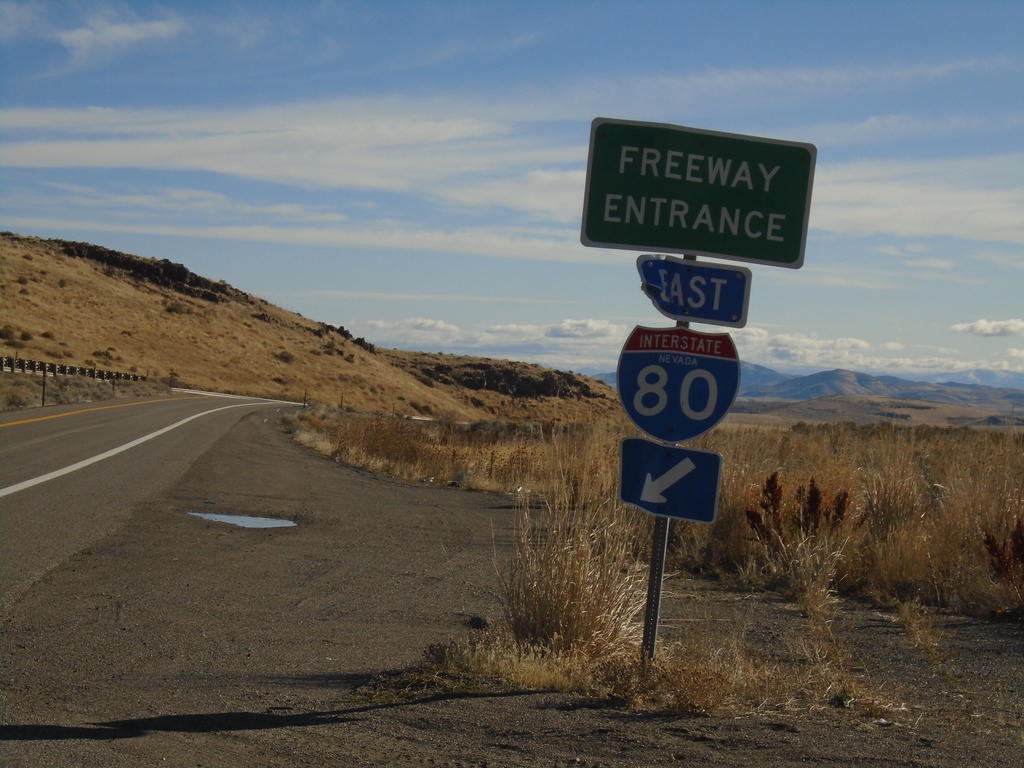
I-80 East - Exit 271 Onramp
I-80 East - Exit 271 Onramp.
Taken 10-20-2019
Primeaux
Eureka County
Nevada
United States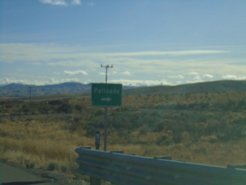
I-80 East - Exit 271 Offramp
I-80 East - Exit 271 Offramp. Turn right for Palisade.
Taken 10-20-2019
Primeaux
Eureka County
Nevada
United States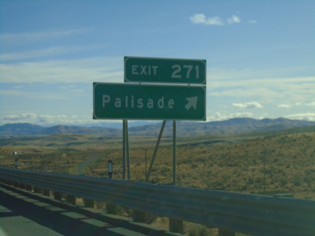
I-80 East - Exit 271
I-80 east at Exit 271 - Palisade
Taken 10-20-2019
Primeaux
Eureka County
Nevada
United States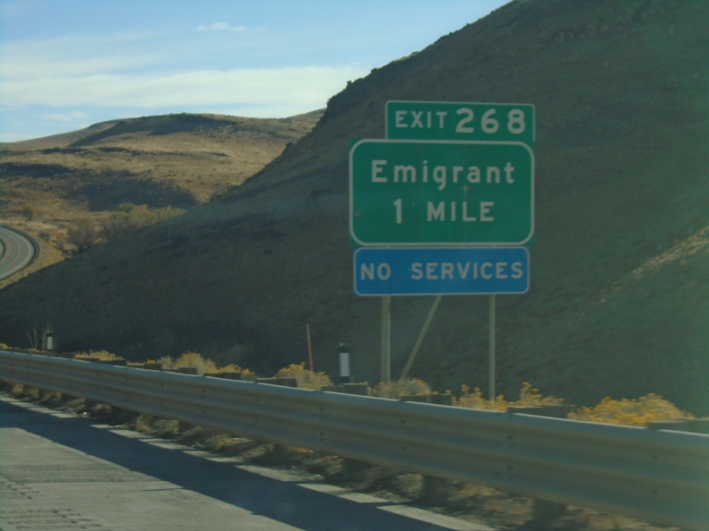
I-80 East - Exit 268
I-80 east approaching Exit 268 - Emigrant
Taken 10-20-2019
Primeaux
Eureka County
Nevada
United States