Signs Tagged With Big Green Sign
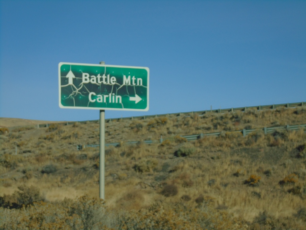
NV-306 North at I-80 (Exit 261)
NV-306 North at I-80 (Exit 261). Use I-80 west for Battle Mountain; I-80 east for Carlin.
Taken 10-20-2019

 Crescent Valley
Eureka County
Nevada
United States
Crescent Valley
Eureka County
Nevada
United States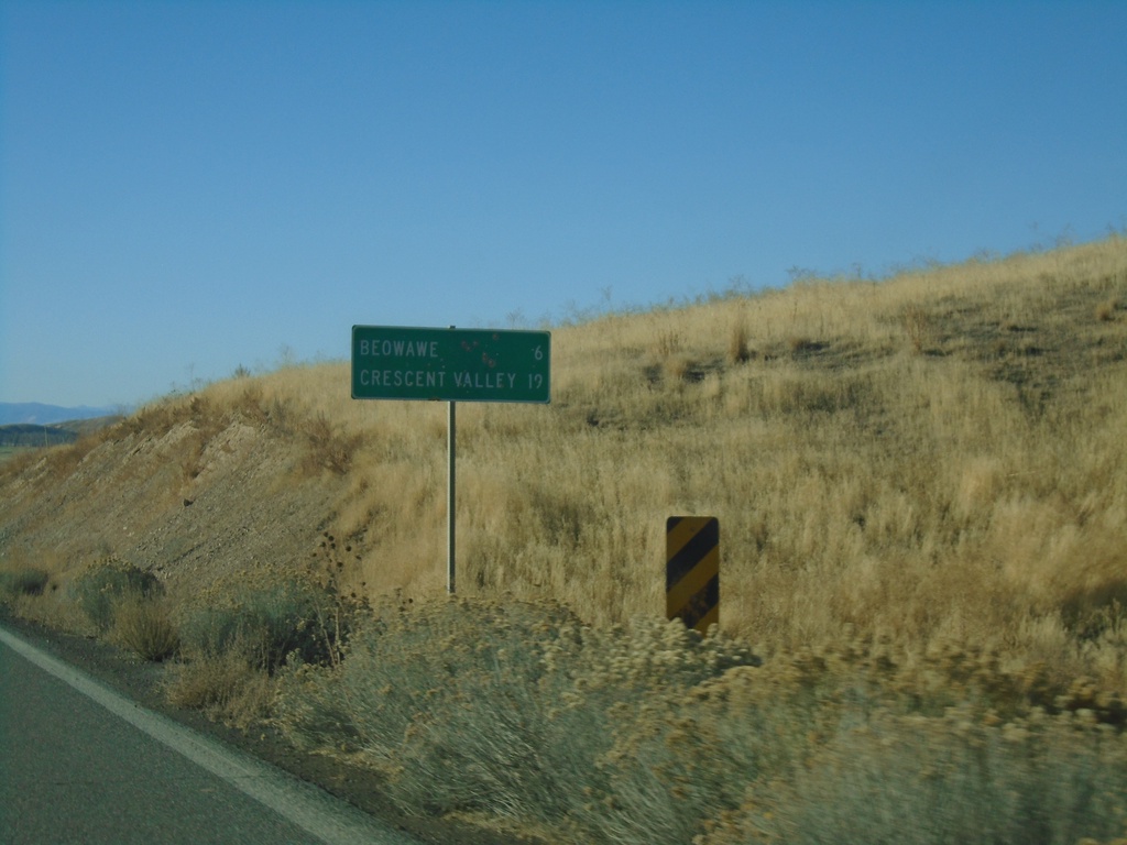
NV-306 South - Distance Marker
Distance marker on NV-306 south. Distance to Beowawe and Crescent Valley.
Taken 10-20-2019
Crescent Valley
Eureka County
Nevada
United States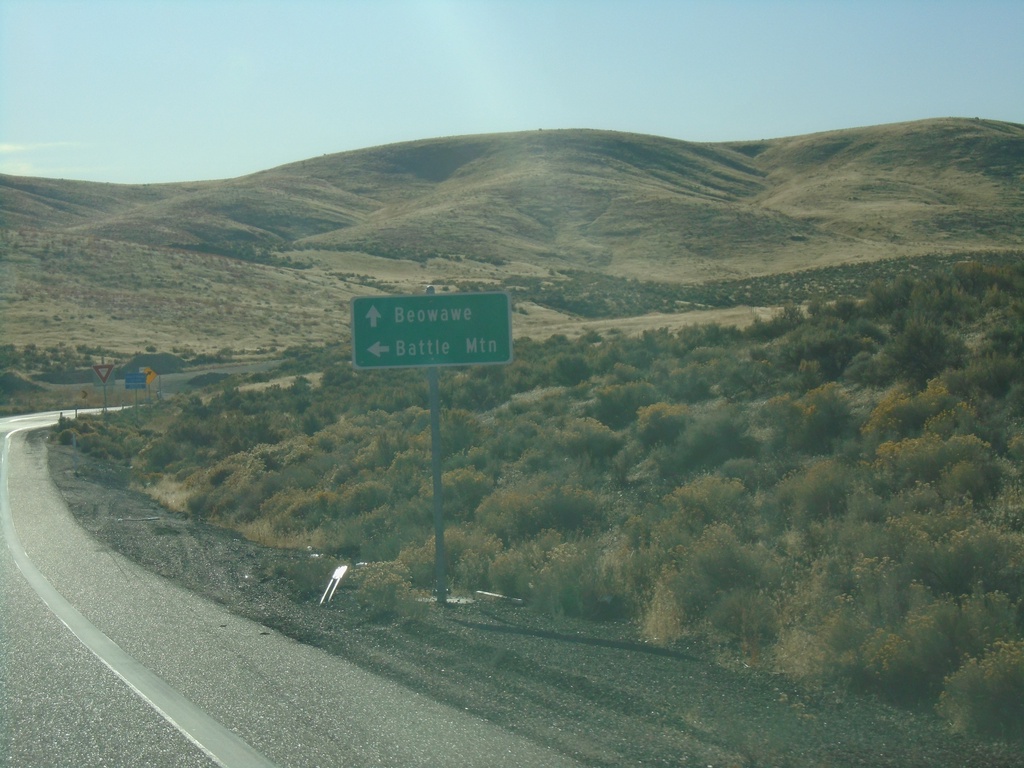
I-80 East Exit 261 Offramp at NV-306
I-80 offramp at NV-306 south to Beowawe. Turn left to return to I-80 west to Battle Mountain
Taken 10-20-2019
Beowawe
Eureka County
Nevada
United States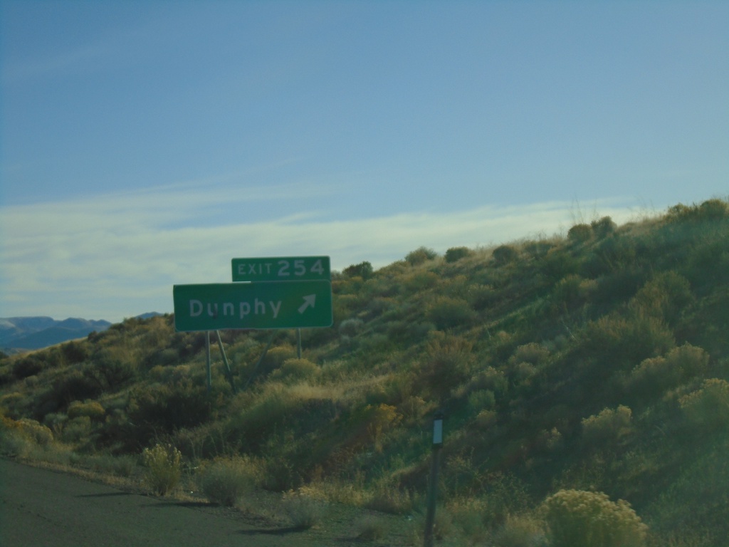
I-80 East - Exit 254
I-80 East at Exit 254 - Dunphy
Taken 10-20-2019
Battle Mountain
Eureka County
Nevada
United States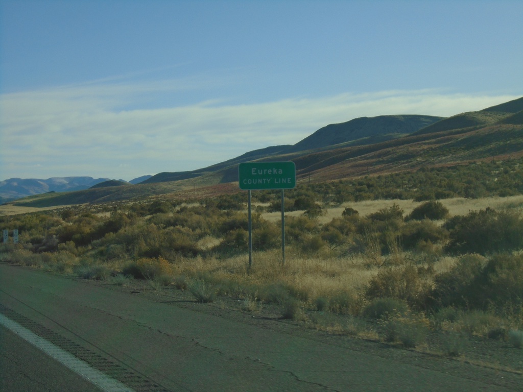
I-80 East - Eureka County Line
I-80 east at Eureka County Line.
Taken 10-20-2019
Battle Mountain
Eureka County
Nevada
United States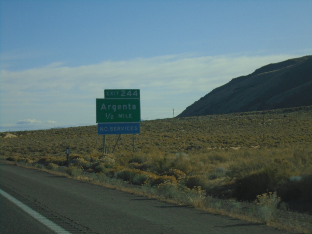
I-80 East - Exit 244
I-80 east approaching Exit 244 - Argenta
Taken 10-20-2019
Argenta
Lander County
Nevada
United States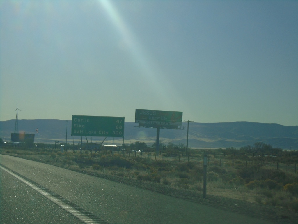
I-80 East - Distance Marker
Distance marker on I-80 east. Distance to Carlin, Elko, and Salt Lake City. This is the first appearance of Salt Lake City as a control city along I-80 east in Nevada.
Taken 10-20-2019
Battle Mountain
Lander County
Nevada
United States
BL-80/NV-304 East at I-80 West
BL-80/NV-304 East at I-80 West to Winnemucca. Use I-80 east for Elko.
Taken 10-20-2019

 Battle Mountain
Lander County
Nevada
United States
Battle Mountain
Lander County
Nevada
United States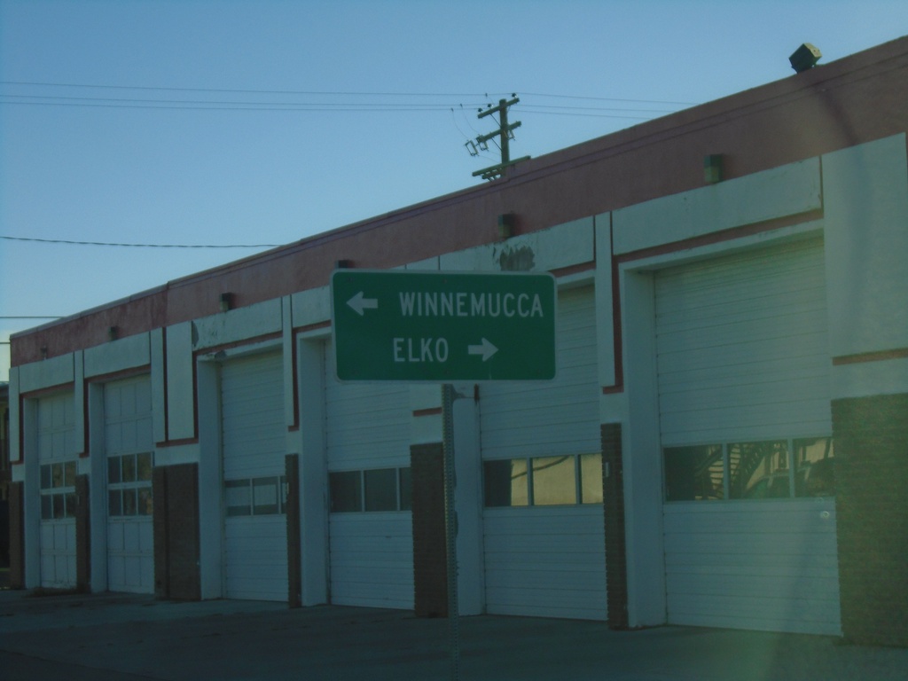
End NV-305 North at BL-80/NV-304
End of NV-305 at BL-80/NV-304. Turn right on BL-80/NV-304 for Elko; turn left on BL-80/NV-304 for Winnemucca.
Taken 10-20-2019
 Battle Mountain
Lander County
Nevada
United States
Battle Mountain
Lander County
Nevada
United States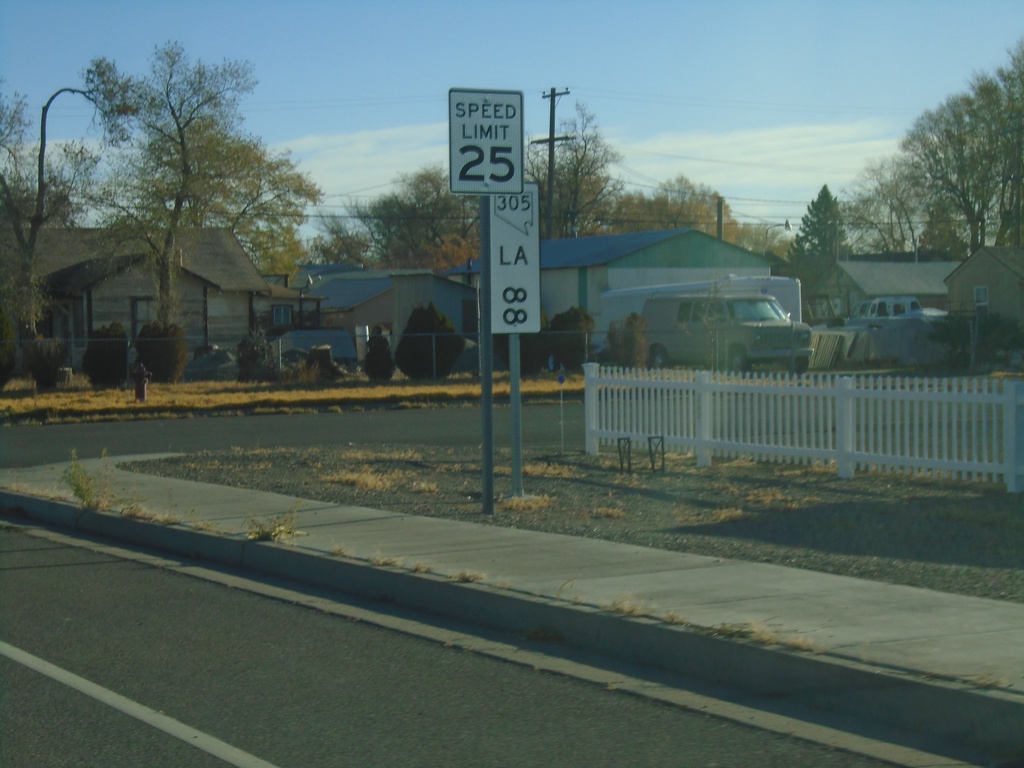
NV-305 North - Postmile 88
NV-305 North - Lander County Postmile 88
Taken 10-20-2019
Battle Mountain
Lander County
Nevada
United States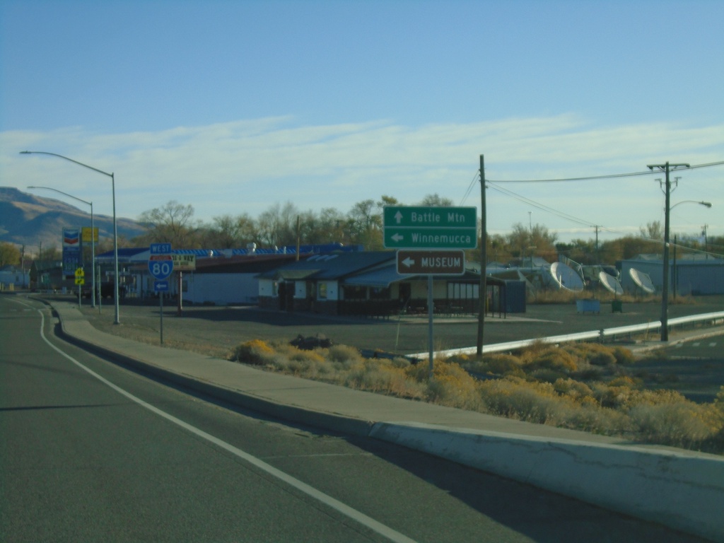
NV-305 North at I-80 West
NV-305 North at I-80 West (Exit 231). Use I-80 west for Winnemucca. Continue north on NV-305 for Battle Mountain.
Taken 10-20-2019
Battle Mountain
Lander County
Nevada
United States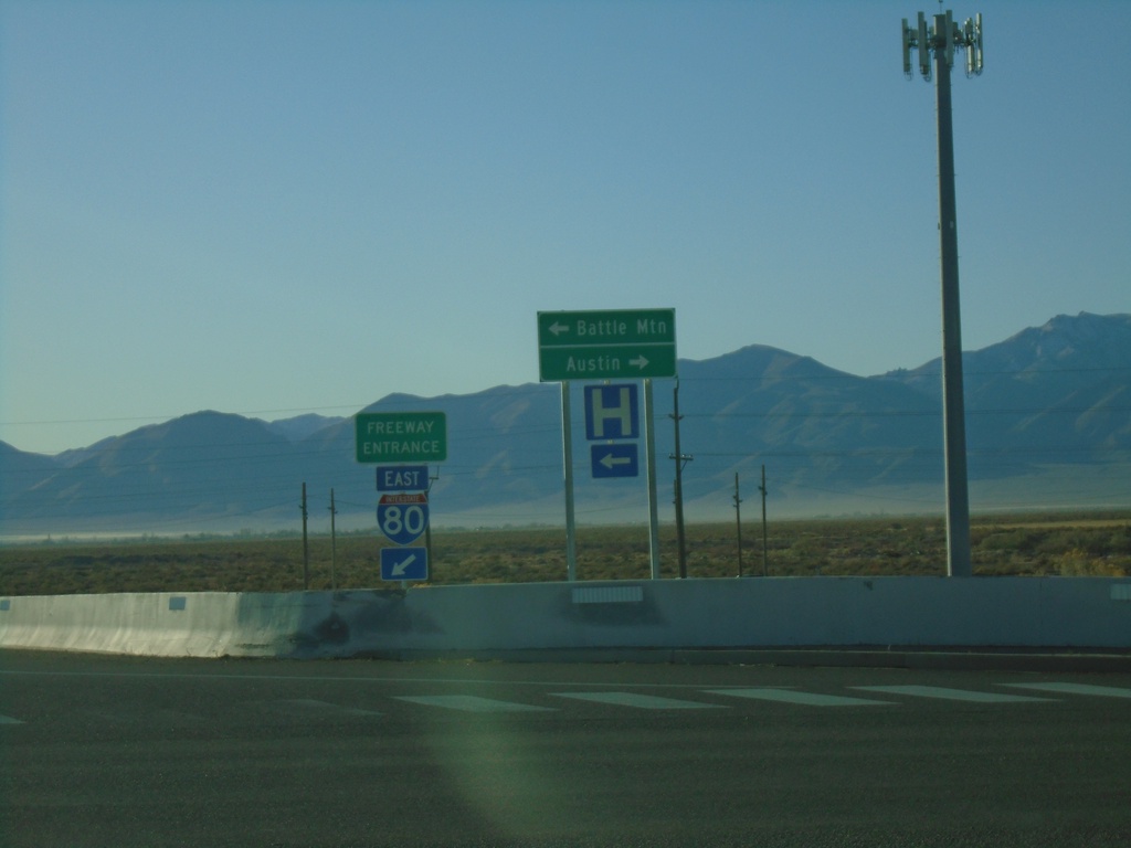
I-80 East Exit 231 Offramp at NV-305
I-80 East Exit 231 Offramp at NV-305 in Battle Mountain. Use NV-305 North for Battle Mountain; NV-305 South for Austin.
Taken 10-20-2019
Battle Mountain
Lander County
Nevada
United States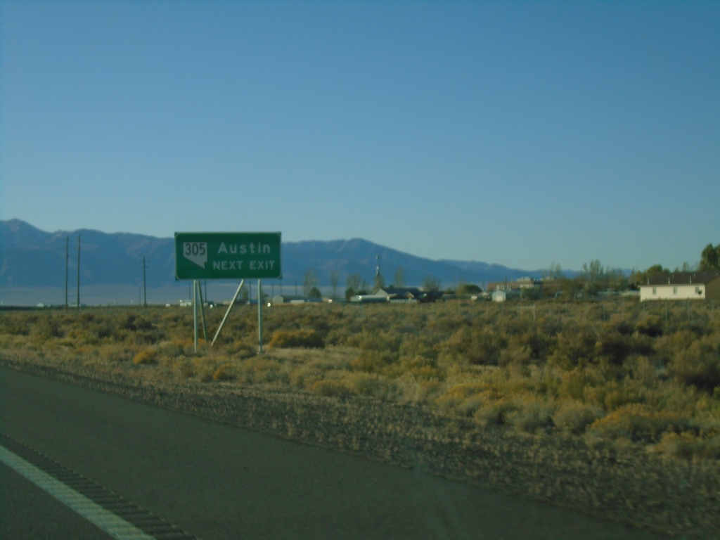
I-80 East Exit 231 - Use NV-305 For Austin
I-80 east approaching Exit 231. Use NV-305 South for Austin.
Taken 10-20-2019
Battle Mountain
Lander County
Nevada
United States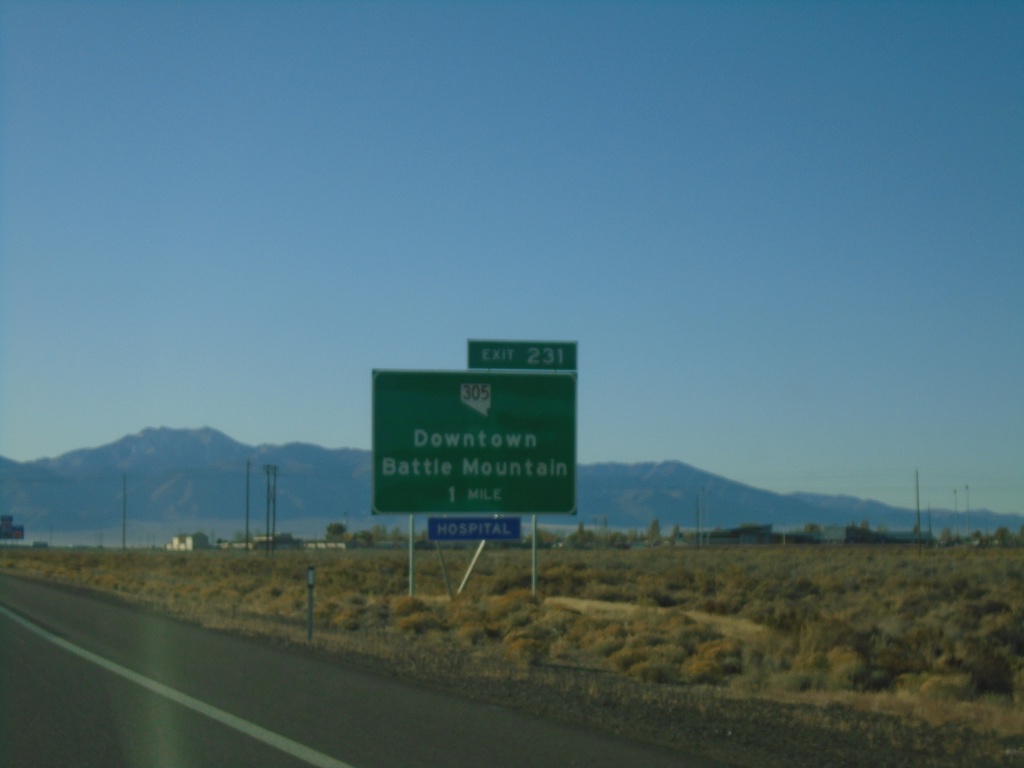
I-80 East - Exit 231
I-80 east approaching Exit 231 - NV-305/Downtown Battle Mountain
Taken 10-20-2019
Battle Mountain
Lander County
Nevada
United States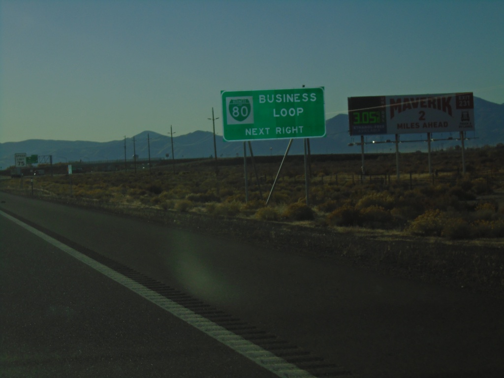
I-80 East Approaching Business Loop I-80
I-80 East approaching Business Loop I-80 in Battle Mountain.
Taken 10-20-2019
Battle Mountain
Lander County
Nevada
United States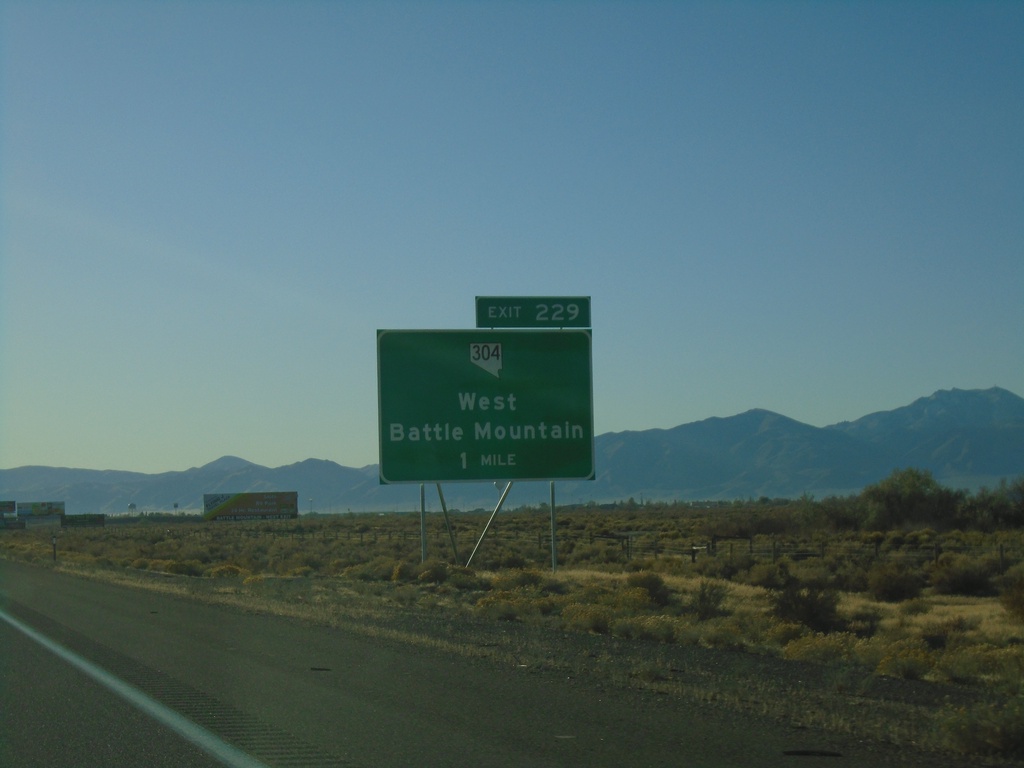
I-80 East - Exit 229
I-80 east approaching Exit 229 - NV-304/West Battle Mountain.
Taken 10-20-2019
Battle Mountain
Lander County
Nevada
United States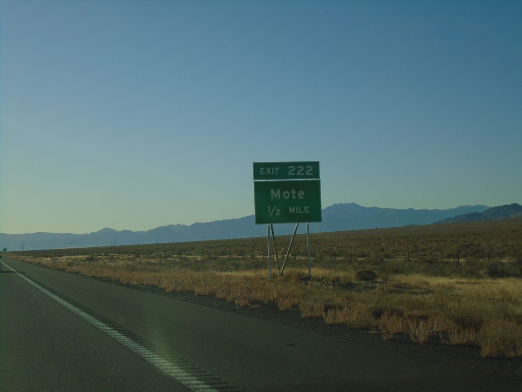
I-80 East - Exit 222
I-80 east approaching Exit 222 - Mote
Taken 10-20-2019
Valmy
Humboldt County
Nevada
United States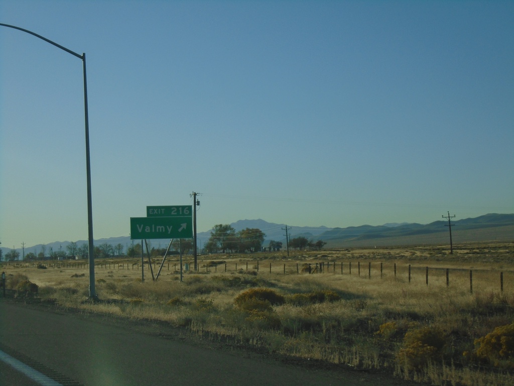
I-80 East - Exit 216
I-80 east at Exit 216 - Valmy
Taken 10-20-2019
Valmy
Humboldt County
Nevada
United States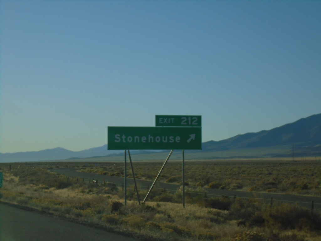
I-80 East - Exit 212
I-80 east at Exit 212 - Stonehouse.
Taken 10-20-2019
Valmy
Humboldt County
Nevada
United States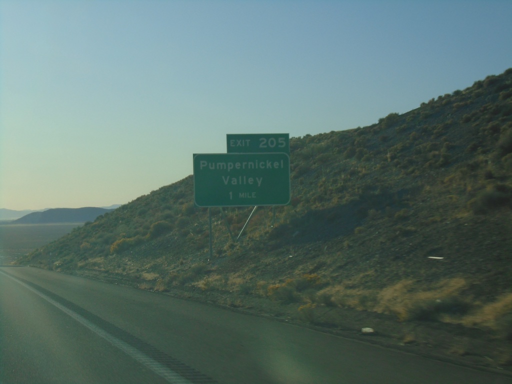
I-80 East - Exit 205
I-80 east approaching Exit 205 - Pumpernickel Valley
Taken 10-20-2019
Golconda
Humboldt County
Nevada
United States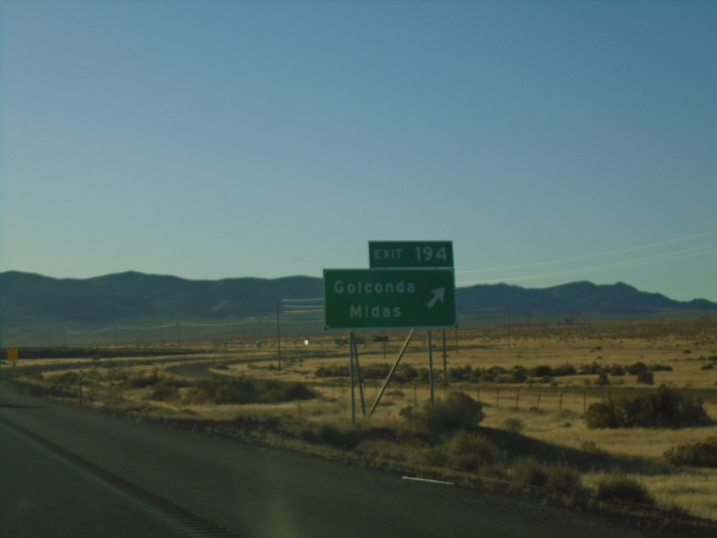
I-80 East - Exit 194
I-80 east at Exit 194 - Golconda/Midas
Taken 10-20-2019
 Golconda
Humboldt County
Nevada
United States
Golconda
Humboldt County
Nevada
United States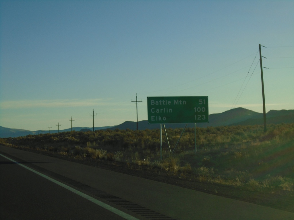
I-80 East - Distance Marker
Distance marker on I-80 west. Distance to Battle Mountain, Carlin, and Elko.
Taken 10-20-2019
Winnemucca
Humboldt County
Nevada
United States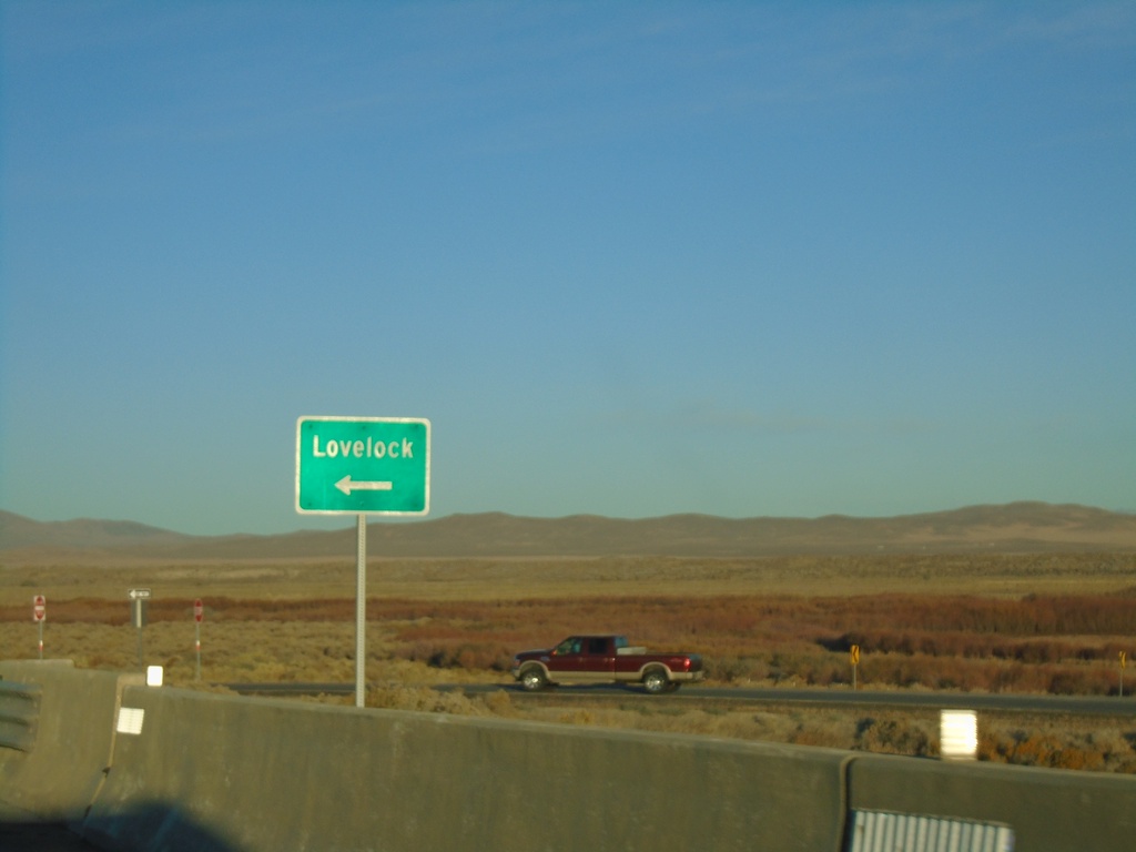
Winnemucca Blvd. at I-80 West
Winnemucca Blvd. at I-80 West to Lovelock (Exit 173).
Taken 10-20-2019
Winnemucca
Humboldt County
Nevada
United States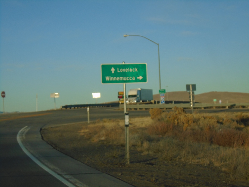
Winnemucca Blvd. West at I-80 (Exit 173)
Winnemucca Blvd. West at I-80 (Exit 173). Use I-80 West for Lovelock; I-80 East for Winnemucca.
Taken 10-20-2019
Winnemucca
Humboldt County
Nevada
United States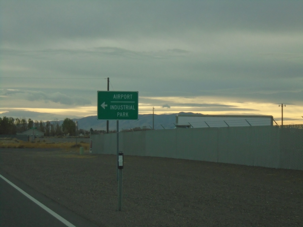
Rose Creek Road West at NV-796
Rose Creek Road West at NV-796 to Airport and Industrial Park.
Taken 10-19-2019
 Winnemucca
Humboldt County
Nevada
United States
Winnemucca
Humboldt County
Nevada
United States