Signs Tagged With Big Green Sign
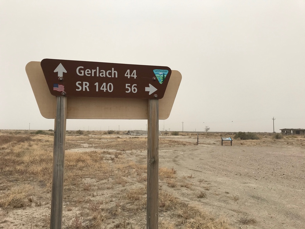
Jungo Road at Jackson Creek Ranch Road
Jungo Road West at Jackson Creek Ranch Road. Use Jackson Creek Ranch Road north for NV-140; continue on Jungo Road west for Gerlach.
Taken 10-19-2019
Sulphur Humboldt County Nevada United States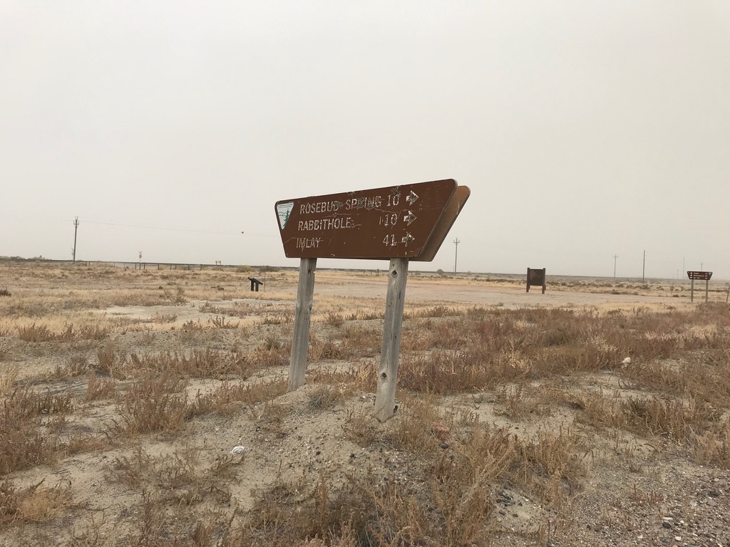
Jungo Road at County Road
Jungo Road at County Road south to Imlay, Rabbithole, and Rosebud Spring. Taken in the ghost town of Sulphur.
Taken 10-19-2019
Winnemucca Humboldt County Nevada United States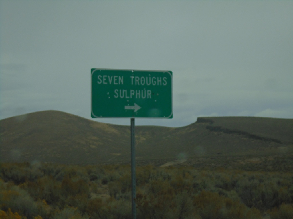
NV-399 West at Seven Troughs Road
NV-399 West at Seven Troughs Road to Seven Troughs and Sulphur
Taken 10-19-2019
 Pershing County
Nevada
United States
Pershing County
Nevada
United States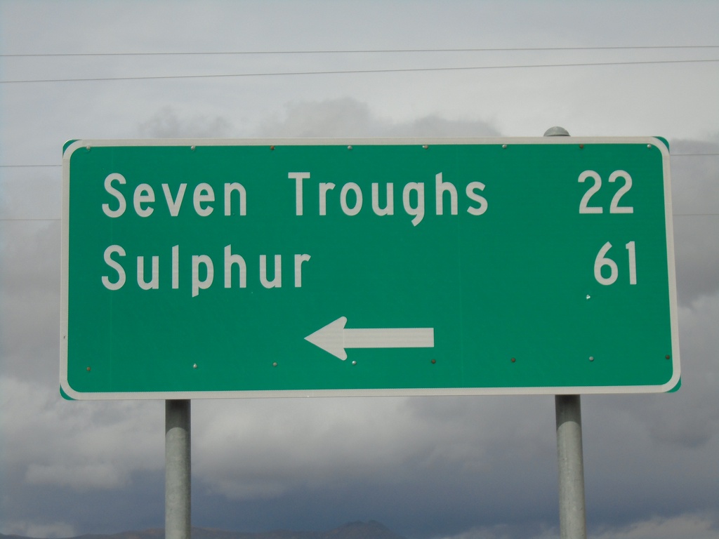
End NV-854 at NV-399
End NV-854 at NV-399 in Pershing County. Use NV-399 west for Seven Troughs and Sulphur.
Taken 10-19-2019
 Lovelock
Pershing County
Nevada
United States
Lovelock
Pershing County
Nevada
United States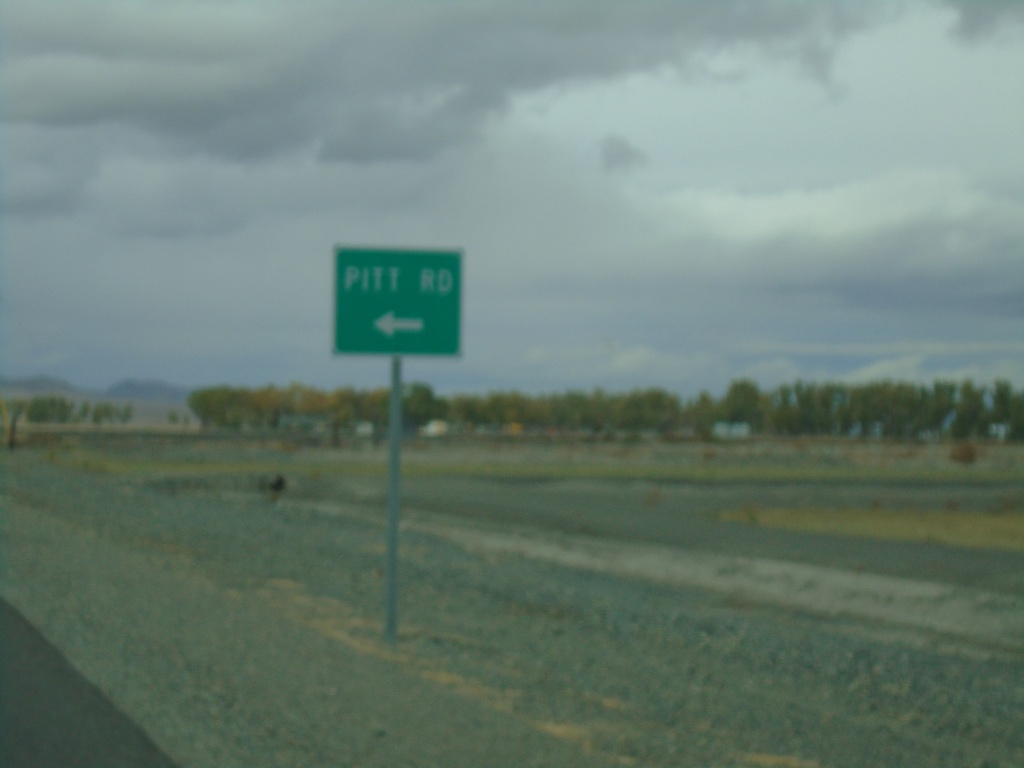
NV-398 North Approaching NV-399
NV-398 North (North Meridian Road) approaching NV-399/Pitt Road.
Taken 10-19-2019
 Lovelock
Pershing County
Nevada
United States
Lovelock
Pershing County
Nevada
United States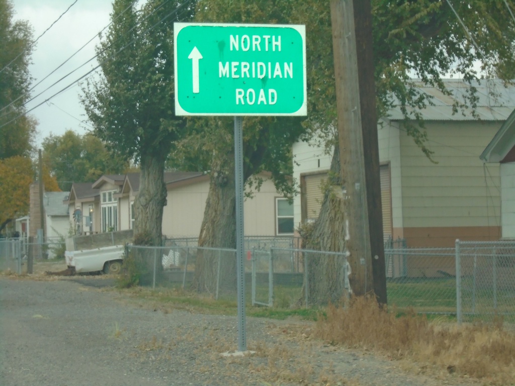
NV-398 North - North Meridian Road
NV-398 North (Central Ave.) becomes North Meridian Road after leaving Lovelock city limits.
Taken 10-19-2019
Lovelock
Pershing County
Nevada
United States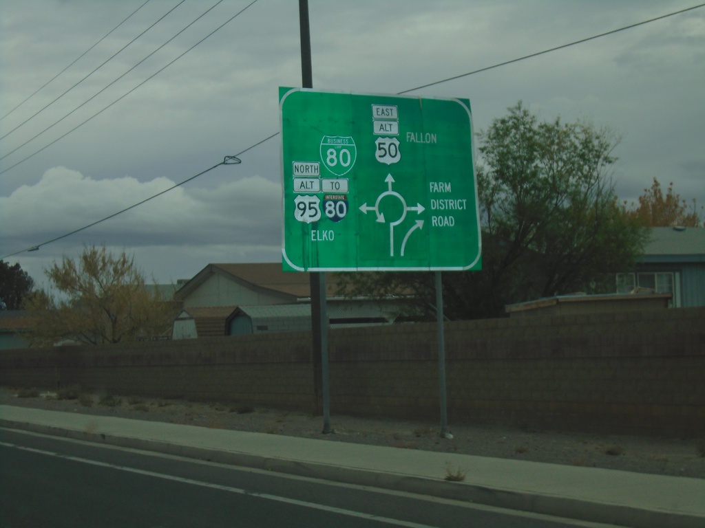
Alt. US-95 North/Alt. US-50 East/BL-80 East - Roundabout
Approaching roundabout on Alt. US-95 North/Alt. US-50 East/BL-80 East. Roundabout for BL-80 East/To I-80/Alt. US-95 North/Elko; Alt. US-50 East to Fallon; (NV-828)/Farm District Road.
Taken 10-19-2019


 Fernley
Lyon County
Nevada
United States
Fernley
Lyon County
Nevada
United States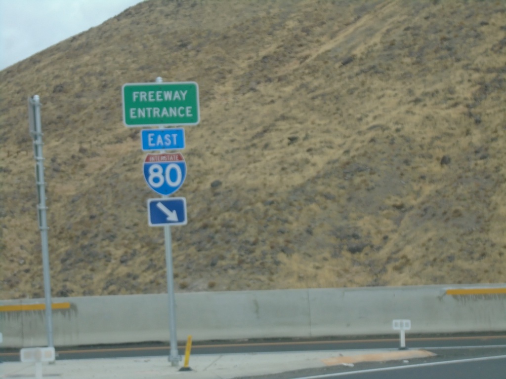
End NV-439 North at I-80
End NV-439 North at I-80 East (Exit 32)
Taken 10-19-2019

 Clark
Storey County
Nevada
United States
Clark
Storey County
Nevada
United States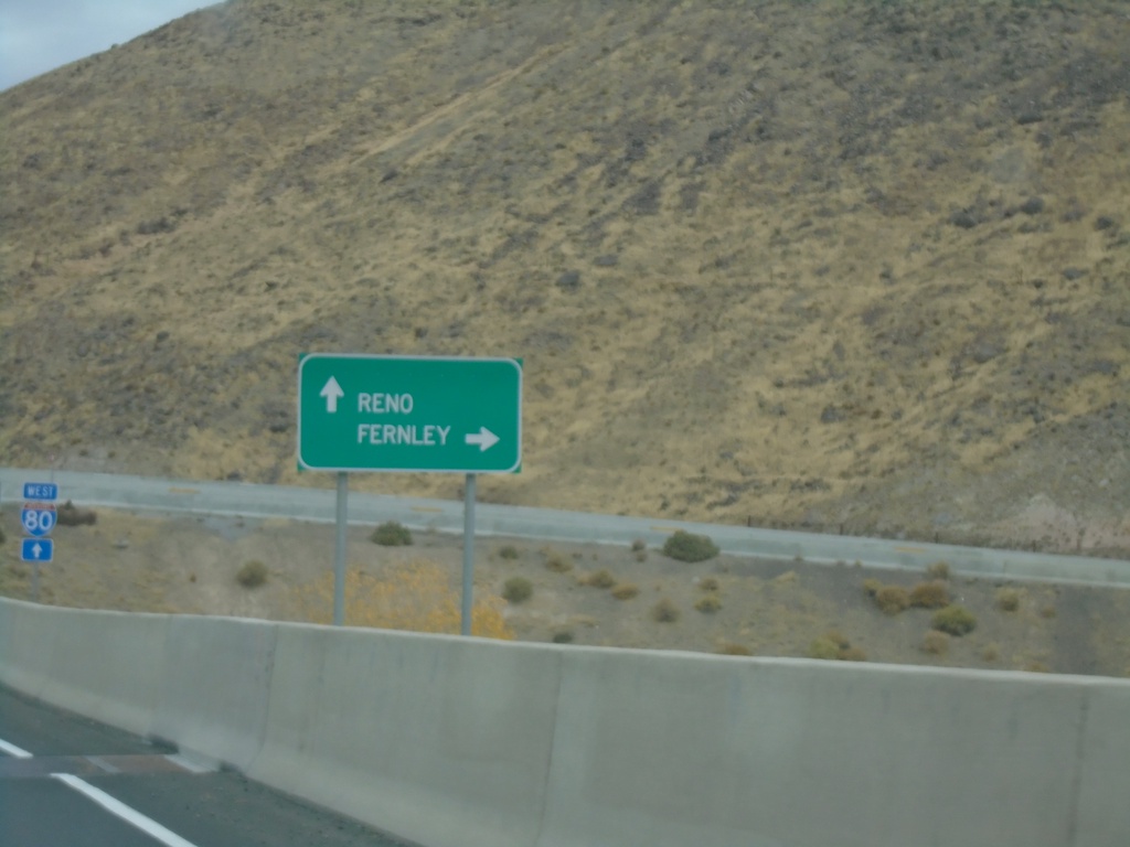
NV-439 North approaching I-80
NV-439 North approaching I-80. Use I-80 west for Reno; I-80 east for Fernley.
Taken 10-19-2019
Clark
Storey County
Nevada
United States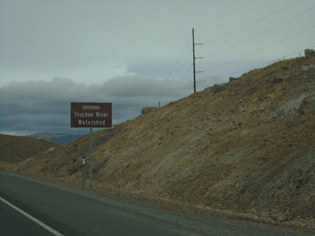
NV-439 North - Truckee Watershed
Entering the Truckee River Watershed on NV-439 north.
Taken 10-19-2019
Fernley
Lyon County
Nevada
United States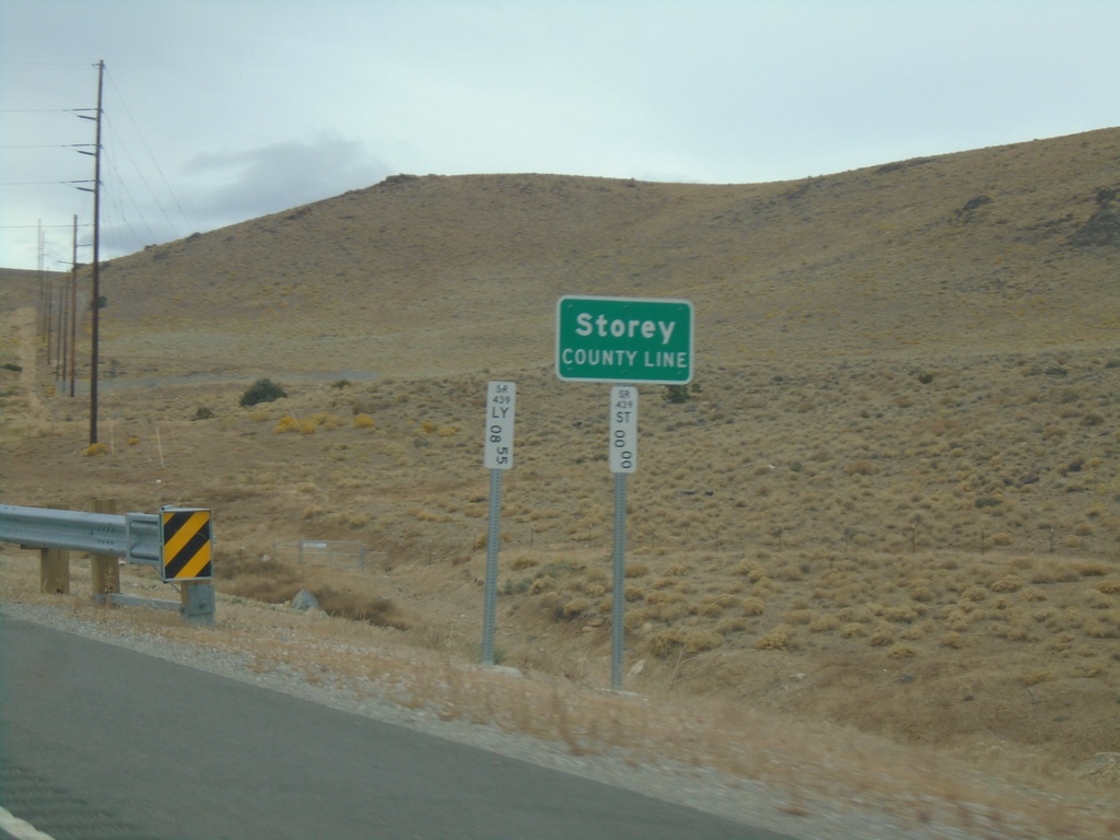
NV-439 North - Storey County
Storey County Line on NV-439 north.
Taken 10-19-2019
Silver Springs
Storey County
Nevada
United States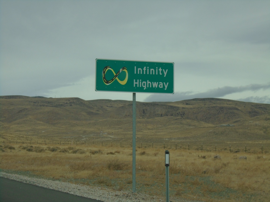
NV-439 North - Infinity Highway
Infinity Highway on NV-439 North. NV-439 North passes by the Tesla Gigafactory.
Taken 10-19-2019
Silver Springs
Lyon County
Nevada
United States
NV-439 North - Distance Marker
Distance marker on NV-439 North. Distance to I-80.
Taken 10-19-2019
Silver Springs
Lyon County
Nevada
United States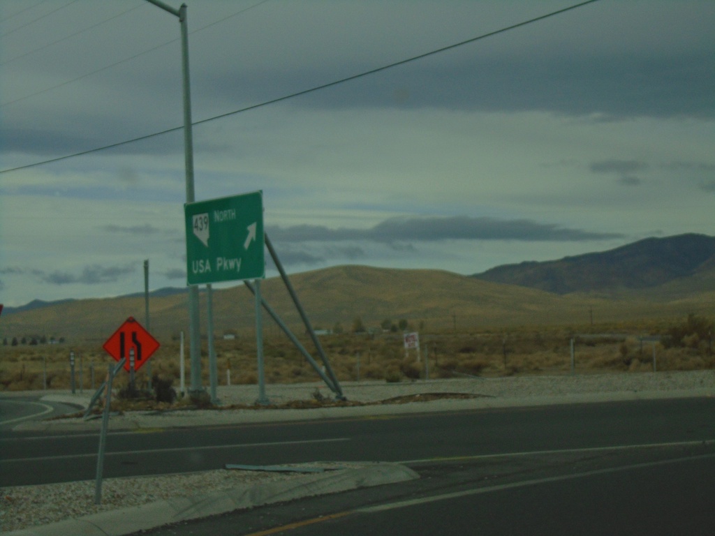
US-50 West at NV-439 North
US-50 West Roundabout at NV-439 North/USA Parkway
Taken 10-19-2019
 Silver Springs
Lyon County
Nevada
United States
Silver Springs
Lyon County
Nevada
United States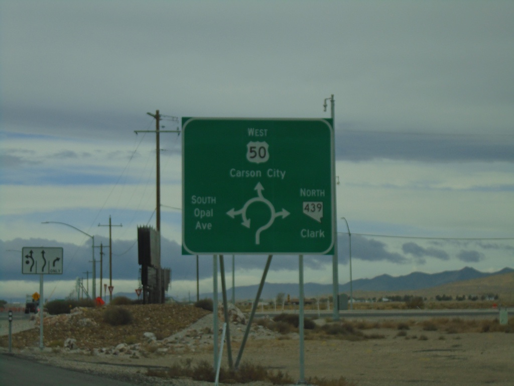
US-50 West at NV-439 Roundabout
US-50 West at NV-439 roundabout in Lyon County. Use US-50 West for Carson City; use NV-439 North for Clark; South Opal Ave. also enters the roundabout here.
Taken 10-19-2019
Silver Springs
Lyon County
Nevada
United States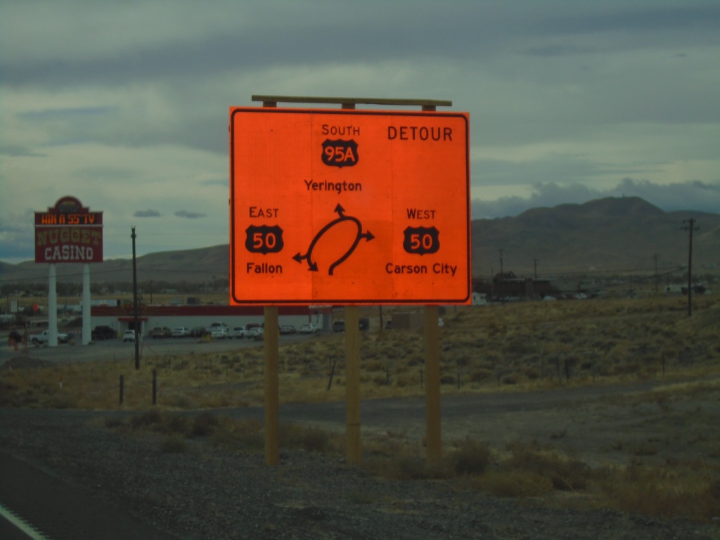
Alt. US-50 West/Alt. US-95 South - US-50
Alt. US-50 West/Alt. US-95 South at US-50. Currently there is a construction project to replace the intersection with a roundabout. Use US-50 West for Carson City; US-50 East for Fallon; Alt. US-95 South for Yerington. This is the western end of Alt. US-50.
Taken 10-19-2019
Silver Springs
Lyon County
Nevada
United States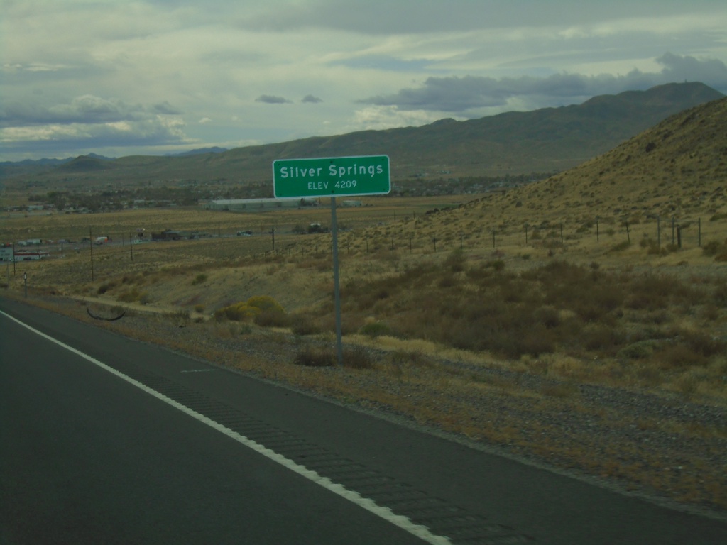
Alt. US-50 West/Alt. US-95 South - Silver Springs
Entering Silver Springs on Alt. US-50 West/Alt. US-95 South
Taken 10-19-2019
Silver Springs
Lyon County
Nevada
United States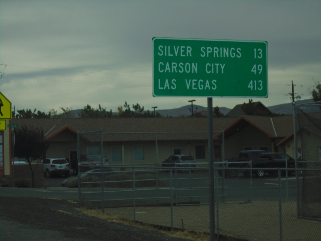
Alt. US-95 South/Alt. US-50 West - Distance Marker
Distance Marker on Alt. US-95 South/Alt. US-50 West. Distance to Silver Springs, Carson City, and Las Vegas.
Taken 10-19-2019
Fernley
Lyon County
Nevada
United States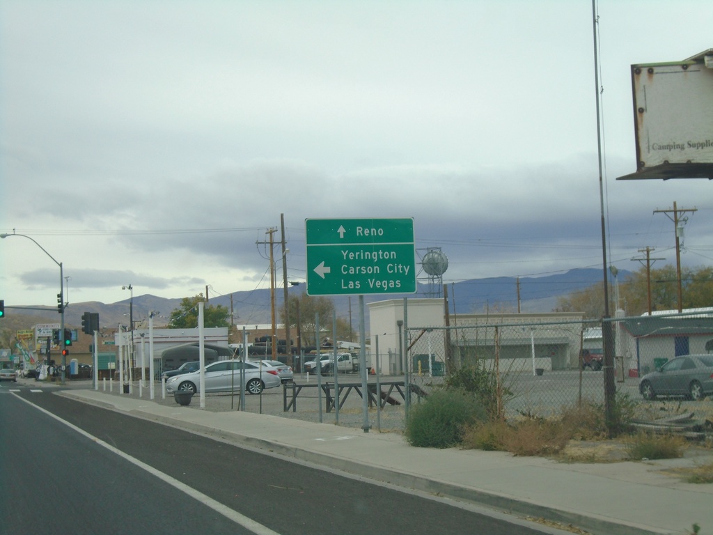
US-95 Alt. South/US-50 Alt. West at NV-427 North
US-95A South/US-50A West/BL-80 West at US-95A South to Carson City, Yerington, and Las Vegas. Use BL-80 West and NV-427 North to Reno.
Taken 10-19-2019
 Fernley
Lyon County
Nevada
United States
Fernley
Lyon County
Nevada
United States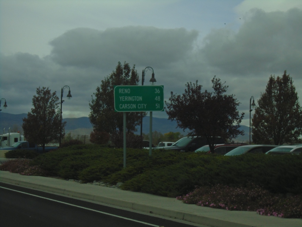
Alt. US-95 South/Alt. US-50 West/BL-80 West - Distance Marker
Distance marker on Alt. US-95 South/Alt. US-50 West/BL-80 West. Distance to Reno (via I-80), Yerington, and Carson City.
Taken 10-19-2019
Fernley
Lyon County
Nevada
United States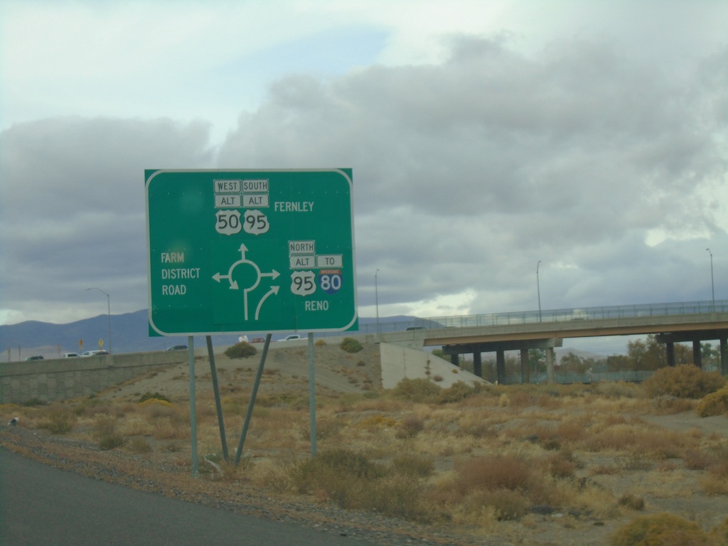
Alt. US-50 West Approaching Alt. US-95/NV-828/BL-80
Alt. US-50 West Approaching Alt. US-95/NV-828/BL-80 roundabout in Fernley. Use Alt. US-95 North/To I-80/(BL-80) to Reno; Alt. US-95 South/Alt. US-50 West/(BL-80) to Fernley; and (NV-828) for Farm District Road.
Taken 10-19-2019
Fernley
Lyon County
Nevada
United States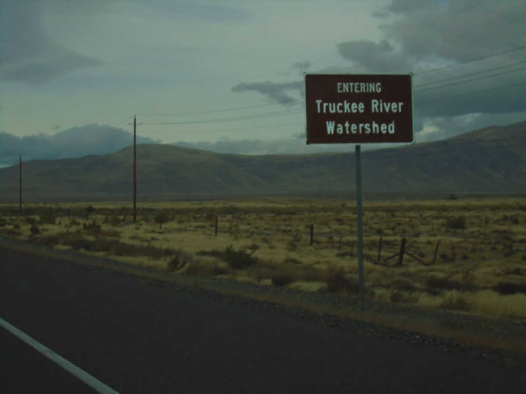
Alt. US-50 West - Ragtown Pass
Alt. US-50 West entering the Truckee River Watershed at Ragtown Pass.
Taken 10-19-2019
Fernley
Lyon County
Nevada
United States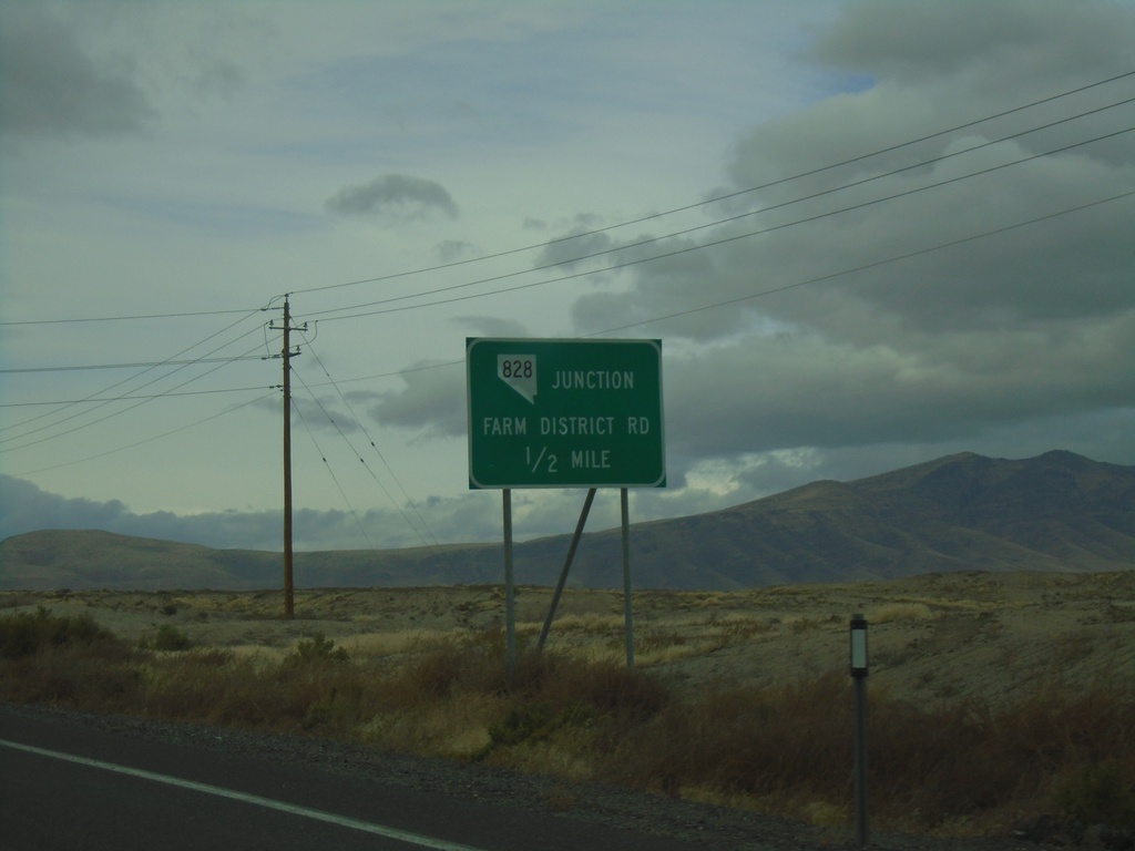
Alt. US-50 West Approaching NV-828
Alt. US-50 West approaching NV-828 - Farm District Road.
Taken 10-19-2019
Fernley
Lyon County
Nevada
United States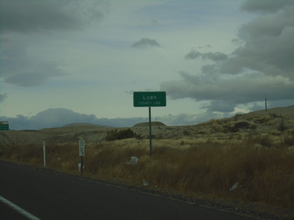
Alt. US-50 West - Lyon County
Lyon County Line on Alt. US-50 West
Taken 10-19-2019
Fernley
Lyon County
Nevada
United States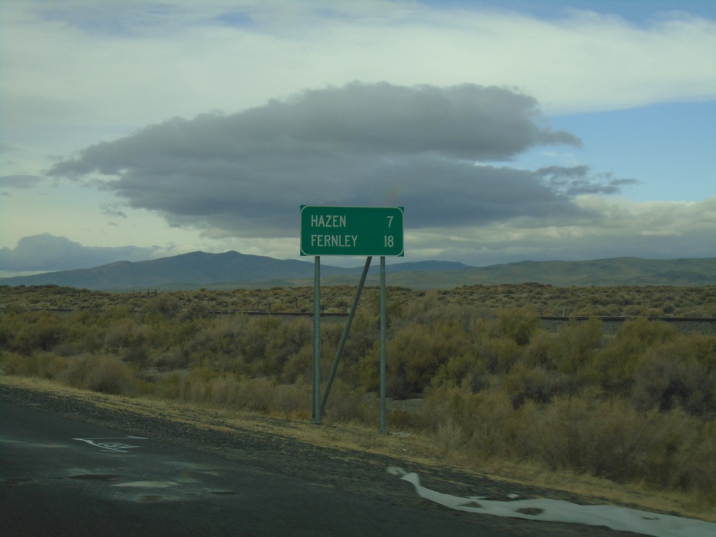
Alt. US-50 West - Distance Marker
Distance marker on Alt. US-50 West. Distance to Hazen and Fernley.
Taken 10-19-2019
Fallon
Churchill County
Nevada
United States