Signs Tagged With Big Green Sign
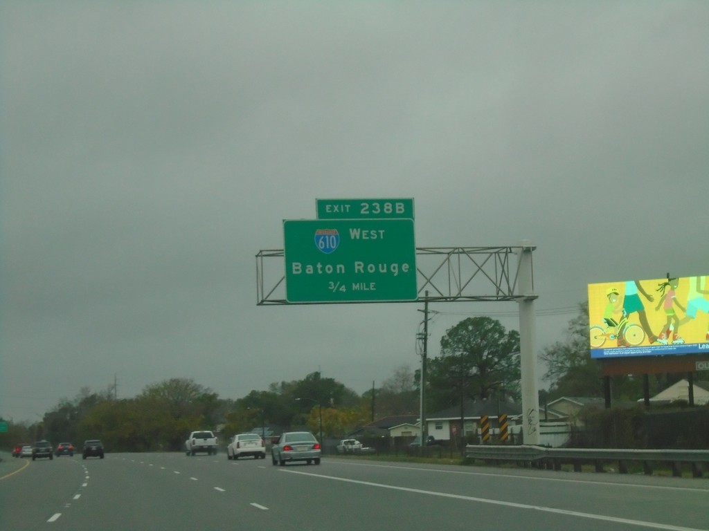
I-10 West - Exit 238B
I-10 West approaching Exit 238B - I-610 West/Baton Rouge.
Taken 12-27-2018

 New Orleans
Orleans Parish
Louisiana
United States
New Orleans
Orleans Parish
Louisiana
United States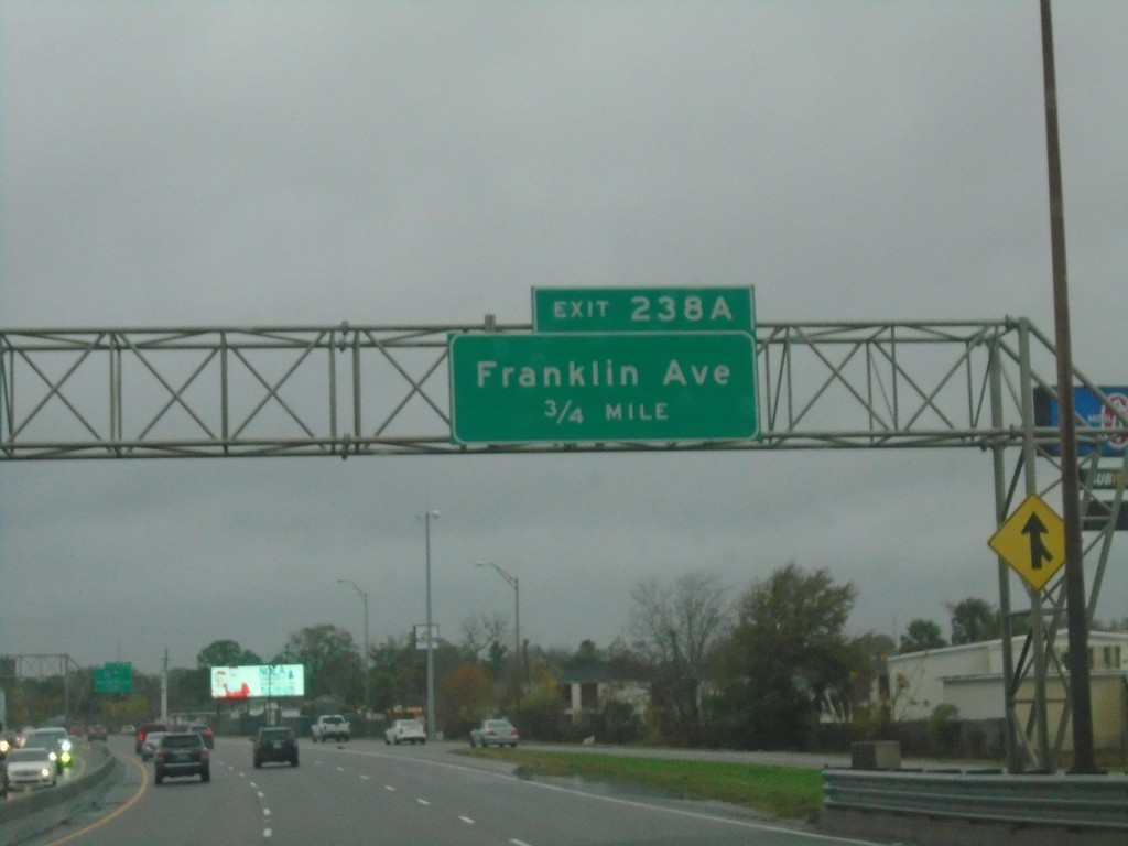
I-10 West - Exit 238A
I-10 west approaching Exit 238 - Franklin Ave.
Taken 12-27-2018
New Orleans
Orleans Parish
Louisiana
United States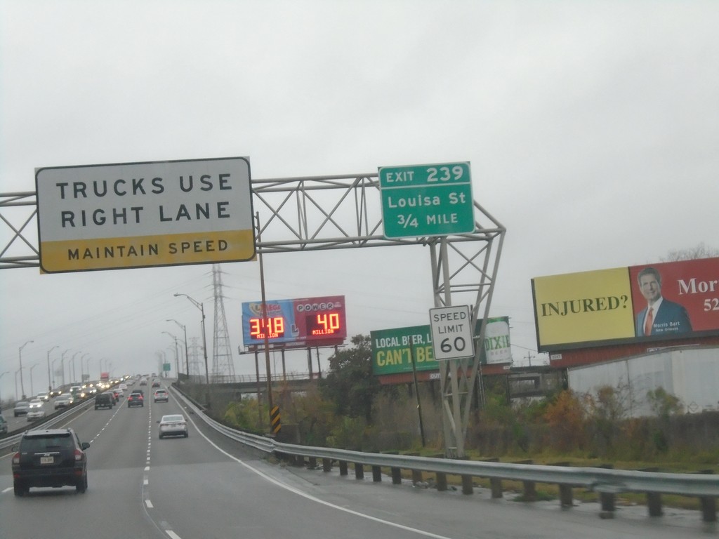
I-10 West - Exit 239
I-10 west approaching Exit 239 - Louisa Ave. Trucks Use Right Lane - Maintain Speed. Speed Limit 60.
Taken 12-27-2018
New Orleans
Orleans Parish
Louisiana
United States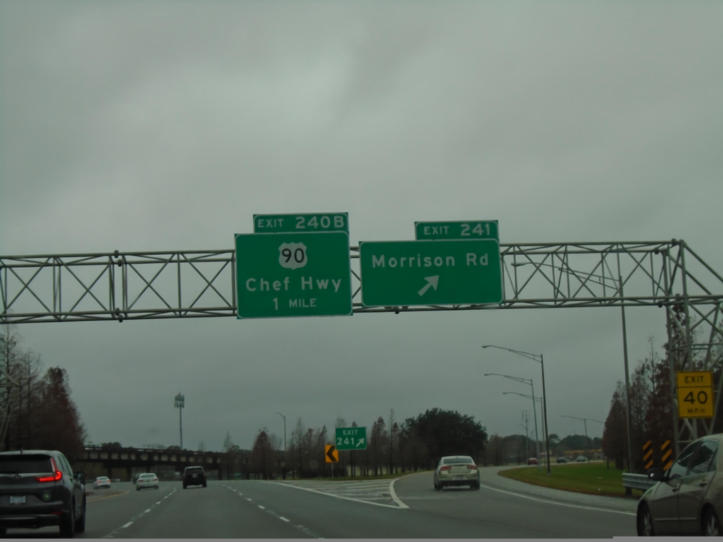
I-10 West - Exits 241 and 240B
I-10 west at Exit 241 - Morrison Road. Approaching Exit 240B - US-90/Chef Hwy.
Taken 12-27-2018
 New Orleans
Orleans Parish
Louisiana
United States
New Orleans
Orleans Parish
Louisiana
United States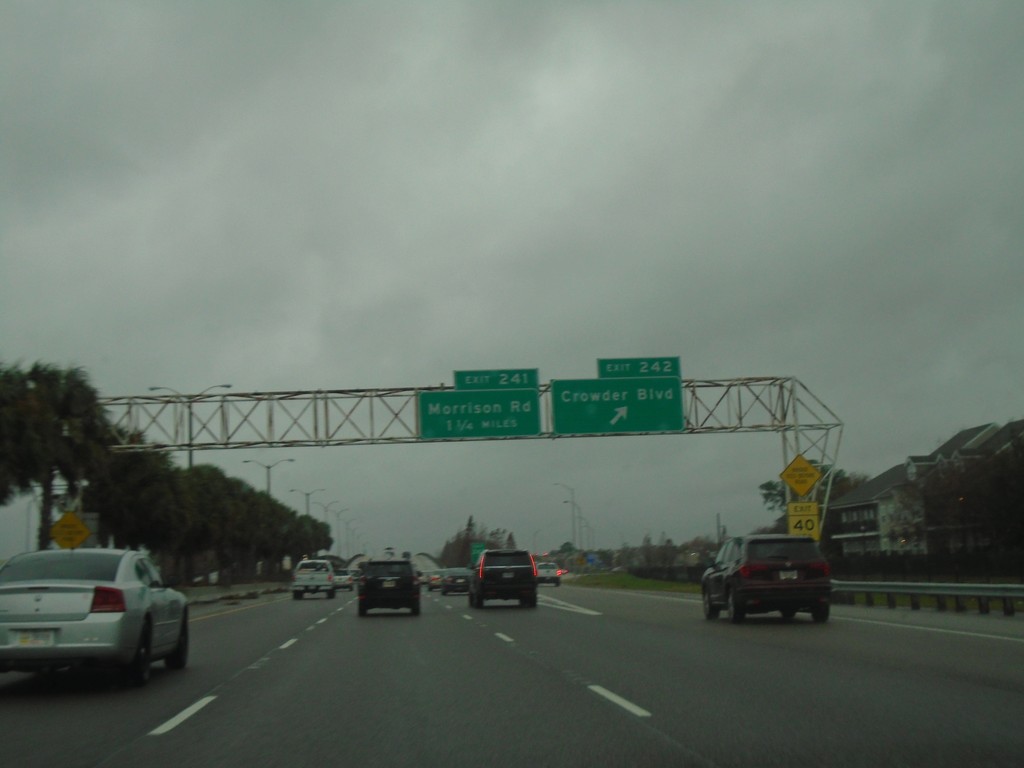
I-10 West - Exits 242 and 241
I-10 west at Exit 242 - Crowder Blvd. Approaching Exit 241 - Morrison Road.
Taken 12-27-2018
New Orleans
Orleans Parish
Louisiana
United States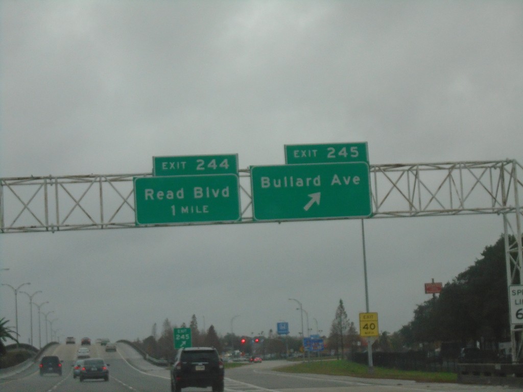
I-10 West - Exits 245 and 244
I-10 west at Exit 245 - Bullard Ave. Approaching Exit 244 - Read Blvd.
Taken 12-27-2018
New Orleans
Orleans Parish
Louisiana
United States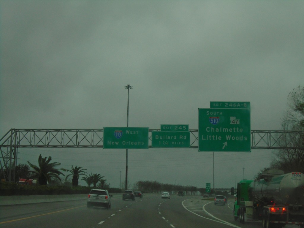
I-10 West - Exits 246A-B and 245
I-10 west at Exit 246A-B - I-510 South/LA-47/Chalmette/Little Woods. Approaching Exit 245 - Bullard Road. Continue west on I-10 for New Orleans.
Taken 12-27-2018

 New Orleans
Orleans Parish
Louisiana
United States
New Orleans
Orleans Parish
Louisiana
United States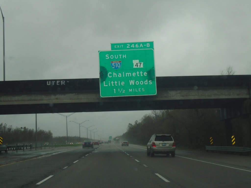
I-10 West - Exits 246A-B
I-10 west approaching Exits 246A-B - I-510 South/LA-47/Chalmette/Little Woods.
Taken 12-27-2018
New Orleans
Orleans Parish
Louisiana
United States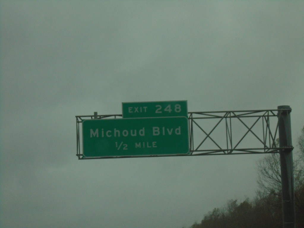
I-10 West - Exit 248
I-10 west approaching Exit 248 - Michoud Blvd.
Taken 12-27-2018
New Orleans
Orleans Parish
Louisiana
United States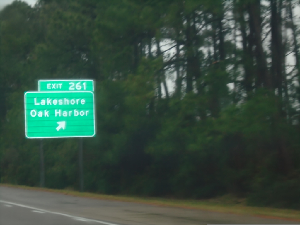
I-10 West - Exit 261
I-10 west at Exit 261 - Lakeshore/Oak Harbor.
Taken 12-27-2018
Slidell
St. Tammany Parish
Louisiana
United States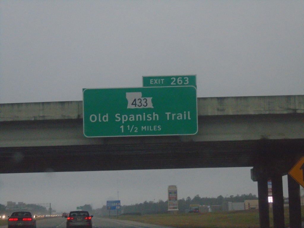
I-10 West - Exit 263
I-10 west approaching Exit 263 - LA-433/Old Spanish Trail.
Taken 12-27-2018
 Slidell
St. Tammany Parish
Louisiana
United States
Slidell
St. Tammany Parish
Louisiana
United States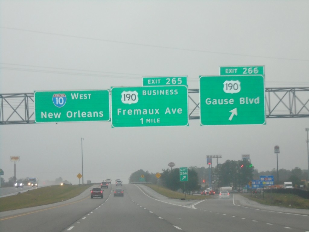
I-10 West - Exits 266 and 265
I-10 west at Exit 266 - US-190/Gause Blvd. Approaching Exit 265 - Bus. US-190/Fremaux Ave. Continue west on I-10 for New Orleans.
Taken 12-27-2018

 Slidell
St. Tammany Parish
Louisiana
United States
Slidell
St. Tammany Parish
Louisiana
United States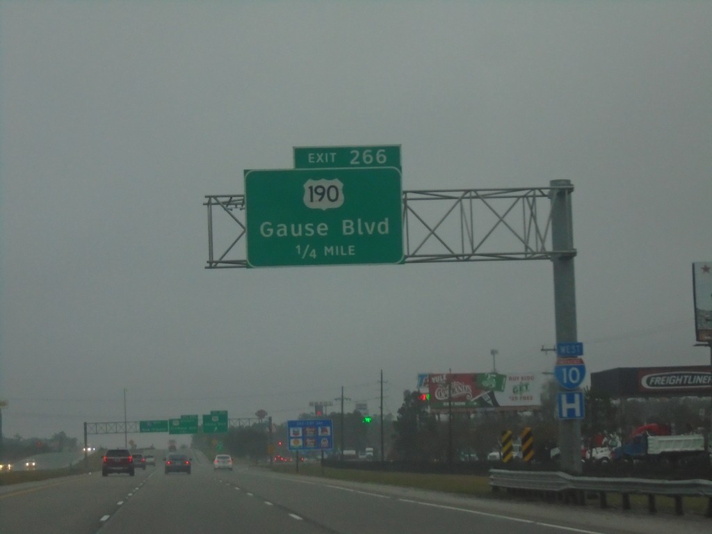
I-10 West - Exit 266
I-10 west approaching Exit 266 - US-190/Gause Blvd.
Taken 12-27-2018
Slidell
St. Tammany Parish
Louisiana
United States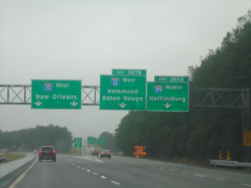
I-10 West - Exits 267B and 267A
I-10 west at Exit 267B - I-12 West/Hammond/Baton Rouge and Exit 267A - I-59 North/Hattiesburg (MS). Continue west on I-10 for New Orleans. This is the southern terminus of I-59 and the eastern terminus of I-12.
Taken 12-27-2018

 Slidell
St. Tammany Parish
Louisiana
United States
Slidell
St. Tammany Parish
Louisiana
United States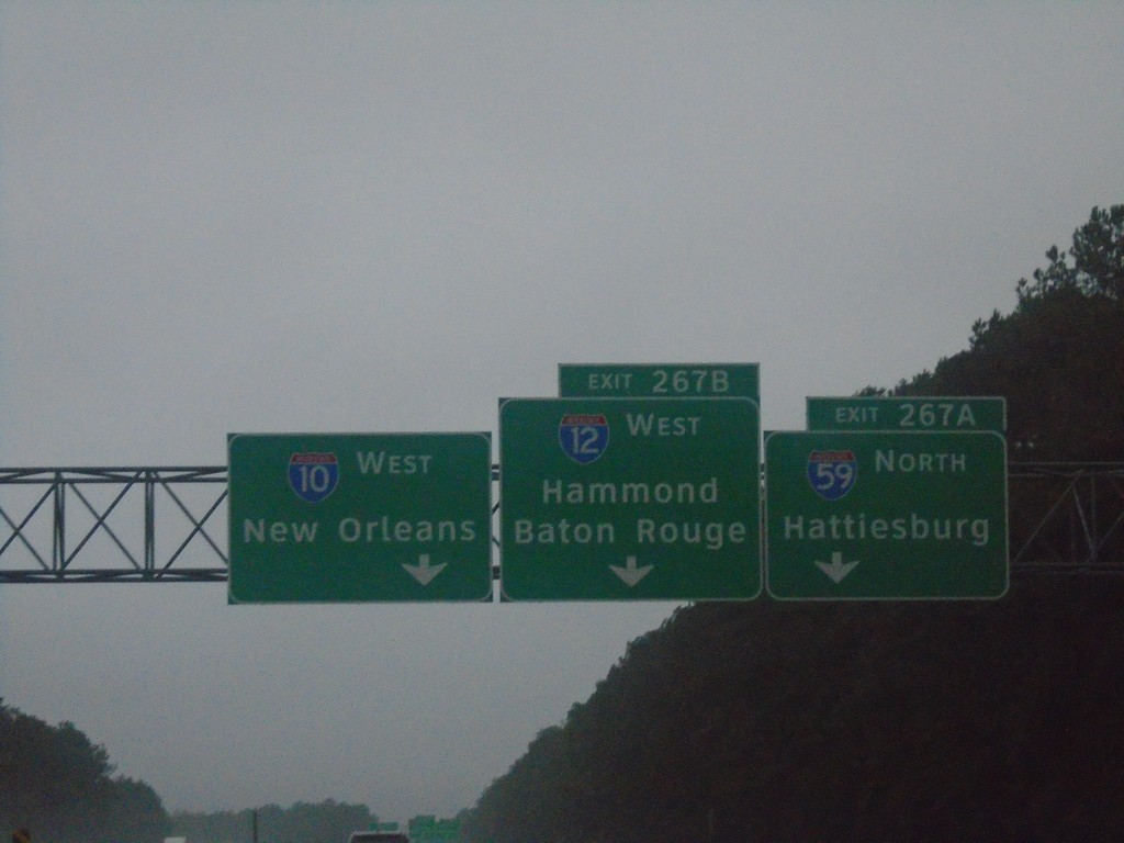
I-10 West - Exits 267A and 267B
I-10 west approaching Exit 267B - I-12 West/Hammond/Baton Rouge. Approaching Exit 267A - I-59 North/Hattiesburg (MS).
Taken 12-27-2018
Slidell
St. Tammany Parish
Louisiana
United States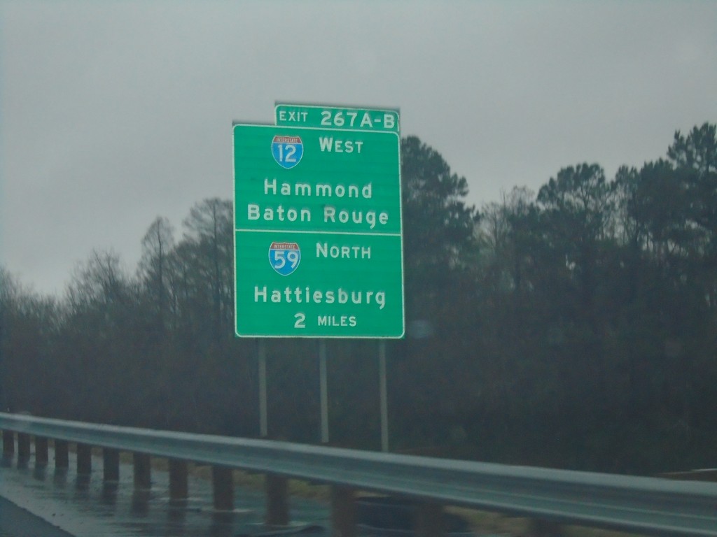
I-10 West - Exit 267A-B
I-10 West approaching Exit 267A-B - I-12 West/Hammond/Baton Rouge and I-59 North/Hattiesburg (MS).
Taken 12-27-2018
Slidell
St. Tammany Parish
Louisiana
United States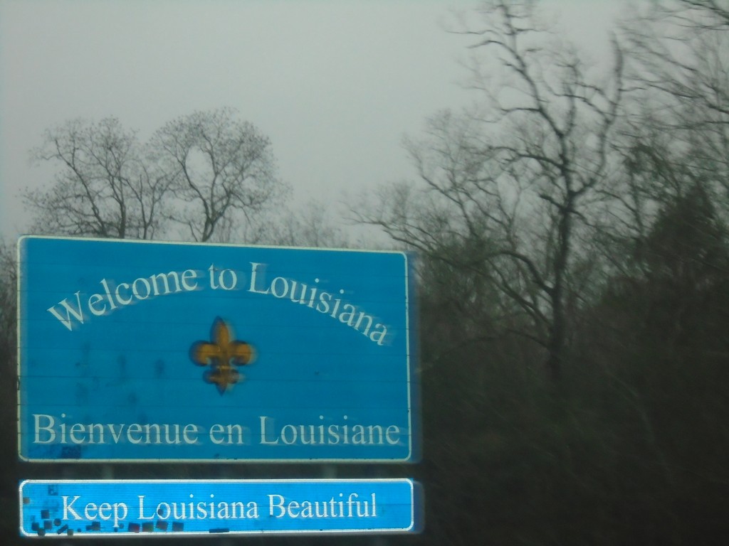
I-10 West - Welcome To Louisiana
Welcome To Louisiana/Bienvenue en Louisiane on I-10 west.
Taken 12-27-2018
Slidell
St. Tammany Parish
Louisiana
United States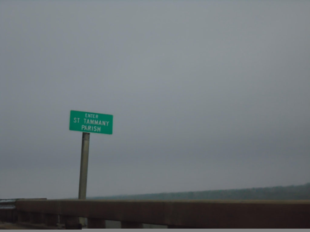
I-10 West - St. Tammany Parish
Enter St. Tammany Parish on I-10 west at the Pearl River bridge. Taken at the Mississippi-Louisiana State Line.
Taken 12-27-2018
Slidell
St. Tammany Parish
Louisiana
United States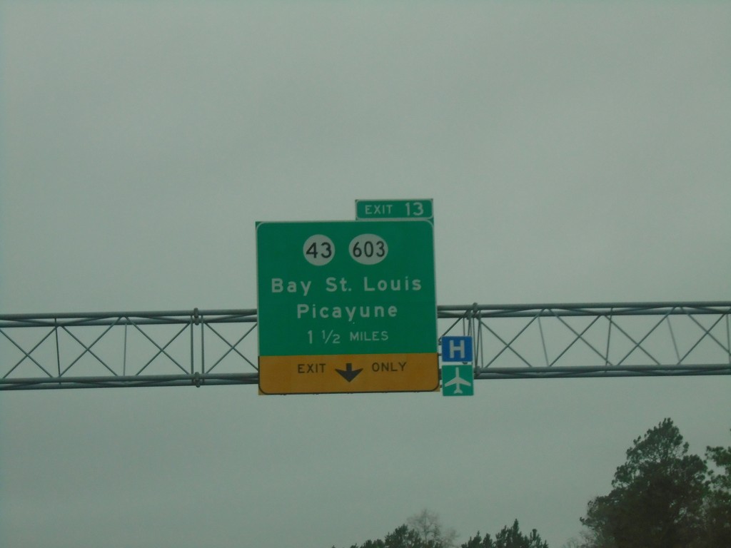
I-10 West - Exit 13
I-10 west approaching Exit 13 - MS-43/MS-603/Bay St. Louis/Picayune.
Taken 12-27-2018

 Diamondhead
Hancock County
Mississippi
United States
Diamondhead
Hancock County
Mississippi
United States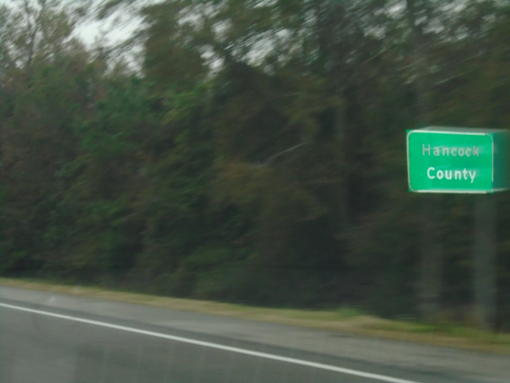
I-10 West - Hancock County
Entering Hancock County on I-10 west.
Taken 12-27-2018
Diamondhead
Hancock County
Mississippi
United States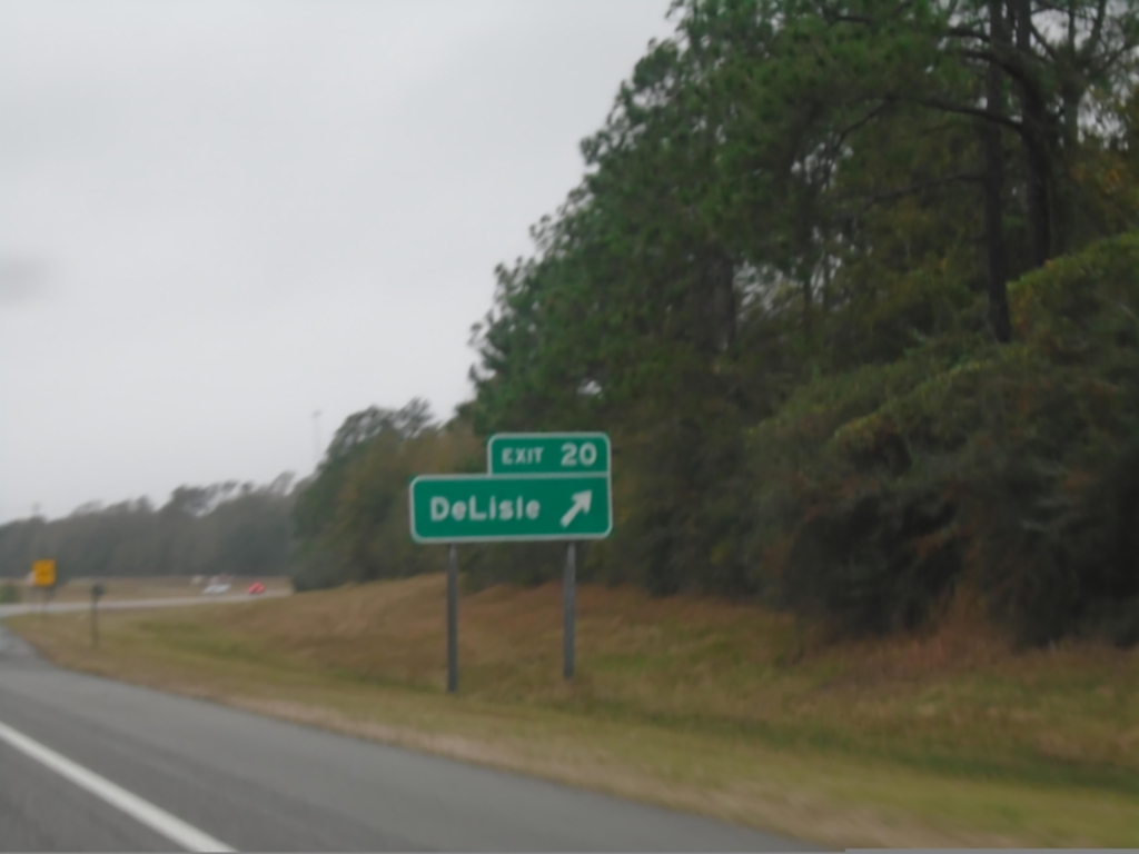
I-10 West - Exit 20
I-10 west at Exit 20 - DeLisle.
Taken 12-27-2018
Pass Christian
Harrison County
Mississippi
United States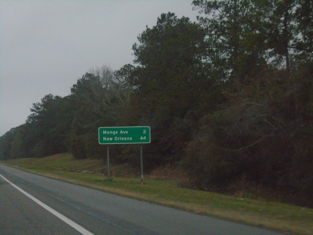
I-10 West - Distance Marker
Distance marker on I-10 west. Distance to Menge Ave. and New Orleans (LA).
Taken 12-27-2018
Long Beach
Harrison County
Mississippi
United States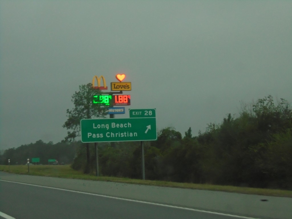
I-10 West - Exit 28
I-10 west at Exit 28 - Long Beach/Pass Christian.
Taken 12-27-2018
Long Beach
Harrison County
Mississippi
United States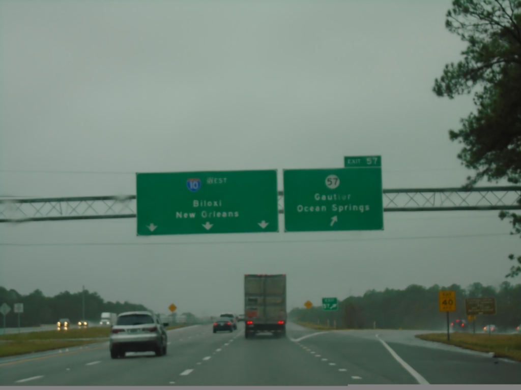
I-10 West - Exit 57
I-10 west at Exit 57 - MS-57/Gautier/Ocean Springs. Continue west on I-10 for Biloxi and New Orleans (LA).
Taken 12-27-2018
Vancleave
Jackson County
Mississippi
United States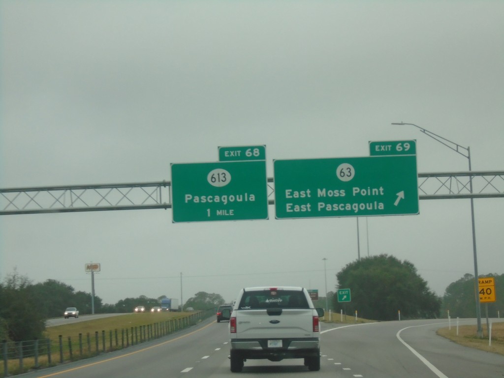
I-10 West - Exits 69 and 68
I-10 west at Exit 69 - MS-63/East Moss Point/East Pascagoula. Approaching Exit 68 - MS-613/Pascagoula.
Taken 12-27-2018

 Moss Point
Jackson County
Mississippi
United States
Moss Point
Jackson County
Mississippi
United States