Signs Tagged With Big Green Sign
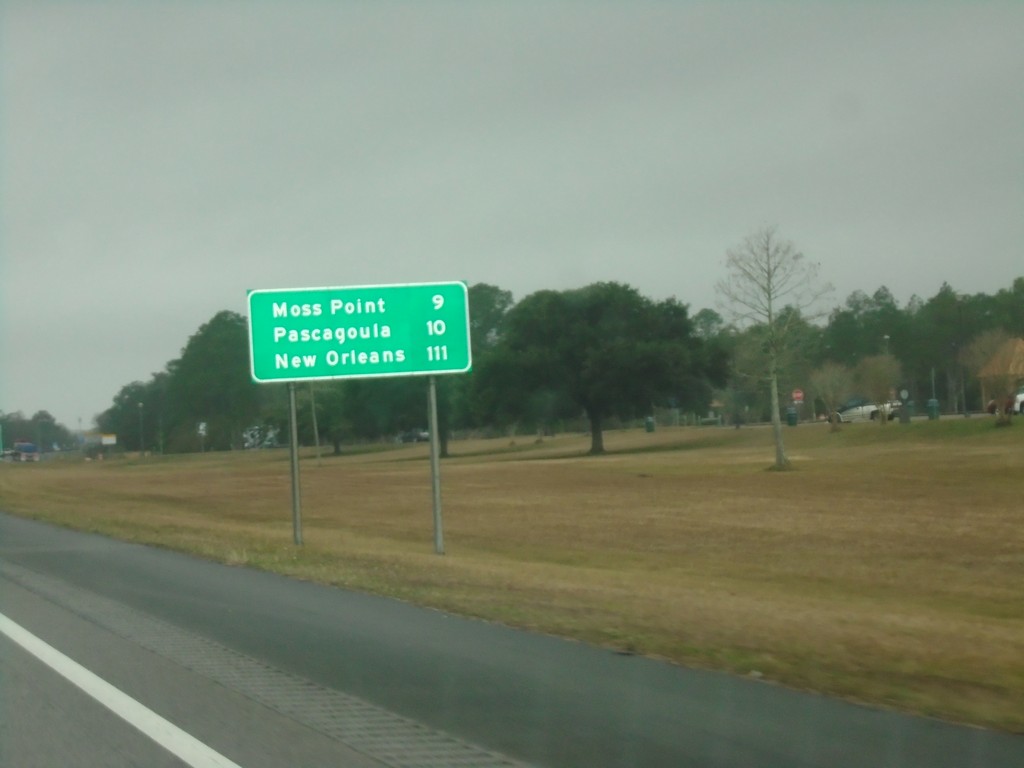
I-10 West - Distance Marker
First distance marker in Mississippi on I-10 westbound. Distance to Moss Point, Pascagoula, and New Orleans (LA).
Taken 12-27-2018
 Moss Point
Jackson County
Mississippi
United States
Moss Point
Jackson County
Mississippi
United States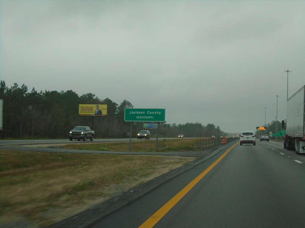
I-10 West - Entering Mississippi
Entering Jackson County Mississippi on I-10 west.
Taken 12-27-2018
Moss Point
Jackson County
Mississippi
United States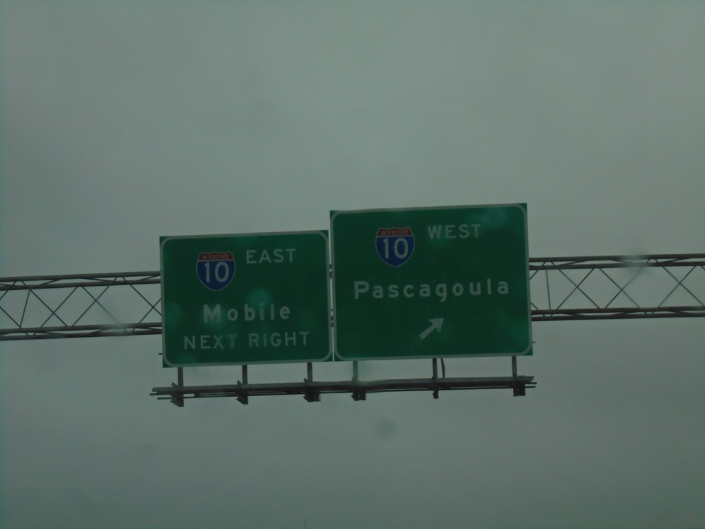
AL-193 South at I-10
AL-193 South at I-10 in Mobile. Use I-10 west for Pascagoula (MS); I-10 east for Mobile.
Taken 12-27-2018
 Mobile
 County
Alabama
United States
Mobile
Mobile County
Alabama
United States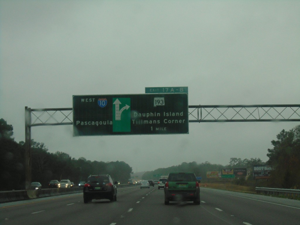
I-10 West - Exits 17A-B
I-10 west approaching Exits 17A-B - AL-193/Dauphin Island/Tillman’s Corner. Continue west on I-10 for Pascagoula (MS).
Taken 12-27-2018
Mobile
Mobile County
Alabama
United States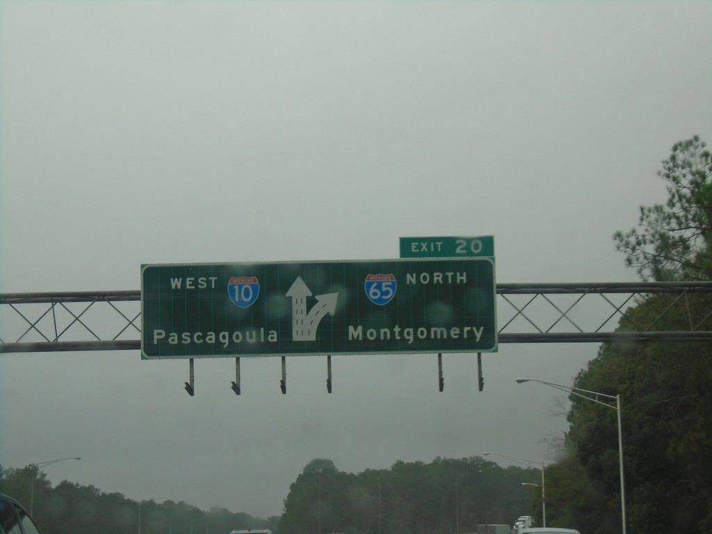
I-10 West Approaching Exit 20
I-10 west approaching Exit 20 - I-65 North/Montgomery. I-10 continues west towards Pascagoula (MS). This is the southern terminus of I-65.
Taken 12-27-2018
 Mobile
 County
Alabama
United States
Mobile
Mobile County
Alabama
United States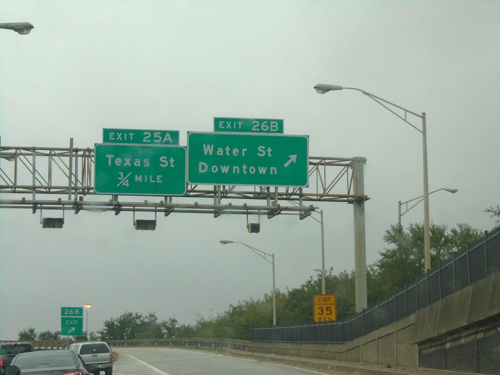
I-10 West - Exits 26B and 25A
I-10 west at Exit 26B - Water St./Downtown. Approaching Exit 25A - Texas St.
Taken 12-27-2018
Mobile
Mobile County
Alabama
United States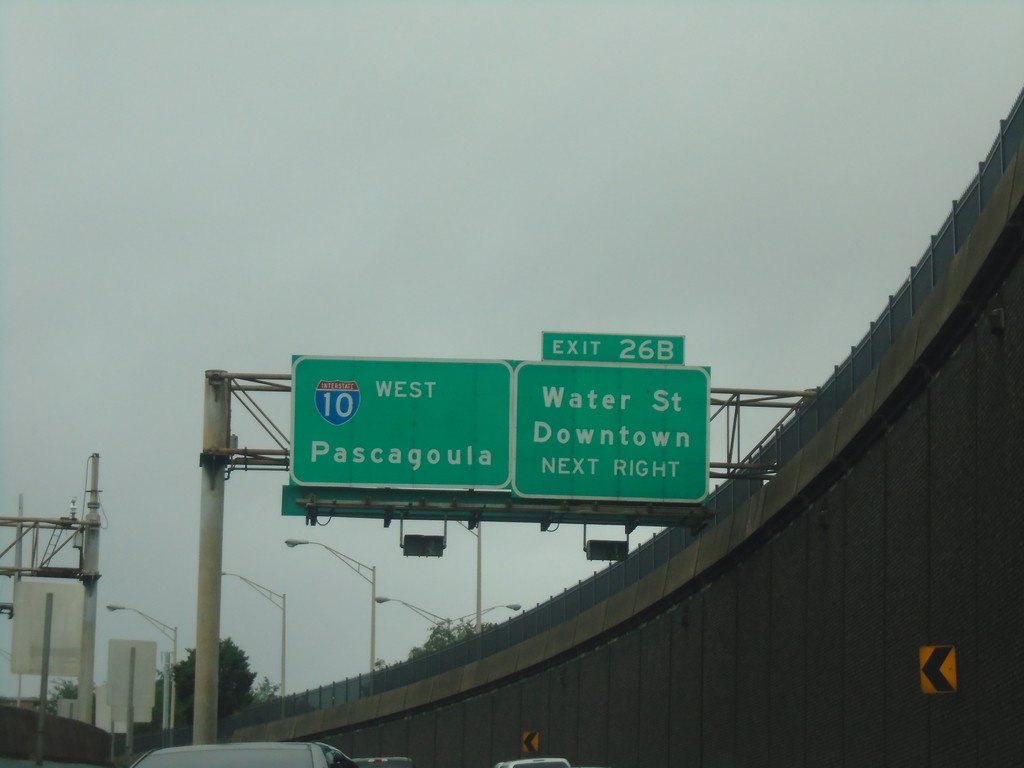
I-10 West - Exit 26B
I-10 west approaching Exit 26B - Water St./Downtown. Continue west on I-10 for Pascagoula (MS). Picture taken exiting the George Wallace Tunnel.
Taken 12-27-2018
Mobile
Mobile County
Alabama
United States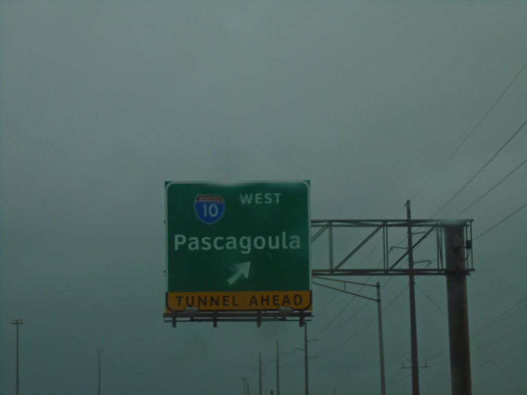
US-90/US-98 East at I-10 West - Mobile
US-90/US-98 East at I-10 West in Mobile. Use I-10 west for Pascagoula (Mississippi).
Taken 12-27-2018

 Mobile
 County
Alabama
United States
Mobile
Mobile County
Alabama
United States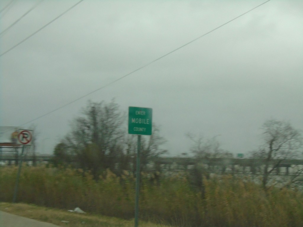
US-90/US-98 West - Mobile County
Enter Mobile County on US-90/US-98 West (Battleship Parkway).
Taken 12-27-2018
Spanish Fort
Mobile County
Alabama
United States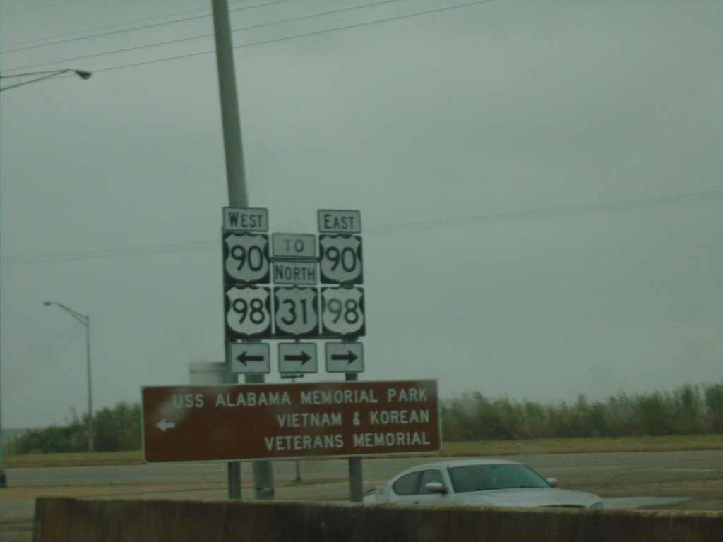
I-10 West - Exit 30 Offramp at US-90/US-98
I-10 West - Exit 30 Offramp at US-90/US-98 - Battleship Parkway. Turn left for US-90/US-98 West to USS Alabama Memorial Park/Vietnam and Korean Veterans Memorial. Turn left for US-90/US-98 East/To US-31.
Taken 12-27-2018
 Spanish Fort
Baldwin County
Alabama
United States
Spanish Fort
Baldwin County
Alabama
United States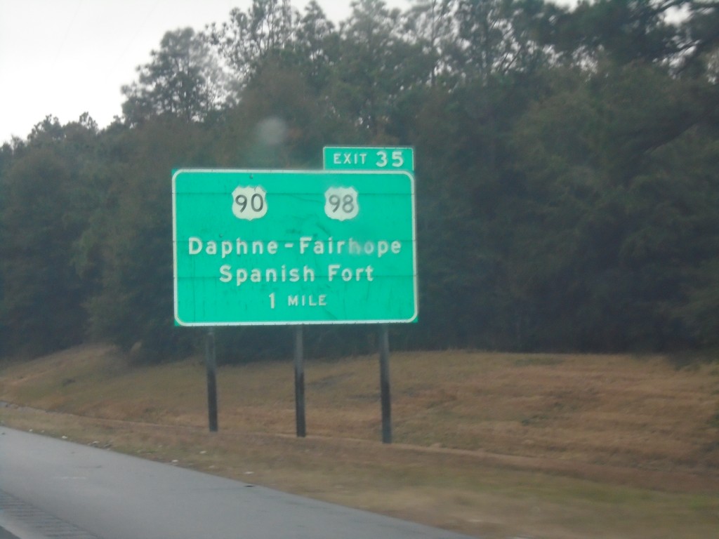
I-10 West - Exit 38
I-10 west approaching Exit 38 - US-90/US-98/Daphne - Fairhope/Spanish Fort.
Taken 12-27-2018
Spanish Fort
Baldwin County
Alabama
United States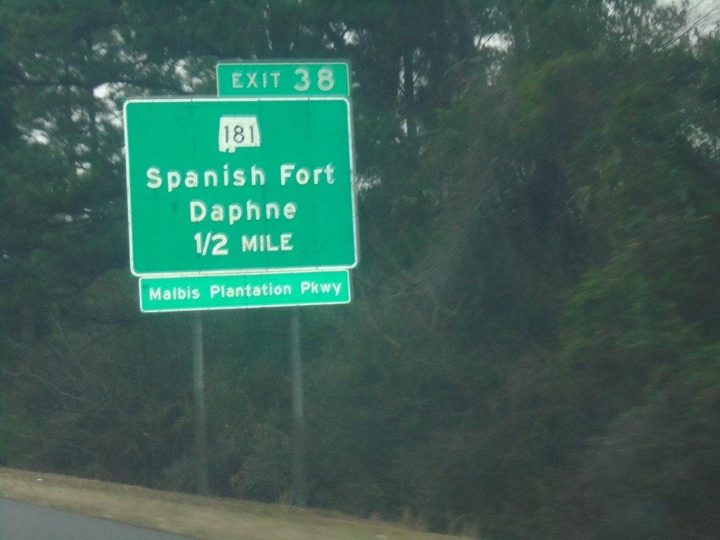
I-10 West - Exit 38
I-10 west approaching Exit 38 - AL-181/Spanish Fort/Daphne/Malbis Plantation Parkway.
Taken 12-27-2018
 Spanish Fort
Baldwin County
Alabama
United States
Spanish Fort
Baldwin County
Alabama
United States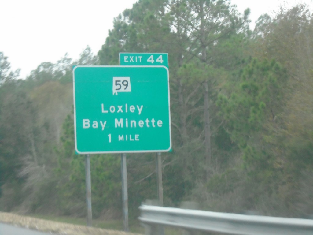
I-10 West - Exit 44
I-10 west approaching Exit 44 - AL-59/Loxley/Bay Minette.
Taken 12-27-2018
 Loxley
Baldwin County
Alabama
United States
Loxley
Baldwin County
Alabama
United States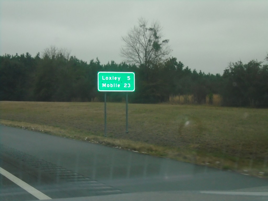
I-10 West - Distance Marker
Distance marker on I-10 west. Distance to Loxley and Mobile.
Taken 12-27-2018
Loxley
Baldwin County
Alabama
United States
Baldwin Beach Express North at I-10 West
Baldwin Beach Express North at I-10 West to Mobile.
Taken 12-27-2018
Robertsdale
Baldwin County
Alabama
United States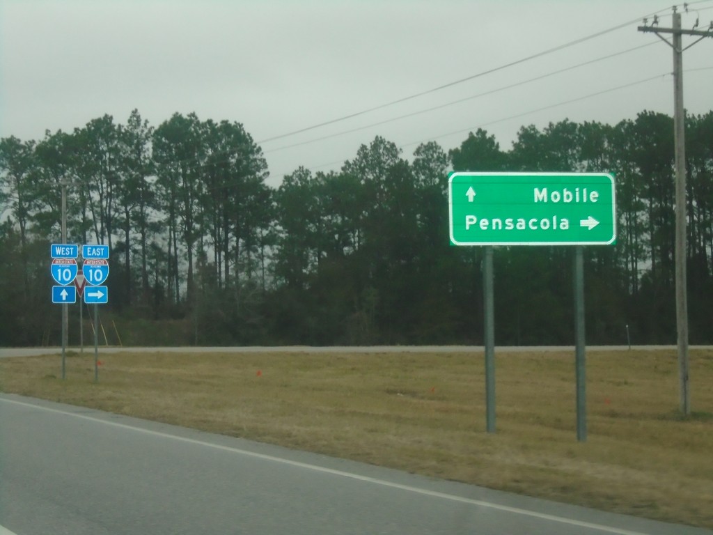
Baldwin Beach Express North at I-10
Baldwin Beach Express North at I-10 in Baldwin County. Use I-10 east for Pensacola (Florida); I-10 west for Mobile.
Taken 12-27-2018
Robertsdale
Baldwin County
Alabama
United States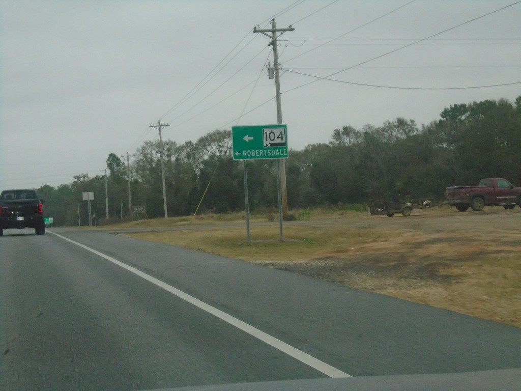
Baldwin Beach Express North at Sliver Hill Ave.
Baldwin Beach Express North at Sliver Hill Ave. Use Silver Hill Ave. west for AL-104 and Robertsdale.
Taken 12-27-2018
 Robertsdale
Baldwin County
Alabama
United States
Robertsdale
Baldwin County
Alabama
United States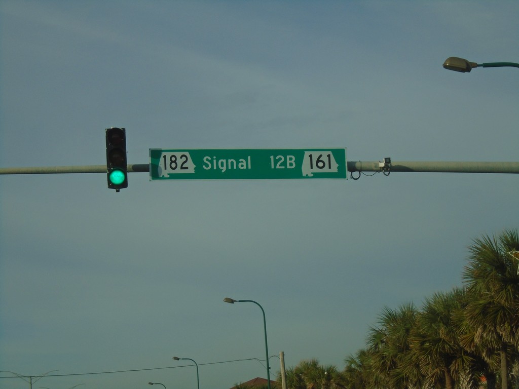
AL-182 West at AL-161
AL-182 West at AL-161 - Signal 12B.
Taken 12-26-2018

 Orange Beach
Baldwin County
Alabama
United States
Orange Beach
Baldwin County
Alabama
United States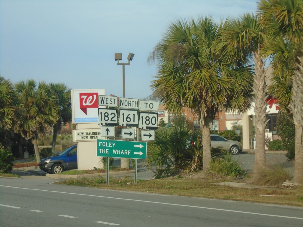
AL-182 West at AL-161 (To AL-180) - Orange Beach
AL-182 West at AL-161 North (To AL-180) in Orange Beach. Turn right on AL-160 for Foley and The Wharf.
Taken 12-26-2018
 Orange Beach
Baldwin County
Alabama
United States
Orange Beach
Baldwin County
Alabama
United States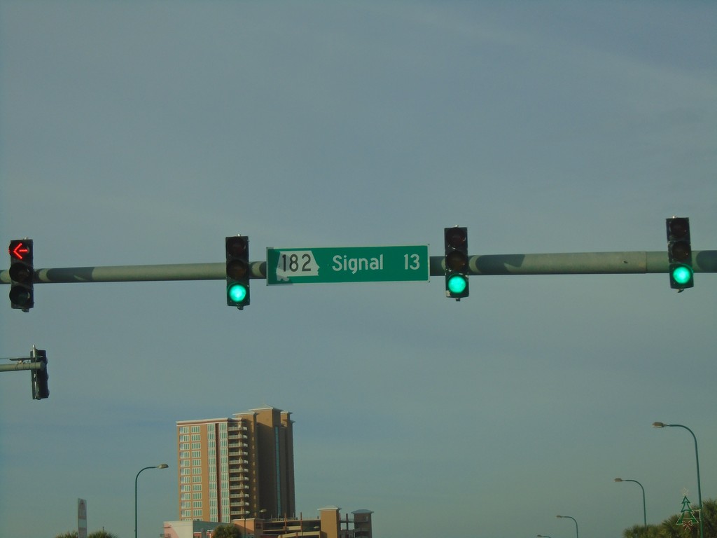
AL-182 West - Signal 13
Signal 13 on AL-182 west in Orange Beach. The stop lights in Orange Beach are signed with the signal number and their milepost number. When multiple signals occur within a milepost, letters in alphabetical order are appended to the milepost.
Taken 12-26-2018
Orange Beach
Baldwin County
Alabama
United States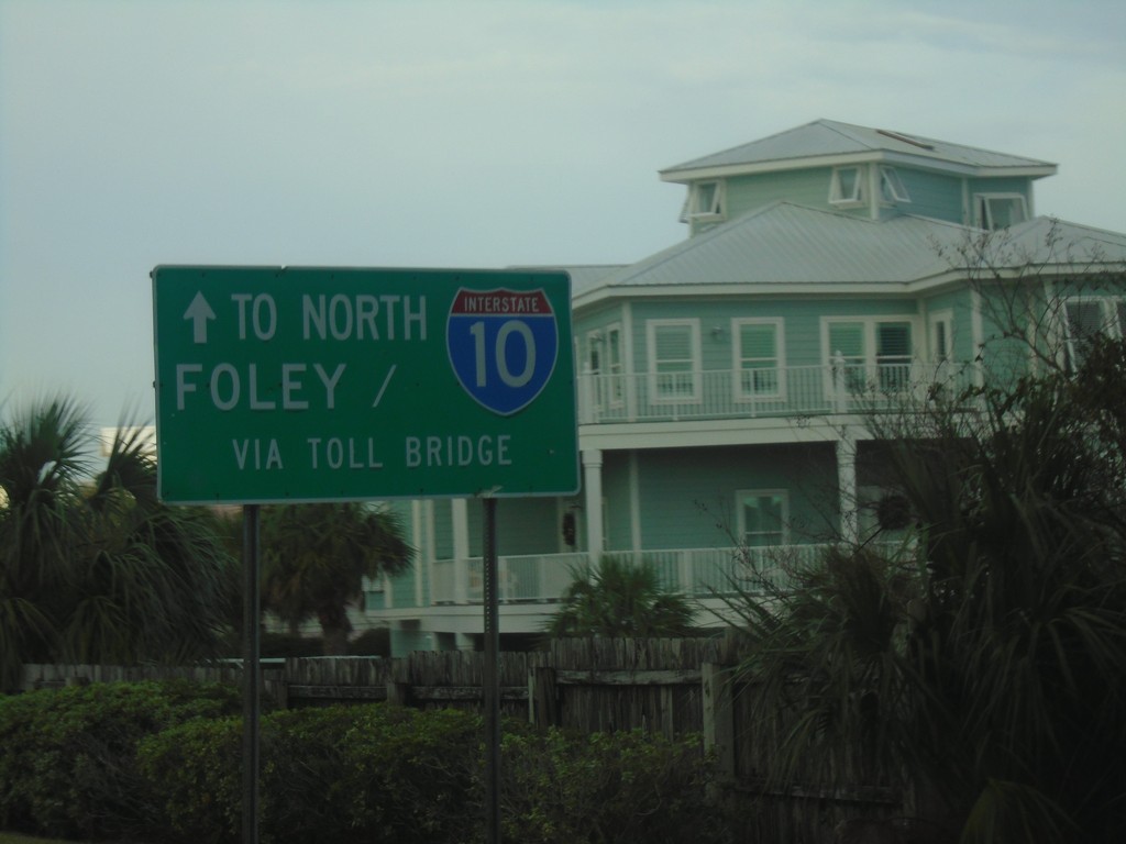
AL-182 West - Continue Straight for I-10 and Foley
AL-182 West - Continue Straight for I-10 and Foley via Toll Bridge (and AL-161).
Taken 12-26-2018
Orange Beach
Baldwin County
Alabama
United States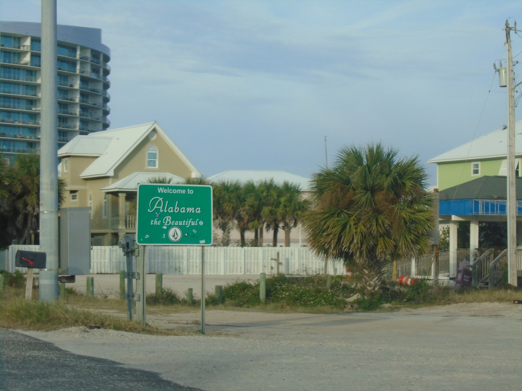
AL-182 West - Welcome To Alabama
Welcome To Alabama on AL-182 West in Orange Beach.
Taken 12-26-2018
Orange Beach
Baldwin County
Alabama
United States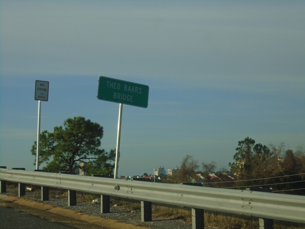
FL-292 West - Theo Baars Bridge
FL-292 West at Theo Baars Bridge over the Intracostal Waterway.
Taken 12-26-2018
 Pensacola
Escambia County
Florida
United States
Pensacola
Escambia County
Florida
United States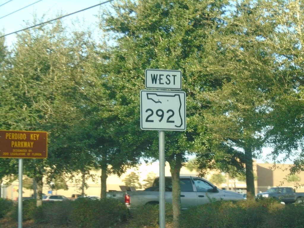
FL-292 West - Perdido Key Parkway
FL-292 West - Perdido Key Parkway.
Taken 12-26-2018
Pensacola
Escambia County
Florida
United States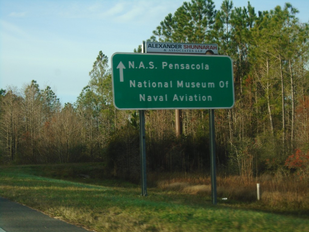
FL-173 South - NAS Pensacola
FL-173 South - NAS Pensacola/National Museum of Naval Aviation.
Taken 12-26-2018
 Pensacola
Escambia County
Florida
United States
Pensacola
Escambia County
Florida
United States