Signs Tagged With Big Green Sign
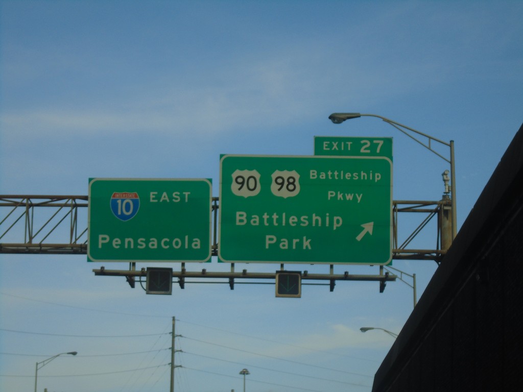
I-10 East - Exit 27
I-10 east at Exit 27 - US-90/US-98/Battleship Parkway/Battleship Park. Continue on I-10 east for Pensacola (FL).
Taken 12-23-2018


 Mobile
 County
Alabama
United States
Mobile
Mobile County
Alabama
United States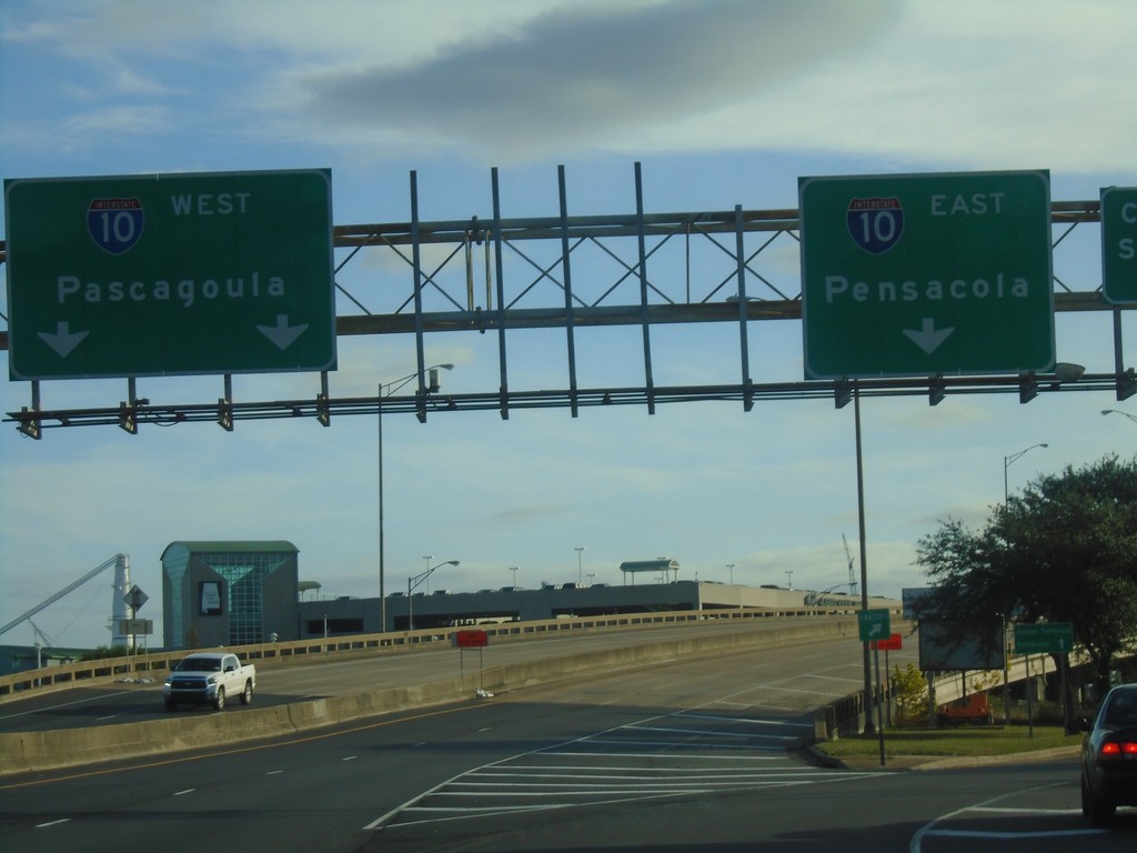
Water St. South at I-10
Water St. South at I-10 junction. Use I-10 west for Pascagoula (MS); I-10 east for Pensacola (FL).
Taken 12-23-2018
Mobile
Mobile County
Alabama
United States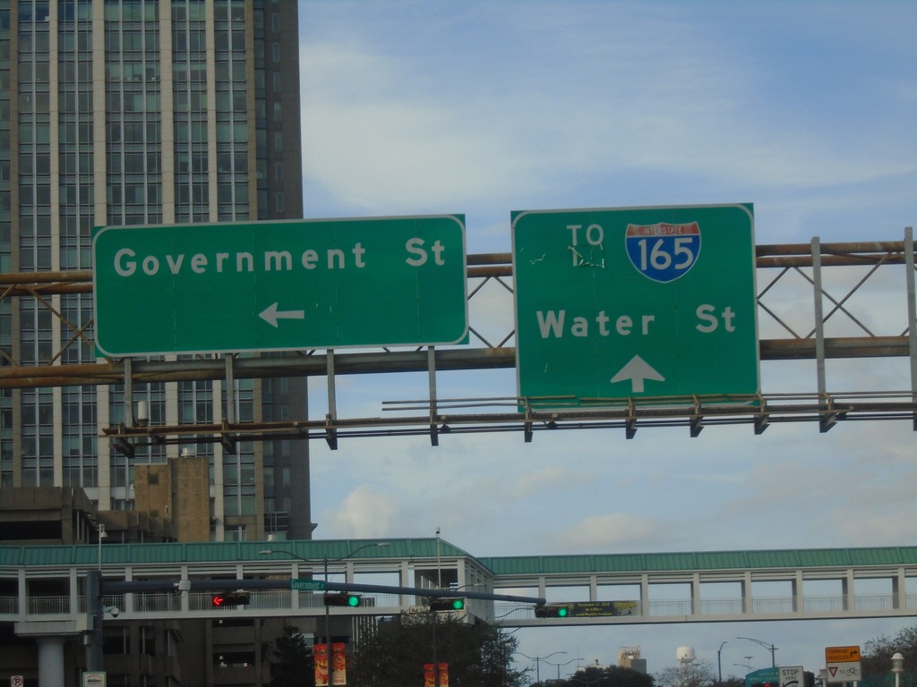
I-10 - Exit 26B Offramp at Government St.
I-10 - Exit 26B offramp at Government St. in Mobile. Continue straight on Water St. for I-165.
Taken 12-23-2018
 Mobile
 County
Alabama
United States
Mobile
Mobile County
Alabama
United States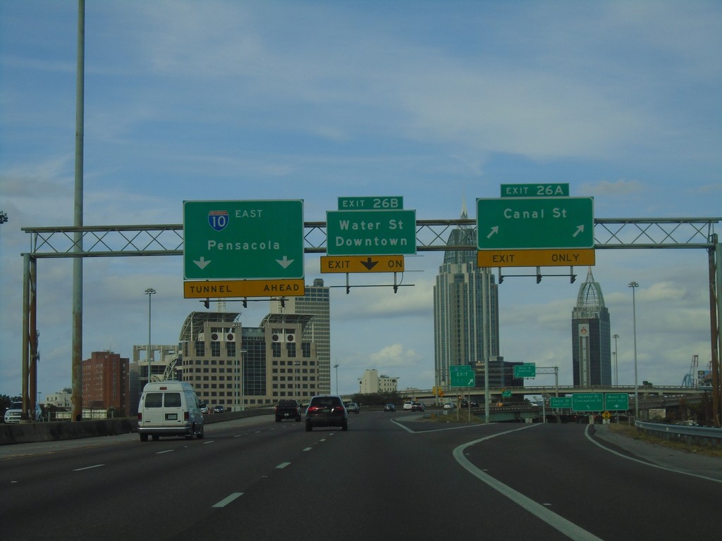
I-10 East - Exits 26A and 26B
I-10 east at Exit 26A - Canal St. Approaching Exit 26B - Water St./Downtown. I-10 continues east towards Pensacola (Florida).
Taken 12-23-2018
Mobile
Mobile County
Alabama
United States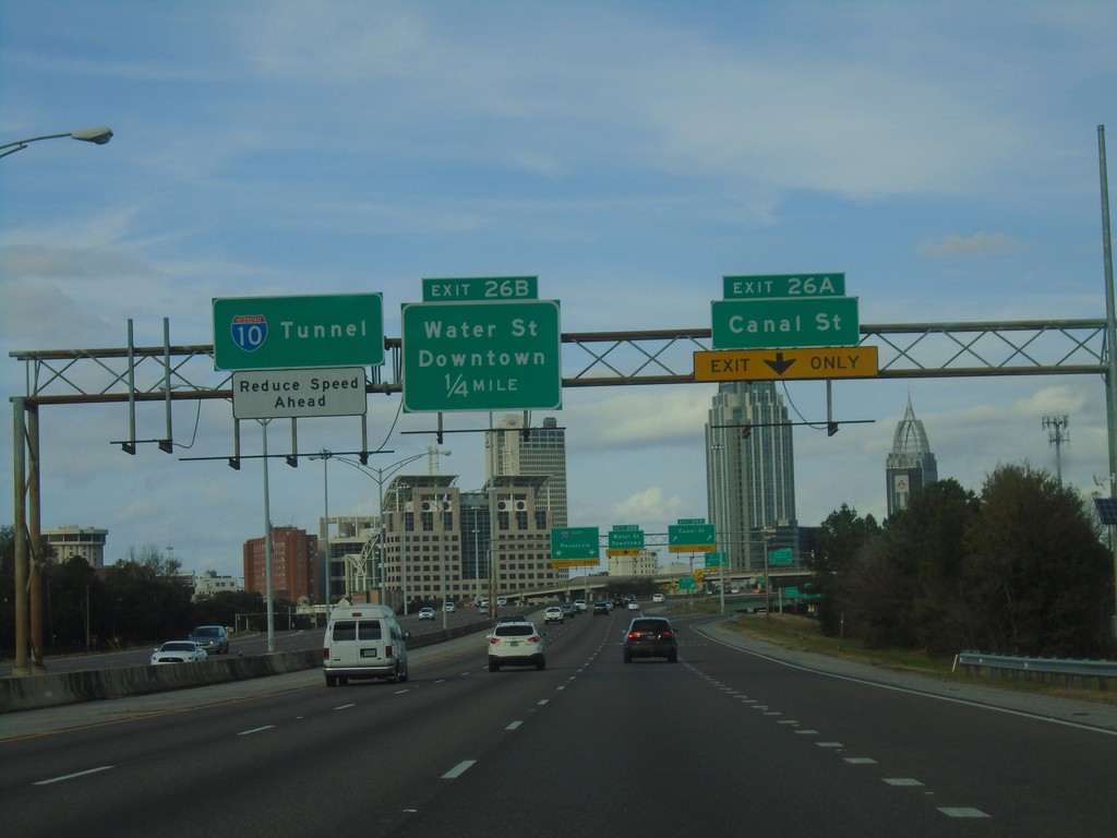
I-10 East - Exits 26A and 26B
I-10 east at Exit 26A - Canal St. Approaching Exit 26B - Water St./Downtown. I-10 continues east towards (the George Wallace) Tunnel.
Taken 12-23-2018
Mobile
Mobile County
Alabama
United States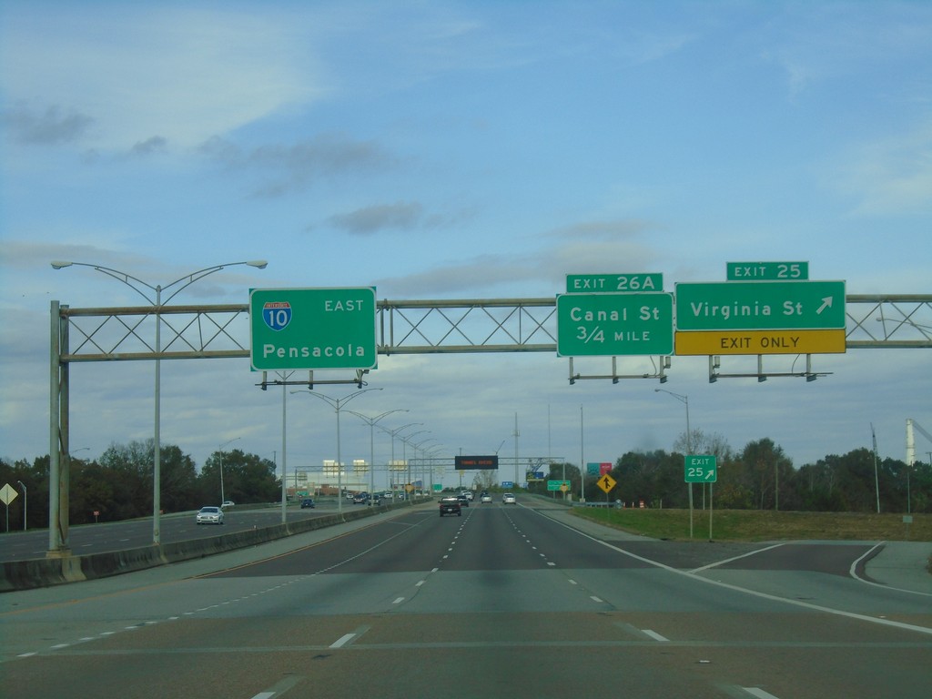
I-10 East - Exits 25 and 26A
I-10 east at Exit 25 - Virginia St. Approaching Exit 26A - Canal St. I-10 continues east towards Pensacola (Florida).
Taken 12-23-2018
Mobile
Mobile County
Alabama
United States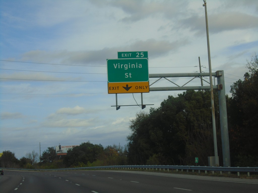
I-10 East - Exit 25
I-10 east approaching Exit 25 - Virginia St.
Taken 12-23-2018
Mobile
Mobile County
Alabama
United States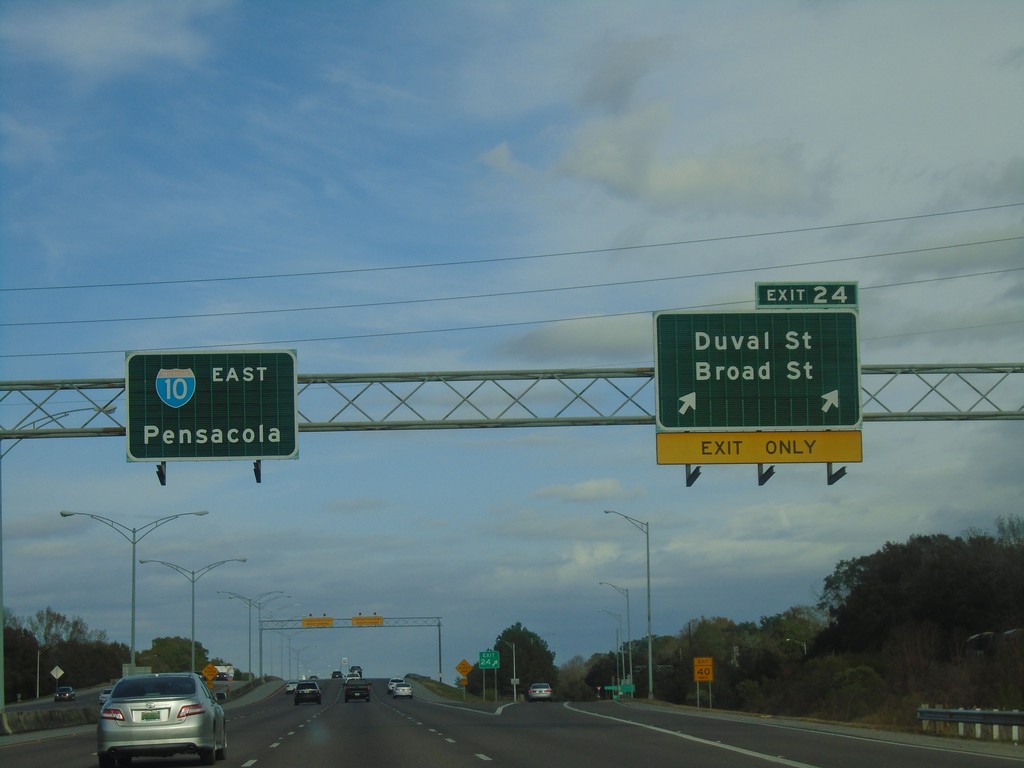
I-10 East - Exit 24
I-10 east at Exit 24 - Duval St./Broad St. I-10 continues east towards Pensacola (Florida).
Taken 12-23-2018
Mobile
Mobile County
Alabama
United States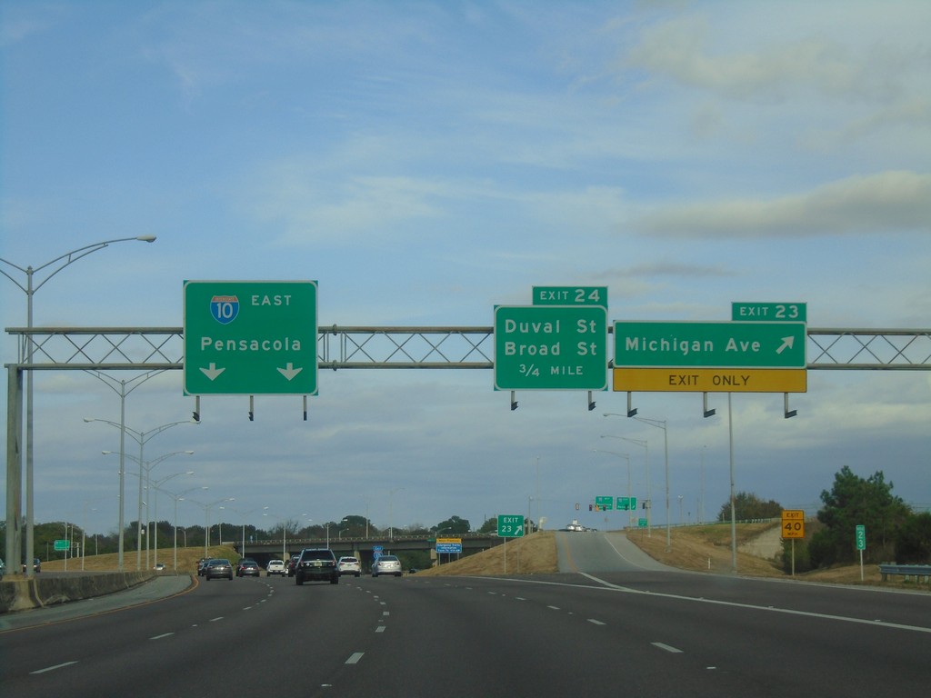
I-10 East - Exit 23
I-10 east at Exit 23 - Michigan Ave. Approaching Exit 24 - Duval St./Broad St. I-10 continues east towards Pensacola (Florida).
Taken 12-23-2018
Mobile
Mobile County
Alabama
United States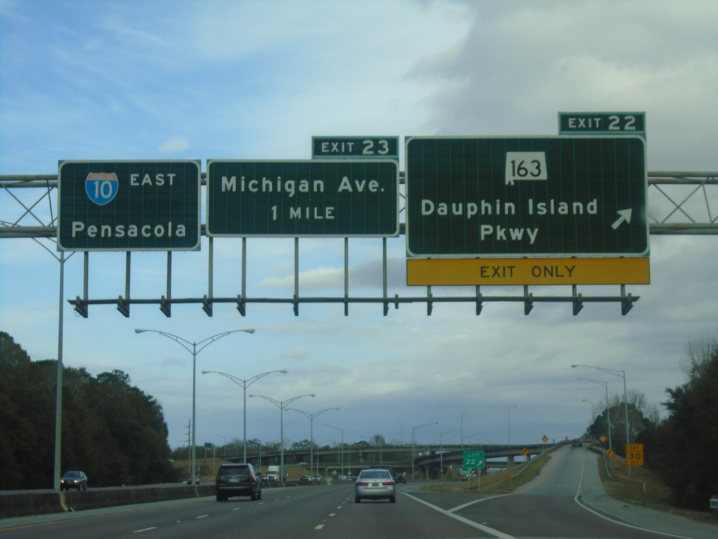
I-10 East - Exits 22 and 23
I-10 east at Exit 22 - AL-163/Dauphin Island Parkway. Approaching Exit 23 - Michigan Ave. Continue east on I-10 for Pensacola (Florida).
Taken 12-23-2018
 Mobile
 County
Alabama
United States
Mobile
Mobile County
Alabama
United States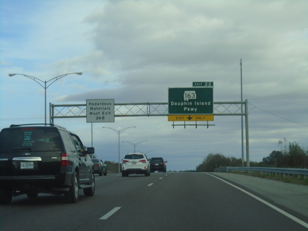
I-10 East - Exit 22
I-10 east approaching Exit 22 - AL-163/Dauphin Island Parkway. Vehicles carrying hazardous materials must exit at Exit 26B.
Taken 12-23-2018
Mobile
Mobile County
Alabama
United States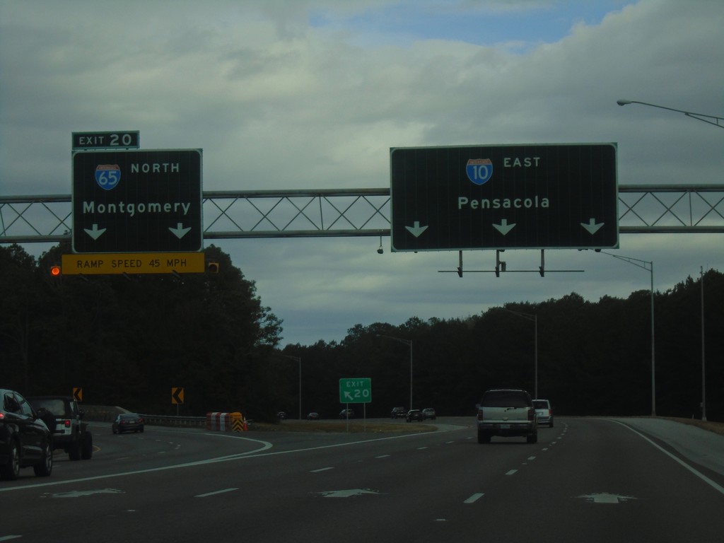
I-10 East - Exit 20
I-10 east at Exit 20 - I-65 North/Montgomery. Continue east on I-10 for Pensacola (Florida). This is the southern end of I-65.
Taken 12-23-2018
 Mobile
 County
Alabama
United States
Mobile
Mobile County
Alabama
United States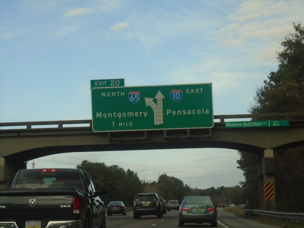
I-10 East Approaching Exit 20
I-10 East Approaching Exit 20 - I-65 North/Montgomery. Continue east on I-10 for Pensacola (Florida).
Taken 12-23-2018
Mobile
Mobile County
Alabama
United States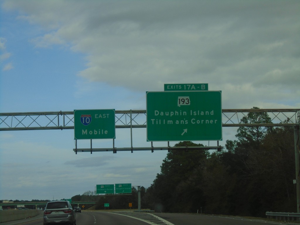
I-10 East - Exits 17A-B
I-10 east at Exits 17A-B - AL-193/Dauphin Island/Tillman’s Corner. Continue east on I-10 to Mobile.
Taken 12-23-2018
 Mobile
 County
Alabama
United States
Mobile
Mobile County
Alabama
United States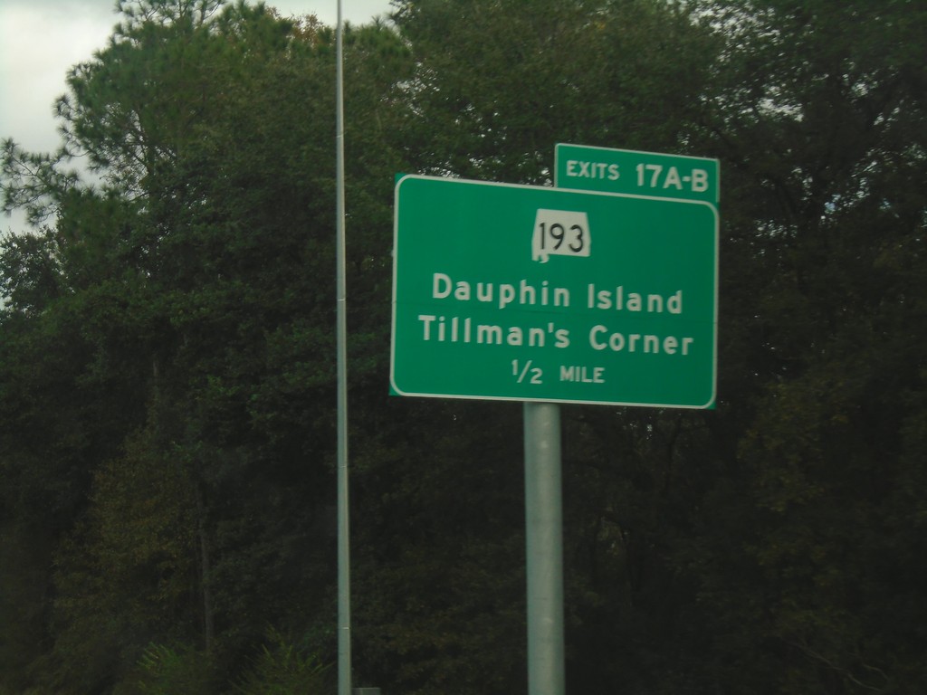
I-10 East - Exits 17A-B
I-10 east approaching Exits 17A-B - AL-193/Dauphin Island/Tillman’s Corner.
Taken 12-23-2018
Theodore
Mobile County
Alabama
United States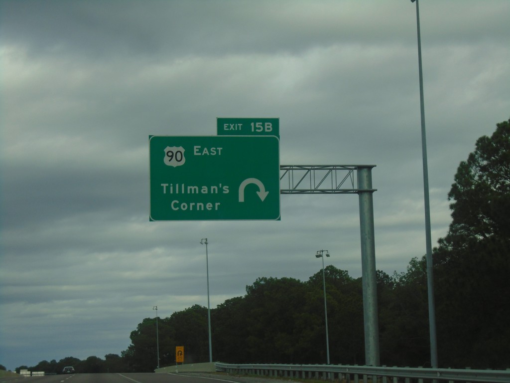
I-10 East - Exit 15B
I-10 east at Exit 15B - US-90 East/Tillman’s Corner.
Taken 12-23-2018
Theodore
Mobile County
Alabama
United States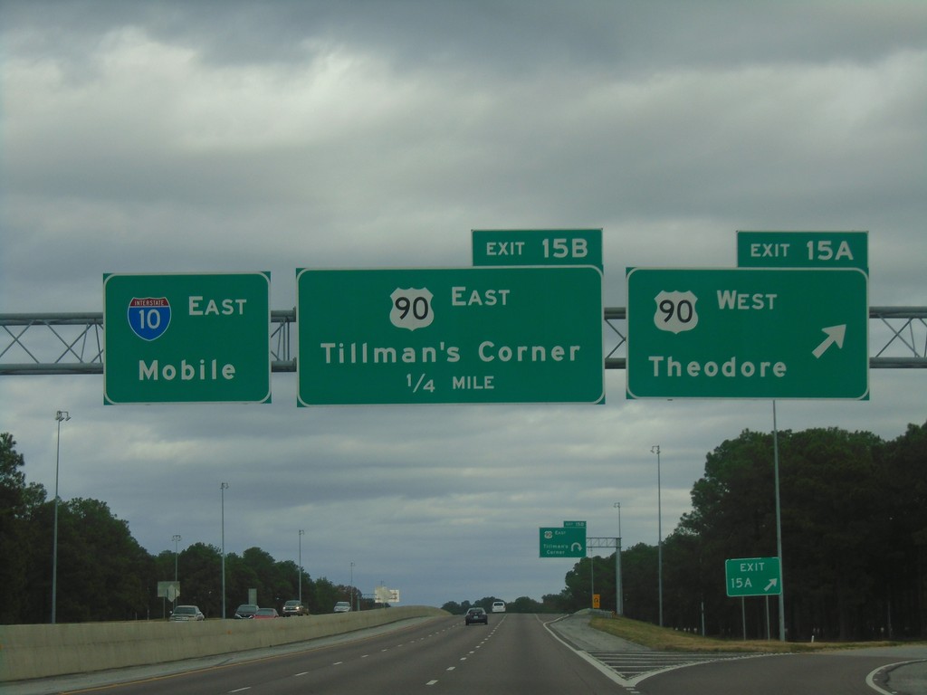
I-10 East - Exits 15A and 15B
I-10 east at Exit 15A - US-90 West/Theodore. Approaching Exit 15B - US-90 East/Tillman’s Corner. Continue east on I-10 for Mobile.
Taken 12-23-2018
Theodore
Mobile County
Alabama
United States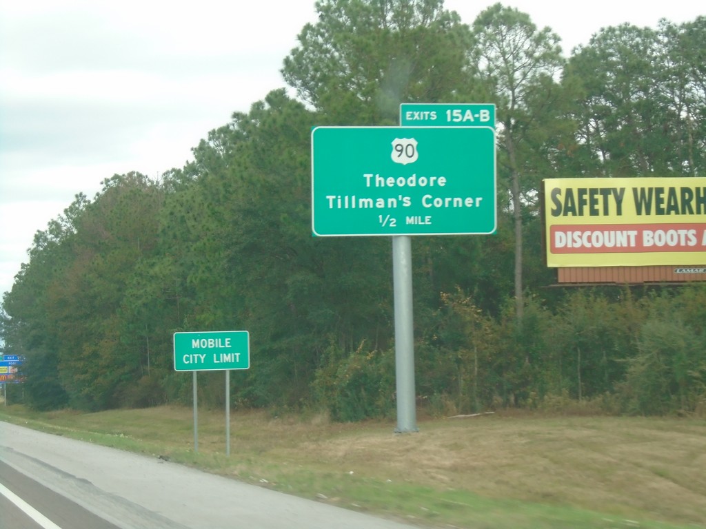
I-10 East - Exits 15A-B
I-10 East approaching Exits 15A-B - US-90/Theodore/Tillman’s Corner. Entering the city of Mobile.
Taken 12-23-2018
Theodore
Mobile County
Alabama
United States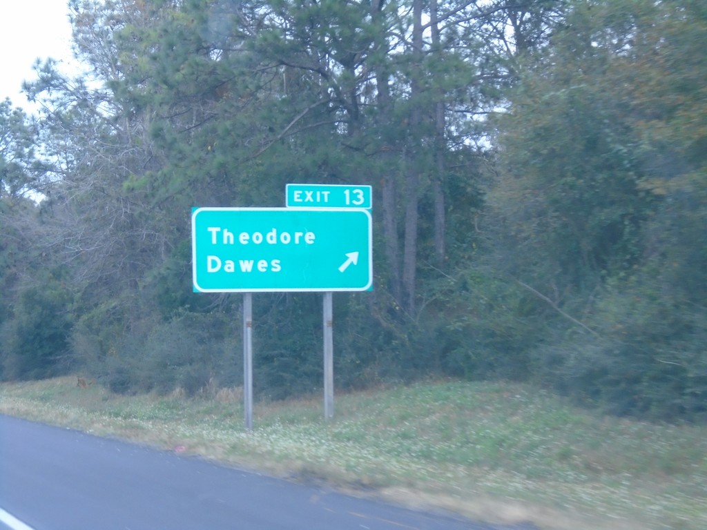
I-10 East - Exit 13
I-10 east at Exit 13 - Theodore/Dawes.
Taken 12-23-2018
Theodore
Mobile County
Alabama
United States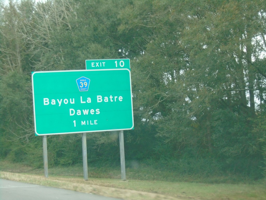
I-10 East - Exit 10
I-10 east approaching Exit 10 - CR-39/Bayou La Batre/Dawes.
Taken 12-23-2018
 Theodore
Mobile County
Alabama
United States
Theodore
Mobile County
Alabama
United States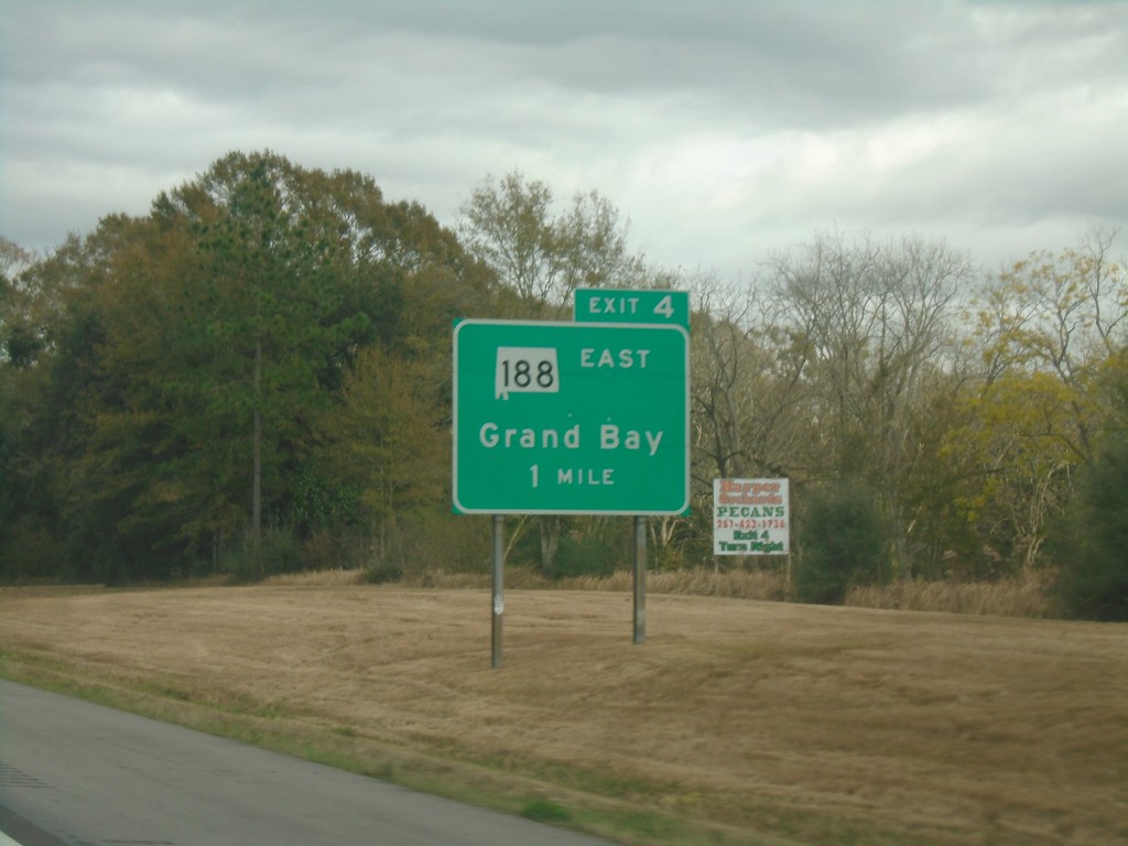
I-10 East - Exit 4
I-10 east approaching Exit 4 - AL-188 East/Grand Bay. This is the first exit in Alabama eastbound on I-10.
Taken 12-23-2018
 Grand Bay
Mobile County
Alabama
United States
Grand Bay
Mobile County
Alabama
United States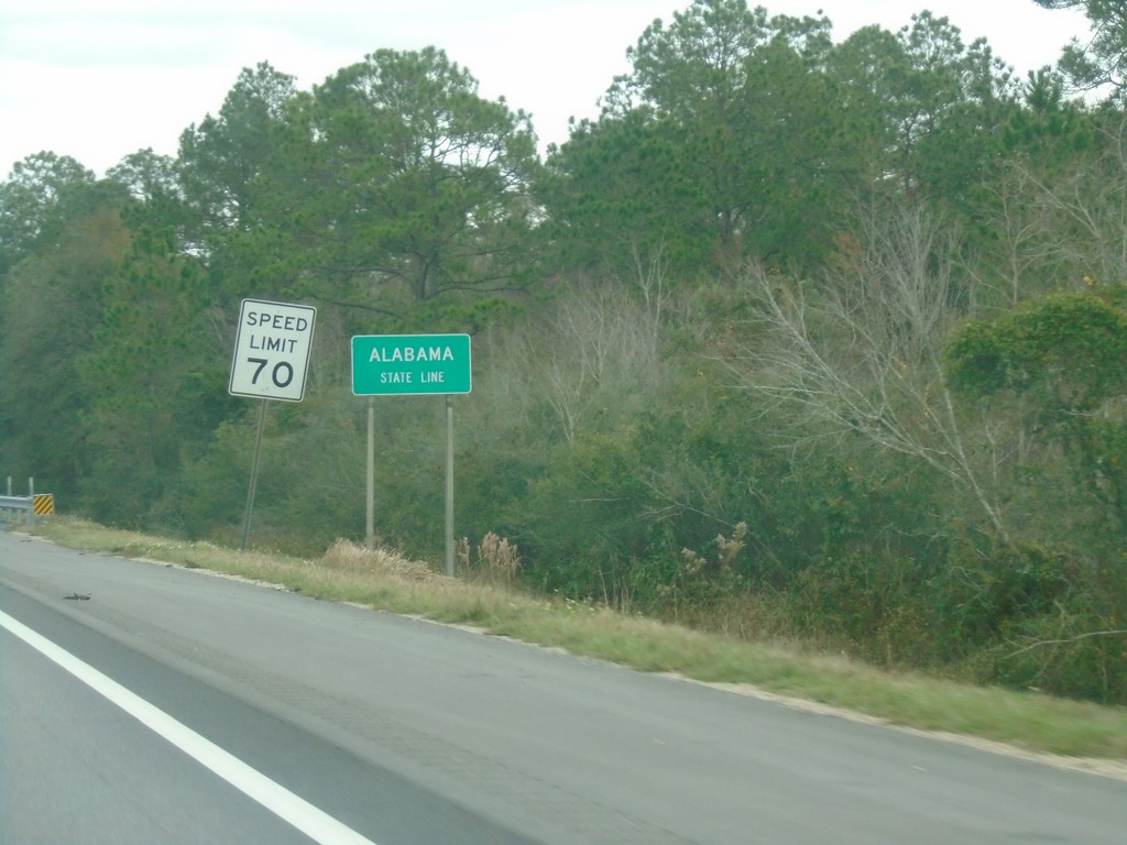
I-10 East - Alabama State Line
Alabama State Line on I-10 East.
Taken 12-23-2018
Grand Bay
Mobile County
Alabama
United States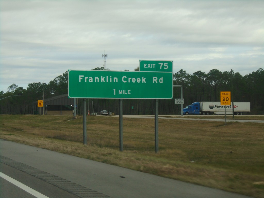
I-10 East - Exit 75
I-10 east approaching Exit 75 - Franklin Creek Road. This is the last exit on I-10 in Mississippi.
Taken 12-23-2018
Moss Point
Jackson County
Mississippi
United States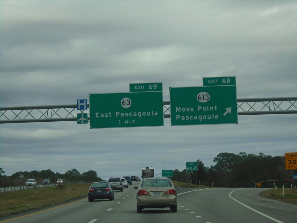
I-10 East - Exits 68 and 69
I-10 east at Exit 68 - MS-613/Moss Point/Pascagoula. Approaching Exit 69 - MS-63/East Pascagoula.
Taken 12-23-2018

 Moss Point
Jackson County
Mississippi
United States
Moss Point
Jackson County
Mississippi
United States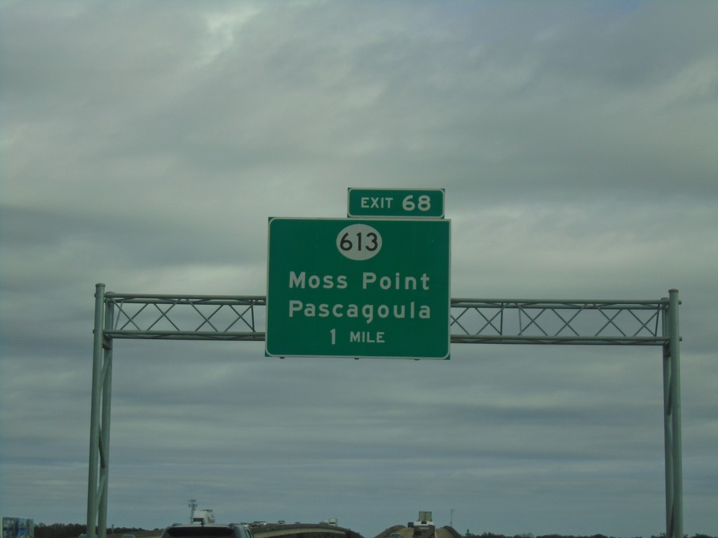
I-10 East - Exit 68
I-10 east approaching Exit 68 - MS-613/Moss Point/Pascagoula.
Taken 12-23-2018
Moss Point
Jackson County
Mississippi
United States