Signs Tagged With Big Green Sign
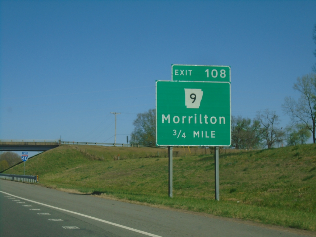
I-40 East - Exit 108
I-40 east approaching Exit 108 - AR-9/Morrilton
Taken 03-28-2026

 Morrilton
Conway County
Arkansas
United States
Morrilton
Conway County
Arkansas
United States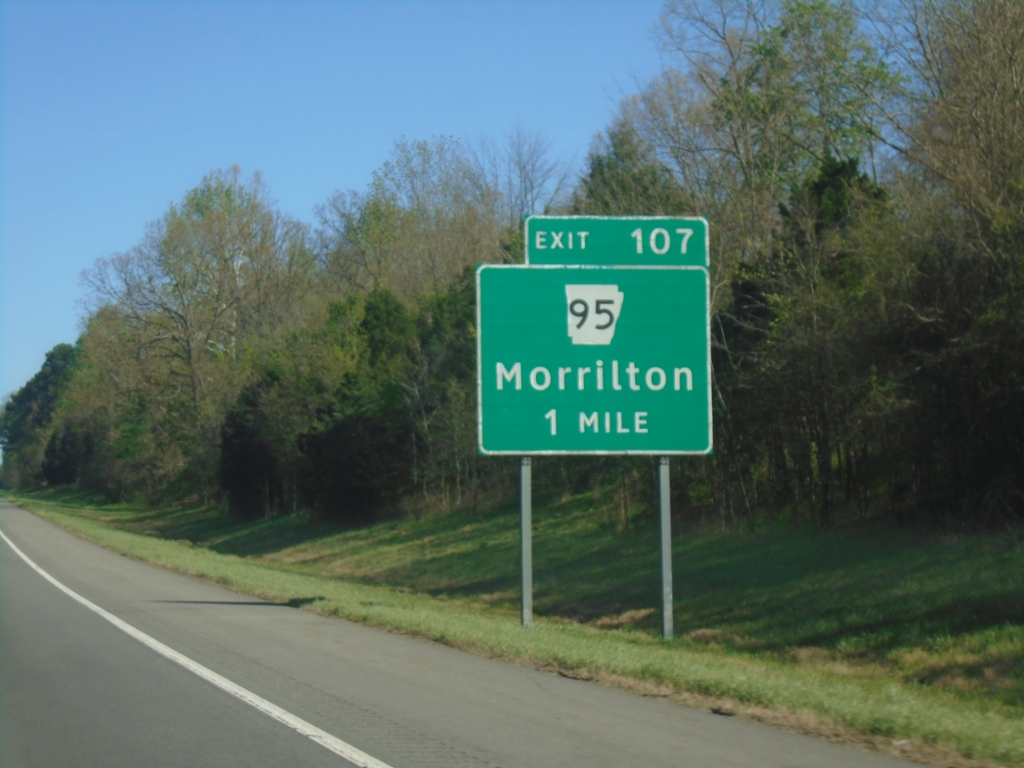
I-40 East - Exit 107
I-40 east approaching Exit 107 - AR-95/Morrilton.
Taken 03-28-2026
 Morrilton
Conway County
Arkansas
United States
Morrilton
Conway County
Arkansas
United States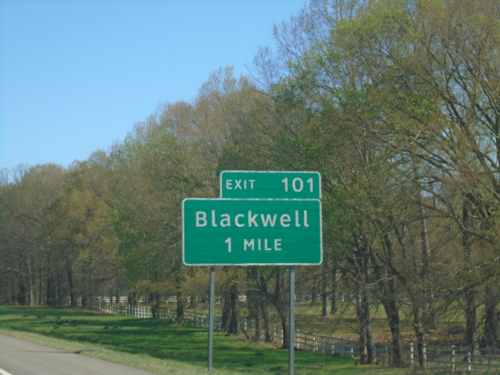
I-40 East - Exit 101
I-40 east approaching Exit 101 - Blackwell
Taken 03-28-2026
Atkins
Conway County
Arkansas
United States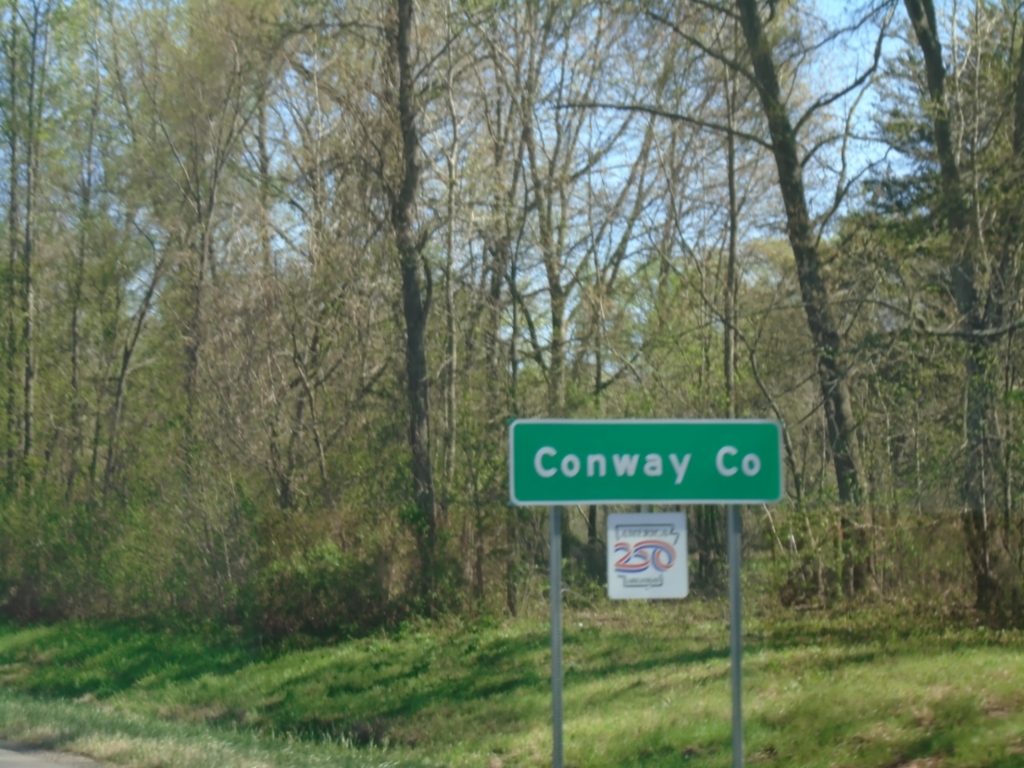
I-40 East - Conway County
Entering Conway County on I-40 East.
Taken 03-28-2026
Atkins
Conway County
Arkansas
United States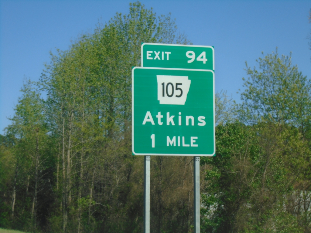
I-40 East - Exit 94
I-40 east approaching Exit 94 - AR-105/Atkins.
Taken 03-28-2026
 Atkins
Pope County
Arkansas
United States
Atkins
Pope County
Arkansas
United States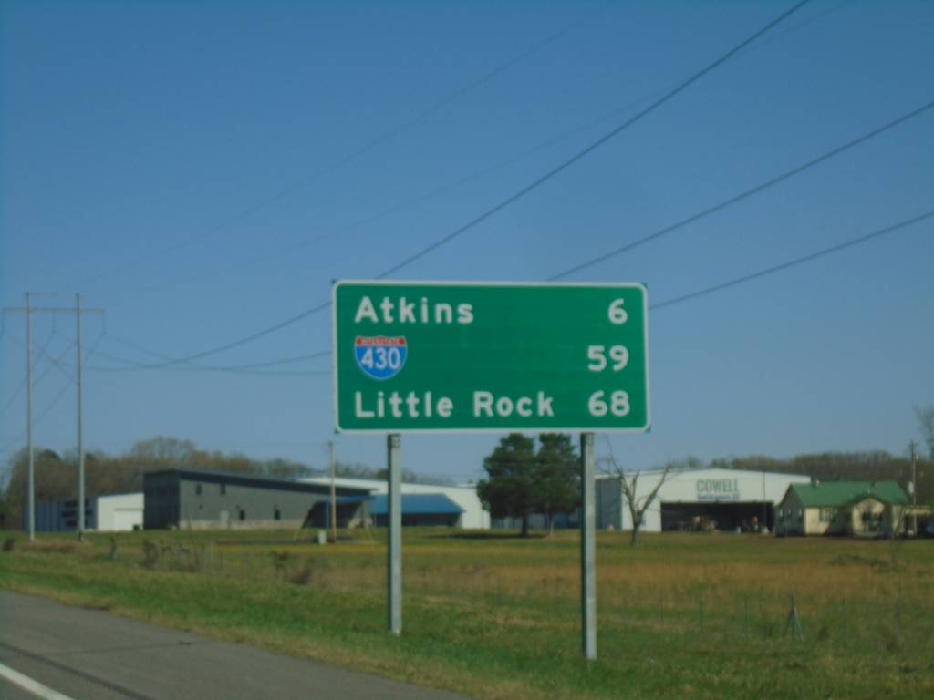
I-40 East - Distance Marker
Distance marker on I-40 east. Distance to Atkins, Jct. I-430, and Little Rock.
Taken 03-28-2026
 Pottsville
Pope County
Arkansas
United States
Pottsville
Pope County
Arkansas
United States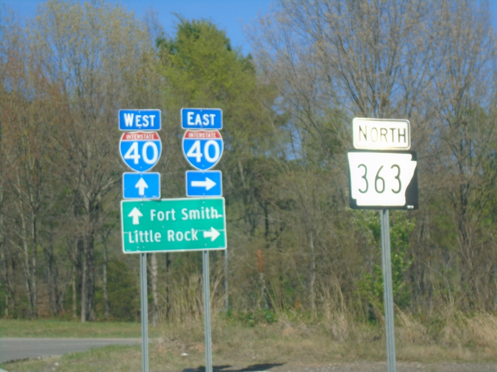
AR-363 North at I-40
AR-363 North at I-40 (Exit 88) in Pope County. Use I-40 East to Little Rock; I-40 West to Fort Smith.
Taken 03-28-2026
 Pottsville
Pope County
Arkansas
United States
Pottsville
Pope County
Arkansas
United States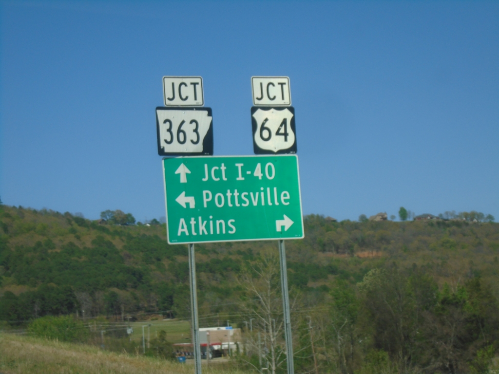
AR-247 at US-64/AR-363
AR-247 at US-64/AR-363 in Pope County. Use US-64 East to Atkins; US-64 West to Pottsville. Use AR-363 North to I-40 Junction.
Taken 03-28-2026

 Pottsville
Pope County
Arkansas
United States
Pottsville
Pope County
Arkansas
United States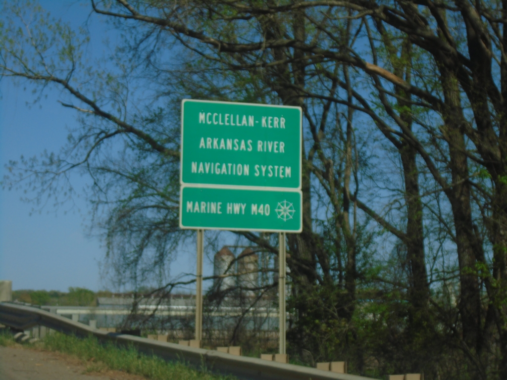
AR-7 North - Arkansas River
AR-7 North crossing the Arkansas River. This is part of the McClellan-Kerr Arkansas River Navigation System and Marine Highway M40.
Taken 03-28-2026
 Dardanelle
Yell County
Arkansas
United States
Dardanelle
Yell County
Arkansas
United States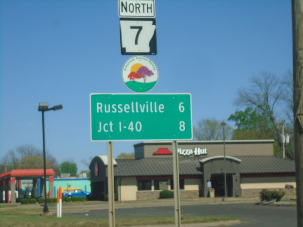
AR-7 North - Dardanelle
AR-7 North in Dardanelle. Distance to Russellville and I-40. AR-7 is part of the Arkansas Scenic 7 Byway.
Taken 03-28-2026
Dardanelle
Yell County
Arkansas
United States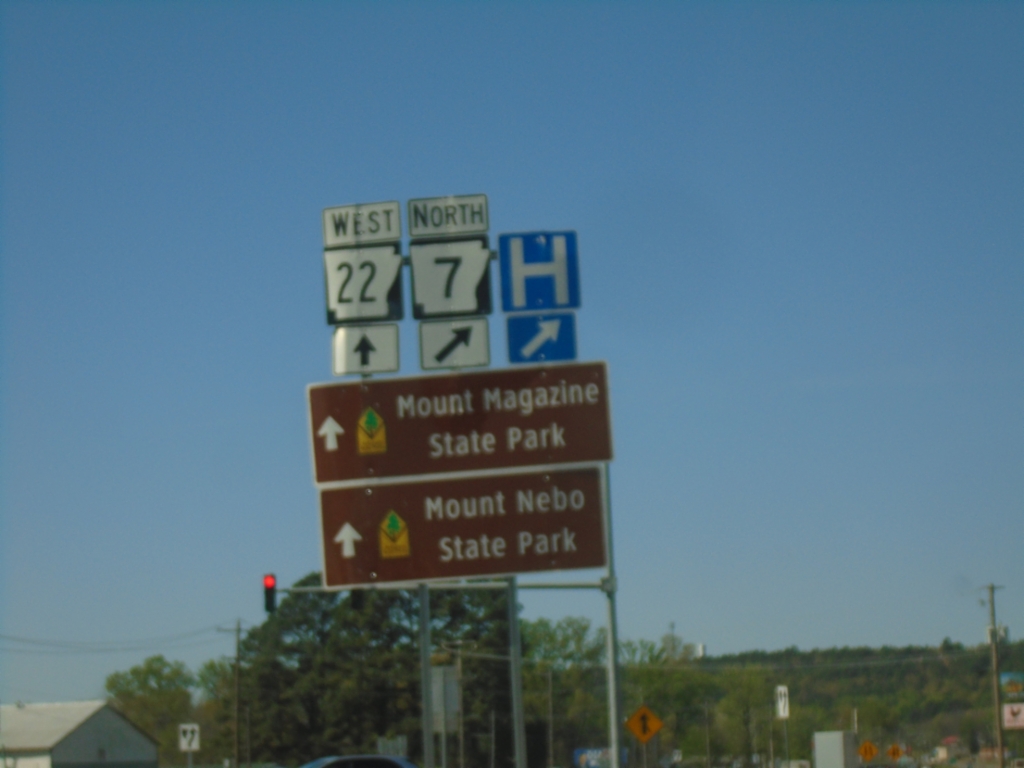
AR-7 North/AR-22 West Split
AR-7 North/AR-22 West Split in Dardanelle. Use AR-22 West to Mount Magazine State Park and Mount Nebo State Park.
Taken 03-28-2026
 Dardanelle
Yell County
Arkansas
United States
Dardanelle
Yell County
Arkansas
United States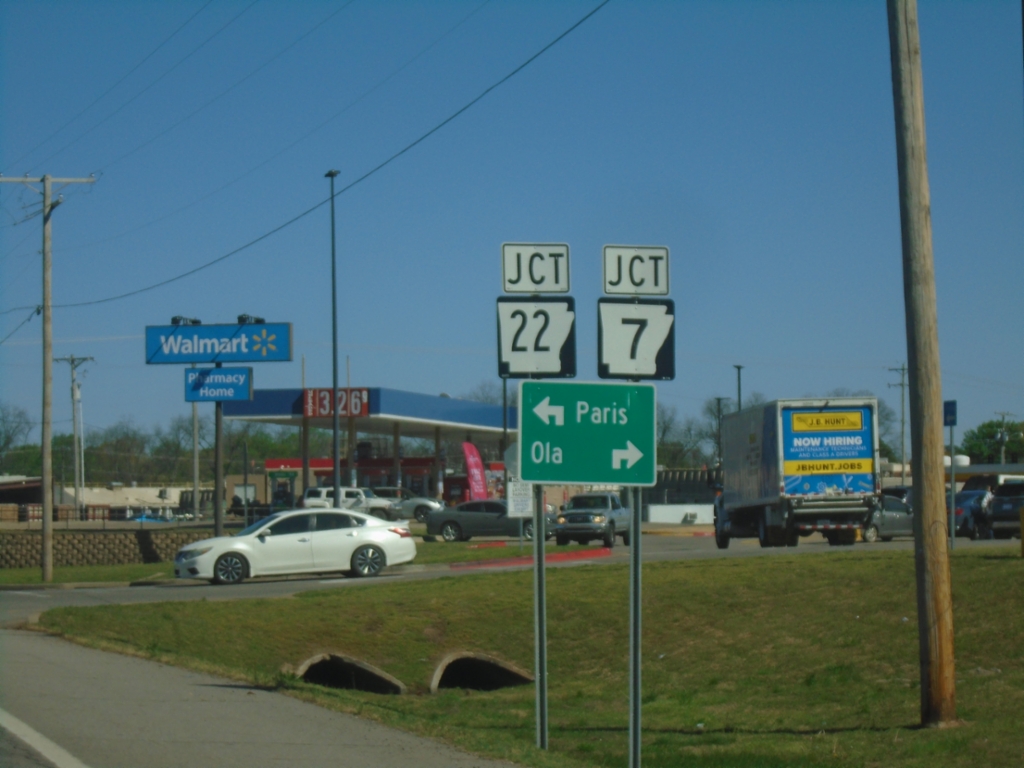
AR-27 North Approaching AR-22 and AR-7
AR-27 North Approaching AR-22 and AR-7 in Dardanelle. Turn right for AR-7/AR-22 to Ola; left for AR-7/AR-22 to Paris.
Taken 03-28-2026
 Dardanelle
Yell County
Arkansas
United States
Dardanelle
Yell County
Arkansas
United States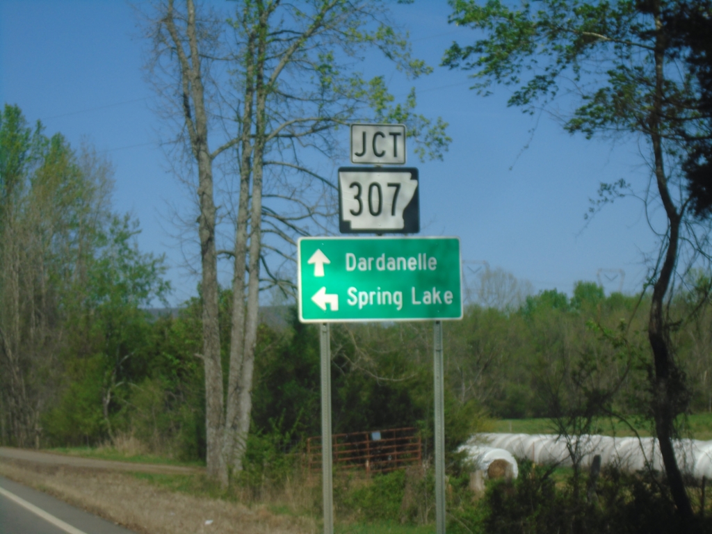
AR-27 North at AR-307
AR-27 North at AR-307 to Spring Lake. Continue north on AR-27 for Dardanelle.
Taken 03-28-2026
 Belleville
St. Louis County
Arkansas
United States
Belleville
St. Louis County
Arkansas
United States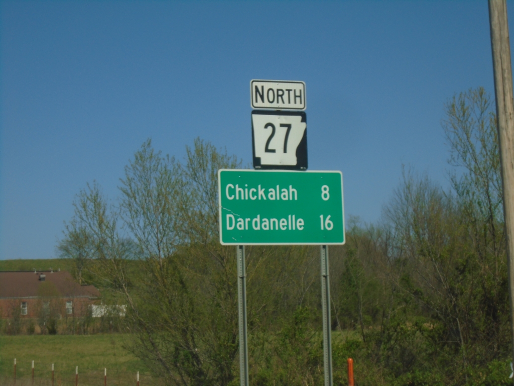
AR-27 North - Distance Marker
Distance marker on AR-27 North. Distance to Chickalah and Dardanelle.
Taken 03-28-2026
Ranger
Yell County
Arkansas
United States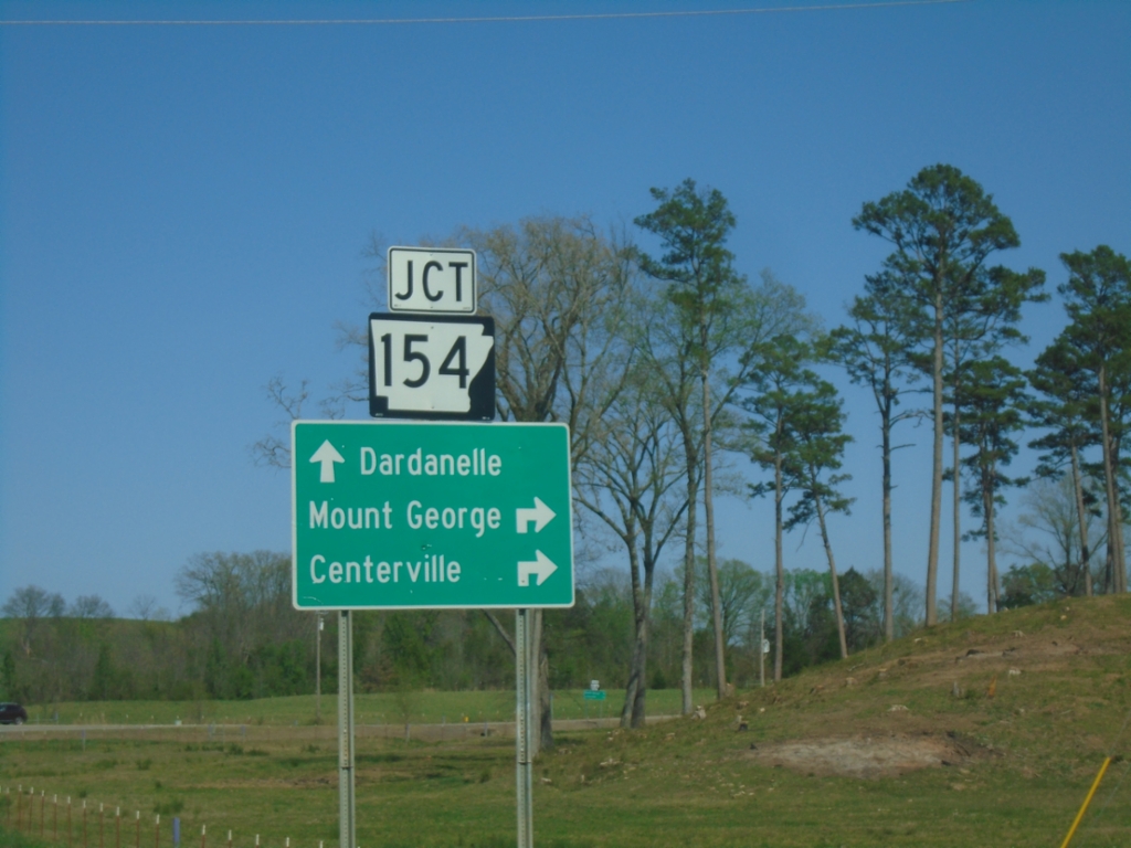
AR-27 East at AR-154
AR-27 East at AR-154 in Yell County. Use AR-154 to Mount George and Centerville. Continue on AR-27 for Dardanelle.
Taken 03-28-2026
 Danville
Yell County
Arkansas
United States
Danville
Yell County
Arkansas
United States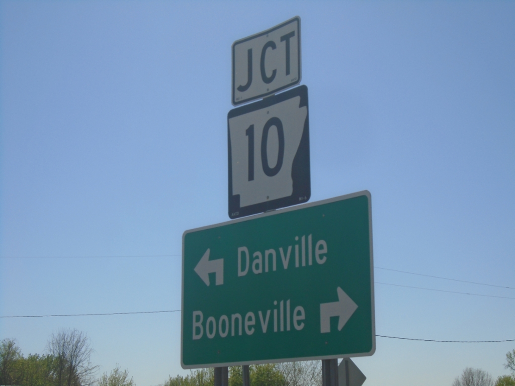
AR-27 West at AR-10
AR-27 West at AR-10 in Danville. Use AR-10 West to Booneville; AR-10 East to Danville.
Taken 03-28-2026
 Danville
Yell County
Arkansas
United States
Danville
Yell County
Arkansas
United States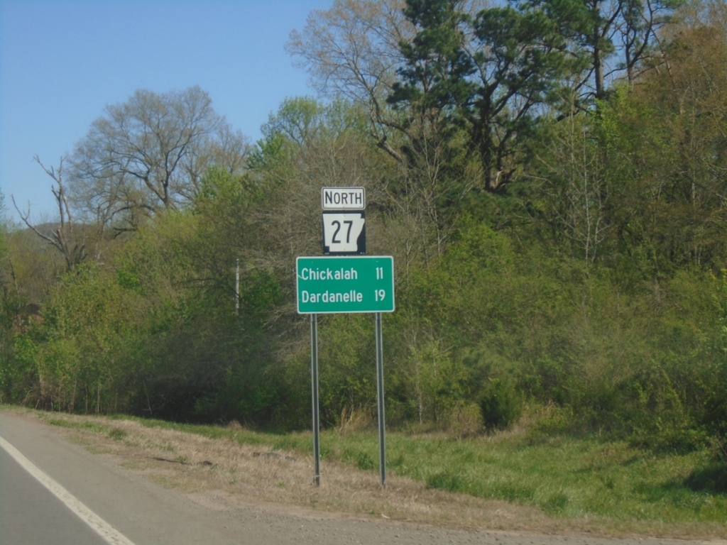
AR-27 North - Distance Marker
Distance marker on AR-27 North. Distance to Chickalah and Dardanelle.
Taken 03-28-2026
Danville
Yell County
Arkansas
United States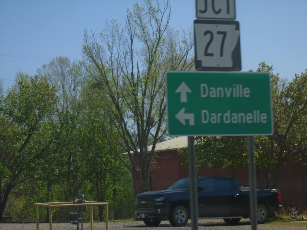
AR-10 East at AR-27
AR-10 East at AR-27 in Danville. Use AR-27 East to Dardanelle; continue on AR-10 East to Danville.
Taken 03-28-2026
Danville
Yell County
Arkansas
United States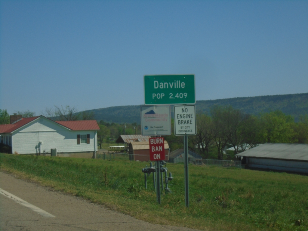
AR-10 East - Danville
Entering Danville on AR-10 East. Danville is one of the county seats of Yell County.
Taken 03-28-2026
Belleville
Yell County
Arkansas
United States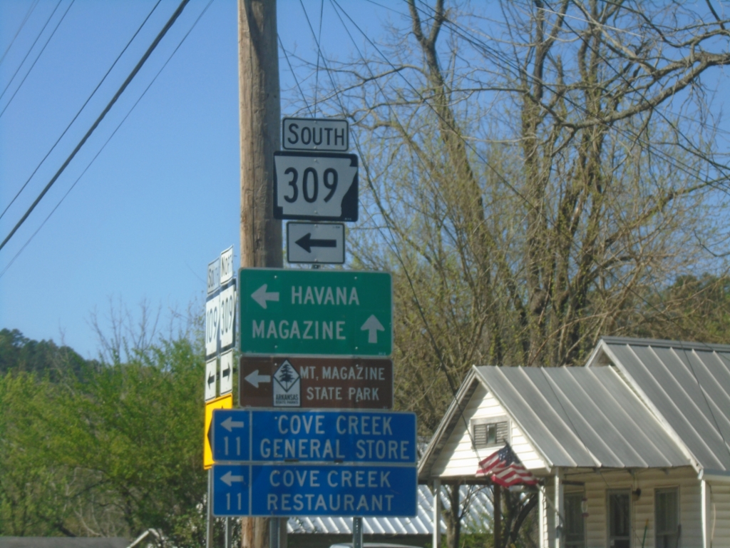
AR-109/AR-309 South at AR-109/AR-309 Split
AR-109/AR-309 South at AR-109/AR-309 Split in Paris. Turn left for AR-309 South to Havana and Mount Magazine State Park. Continue on AR-109 for Magazine.
Taken 03-28-2026

 Paris
Logan County
Arkansas
United States
Paris
Logan County
Arkansas
United States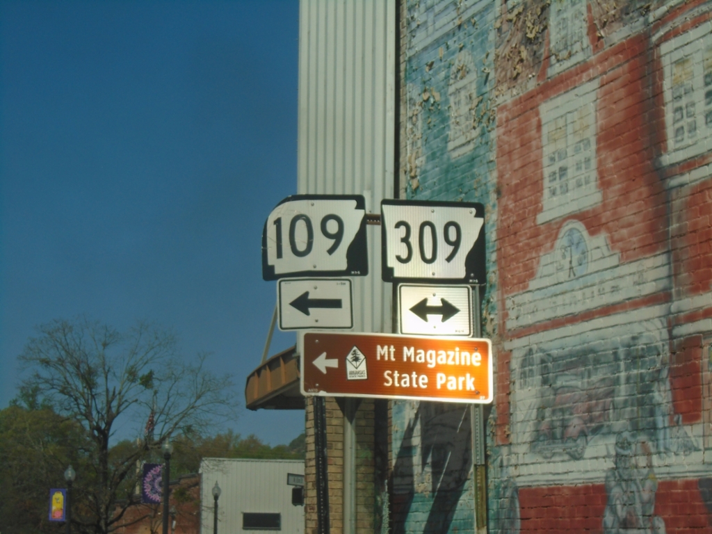
AR-22 West at AR-109/AR-309
AR-22 West at AR-109/AR-309 in Paris. Turn left on AR-109/AR-309 South to Mount Magazine State Park.
Taken 03-28-2026
Paris
Logan County
Arkansas
United States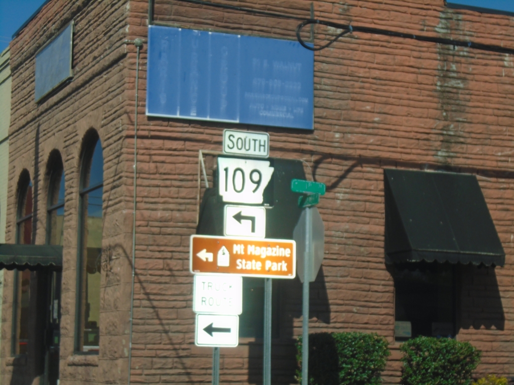
AR-22 West at AR-109/AR-309
AR-22 West at AR-109/AR-309. Turn left on AR-109/AR-309 South to Mount Magazine State Park.
Taken 03-28-2026
Paris
Logan County
Arkansas
United States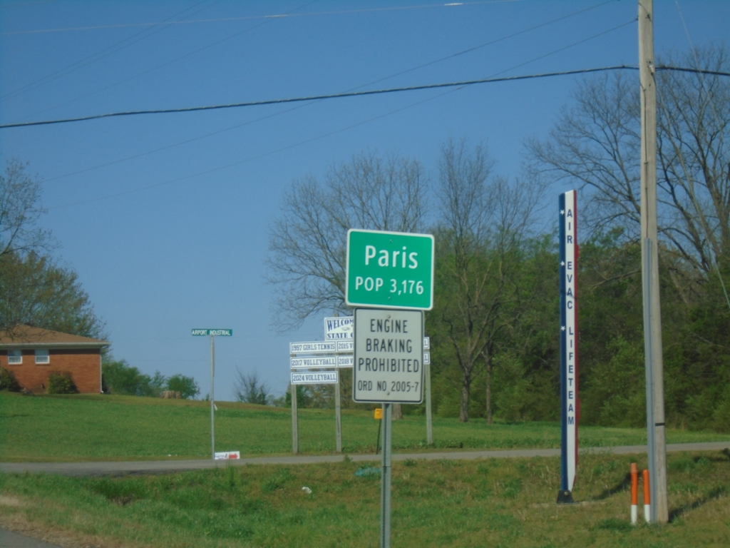
AR-22 West - Paris
Entering Paris on AR-22 west. Paris is one of the county seats of Logan County.
Taken 03-28-2026
Paris
Logan County
Arkansas
United States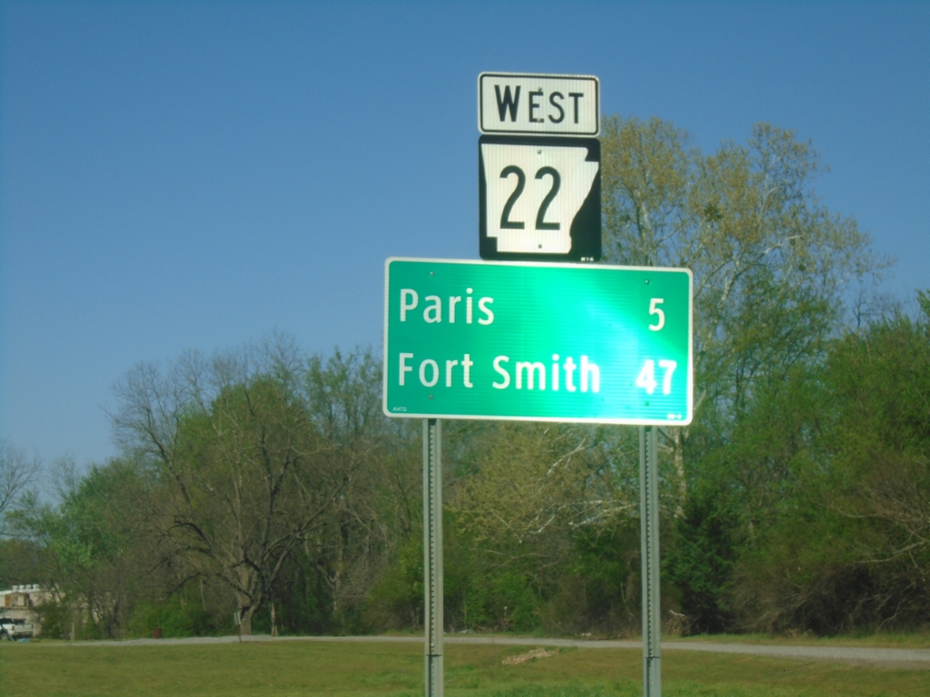
AR-22 West - Distance Marker
Distance marker on AR-22 west. Distance to Paris and Fort Smith.
Taken 03-28-2026
Subiaco
Logan County
Arkansas
United States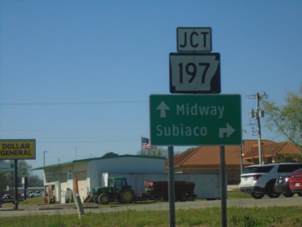
AR-109 South at AR-197
AR-109 South at AR-197 in Scranton. Use AR-197 West to Subiaco. Continue south on AR-109 to Midway.
Taken 03-28-2026
 Scranton
Logan County
Arkansas
United States
Scranton
Logan County
Arkansas
United States