Signs Tagged With Big Green Sign
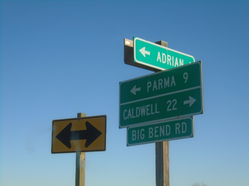
OR-452 East at OR-454
OR-452 East at OR-454 (Big Bend Road) in Malheur County. Turn right for OR-454 East to Caldwell (Idaho); turn left for OR-452 East to Parma (Idaho). OR-452 and OR-454 are both unsigned for their entire length.
Taken 11-10-2018

 Adrian
Malheur County
Oregon
United States
Adrian
Malheur County
Oregon
United States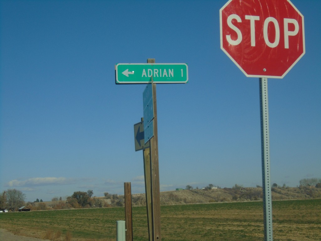
OR-454 North at OR-452
OR-454 North at OR-452 in Malheur County. Use OR-452 West for Adrian.
Taken 11-10-2018
Adrian
Malheur County
Oregon
United States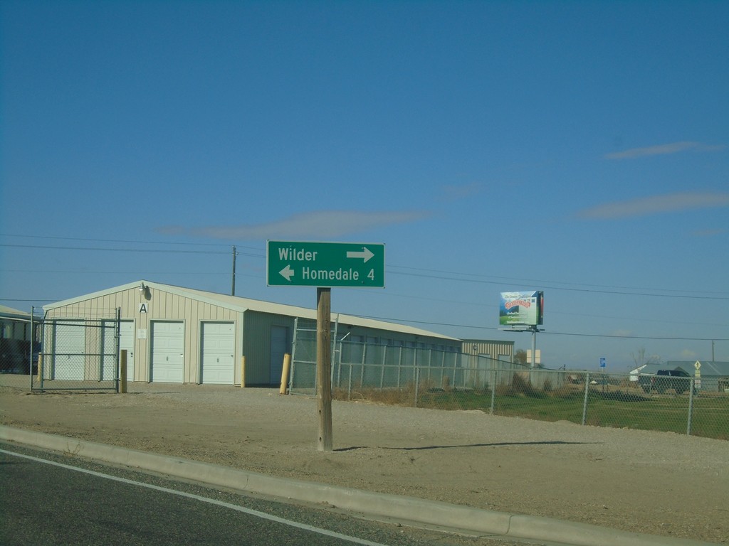
ID-19 West at US-95 - Wilder
ID-19 West at US-95 in Wilder. Turn right on US-95 North to Wilder; left for US-95 South/ID-19 West to Homedale.
Taken 11-10-2018

 Wilder
Canyon County
Idaho
United States
Wilder
Canyon County
Idaho
United States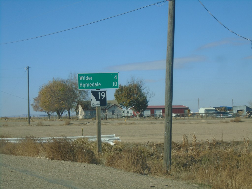
ID-19 West - Distance Marker
Distance marker on ID-19 west. Distance to Wilder and Homedale.
Taken 11-10-2018
Greenleaf
Canyon County
Idaho
United States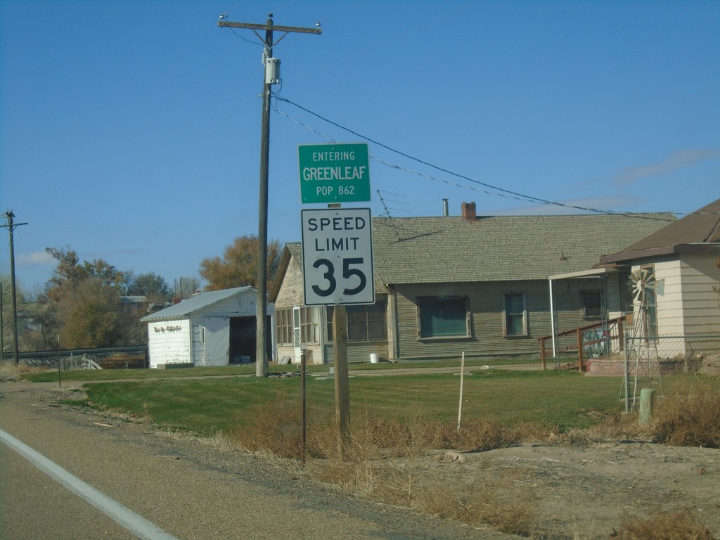
ID-19 West - Greenleaf
Entering Greenleaf on ID-19 west. Speed Limit 35 MPH.
Taken 11-10-2018
Greenleaf
Canyon County
Idaho
United States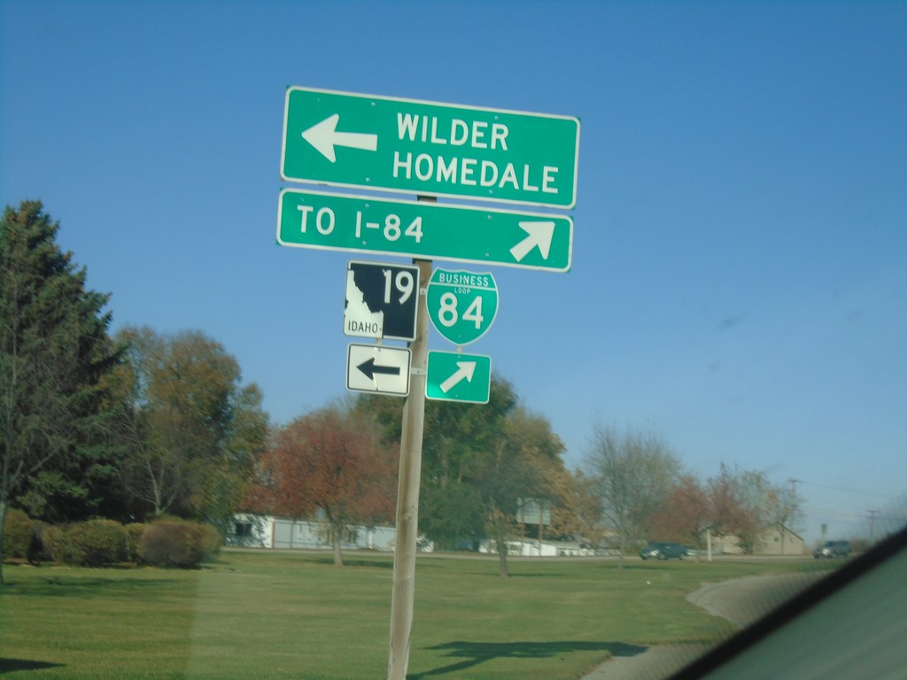
BL-84 West at ID-19 - Caldwell
BL-84 West at ID-19 in Caldwell. Turn left for ID-19 West to Wilder and Homedale. Turn right to continue on BL-84 West to I-84.
Taken 11-10-2018

 Caldwell
Canyon County
Idaho
United States
Caldwell
Canyon County
Idaho
United States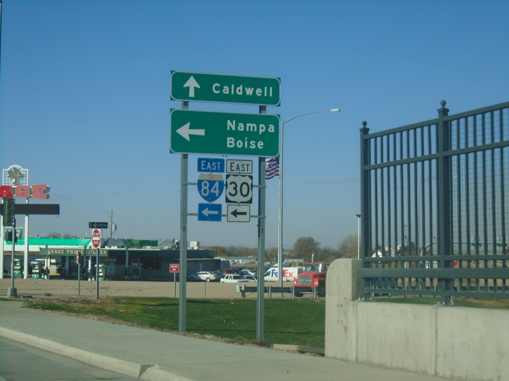
US-20/US-26 West at I-84 East - Caldwell
US-20/US-26 West at I-84 East in Caldwell. Turn left for US-20/US-26 West to Nampa and Boise. Continue west on Franklin Road to Caldwell.
Taken 11-10-2018


 Caldwell
Canyon County
Idaho
United States
Caldwell
Canyon County
Idaho
United States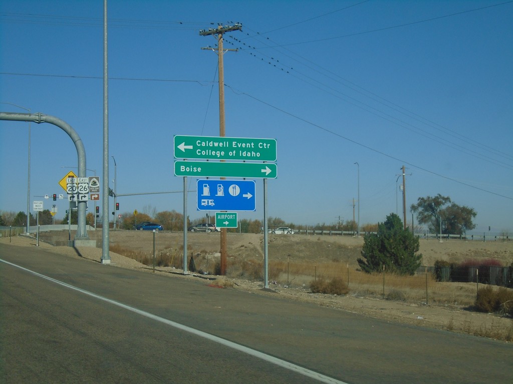
I-84 West Offramp at US-20/US-26 East
I-84 West (Exit 29) offramp at US-20/US-26 East in Caldwell. Turn right for US-20/US-26 East to Boise; left for Franklin Road West to Caldwell Event Center and College of Idaho.
Taken 11-10-2018
Caldwell
Canyon County
Idaho
United States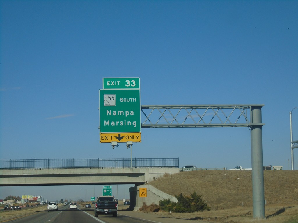
I-84 West - Exit 33
I-84 west at Exit 33 - ID-55 South/Nampa/Marsing. ID-55 leaves I-84 westbound here. This interchange has recently been reconfigured westbound, removing the 33A ramp, and renumbering the interchange to 33.
Taken 11-10-2018
 Nampa
Canyon County
Idaho
United States
Nampa
Canyon County
Idaho
United States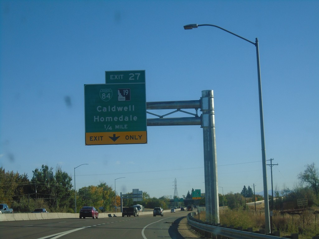
I-84 East - Exit 27
I-84 East approaching Exit 27 - BL-84/ID-19/Caldwell/Homedale.
Taken 10-14-2018
Caldwell
Canyon County
Idaho
United States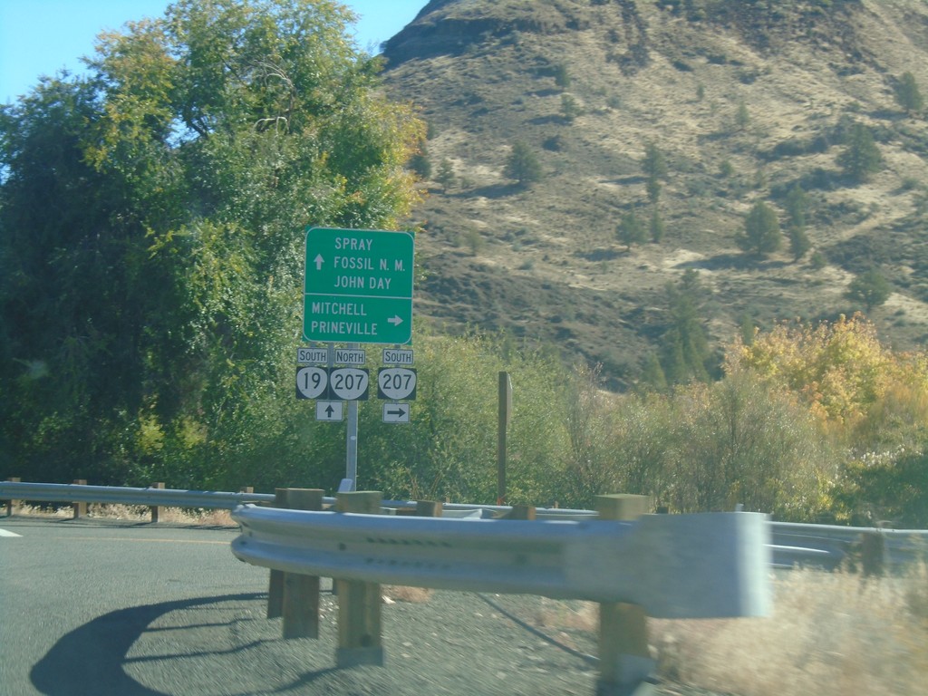
OR-19 South at OR-207
OR-19 South at OR-207 in Service Creek. Use OR-207 south for Mitchell and Prineville. Use OR-19 South/OR-207 North for Spray, (John Day) Fossil (Beds) National Monument (Sheep Rock Unit), and John Day. OR-207 north joins OR-19 south to Spray.
Taken 10-14-2018

 Fossil
Wheeler County
Oregon
United States
Fossil
Wheeler County
Oregon
United States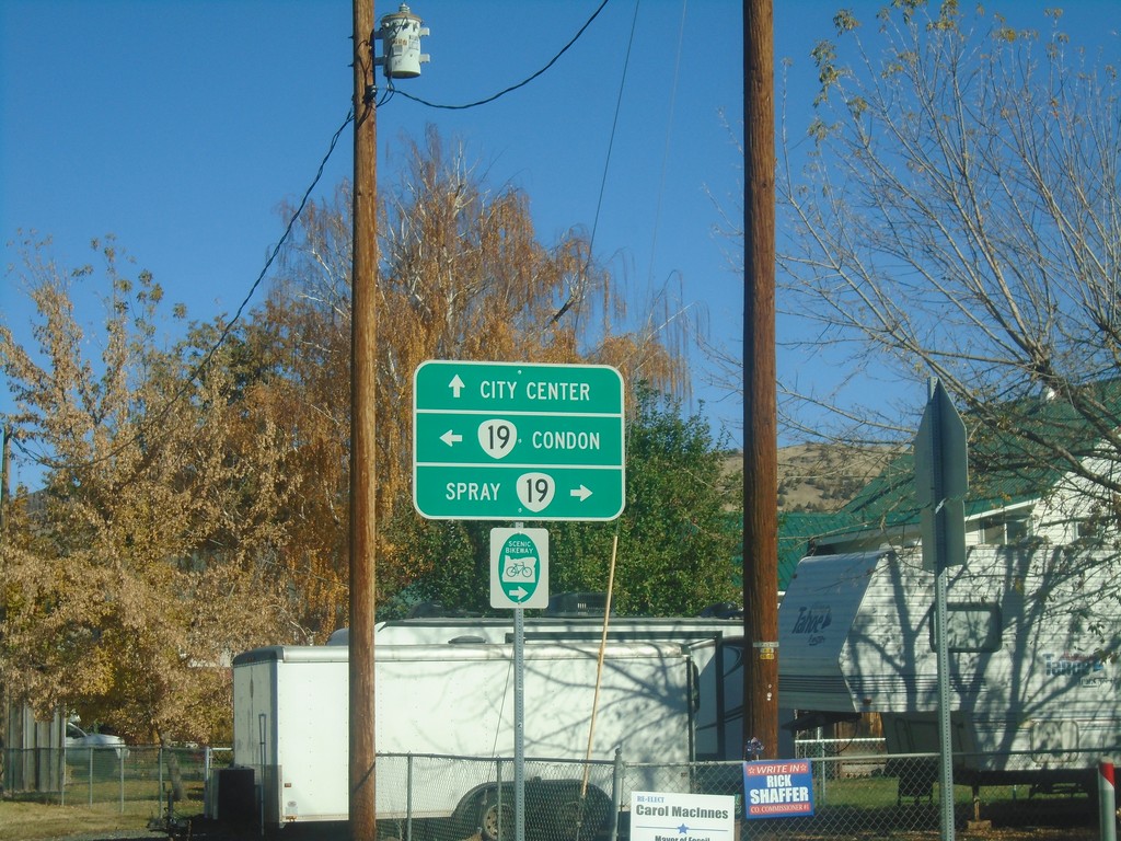
End OR-218 East at OR-19
End OR-218 East at OR-19 in Fossil. Turn left for OR-19 north to Condon; left for OR-19 south to Spray. Continue straight on Washington St. for (Fossil) City Center.
Taken 10-14-2018
 Fossil
Wheeler County
Oregon
United States
Fossil
Wheeler County
Oregon
United States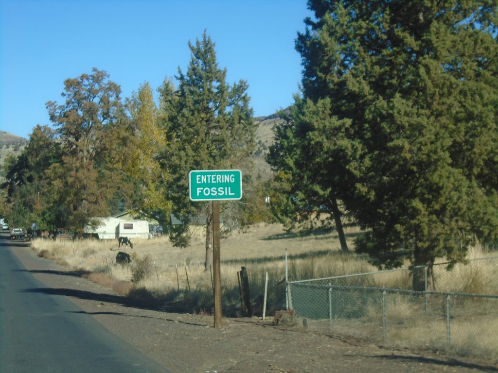
OR-218 East - Fossil
Entering Fossil on OR-218 east. Fossil is the Wheeler County Seat.
Taken 10-14-2018
Fossil
Wheeler County
Oregon
United States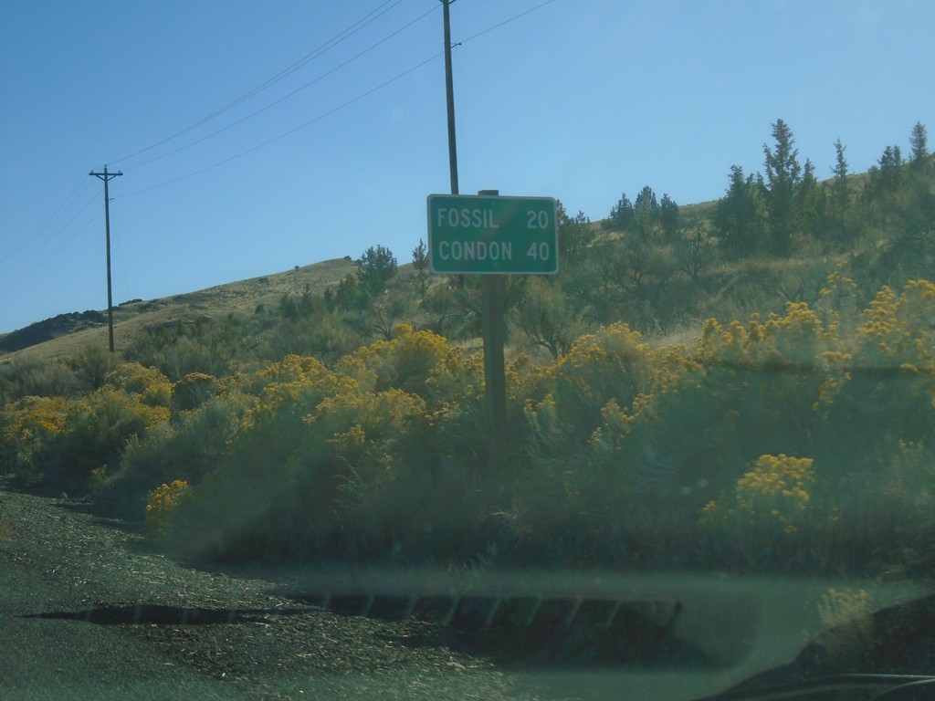
OR-218 East - Distance Marker
Distance marker on OR-218 east. Distance to Fossil and Condon.
Taken 10-14-2018
Fossil
Wheeler County
Oregon
United States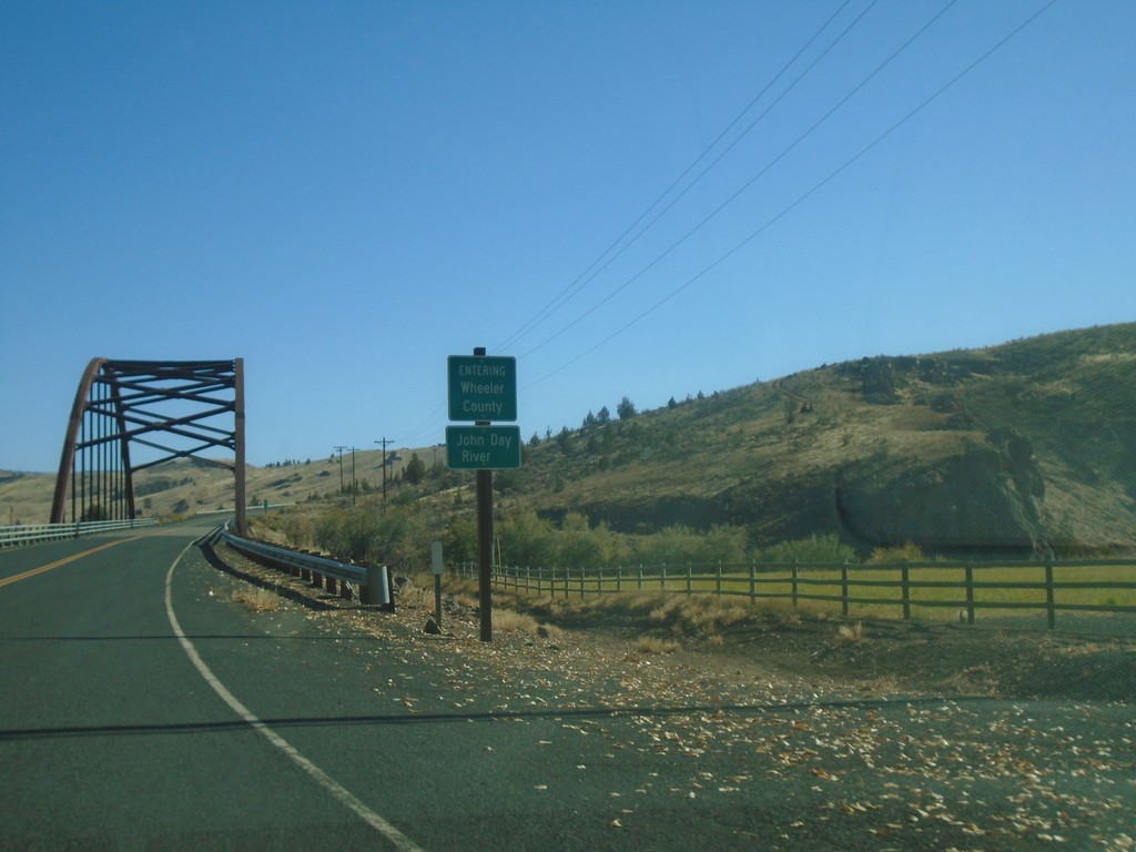
OR-218 East - Wheeler County
Entering Wheeler County on OR-218 East at the John Day River bridge.
Taken 10-14-2018
Fossil
Wheeler County
Oregon
United States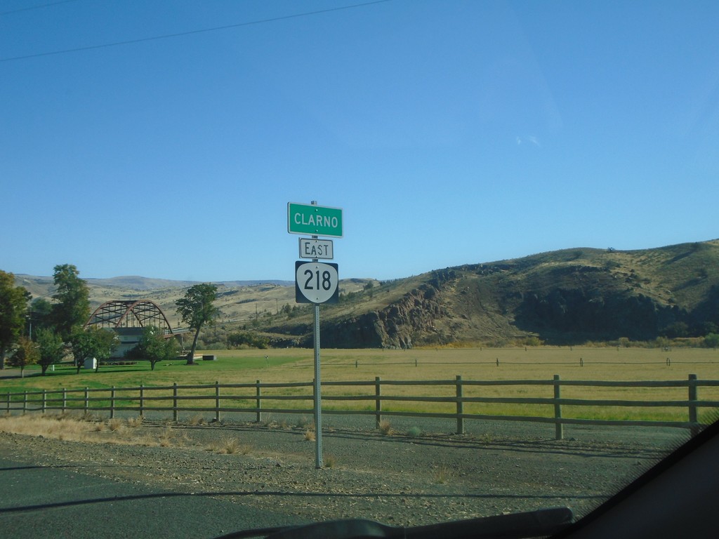
OR-218 East - Clarno
Entering Clarno on OR-218 east.
Taken 10-14-2018
Antelope
Wasco County
Oregon
United States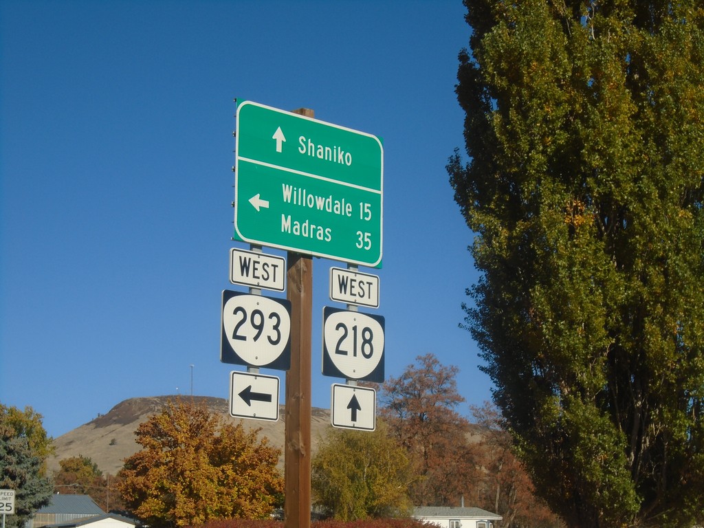
OR-218 West at OR-293 West - Antelope
OR-218 West at OR-293 West in Antelope. Turn left for OR-293 West to Willowdale and Madras; continue straight on OR-218 for Shaniko.
Taken 10-14-2018
 Antelope
Wasco County
Oregon
United States
Antelope
Wasco County
Oregon
United States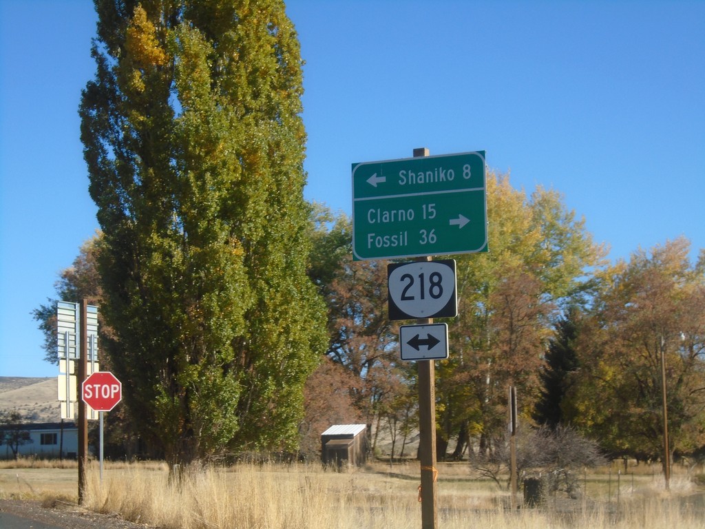
End OR-293 East at OR-218
End OR-293 East at OR-218 in Antelope. Use OR-218 west to Shaniko; OR-218 east to Clarno and Fossil.
Taken 10-14-2018
Antelope
Wasco County
Oregon
United States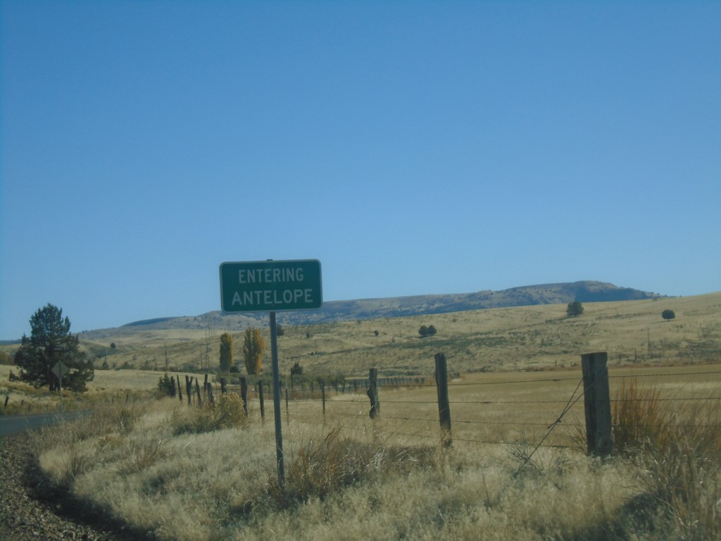
OR-293 East - Antelope
Entering Antelope on OR-293 East.
Taken 10-14-2018
Antelope
Wasco County
Oregon
United States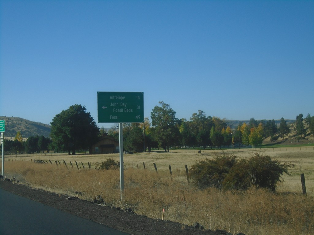
US-97 South at OR-293
US-97 south at OR-293. Use OR-293 east to Antelope, John Day Fossil Beds, and Fossil.
Taken 10-14-2018
 Madras
Jefferson County
Oregon
United States
Madras
Jefferson County
Oregon
United States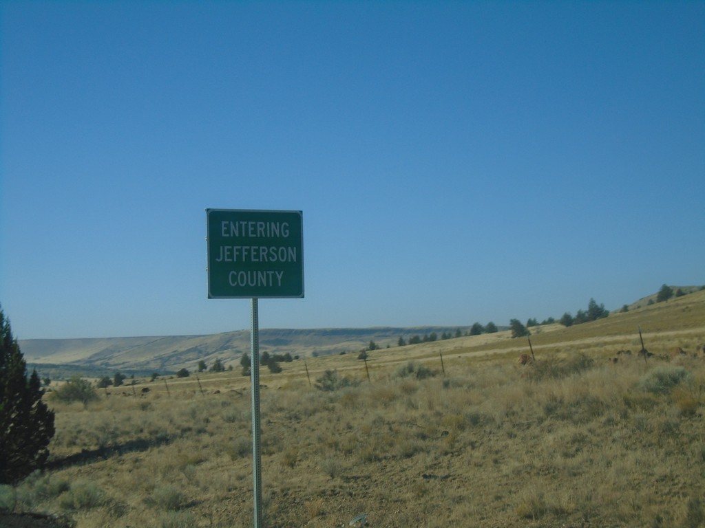
US-97 South - Jefferson County
Entering Jefferson County on US-97 South.
Taken 10-14-2018
Madras
Jefferson County
Oregon
United States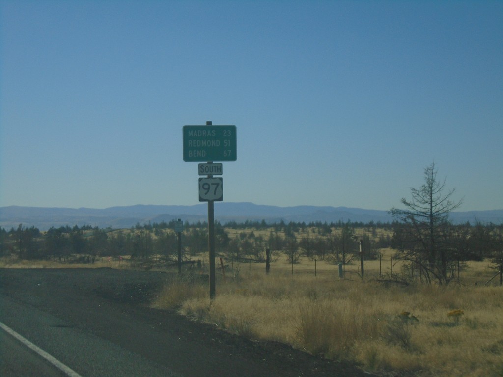
US-97 South - Distance Marker
Distance marker on US-97 south. Distance to Madras, Redmond, and Bend.
Taken 10-14-2018
Maupin
Wasco County
Oregon
United States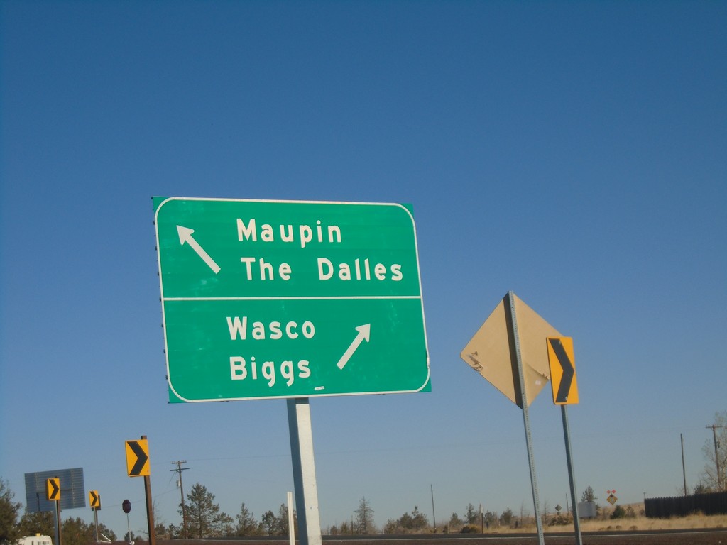
US-97 North at US-197 - Wasco County
US-97 North at US-197 in Wasco County. Use US-197 north for Maupin and The Dalles; US-97 North for Wasco and Biggs.
Taken 10-14-2018
 Maupin
Wasco County
Oregon
United States
Maupin
Wasco County
Oregon
United States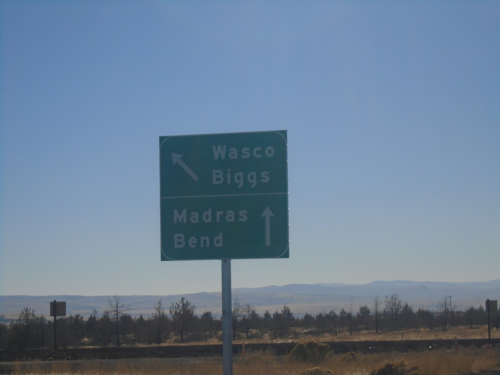
End US-197 South Approaching US-97
End US-197 South approaching US-97. Use US-97 south for Madras and Bend; US-97 north for Biggs and Wasco.
Taken 10-14-2018
Maupin
Wasco County
Oregon
United States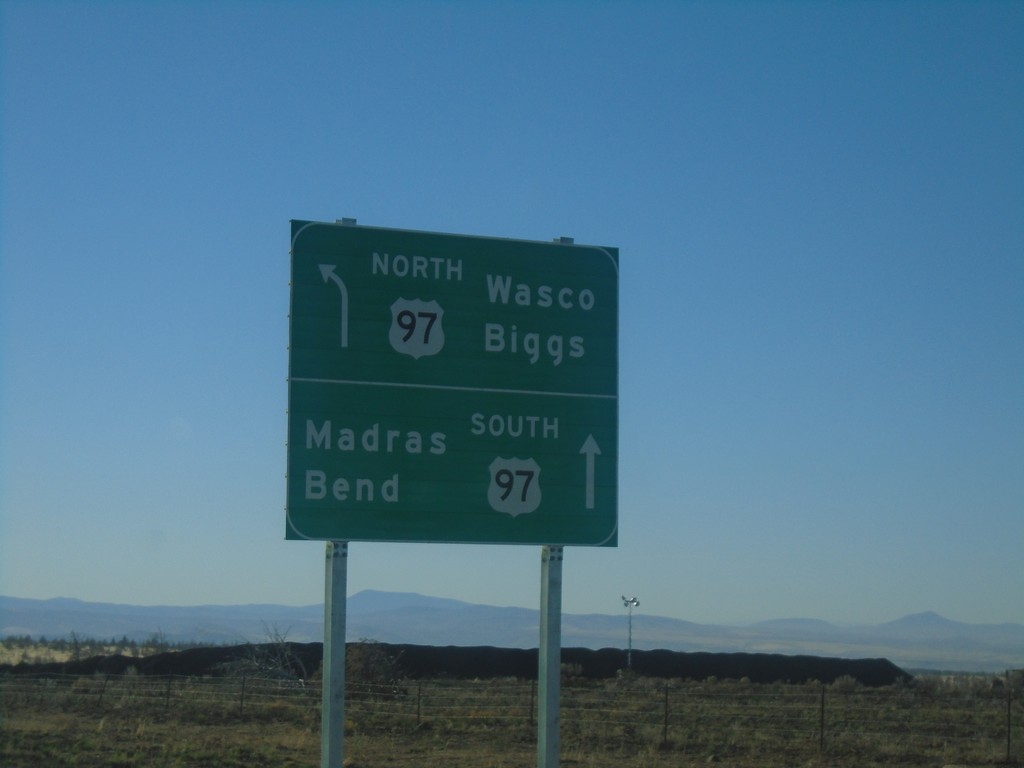
US-197 South Approaching US-197
US-197 South approaching US-197. Use US-97 north for Wasco and Biggs; US-97 south for Madras and Bend.
Taken 10-14-2018
Maupin
Wasco County
Oregon
United States