Signs Tagged With Big Green Sign
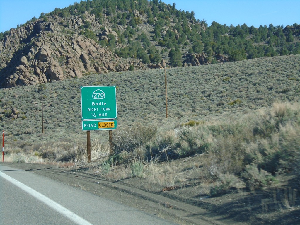
US-395 South Approaching CA-270
US-395 South Approaching CA-270 east to Bodie. CA-270 east was closed at the time this photo was taken.
Taken 04-27-2019

 Bridgeport
Mono County
California
United States
Bridgeport
Mono County
California
United States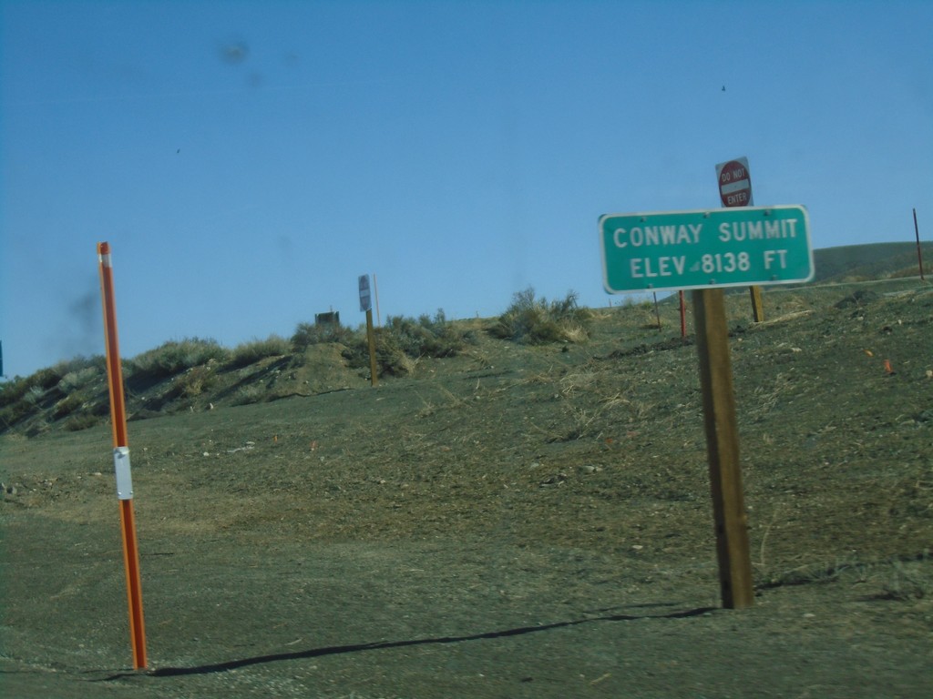
US-395 North - Conway Summit
Conway Summit - Elevation 8138 Feet on US-395 north. Conway Summit is the highest point on US-395.
Taken 04-27-2019
Bridgeport
Mono County
California
United States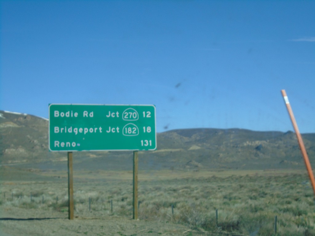
US-395 North - Distance Marker
Distance marker on US-395 north. Distance to Bodie Road - Jct. CA-270, Bridgeport - Jct. CA-182, and Reno (Nevada).
Taken 04-27-2019
 Lee Vining
Mono County
California
United States
Lee Vining
Mono County
California
United States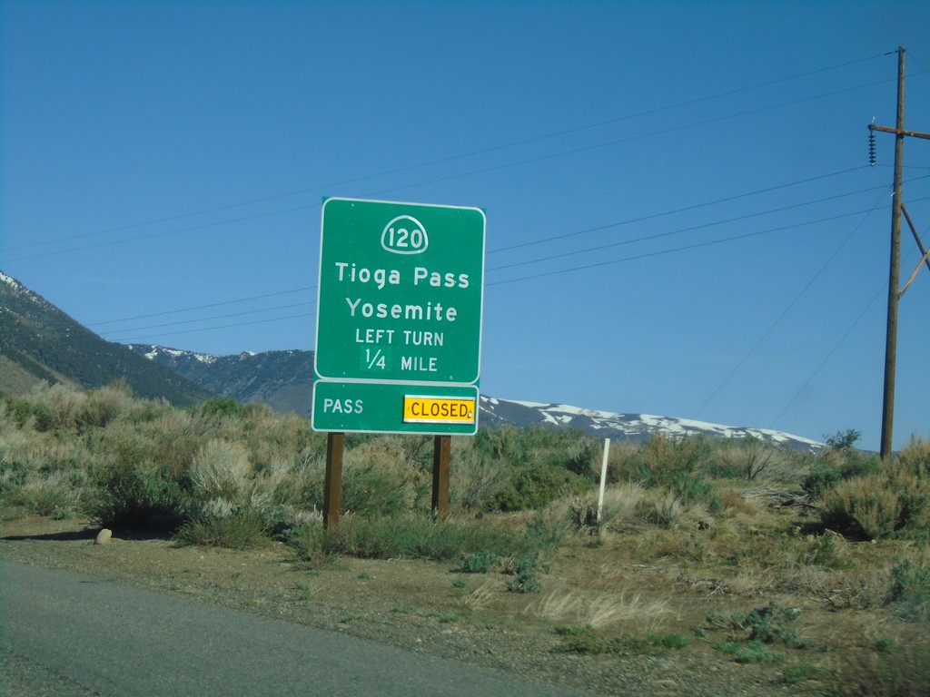
US-395 North Approaching CA-120
US-395 north approaching CA-120 east to Tioga Pass and Yosemite. Tioga Pass is closed when this picture was taken.
Taken 04-27-2019
 Lee Vining
Mono County
California
United States
Lee Vining
Mono County
California
United States
CA-120 West at US-395 North
CA-120 West at US-395 North in Mono County. Turn left (across the divided highway) for US-395 south to Bishop; left for US-395 north to Lee Vining. CA-120 west joins US-395 north to Lee Vining.
Taken 04-27-2019
Lee Vining
Mono County
California
United States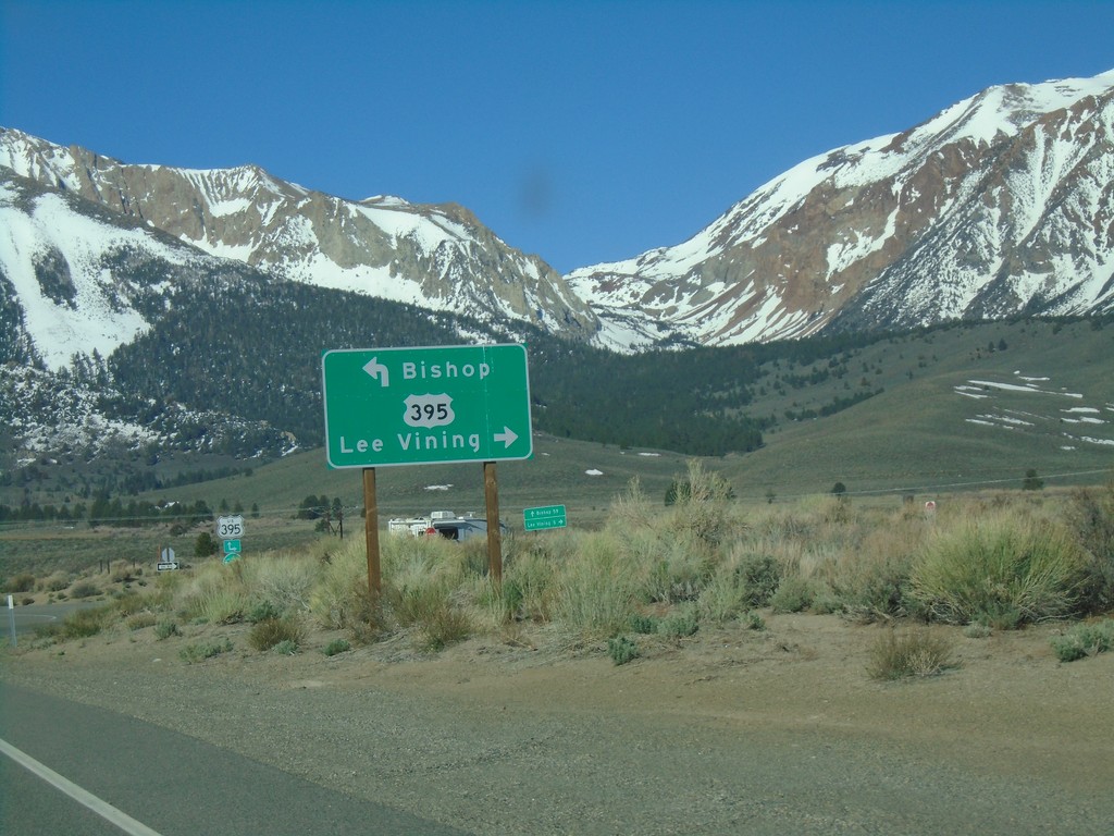
CA-120 West at US-395
CA-120 West at US-395 in Mono County. Turn left for US-395 south to Bishop; left for US-395 north/(CA-120 west) to Lee Vining. CA-120 west joins US-395 north to Lee Vining.
Taken 04-27-2019
Lee Vining
Mono County
California
United States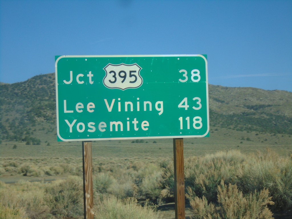
CA-120 West - Distance Marker
Distance marker on CA-120 west. Distance to Jct. US-395, Lee Vining, and Yosemite.
Taken 04-27-2019
Bishop
Mono County
California
United States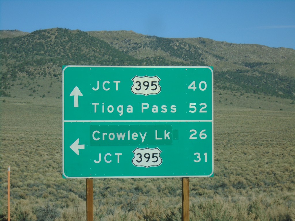
CA-120 West at Benton Crossing Road
CA-120 West at Benton Crossing Road in Mono County. Turn left for Benton Cross Road south to Crowley Lake and US-395; continue straight for CA-120 West to Tioga Pass and US-395.
Taken 04-27-2019
Benton Hot Springs
Mono County
California
United States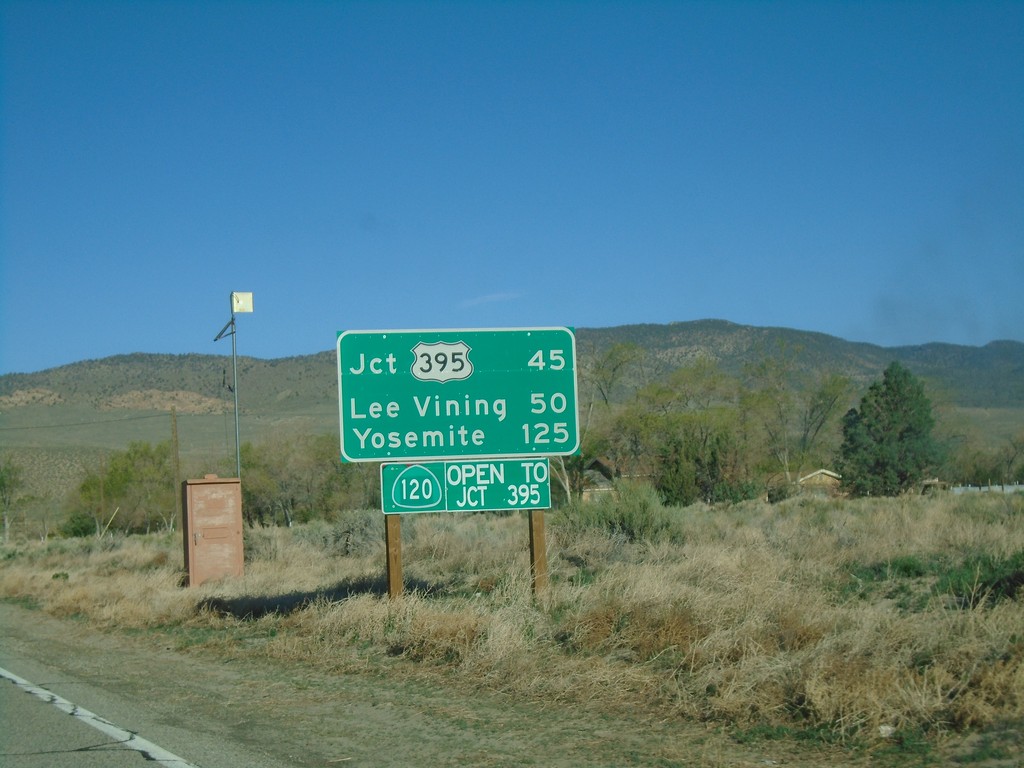
CA-120 West - Distance Marker
Distance marker on CA-120 west. Distance to US-395, Lee Vining, and Yosemite. CA-120 is open to US-395. This stretch of CA-120 is closed during the winter months.
Taken 04-27-2019
Benton
Mono County
California
United States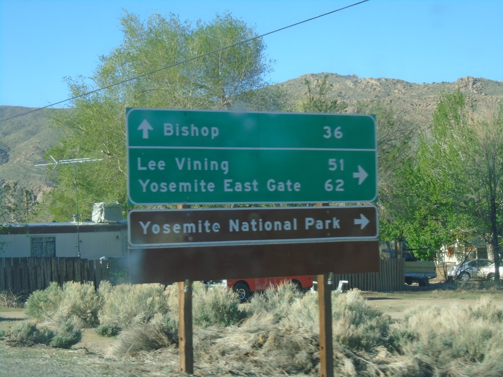
US-6 West at CA-120 West
US-6 West at CA-120 West. Use CA-120 west for Lee Vining, Yosemite East Gate, and Yosemite National Park. Continue west on US-6 for Bishop.
Taken 04-27-2019
 Benton
Mono County
California
United States
Benton
Mono County
California
United States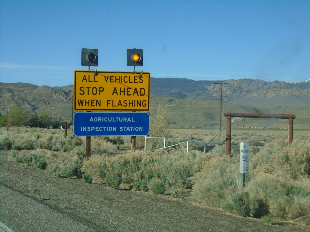
US-6 West - California State Agricultural Inspection
US-6 west approaching the California State Agricultural Inspection Station at Benton. All traffic must stop for inspection.
Taken 04-27-2019
Benton
Mono County
California
United States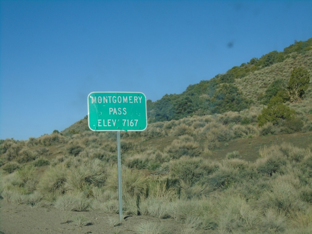
US-6 West - Montgomery Pass
US-6 west at Montgomery Pass - Elevation 7167 Feet.
Taken 04-27-2019
Dyer
Mineral County
Nevada
United States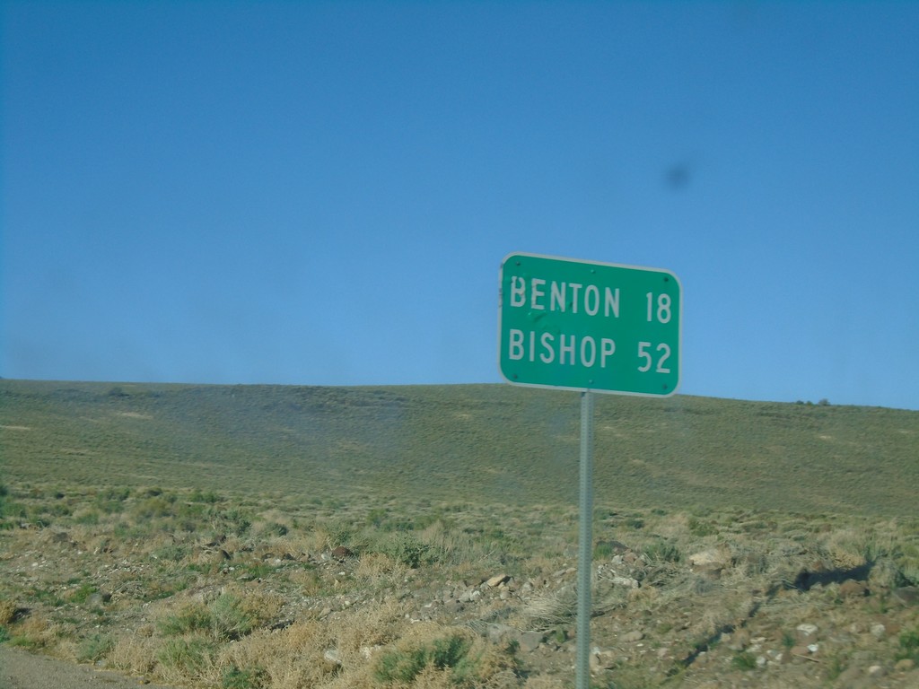
US-6 West - Distance Marker
Distance marker on US-6 west. Distance to Benton (California) and Bishop (California).
Taken 04-27-2019
Dyer
Mineral County
Nevada
United States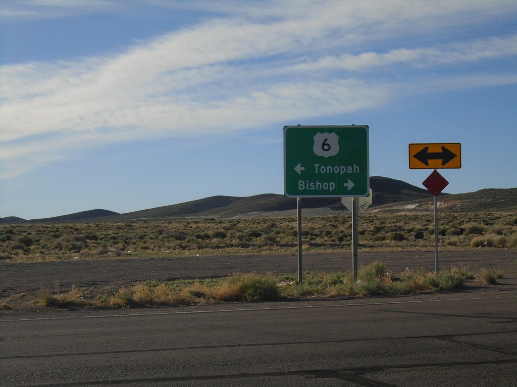
End NV-360 at US-6
End NV-360 at US-6. Use US-6 west to Bishop (California); US-6 east to Tonopah.
Taken 04-27-2019
 Dyer
Mineral County
Nevada
United States
Dyer
Mineral County
Nevada
United States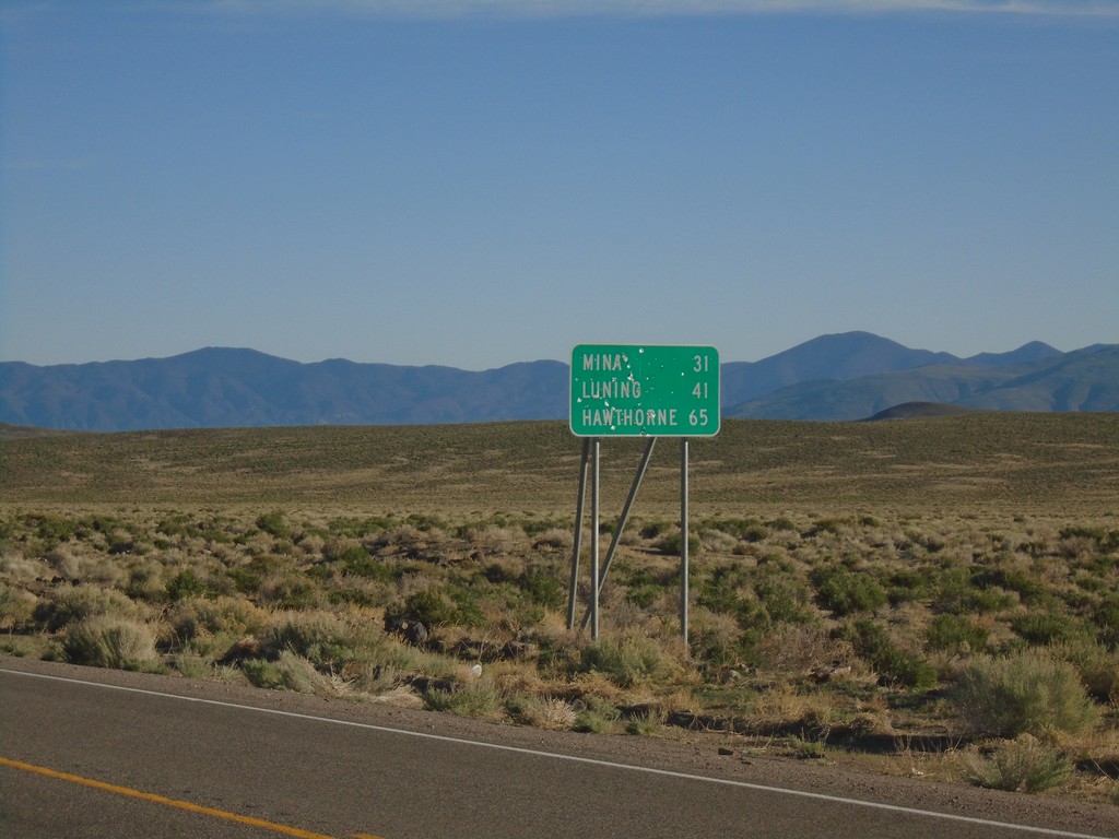
NV-360 North - Distance Marker
Distance marker on NV-360 north. Distance to Mina, Luning, and Hawthorne.
Taken 04-27-2019
Dyer
Mineral County
Nevada
United States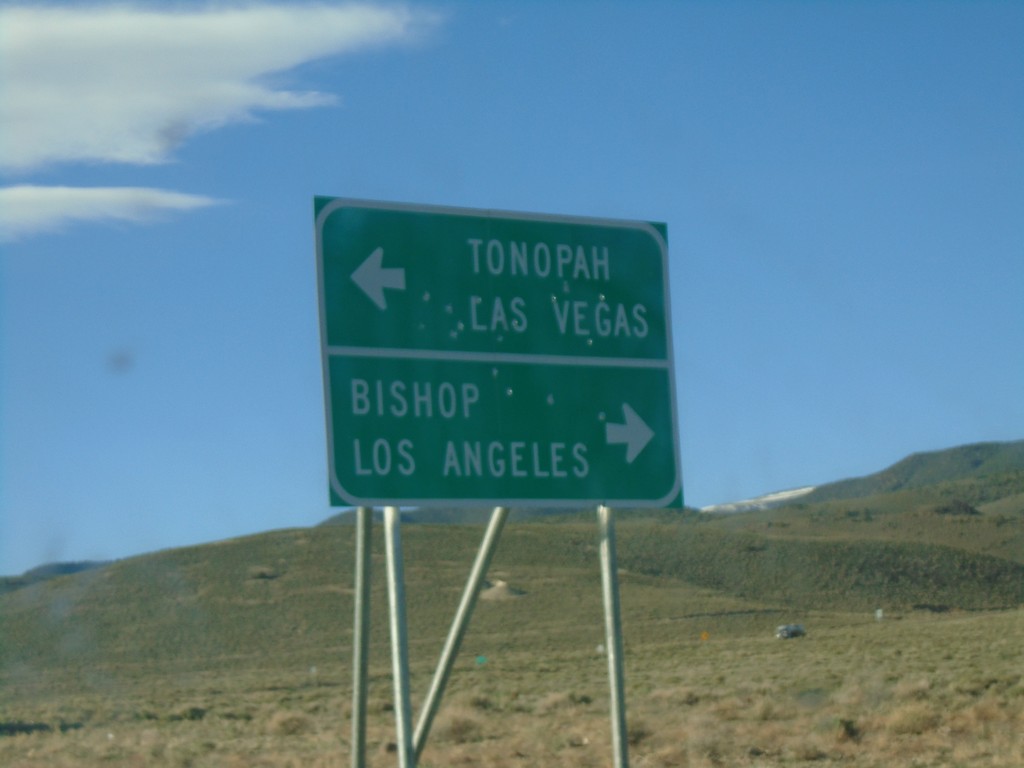
NV-360 South at US-6
NV-360 South at US-6. Use US-6 west for Bishop (California) and Los Angeles (California). Use US-6 east for Tonopah and Las Vegas (via US-95).
Taken 04-27-2019
Dyer
Mineral County
Nevada
United States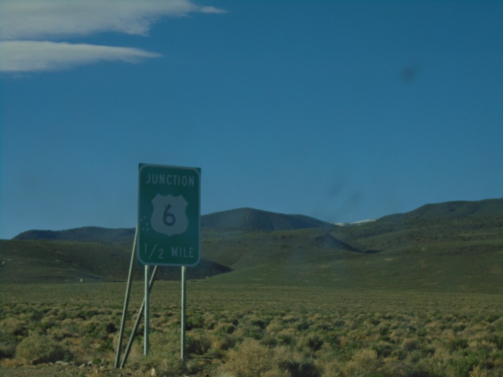
NV-360 South Approaching US-6
NV-360 South approaching US-6 in Mineral County.
Taken 04-27-2019
Dyer
Mineral County
Nevada
United States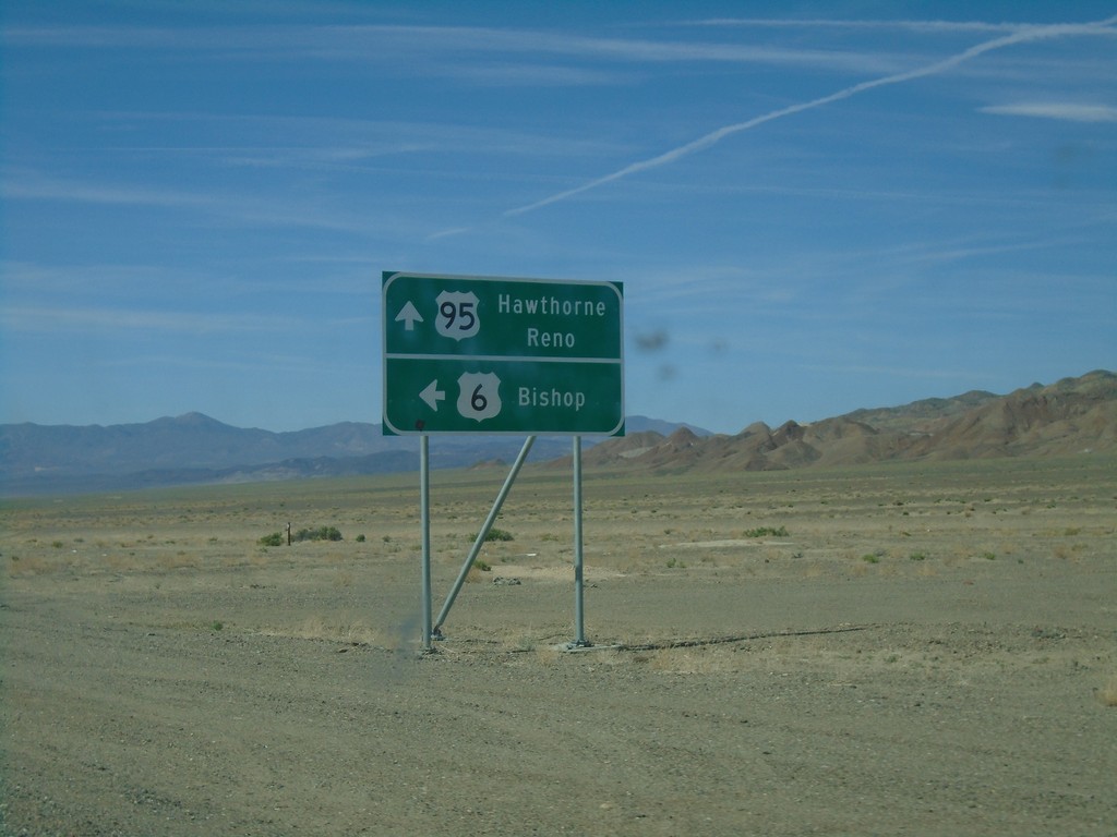
US-6 West/US-95 North at Split
US-6 West/US-95 North at US-6/US-95 split. Continue ahead for US-95 north to Hawthorne and Reno. Turn left for US-6 west to Bishop (California).
Taken 04-26-2019
 Coaldale
Esmeralda County
Nevada
United States
Coaldale
Esmeralda County
Nevada
United States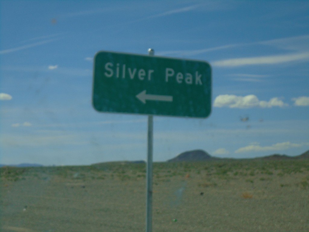
US-6 West/US-95 North At NV-265
US-6 West/US-95 North at NV-265 to Sliver Peak.
Taken 04-26-2019
 Coaldale
Esmeralda County
Nevada
United States
Coaldale
Esmeralda County
Nevada
United States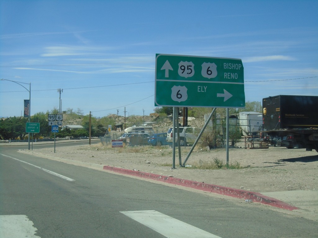
US-95 North At US-6
US-95 north at US-96. Use US-6 east for Ely. Use US-95 north/US-6 west for Bishop (California) and Reno. US-6 joins US-95 north to Coaldale Junction.
Taken 04-26-2019
Tonopah
Nye County
Nevada
United States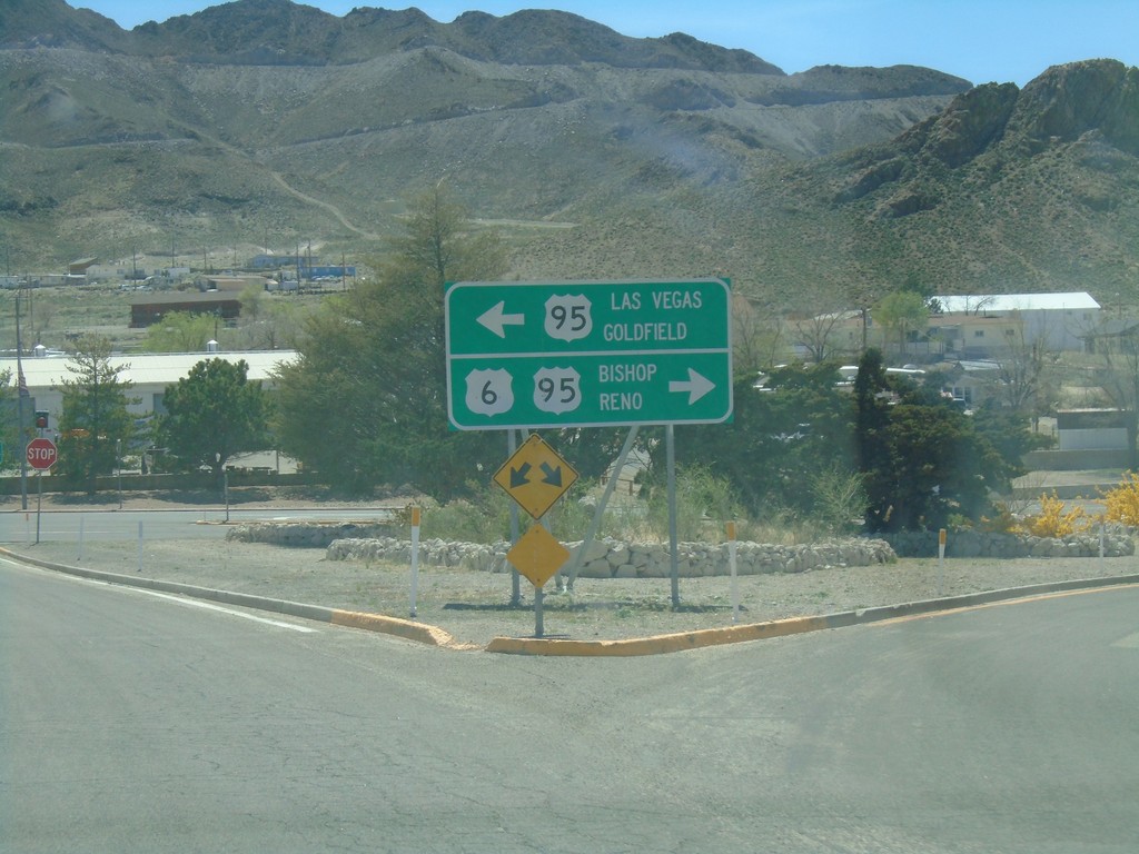
US-6 West At US-95
US-6 west at US-95. Use US-95 south for Las Vegas and Goldfield. Use US-95 north/US-6 west for Bishop (California) and Reno. US-6 joins US-95 north to Coaldale Junction.
Taken 04-26-2019
Tonopah
Nye County
Nevada
United States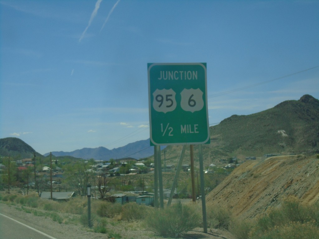
US-6 West Approaching US-95
US-6 west approaching US-95 junction in Tonopah. US-6 west joins US-95 north to Coaldale Junction.
Taken 04-26-2019
Tonopah
Nye County
Nevada
United States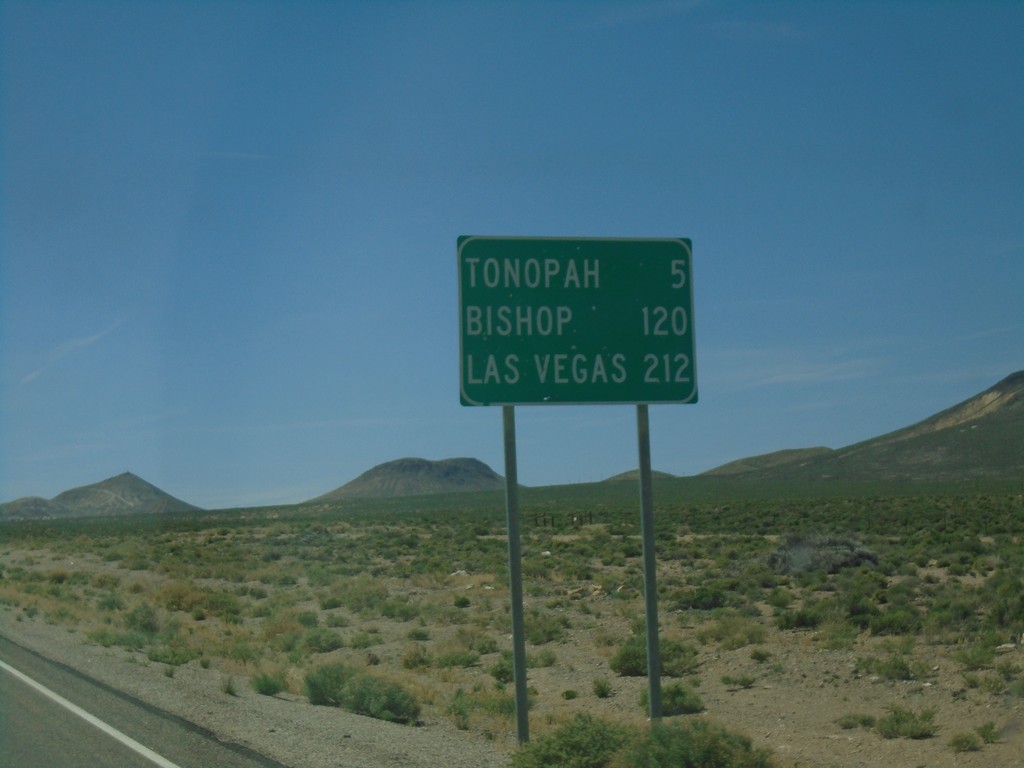
US-6 West - Distance Marker
Distance marker on US-6 west. Distance to Tonopah, Bishop (California), and Las Vegas (via US-95).
Taken 04-26-2019
Tonopah
Nye County
Nevada
United States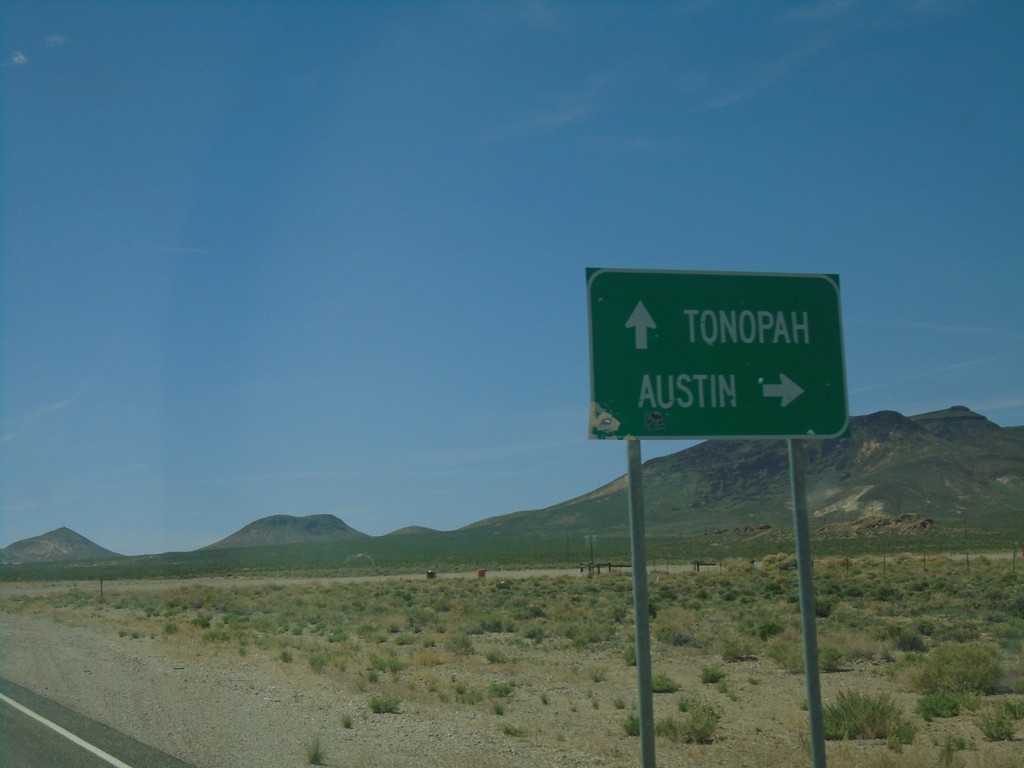
US-6 West at NV-376 North
US-6 West at NV-376 North to Austin. Continue west on US-6 for Tonopah.
Taken 04-26-2019
 Tonopah
Nye County
Nevada
United States
Tonopah
Nye County
Nevada
United States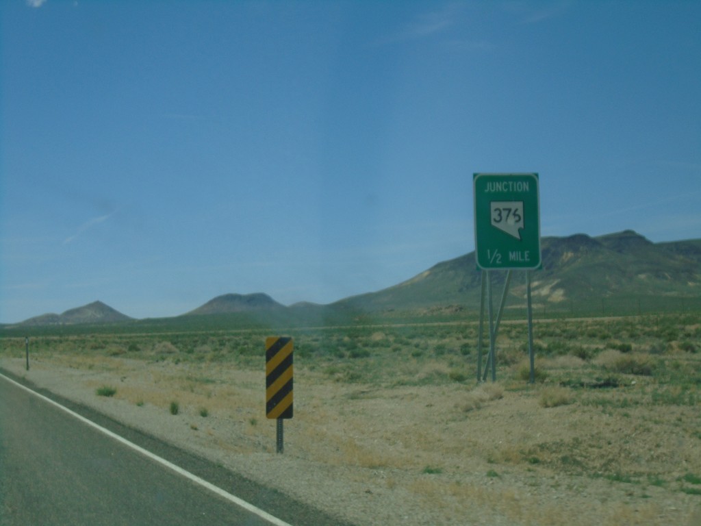
US-6 West Approaching NV-375 North
US-6 West approaching NV-375 North in Nye County.
Taken 04-26-2019
Tonopah
Nye County
Nevada
United States