Signs Tagged With Big Green Sign
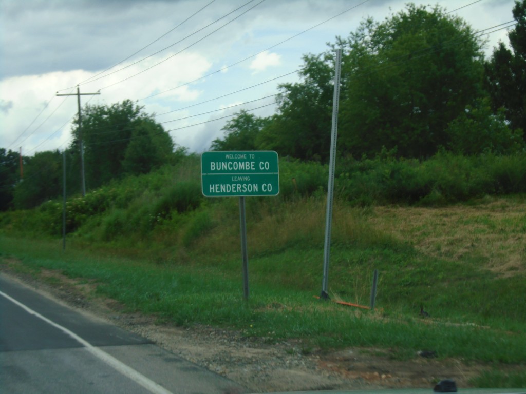
NC-280 East - Buncombe County
Welcome to Buncombe County/Leaving Henderson County on NC-280 East.
Taken 06-23-2019
 Fletcher
Buncombe County
North Carolina
United States
Fletcher
Buncombe County
North Carolina
United States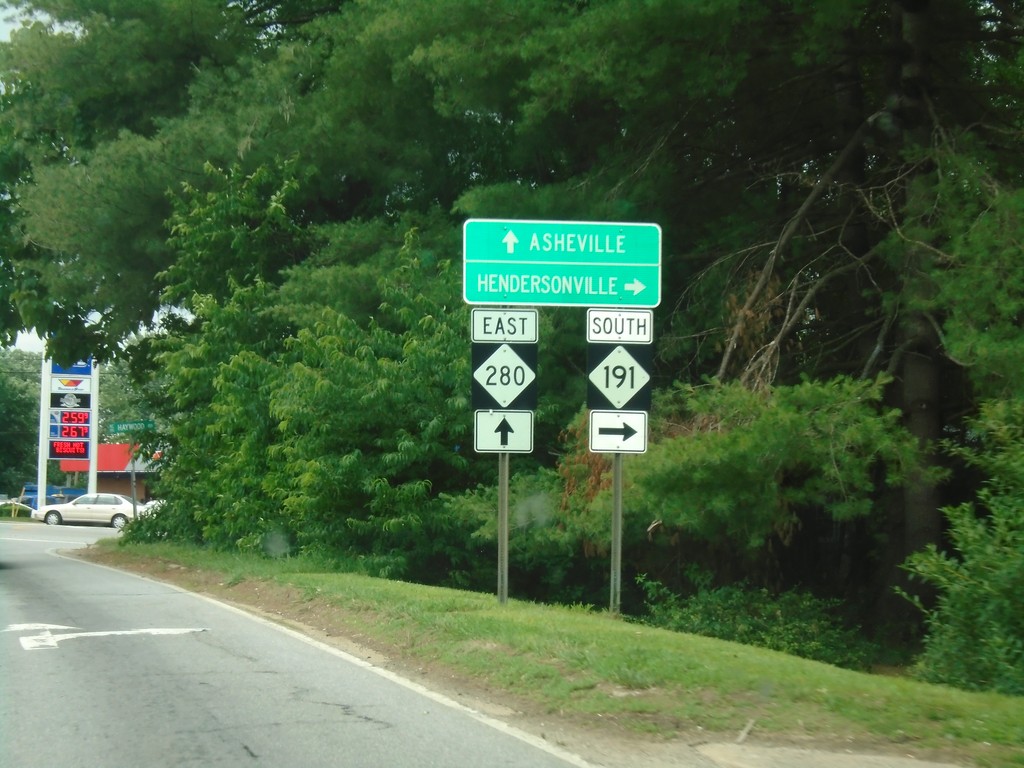
NC-280 East at NC-191 South
NC-280 East at NC-191 South. Use NC-191 south for Hendersonville; continue on NC-280 east for Asheville.
Taken 06-23-2019
 Mills River
Henderson County
North Carolina
United States
Mills River
Henderson County
North Carolina
United States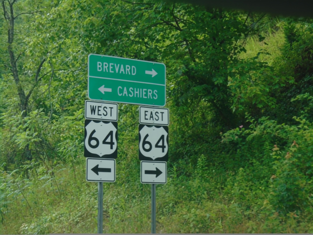
End US-178 West at US-64
End US-178 West at US-64 in Transylvania County. Use US-64 west for Cashiers; US-64 east for Brevard.
Taken 06-23-2019

 Rosman
Transylvania County
North Carolina
United States
Rosman
Transylvania County
North Carolina
United States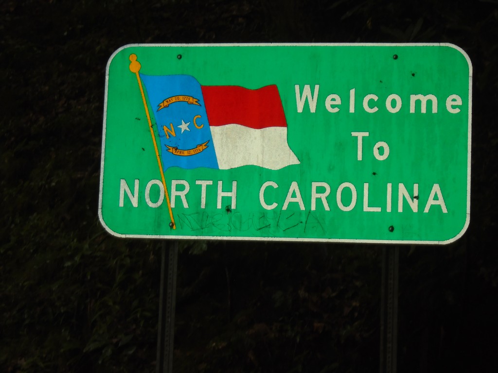
US-178 West - North Carolina
Welcome to North Carolina on US-178 West.
Taken 06-23-2019
Rosman
Transylvania County
North Carolina
United States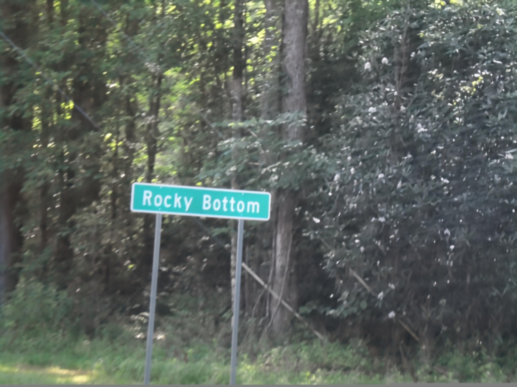
US-178 North - Rocky Bottom
Entering Rocky Bottom on US-178 North.
Taken 06-23-2019
Sunset
Pickens County
South Carolina
United States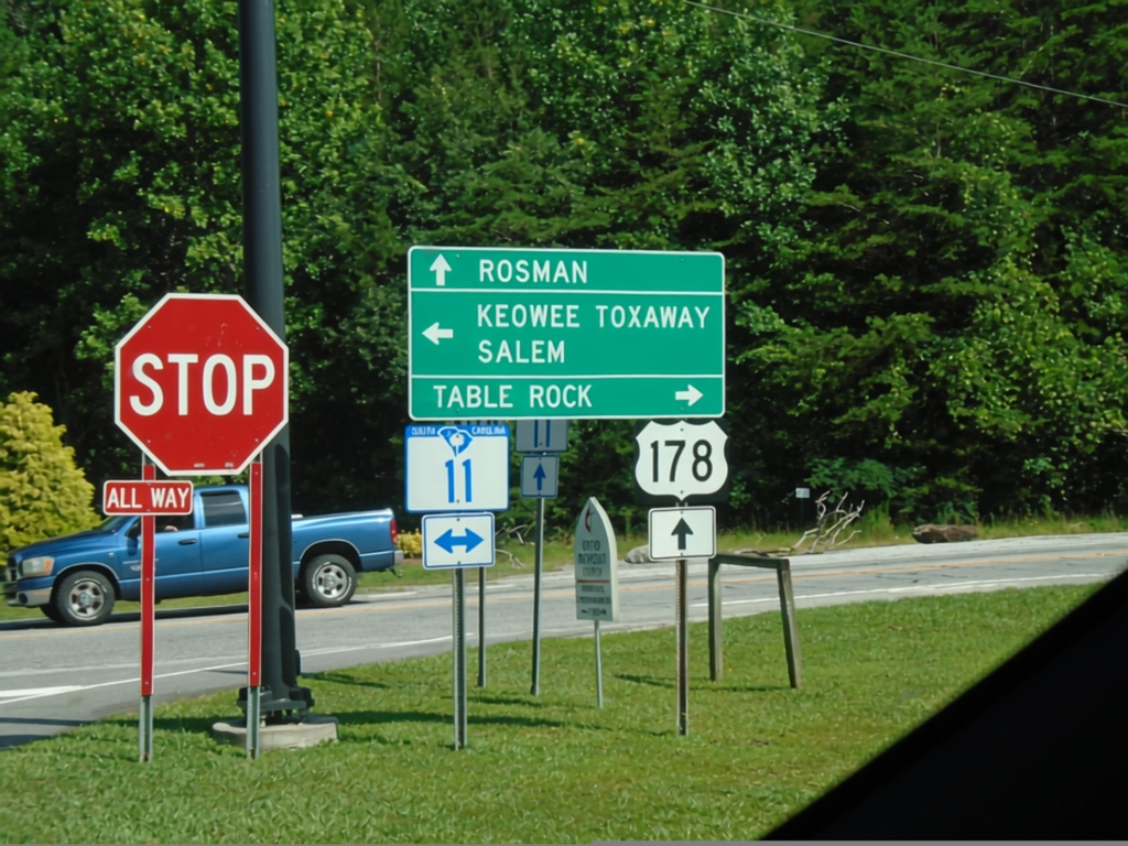
US-178 North at SC-11
US-178 North at SC-11 in Pickens County. Turn right for SC-11 East to Table Rock; left for SC-11 West to Keowee Toxaway and Salem. Continue north on US-178 for Rosman (NC).
Taken 06-23-2019
 Pickens
 County
South Carolina
United States
Pickens
Pickens County
South Carolina
United States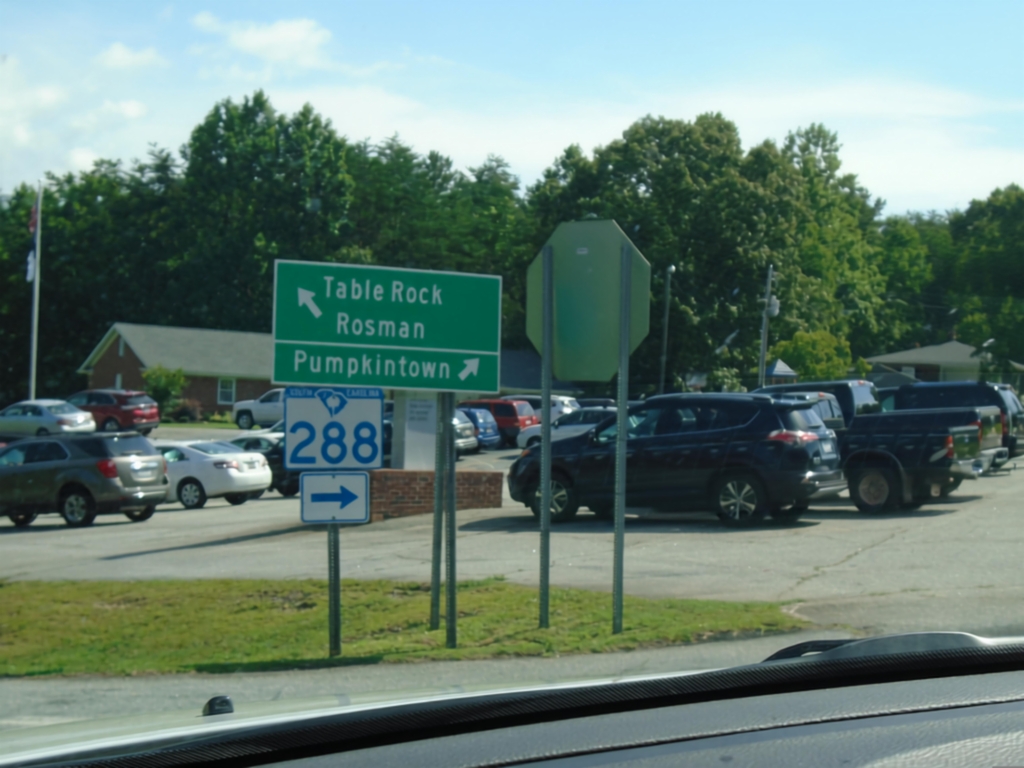
US-178 North at SC-288
US-178 North at SC-288 to Pumpkintown. Continue north on US-178 for Table Rock and Rosman (NC).
Taken 06-23-2019
 Pickens
 County
South Carolina
United States
Pickens
Pickens County
South Carolina
United States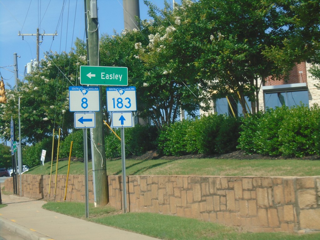
SC-8 West at SC-183 - Pickens
SC-8 West at SC-183 in Pickens. Turn left for SC-8 to Easley. SC-8 joins SC-183 through Pickens.
Taken 06-23-2019

 Pickens
 County
South Carolina
United States
Pickens
Pickens County
South Carolina
United States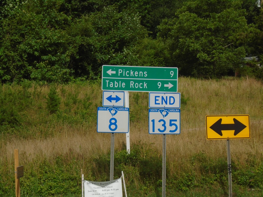
End SC-135 North at SC-8
End SC-135 North at SC-8. Turn right for SC-8 to Table Rock; left for SC-8 to Pickens.
Taken 06-23-2019
 Pickens
 County
South Carolina
United States
Pickens
Pickens County
South Carolina
United States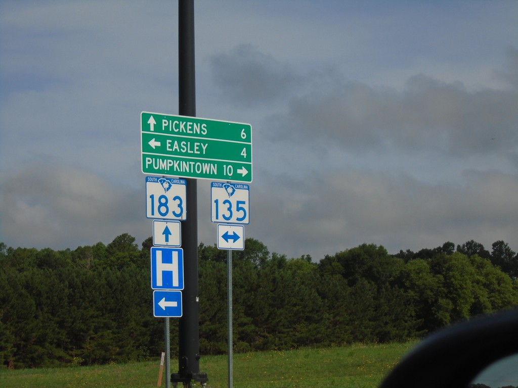
SC-183 West at SC-135
SC-183 West at SC-135 in Easley. Turn right for SC-135 North to Pumpkintown; left for SC-135 South to Easley. Continue straight on SC-183 for Pickens.
Taken 06-23-2019
Easley
Pickens County
South Carolina
United States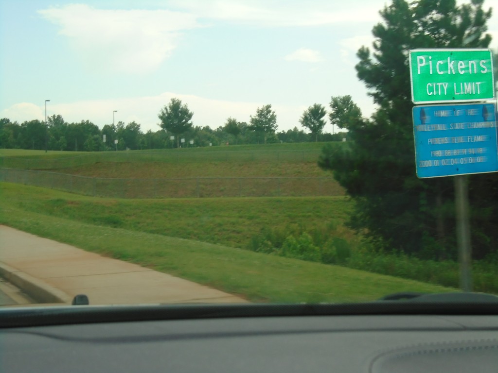
US-178 East - Pickens
Pickens City Limit on US-178 East.
Taken 06-22-2019
Pickens
Pickens County
South Carolina
United States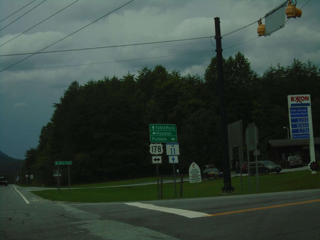
SC-11 East at US-178
SC-11 East at US-178 in Pickens County. Use US-178 West for Rosman (NC); US-178 East for Pickens. Continue east on SC-11 for Table Rock.
Taken 06-22-2019
Pickens
Pickens County
South Carolina
United States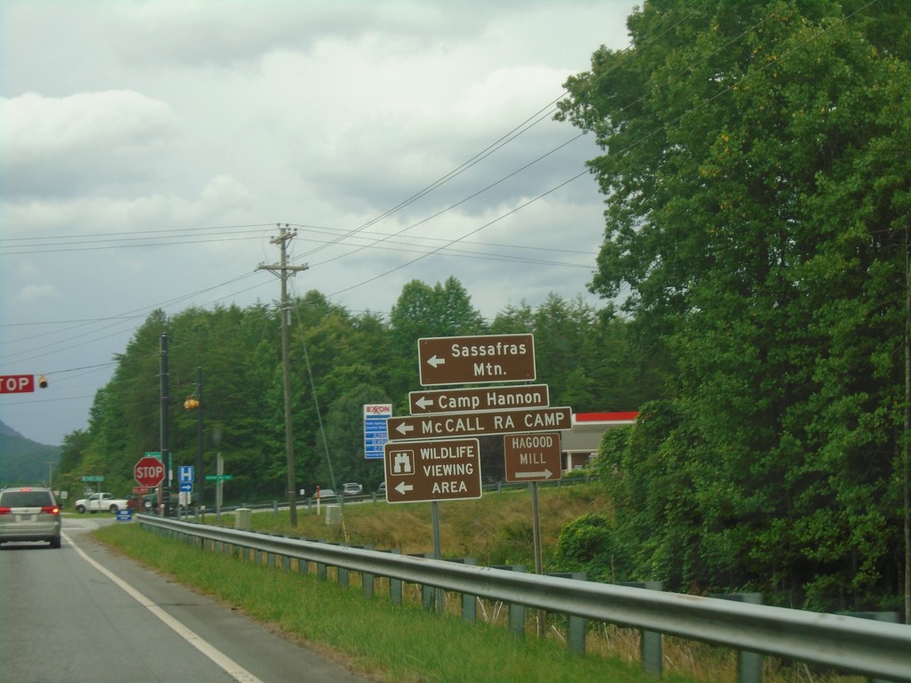
SC-11 West at US-178
SC-11 West at US-178 in Pickens County. Use US-178 West for Sassafras Mountain, Camp Hannon, and McCall RA Camp.
Taken 06-22-2019
Pickens
Pickens County
South Carolina
United States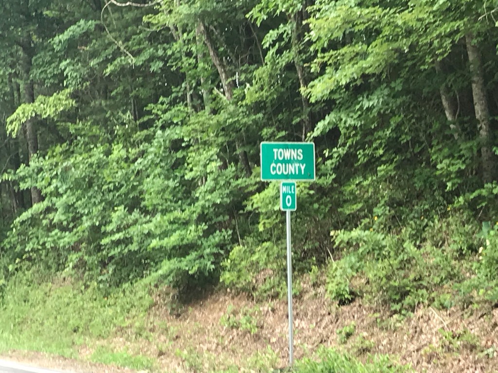
GA-180 East - Towns County
Towns County on GA-180 East at Milepost 0. The Mileposts in Georgia reset at each county line on state highways.
Taken 06-22-2019
 Blairsville
Union County
Georgia
United States
Blairsville
Union County
Georgia
United States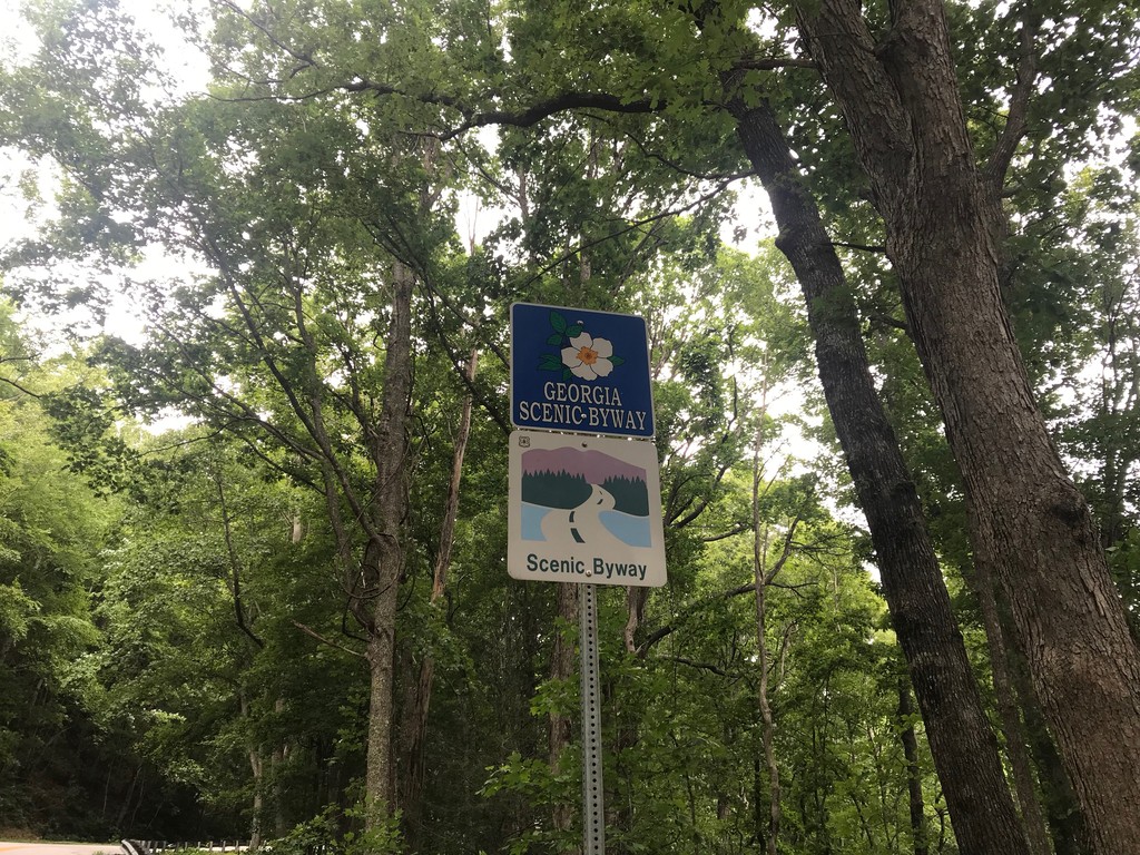
GA-180 Spur North - Georgia Scenic Byway
GA-180 Spur North - Georgia Scenic Byway and National Scenic Byway
Taken 06-22-2019
 Blairsville
Union County
Georgia
United States
Blairsville
Union County
Georgia
United States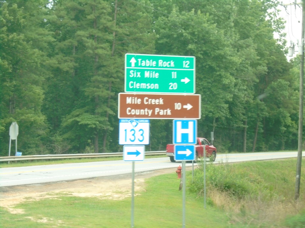
SC-11 East at SC-133
SC-11 East at SC-133 South to Six Mile, Clemson, and Mile Creek County Park. Continue east on SC-11 for Table Rock.
Taken 06-22-2019
 Sunset
Pickens County
South Carolina
United States
Sunset
Pickens County
South Carolina
United States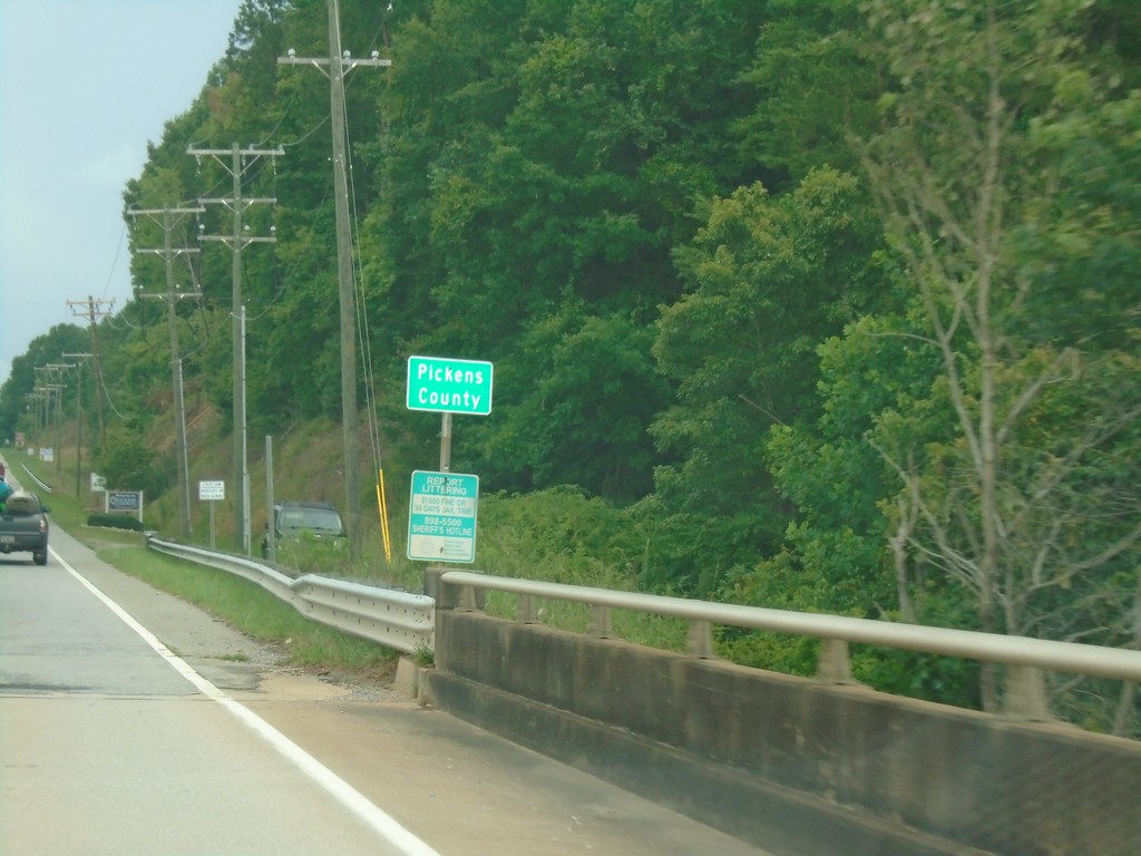
SC-11 East - Pickens County
Pickens County on SC-11 east.
Taken 06-22-2019
Salem
Oconee County
South Carolina
United States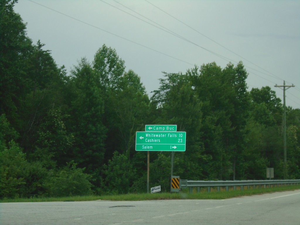
SC-11 East at SC-130 - Salem
SC-11 East at SC-130 in Salem. Turn left for SC-130 north to Camp Buc, Whitewater Falls, and Cashiers (NC). Turn right for SC-130 south to Salem.
Taken 06-22-2019
 Salem
Oconee County
South Carolina
United States
Salem
Oconee County
South Carolina
United States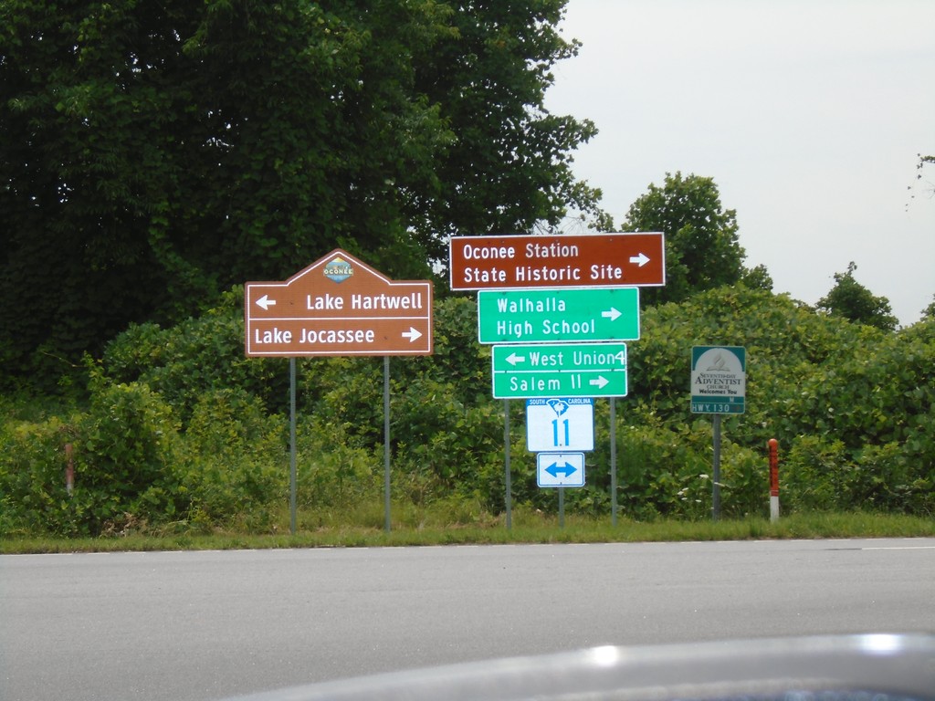
Connector from SC-183 to SC-11 at SC-11
Connector from SC-183 to SC-11 at SC-11 in Oconee County. Turn left for SC-11 west to West Union and Lake Hartwell; turn right for SC-11 east to Salem, Walhalla High School and Lake Jocassee.
Taken 06-22-2019
Walhalla
Oconee County
South Carolina
United States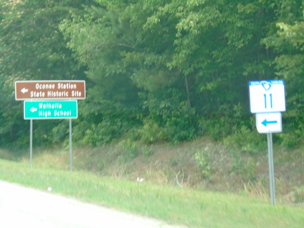
SC-183 North at SC-11 East
SC-183 North at SC-11 East to Oconee Station State Historic Park and Walhalla High School.
Taken 06-22-2019
West Union
Oconee County
South Carolina
United States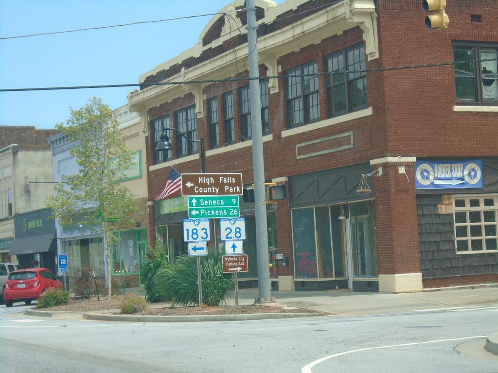
SC-28 South/SC-183 North at SC-28/SC-183 Split
SC-28 South/SC-183 North at SC-28/SC-183 split in Walhalla. Turn left for SC-183 north to Pickens and High Rock State Park; continue straight for SC-28 south to Seneca.
Taken 06-22-2019
 Walhalla
Oconee County
South Carolina
United States
Walhalla
Oconee County
South Carolina
United States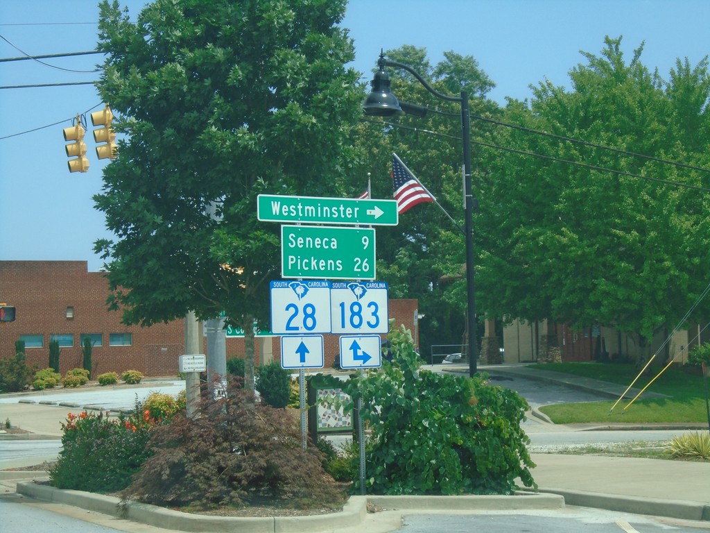
SC-28 South at SC-183 - Walhalla
SC-28 South at SC-183 in Walhalla. Turn left for SC-183 south to Westminster. Continue on SC-28 South/SC-183 North to Seneca (via SC-28) and Pickens (via SC-183).
Taken 06-22-2019
Walhalla
Oconee County
South Carolina
United States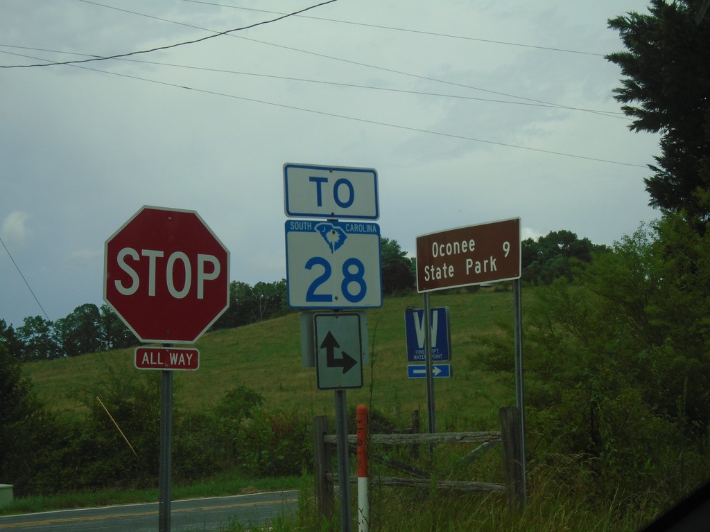
Chattoga Ridge Road at Whetstone Road
Chattoga Ridge Road at Whetstone Road. Use Chattoga Ridge Road or Whetstone Road for SC-28. Use Whetstone Road south for Oconee State Park.
Taken 06-22-2019
Mountain Rest
Oconee County
South Carolina
United States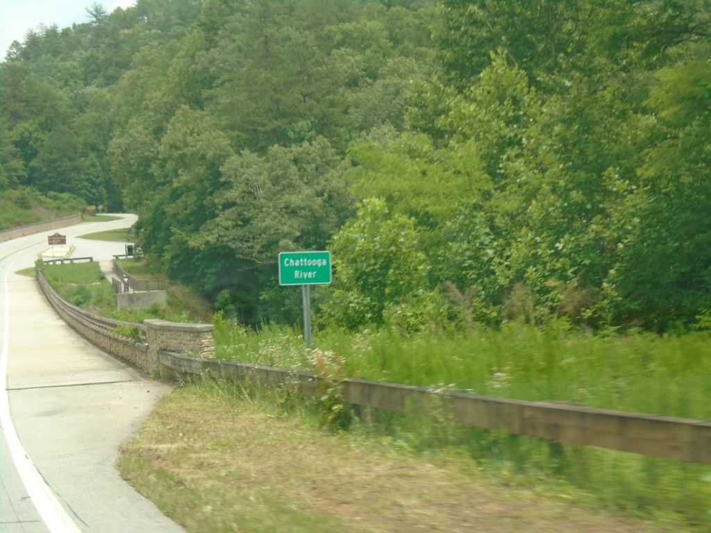
US-76 East - Chattooga River
Chattooga River on US-76 east. The Chattooga River is the boundary between Georgia and South Carolina.
Taken 06-22-2019
 Mountain Rest
Oconee County
South Carolina
United States
Mountain Rest
Oconee County
South Carolina
United States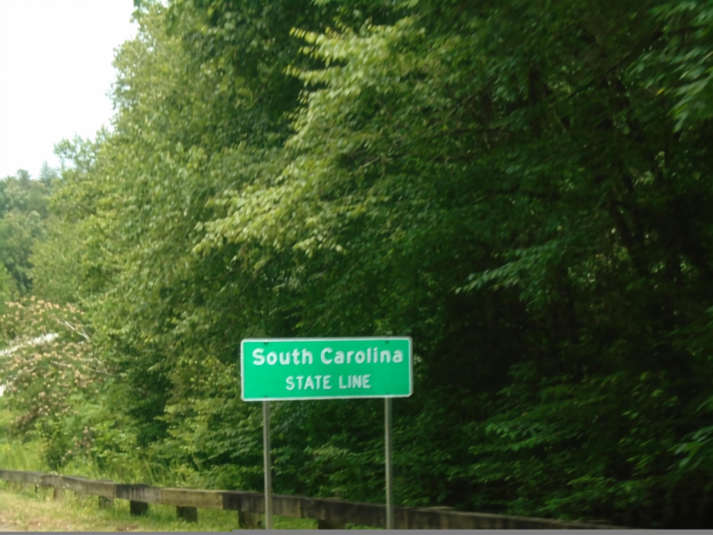
US-76 East - South Carolina
South Carolina State Line on US-76 east. Taken at the Georgia/South Carolina border.
Taken 06-22-2019
Mountain Rest
Oconee County
South Carolina
United States