Signs Tagged With Big Green Sign
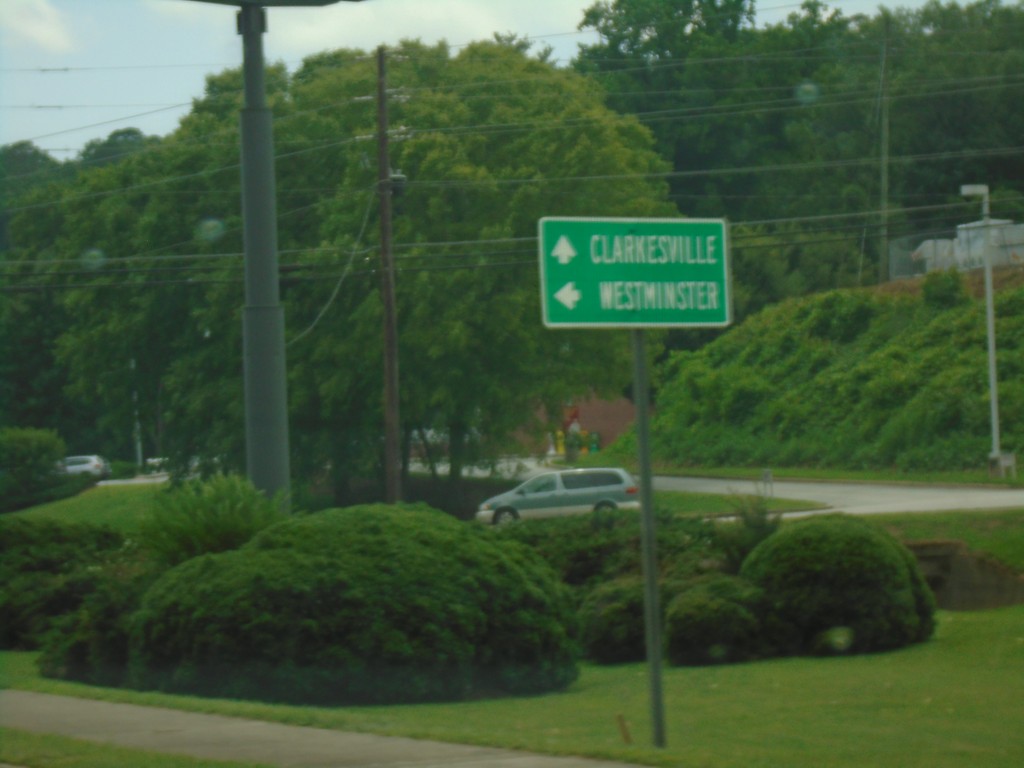
US-23/US-441/GA-15 South/US-76/GA-2 East at US-76/GA-2 Split
US-23/US-441/GA-15 South/US-76/GA-2 East at US-76/GA-2 Split in Clayton. Turn left for US-76/GA-2 East to Westminster (SC); continue south on US-441/US-23/GA-15 to Clarkesville.
Taken 06-22-2019


 Clayton
Rabun County
Georgia
United States
Clayton
Rabun County
Georgia
United States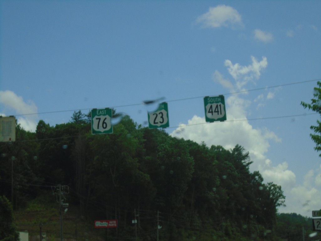
US-23/US-441 South/US-76 East - Clayton
US-23/US-441 South/US-76 East in Clayton
Taken 06-22-2019
Clayton
Rabun County
Georgia
United States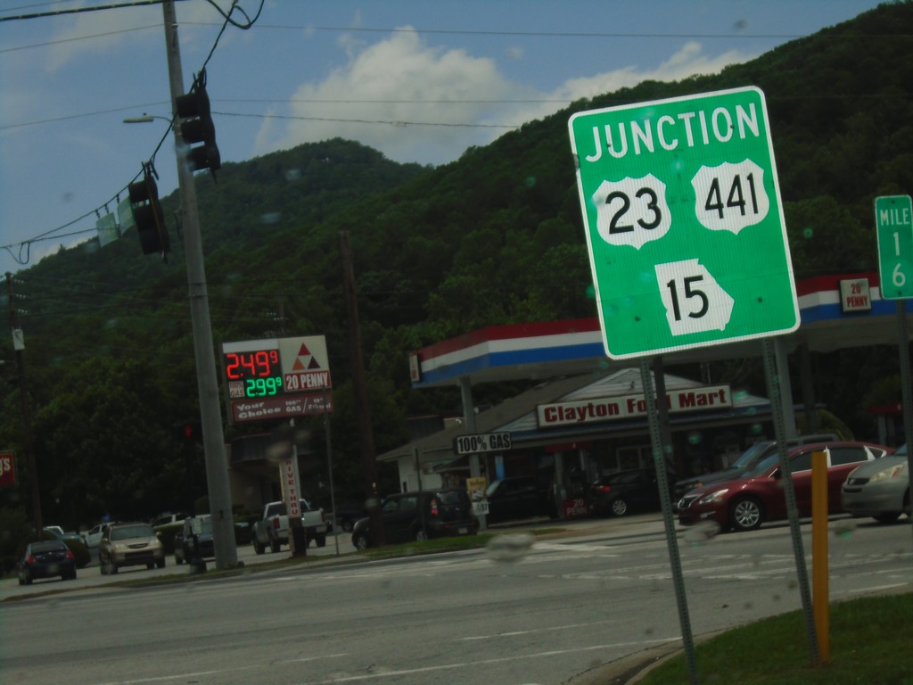
US-76/GA-2 East at US-23/US-441/GA-15 - Clayton
US-76/GA-2 East at US-23/US-441/GA-15 in Clayton. US-76/GA-2 East joins US-23/US-441/GA-15 South through Clayton.
Taken 06-22-2019
Clayton
Rabun County
Georgia
United States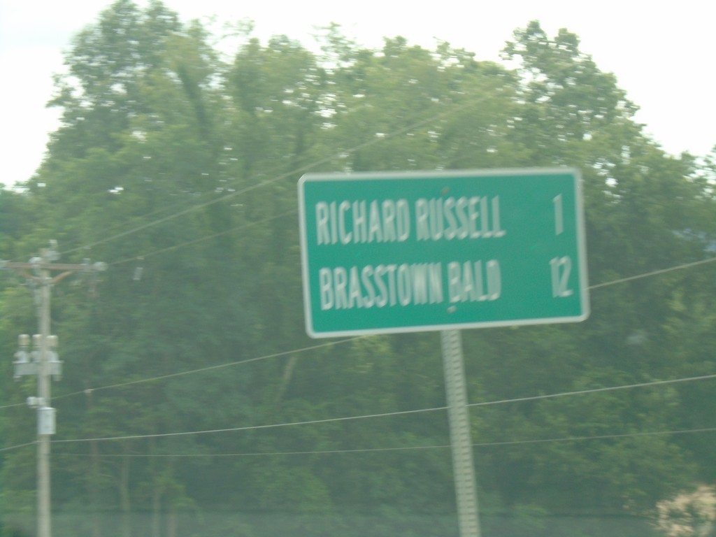
GA-180 East - Distance Marker
Distance marker on GA-180 east. Distance to Richard Russell and Brasstown Bald.
Taken 06-22-2019
 Blairsville
Union County
Georgia
United States
Blairsville
Union County
Georgia
United States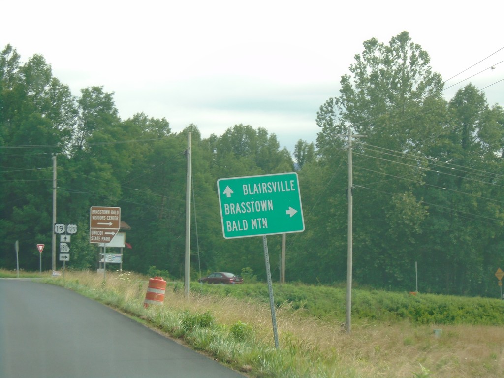
US-19/US-129/GA-11 North/GA-180 East Approaching GA-180
US-19/US-129/GA-11 North/GA-180 East approaching GA-180. Turn right to continue east on GA-180 towards Brasstown Bald. Continue straight for US-19/US-129/GA-11 North to Blairsville.
Taken 06-22-2019


 Blairsville
Union County
Georgia
United States
Blairsville
Union County
Georgia
United States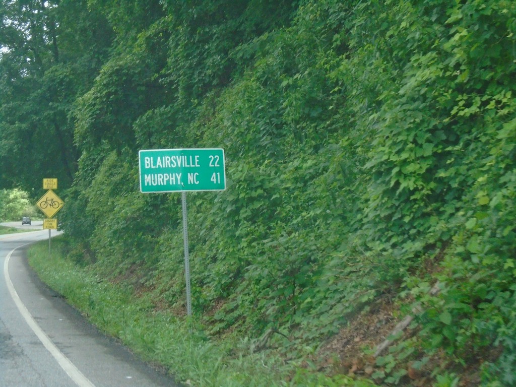
US-19/US-129/GA-11 North - Distance Marker
Distance maker on US-19/US-129/GA-11 north. Distance to Blairsville and Murphy (NC).
Taken 06-22-2019
Cleveland
Lumpkin County
Georgia
United States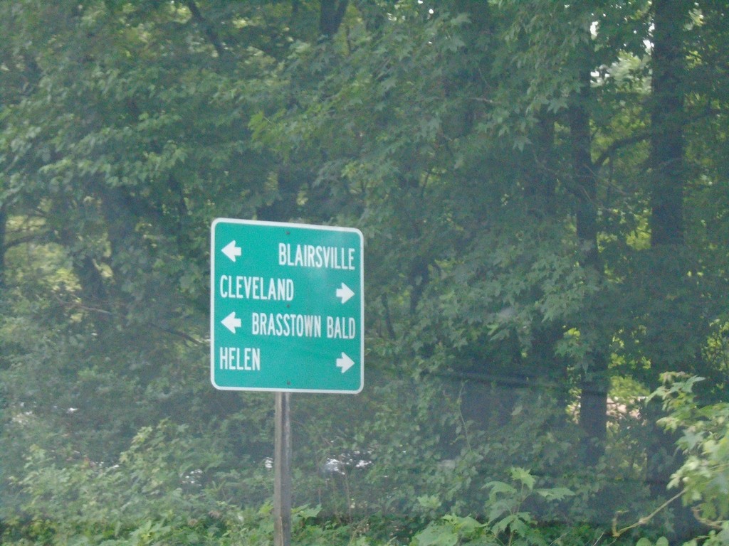
US-19/GA-9 North Approaching US-129/GA-11
US-19/GA-9 North approaching US-129/GA-11 in Lumpkin County. Turn left to continue north on US-19/US-129/GA-11 for Blairsville and Brasstown Bald; right for US-129/GA-11 south to Helen and Cleveland. GA-9 north ends here.
Taken 06-22-2019
 Cleveland
Lumpkin County
Georgia
United States
Cleveland
Lumpkin County
Georgia
United States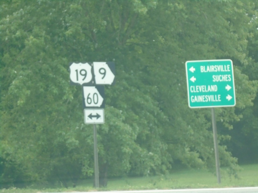
End Bus. US-19 at US-19/GA-60/GA-9 - Dahlonega
End Bus. US-19 at US-19/GA-60/GA-9 in Dahlonega. Turn right for US-19/GA-60/GA-9 South to Gainsville and Cleveland. Turn left for US-19/GA-60/GA-9 North to Blairsville and Suches.
Taken 06-22-2019

 Dahlonega
Lumpkin County
Georgia
United States
Dahlonega
Lumpkin County
Georgia
United States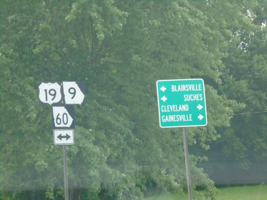
End Bus. US-19 at US-19/GA-60/GA-9 - Dahlonega
End Bus. US-19 at US-19/GA-60/GA-9 in Dahlonega. Turn right for US-19/GA-60/GA-9 South to Gainsville and Cleveland. Turn left for US-19/GA-60/GA-9 North to Blairsville and Suches.
Taken 06-22-2019
Dahlonega
Lumpkin County
Georgia
United States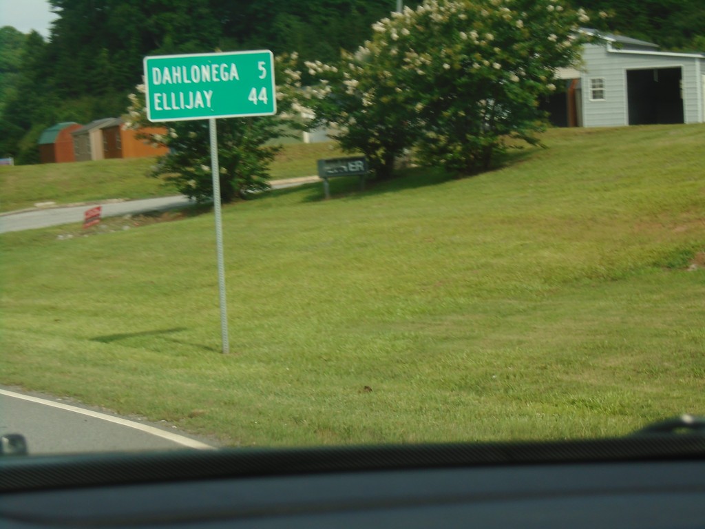
US-19/GA-60 North - Distance Marker
Distance Marker on US-19/GA-60 North. Distance to Dahlonega and Ellijay.
Taken 06-22-2019
Dahlonega
Lumpkin County
Georgia
United States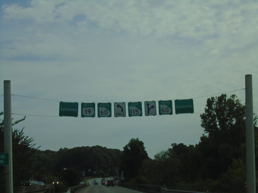
US-19 North/GA-400 North at GA-60 and GA-115
US-19 North/GA-400 North at GA-60 and GA-115. GA-400 north ends here. Turn left to continue on US-19 North and for GA-60 north to Dahlonega. Turn right for GA-60 south to Gainsville. Continue straight for GA-115.
Taken 06-22-2019

 Dahlonega
Lumpkin County
Georgia
United States
Dahlonega
Lumpkin County
Georgia
United States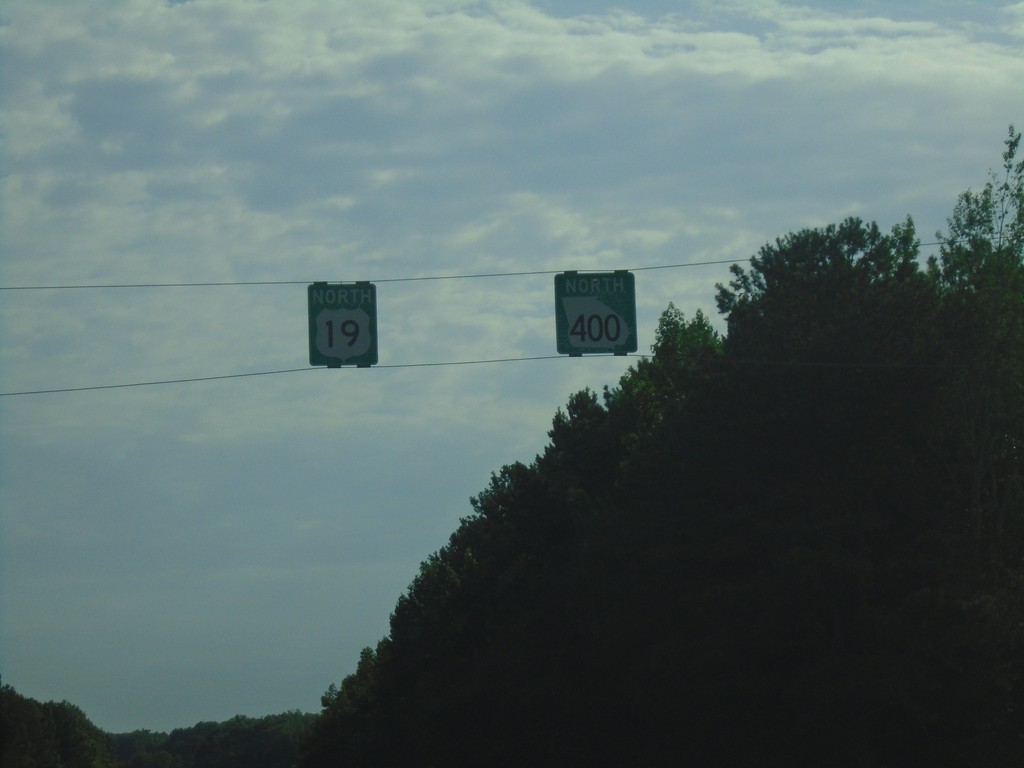
US-19 North/GA-400 North - Forsyth County
US-19 North/GA-400 North in Forsyth County.
Taken 06-22-2019
Cumming
Forsyth County
Georgia
United States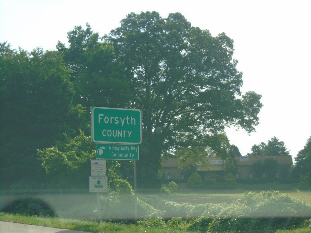
GA-400 North - Forsyth County
Entering Forsyth County on GA-400 North.
Taken 06-22-2019
Alpharetta
Forsyth County
Georgia
United States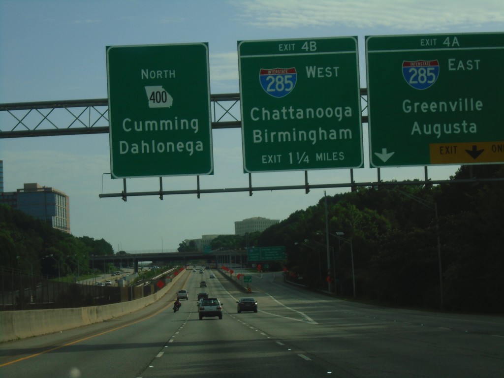
GA-400 North - Exits 4A and 4B
GA-400 North approaching Exit 4A and 4B. Exit 4A - I-285 East/Greenville (SC)/Augusta. Exit 4B - I-285 West/Chattanooga (TN)/Birmingham (AL). Continue north on GA-400 North for Dahlonega and Cumming.
Taken 06-22-2019
 Atlanta
Fulton County
Georgia
United States
Atlanta
Fulton County
Georgia
United States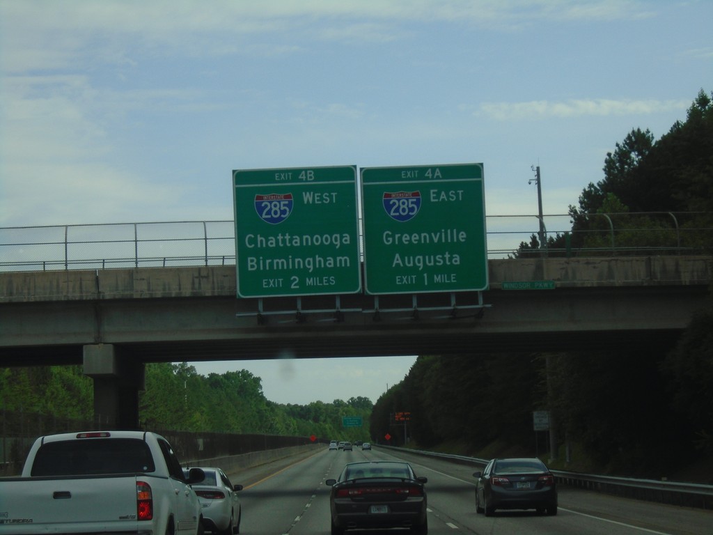
GA-400 North - Exits 4A and 4B
GA-400 north approaching Exits 4A and 4B. Exit 4A - I-285 East/Greenville (SC)/Augusta. Exit 4B - I-285 West/Chattanooga (TN)/Birmingham (AL).
Taken 06-22-2019
Atlanta
Fulton County
Georgia
United States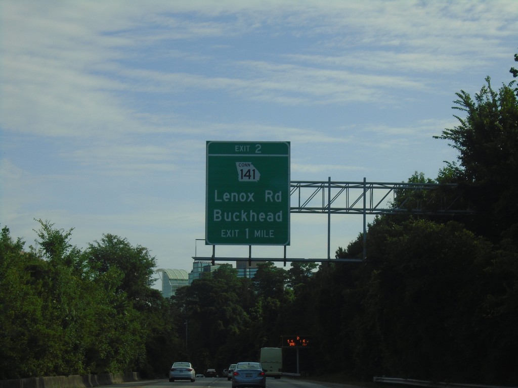
GA-400 North - Exit 2
GA-400 North approaching Exit 2 - GA-141 Connector/Lenox Road/Buckhead
Taken 06-22-2019
 Atlanta
Fulton County
Georgia
United States
Atlanta
Fulton County
Georgia
United States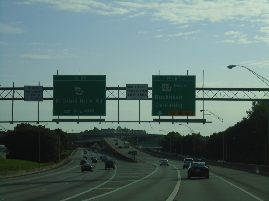
I-85 North - Exits 87 and 89
I-85 north at Exit 87 - GA-400 North/Cummings/Buckhead. Approaching Exit 89 - GA-42/N Druid Hills Road.
Taken 06-22-2019

 Atlanta
Fulton County
Georgia
United States
Atlanta
Fulton County
Georgia
United States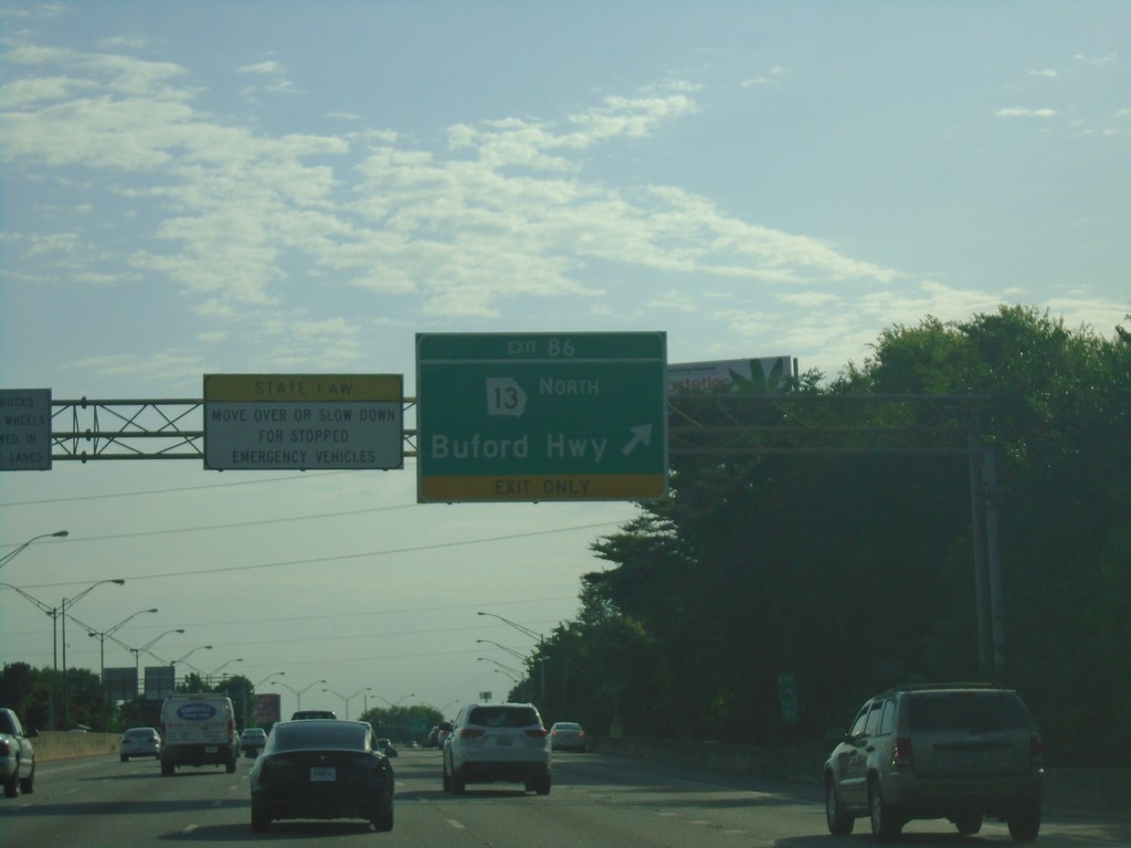
I-85 North - Exit 86
I-85 north at Exit 86 - GA-13 North/Buford Highway.
Taken 06-22-2019
 Atlanta
Fulton County
Georgia
United States
Atlanta
Fulton County
Georgia
United States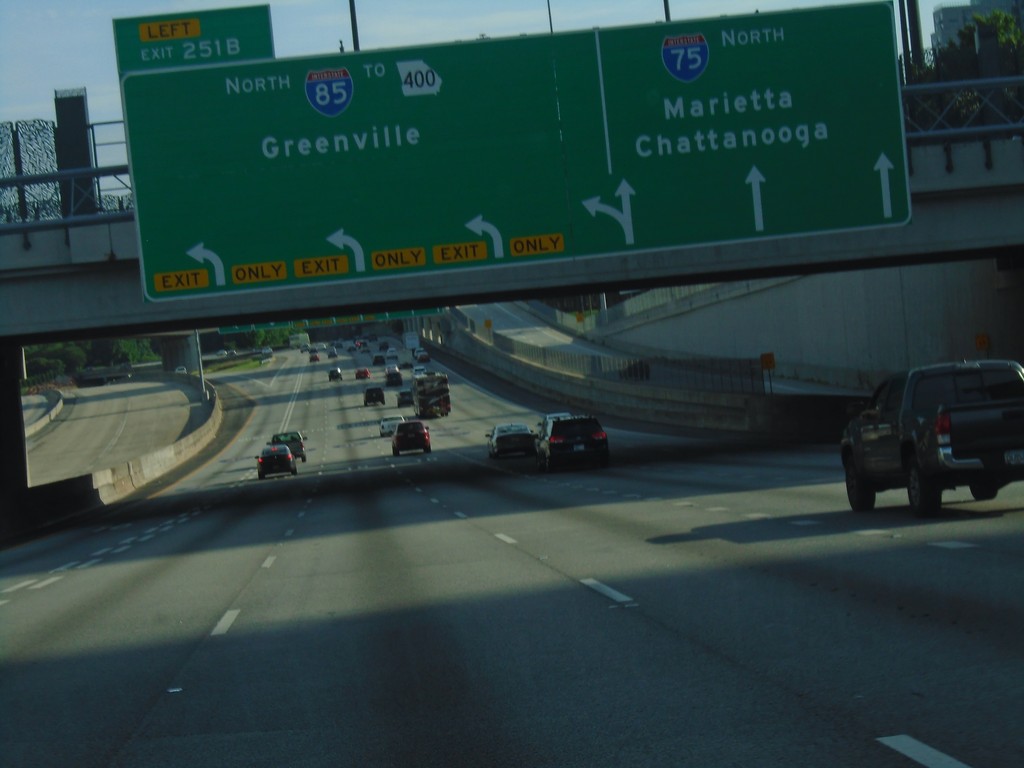
I-75/I-85 North - Exit 251B
I-75/I-85 north at I-75/I-85 Split - Exit 251B - I-85 North/To GA-400/Greenville (SC). Continue north on I-75 for Chattanooga (TN) and Marietta.
Taken 06-22-2019
 Atlanta
Fulton County
Georgia
United States
Atlanta
Fulton County
Georgia
United States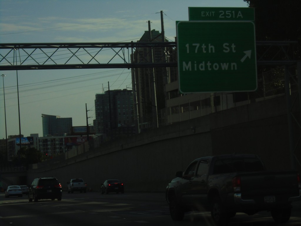
I-75/I-85 North at Exits 251A
I-75/I-85 north at Exit 251A - 17th St./Midtown.
Taken 06-22-2019
Atlanta
Fulton County
Georgia
United States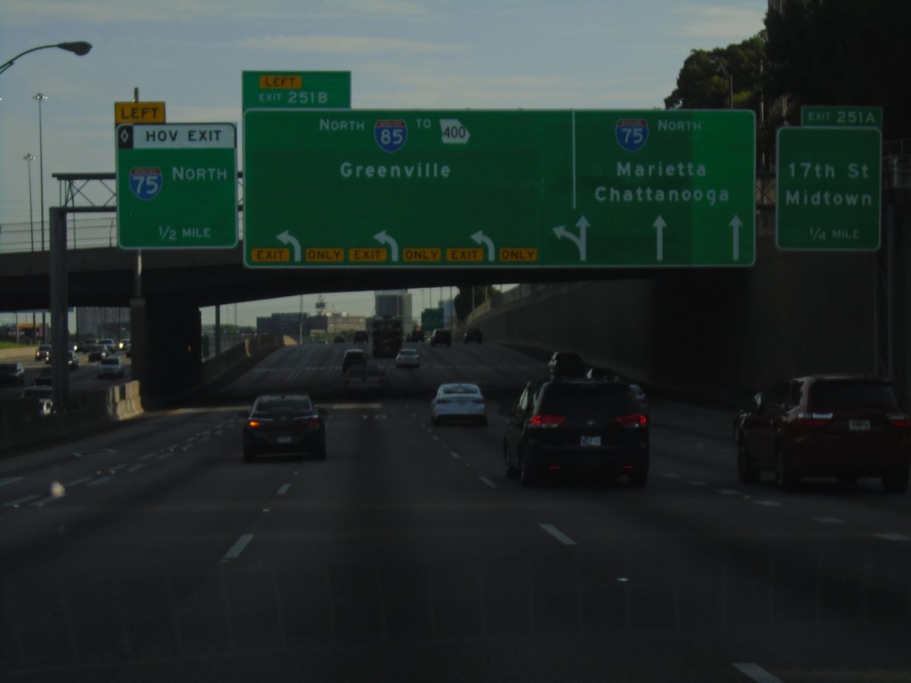
I-75/I-85 North Approaching Exits 251A and 251B
I-75/I-85 north approaching Exits 251A and 251B (I-85/I-75 split). Exit 251A - 17th St./Midtown; Exit 251B - I-85 North/To GA-400/Greenville (SC). Approaching HOV exit for I-75 north.
Taken 06-22-2019
Atlanta
Fulton County
Georgia
United States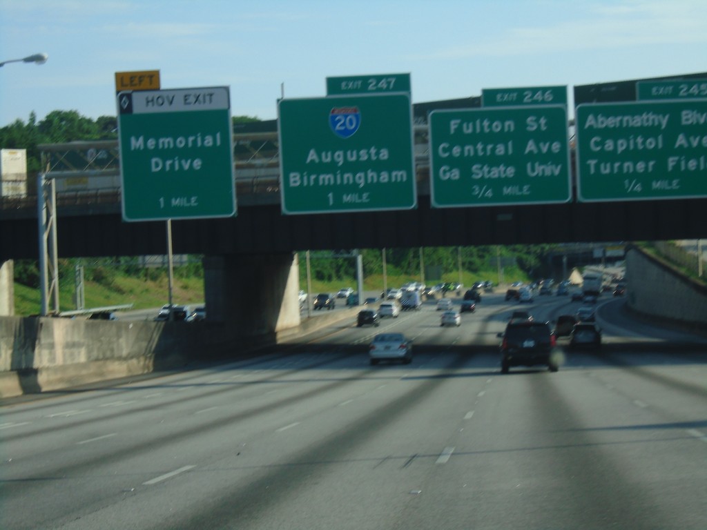
I-75 North/I-85 North - Exits 245, 246, and 247
I-75 North/I-85 North in Atlanta. Exit 245 - Abernathy Blvd./Capitol Ave./Turner Field. Exit 246 - Fulton St./Central Ave./Georgia State University. Exit 247 - I-20/Augusta/Birmingham (AL). Approaching HOV lane exit for Memorial Drive.
Taken 06-22-2019
 Atlanta
Fulton County
Georgia
United States
Atlanta
Fulton County
Georgia
United States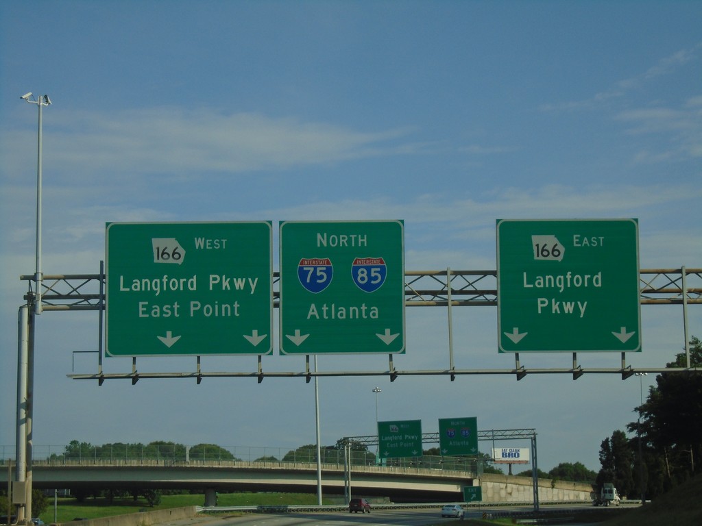
Northbound Ramp from I-85 to GA-166
Northbound Ramp from I-85 to GA-166. Use right lanes for GA-166 East/Langford Parkway; use left lanes for GA-166 West/Langford Parkway/East Point. Continue in center lanes for I-75 North/I-85 North/Atlanta.
Taken 06-22-2019
 Atlanta
Fulton County
Georgia
United States
Atlanta
Fulton County
Georgia
United States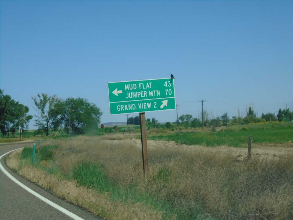
ID-78 West at Mud Flat Road
ID-78 west at Mud Flat Road to Mud Flat and Juniper Mountain. Continue west on ID-78 for Grand View.
Taken 06-15-2019
 Grand View
Owyhee County
Idaho
United States
Grand View
Owyhee County
Idaho
United States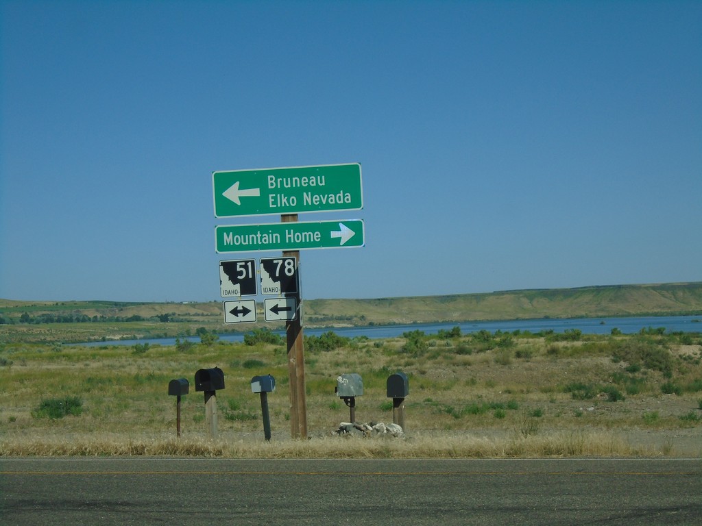
ID-78 West at ID-51
ID-78 west at ID-51. Use ID-51 north for Mountain Home. Use ID-51 South/ID-78 West for Bruneau and Elko, Nevada.
Taken 06-15-2019
 Bruneau
Owyhee County
Idaho
United States
Bruneau
Owyhee County
Idaho
United States