Signs Tagged With Big Green Sign
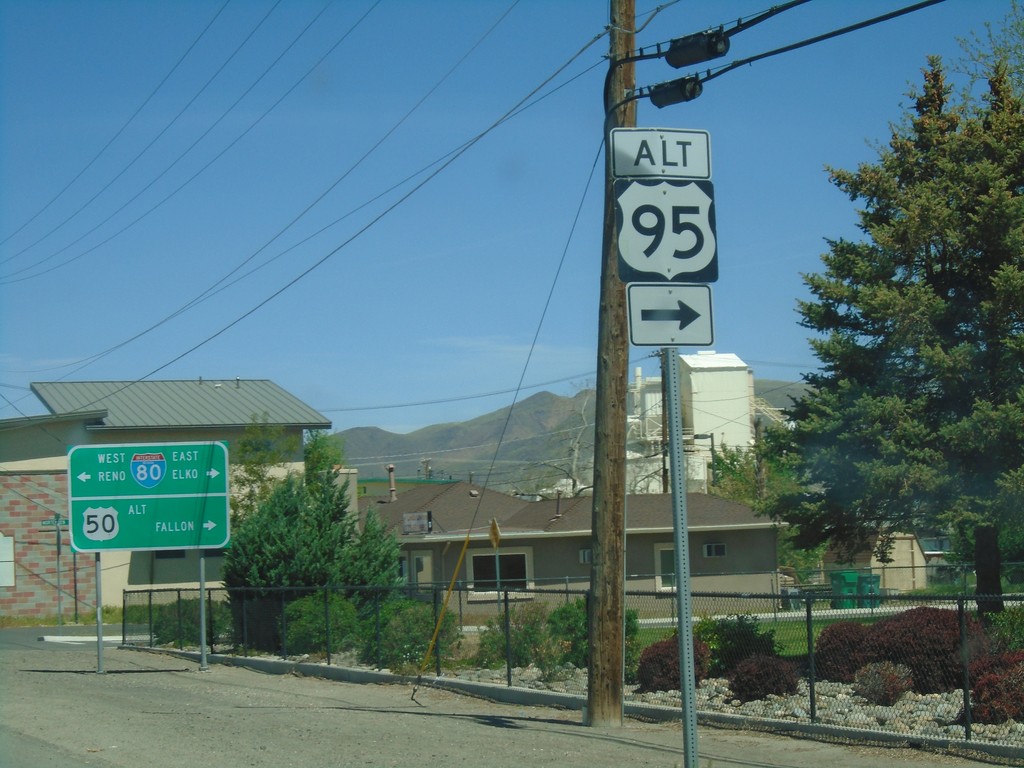
US-95 Alt. North/US-50 Alt. West at BL-80/NV-427
US-95 ALT at US-50 ALT to Fallon and BL-80/NV-427 to Reno and Elko. Turn right to continue north US-95 Alt.
Taken 04-27-2019


 Fernley
Lyon County
Nevada
United States
Fernley
Lyon County
Nevada
United States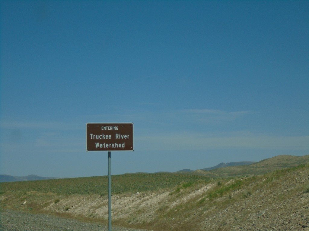
Alt. US-95 North/Alt. US-50 East - Truckee River Watershed
Entering the Truckee River Watershed on Alt. US-95 North/Alt. US-50 East. Taken at the divide in the Virginia Range. These type of watershed signs have been appearing in western Nevada.
Taken 04-27-2019
Fernley
Lyon County
Nevada
United States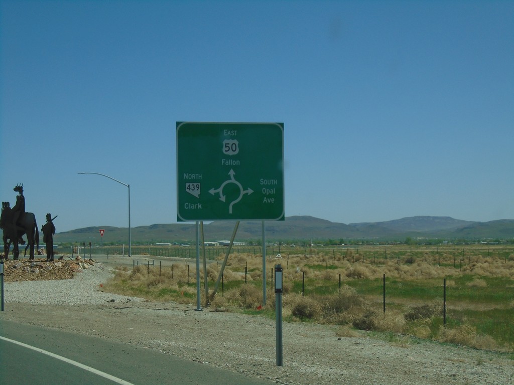
US-50 East at NV-439 Roundabout
US-50 East at NV-439 (USA Parkway) Roundabout in Lyon County. Use US-50 East for Fallon; NV-439 North for Clark (I-80 Jct.); turn south for South Opal Ave.
Taken 04-27-2019

 Silver Springs
Lyon County
Nevada
United States
Silver Springs
Lyon County
Nevada
United States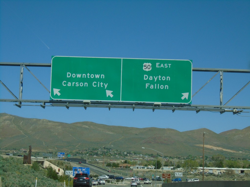
US-395 North/US-50 East on Exit 39 Offramp
US-395 North/US-50 East on Exit 39 Offramp. Use left lane for Carson City Downtown; left lane for US-50 east to Dayton and Fallon.
Taken 04-27-2019

 Carson City
Nevada
United States
Carson City
Nevada
United States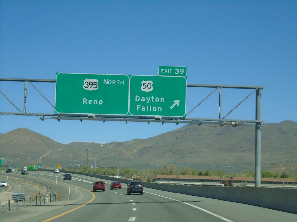
I-580 North - Exit 39
US-395 north at Exit 39 - US-50/Dayton/Fallon. Continue north on I-580/US-395 for Reno. The US-50/US-395 split ends here. The I-580 shield is not listed on the overhead.
Taken 04-27-2019
Carson City
Nevada
United States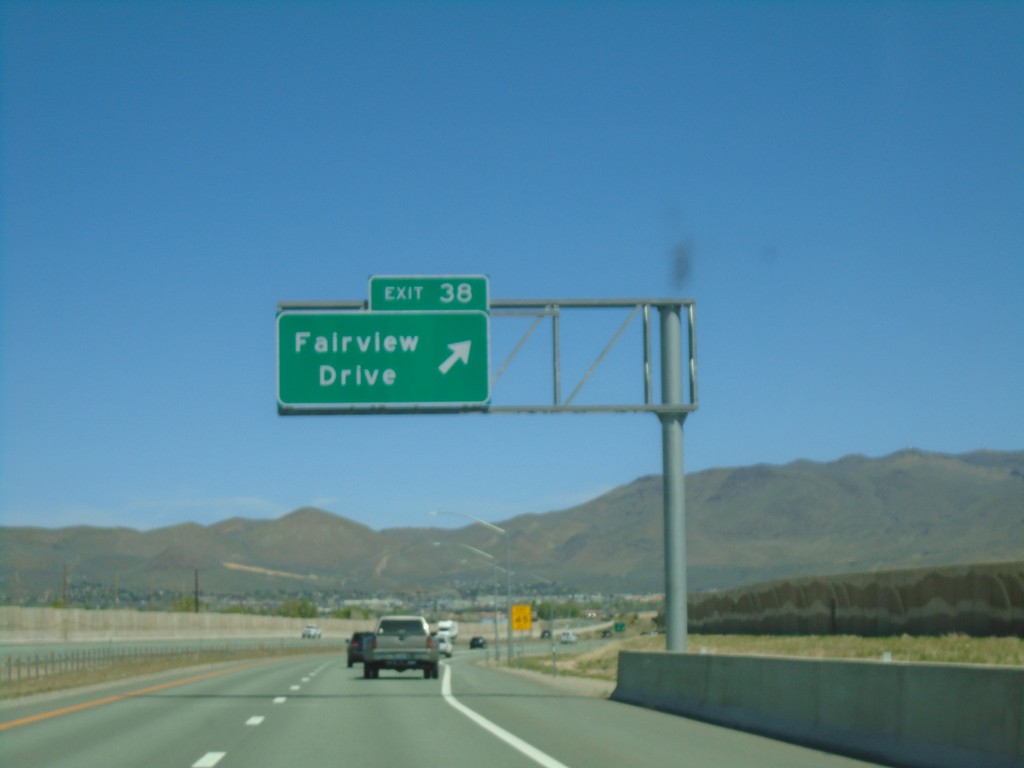
I-580 North - Exit 38
I-580 north at Exit 38 - Fairview Drive.
Taken 04-27-2019
Carson City
Nevada
United States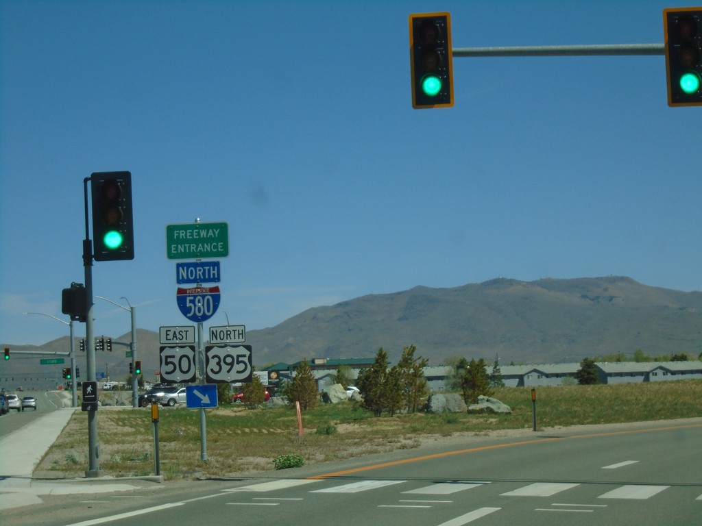
I-580/US-50/US-395 Freeway Entrance
I-580 North/US-50 East/US-395 North Freeway Entrance in Carson City. This is the southern beginning of I-580.
Taken 04-27-2019
 Carson City
Nevada
United States
Carson City
Nevada
United States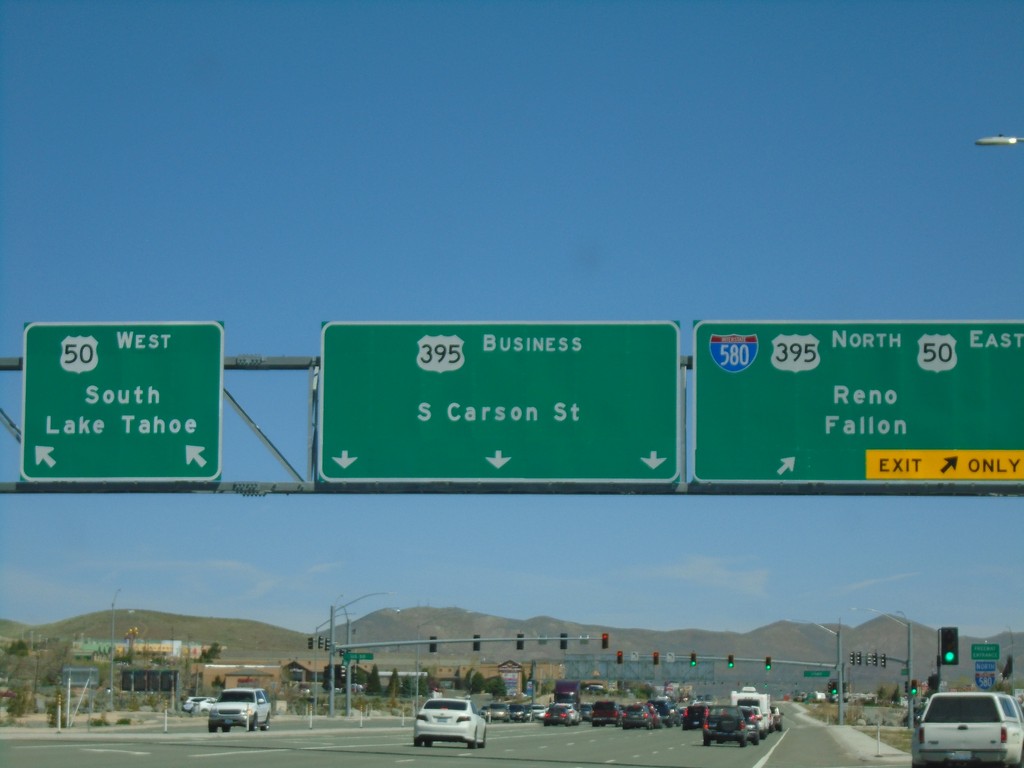
US-395 North at US-50/I-580 - Carson City
US-395 North at US-50/I-580 in Carson City. Turn left for US-50 West/South Lake Tahoe. Continue straight for Bus. US-395/S. Carson St. Merge right for I-580/US-395 North/US-50 East/Fallon/Reno.
Taken 04-27-2019
Carson City
Nevada
United States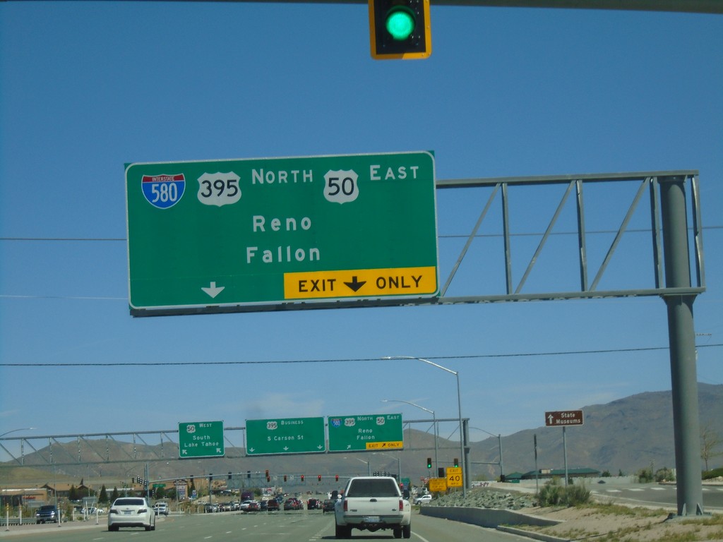
US-395 North Approaching I-580/US-50
US-395 North approaching I-580/US-50 in Carson City. Merge right for I-580/US-395 North/US-50 East/Fallon/Reno. I-580 begins here at the US-50/US-395 junction.
Taken 04-27-2019
Carson City
Nevada
United States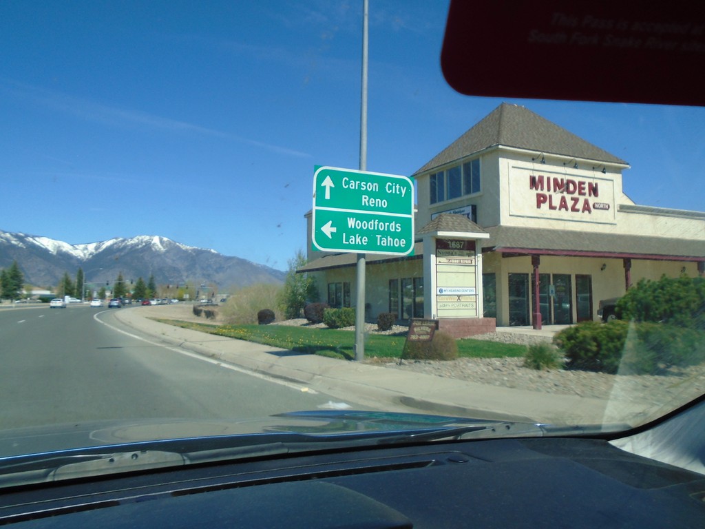
US-395 North Approaching NV-88
US-395 North approaching NV-88 in Minden. Use NV-88 west to Woodfords (California) and Lake Tahoe. Continue north on US-395 for Carson City and Reno.
Taken 04-27-2019
 Minden
Douglas County
Nevada
United States
Minden
Douglas County
Nevada
United States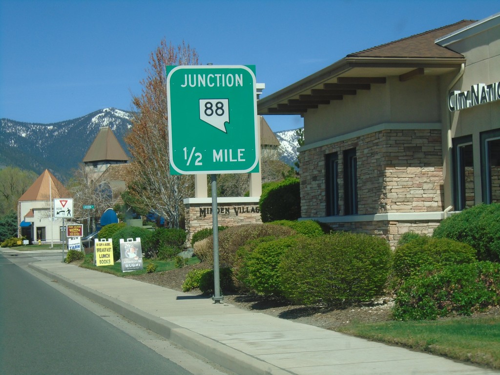
US-395 North Approaching NV-88
US-395 North approaching NV-88 in Minden.
Taken 04-27-2019
Minden
Douglas County
Nevada
United States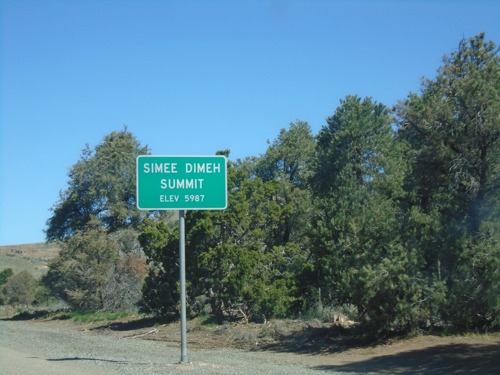
US-395 North - Simee Dimeh Summit
Simee Dimeh Summit on US-395 North - Elevation 5987 Feet.
Taken 04-27-2019
Gardnerville
Douglas County
Nevada
United States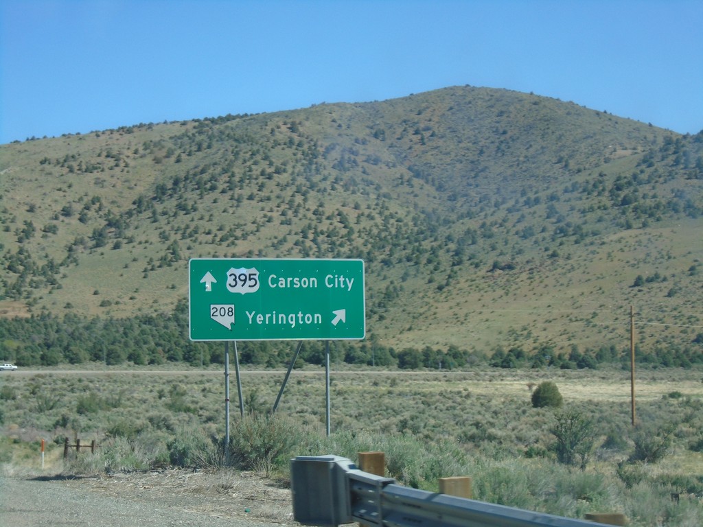
US-395 North - NV-208 Junction
US-395 north at NV-208 east to Yerrington. Continue north on US-395 for Carson City.
Taken 04-27-2019
 Gardnerville
Douglas County
Nevada
United States
Gardnerville
Douglas County
Nevada
United States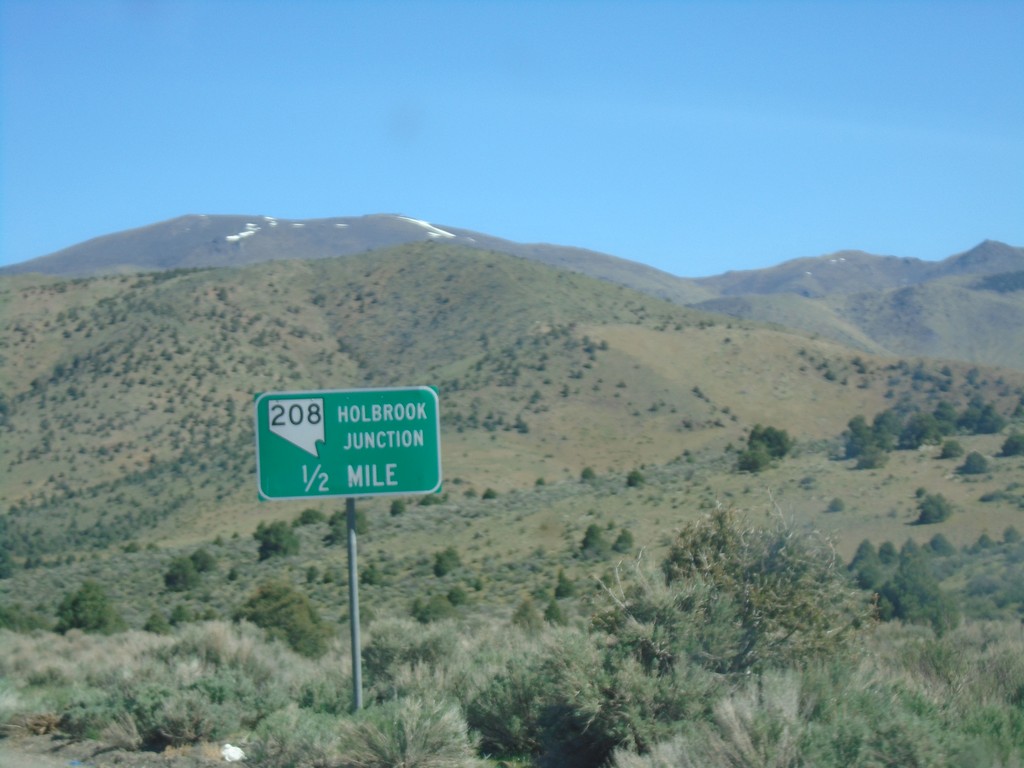
US-395 North Approaching NV-208 - Holbrook Junction
US-395 North approaching NV-208 - Holbrook Junction.
Taken 04-27-2019
Gardnerville
Douglas County
Nevada
United States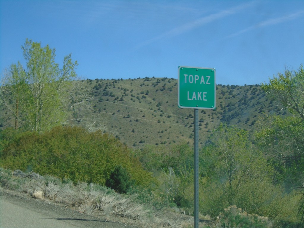
US-395 North - Topaz Lake
Entering Topaz Lake on US-395 north. Topaz Lake is a small community on the shore of Topaz Lake on the California-Nevada state line.
Taken 04-27-2019
Gardnerville
Douglas County
Nevada
United States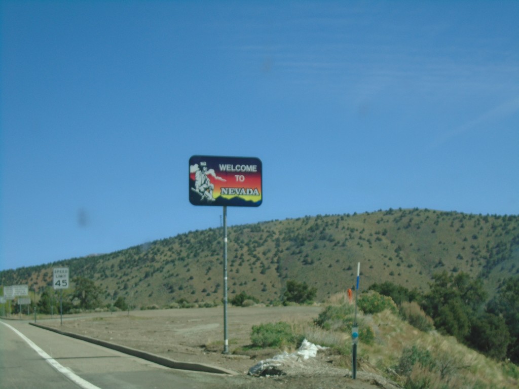
US-395 North - Welcome to Nevada
Welcome to Nevada on US-395 north. Taken at the California - Nevada state line.
Taken 04-27-2019
Gardnerville
Douglas County
Nevada
United States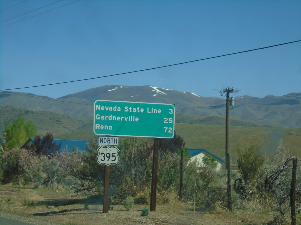
US-395 North - Distance Marker
Distance marker to Nevada State Line, Carson City, and Reno on US-395 north.
Taken 04-27-2019
Coleville
Mono County
California
United States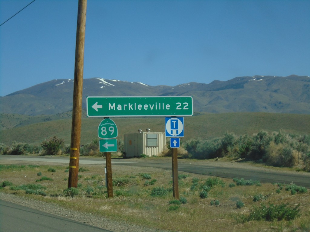
US-395 North at CA-89
US-395 North at CA-89 North. Turn left on CA-89 for Markleeville.
Taken 04-27-2019
 Coleville
Mono County
California
United States
Coleville
Mono County
California
United States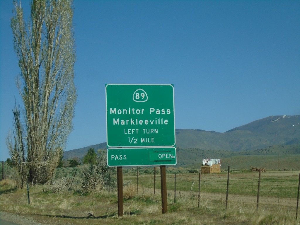
US-395 North Approaching CA-89
US-395 North approaching CA-89 to Markleeville and Monitor Pass. Monitor Pass was open when this picture was taken.
Taken 04-27-2019
Coleville
Mono County
California
United States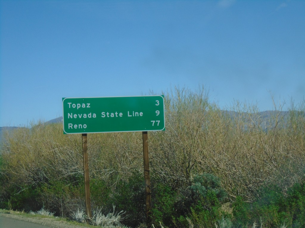
US-395 North - Distance Marker
Distance marker on US-395 north. Distance to Topaz, Nevada State Line, and Reno (Nevada).
Taken 04-27-2019
Coleville
Mono County
California
United States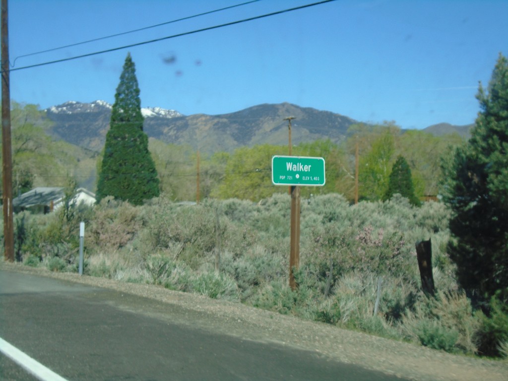
US-395 North - Walker
Entering Walker on US-395 north.
Taken 04-27-2019
Coleville
Mono County
California
United States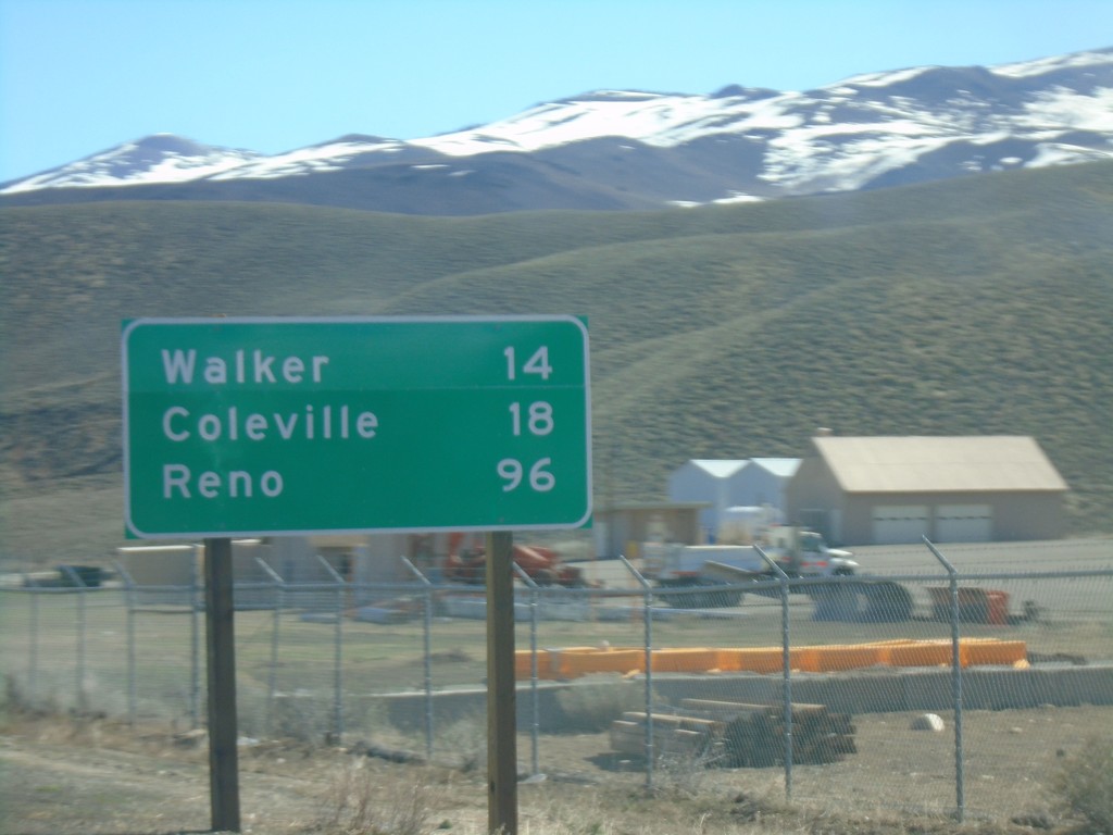
US-395 North - Distance Marker
Distance maker on US-395 north. Distance to Walker, Coleville, and Reno (Nevada).
Taken 04-27-2019
Coleville
Mono County
California
United States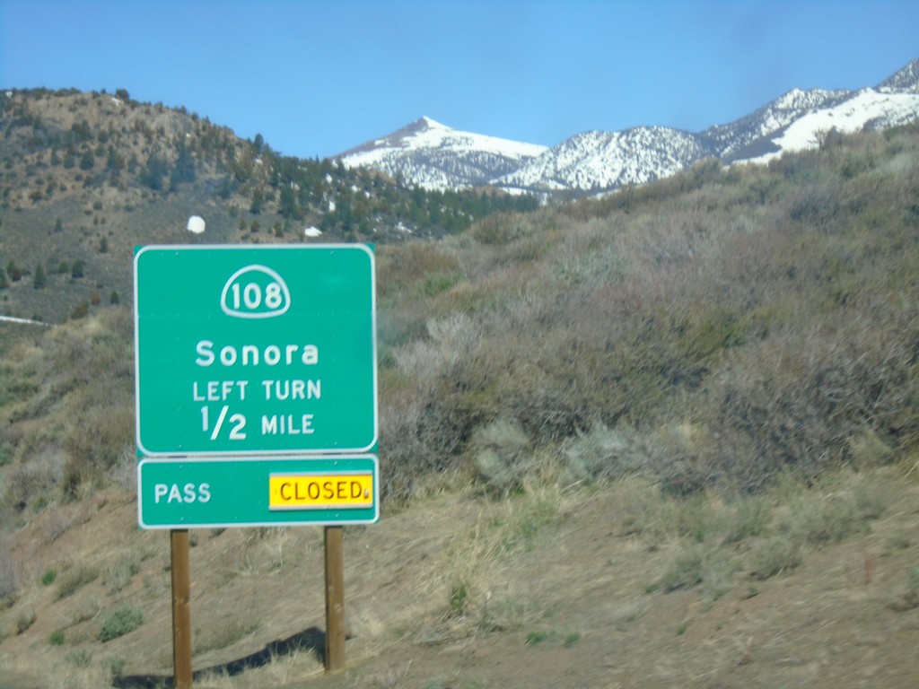
US-395 North Approaching CA-108
US-395 North approaching CA-108/Sonora. Sonora Pass was closed when this picture was taken.
Taken 04-27-2019
 Bridgeport
Mono County
California
United States
Bridgeport
Mono County
California
United States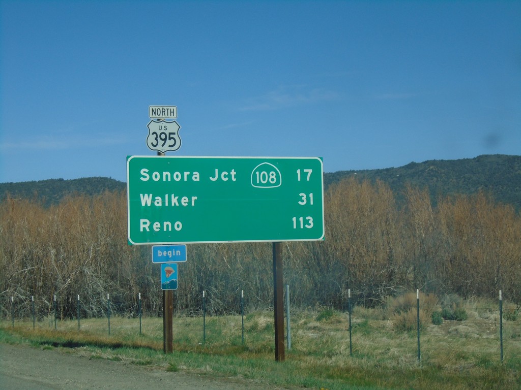
US-395 North - Distance Marker
Distance marker on US-395 north. Distance to Sonora Jct. - CA-108, Walker, and Reno (Nevada). Begin scenic route.
Taken 04-27-2019
Bridgeport
Mono County
California
United States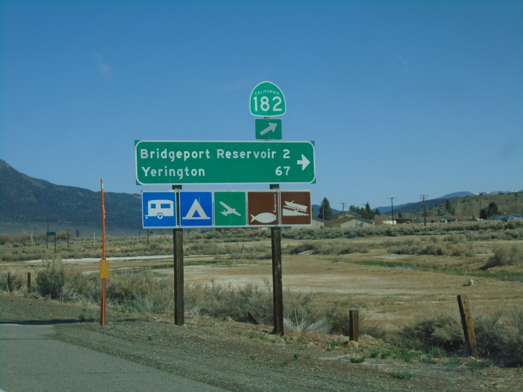
US-395 North at CA-182
US-395 north at CA-182 in Bridgeport. Turn right for Bridgeport Reservoir and Yerington (Nevada).
Taken 04-27-2019
 Bridgeport
Mono County
California
United States
Bridgeport
Mono County
California
United States