Signs Tagged With Big Green Sign
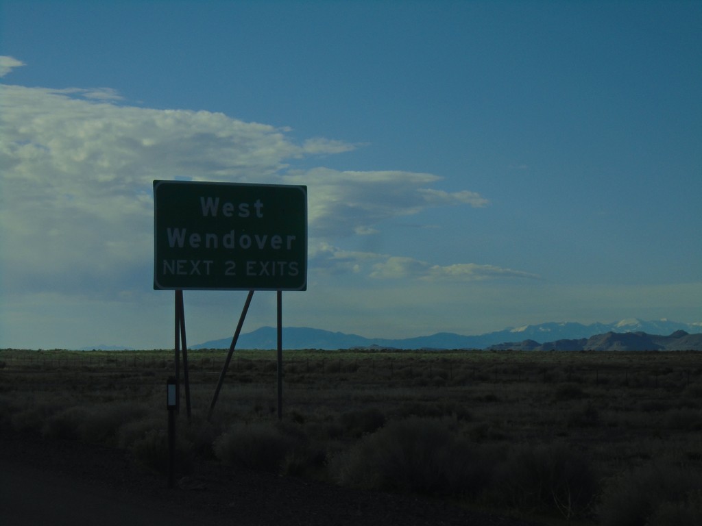
I-80 East - West Wendover Exits
West Wendover - Next 2 Exits on I-80 east.
Taken 04-26-2019

 West Wendover
Elko County
Nevada
United States
West Wendover
Elko County
Nevada
United States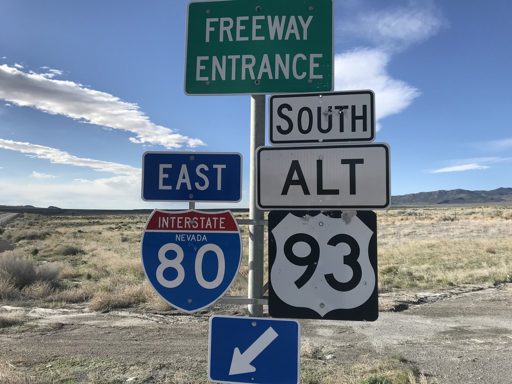
Pilot Peak Interchange at I-80 East/Alt. US-93 South
Pilot Peak interchange (Exit 398) at I-80 East/Alt. US-93 South in Elko County.
Taken 04-26-2019
West Wendover
Elko County
Nevada
United States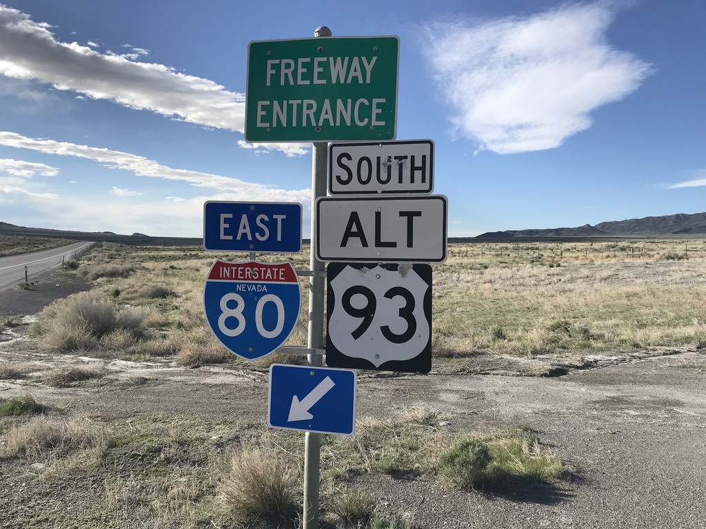
Pilot Peak Interchange at I-80 East/Alt. US-93 South
Pilot Peak interchange (Exit 398) at I-80 East/Alt. US-93 South in Elko County.
Taken 04-26-2019
West Wendover
Elko County
Nevada
United States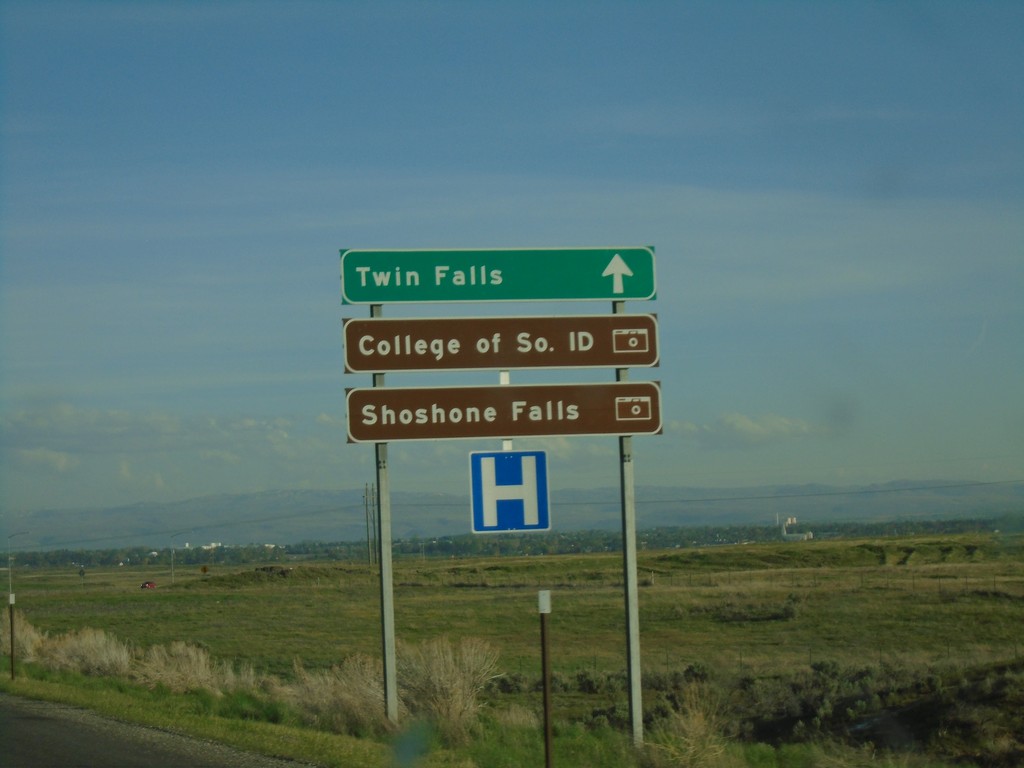
I-84 East at Exit 173 Offramp
I-84 east - Exit 173 offramp. Use right lane for Twin Falls, College of Southern Idaho, and Shoshone Falls.
Taken 04-25-2019

 Twin Falls
 County
Idaho
United States
Twin Falls
Twin Falls County
Idaho
United States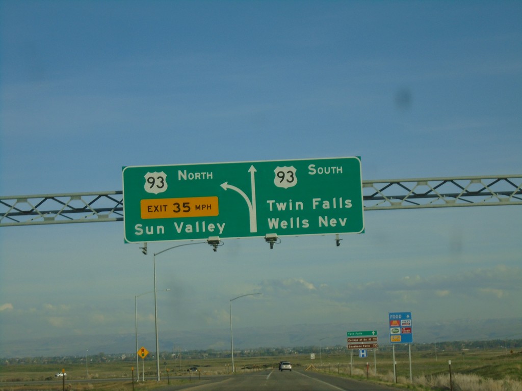
I-84 East at Exit 173 Offramp
I-84 east - Exit 173 offramp. Use right lane for US-93 south to Twin Falls and Wells, Nev. Use left lane for US-93 north to Sun Valley.
Taken 04-25-2019
Twin Falls
Twin Falls County
Idaho
United States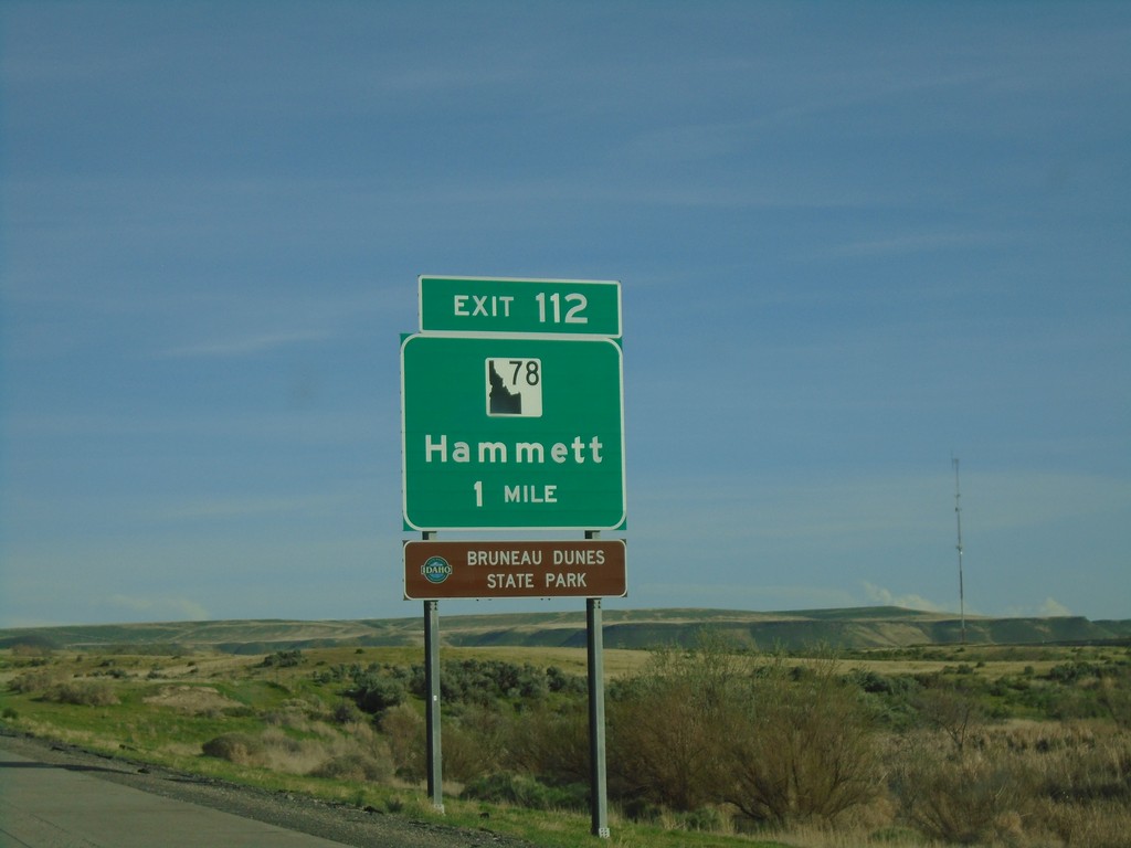
I-84 East - Exit 112
I-84 East approaching Exit 112 - ID-78/Hammett. This new style of black and white shield has been showing up on guide signs in the last few years.
Taken 04-25-2019


 Hammett
Elmore County
Idaho
United States
Hammett
Elmore County
Idaho
United States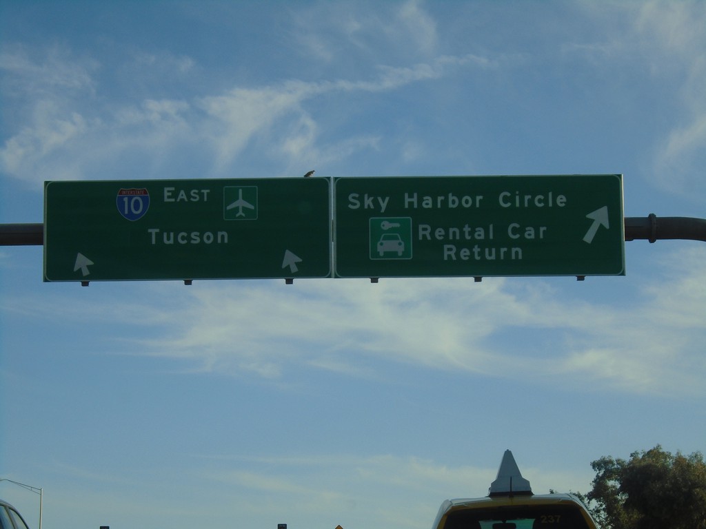
I-10 East - Exit 148 Offramp
I-10 East - Exit 148 Offramp in Phoenix. Use right lane for Sky Harbor Circle/Rental Car Return. Use left lane to return to I-10 East towards Tucson.
Taken 03-24-2019
 Phoenix
Maricopa County
Arizona
United States
Phoenix
Maricopa County
Arizona
United States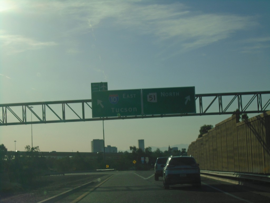
End AZ-202 Loop West at I-10 and AZ-51
End AZ-202 Loop West at I-10 and AZ-51 in Phoenix. Use right lane for AZ-51 North; left lane for I-10 East/Tucson.
Taken 03-24-2019

 Phoenix
Maricopa County
Arizona
United States
Phoenix
Maricopa County
Arizona
United States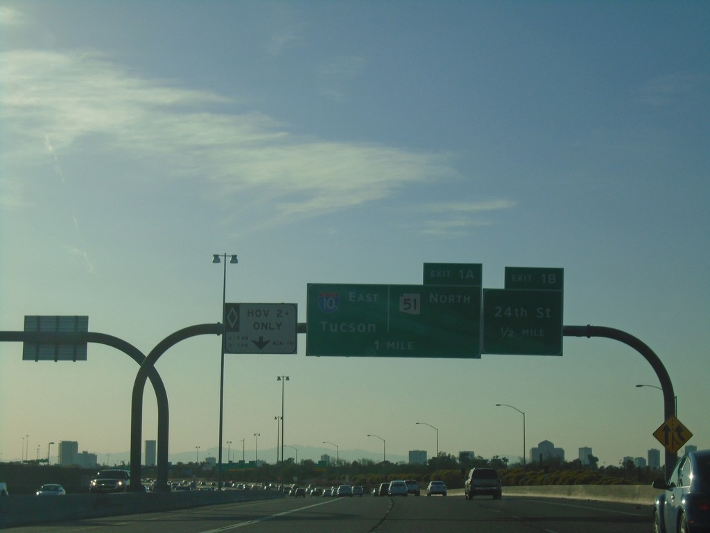
AZ-202 Loop West - Exits 1B and 1A
AZ-202 Loop West approaching Exit 1B - 24th St. Approaching Exit 1A - 1-10 East/Tucson/AZ-51 North.
Taken 03-24-2019
Phoenix
Maricopa County
Arizona
United States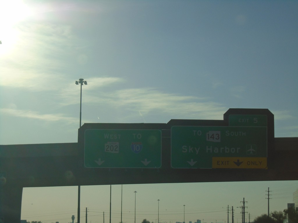
AZ-202 Loop West - Exit 5
AZ-202 Loop West at Exit 5 - To AZ-143 South/Sky Harbor Airport. Continue west on AZ-202 Loop for I-10.
Taken 03-24-2019
 Tempe
Maricopa County
Arizona
United States
Tempe
Maricopa County
Arizona
United States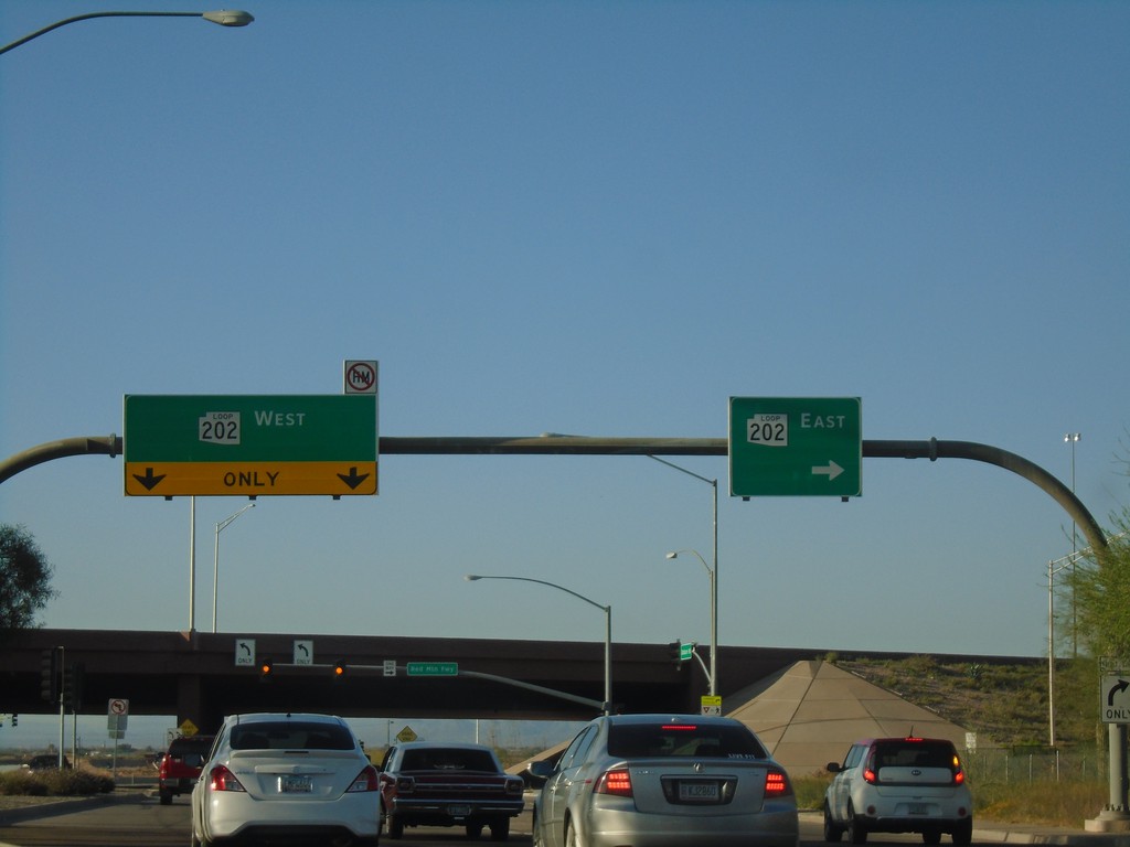
Dobson Road North At AZ-202 Loop
Dobson Road North At AZ-202 Loop in Mesa.
Taken 03-24-2019
Mesa
Maricopa County
Arizona
United States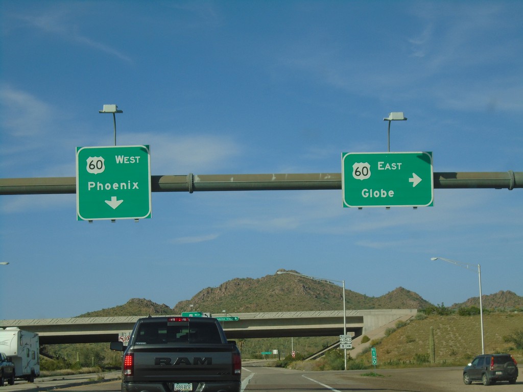
End AZ-79 North at US-60
End AZ-79 North at US-60. Use US-60 East for Globe; US-60 West for Phoenix.
Taken 03-24-2019

 Queen Valley
Pinal County
Arizona
United States
Queen Valley
Pinal County
Arizona
United States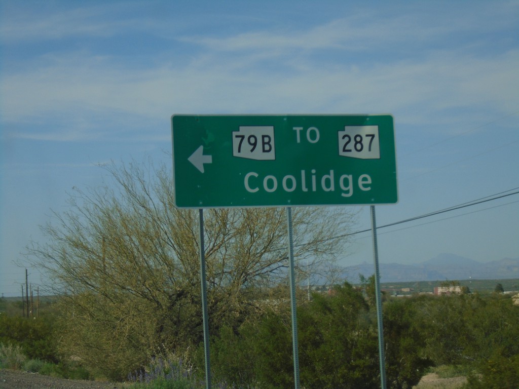
AZ-79 North at Bus. AZ-79/To AZ-287
AZ-79 North at Bus. AZ-79/To AZ-287 in Florence. Turn left for AZ-79 Bus./To AZ-287 to Coolidge.
Taken 03-24-2019

 Florence
Pinal County
Arizona
United States
Florence
Pinal County
Arizona
United States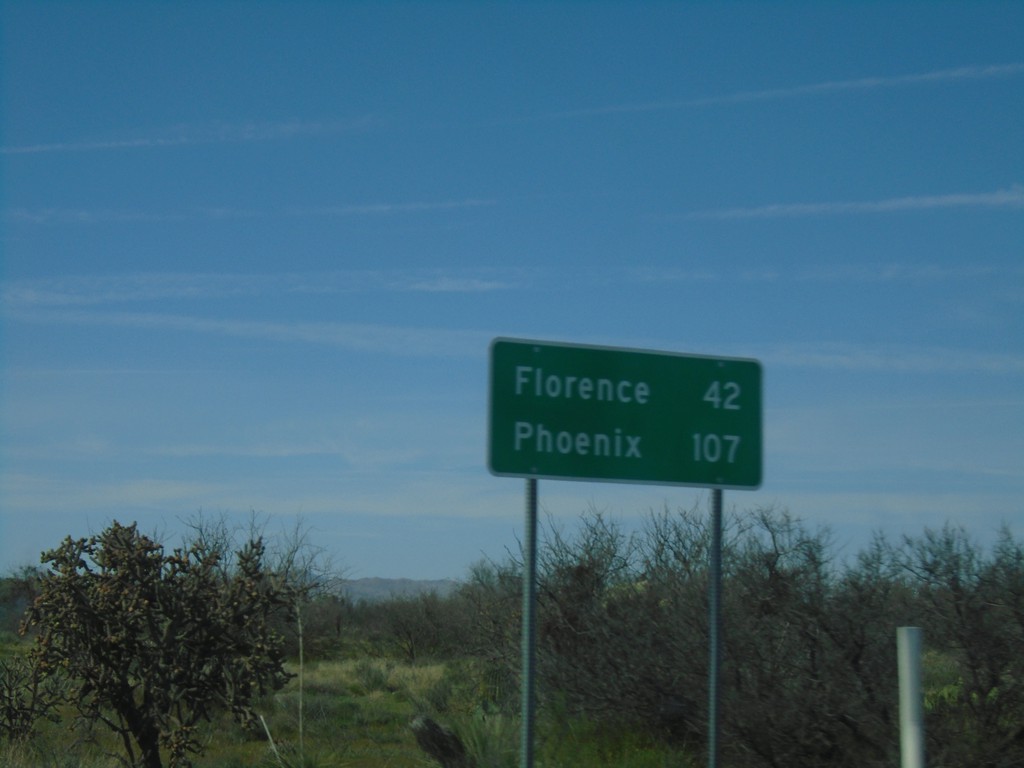
AZ-79 North - Distance Marker
Distance marker on AZ-79 North. Distance to Florence and Phoenix.
Taken 03-24-2019
Oracle
Pinal County
Arizona
United States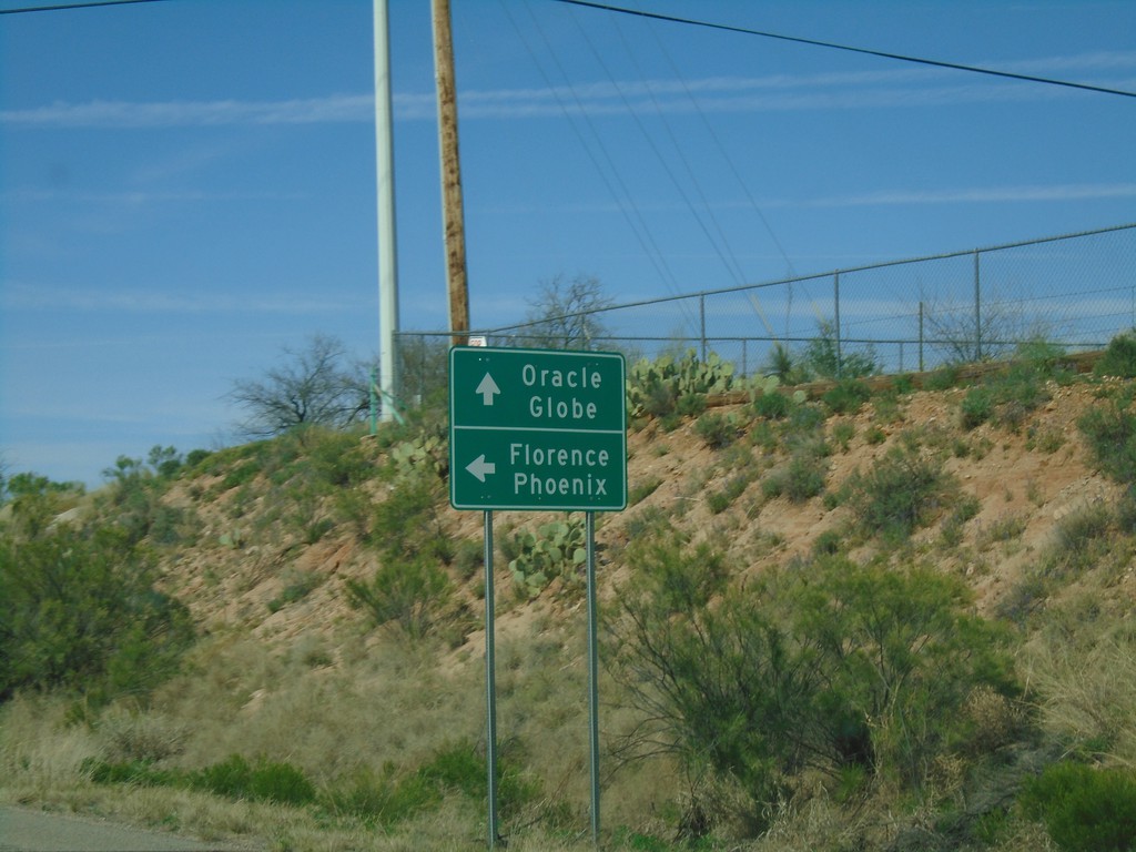
AZ-77 North at AZ-79
AZ-77 North at AZ-79. Continue north on AZ-77 to Globe and Oracle. Turn left for AZ-79 north to Florence and Phoenix.
Taken 03-24-2019
 Oracle
Pinal County
Arizona
United States
Oracle
Pinal County
Arizona
United States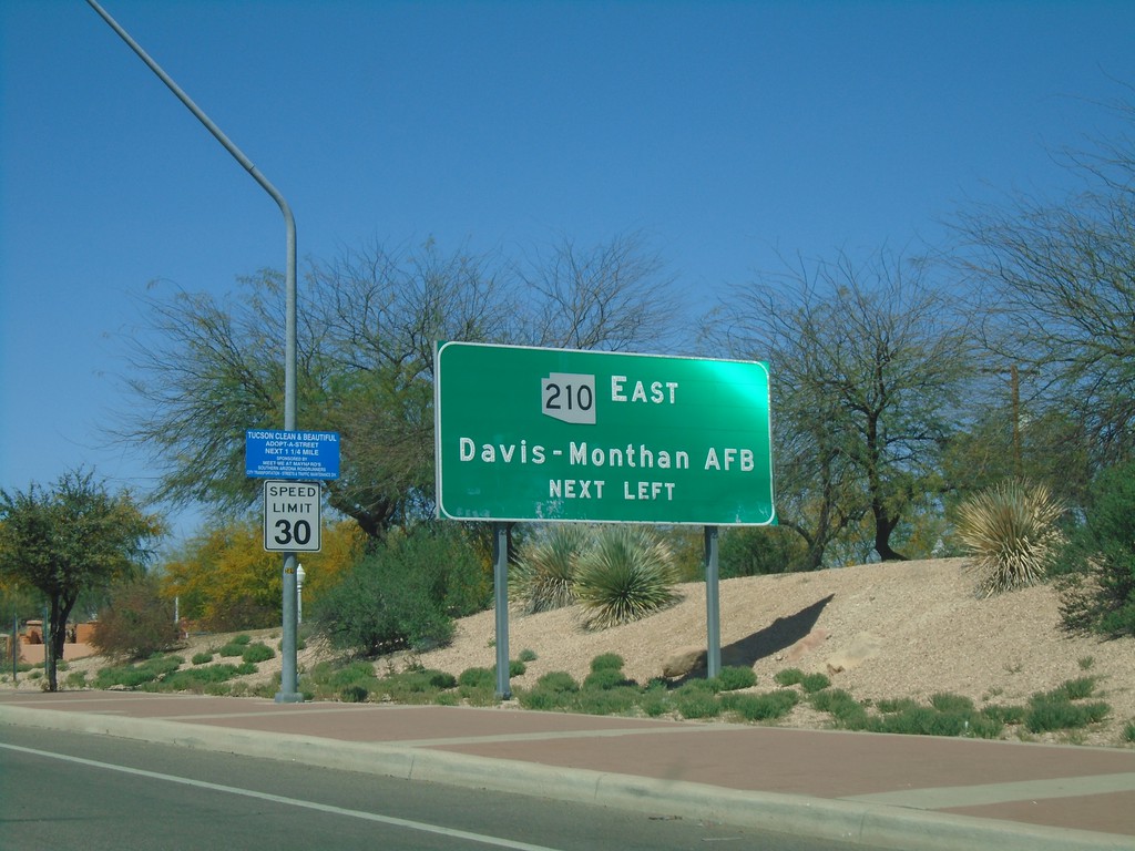
Broadway Blvd. West Approaching AZ-210
Broadway Blvd. West approaching AZ-210 East to Davis-Monthan AFB.
Taken 03-24-2019
 Tucson
Pima County
Arizona
United States
Tucson
Pima County
Arizona
United States
Broadway Blvd. West Approaching AZ-210
Broadway Blvd. West approaching AZ-210 in Tucson.
Taken 03-24-2019
Tucson
Pima County
Arizona
United States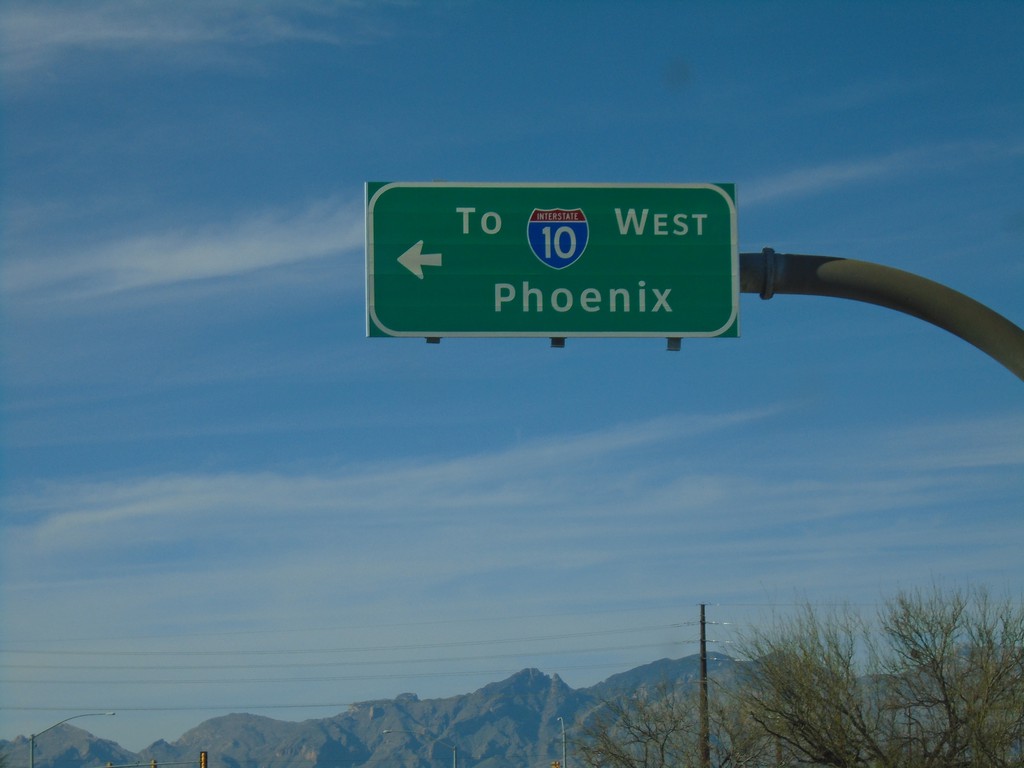
Alvernon Way North at Irvington Road
Alvernon Way North at Irvington Road in Tucson. Turn left on Irvington Road for I-10 West to Phoenix.
Taken 03-23-2019
Tucson
Pima County
Arizona
United States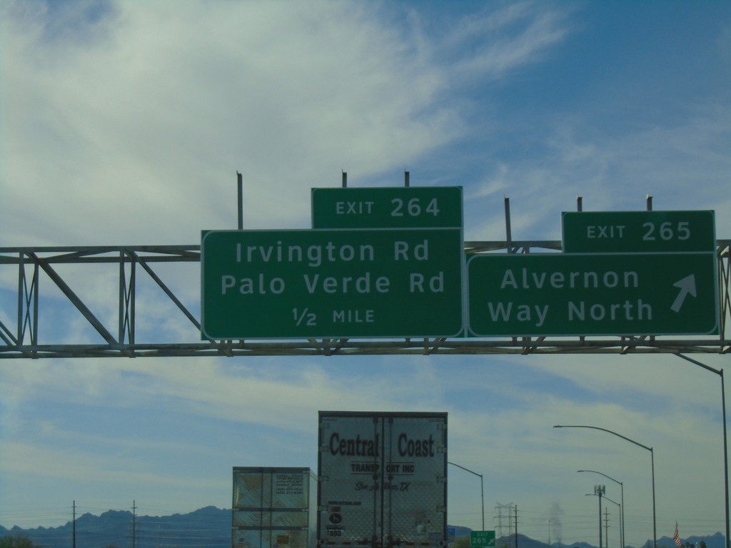
I-10 West - Exits 265 and 264
I-10 west at Exit 265 - Alvernon Way North. Approaching Exit 264 - Irvington Road/Palo Verde Road.
Taken 03-23-2019
Tucson
Pima County
Arizona
United States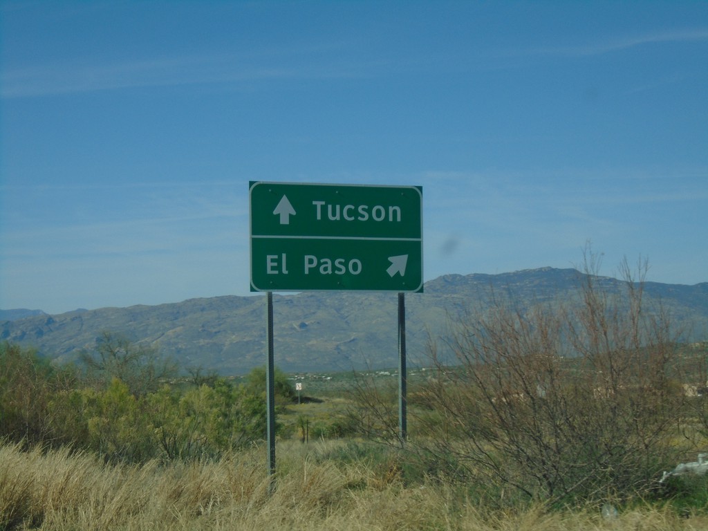
AZ-83 North at I-10
AZ-83 north at I-10. Use I-10 east for El Paso (Texas); I-10 west for Tucson.
Taken 03-23-2019
 Vail
Pima County
Arizona
United States
Vail
Pima County
Arizona
United States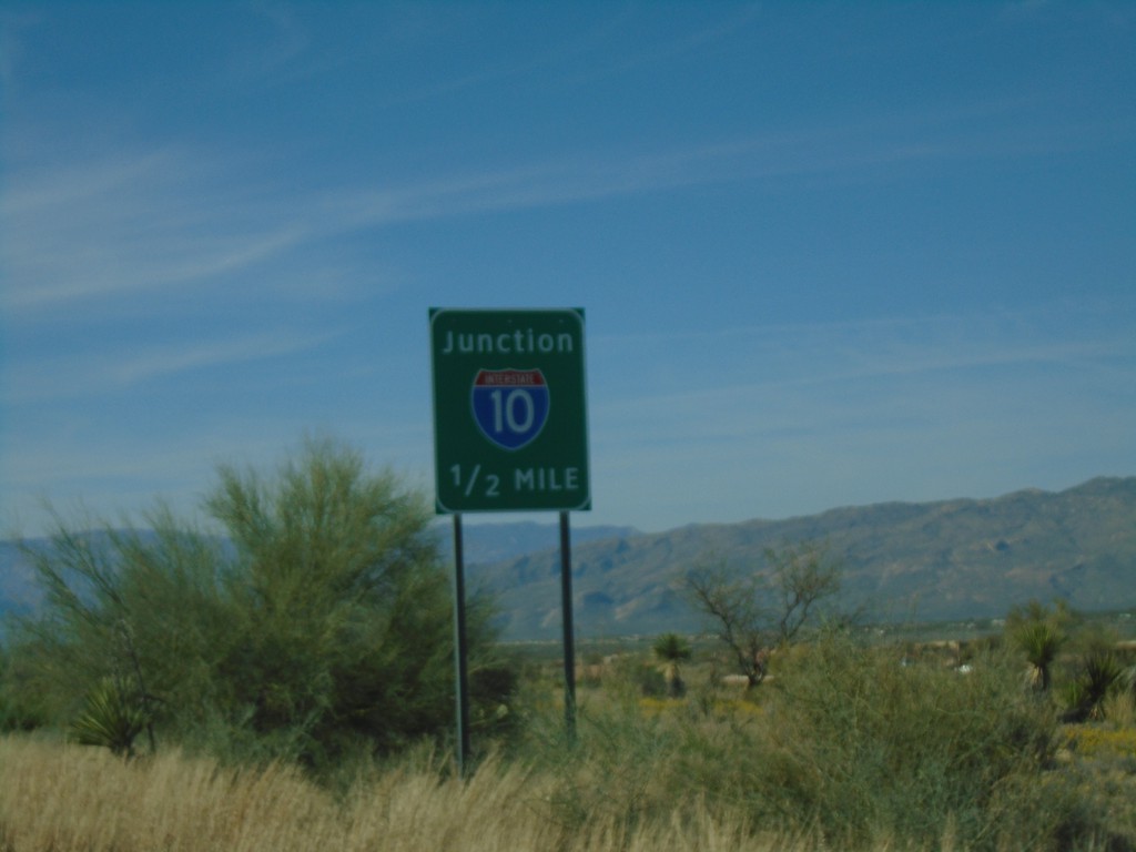
AZ-83 North Approaching I-10
AZ-83 North approaching I-10 in Pima County.
Taken 03-23-2019
Vail
Pima County
Arizona
United States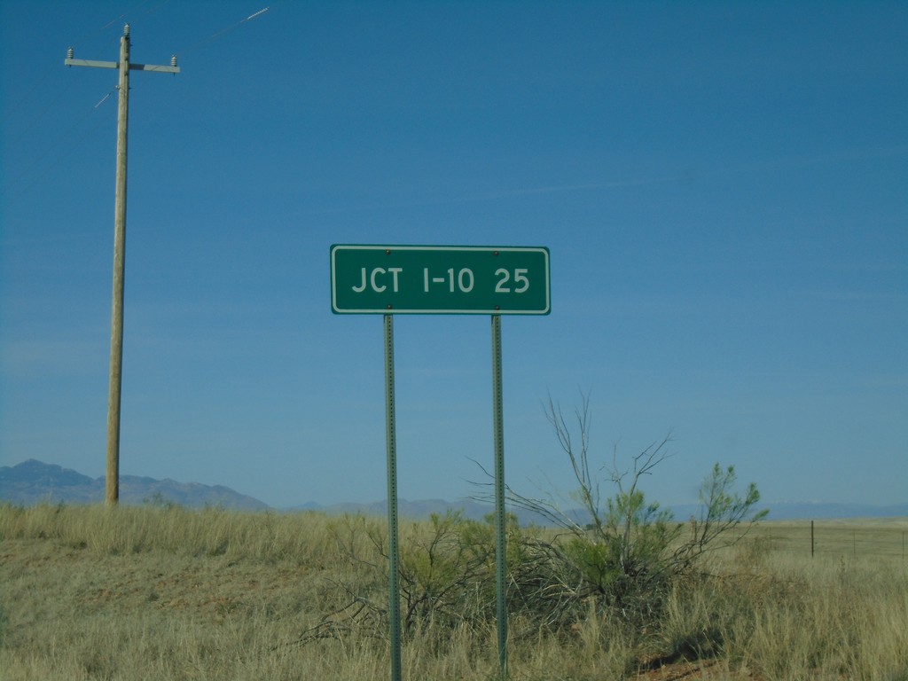
AZ-83 North - Distance Marker
Distance marker on AZ-83 north. Distance to I-10.
Taken 03-23-2019
Sonoita
Santa Cruz County
Arizona
United States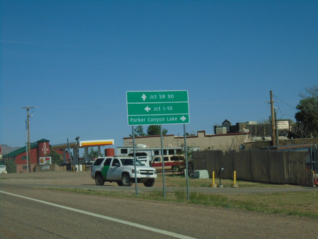
AZ-82 East Approaching AZ-83
AZ-82 east approaching AZ-83. Use AZ-83 north for I-10. Continue east on AZ-82 for SR-90. Turn right on county road for Parker Canyon Lake.
Taken 03-23-2019
 Sonoita
Santa Cruz County
Arizona
United States
Sonoita
Santa Cruz County
Arizona
United States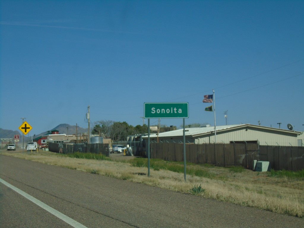
AZ-82 East - Sonoita
Entering Sonoita on AZ-82 East.
Taken 03-23-2019
Sonoita
Santa Cruz County
Arizona
United States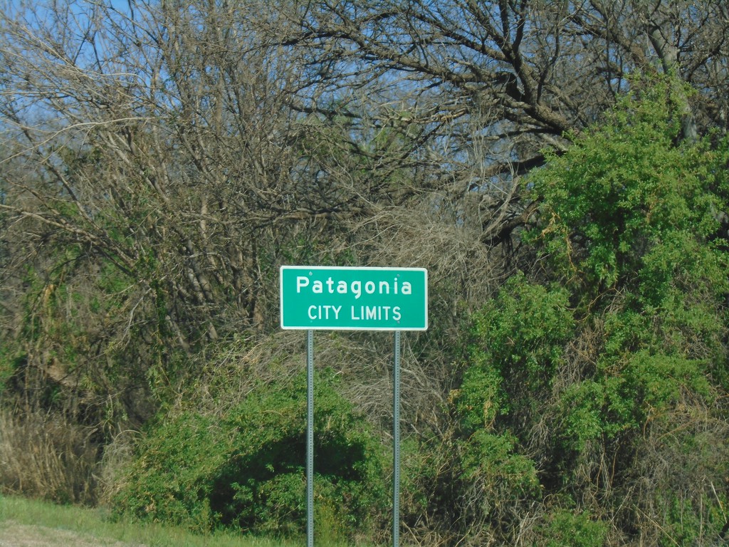
AZ-82 East - Patagonia City Limits
Patagonia City Limits on AZ-82 East.
Taken 03-23-2019
Patagonia
Santa Cruz County
Arizona
United States