Signs Tagged With Big Green Sign
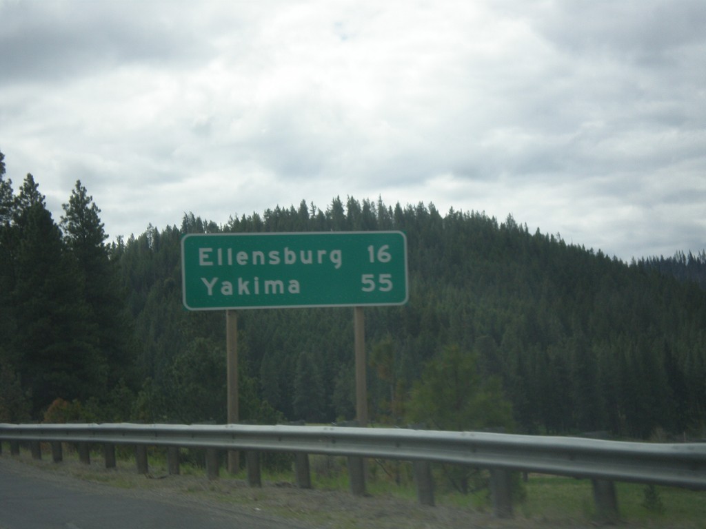
US-97 South - Distance Marker
Distance marker on US-97 south. Distance to Ellensburg and Yakima.
Taken 04-30-2018
 Cle Elum
Kittitas County
Washington
United States
Cle Elum
Kittitas County
Washington
United States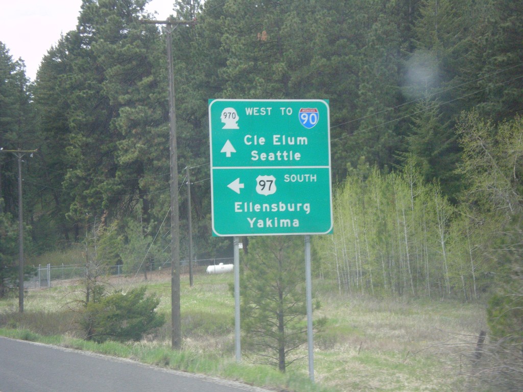
US-97 South at WA-970 (To I-90)
US-97 South at WA-970 in Kittitas County. Use WA-970 West for I-90, Cle Elum, and Seattle. Turn left to continue south on US-97 towards Ellensburg and Yakima.
Taken 04-30-2018

 Cle Elum
Kittitas County
Washington
United States
Cle Elum
Kittitas County
Washington
United States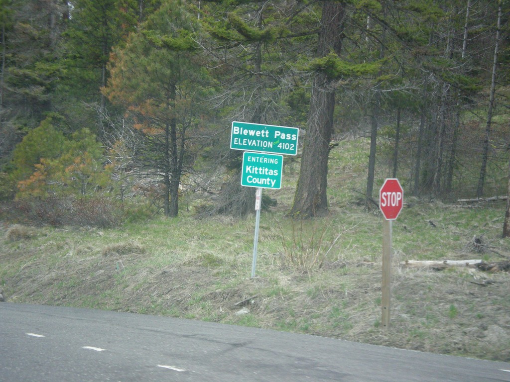
US-97 South - Blewett Pass
US-97 South at Blewett Pass - Elevation 4102 Feet. Entering Kittitas County. Blewett Pass is at the summit of the Wenatchee Mountains.
Taken 04-30-2018
Liberty
Kittitas County
Washington
United States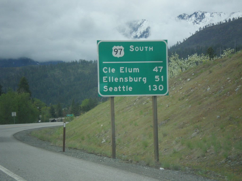
US-97 South - Distance Marker
Distance Marker on US-97 south. Distance to Cle Elum (via WA-970), Ellensburg, and Seattle (via WA-970 and I-90). This type of distance marker with the route name on top is not typical in Washington.
Taken 04-30-2018
Peshastin
Chelan County
Washington
United States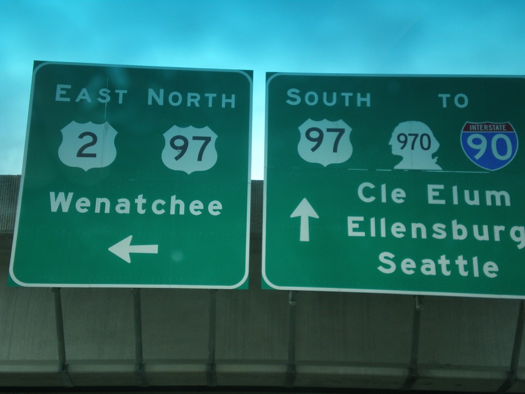
US-97 South at US-2/US-97 Jct.
US-97 South at US-2/US-97 Jct. Continue south for US-97/To I-90/To WA-970 to Cle Elum, Ellensburg, and Seattle. Turn left for US-2 East/US-97 North onramp to Wenatchee. US-97 south leaves US-2 westbound here.
Taken 04-30-2018
 Peshastin
Chelan County
Washington
United States
Peshastin
Chelan County
Washington
United States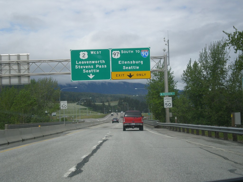
US-2 West/US-97 South At US-2/US-97 Split
US-2 West/US-97 South at the US-2/US-97 split. Use US-97 South to I-90/Ellensburg/Seattle (via Snoqualmie Pass). Use US-2 West to Leavenworth, Stevens Pass and Seattle (via Stevens Pass).
Taken 04-30-2018
Dryden
Chelan County
Washington
United States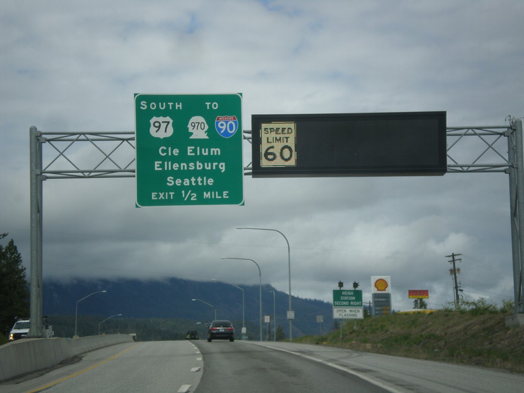
US-2 West/US-97 South Approaching US-2/US-97 Split
US-2 West/US-97 South approaching US-2/US-97 Split. Use US-97 south for WA-970/I-90 to Cle Elum, Ellensburg, and Seattle. A variable speed limit sign shows the speed as 60 MPH.
Taken 04-30-2018
Cashmere
Chelan County
Washington
United States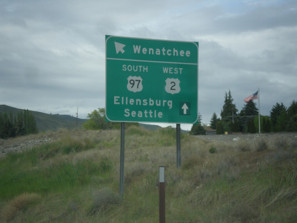
US-2 West/US-97 South at WA-285
US-2 West/US-97 South at WA-285 in Wenatchee. Merge left for (WA-285 South) to Ellensburg. Continue straight for US-2 West/US-97 South to Seattle and Ellensburg.
Taken 04-30-2018
 Wenatchee
Chelan County
Washington
United States
Wenatchee
Chelan County
Washington
United States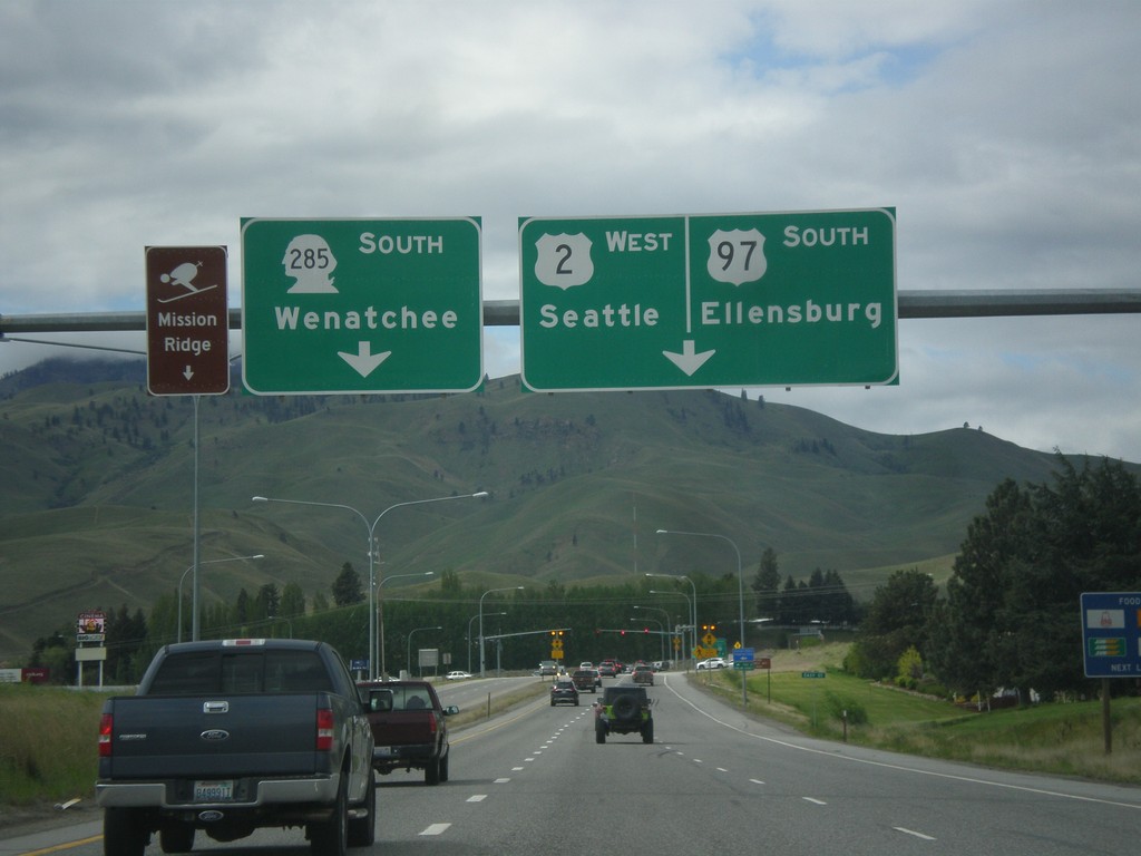
US-2 West/US-97 South Approaching WA-285
US-2 West/US-97 South approaching WA-285. Use right lane for US-2 West/US-97 South to Ellensburg and Seattle. Continue straight for WA-285 South to Wenatchee and Mission Ridge Ski Area.
Taken 04-30-2018
Sunnyslope
Chelan County
Washington
United States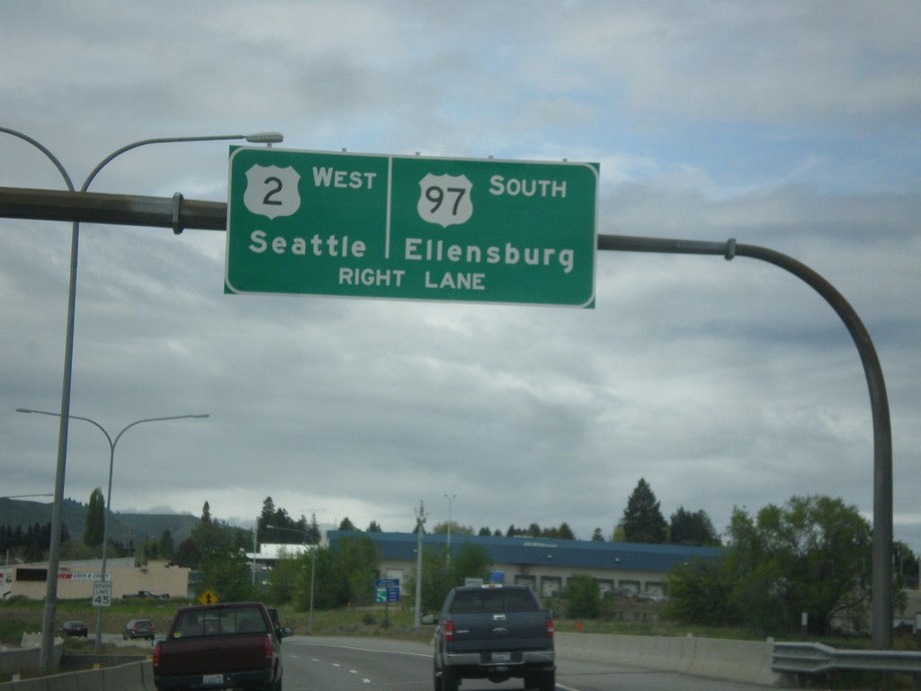
US-2 West/US-97 South Approaching WA-285
US-2 West/US-97 South approaching WA-285 in Wenatchee. Use right lane to continue on US-2 West/US-97 South to Seattle and Ellensburg.
Taken 04-30-2018
Wenatchee
Chelan County
Washington
United States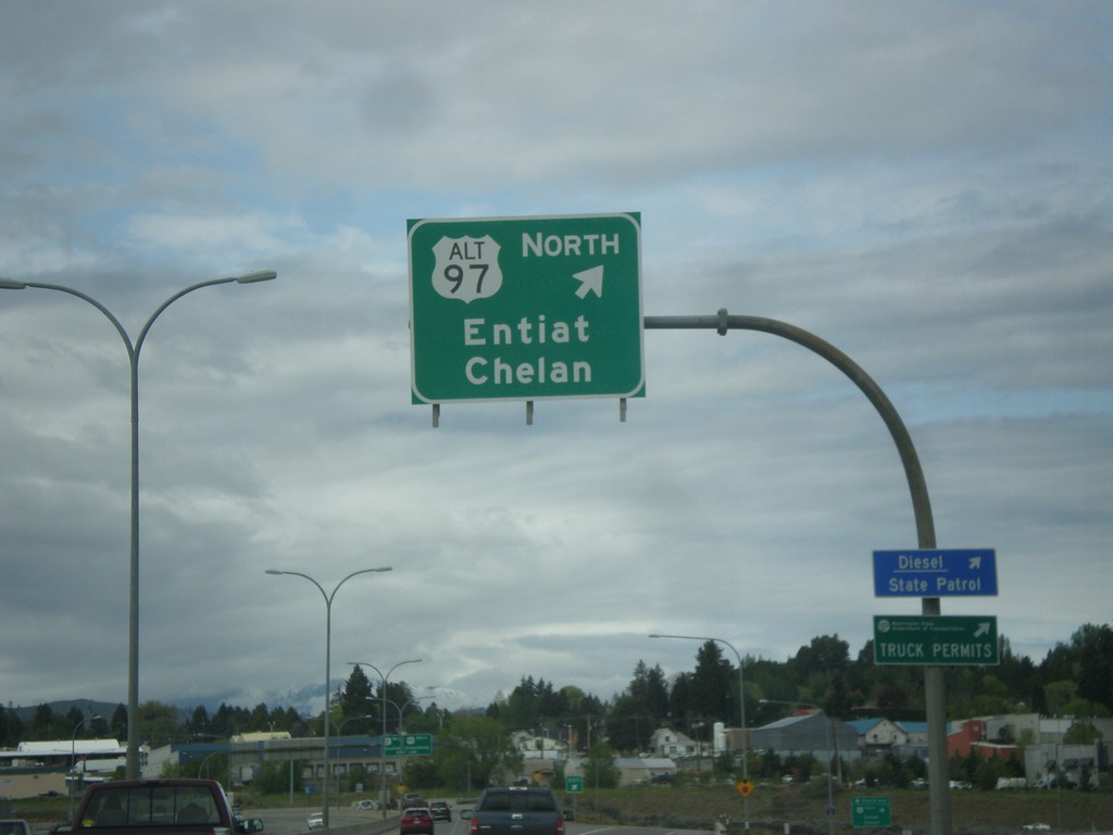
US-2 West/US-97 South at Alt. US-97 North
US-2 West/US-97 South at Alt. US-97 North to Entiat and Chelan.
Taken 04-30-2018
 Wenatchee
Chelan County
Washington
United States
Wenatchee
Chelan County
Washington
United States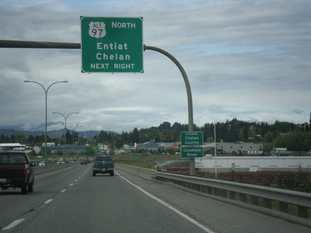
US-2 West/US-97 South Approaching US-97 Alt. North
US-2 West/US-97 South approaching US-97 Alt. North to Entiat and Chelan. Entering Chelan County and crossing the Columbia River.
Taken 04-30-2018
Wenatchee
Chelan County
Washington
United States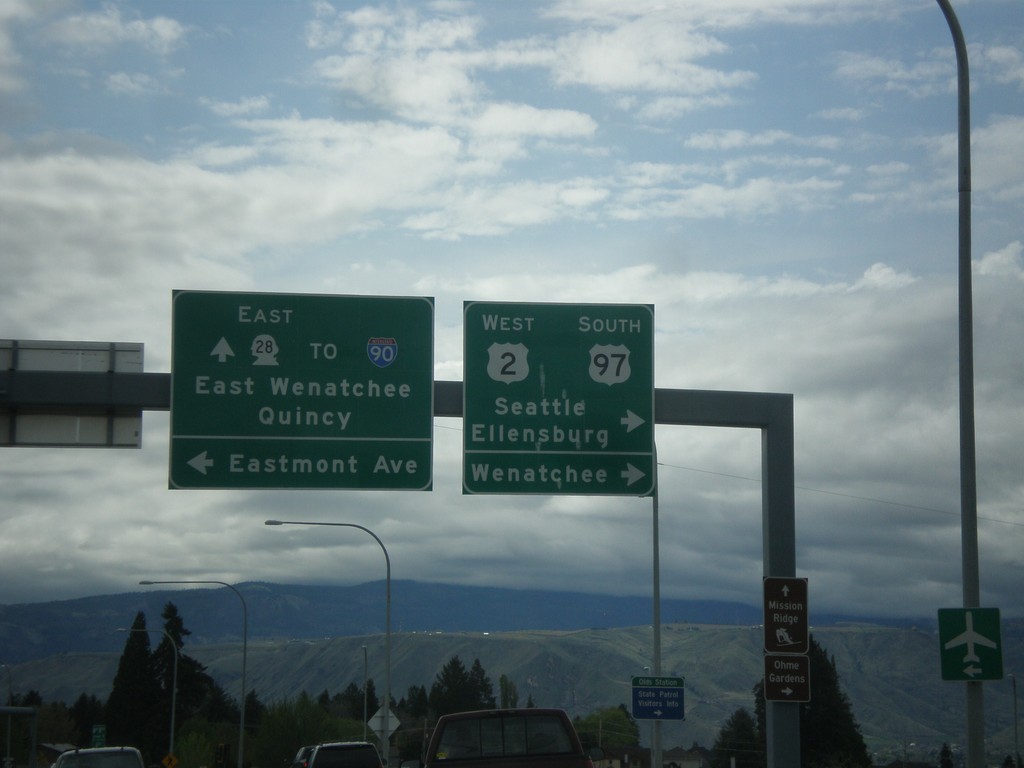
US-2 West/US-97 South at WA-28
US-2 West/US-97 South at WA-28 in Douglas County. Turn right to continue on US-2 West/US-97 South towards Ellensburg, Seattle, and Wenatchee (on the other bank of the Columbia River). Continue straight for WA-28 East to Quincy, East Wenatchee and I-90. Turn left for Eastmont Ave.
Taken 04-30-2018
 East Wenatchee
Douglas County
Washington
United States
East Wenatchee
Douglas County
Washington
United States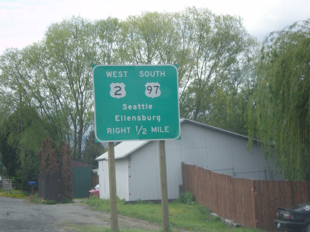
US-2 West/US-97 South Approaching WA-28
US-2 West/US-97 South approaching WA-28 in Douglas County. Use US-2 West/US-97 South for Seattle and Ellensburg.
Taken 04-30-2018
East Wenatchee
Douglas County
Washington
United States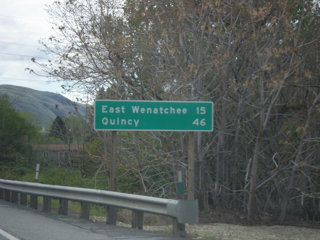
US-2 West/US-97 South - Distance Marker
Distance Marker on US-2 West/US-97 South. Distance to East Wenatchee and Quincy. Both of those cities are via WA-28.
Taken 04-30-2018
Orondo
Douglas County
Washington
United States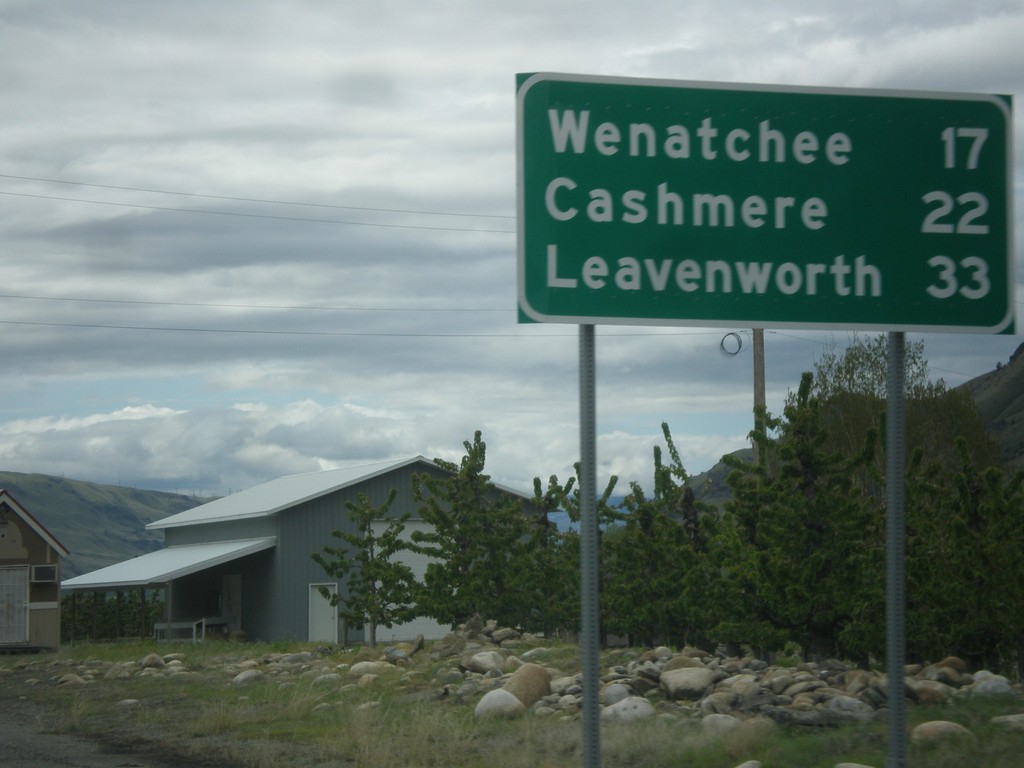
US-2 West/US-97 South - Distance Marker
Distance Marker on US-2 West/US-97 South. Distance to Wenatchee, Cashmere, and Leavenworth.
Taken 04-30-2018
Orondo
Douglas County
Washington
United States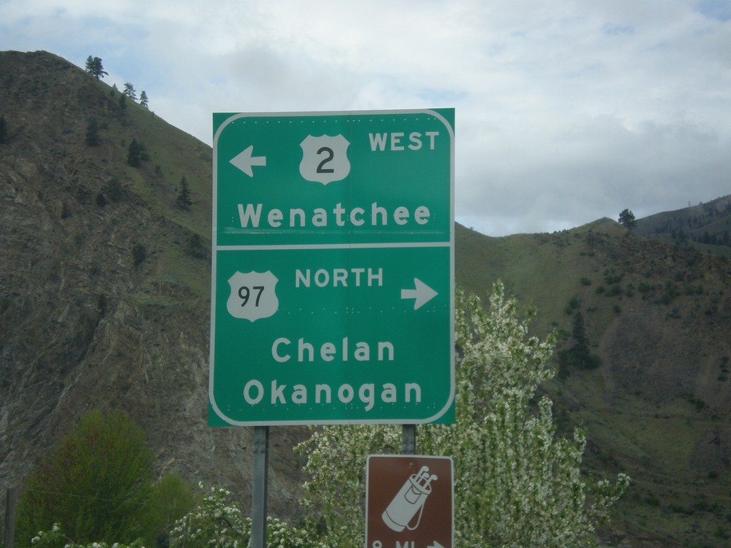
US-2 West at US-97
US-2 West at US-97 in Orondo. Turn right for US-97 north to Chelan and Okanogan. Turn left for US-2 West/(US-97 South) to Wenatchee. US-97 south joins US-2 west to Cashmere.
Taken 04-30-2018
Orondo
Douglas County
Washington
United States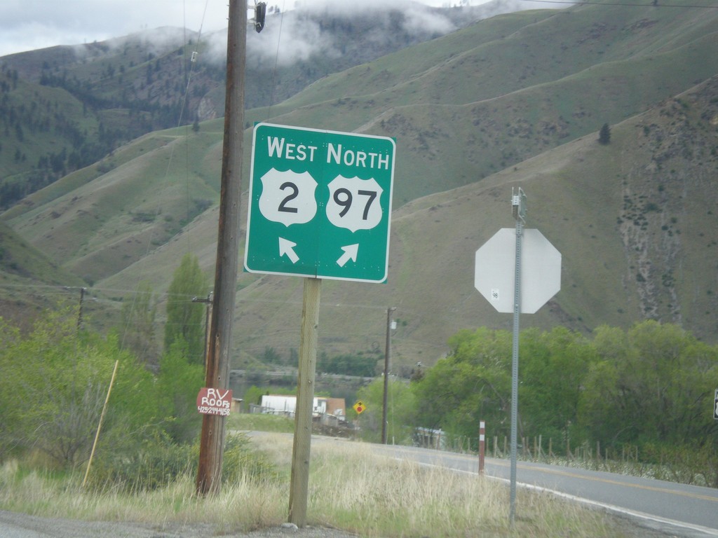
US-2 West at Connection to US-97 North
US-2 West at connection to US-97 North in Orondo. Turn right for US-97 north; left for US-2 west.
Taken 04-30-2018
Orondo
Douglas County
Washington
United States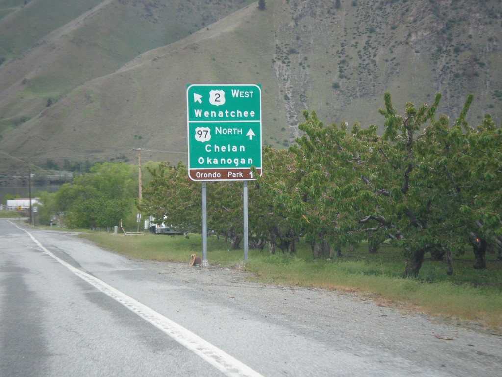
US-2 West at US-97 North
US-2 West at US-97 North. Turn right for connection to US-97 North/Chelan/Okanogan. Merge left for US-2 West towards Wenatchee.
Taken 04-30-2018
Orondo
Douglas County
Washington
United States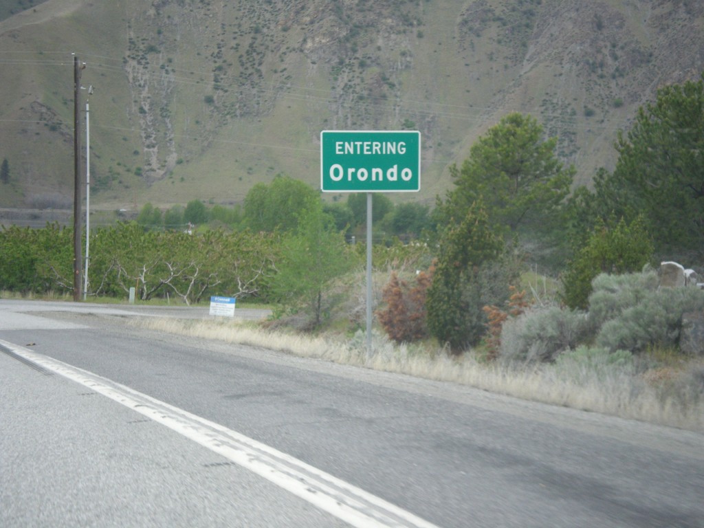
US-2 West - Orondo
Entering Orondo on US-2 west.
Taken 04-30-2018
Orondo
Douglas County
Washington
United States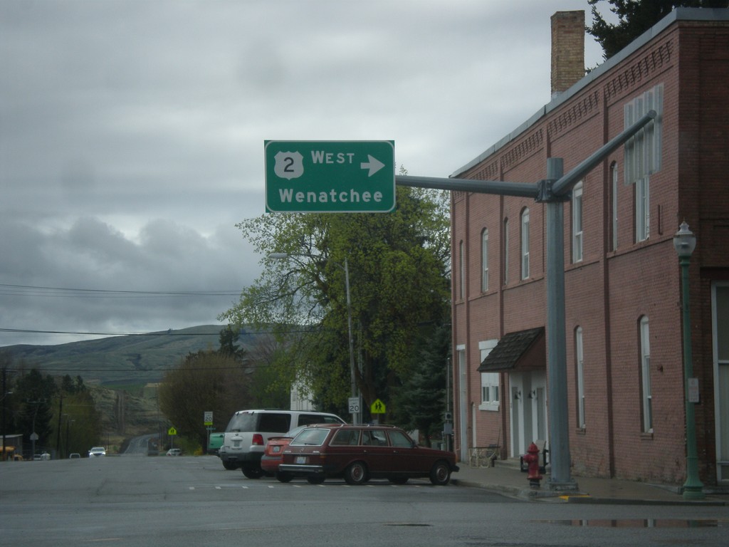
US-2 West - Waterville
US-2 west (Chelan St.) at Locust St. Turn right on Locust St. to continue west on US-2 towards Wenatchee.
Taken 04-30-2018
Waterville
Douglas County
Washington
United States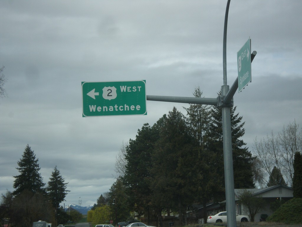
US-2 West - Waterville
US-2 west (Poplar Ave.) at Chelan St. in Waterville. Turn left on Chelan St. to continue west on US-2 towards Wenatchee.
Taken 04-30-2018
Wenatchee
Douglas County
Washington
United States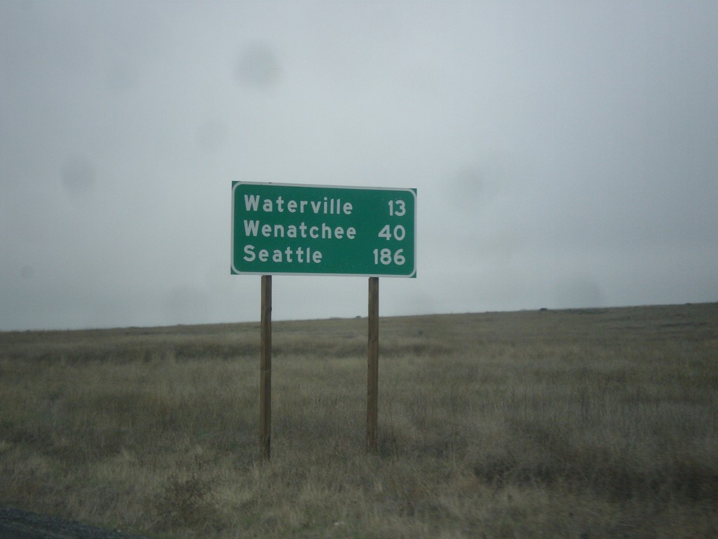
US-2 West - Distance Marker
Distance marker on US-2 west. Distance to Waterville, Wenatchee, and Seattle.
Taken 04-30-2018
Waterville
Douglas County
Washington
United States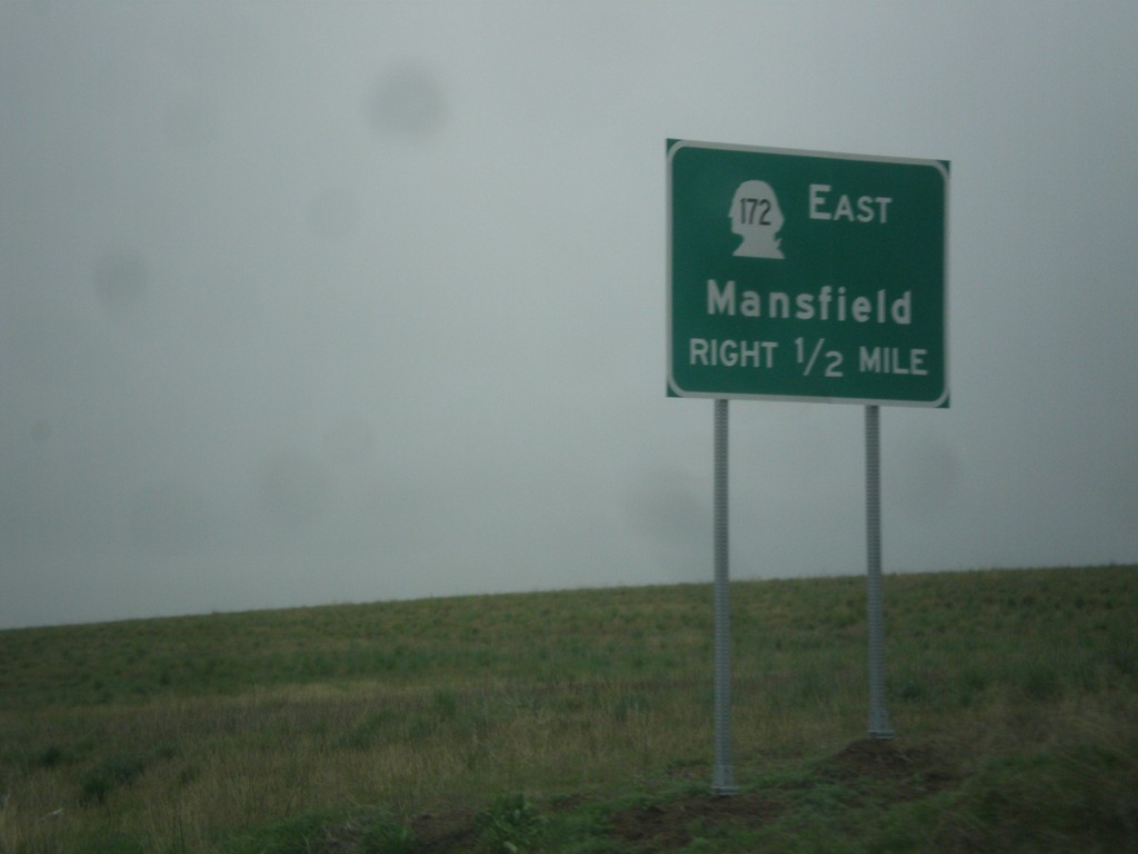
US-2 West Approaching WA-172
US-2 West approaching WA-172 East to Mansfield.
Taken 04-30-2018
 Waterville
Douglas County
Washington
United States
Waterville
Douglas County
Washington
United States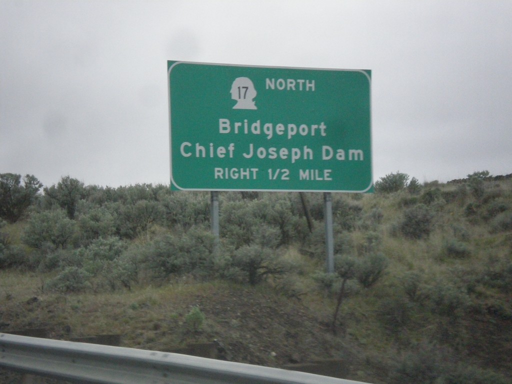
US-2 West/WA-17 North Approaching US-2/WA-17 Split
US-2 West/WA-17 North approaching US-2/WA-17 split in Douglas County. Use WA-17 north for Bridgeport and Chief Joseph Dam.
Taken 04-30-2018
 Coulee City
Douglas County
Washington
United States
Coulee City
Douglas County
Washington
United States