Signs Tagged With Big Green Sign
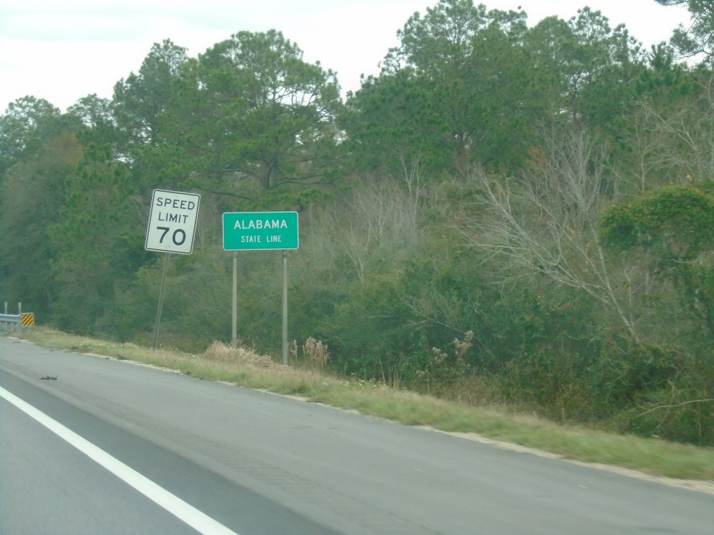
I-10 East - Alabama State Line
Alabama State Line on I-10 East.
Taken 12-23-2018
 Grand Bay
Mobile County
Alabama
United States
Grand Bay
Mobile County
Alabama
United States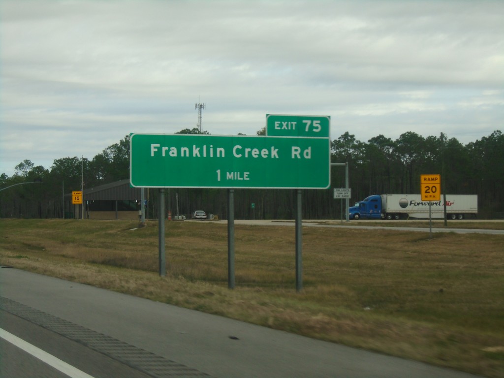
I-10 East - Exit 75
I-10 east approaching Exit 75 - Franklin Creek Road. This is the last exit on I-10 in Mississippi.
Taken 12-23-2018
Moss Point
Jackson County
Mississippi
United States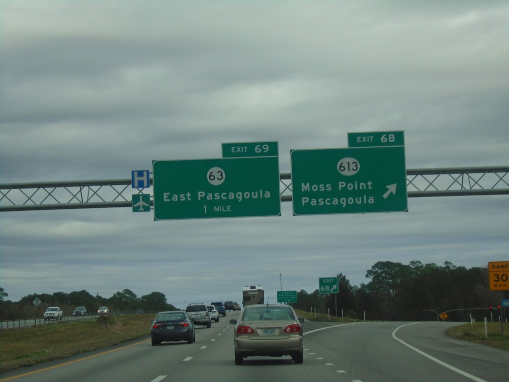
I-10 East - Exits 68 and 69
I-10 east at Exit 68 - MS-613/Moss Point/Pascagoula. Approaching Exit 69 - MS-63/East Pascagoula.
Taken 12-23-2018

 Moss Point
Jackson County
Mississippi
United States
Moss Point
Jackson County
Mississippi
United States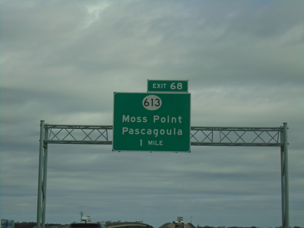
I-10 East - Exit 68
I-10 east approaching Exit 68 - MS-613/Moss Point/Pascagoula.
Taken 12-23-2018
Moss Point
Jackson County
Mississippi
United States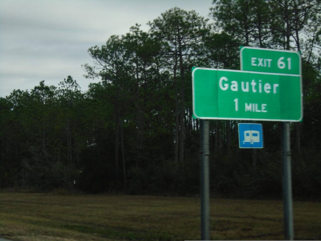
I-10 East - Exit 61
I-10 east approaching Exit 61 - Gautier
Taken 12-23-2018
Ocean Springs
Jackson County
Mississippi
United States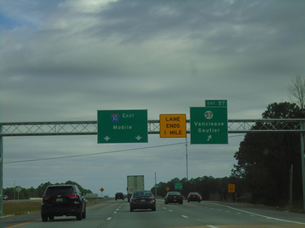
I-10 East - Exit 57
I-10 east at Exit 57 - MS-57/Vancleave/Gautier. Continue east on I-10 for Mobile (AL).
Taken 12-23-2018
 Ocean Springs
Jackson County
Mississippi
United States
Ocean Springs
Jackson County
Mississippi
United States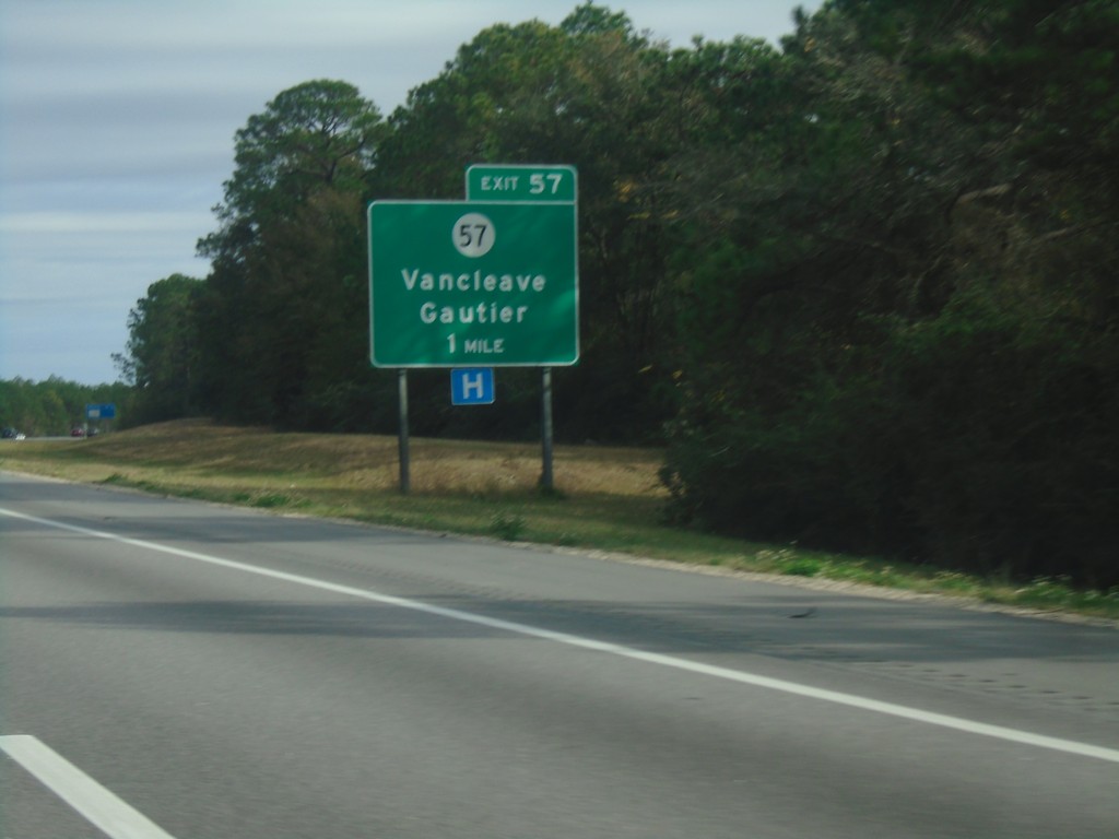
I-10 East - Exit 57
I-10 east approaching Exit 57 - MS-57/Vancleave/Gautier.
Taken 12-23-2018
Ocean Springs
Jackson County
Mississippi
United States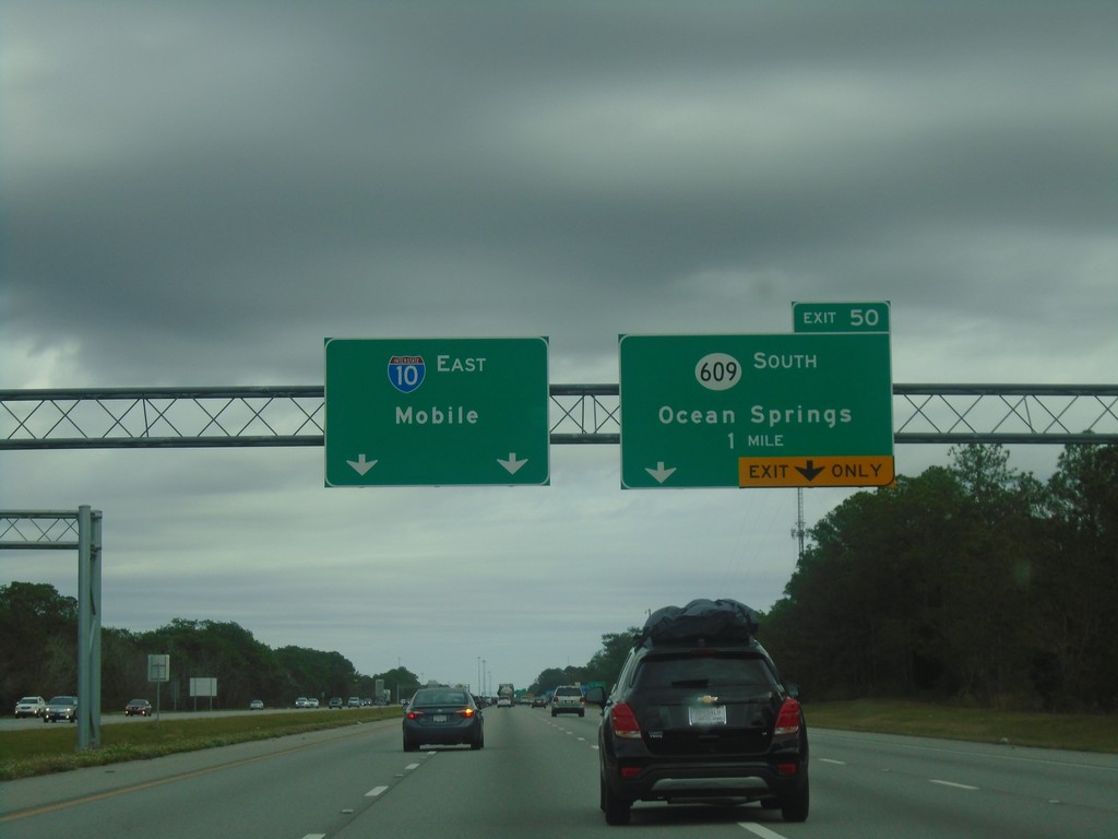
I-10 East - Exit 50
I-10 east approaching Exit 50 - MS-609 South/Ocean Springs. Continue east on I-10 for Mobile (AL).
Taken 12-23-2018
 Biloxi
Jackson County
Mississippi
United States
Biloxi
Jackson County
Mississippi
United States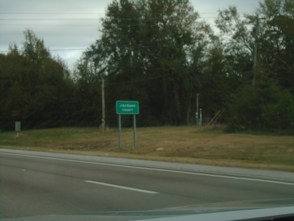
I-10 East - Jackson County
Entering Jackson County on I-10 east.
Taken 12-23-2018
Biloxi
Jackson County
Mississippi
United States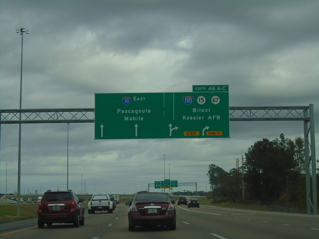
I-10 East - Exits 46A-C
I-10 East at Exits 46A-C - I-110/MS-15/MS-67/Biloxi/Kessler AFB. Continue east on I-10 for Pascagoula and Mobile (AL).
Taken 12-23-2018


 D'Iberville
Harrison County
Mississippi
United States
D'Iberville
Harrison County
Mississippi
United States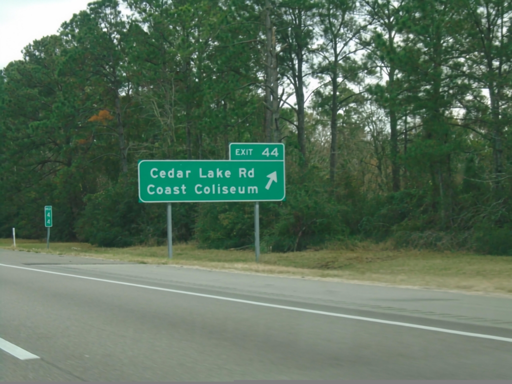
I-10 East - Exit 44
I-10 east at Exit 44 - Cedar Lake Road/Coast Coliseum.
Taken 12-23-2018
Biloxi
Harrison County
Mississippi
United States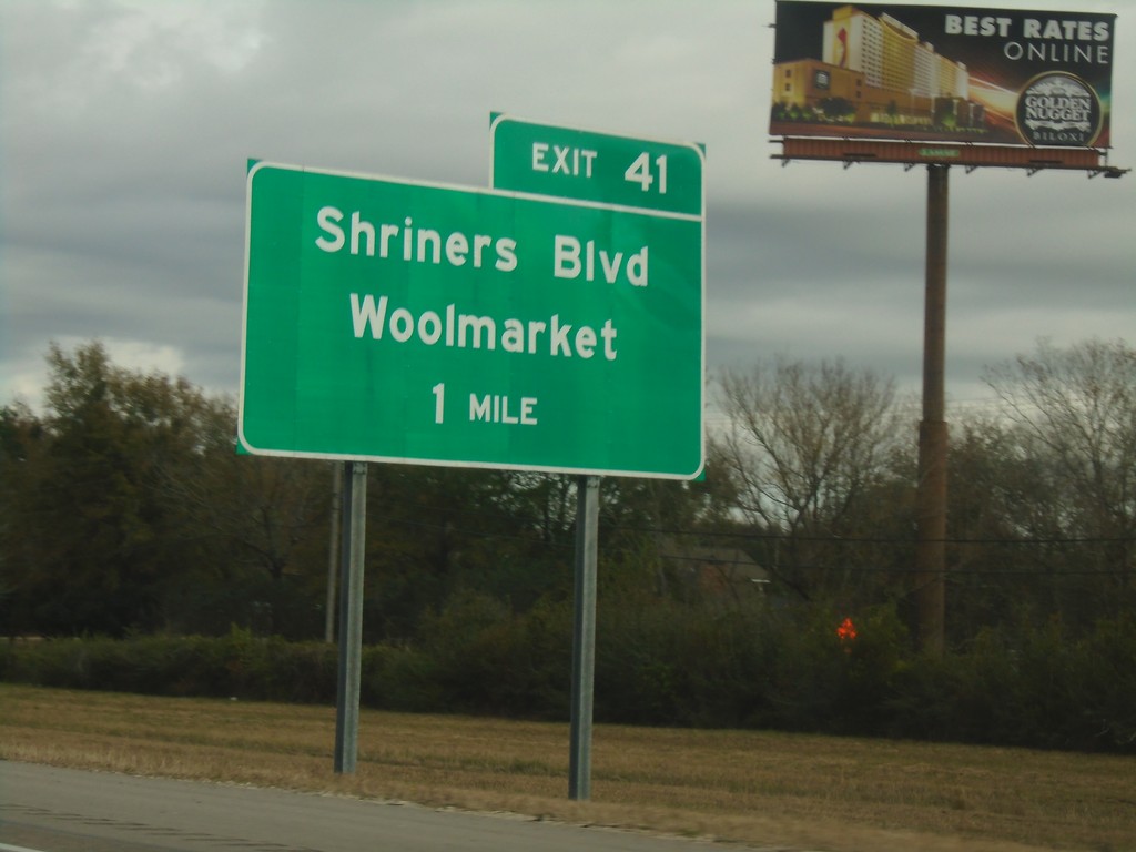
I-10 East - Exit 41
I-10 east approaching Exit 41 - Shriners Blvd./Woolmarket.
Taken 12-23-2018
Biloxi
Harrison County
Mississippi
United States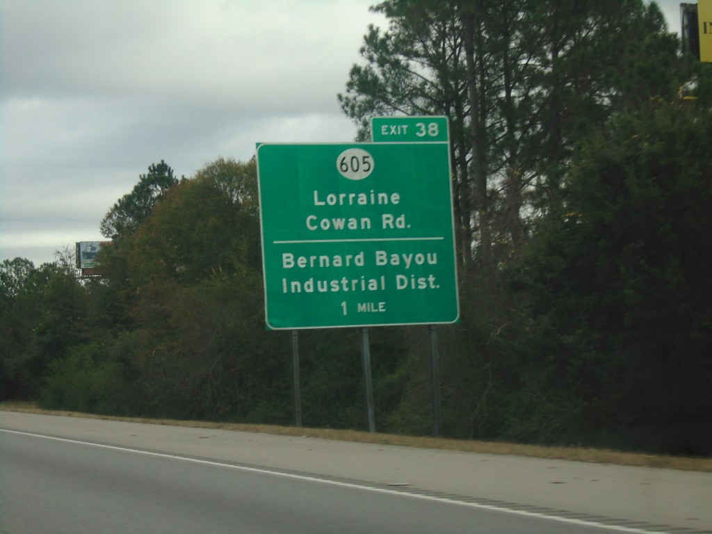
I-10 East - Exit 38
I-10 east approaching Exit 38 - MS-605/Lorraine/Cowan Road/Bernard Bayou Industrial District.
Taken 12-23-2018
 Gulfport
Harrison County
Mississippi
United States
Gulfport
Harrison County
Mississippi
United States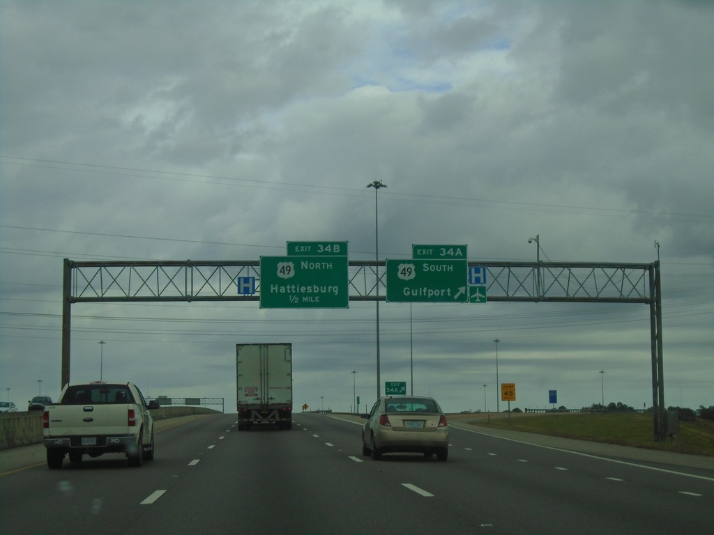
I-10 East - Exit 34
I-10 east at Exit 34A - US-49 South/Gulfport. Approaching Exit 34B - US-49 North/Hattiesburg.
Taken 12-23-2018
 Gulfport
Harrison County
Mississippi
United States
Gulfport
Harrison County
Mississippi
United States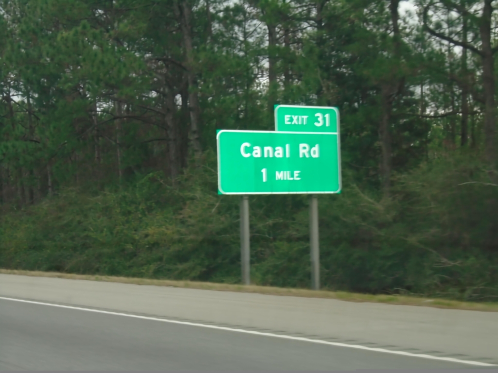
I-10 East - Exit 31
I-10 east approaching Exit 31 - Canal Road.
Taken 12-23-2018
Gulfport
Harrison County
Mississippi
United States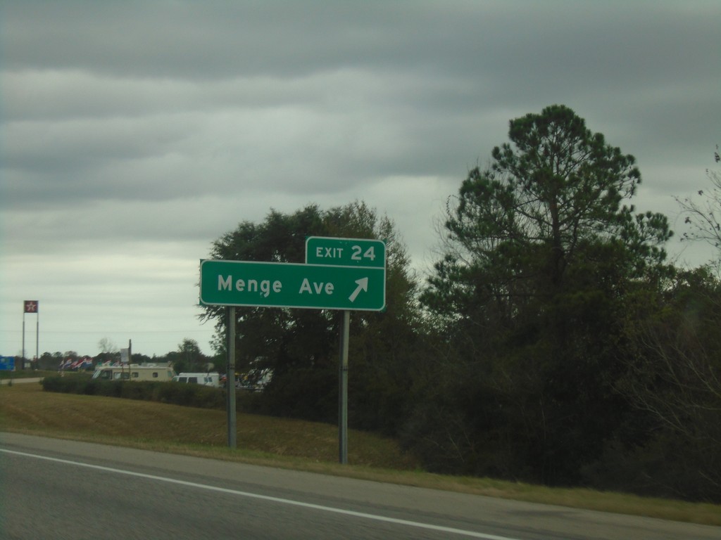
I-10 East - Exit 24
I-10 east at Exit 24 - Menge Ave.
Taken 12-23-2018
Pass Christian
Harrison County
Mississippi
United States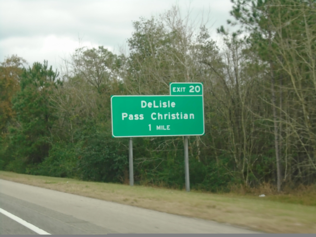
I-10 East - Exit 20
I-10 east approaching Exit 20 - DeLisle/Pass Christian.
Taken 12-23-2018
Pass Christian
Harrison County
Mississippi
United States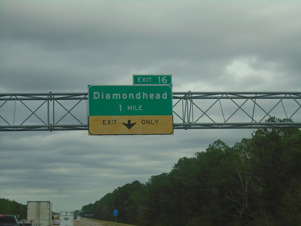
I-10 East - Exit 16
I-10 east approaching Exit 16 - Diamondhead.
Taken 12-23-2018
Kiln
Hancock County
Mississippi
United States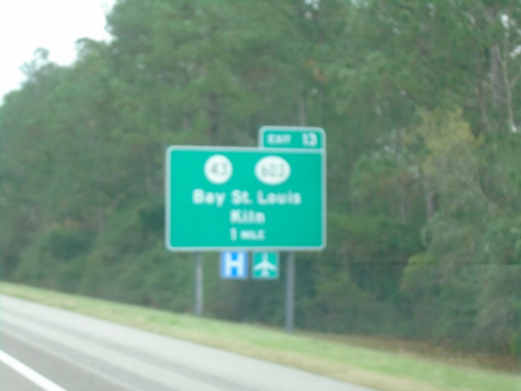
I-10 East - Exit 13
I-10 east approaching Exit 13 - MS-43/MS-603/Bay St. Louis/Kiln.
Taken 12-23-2018

 Bay St. Louis
Hancock County
Mississippi
United States
Bay St. Louis
Hancock County
Mississippi
United States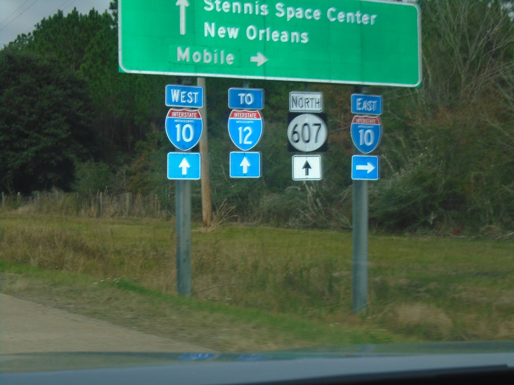
MS-607 North at I-10
MS-607 north at I-10. Use I-10 east for Mobile (AL); I-10 west for New Orleans (LA) and I-12. Continue north on MS-607 for Stennis Space Center. The I-12 shield contains the text MISSISSIPPI, but the highway never enters Mississippi.
Taken 12-23-2018

 Pearlington
Hancock County
Mississippi
United States
Pearlington
Hancock County
Mississippi
United States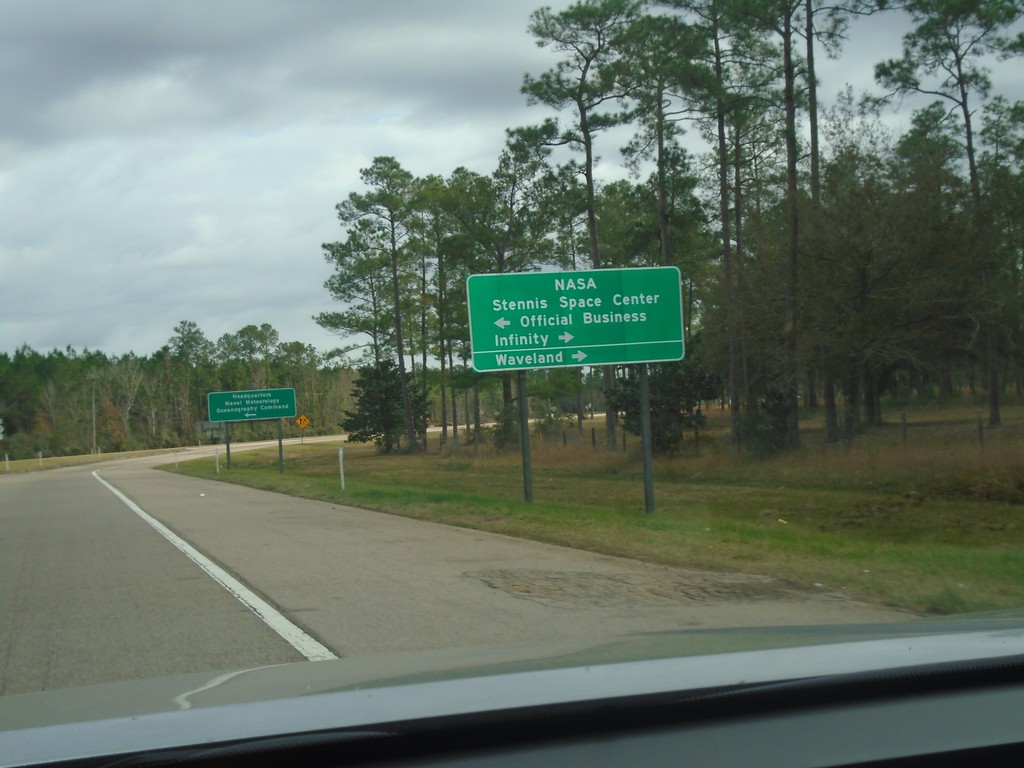
I-10 East at Exit 2 Offramp
I-10 East at Exit 2 offramp. Turn left on MS-607 North for NASA/Stennis Space Center/Official Business. Turn right for MS-607 South Stennis Space Center/Infinity/Waveland.
Taken 12-23-2018
Pearlington
Hancock County
Mississippi
United States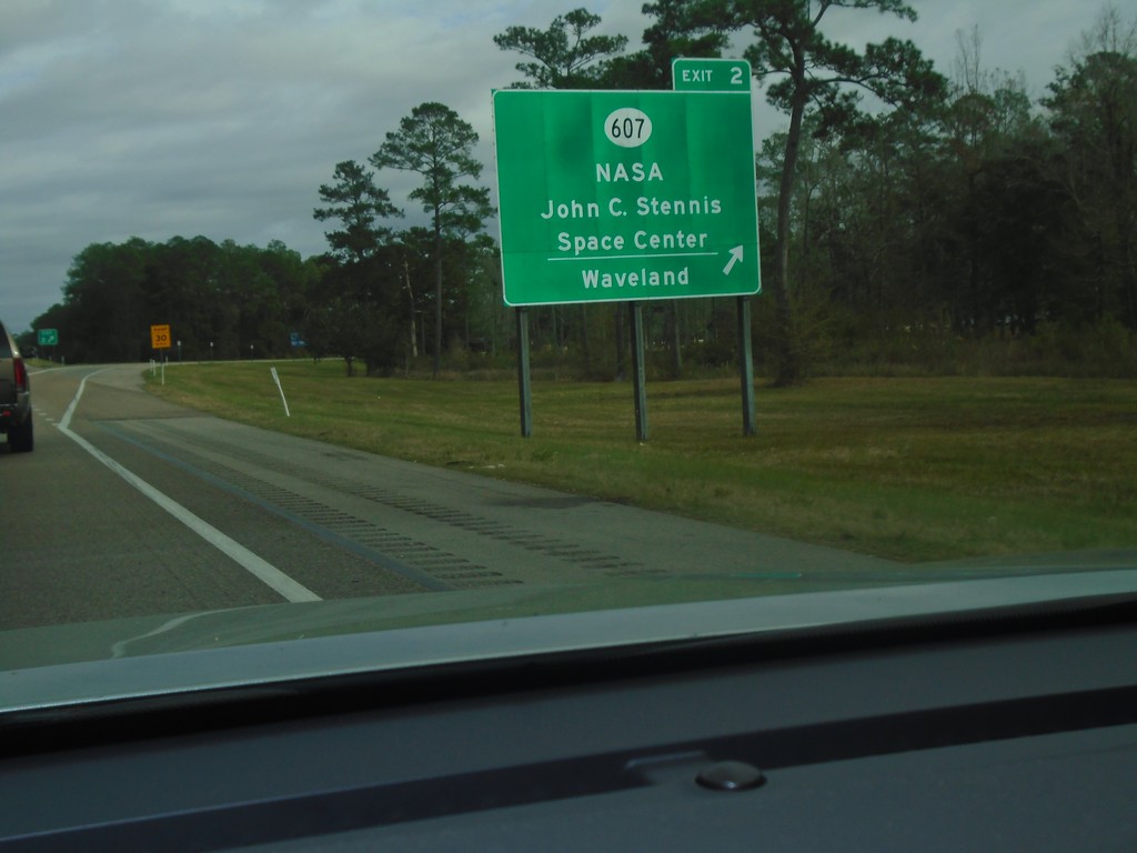
I-10 East - Exit 2
I-10 east at Exit 2 - MS-607/NASA/John C. Stennis Space Center/Waveland.
Taken 12-23-2018
Pearlington
Hancock County
Mississippi
United States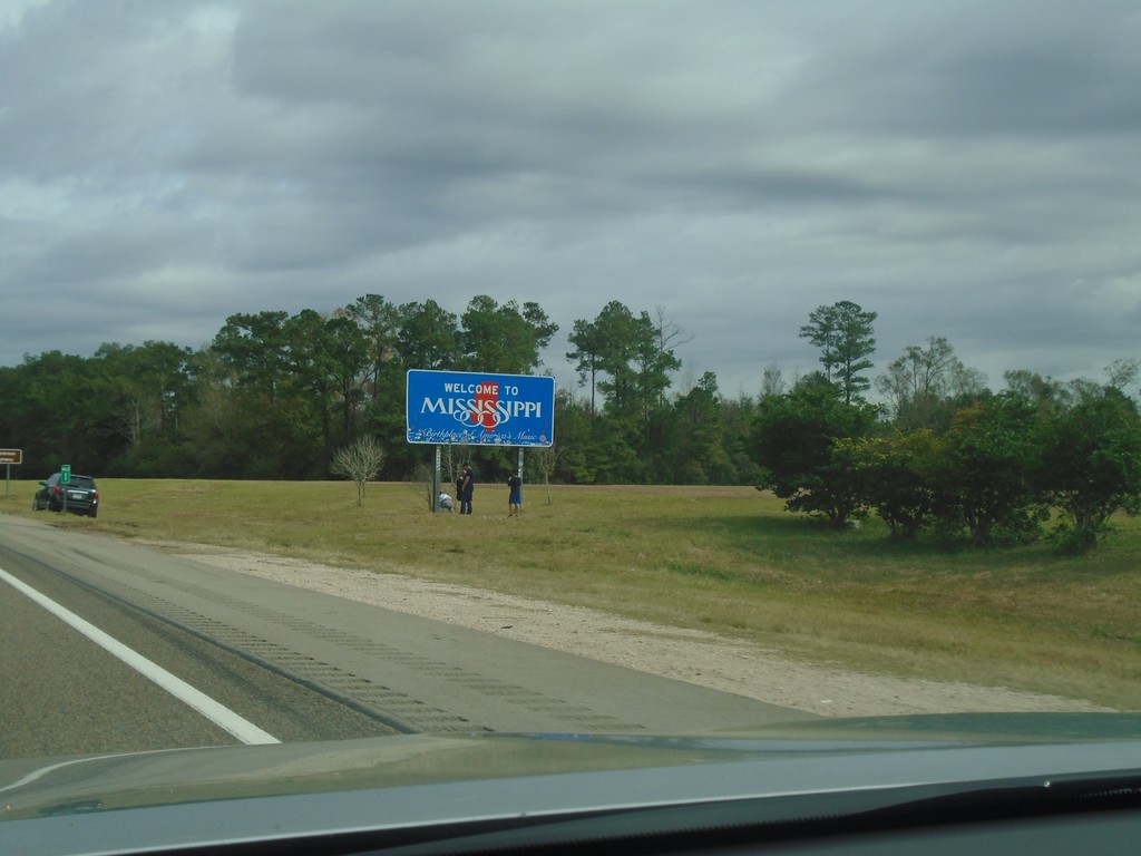
I-10 East - Entering Mississippi
Entering Mississippi on I-10 east.
Taken 12-23-2018
Slidell
Hancock County
Mississippi
United States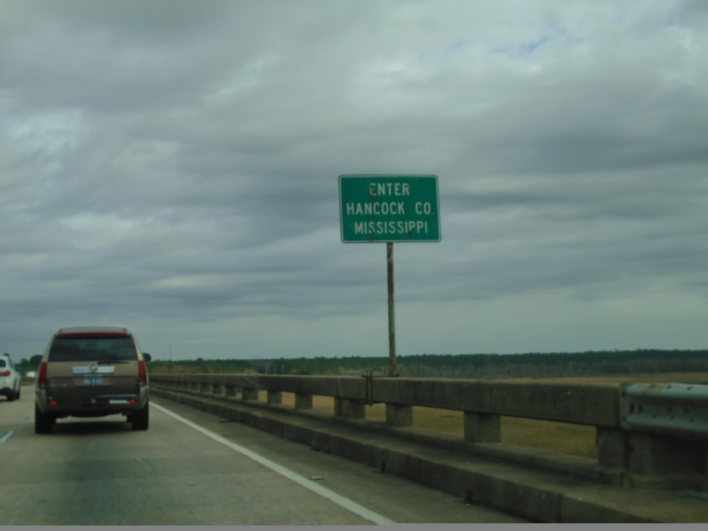
I-10 East - Enter Hancock County Mississippi
Enter Hancock County Mississippi on I-10 east. Taken on the Pearl River bridge.
Taken 12-23-2018
Slidell
Hancock County
Mississippi
United States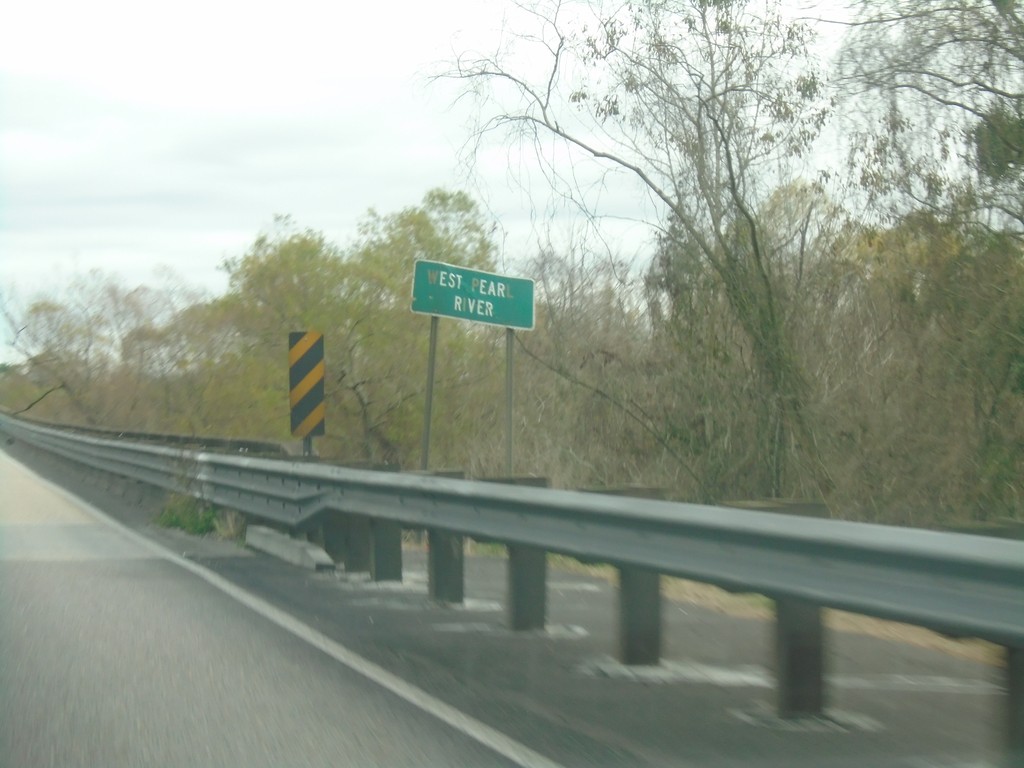
I-10 East - West Pearl River
I-10 East - West Pearl River Bridge.
Taken 12-23-2018
Slidell
St. Tammany Parish
Louisiana
United States