Signs Tagged With Big Green Sign
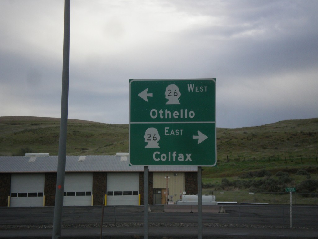
WA-260/WA-261 North at WA-26
WA-260/WA-261 North at WA-26 in Washtucna. Turn right for WA-26 east to Colfax; left for WA-26 west to Othello. This is the northern end of WA-260. WA-261 continues north towards Ritzville.
Taken 04-30-2018


 Washtucna
Adams County
Washington
United States
Washtucna
Adams County
Washington
United States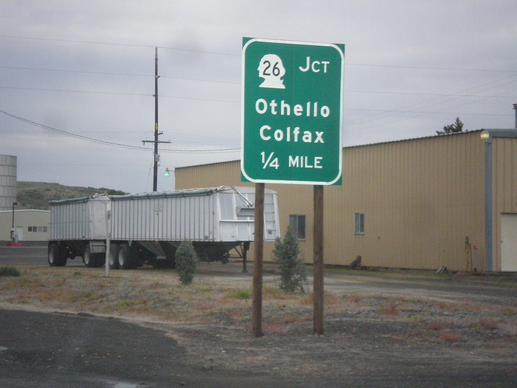
WA-260/WA-261 North Approaching WA-26
WA-260/WA-261 North approaching WA-26 to Colfax and Othello in Washtucna.
Taken 04-30-2018
Washtucna
Adams County
Washington
United States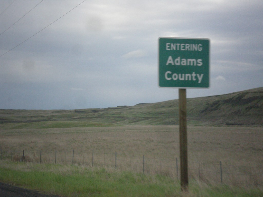
WA-260/WA-261 North - Adams County
Entering Adams County on WA-260/WA-261 North.
Taken 04-30-2018
Washtucna
Adams County
Washington
United States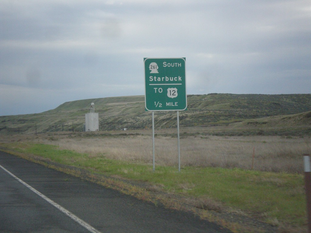
WA-260 North Approaching WA-261 South
WA-260 North Approaching WA-261 South to Starbuck and US-12. WA-261 joins WA-260 north to Washtucna.
Taken 04-30-2018
 Washtucna
Franklin County
Washington
United States
Washtucna
Franklin County
Washington
United States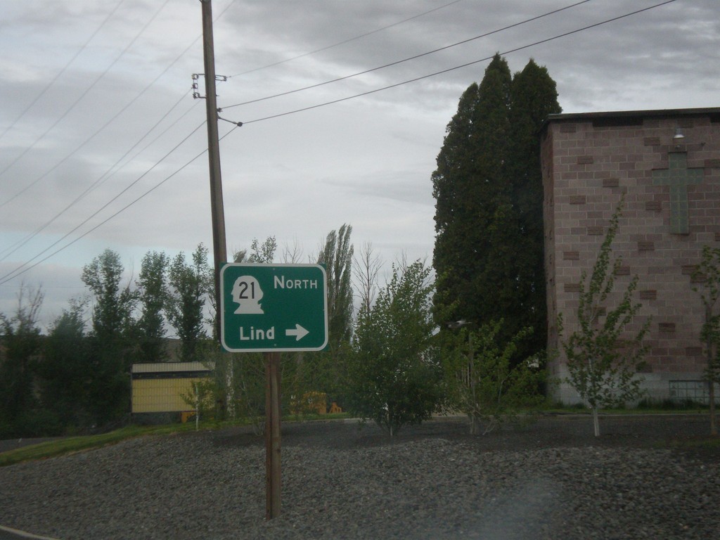
WA-260 South at WA-21 North
WA-260 South at WA-21 North to Lind in Kahlotus.
Taken 04-30-2018
 Kahlotus
Franklin County
Washington
United States
Kahlotus
Franklin County
Washington
United States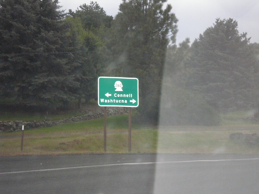
End WA-263 North at WA-260
End WA-263 North at WA-260 in Kahlotus. Turn right for WA-260 north to Washtucna; left for WA-260 south to Connell.
Taken 04-30-2018
 Kahlotus
Franklin County
Washington
United States
Kahlotus
Franklin County
Washington
United States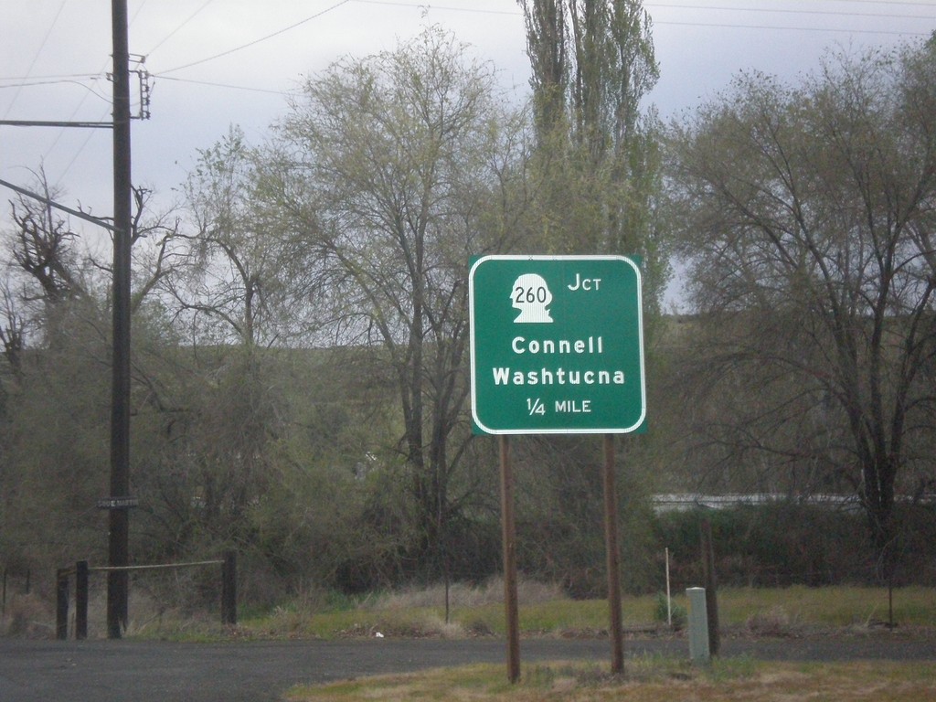
WA-263 North Approaching WA-260
WA-263 North approaching WA-260 to Connell and Washtucna in Kahlotus.
Taken 04-30-2018
Kahlotus
Franklin County
Washington
United States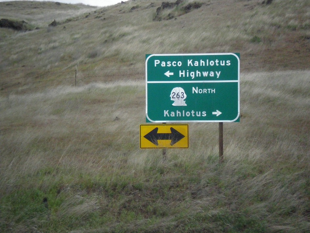
WA-263 North at Pasco Kahlotus Highway
WA-263 North at Pasco Kahlotus Highway in Franklin County. Turn left for Pasco Kahlotus Highway; right to continue north on WA-263 to Kahlotus.
Taken 04-30-2018
Pasco
Franklin County
Washington
United States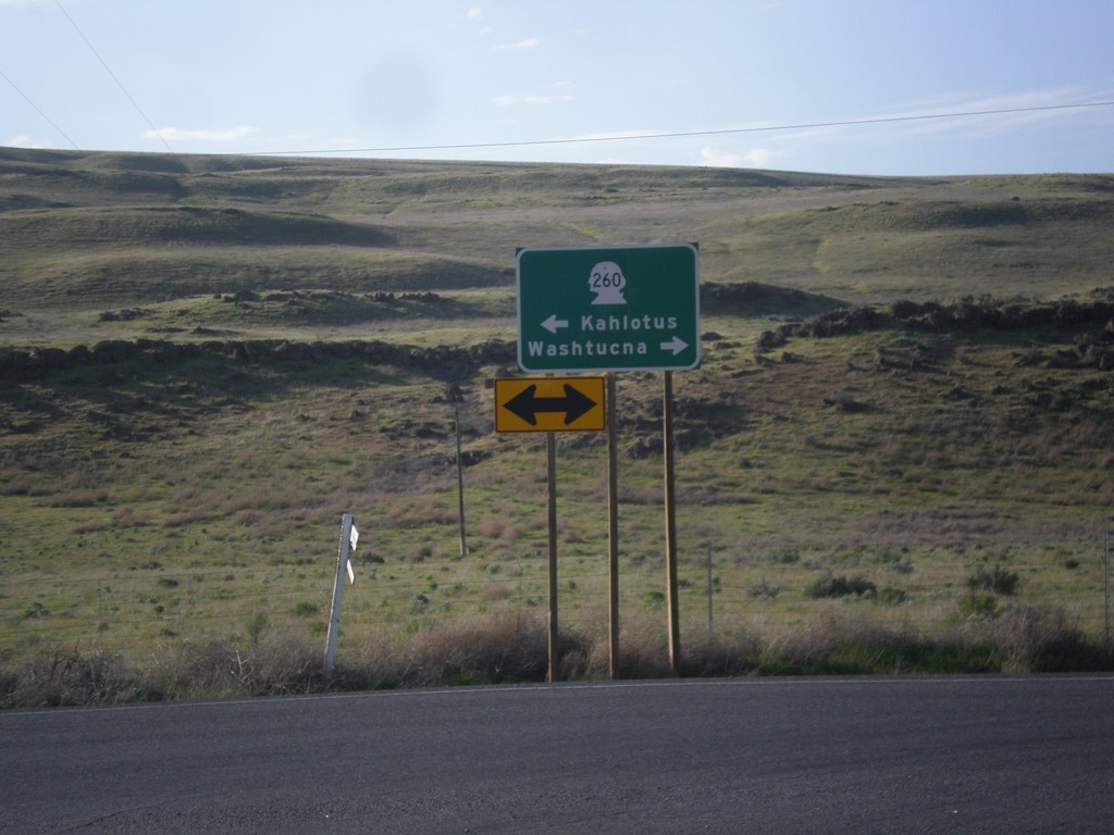
WA-261 North at WA-260
WA-261 North at WA-260 in Franklin County. Turn right for WA-260/WA-261 North to Washtucna; left for WA-261 South to Kahlotus. WA-260 joins WA-261 north to Washtucna.
Taken 04-29-2018
Washtucna
Franklin County
Washington
United States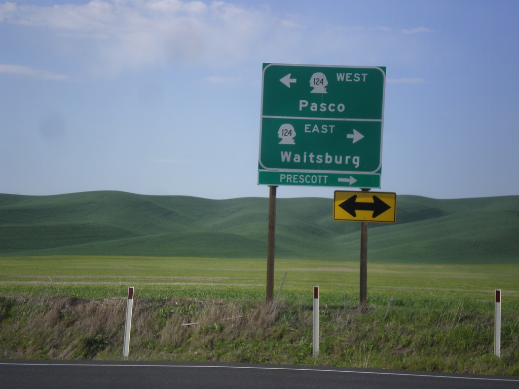
End WA-125 North at WA-124
End WA-125 North at WA-124. Turn right for WA-124 east to Waitsburg and Prescott. Turn left for WA-124 west to Pasco.
Taken 04-29-2018

 Prescott
Walla Walla County
Washington
United States
Prescott
Walla Walla County
Washington
United States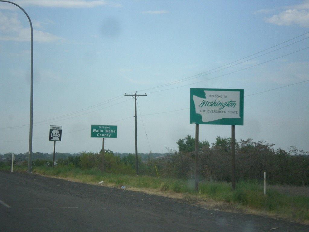
WA-125 North - Welcome To Washington
Welcome to Washington on WA-125 north. Entering Walla Walla County.
Taken 04-29-2018
Walla Walla
Walla Walla County
Washington
United States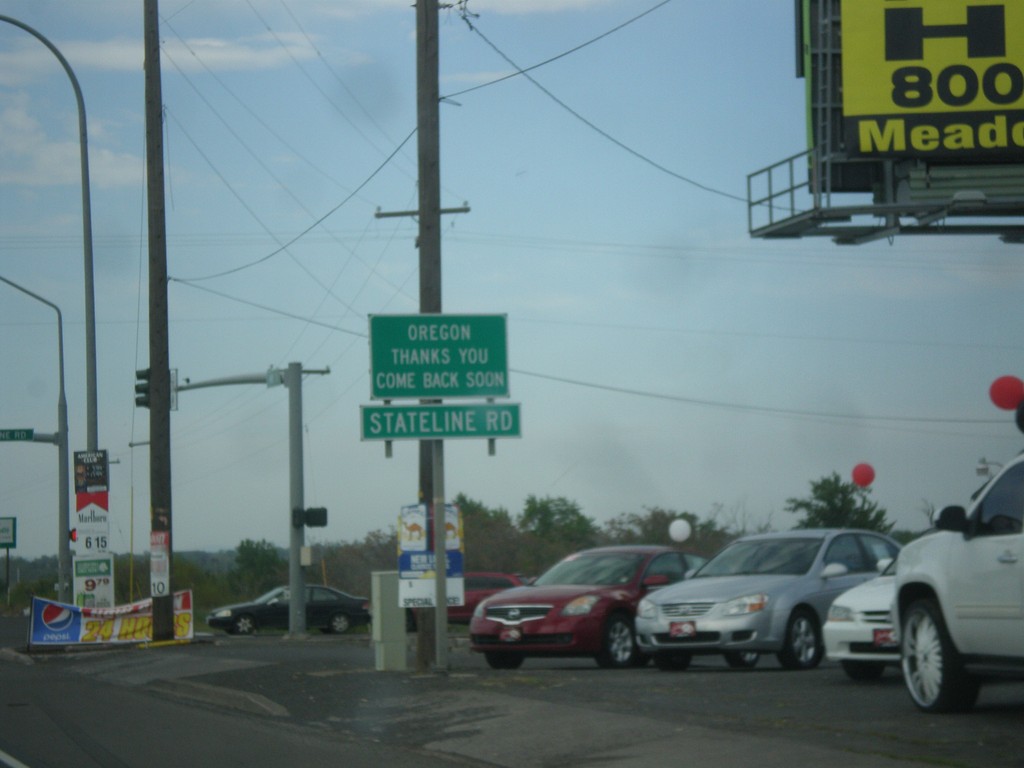
OR-11 North at Stateline Road - Leaving Oregon
OR-11 North at Stateline Road in Umatilla County. Stateline Road parallels the Oregon-Washington border. Oregon Thanks You - Come Back Soon.
Taken 04-29-2018
 Milton-Freewater
Umatilla County
Oregon
United States
Milton-Freewater
Umatilla County
Oregon
United States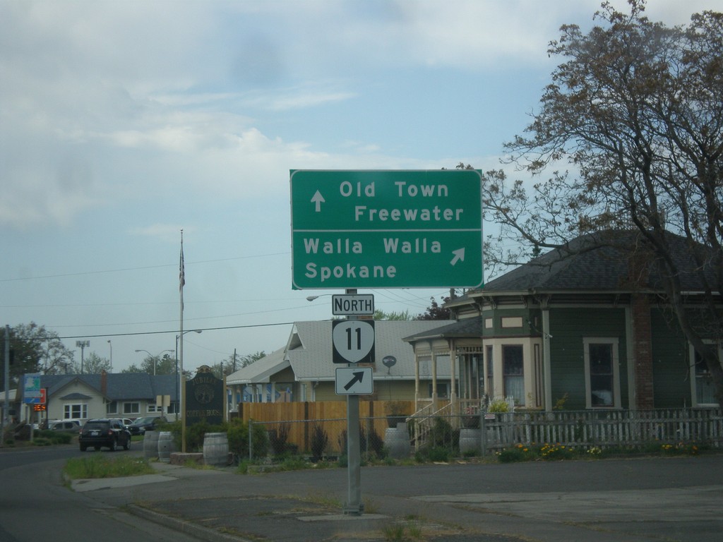
OR-11 North (Main St.) at Columbia St.
OR-11 North (Main St.) at Columbia St. Turn right on Columbia St. to continue north on OR-11 to Walla Walla (WA) and Spokane (WA). Continue straight on Main St. for Old Town Freewater.
Taken 04-29-2018
Milton-Freewater
Umatilla County
Oregon
United States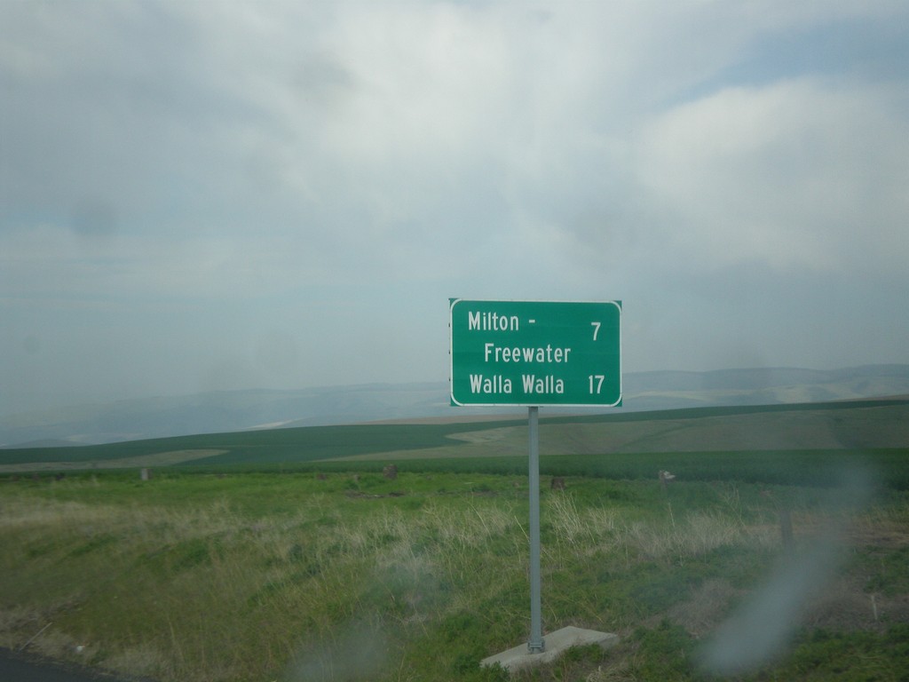
OR-11 North - Distance Marker
Distance marker on OR-11 north. Distance to Milton-Freewater and Walla Walla (Washington).
Taken 04-29-2018
Weston
Umatilla County
Oregon
United States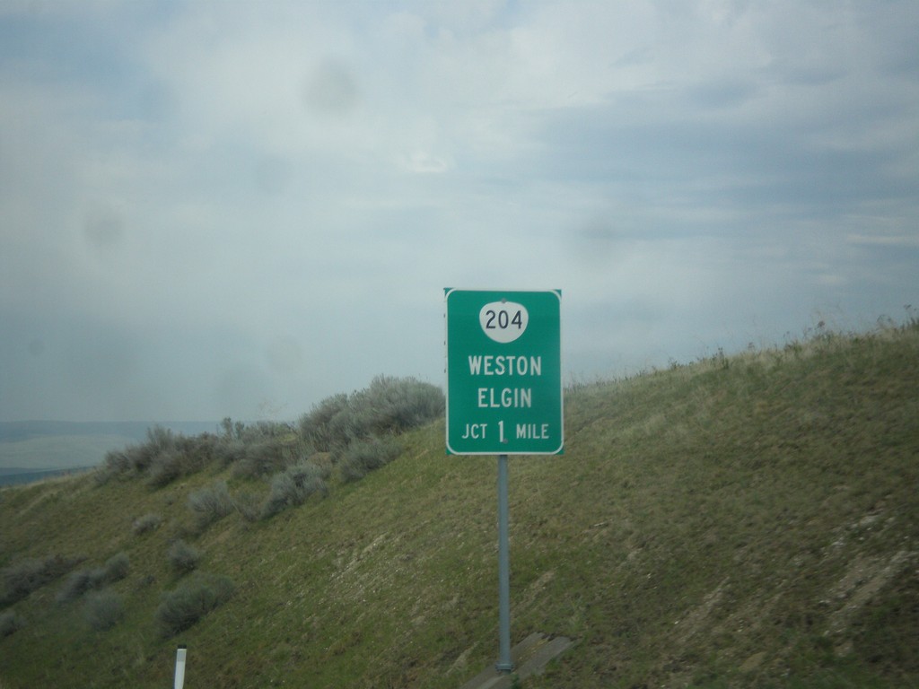
OR-11 North Approaching OR-204
OR-11 North Approaching OR-204 east to Weston and Elgin.
Taken 04-29-2018
 Weston
Umatilla County
Oregon
United States
Weston
Umatilla County
Oregon
United States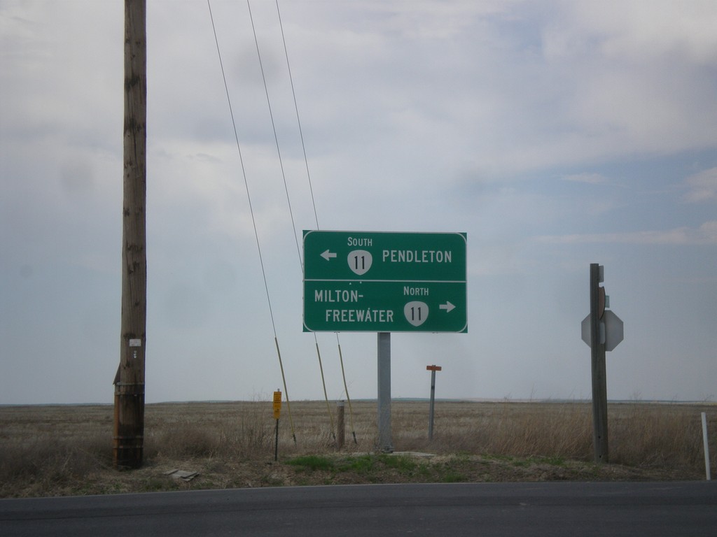
End OR-331 North at OR-11
End OR-331 North at OR-11 in Umatilla County. Turn right for OR-11 north to Milton-Freewater; turn left for OR-11 south to Pendleton.
Taken 04-29-2018
 Pendleton
Umatilla County
Oregon
United States
Pendleton
Umatilla County
Oregon
United States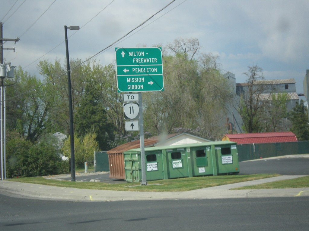
OR-331 North at Mission Road
OR-331 North at Mission Road. Turn right for Mission Road east to Mission and Gibbon. Turn left for Mission Road west to Pendleton. Continue north on OR-331 for OR-11 to Milton-Freewater.
Taken 04-29-2018
Pendleton
Umatilla County
Oregon
United States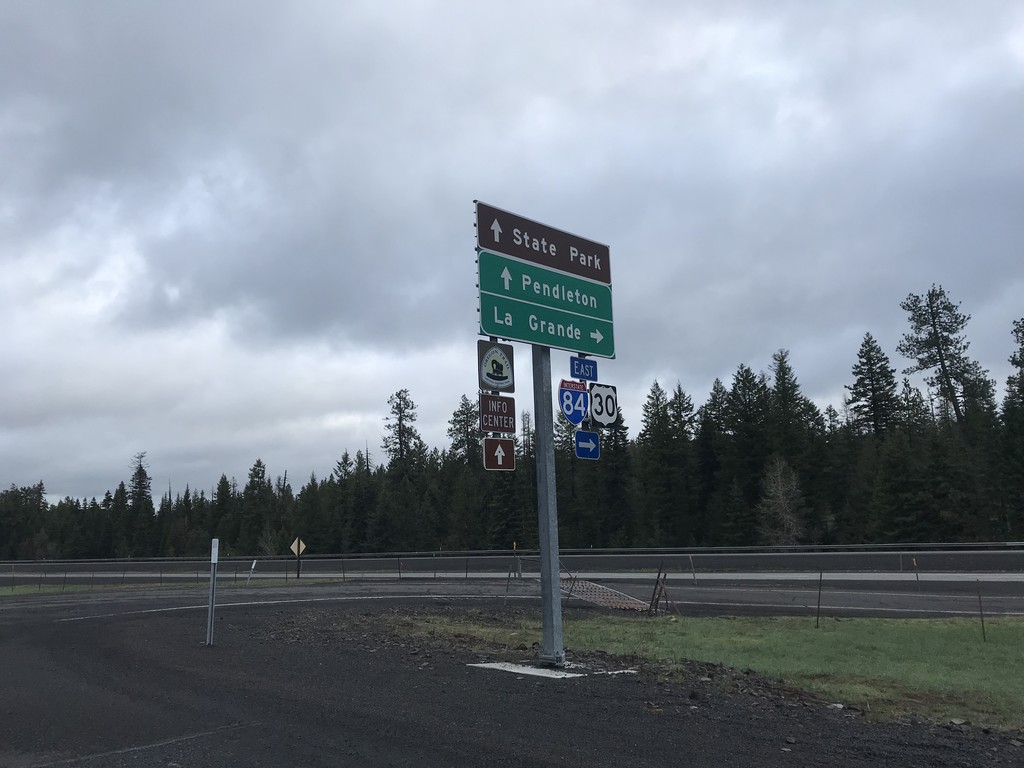
I-84 East Exit 234 Freeway Entrance
I-84 East Exit 234 Freeway Entrance. Use I-84 east for LaGrande. Continue west on Frontage Road for (Emigrant Springs) State Park and I-84 west to Pendleton.
Taken 04-29-2018

 Meacham
Umatilla County
Oregon
United States
Meacham
Umatilla County
Oregon
United States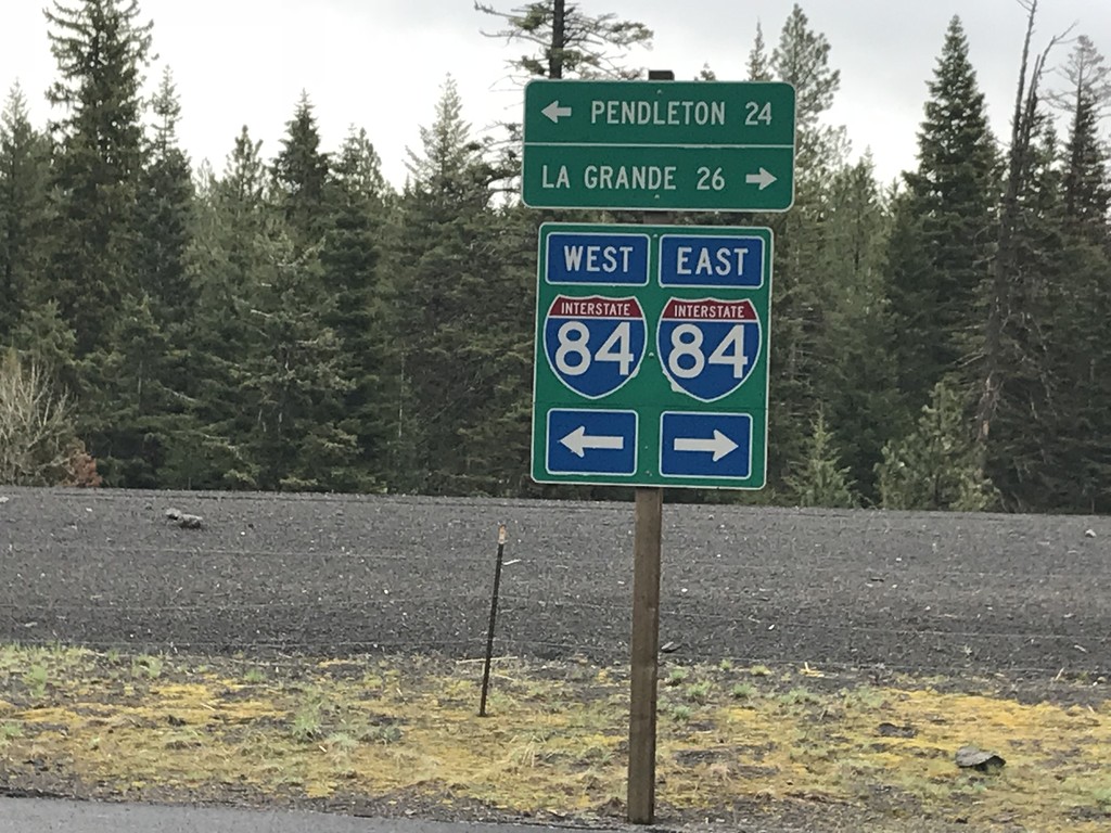
Emigrant Springs State Park Road at Frontage Road
Emigrant Springs State Park Road at Frontage Road. Turn right for access to I-84 east to La Grande; left for access to I-84 west to Pendleton.
Taken 04-29-2018
Meacham
Umatilla County
Oregon
United States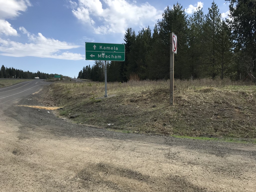
I-84 at Mecham Interchange
I-84/US-30 at Mecham Interchange. Continue straight for Kamela; turn left for Mecham.
Taken 04-27-2018
Meacham
Umatilla County
Oregon
United States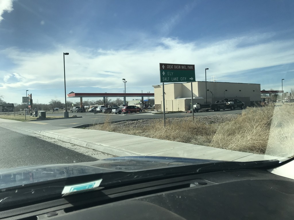
US-50 West at US-6 Jct.
US-50 west at US-6 jct. in Delta. Turn right on US-6 east for Salt Lake City. Continue west on US-6/US-50 for Ely (Nevada) and Great Basin National Park (Nevada). US-6 joins US-50 westbound to Ely.
Taken 03-30-2018

 Delta
Millard County
Utah
United States
Delta
Millard County
Utah
United States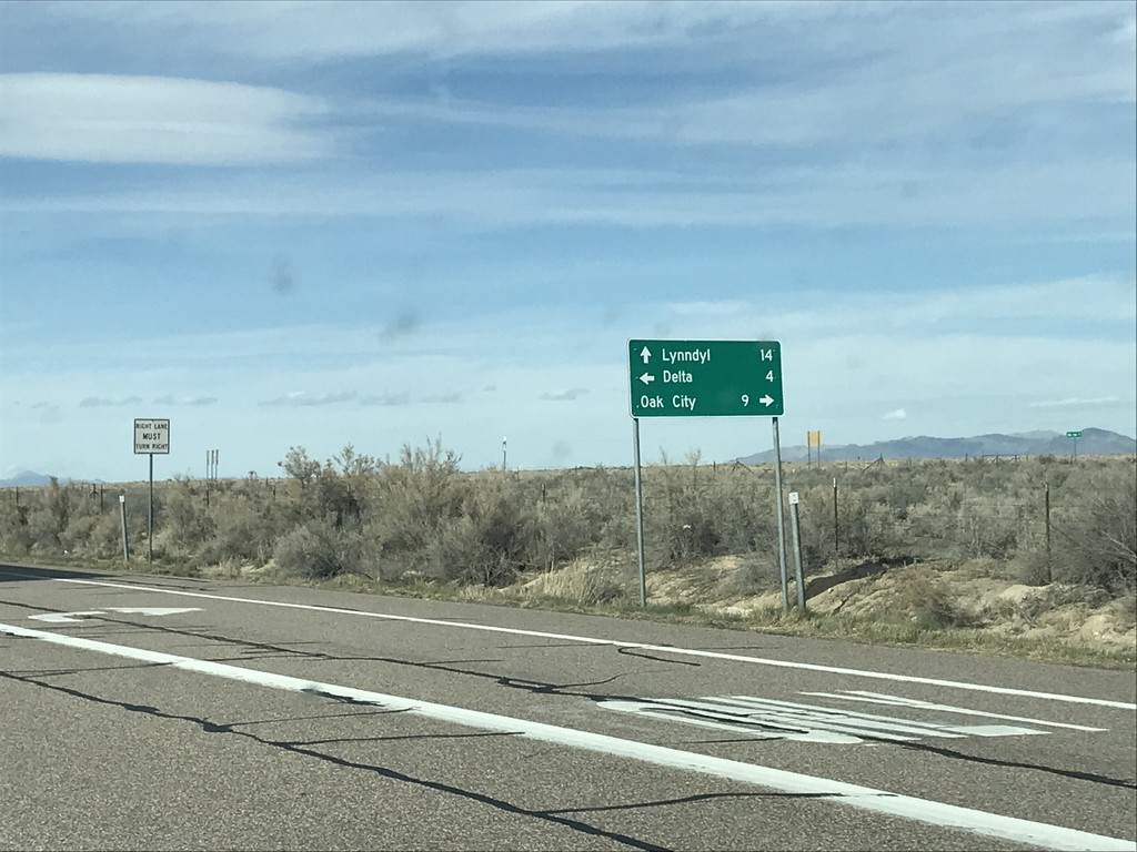
US-50 West at UT-125 and UT-136
US-50 West at UT-125 and UT-136 junction. Turn right for UT-125 east to Oak City. Continue straight for UT-136 north to Lynndyl. Turn left to continue west on US-50 towards Delta.
Taken 03-30-2018

 Delta
Millard County
Utah
United States
Delta
Millard County
Utah
United States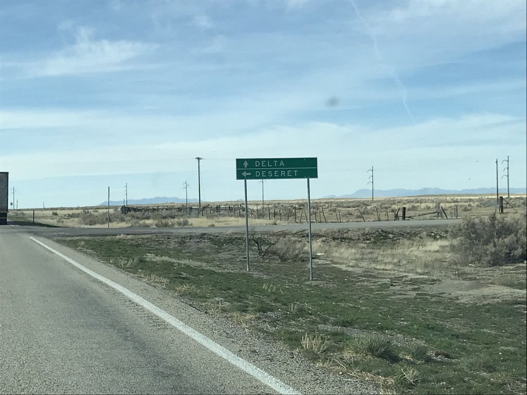
US-50 West at 4500 South
US-50 West at 4500 South to Deseret. Continue west on US-50 for Delta.
Taken 03-30-2018
Delta
Millard County
Utah
United States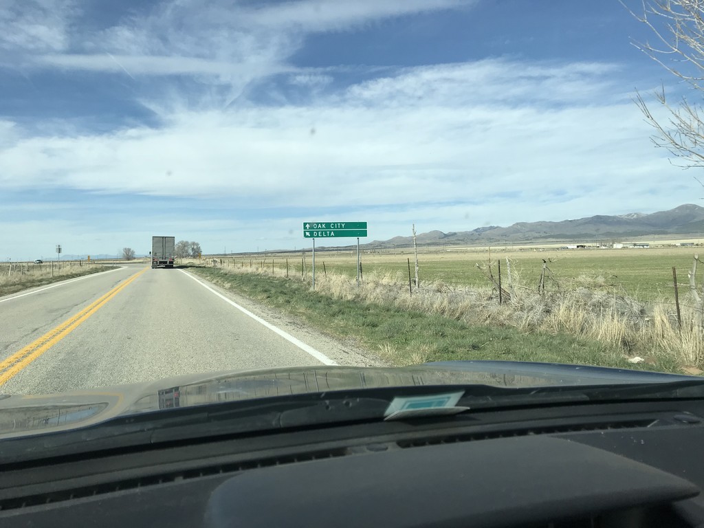
US-50 West at N 3200 W Jct.
US-50 West at N 3200 W Jct in Millard County. Merge left to continue west on US-50 to Delta; continue straight for N 3200 W to Oak City.
Taken 03-30-2018
Delta
Millard County
Utah
United States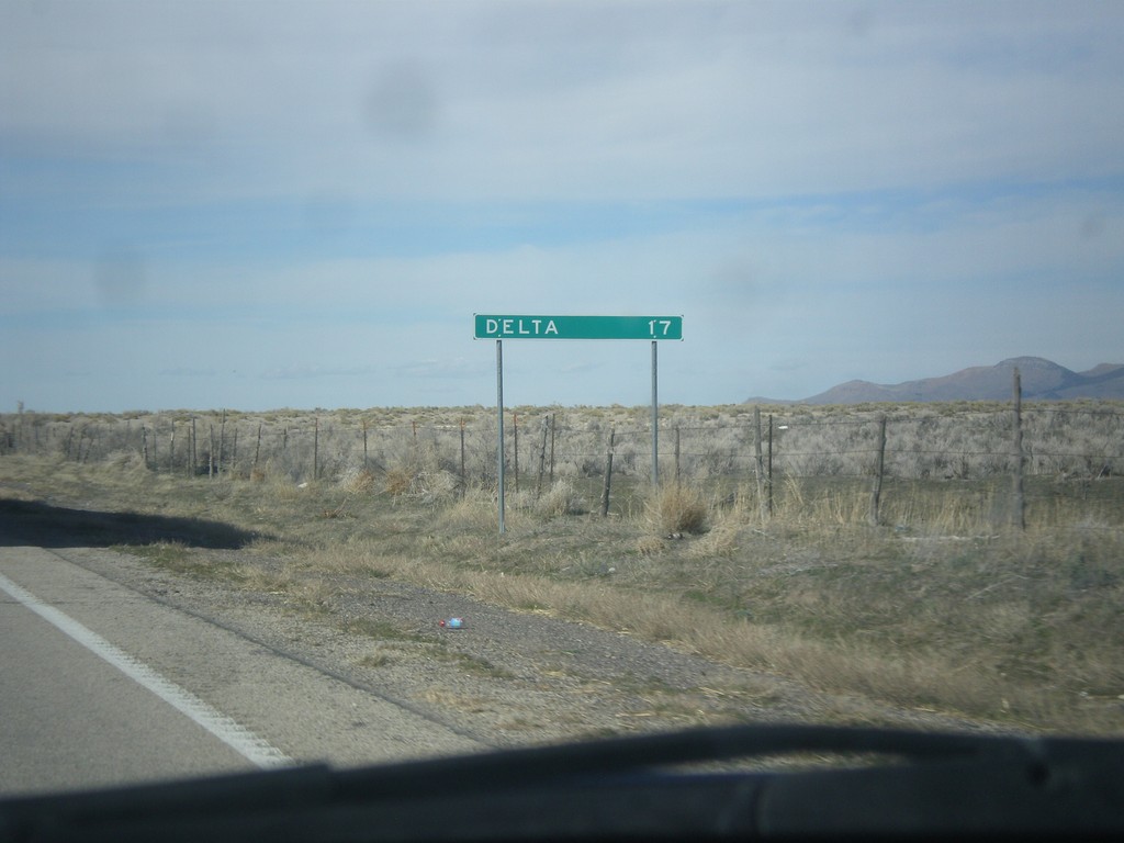
US-50 West - Distance Marker
Distance marker on US-50 west. Distance to Delta.
Taken 03-29-2018
Delta
Millard County
Utah
United States