Signs Tagged With Big Green Sign
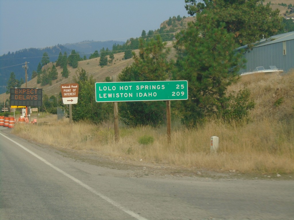
US-12 West - Distance Marker
Distance marker on US-12 west. Distance to Lolo Hot Springs and Lewiston Idaho.
Taken 08-11-2018
 Lolo
Missoula County
Montana
United States
Lolo
Missoula County
Montana
United States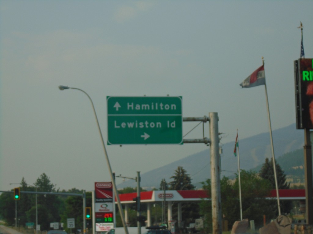
US-93 South/US-12 West at US-12 - Lolo
US-93 South/US-12 West Split in Lolo. Turn right for US-12 west to Lewiston (Idaho); continue straight for US-93 south to Hamilton.
Taken 08-11-2018
 Lolo
Missoula County
Montana
United States
Lolo
Missoula County
Montana
United States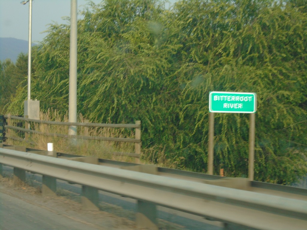
US-12 West/US-93 South - Bitterroot River
US-12 West/US-93 South - Bitterroot River
Taken 08-11-2018
Missoula
Missoula County
Montana
United States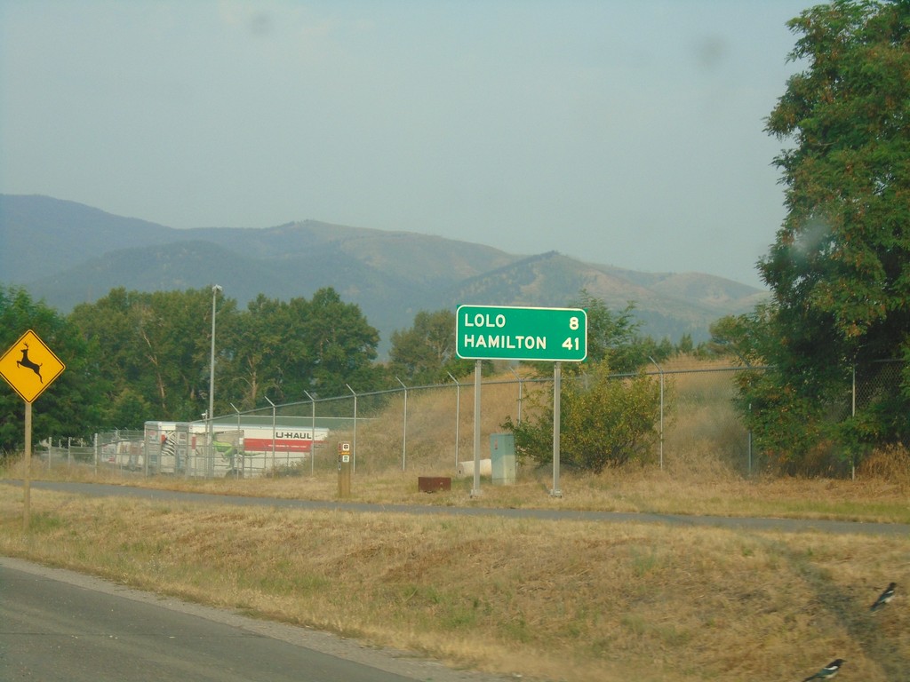
US-93 South/US-12 East - Distance Marker
Distance marker on US-93 South/US-12 East. Distance to Lolo and Hamilton.
Taken 08-11-2018
Missoula
Missoula County
Montana
United States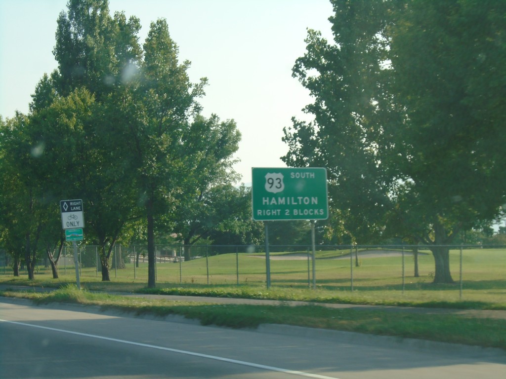
US-93 South Approaching US-12 - Missoula
US-93 South (Reserve St.) approaching US-12 (Brooks St.) in Missoula. Turn right on Brooks St. to continue south on US-93 towards Missoula. US-12 and US-93 join southbound to Lolo.
Taken 08-10-2018
Missoula
Missoula County
Montana
United States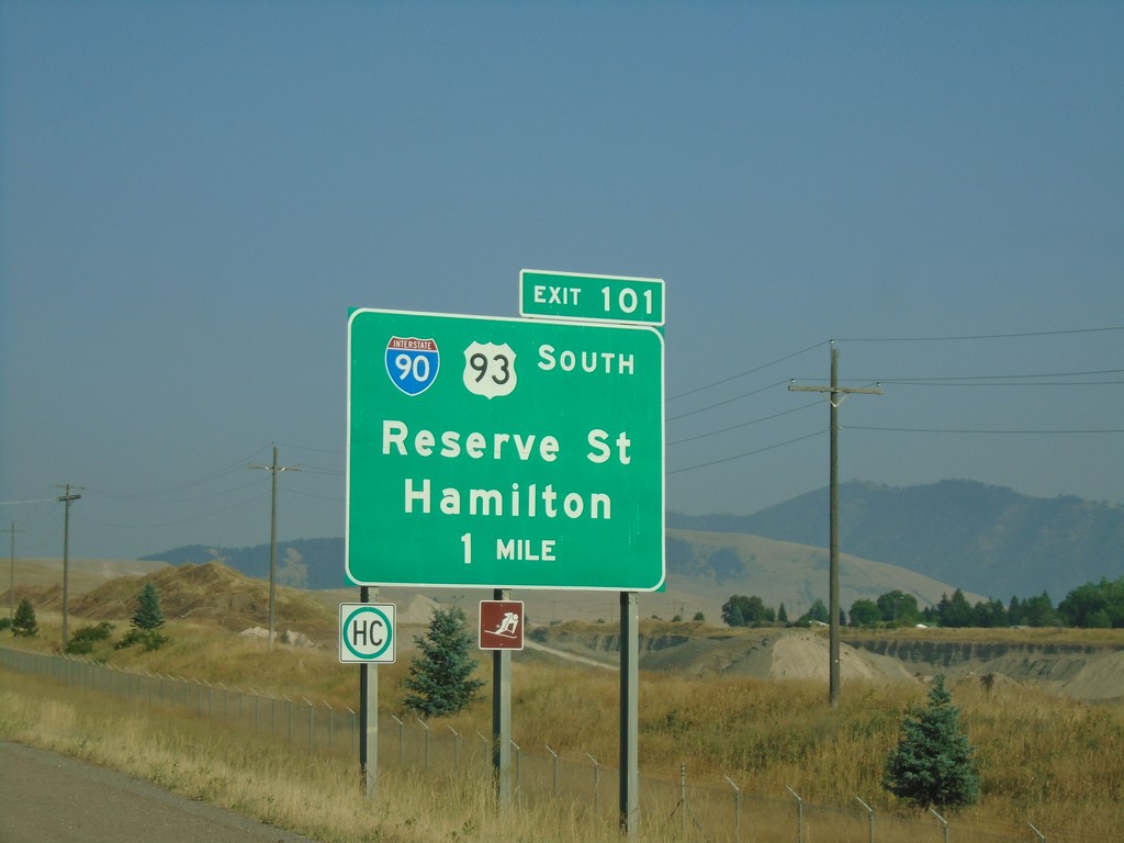
I-90 East - Exit 101
I-90 east approaching Exit 101 - BL-90/US-93/Reserve St./Hamilton. The BL-90 shield is incorrectly displayed as an I-90 shield. US-93 south leaves I-90 here.
Taken 08-10-2018

 Missoula
 County
Montana
United States
Missoula
Missoula County
Montana
United States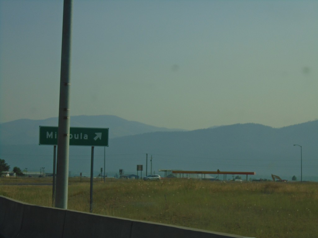
US-93 South/MT-200 East at I-90 East
US-93 South/MT-200 East at I-90 East to Missoula.
Taken 08-10-2018
Missoula
Missoula County
Montana
United States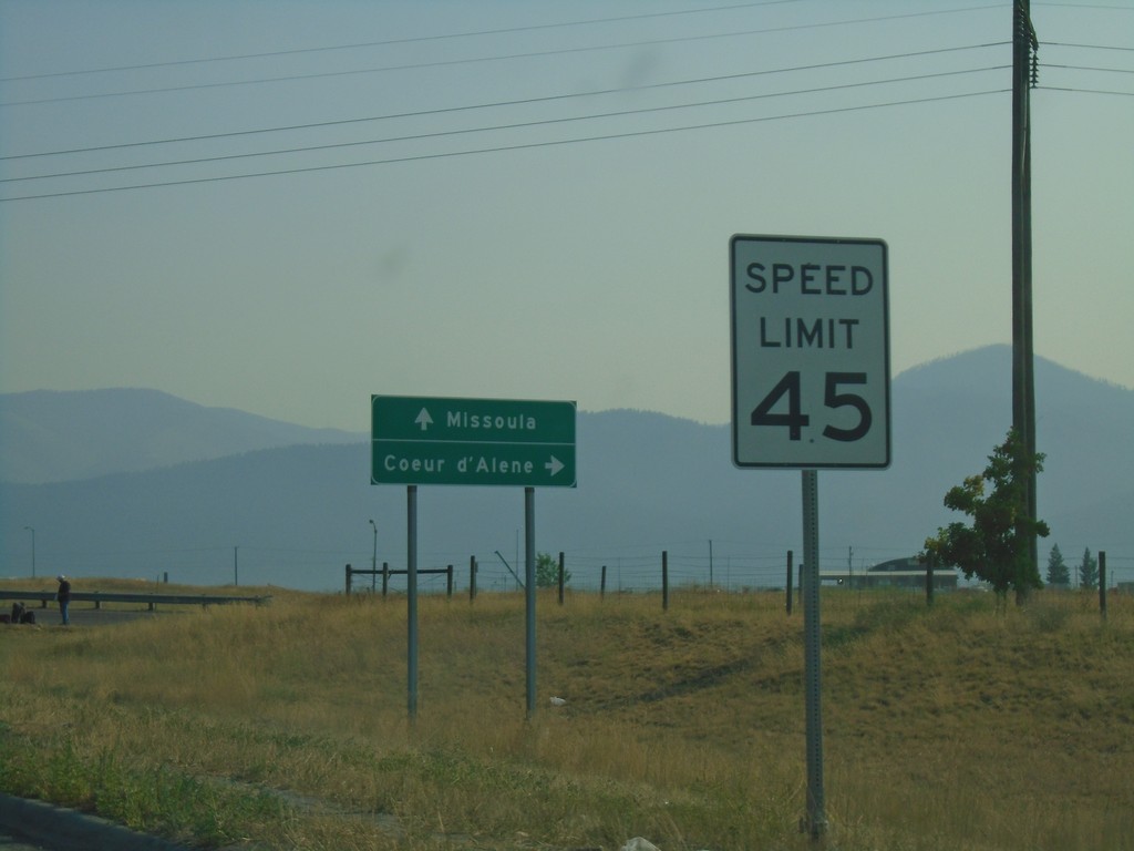
US-93 South/MT-200 East Approaching I-90
US-93 South/MT-200 East approaching I-90. Use I-90 west for Coeur d’Alene (Idaho); I-90 east for Missoula.
Taken 08-10-2018
Missoula
Missoula County
Montana
United States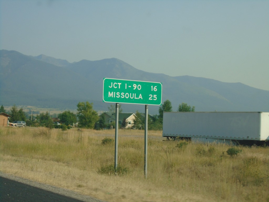
US-93 South/MT-200 East - Distance Marker
Distance Marker on US-93 South/MT-200 East. Distance to Jct I-90 and Missoula.
Taken 08-10-2018
Arlee
Lake County
Montana
United States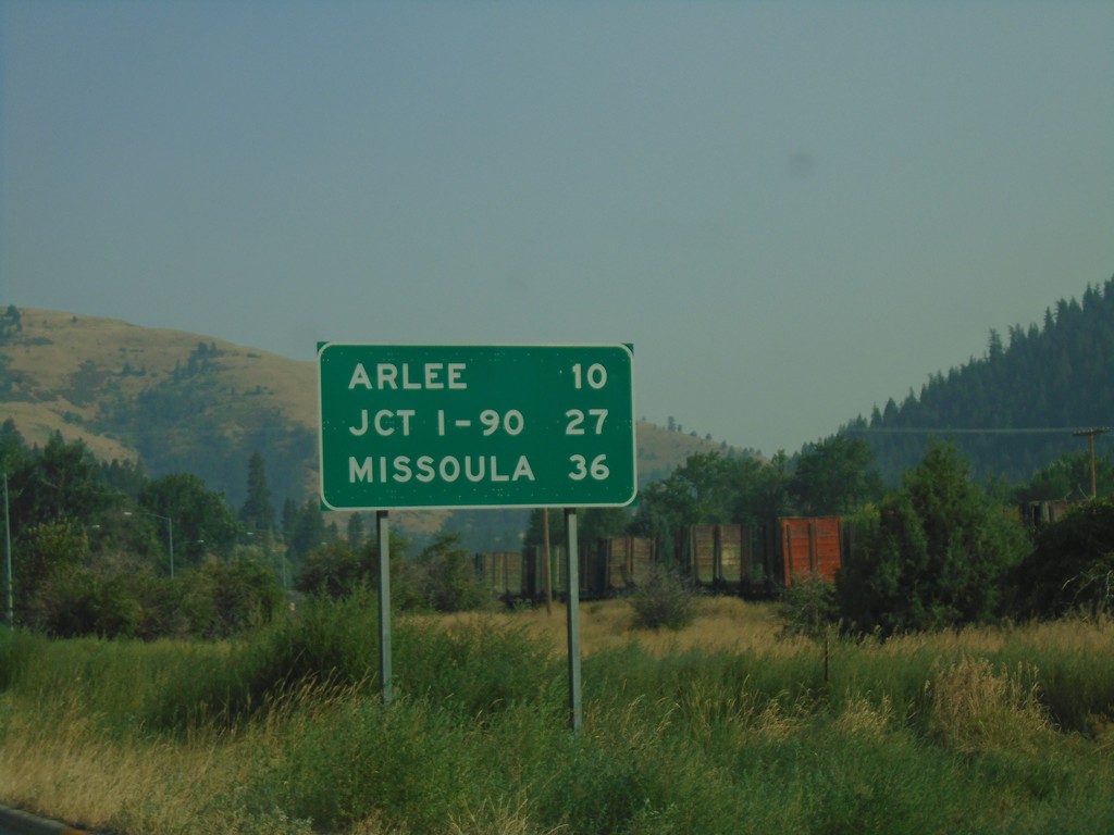
US-93 South - Distance Marker
Distance Marker on US-93 South - Arlee, Jct. I-90, Missoula.
Taken 08-10-2018
Ravalli
Lake County
Montana
United States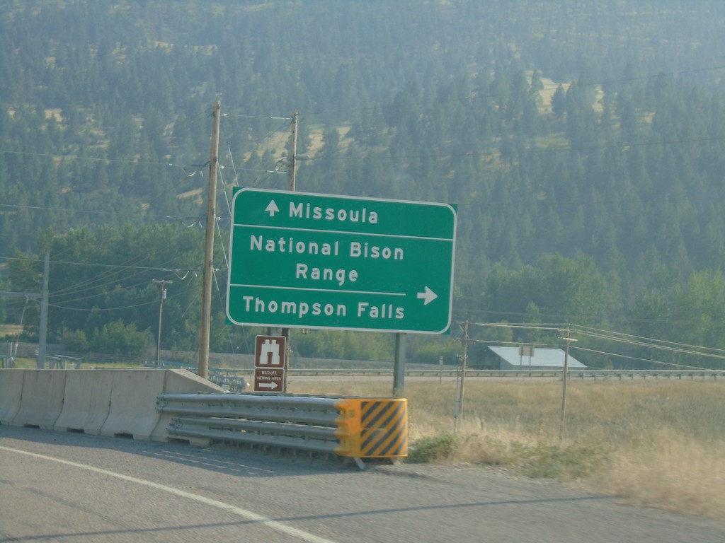
US-93 South At MT-200
US-93 south at MT-200. Use MT-200 West for National Bison Range and Thompson Falls. Use US-93 South/MT-200 East to Missoula. MT-200 East joins US-93 south to Missoula.
Taken 08-10-2018
Ravalli
Lake County
Montana
United States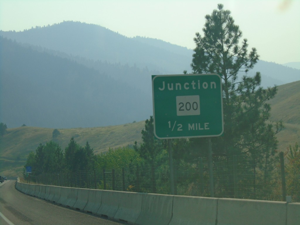
US-93 South Approaching MT-200
US-93 South approaching MT-200 in Lake County.
Taken 08-10-2018
Ravalli
Lake County
Montana
United States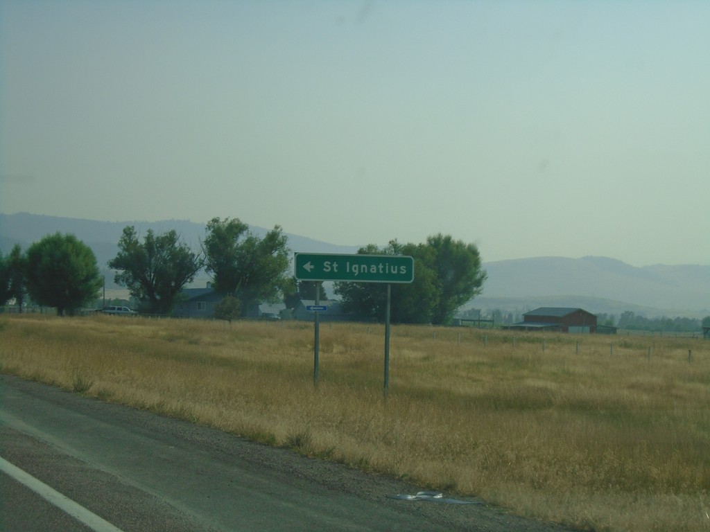
US-93 South at Saint Ignatius
US-93 South at Saint Ignatius junction.
Taken 08-10-2018
Saint Ignatius
Lake County
Montana
United States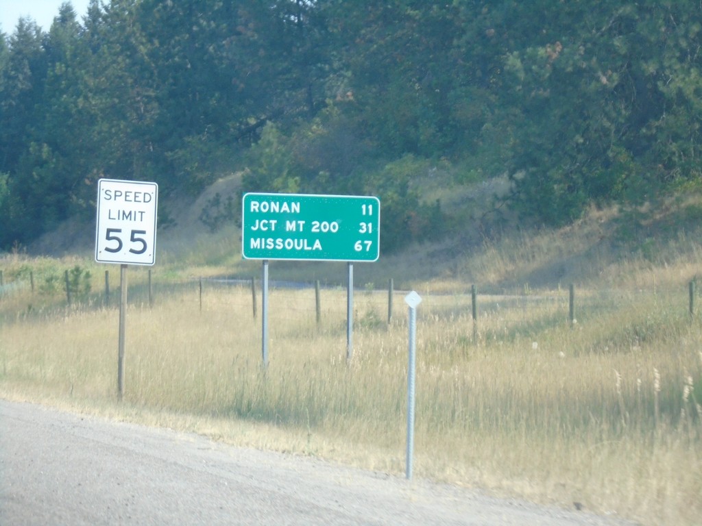
US-93 South - Distance Marker
Distance marker on US-93 south. Distance to Ronan, Jct. MT-200, and Missoula. Speed Limit 55 MPH.
Taken 08-10-2018
Polson
Lake County
Montana
United States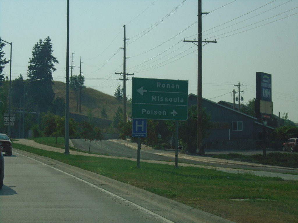
End MT-35 at US-93 - Polson
End MT-35 at US-93 in Polson. Use US-93 north for Polson; US-93 south for Ronan and Missoula.
Taken 08-10-2018
 Polson
Lake County
Montana
United States
Polson
Lake County
Montana
United States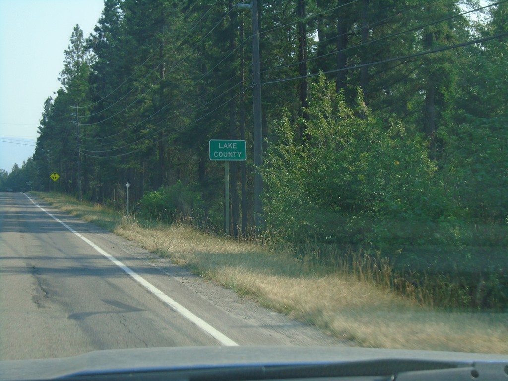
MT-35 South - Lake County
Entering Lake County on MT-35 south.
Taken 08-10-2018
Bigfork
Lake County
Montana
United States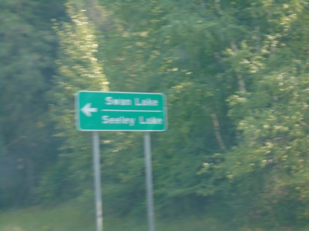
MT-35 South Approaching MTS-209
MT-35 South approaching MTS-209 in Bigfork. Use MTS-209 east for Swan Lake and Seeley Lake.
Taken 08-10-2018
 Bigfork
Flathead County
Montana
United States
Bigfork
Flathead County
Montana
United States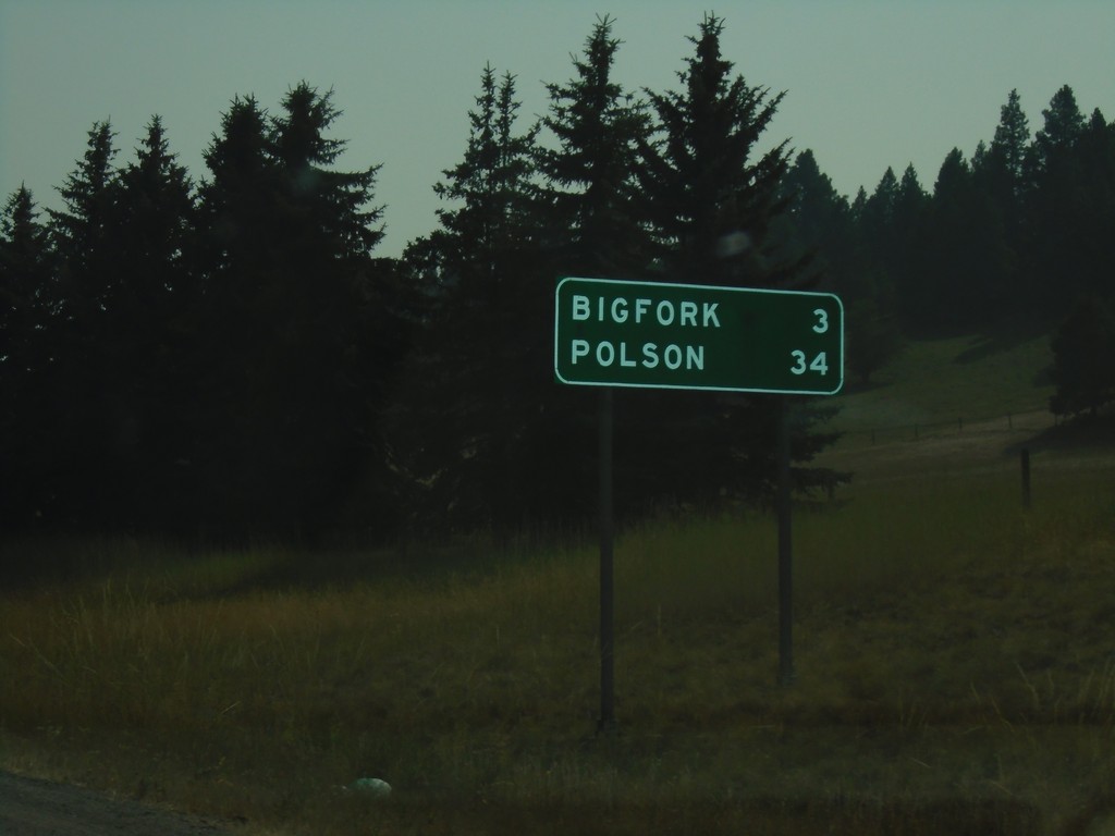
MT-35 South - Distance Marker
Distance marker on MT-35 south. Distance to Bigfork and Polson.
Taken 08-10-2018
Bigfork
Flathead County
Montana
United States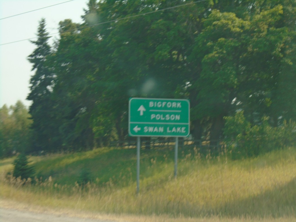
MT-35 South Approaching MT-83
MT-35 South approaching MT-83 south to Swan Lake. Continue south on MT-35 for Bigfork and Polson.
Taken 08-10-2018
 Bigfork
Flathead County
Montana
United States
Bigfork
Flathead County
Montana
United States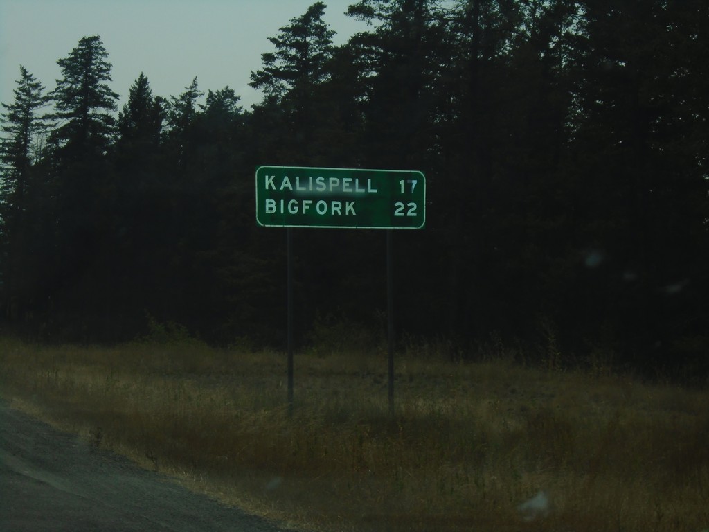
MTS-206 South - Distance Marker
Distance marker on MTS-206 south. Distance to Kalispell and Bigfork.
Taken 08-10-2018
 Columbia Falls
Flathead County
Montana
United States
Columbia Falls
Flathead County
Montana
United States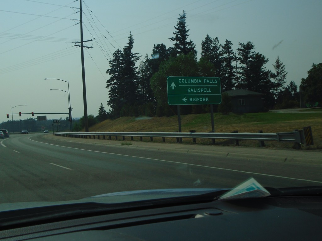
US-2 West at MTS-206 - Columbia Falls
US-2 West at MTS-206 junction in Columbia Falls. Use MTS-206 south for Bigfork; continue west on US-2 for Columbia Falls and Kalispell.
Taken 08-10-2018
 Columbia Falls
Flathead County
Montana
United States
Columbia Falls
Flathead County
Montana
United States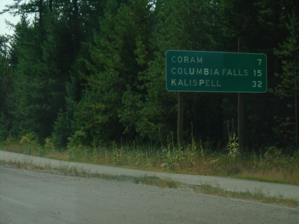
US-2 West - Distance Marker
Distance marker on US-2 west. Distance to Coram, Columbia Falls, and Kalispell.
Taken 08-10-2018
West Glacier
Flathead County
Montana
United States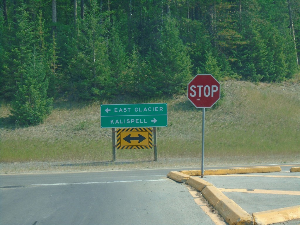
End Going To The Sun Road West at US-2
End Going To The Sun Road West at US-2 in West Glacier. Turn right on US-2 for Kalispell; left on US-2 for East Glacier.
Taken 08-10-2018
West Glacier
Flathead County
Montana
United States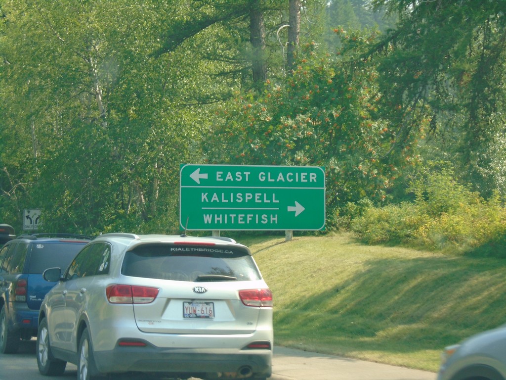
Going To The Sun Road West Approaching US-2
Going To The Sun Road West approaching US-2 in West Glacier. Turn left on US-2 east for East Glacier; right on US-2 west for Kalispell and Whitefish.
Taken 08-10-2018
West Glacier
Flathead County
Montana
United States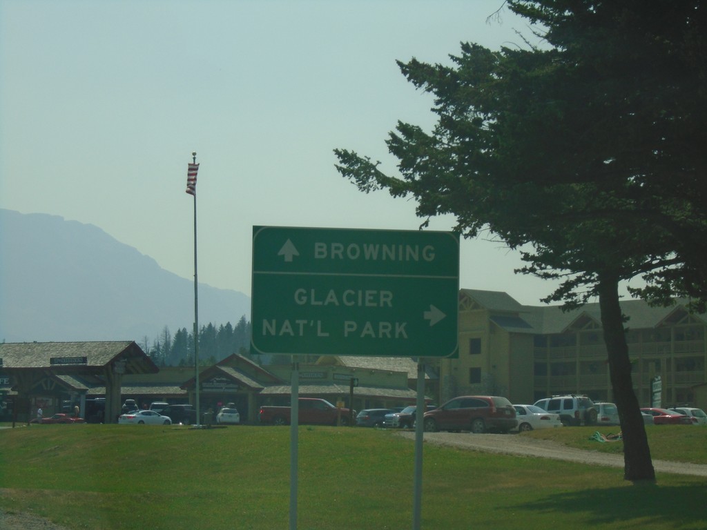
US-89 South - Going To The Sun Road Jct.
US-89 South at Going To The Sun Road Jct. in St. Mary. Turn right for Glacier National Park; continue south on US-89 for Browning.
Taken 08-10-2018
 Saint Mary
Glacier County
Montana
United States
Saint Mary
Glacier County
Montana
United States