Signs Tagged With Big Green Sign
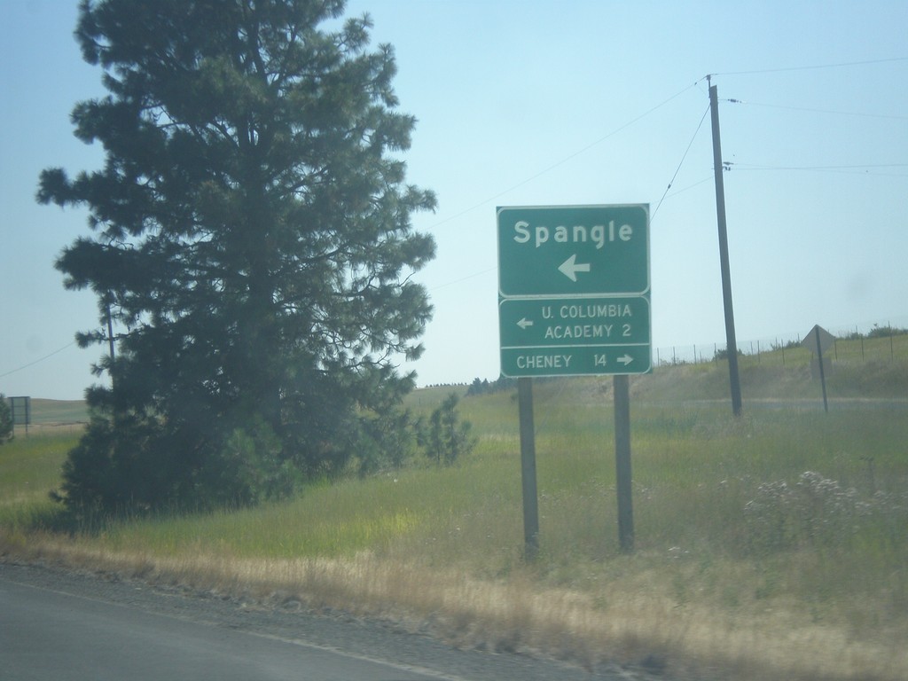
US-195 South - Spangle
US-195 South at Spangle junction. Turn left for Spangle and Upper Columbia Academy. Turn right to Cheney.
Taken 07-29-2017
 Spangle
Spokane County
Washington
United States
Spangle
Spokane County
Washington
United States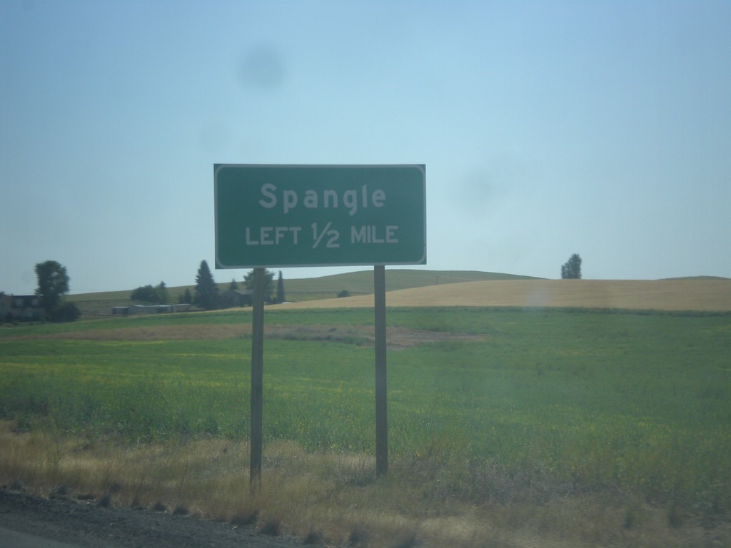
US-195 South - Spangle
US-195 South approaching Spangle junction.
Taken 07-29-2017
Spangle
Spokane County
Washington
United States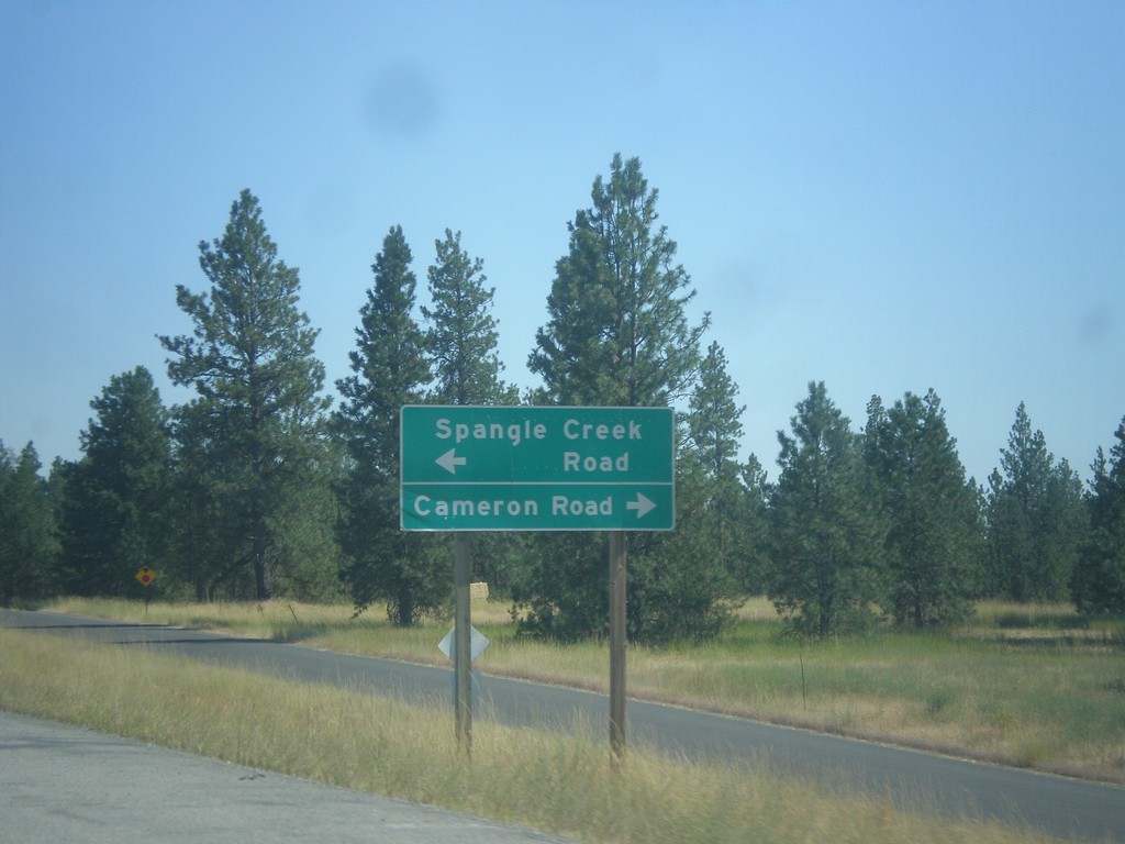
US-195 South - Spangle Creek Road/Cameron Road Jct.
US-195 South at Spangle Creek Road/Cameron Road near Spangle.
Taken 07-29-2017
Spangle
Spokane County
Washington
United States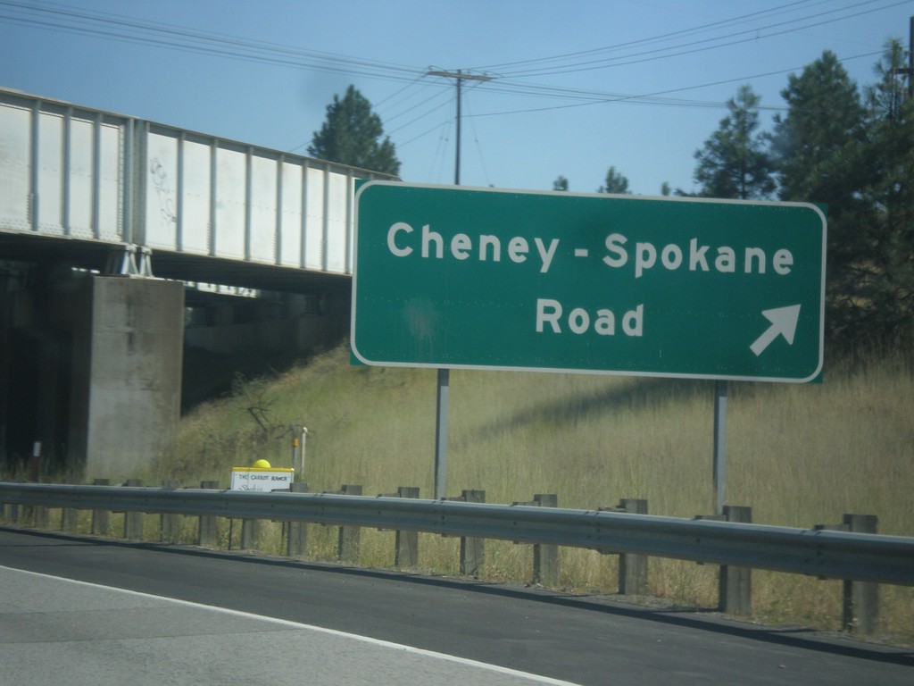
US-195 South - Cheney-Spokane Road Interchange
US-195 South - Cheney-Spokane Road at interchange
Taken 07-29-2017
Spokane
Spokane County
Washington
United States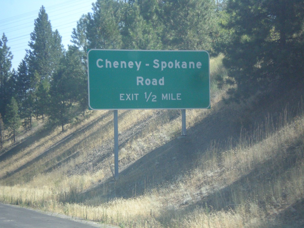
US-195 South Approaching Cheney-Spokane Road Interchange
US-195 South approaching Cheney-Spokane Road interchange.
Taken 07-29-2017
Spokane
Spokane County
Washington
United States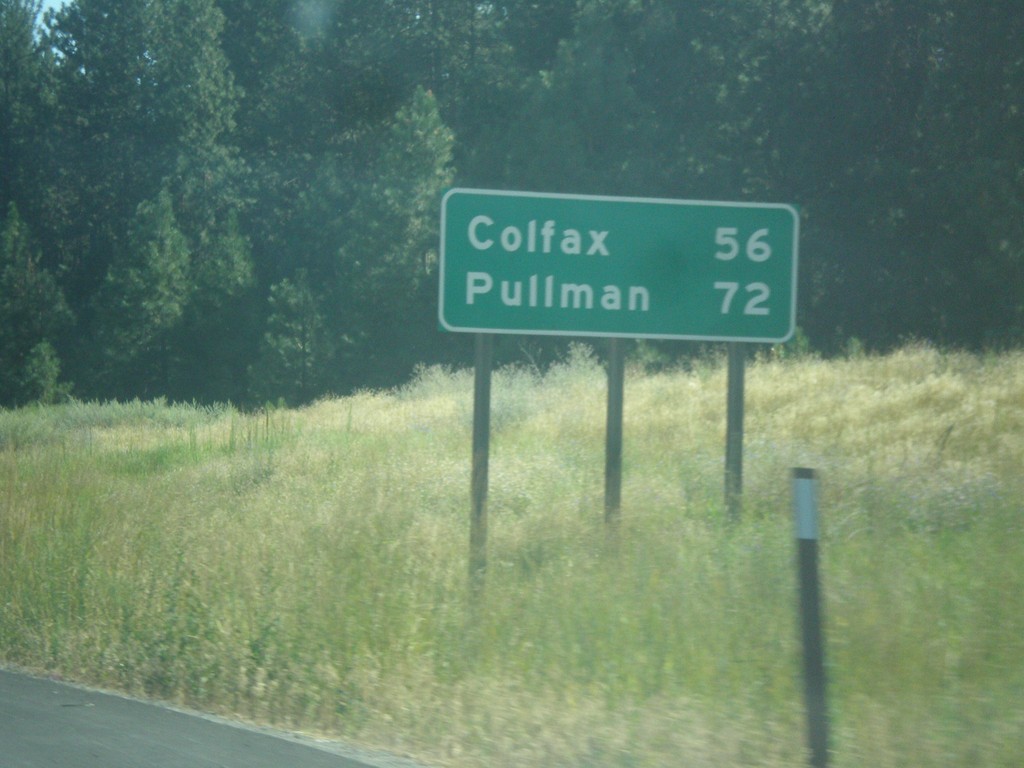
US-195 South - Distance Marker
Distance marker on US-195 south. First distance marker on US-195 southbound. Distance to Colfax and Pullman.
Taken 07-29-2017
Spokane
Spokane County
Washington
United States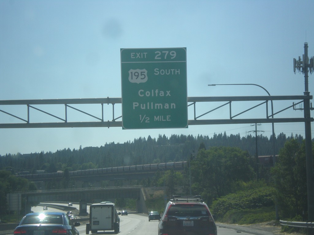
I-90 West - Exit 279
I-90 west approaching Exit 279 - US-195 South/Colfax/Pullman.
Taken 07-29-2017


 Spokane
 County
Washington
United States
Spokane
Spokane County
Washington
United States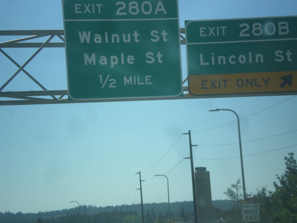
I-90 West - Exits 280B and 280A
I-90 west at Exit 280B - Lincoln St. Approaching Exit 280A - Maple St./Walnut St.
Taken 07-29-2017
Spokane
Spokane County
Washington
United States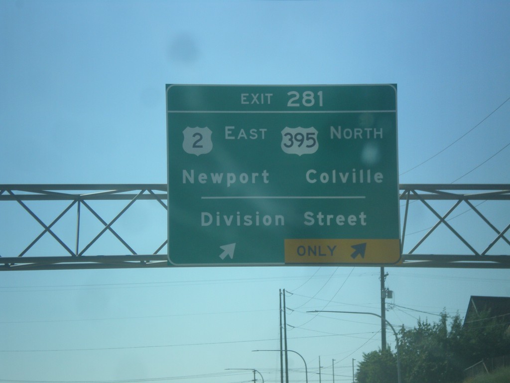
I-90 West - Exit 281
I-90 west at Exit 281 - US-2/Newport/US-395 North/Colville/Division St.. US-395 joins I-90 west to Ritzville. US-2 joins I-90 west through Spokane.
Taken 07-29-2017
Spokane
Spokane County
Washington
United States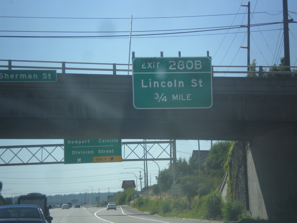
I-90 West Approaching Exit 280B
I-90 West approaching Exit 280B - Lincoln St.
Taken 07-29-2017
Spokane
Spokane County
Washington
United States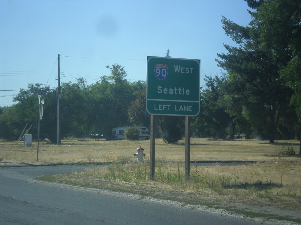
E 2nd Ave. Approaching I-90 West
E 2nd Ave. approaching I-90 West. Use left lane for I-90 West/Seattle.
Taken 07-29-2017
Spokane
Spokane County
Washington
United States
Thor St. South Approaching I-90
Thor St. South approaching I-90 in Spokane.
Taken 07-29-2017
Spokane
Spokane County
Washington
United States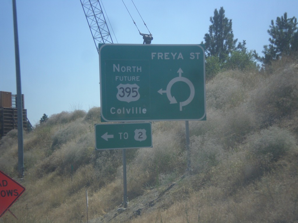
Freya St. South at Future US-395 North
Freya St. South at Future US-395 North. Use Future US-395 north for Colville and US-2.
Taken 07-29-2017
 Spokane
 County
Washington
United States
Spokane
Spokane County
Washington
United States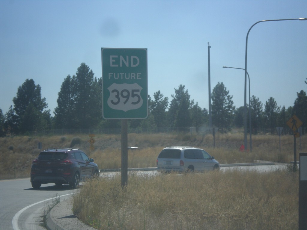
End Future US-395 South
End Future US-395 South at Freya St.
Taken 07-29-2017
Spokane
Spokane County
Washington
United States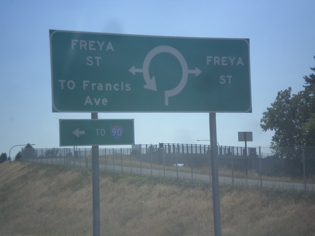
End Future US-395 South Approaching Freya St.
End Future US-395 South approaching Freya St. roundabout.
Taken 07-29-2017
Spokane
Spokane County
Washington
United States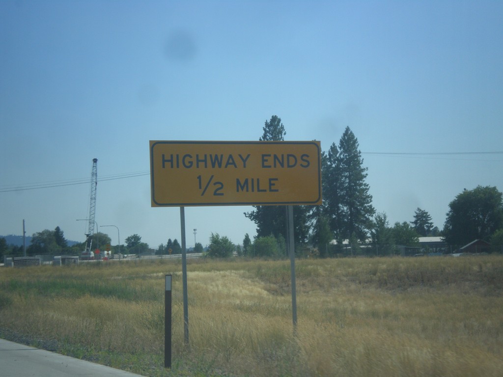
Approaching End Freeway on Future US-395 South
Highway Ends on Future US-395 South
Taken 07-29-2017
Spokane
Spokane County
Washington
United States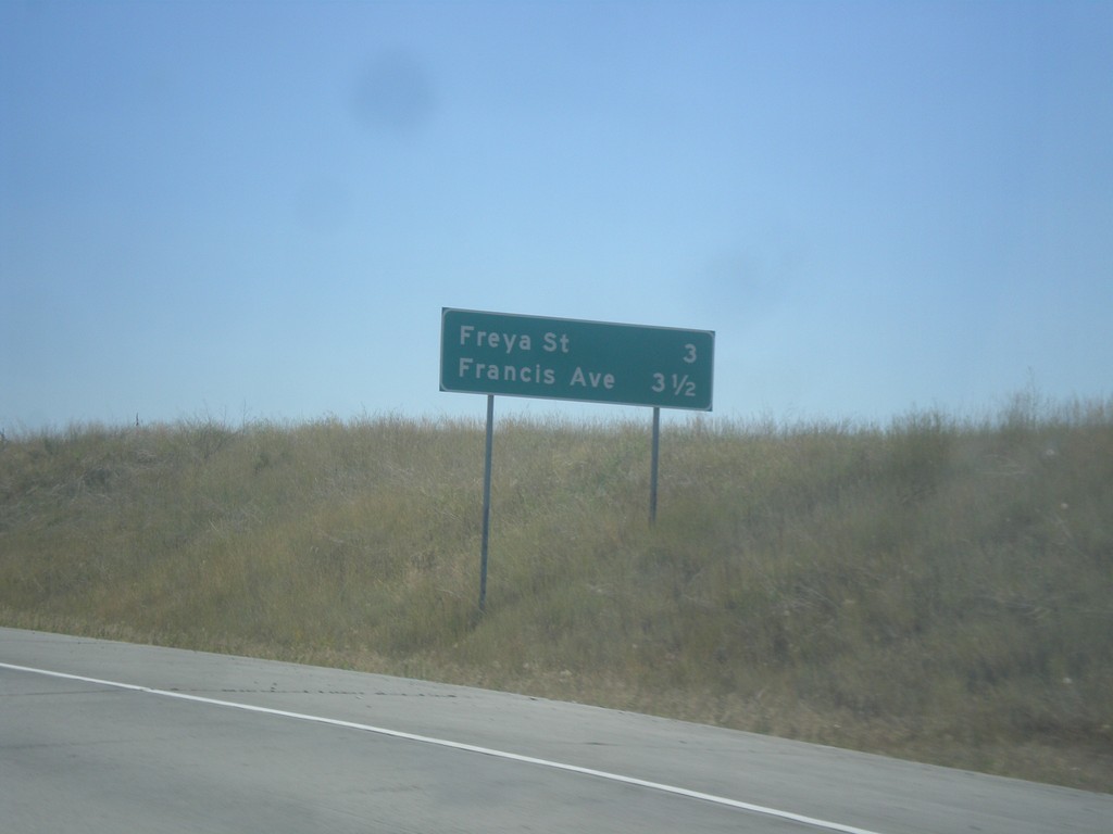
Future US-395 South - Distance Marker
Distance marker on Future US-395 south. Distance to Freya St. and Francis Ave.
Taken 07-29-2017
Spokane
Spokane County
Washington
United States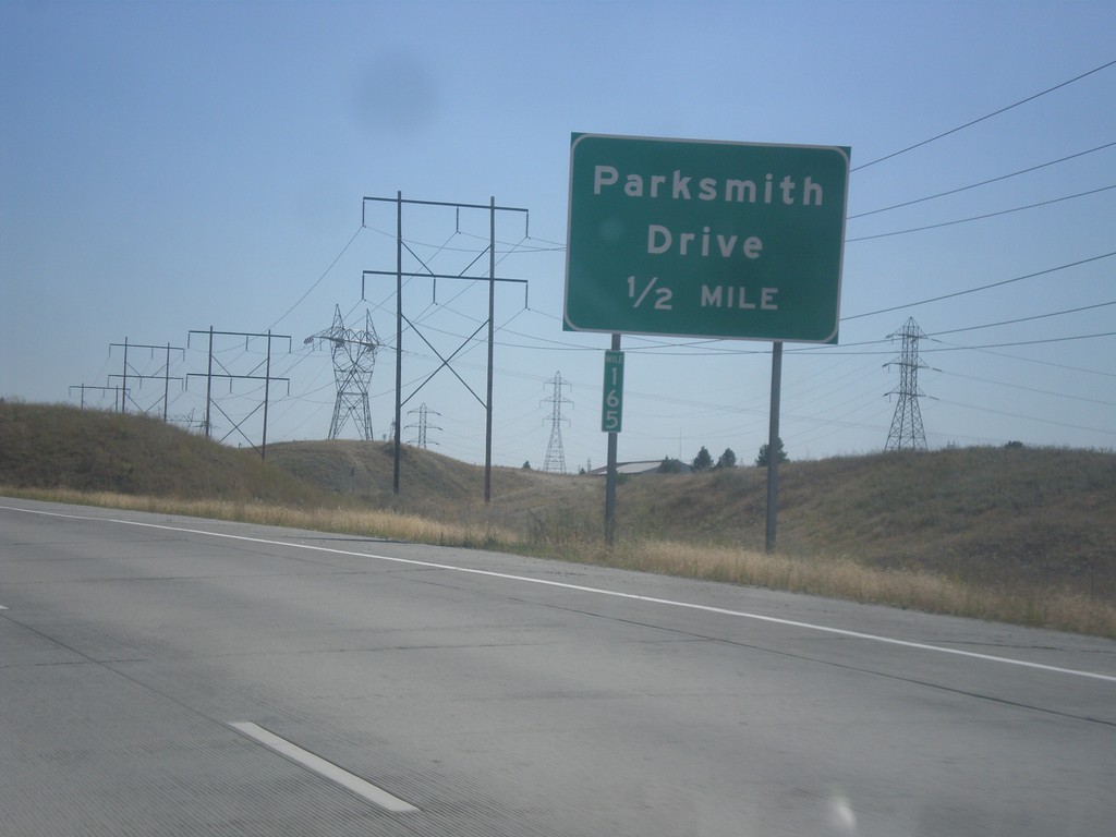
Future US-395 South - Parksmith Drive IC
Future US-395 south approaching the Parksmith Drive interchange.
Taken 07-29-2017
Mead
Spokane County
Washington
United States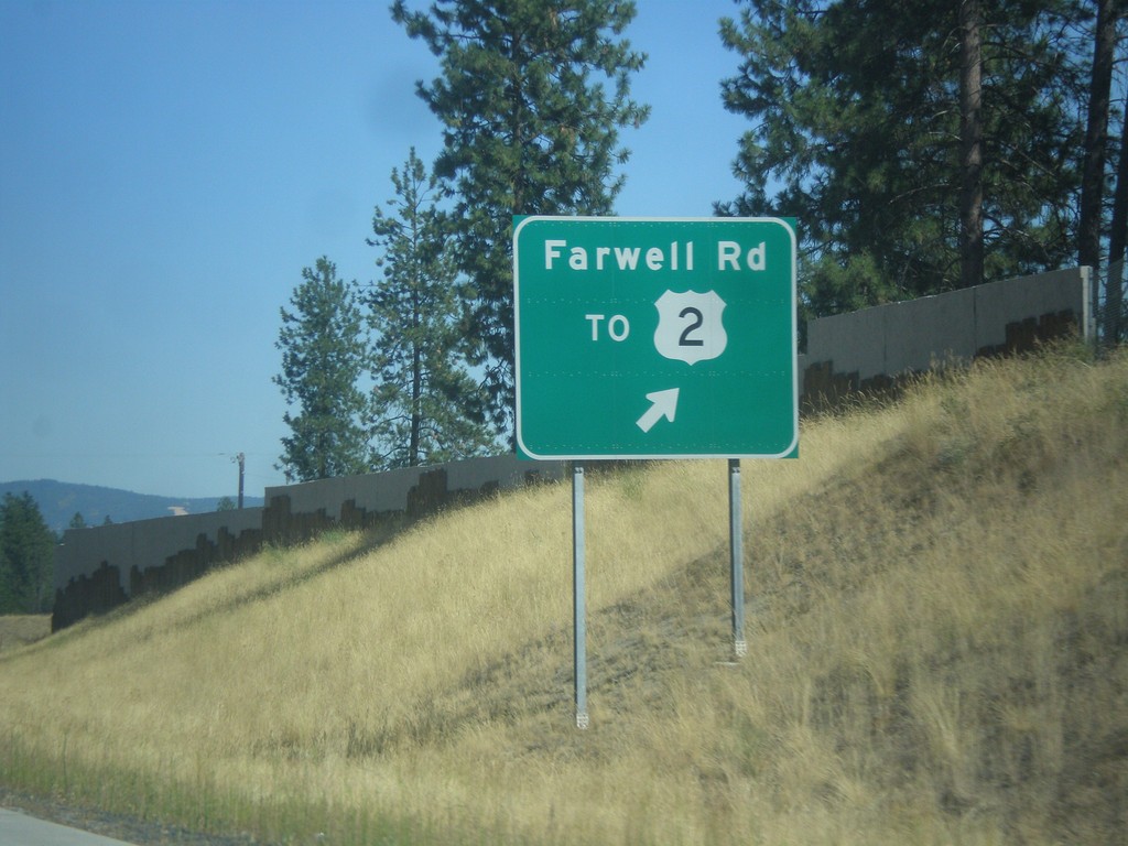
Future US-395 South - Farwell Road IC
Future US-395 South at the Farwell Road/To US-2 interchange.
Taken 07-29-2017
Spokane
Spokane County
Washington
United States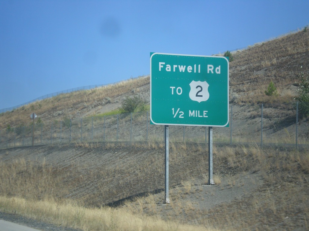
Future US-395 South - Farwell Road IC
Future US-395 South approaching Farwell Road/To US-2 interchange.
Taken 07-29-2017
Spokane
Spokane County
Washington
United States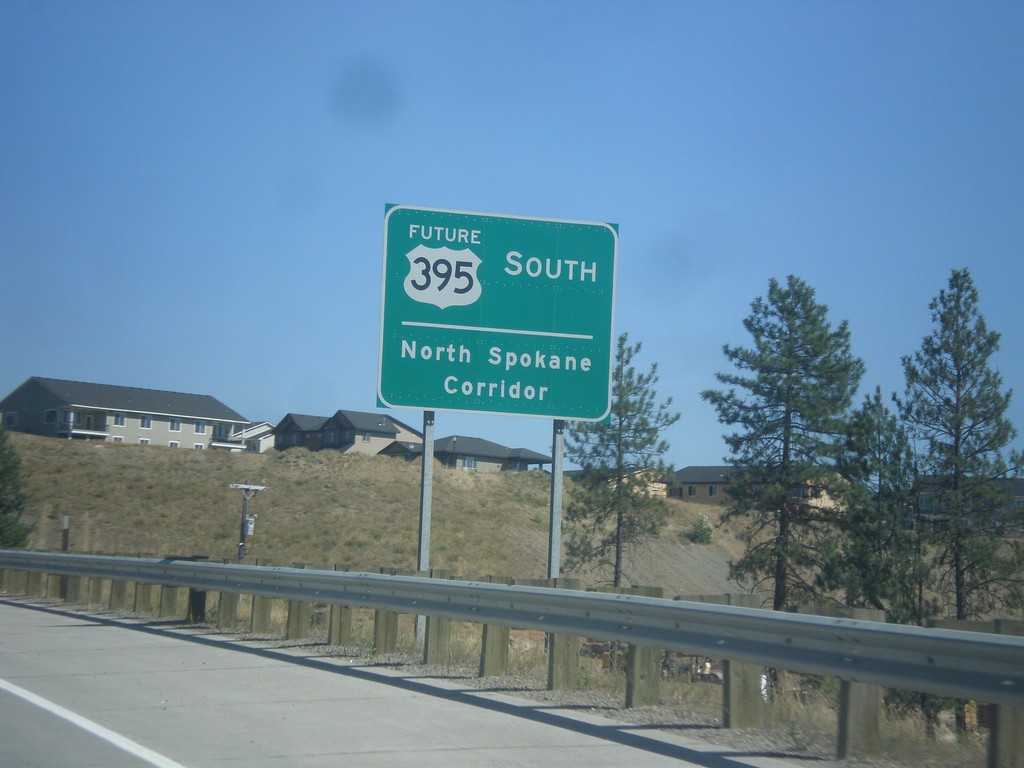
Future US-395 South - North Spokane Corridor
Future US-395 South - North Spokane Corridor. The current alignment of US-395 will be along Division St. until the completion of the North Spokane Corridor.
Taken 07-29-2017
Spokane
Spokane County
Washington
United States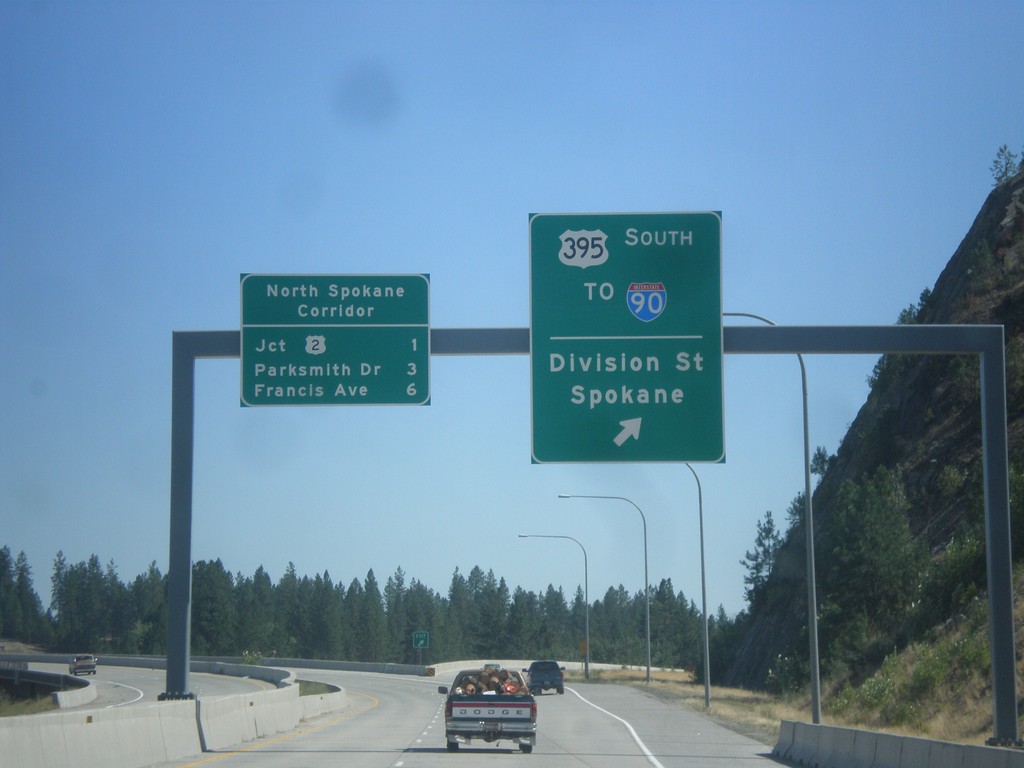
US-395 South at North Spokane Corridor
US-395 South at North Spokane Corridor. Use left lane to continue south on the freeway along the North Spokane Corridor. Use the right lane for the US-395 South/To I-90/Division St./Spokane interchange. The next three exits on the North Spokane Corridor (Future US-395) are US-2, Parksmith Drive, and Francis Ave.
Taken 07-29-2017
Spokane
Spokane County
Washington
United States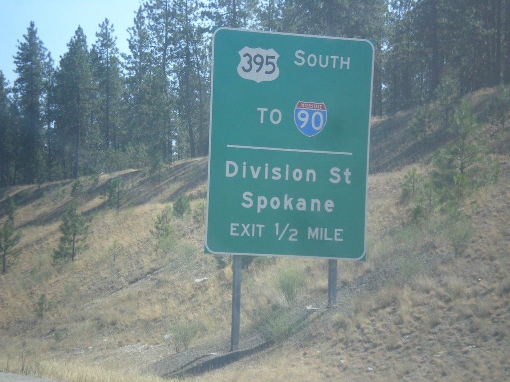
US-395 South - Division St. Interchange
US-395 South approaching US-395 South/To I-90/Division St./Spokane interchange. US-395 leaves the freeway southbound here. When the North Spokane Corridor is connected to I-90, US-395 will be rerouted away from Division St. onto the new freeway.
Taken 07-29-2017
Spokane
Spokane County
Washington
United States
US-395 South - Hatch Road IC
US-395 south approaching Hatch Road interchange. This is the northern end of the new North Spokane Corridor, a freeway which will eventually have a direct connection to I-90.
Taken 07-29-2017
Colbert
Spokane County
Washington
United States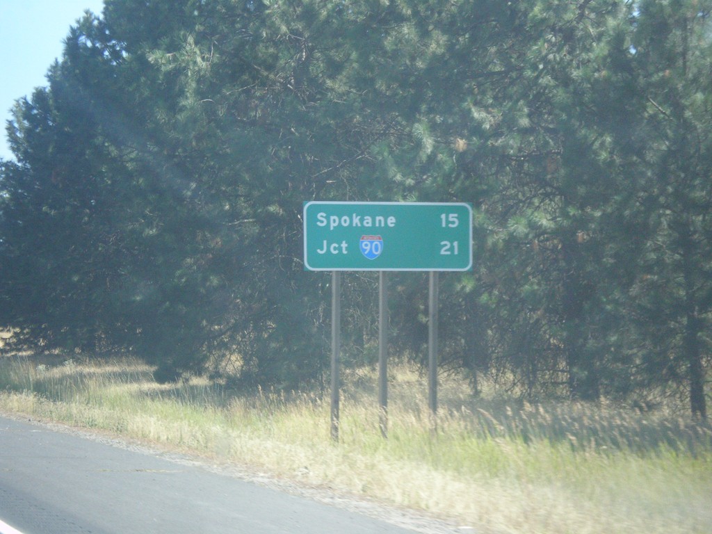
US-395 South - Distance Marker
Distance marker on US-395 south leaving Deer Park. Distance to Spokane and I-90.
Taken 07-29-2017
Deer Park
Spokane County
Washington
United States