Signs Tagged With Big Green Sign
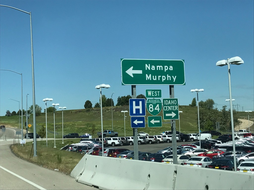
I-84 West - Exit 38 Offramp
I-84 west Exit 38 offramp. Turn left for BL-84 towards Nampa and Murphy. Turn right for the Idaho Center, an event complex.
Taken 05-20-2017


 Nampa
Canyon County
Idaho
United States
Nampa
Canyon County
Idaho
United States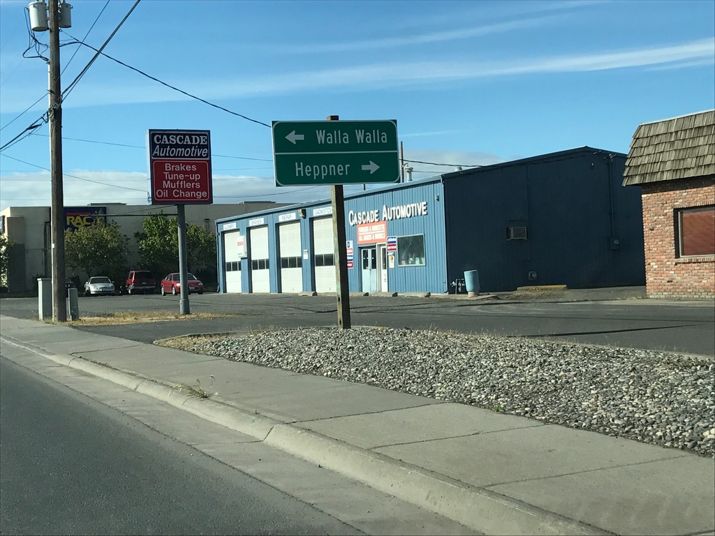
US-395 South Approaching OR-207
US-395 South approaching OR-207 in Hermiston. Use OR-207 south for Heppner; OR-207 north for Walla Walla (Washington).
Taken 04-30-2017

 Hermiston
Umatilla County
Oregon
United States
Hermiston
Umatilla County
Oregon
United States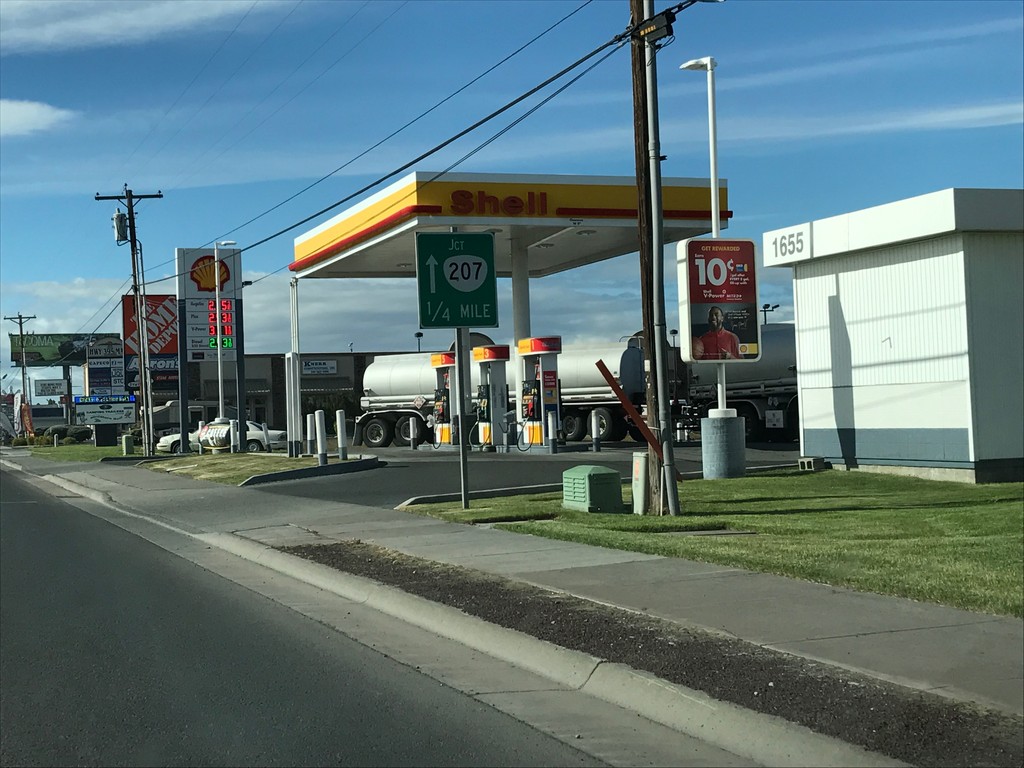
US-395 South Approaching OR-207
US-395 South approaching OR-207 in Hermiston.
Taken 04-30-2017
Hermiston
Umatilla County
Oregon
United States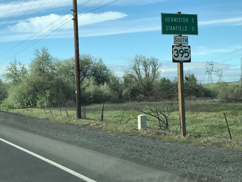
US-395 South - Distance Marker
Distance Marker on US-395 south. Distance to Hermiston and Stanfield.
Taken 04-30-2017
Umatilla
Umatilla County
Oregon
United States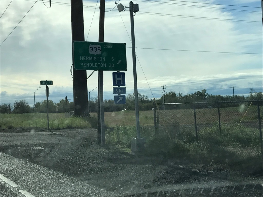
US-730 East/US-395 South at US-730/US-395 Split
US-730 East/US-395 South at US-730/US-395 Split in Umatilla. Merge right to continue south on US-395 to Hermiston and Pendleton.
Taken 04-30-2017
 Umatilla
 County
Oregon
United States
Umatilla
Umatilla County
Oregon
United States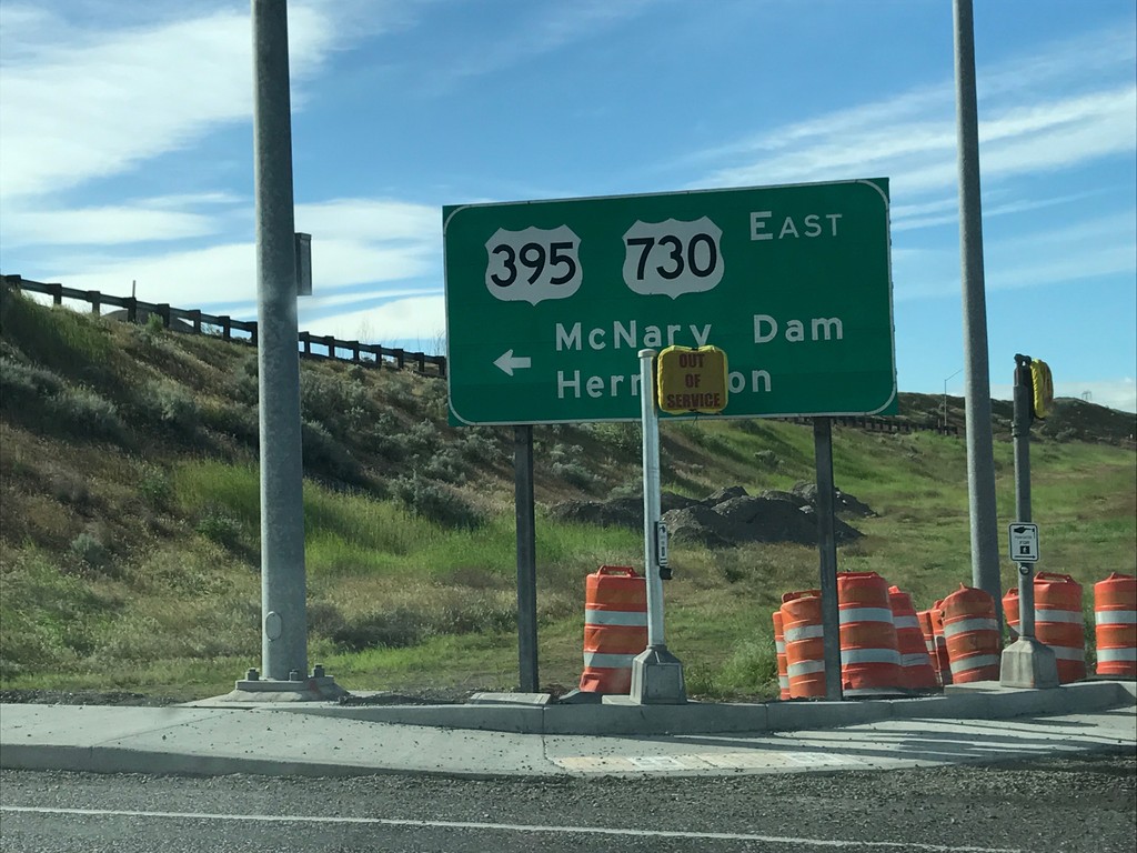
I-82 East Exit 1 Offramp at US-395/US-730
I-82 East Exit 1 Offramp at US-395/US-730 in Umatilla. Turn left for US-730 East/US-395 South/McNary Dam/Hermiston.
Taken 04-30-2017
 Umatilla
 County
Oregon
United States
Umatilla
Umatilla County
Oregon
United States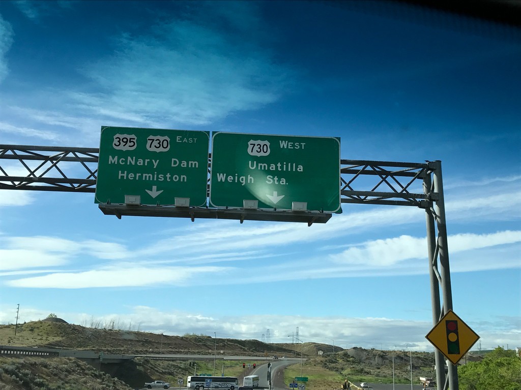
I-82 East - Exit 1 Offramp
I-82 East - Exit 1 Offramp in Umatilla. Turn right for US-730 West/Umatilla/Weigh Station. Turn left for US-730 East/US-395 South/McNary Dam/Hermiston. US-395 leaves I-82 eastbound here.
Taken 04-30-2017
Umatilla
Umatilla County
Oregon
United States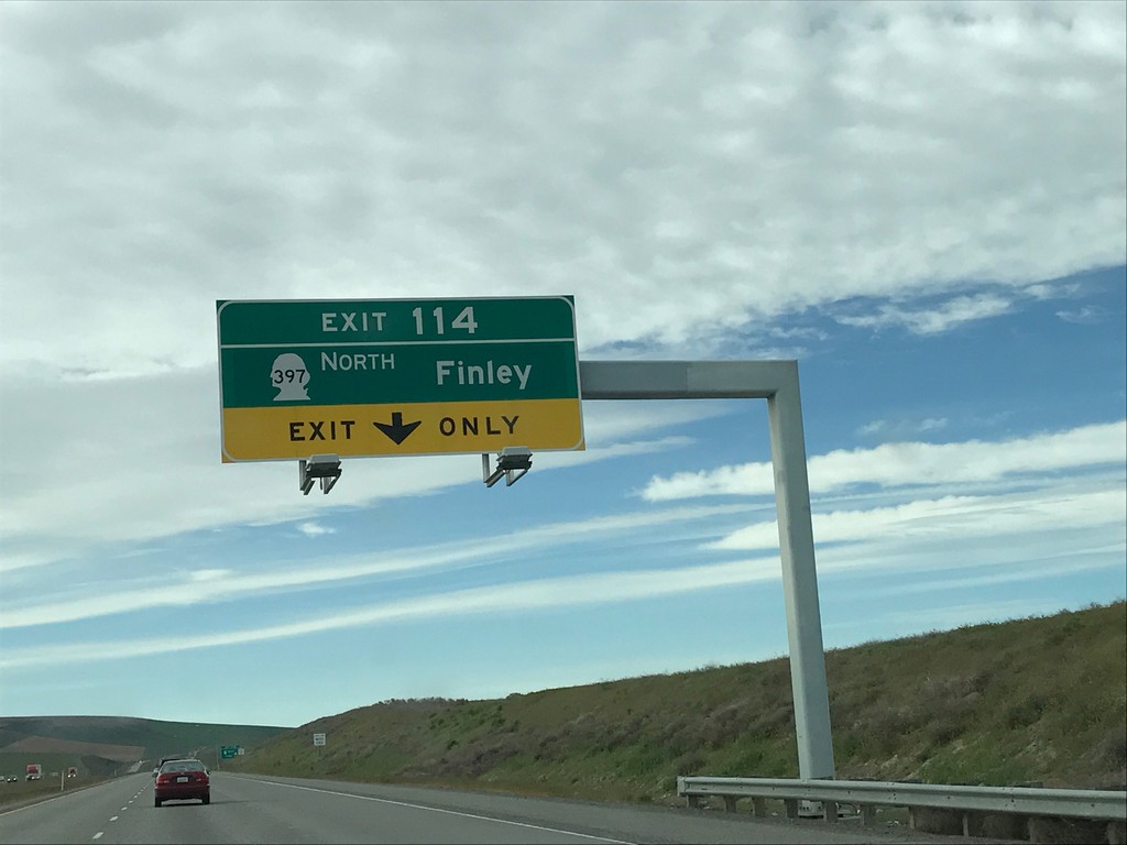
I-82 East - Exit 114
I-82 east approaching Exit 114 - WA-397 North/Finley.
Taken 04-30-2017
 Kennewick
Benton County
Washington
United States
Kennewick
Benton County
Washington
United States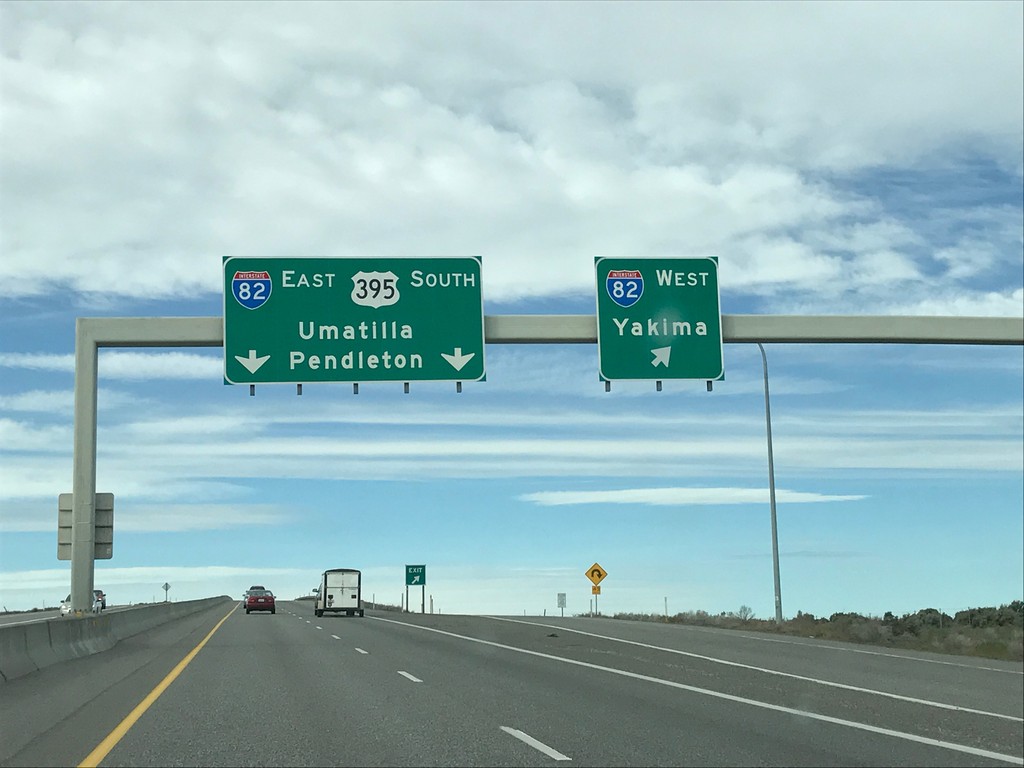
US-395 South at I-82
US-395 south at I-82 in Benton County. Use I-82 West for Yakima; I-82 East/US-395 South for Umatilla (OR) and Pendleton (OR). US-395 south joins I-82 east into Oregon.
Taken 04-30-2017
Kennewick
Benton County
Washington
United States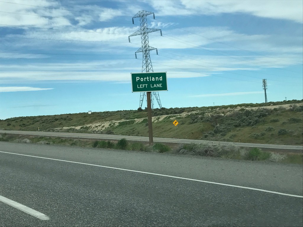
US-395 South Approaching I-82
US-395 South approaching I-82. Use I-82 east for Portland (Oregon).
Taken 04-30-2017
Kennewick
Benton County
Washington
United States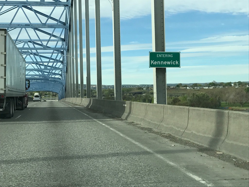
US-395 South - Kennewick
Entering Kennewick on US-395 south crossing the Columbia River on the Blue Bridge. Kennewick is one of the tri-cities of Washington, the other two being Pasco and Richland.
Taken 04-30-2017
Pasco
Franklin County
Washington
United States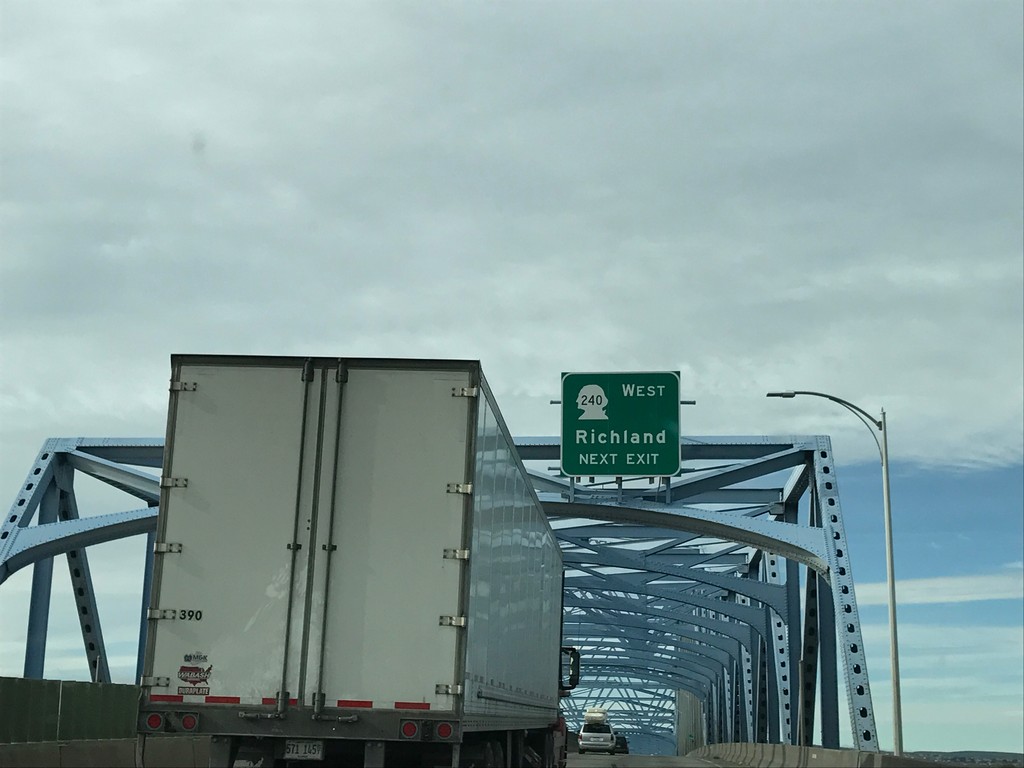
US-395 South Approaching WA-240 West
US-395 South approaching WA-240 West/Richland. Taken on the Blue Bridge over the Columbia River.
Taken 04-30-2017
 Pasco
Franklin County
Washington
United States
Pasco
Franklin County
Washington
United States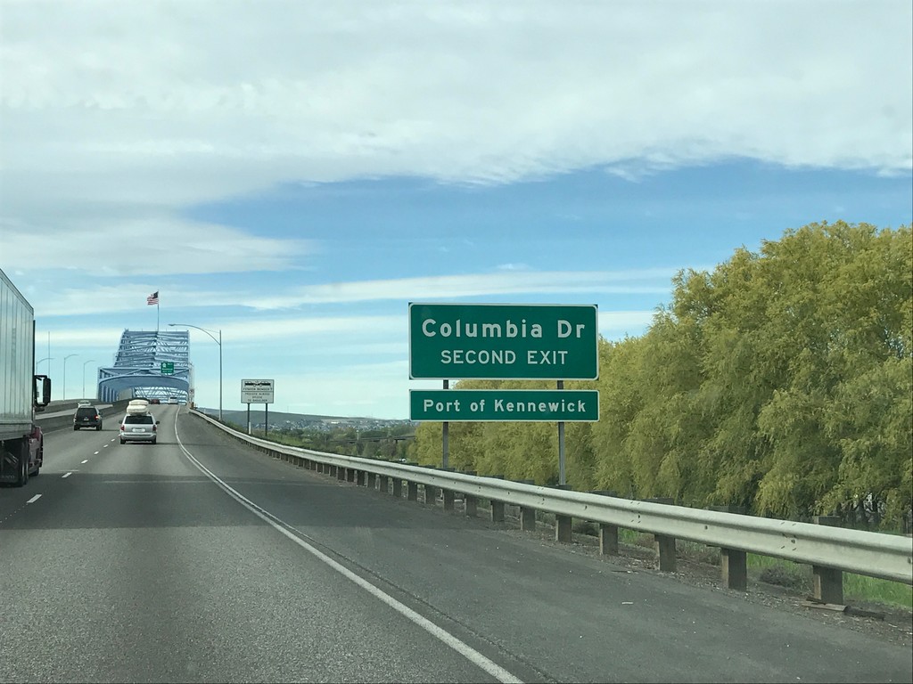
US-395 South - Columbia Drive
US-395 south approaching Columbia Drive/Port of Kennewick. Approaching the Blue Bridge over the Columbia River.
Taken 04-30-2017
Pasco
Franklin County
Washington
United States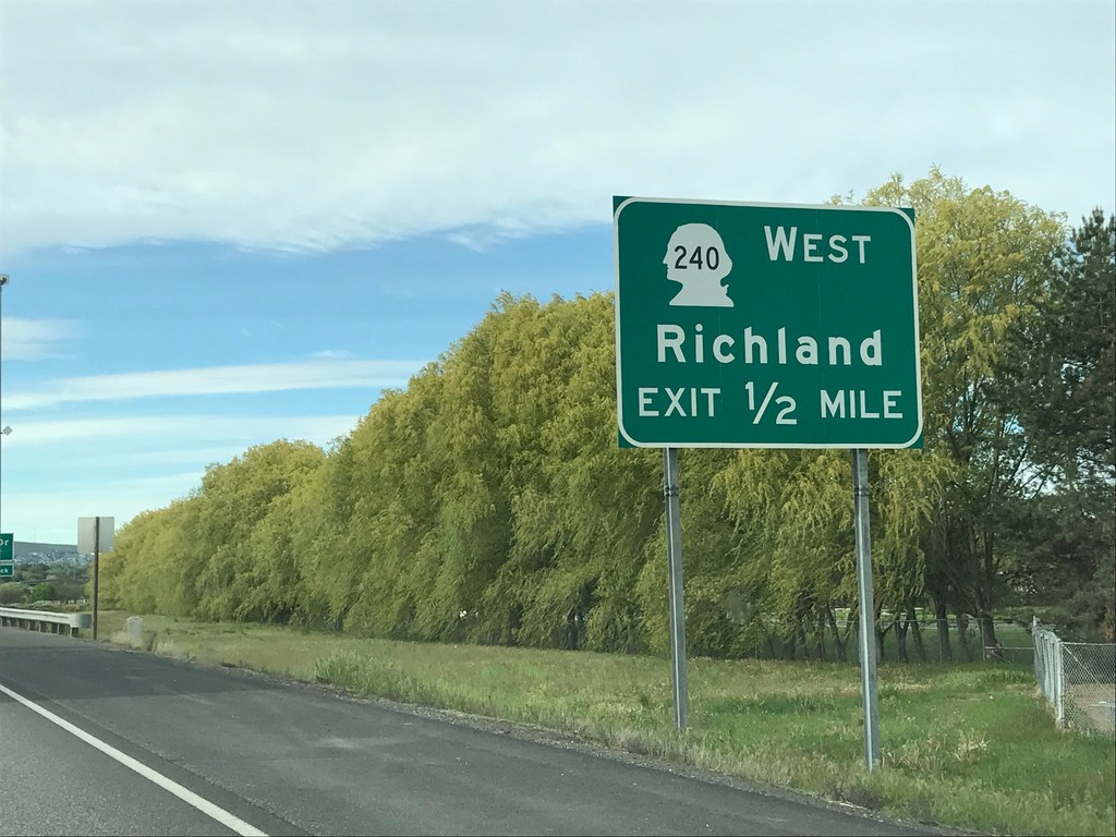
US-395 South - Approaching WA-240 West
US-395 South approaching WA-240 West/Richland in Pasco. Approaching the Blue Bridge over the Columbia River.
Taken 04-30-2017
Pasco
Franklin County
Washington
United States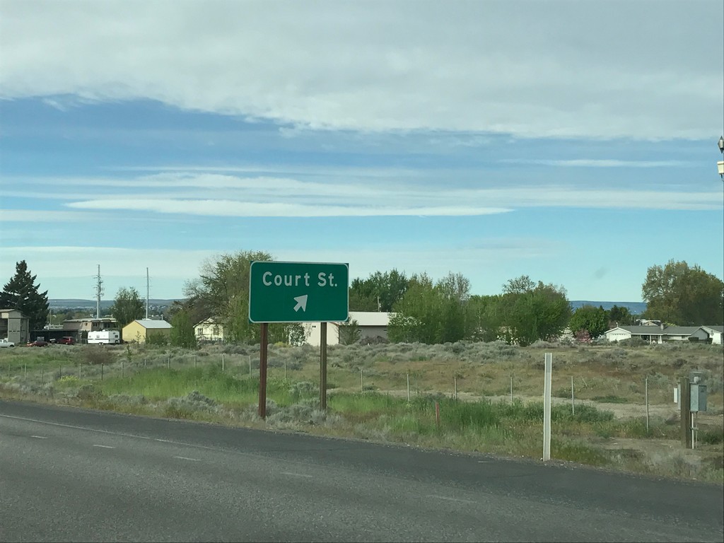
US-395 South - Court St.
US-395 South at Court St. interchange.
Taken 04-30-2017
Pasco
Franklin County
Washington
United States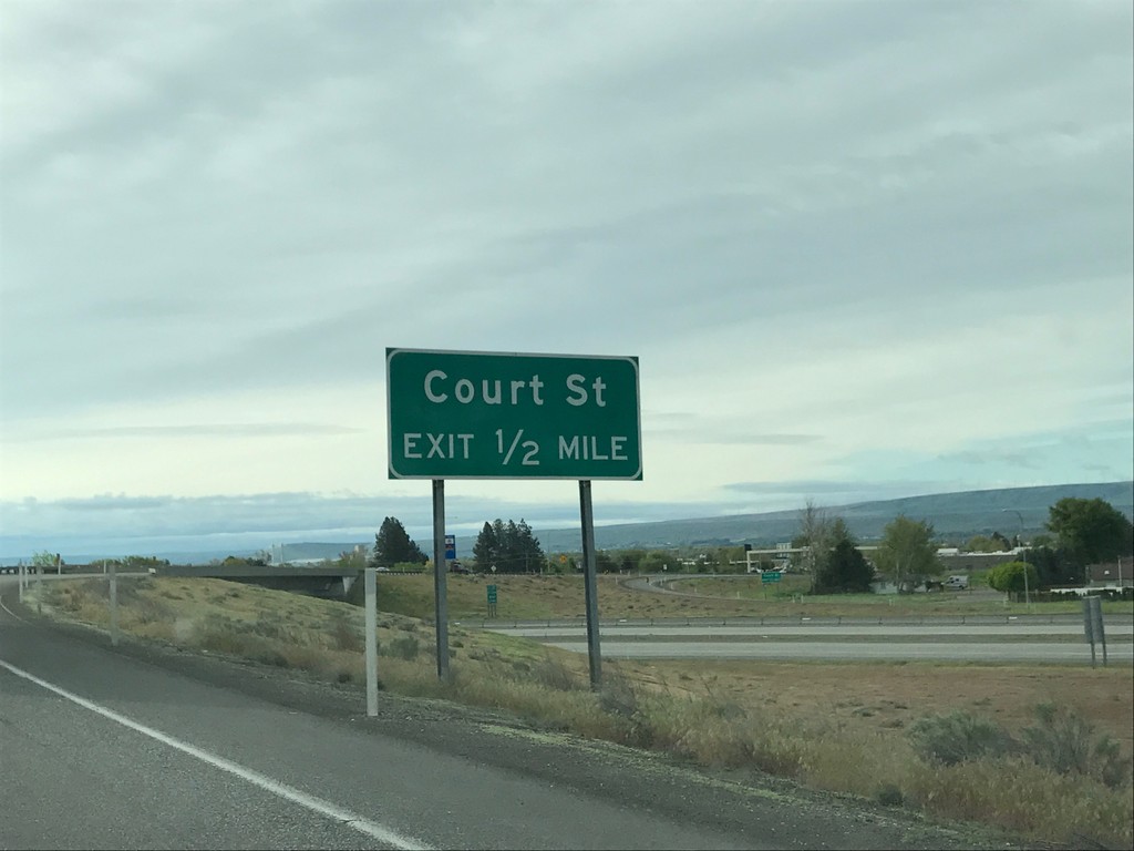
US-395 South - Court St.
US-395 South approaching Court St. interchange.
Taken 04-30-2017
Pasco
Franklin County
Washington
United States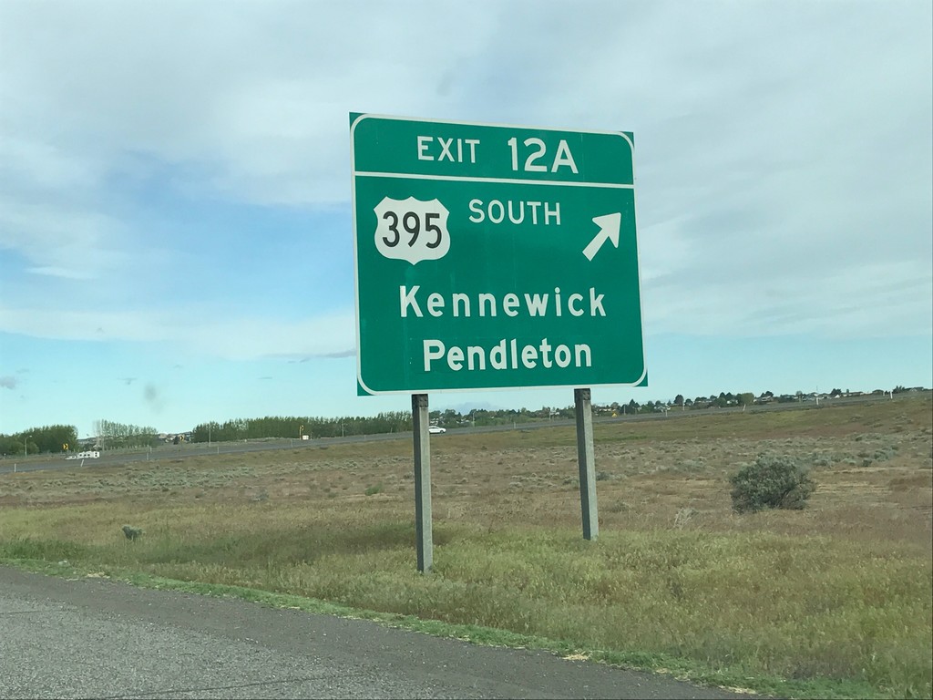
I-182/US-12 West/US-395 South - Exit 12A
I-182/US-12 West/US-395 South at Exit 12A - US-395 South/Kennewick/Pendleton (Oregon). US-395 south leaves I-182 here.
Taken 04-30-2017

 Pasco
Franklin County
Washington
United States
Pasco
Franklin County
Washington
United States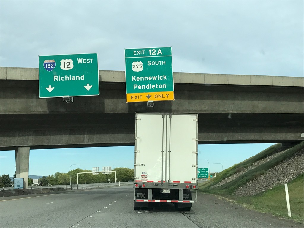
I-182/US-12 West/US-395 South - Exit 12A
I-182/US-12 West/US-395 South at Exit 12A - US-395 South/Kennewick/Pendleton (Oregon). Continue west on I-182/US-12 for Richland.
Taken 04-30-2017
Pasco
Franklin County
Washington
United States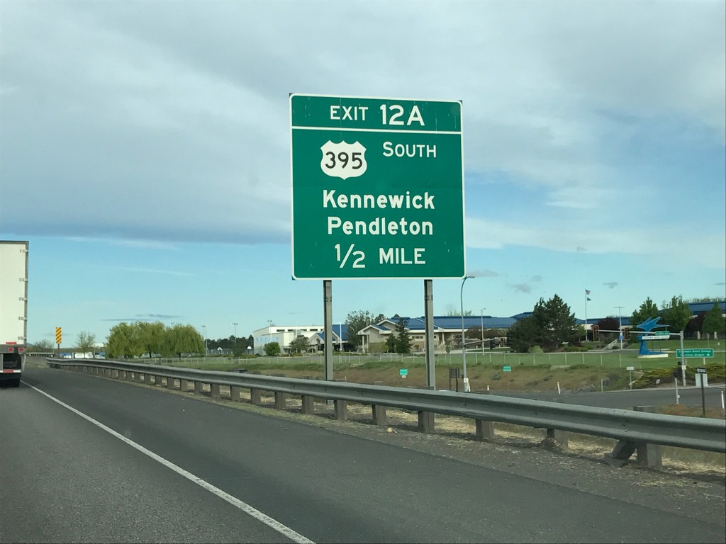
I-182/US-12 West/US-395 South - Exit 12A
I-182/US-12 West/US-395 South - Exit 12A - US-395 South/Kennewick/Pendleton (Oregon).
Taken 04-30-2017
Pasco
Franklin County
Washington
United States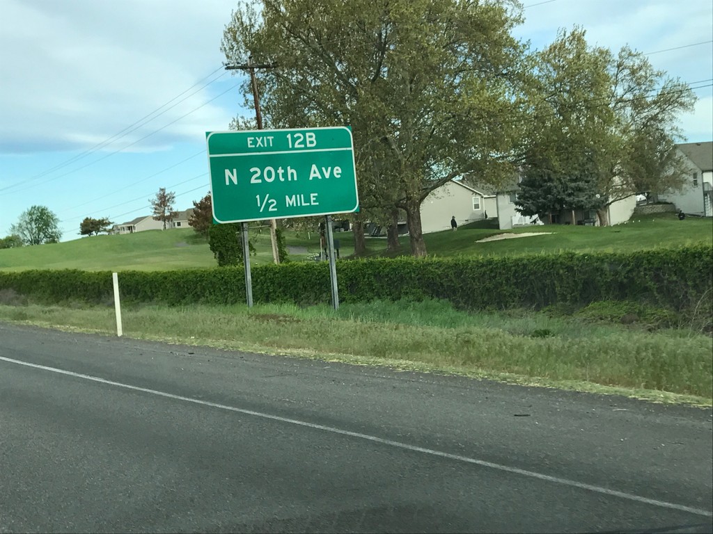
I-182/US-12 West/US-395 South - Exit 12B
I-182/US-12 West/US-395 South at Exit 12B - N 20th Ave.
Taken 04-30-2017
Pasco
Franklin County
Washington
United States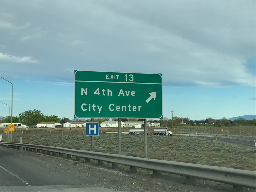
I-182/US-12 West/US-395 South - Exit 13
I-182/US-12 West/US-395 South at Exit 13 - N 4th Ave./(Pasco)City Center.
Taken 04-30-2017
Pasco
Franklin County
Washington
United States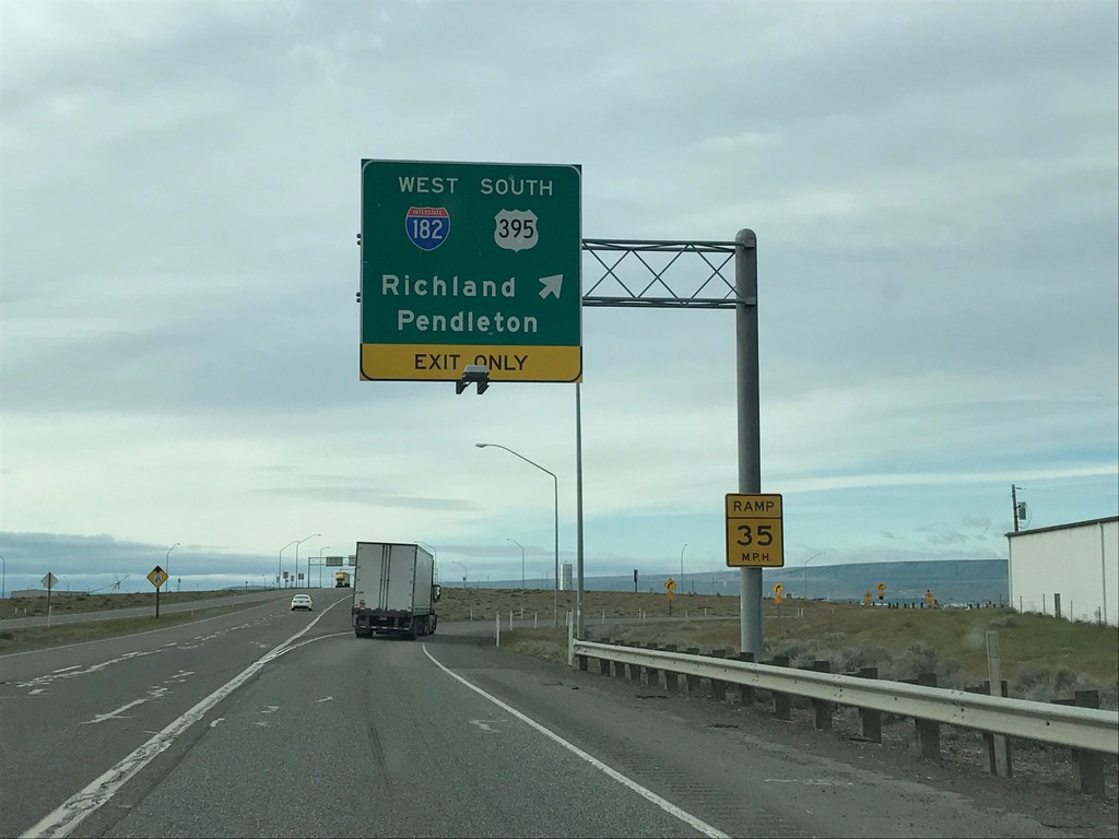
US-395 South at I-182/US-12 - Pasco
US-395 South at I-182/US-12 in Pasco. Merge right to continue south on US-395, and I-182/Pendleton (Oregon)/Richland. US-395 south joins I-182 through Pasco.
Taken 04-30-2017
Pasco
Franklin County
Washington
United States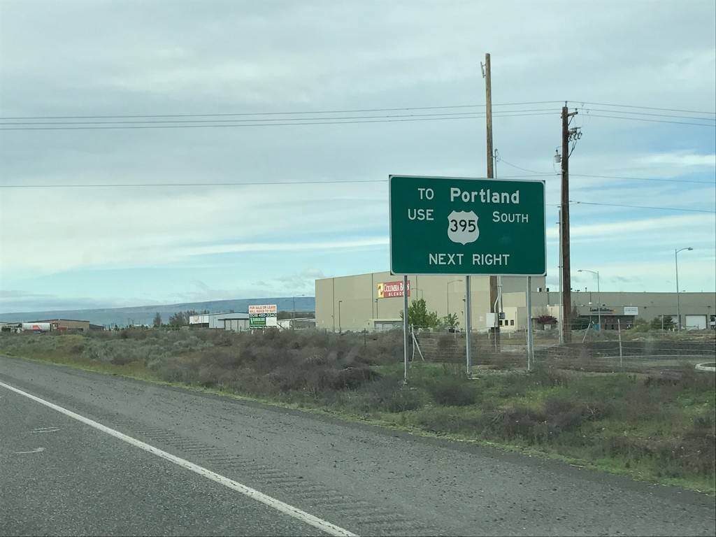
US-395 South Approaching I-182/US-12
US-395 South approaching I-182/US-12 in Pasco. For Portland (Oregon), continue south on US-395.
Taken 04-30-2017
Pasco
Franklin County
Washington
United States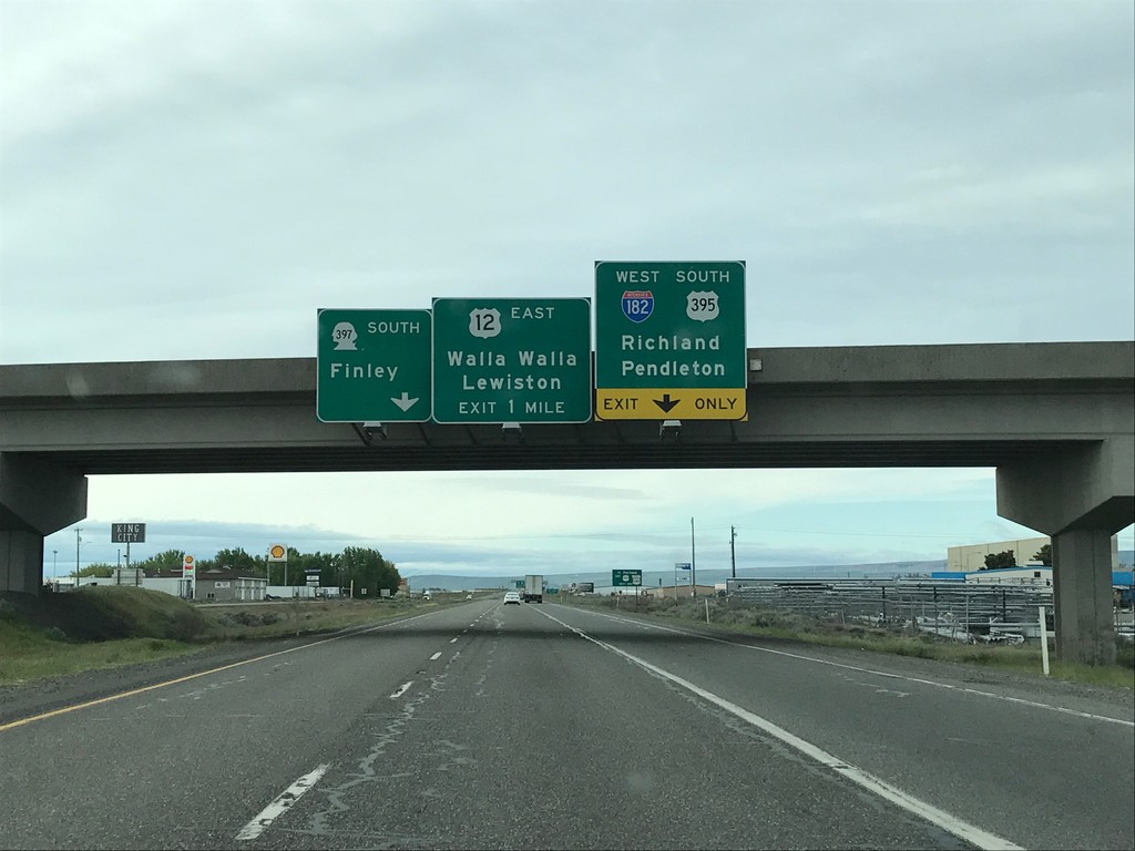
US-395 South - I-182/US-12/WA-397 Jct.
US-395 South - I-182/US-12/WA-397 Jct. in Pasco. Continue on road south for WA-397 South to Finley. Merge right to continue south on US-395 and for I-182/US-12 West to Richland and Pendleton (Oregon). Use US-12 East for Walla Walla and Lewiston (Idaho).
Taken 04-30-2017
Pasco
Franklin County
Washington
United States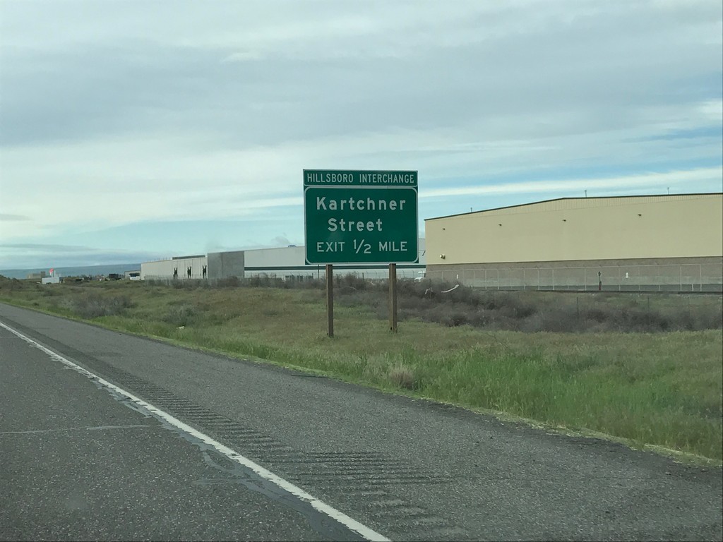
US-395 South - Kartchner St.
US-395 South approaching Kartchner St. (Hillsboro Interchange).
Taken 04-30-2017
Pasco
Franklin County
Washington
United States