Signs Tagged With Big Green Sign
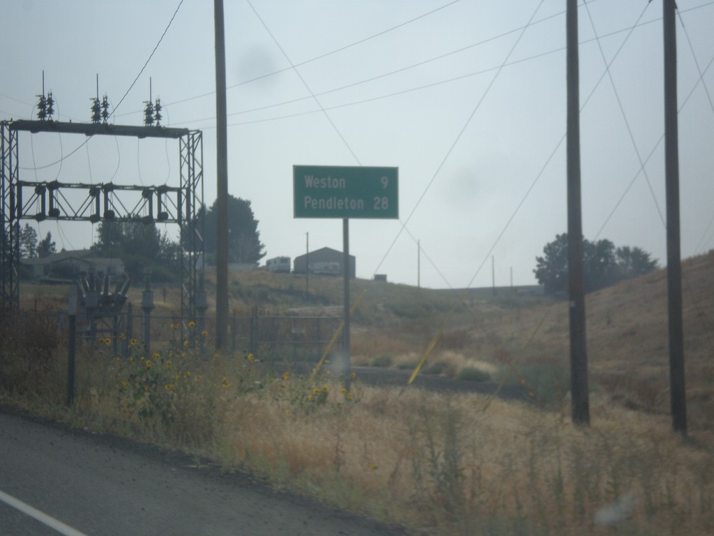
OR-11 South - Distance Marker
Distance marker on OR-11 south. Distance to Weston and Pendleton.
Taken 09-09-2017
 Milton-Freewater
Umatilla County
Oregon
United States
Milton-Freewater
Umatilla County
Oregon
United States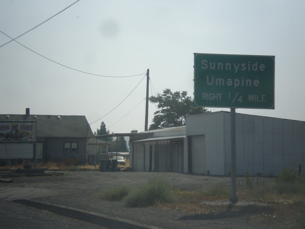
OR-11 South Approaching OR-332
OR-11 South approaching OR-332 to Sunnyside and Umapine.
Taken 09-09-2017
 Milton-Freewater
Umatilla County
Oregon
United States
Milton-Freewater
Umatilla County
Oregon
United States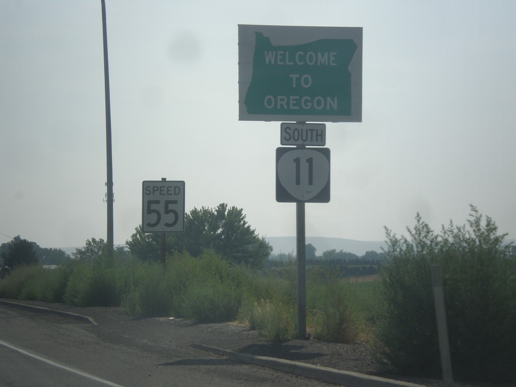
OR-11 South - Welcome To Oregon
Welcome to Oregon on OR-11 south at the Washington-Oregon state line. Also the first speed limit sign in Oregon is in the background - 55 MPH. Most Oregon speed limit signs omit the word Limit.
Taken 09-09-2017
Milton-Freewater
Umatilla County
Oregon
United States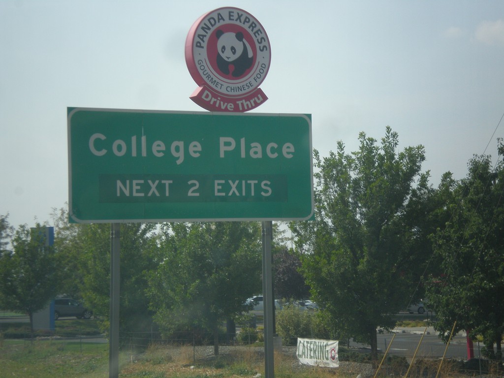
WA-125 South - College Place
College Place Next 2 Exits on WA-125 South.
Taken 09-09-2017
 College Place
Walla Walla County
Washington
United States
College Place
Walla Walla County
Washington
United States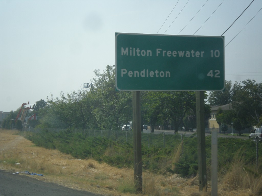
WA-125 South - Distance Marker
Distance marker on WA-125 south. Distance to Milton-Freewater (Oregon) and Pendleton (Oregon).
Taken 09-09-2017
Walla Walla
Walla Walla County
Washington
United States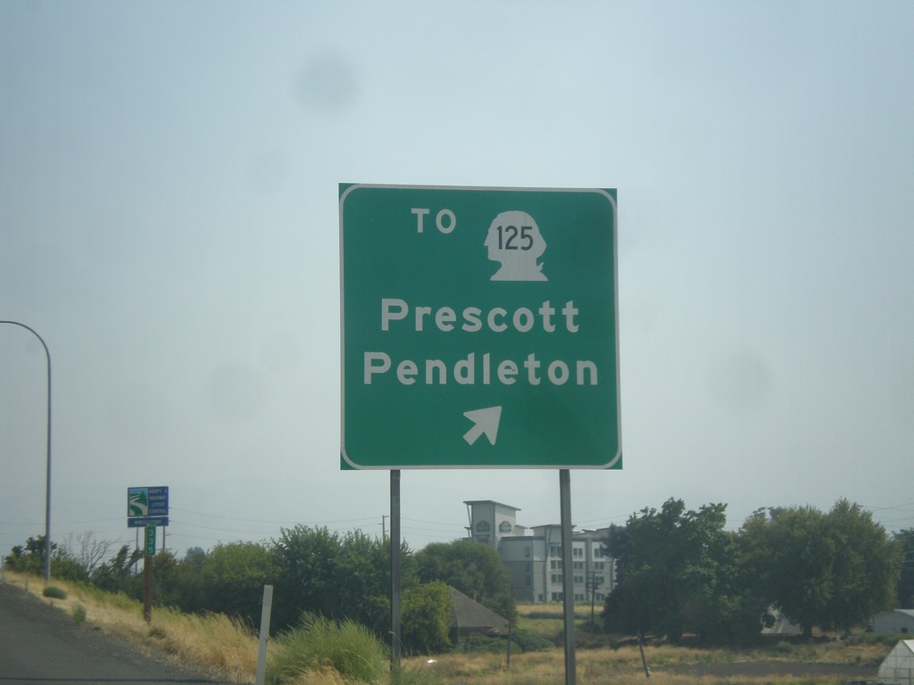
US-12 East at WA-125 Spur Jct.
US-12 East at To WA-125/Prescott/Pendleton (Oregon) interchange.
Taken 09-09-2017

 Walla Walla
 County
Washington
United States
Walla Walla
Walla Walla County
Washington
United States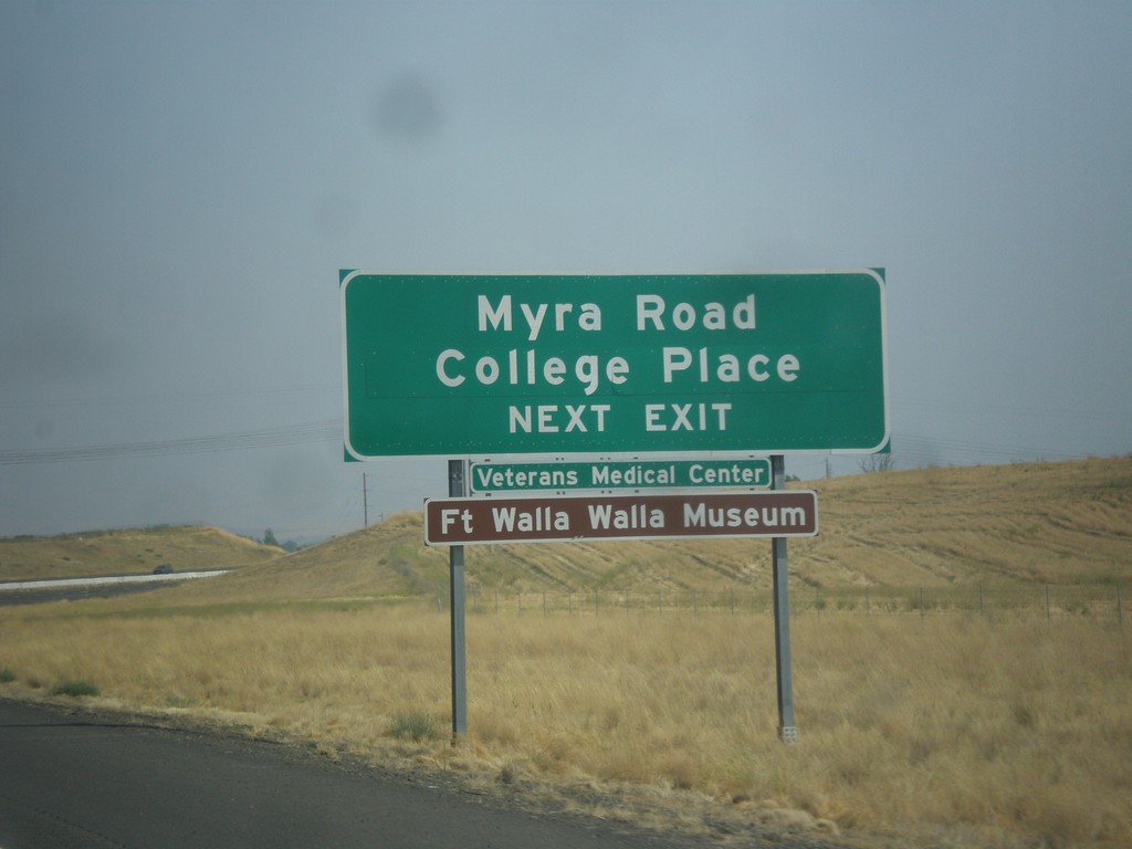
US-12 East Approaching WA-125 Jct.
US-12 East Approaching WA-125 Jct. Use WA-125 interchange for College Place, and Myra Road.
Taken 09-09-2017
Walla Walla
Walla Walla County
Washington
United States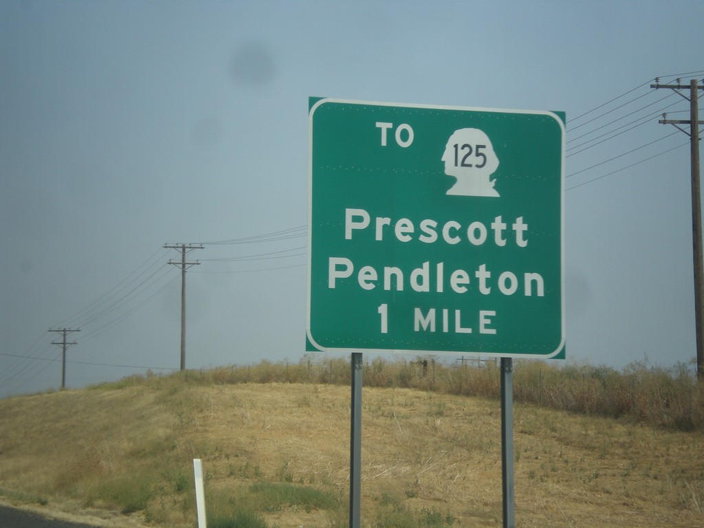
US-12 East Approaching To WA-125/Pendleton (Oregon)/Prescott.
US-12 East approaching To WA-125/Pendleton (Oregon)/Prescott.
Taken 09-09-2017
Walla Walla
Walla Walla County
Washington
United States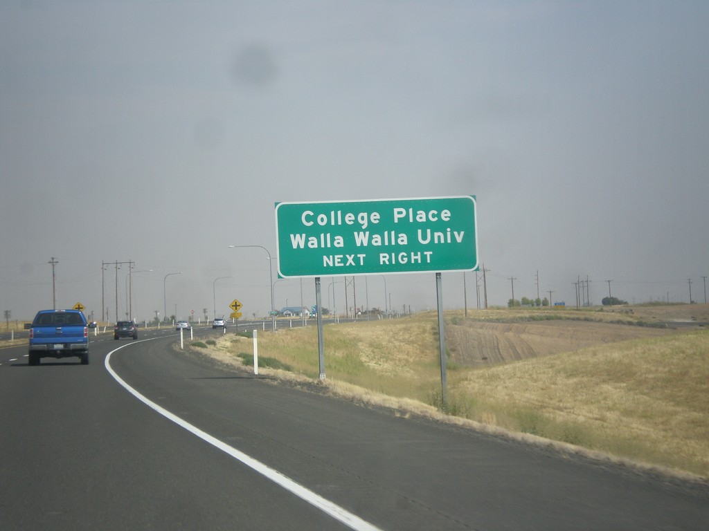
US-12 East Approaching Heritage Road
US-12 East approaching Heritage Road. Use Heritage Road for College Place and Walla Walla University.
Taken 09-09-2017
Walla Walla
Walla Walla County
Washington
United States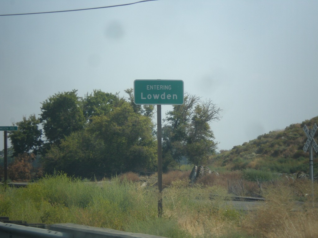
US-12 East - Entering Lowden
Entering Lowden on US-12 east. Lowden is an unincorporated community in Walla Walla County.
Taken 09-09-2017
Touchet
Walla Walla County
Washington
United States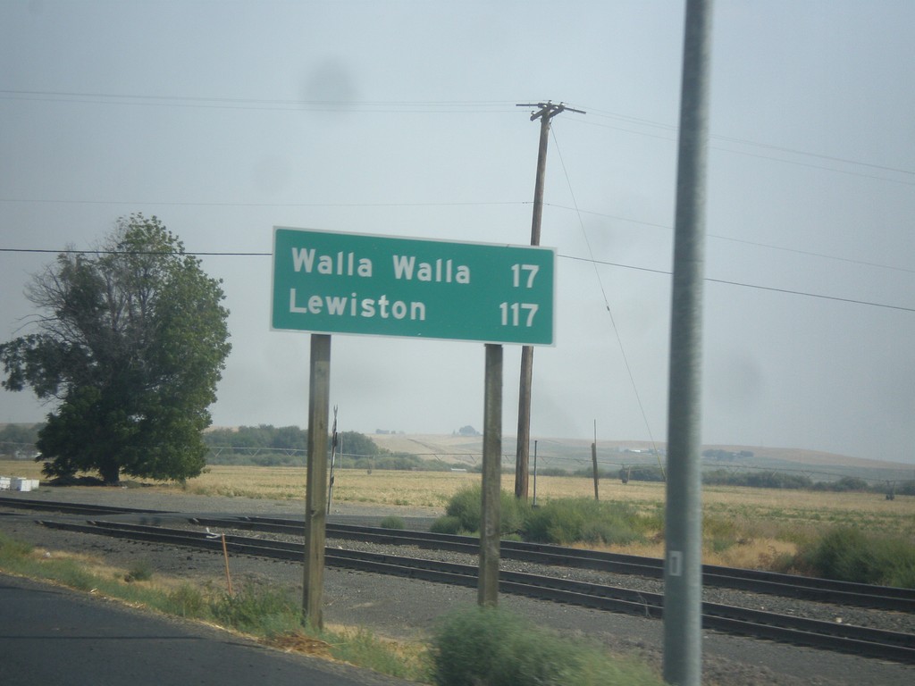
US-12 East - Distance Marker
Distance marker on US-12 east. Distance to Walla Walla and Lewiston (Idaho).
Taken 09-09-2017
Touchet
Walla Walla County
Washington
United States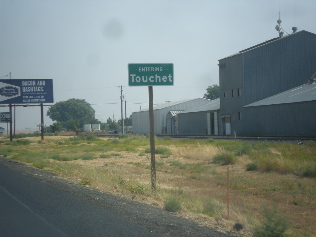
US-12 East - Entering Touchet
Entering Touchet on US-12 East.
Taken 09-09-2017
Touchet
Walla Walla County
Washington
United States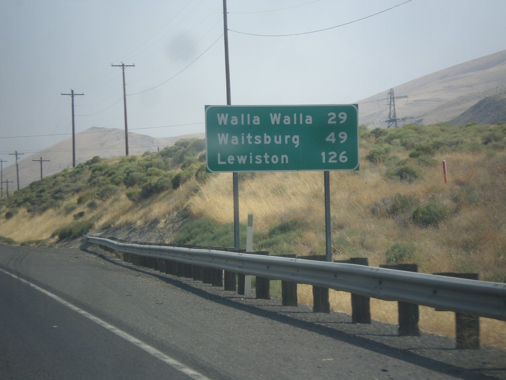
US-12 East - Distance Marker
Distance marker on US-12 east. Distance to Walla Walla, Waitsburg, and Lewiston (Idaho).
Taken 09-09-2017
Touchet
Walla Walla County
Washington
United States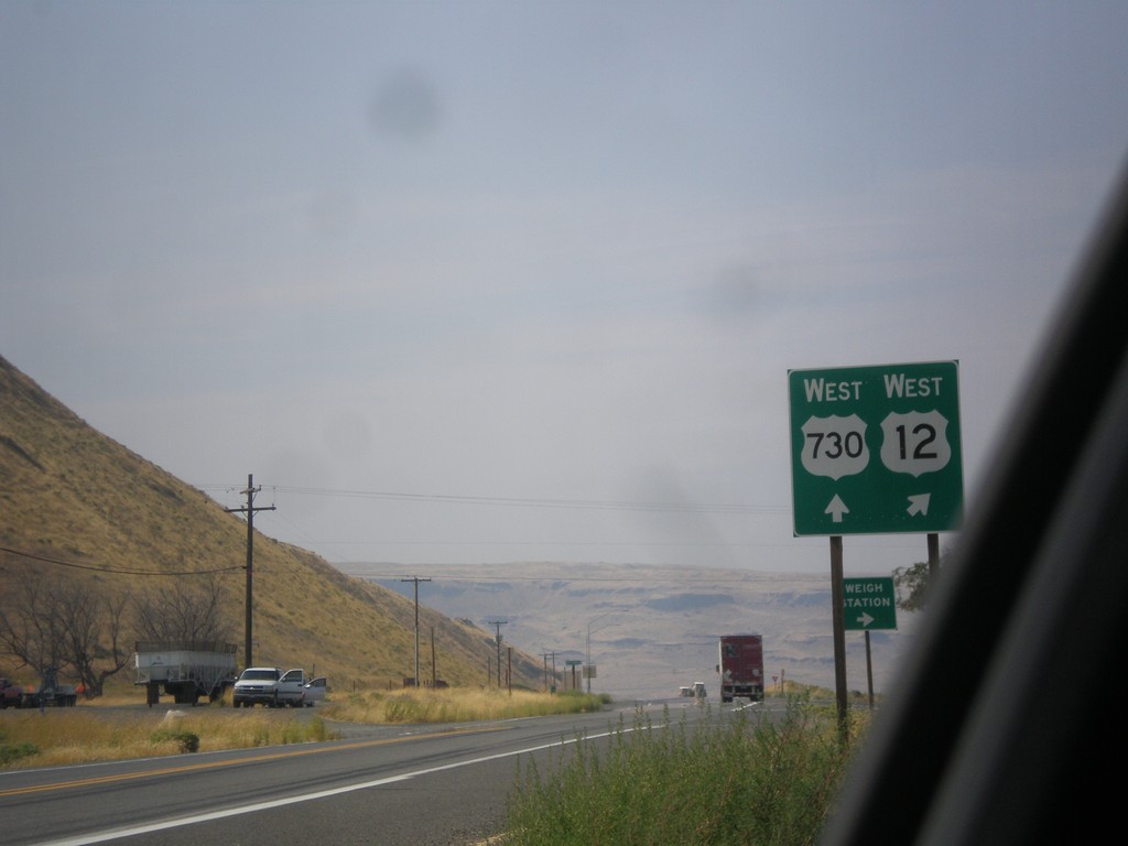
US-12 West at US-730 West
US-12 West at US-730 West in Walla Walla County. Merge right to continue west on US-12. US-730 follows the Columbia River westbound into Oregon.
Taken 09-09-2017
 Touchet
Walla Walla County
Washington
United States
Touchet
Walla Walla County
Washington
United States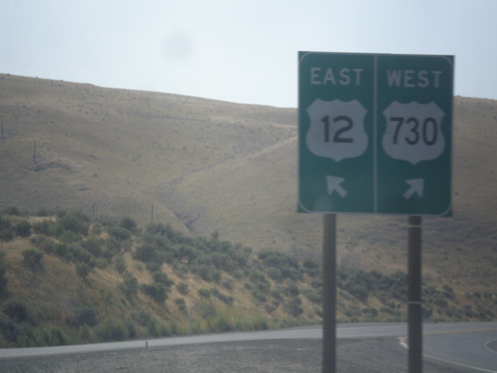
US-12 East at US-730
US-12 East at US-730. Merge right for US-730 west; left for US-12 east. This is the western end of US-730.
Taken 09-09-2017
Wallula Junction
Walla Walla County
Washington
United States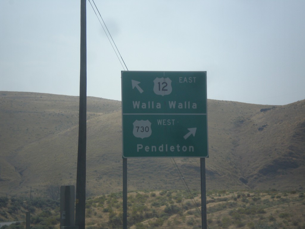
US-12 East at US-730
US-12 East at US-730. Use US-730 West to Pendleton (Oregon); US-12 East to Walla Walla.
Taken 09-09-2017
Wallula Junction
Walla Walla County
Washington
United States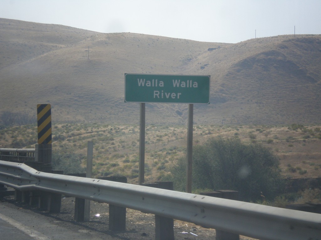
US-12 East - Walla Walla River
US-12 East at Walla Walla River bridge. The Walla Walla River flows into the Columbia River immediately west of this bridge.
Taken 09-09-2017
Burbank
Walla Walla County
Washington
United States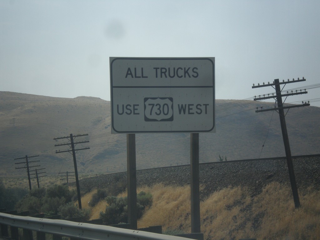
US-12 East Approaching US-730
US-12 East approaching US-730. All trucks use US-730 west, to access the Weigh Station.
Taken 09-09-2017
Burbank
Walla Walla County
Washington
United States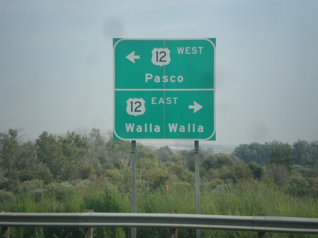
End US-730 East at US-12
End US-730 East at US-12. Turn right for US-12 east to Walla Walla; left for US-12 west to Pasco.
Taken 09-09-2017
Wallula Junction
Walla Walla County
Washington
United States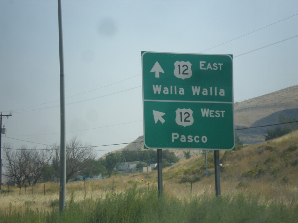
End US-730 East at US-12
End US-730 East at US-12. Merge left for US-12 west to Pasco; right for US-12 east to Walla Walla.
Taken 09-09-2017
Wallula Junction
Walla Walla County
Washington
United States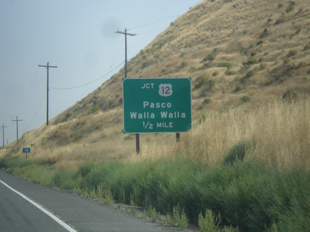
US-730 East Approaching US-12
US-730 East approaching US-12 to Pasco and Walla Walla.
Taken 09-09-2017
Wallula Junction
Walla Walla County
Washington
United States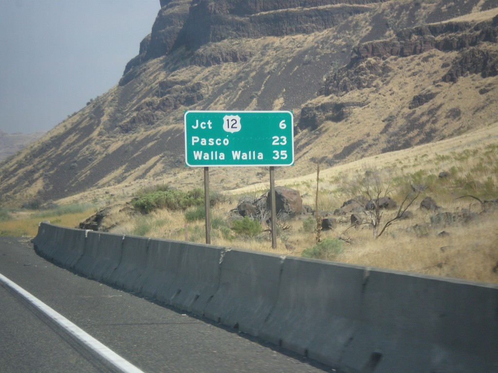
US-730 East - Distance Marker
Distance marker on US-730 east. Distance to Jct. US-12, Pasco, and Walla Walla. This is the first distance marker eastbound along US-730 east in Washington.
Taken 09-09-2017
Kennewick
Walla Walla County
Washington
United States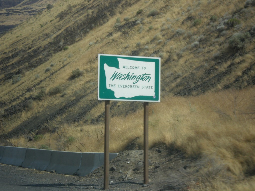
US-730 East - Welcome To Washington
Welcome To Washington on US-730 East.
Taken 09-09-2017
Kennewick
Walla Walla County
Washington
United States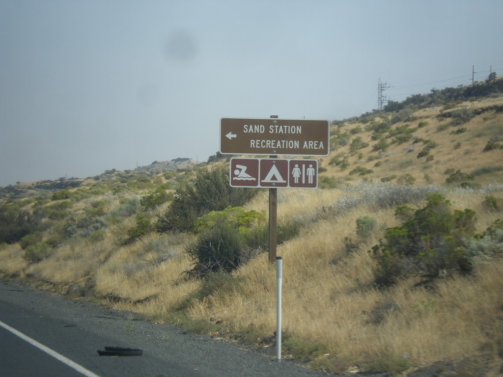
US-730 East - Sand Station Rec. Area
US-730 East at Sand Station Rec. Area on the Columbia River.
Taken 09-09-2017
Helix
Umatilla County
Oregon
United States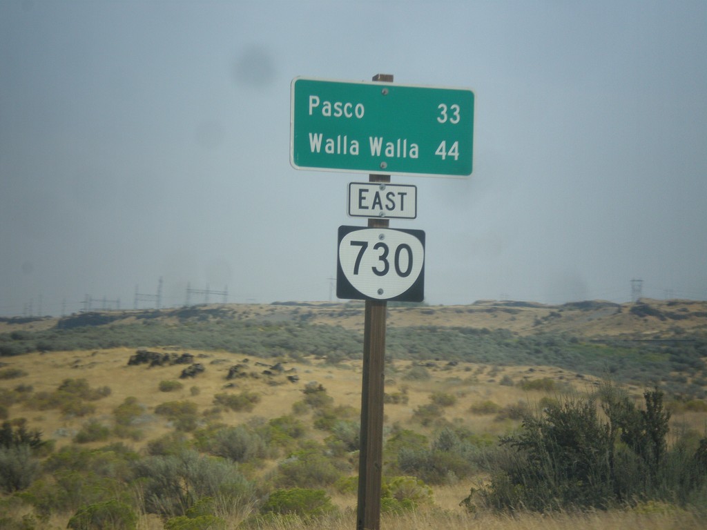
US-730 East - Distance Marker (Signed as OR-730)
Distance marker on US-730 east which is incorrectly signed as OR-730. Distance to Pasco (Washington) and Walla Walla (Washington).
Taken 09-09-2017
Hermiston
Umatilla County
Oregon
United States