Signs Tagged With Big Green Sign
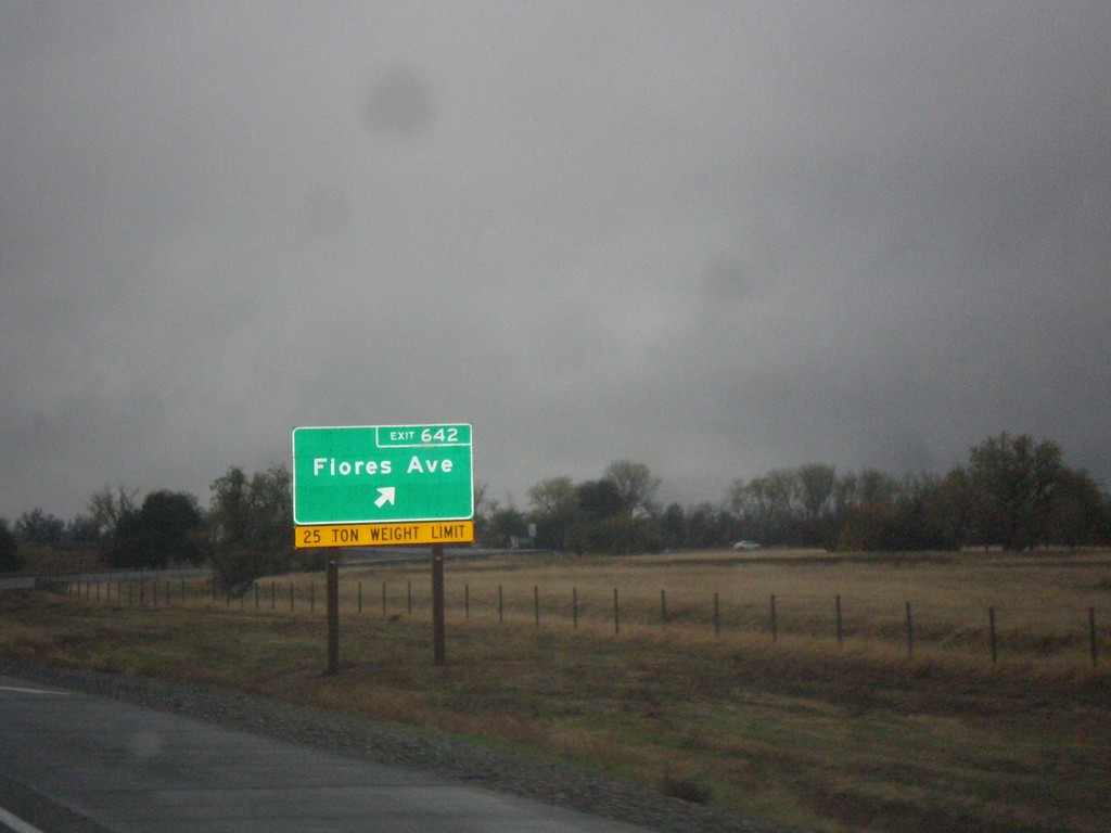
I-5 South - Exit 642
I-5 south at Exit 642 - Flores Ave.
Taken 11-20-2017
 Red Bluff
Tehama County
California
United States
Red Bluff
Tehama County
California
United States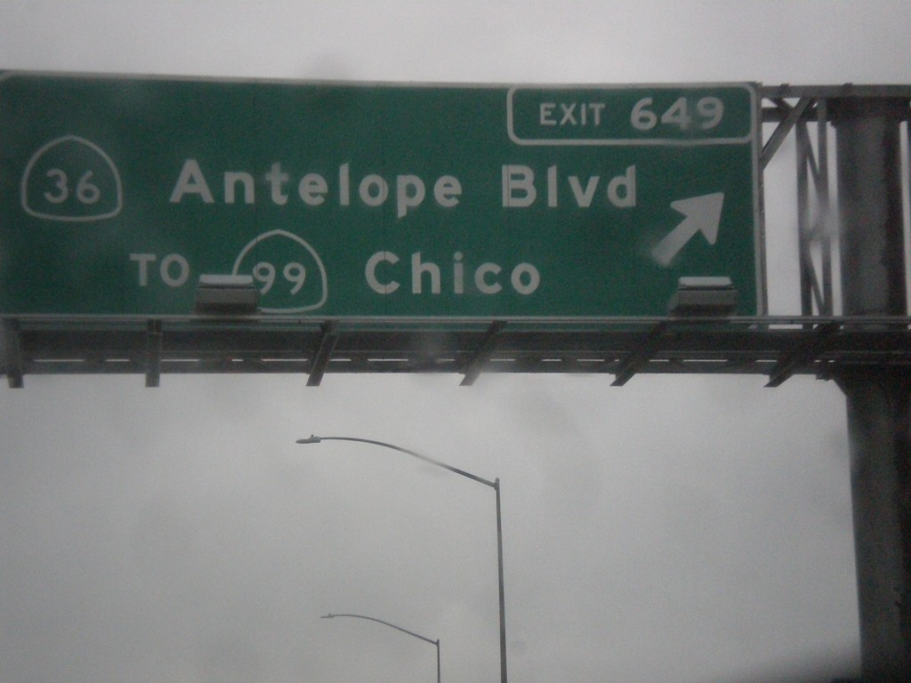
I-5 South - Exit 649
I-5 south at Exit 649 - CA-36/Antelope Blvd./To CA-99/Chico. This used to be the northern terminus of CA-99, but it was moved east of here to the CA-36 junction a few years back.
Taken 11-20-2017

 Red Bluff
Tehama County
California
United States
Red Bluff
Tehama County
California
United States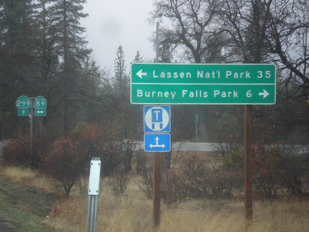
CA-299 West at CA-89
CA-299 west at CA-89 north to Burney Falls State Park, and south to Lassen National Park.
Taken 11-20-2017

 Cassel
Shasta County
California
United States
Cassel
Shasta County
California
United States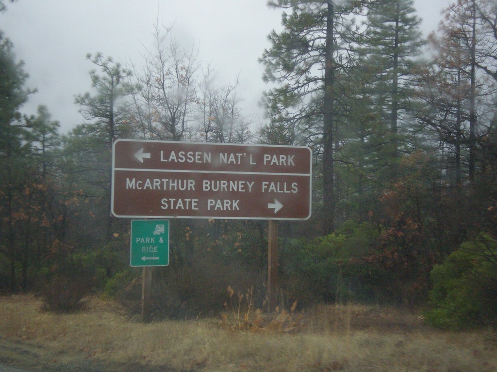
CA-299 West at CA-89
CA-299 west approaching CA-89 north to McArthur Burney Falls State Park, and south to Lassen National Park.
Taken 11-20-2017
Cassel
Shasta County
California
United States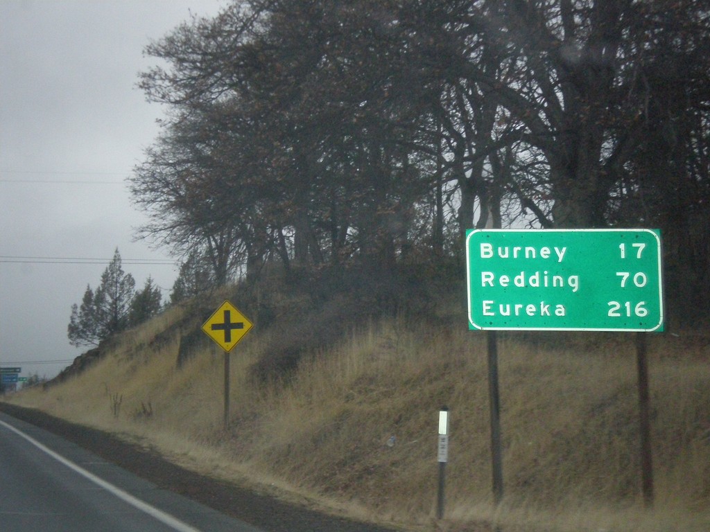
CA-299 West - Distance Marker
Distance marker on CA-299 west. Distance to Burney, Redding, and Eureka.
Taken 11-20-2017
Fall River Mills
Shasta County
California
United States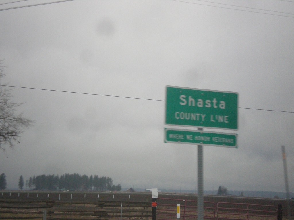
CA-299 West - Shasta County Line
Shasta County Line on CA-299 West.
Taken 11-20-2017
McArthur
Shasta County
California
United States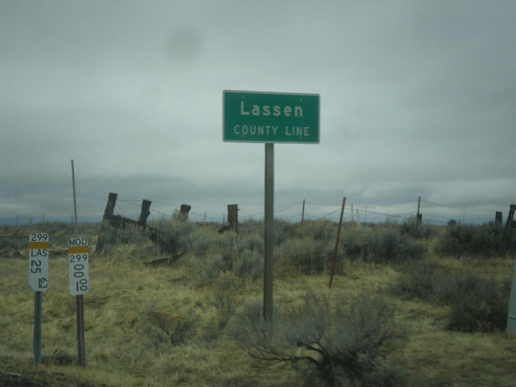
CA-299 West - Lassen County Line
Lassen County Line on CA-299 west.
Taken 11-20-2017
Adin
Modoc County
California
United States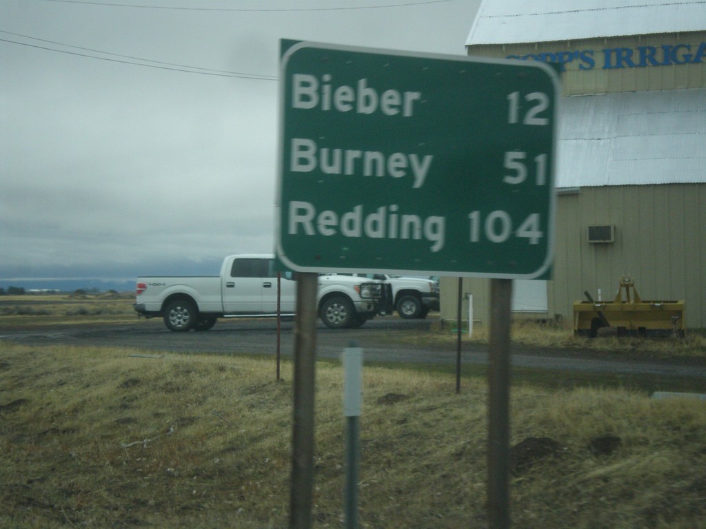
CA-299 West - Distance Marker
Distance marker on CA-299 west. Distance to Bieber, Burney, and Redding.
Taken 11-20-2017
Adin
Modoc County
California
United States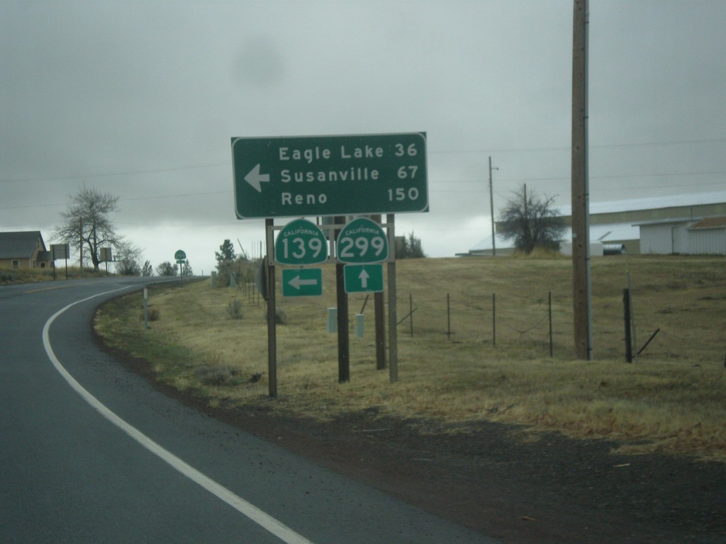
CA-139 South/CA-299 West at CA-139/CA-299 Split
CA-139 South/CA-299 West at CA-139/CA-299 Split. Turn left for CA-139 South to Eagle Lake, Susanville, and Reno (Nevada).
Taken 11-20-2017
 Adin
Modoc County
California
United States
Adin
Modoc County
California
United States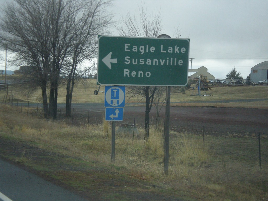
CA-139 South/CA-299 West Approaching CA-139/CA-299 Split
CA-139 South/CA-299 West Approaching CA-139/CA-299 split. Turn left for CA-139 south to Eagle Lake, Susanville, and Reno (Nevada).
Taken 11-20-2017
Adin
Modoc County
California
United States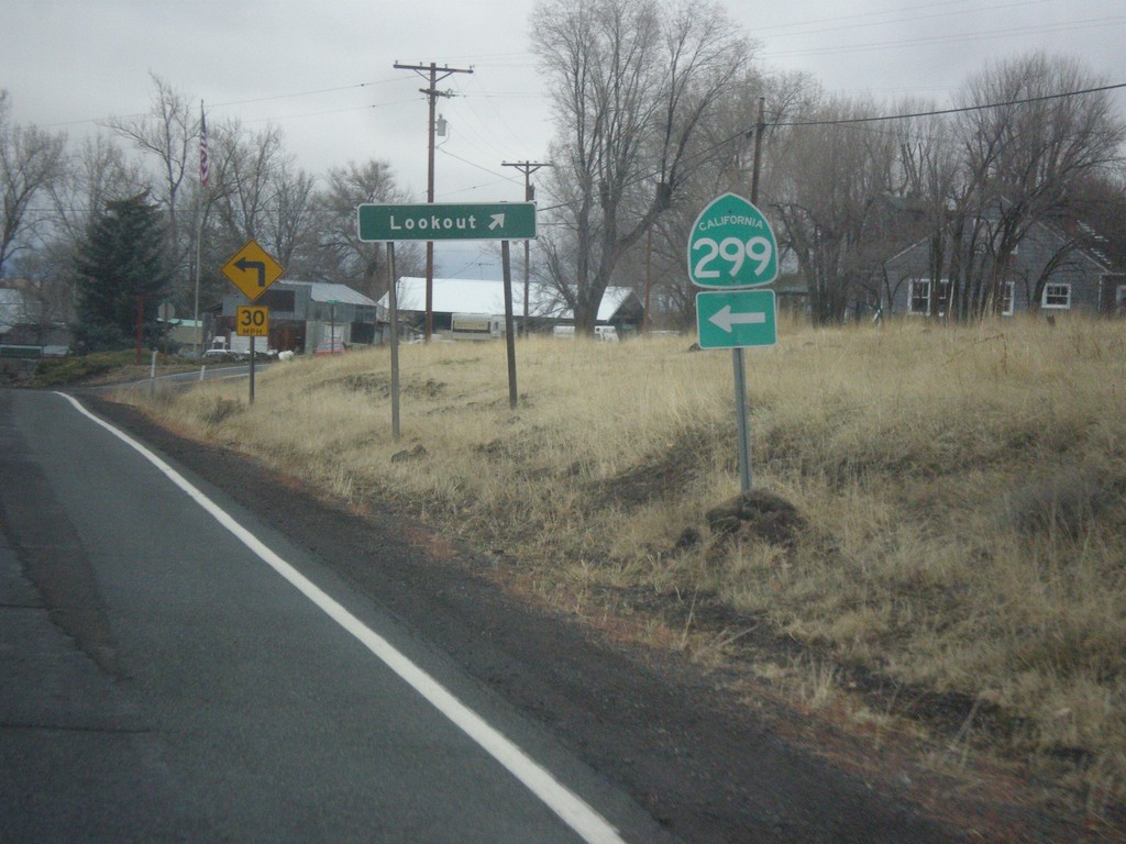
CA-139 South/CA-299 West - Lookout Jct.
CA-139 South/CA-299 West at Lookout Jct. Merge left to continue west on CA-299 (and south on CA-139).
Taken 11-20-2017
Adin
Modoc County
California
United States
CA-139 South/CA-299 West - Distance Marker
Distance Marker on CA-139 South/CA-299 West. Distance to Adin, Susanville (via CA-139), and Redding (via CA-299).
Taken 11-20-2017
Canby
Modoc County
California
United States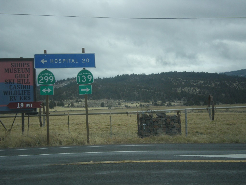
CA-139 South at CA-299
CA-139 South at CA-299. Turn left for CA-299 East and Hospital (in Alturas); turn right for CA-299 West/CA-139 South. CA-139 joins CA-299 west to Adin.
Taken 11-20-2017
Canby
Modoc County
California
United States
CA-139 South at CA-299
CA-139 South at CA-299. Turn left for CA-299 east to Alturas; right for CA-299 West/CA-139 South to Susanville.
Taken 11-20-2017
Canby
Modoc County
California
United States
CA-139 South Approaching CA-299
CA-139 South approaching CA-299 to Susanville and Alturas.
Taken 11-20-2017
Canby
Modoc County
California
United States
CA-139 South Approaching Inspection Station
CA-139 south approaching the Tulelake Agricultural Inspection Station.
Taken 11-20-2017
Tulelake
Modoc County
California
United States
CA-139 South - Distance Marker
Distance marker on CA-139 south. Distance to Canby, Alturas, and Susanville.
Taken 11-20-2017
Tulelake
Modoc County
California
United States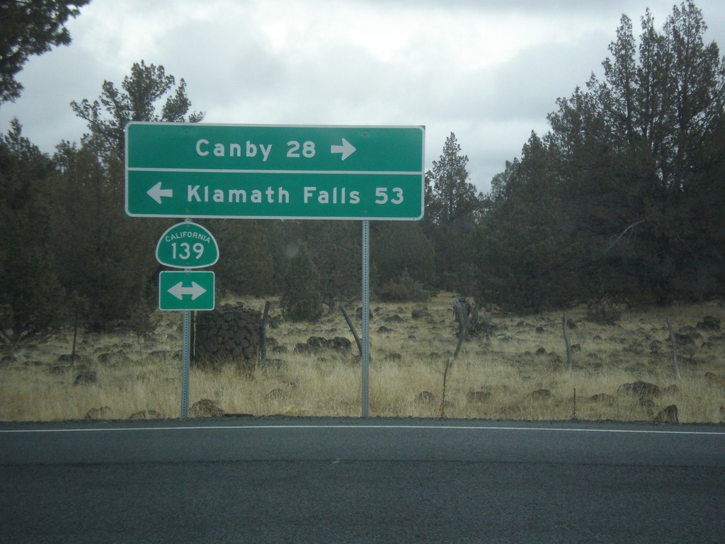
Forest Road 97 at CA-139
Forest Road 97 at CA-139 in Modoc County. Turn right for CA-139 south to Canby; left for CA-139 north to Klamath Falls (Oregon).
Taken 11-20-2017
Perez
Modoc County
California
United States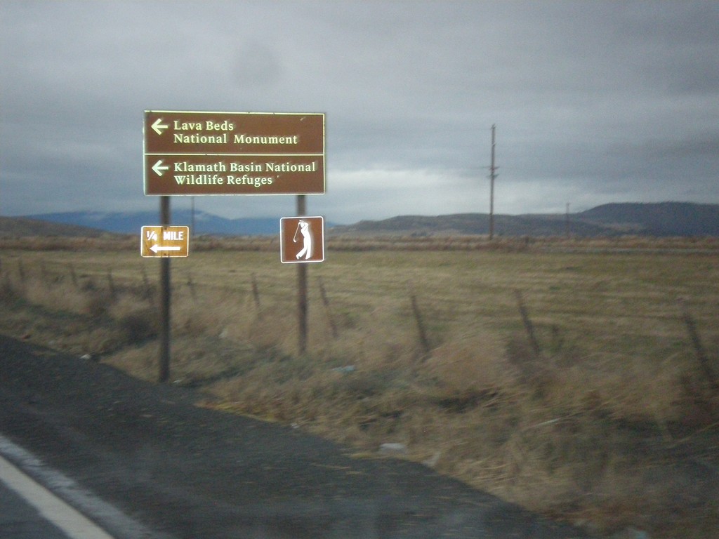
CA-161 West at Hill Road
CA-161 West at Hill Road. Turn left for Hill Road south to Lava Beds National Monument and Klamath Basin National Wildlife Refuge.
Taken 11-20-2017
 Ainsworth Corner
Klamath County
Oregon
United States
Ainsworth Corner
Klamath County
Oregon
United States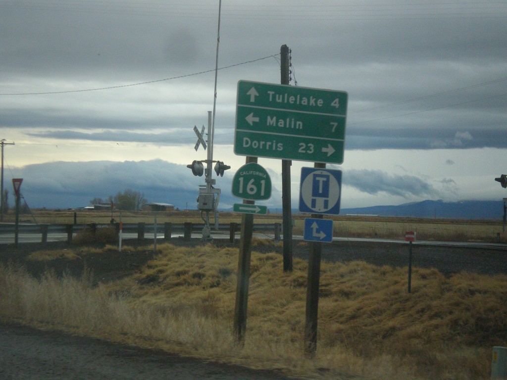
OR-39 South at CA-139 and CA-161
OR-39 south at CA-139 and CA-161. Turn right for CA-161 West to Dorris (California). Turn left on State Line Road to Malin (Oregon). Continue straight on CA-139 south to Tulelake (California). The California-Oregon state line runs along the CA-161 and State Line Road. OR-39 becomes CA-139 at the state line.
Taken 11-20-2017
 Merrill
Klamath County
Oregon
United States
Merrill
Klamath County
Oregon
United States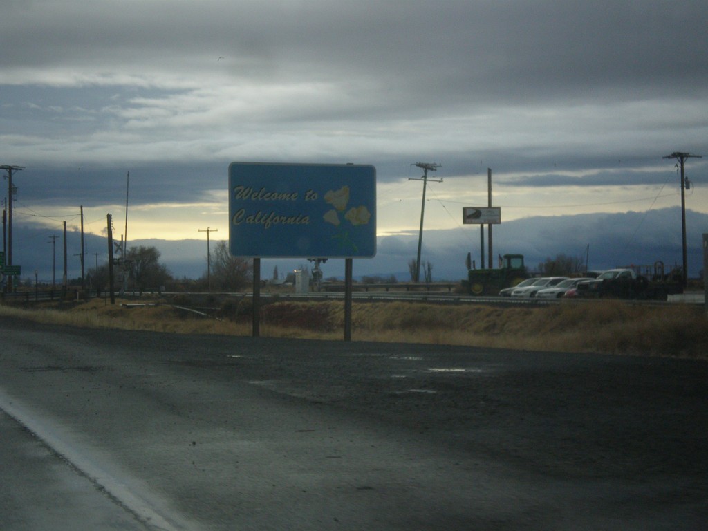
OR-39 South - Welcome To California
Welcome to California on OR-39 south. The Welcome to California sign is north of the Oregon-California line which runs along CA-161.
Taken 11-20-2017
Merrill
Klamath County
Oregon
United States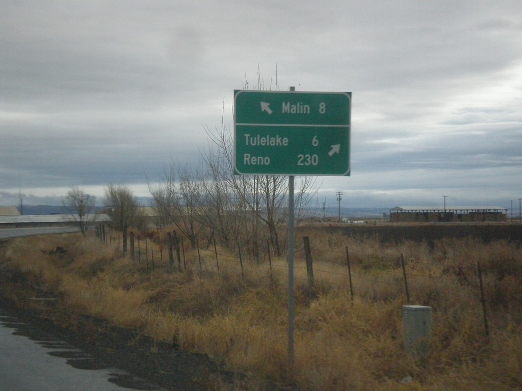
OR-39 South at Malin Jct.
OR-39 South at Malin Jct. Turn right to continue south on OR-39 for Tulelake (California) and Reno (Nevada). Continue ahead to for Malin. The Klamath Falls-Malin Highway continues towards Malin. OR-39 follows the Hatfield highway southbound.
Taken 11-20-2017
Merrill
Klamath County
Oregon
United States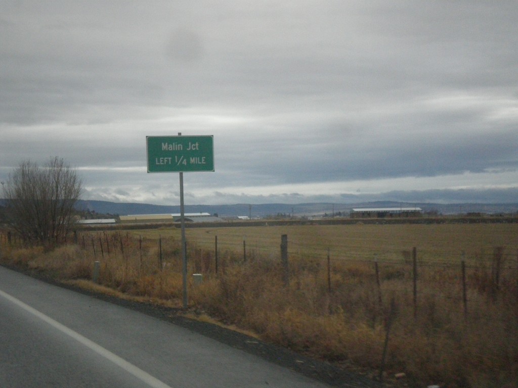
OR-39 South - Malin Jct.
OR-39 South approaching Malin Jct.
Taken 11-20-2017
Merrill
Klamath County
Oregon
United States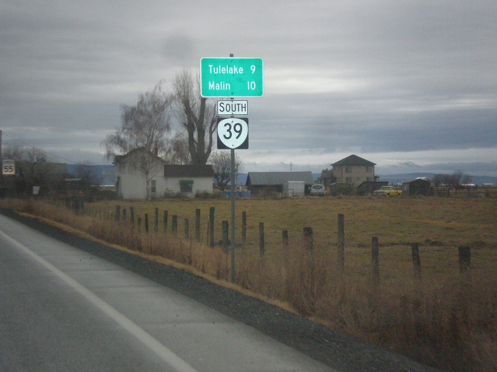
OR-39 South - Distance Marker
Distance marker on OR-39 south. Distance to Malin and Tulelake (California).
Taken 11-20-2017
Merrill
Klamath County
Oregon
United States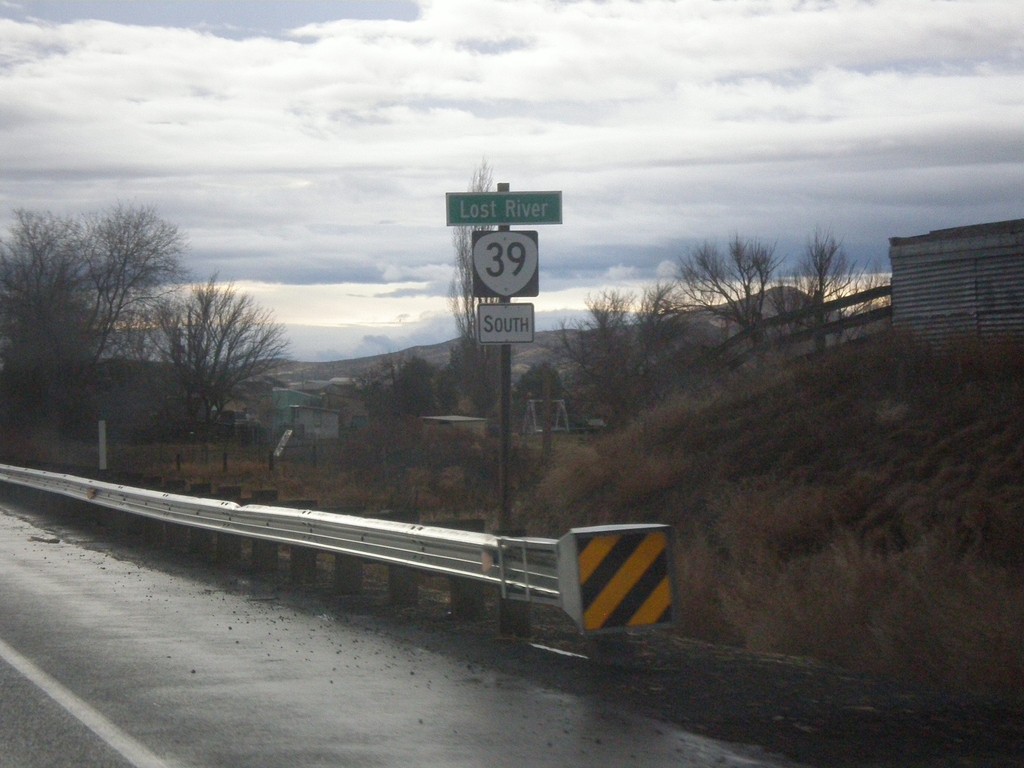
OR-39 South - Lost River
Lost River on OR-39 south.
Taken 11-20-2017
Klamath Falls
Klamath County
Oregon
United States