Signs Tagged With Big Green Sign
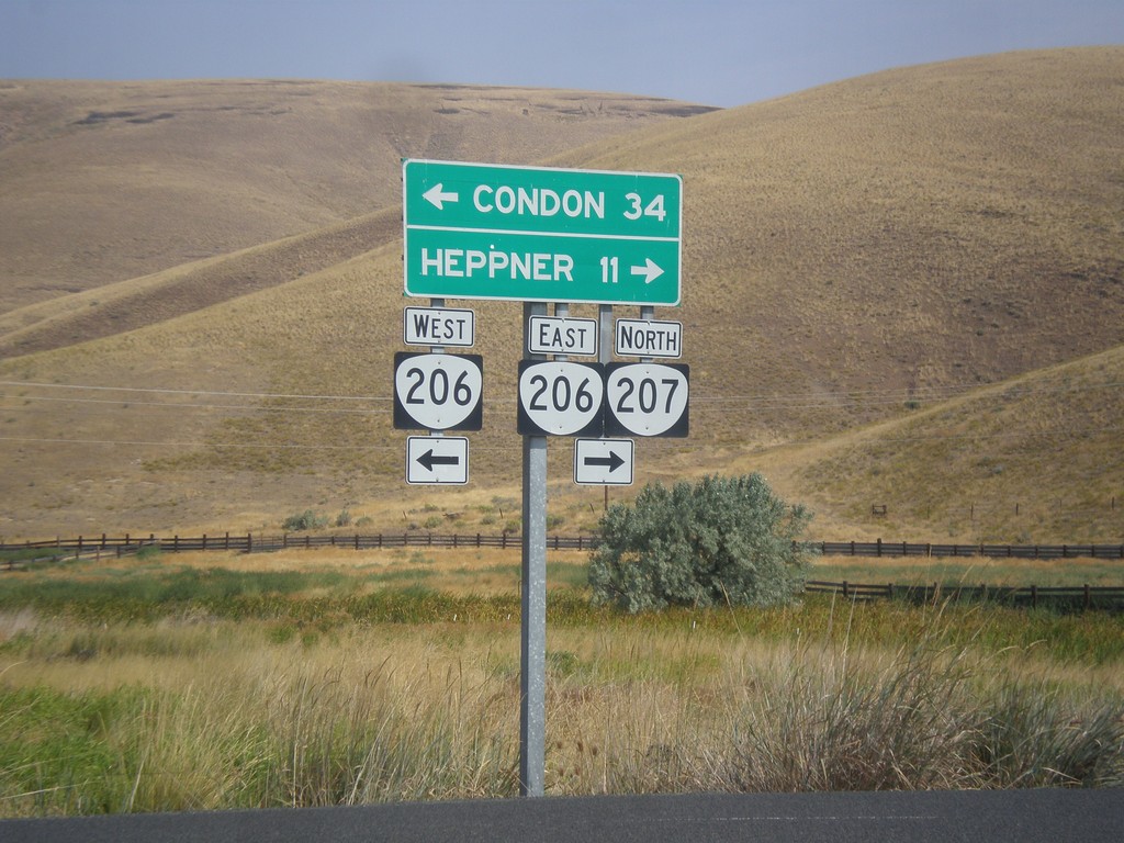
OR-207 North at OR-206
OR-207 North at OR-206 in Ruggs. Turn left for OR-206 West to Condon; turn right for OR-206 East/OR-207 North to Heppner. OR-207 joins OR-206 east to Heppner.
Taken 09-09-2017

 Heppner
Morrow County
Oregon
United States
Heppner
Morrow County
Oregon
United States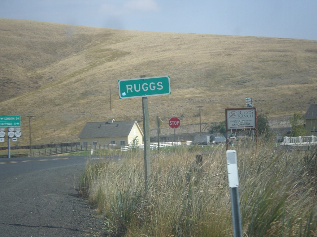
OR-207 North - Ruggs
Entering Ruggs on OR-207 north. Ruggs is a community along the junction of OR-207 and OR-206.
Taken 09-09-2017
Heppner
Morrow County
Oregon
United States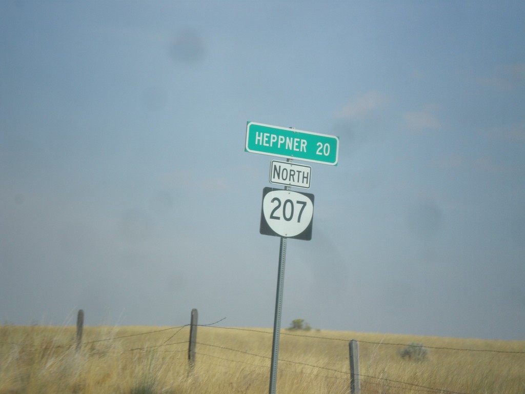
OR-207 North - Distance Marker
Distance marker on OR-207 north. Distance to Heppner.
Taken 09-09-2017
Heppner
Morrow County
Oregon
United States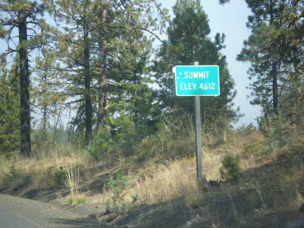
OR-207 North - Summit
Summit on OR-207 north - Elevation 4612 Feet.
Taken 09-09-2017
Spray
Wheeler County
Oregon
United States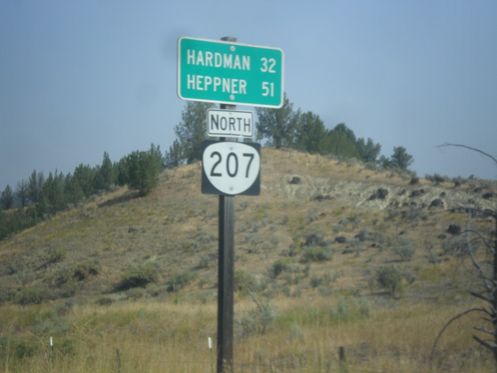
OR-207 North - Distance Marker
Distance marker on OR-207 north. Distance to Hardman and Heppner.
Taken 09-09-2017
Spray
Wheeler County
Oregon
United States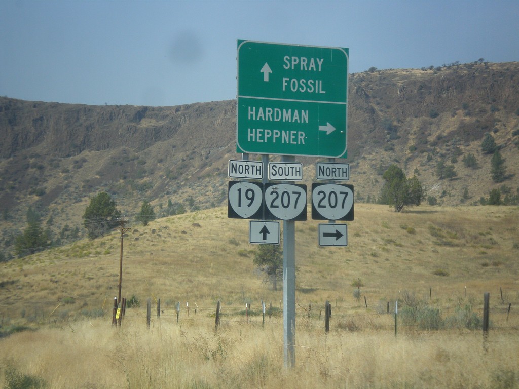
OR-19 North at OR-207 North
OR-19 North at OR-207 north near Spray. Use OR-207 north to Hardman and Heppner. Continue north on OR-19 and south on OR-207 to Spray and Fossil. OR-207 south joins OR-19 north to Service Creek.
Taken 09-09-2017
 Spray
Wheeler County
Oregon
United States
Spray
Wheeler County
Oregon
United States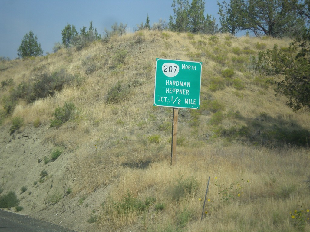
OR-19 North Approaching OR-207
OR-19 North approaching OR-207 north to Hardman and Heppner.
Taken 09-09-2017
Spray
Wheeler County
Oregon
United States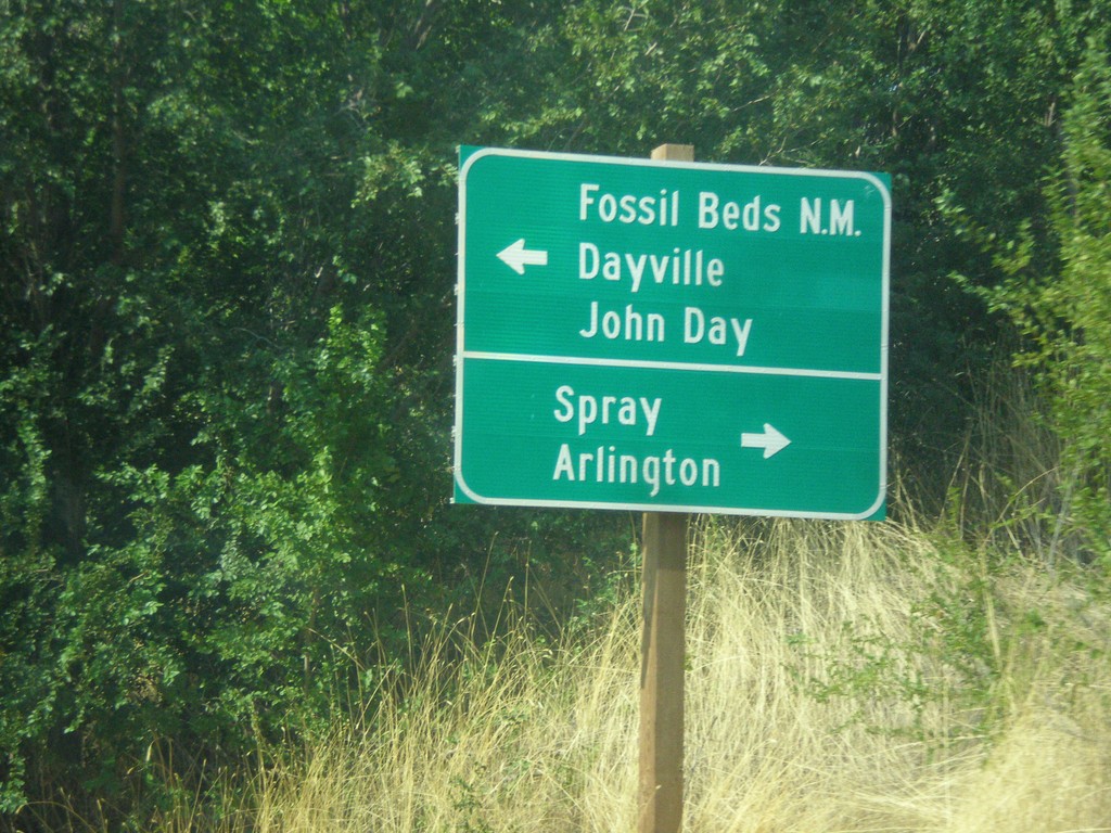
End OR-402 West at OR-19
End OR-402 West at OR-19 in Kimberly. Use OR-19 north for Spray and Arlington; OR-19 south for (John Day) Fossil Beds National Monument, Dayville, and John Day.
Taken 09-09-2017
 Kimberly
Grant County
Oregon
United States
Kimberly
Grant County
Oregon
United States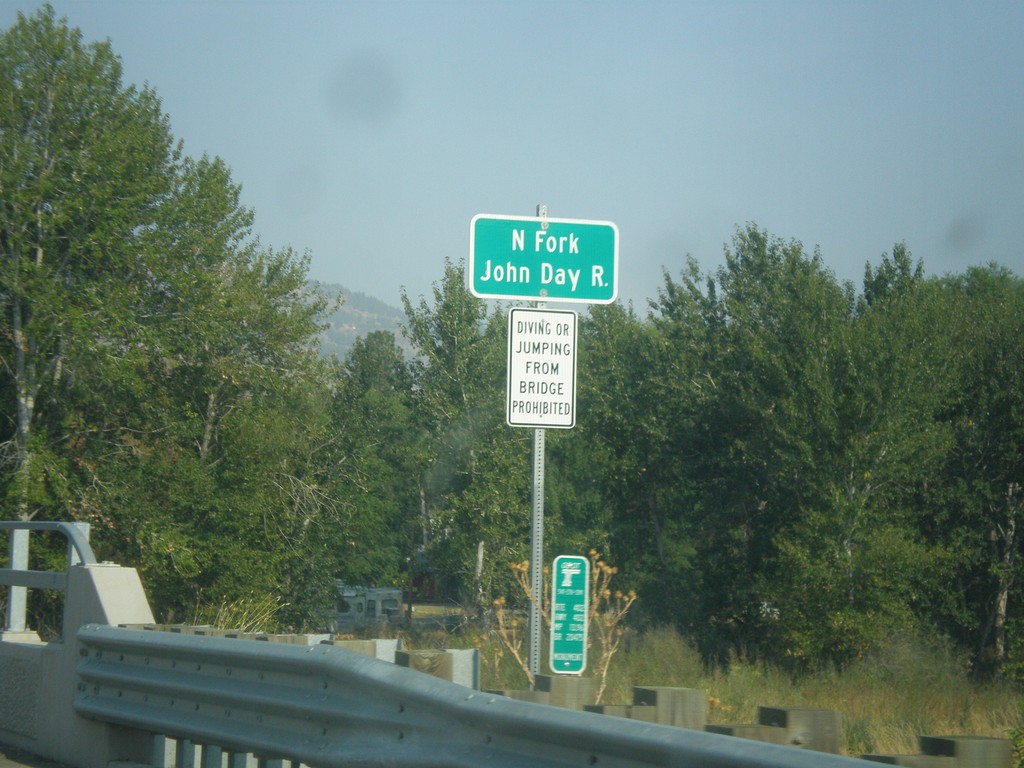
OR-402 West - North Fork John Day River
North Fork John Day River bridge on OR-402 west in Monument.
Taken 09-09-2017
Monument
Grant County
Oregon
United States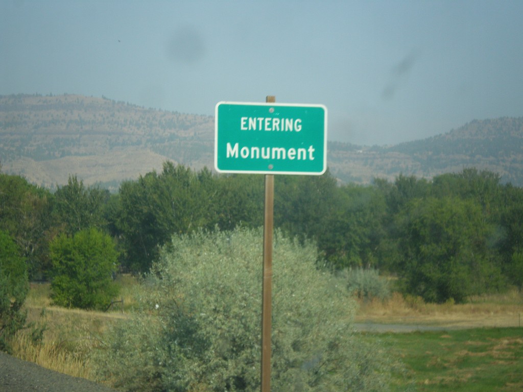
OR-402 West - Monument
Entering Monument on OR-402 west.
Taken 09-09-2017
Monument
Grant County
Oregon
United States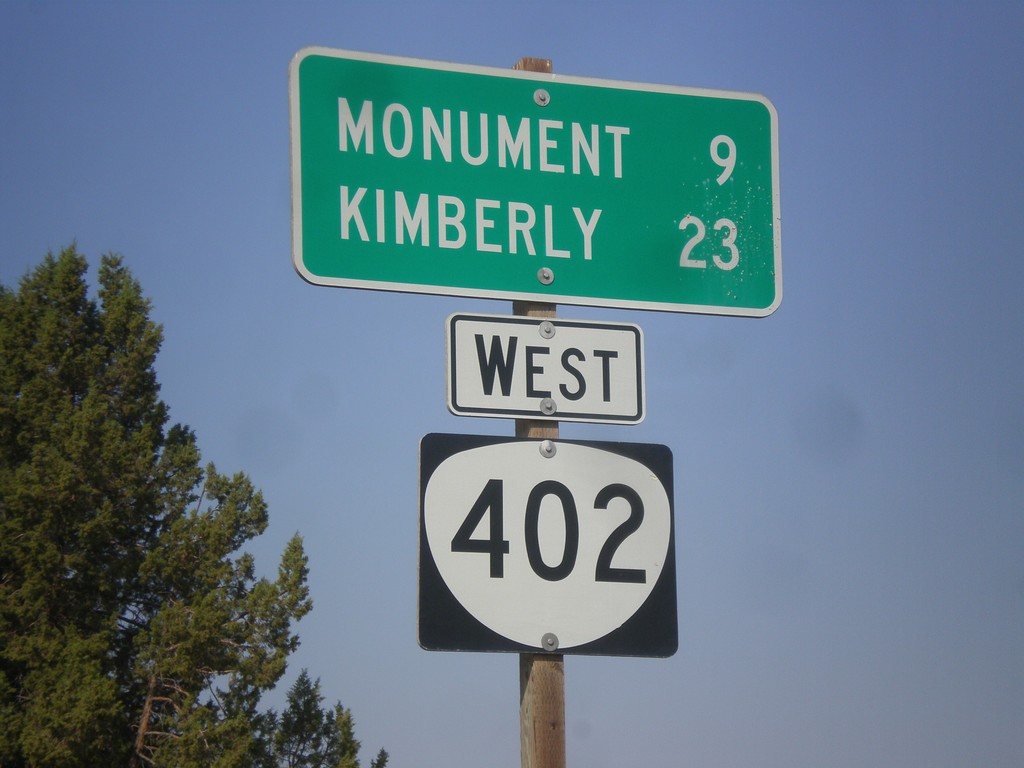
OR-402 West - Distance Marker
Distance marker on OR-402 west. Distance to Monument and Kimberly.
Taken 09-09-2017
Hamilton
Grant County
Oregon
United States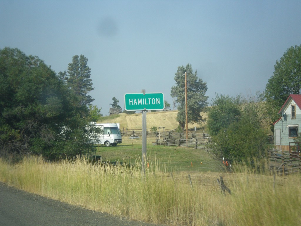
OR-402 West - Hamilton
Entering Hamilton on OR-402 west.
Taken 09-09-2017
Long Creek
Grant County
Oregon
United States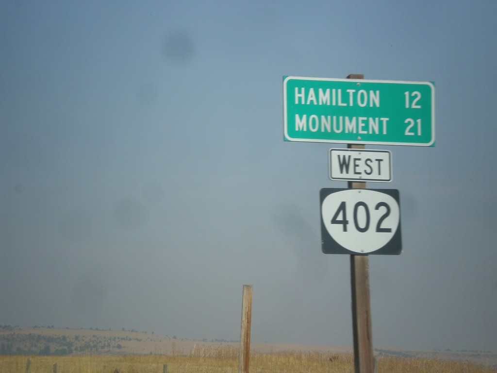
OR-402 West - Distance Marker
Distance marker on OR-402 west. Distance to Hamilton and Monument.
Taken 09-09-2017
Long Creek
Grant County
Oregon
United States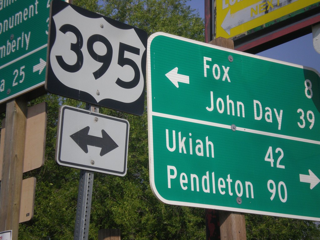
East Main St. at US-395/OR-402 in Long Creek
East Main St. at US-395/OR-402 in Long Creek. Turn left for US-395 north to Ukiah and Pendleton. Turn left for US-395 south to Fox and John Day.
Taken 09-09-2017
 Long Creek
Grant County
Oregon
United States
Long Creek
Grant County
Oregon
United States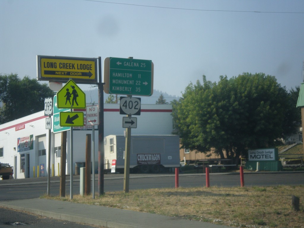
US-395 South at OR-402 West
US-395 south at OR-402 west to Hamilton, Monument, and Kimberly. Turn left for forest road east to Galena on the Middle Fork John Day River.
Taken 09-09-2017
Long Creek
Grant County
Oregon
United States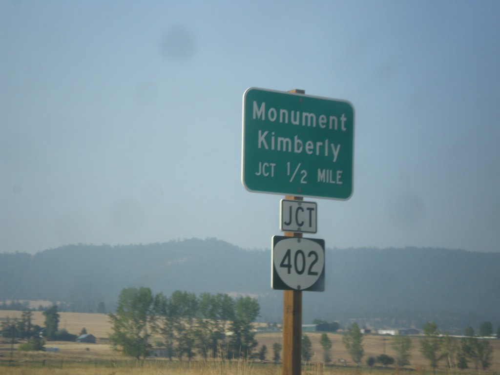
US-395 South Approaching OR-402
US-395 South approaching OR-402 in Long Creek. Use OR-402 west for Monument and Kimberly.
Taken 09-09-2017
Long Creek
Grant County
Oregon
United States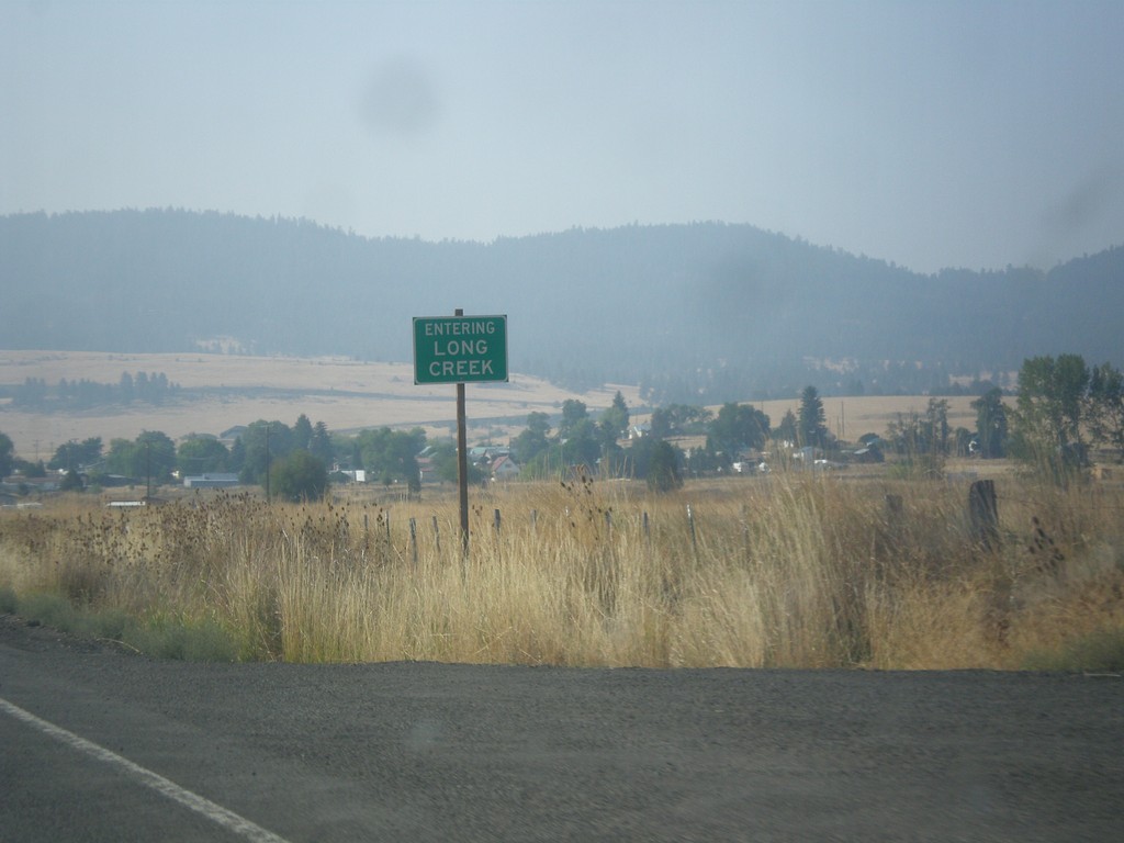
US-395 South - Entering Long Creek
Entering Long Creek on US-395 south.
Taken 09-09-2017
Long Creek
Grant County
Oregon
United States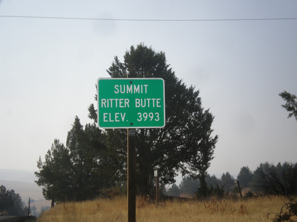
US-395 South - Ritter Butte Summit
US-395 South - Summit Ritter Butte - Elevation 3993 Feet.
Taken 09-09-2017
Ritter
Grant County
Oregon
United States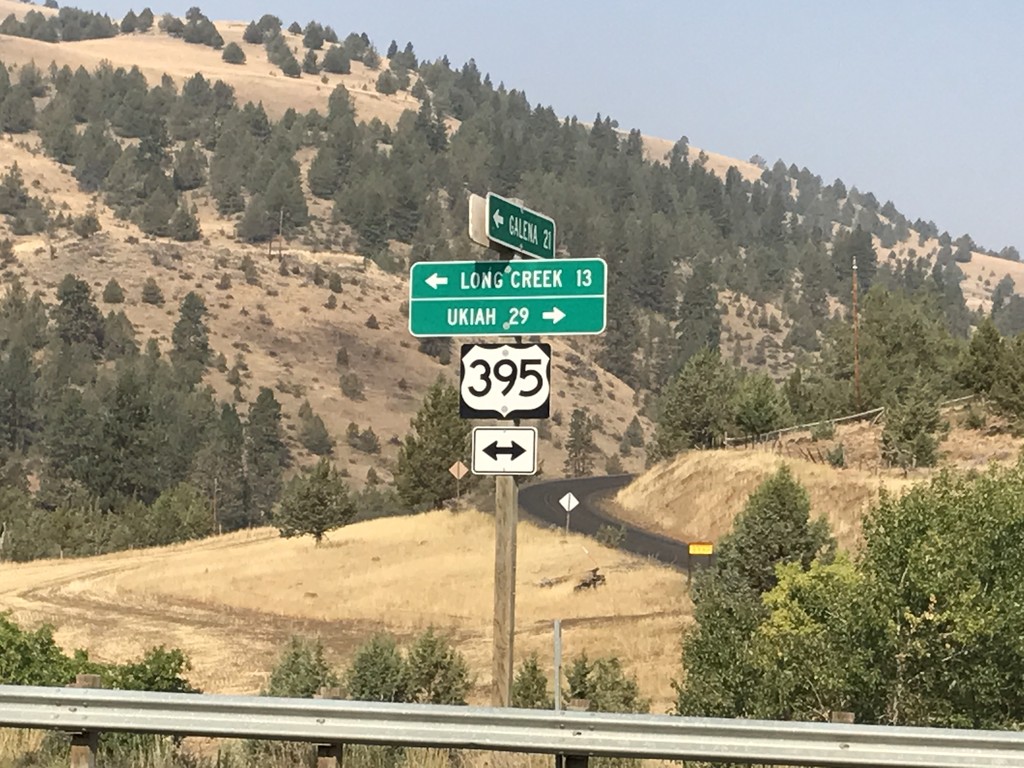
Middle Fork John Day River Road at US-395
Middle Fork John Day River Road at US-395 in Grant County. Turn left for US-395 south to Long Creek; left for US-395 north to Ukiah.
Taken 09-09-2017
Long Creek
Grant County
Oregon
United States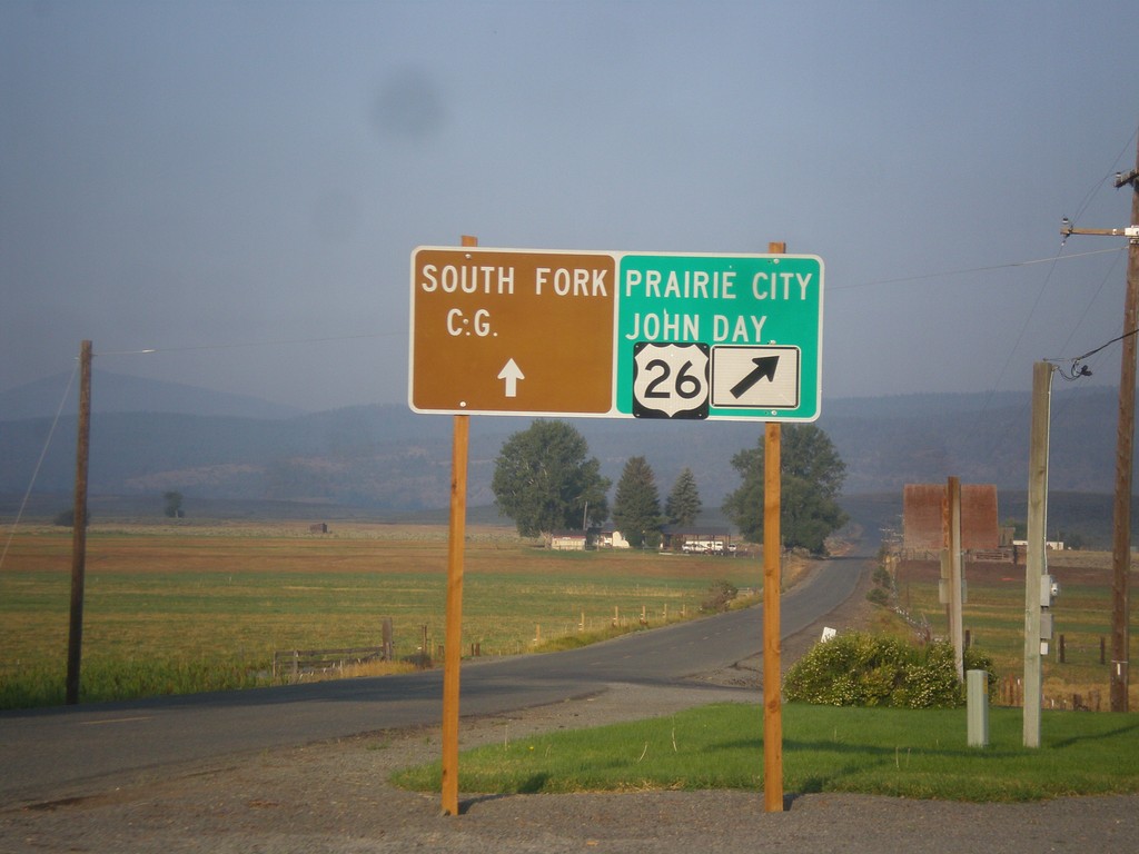
US-26 West - Burnt River Lane
US-26 West at Burnt River Lane in Unity. Merge left for South Fork (Burnt River) Campground. Merge right for US-26 west to Prairie City and John Day.
Taken 09-09-2017
 Unity
Baker County
Oregon
United States
Unity
Baker County
Oregon
United States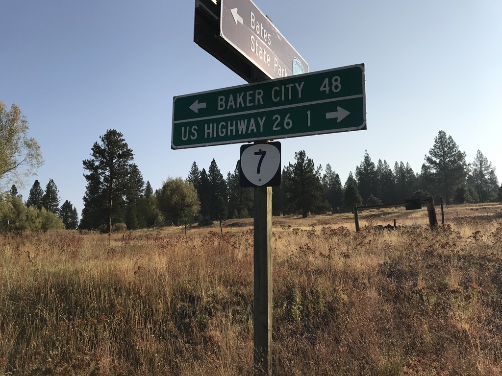
End Middle Fork John Day River Road at OR-7
End Middle Fork John Day River Road at OR-7 in Grant County. Use OR-7 west for US-26 Jct; OR-7 east for Baker City.
Taken 09-09-2017
 Austin
Grant County
Oregon
United States
Austin
Grant County
Oregon
United States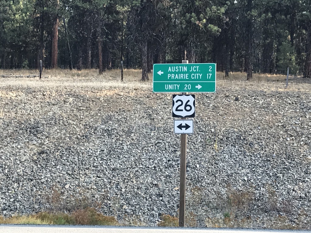
Forest Service Road at US-26
Forest Service Road at US-26 in Grant County. Turn right for US-26 east to Unity; left for US-26 west to Austin Jct. and Prairie City.
Taken 09-09-2017
Austin
Grant County
Oregon
United States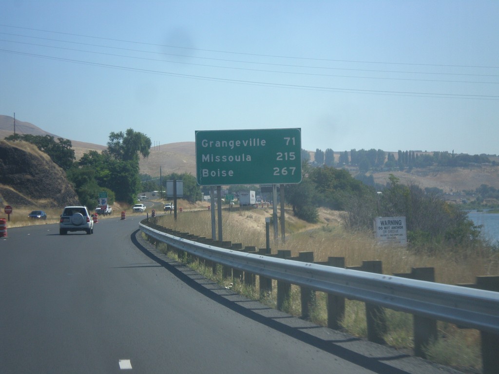
US-12 East/US-95 South - Distance Marker
Distance marker on US-95 South/US-12 East to Grangeville, Missoula (MT - via US-12), and Boise.
Taken 07-30-2017

 Lewiston
Nez Perce County
Idaho
United States
Lewiston
Nez Perce County
Idaho
United States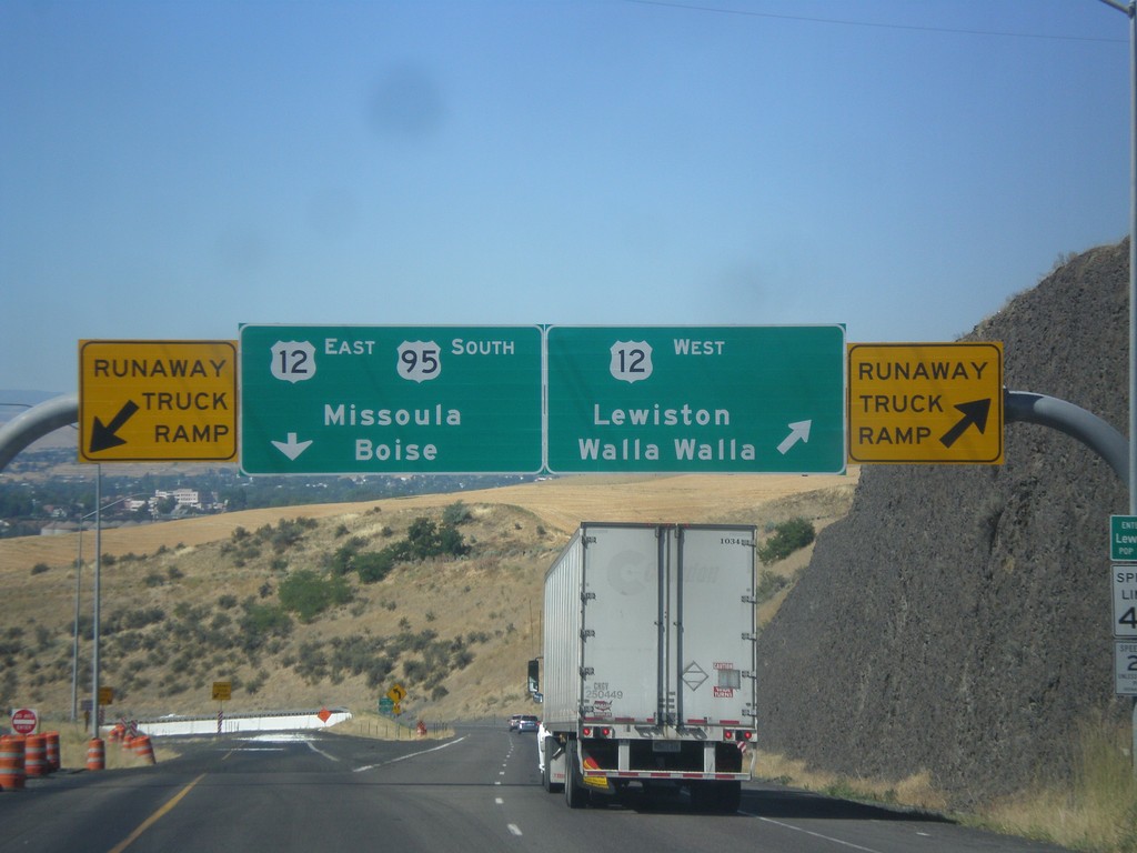
US-95 South at US-12
US-95 south at US-12 junction. Merge right for US-12 West/Lewiston/Walla Walla (Washington). Use left lane for US-95 South/US-12 East/Missoula (Montana)/Boise. Use either lane for access to Runaway Truck Ramps.
Taken 07-30-2017
Lewiston
Nez Perce County
Idaho
United States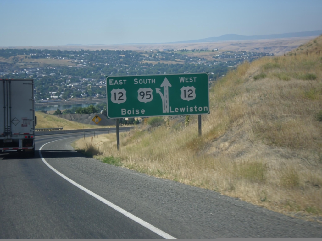
US-95 South Approaching US-12
US-95 south approaching US-12. Use right lane for US-12 west to Lewiston; left lane for US-95 South/US-12 East to Boise.
Taken 07-30-2017
Lewiston
Nez Perce County
Idaho
United States