Signs Tagged With Big Green Sign
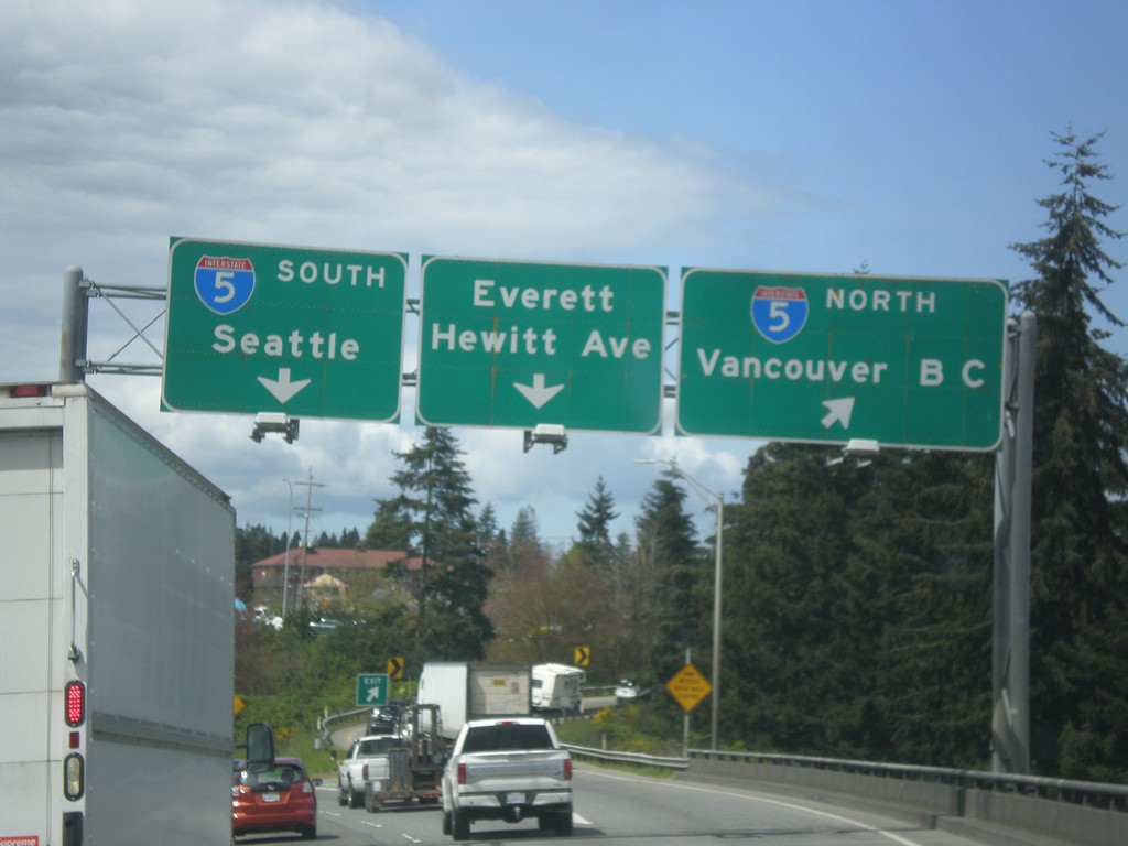
End US-2 West at I-5
End US-2 West at I-5 in Everett. Use I-5 north to Vancouver BC and I-5 south to Seattle. Continue straight for Everett/Hewitt Ave.
Taken 04-28-2017

 Everett
Snohomish County
Washington
United States
Everett
Snohomish County
Washington
United States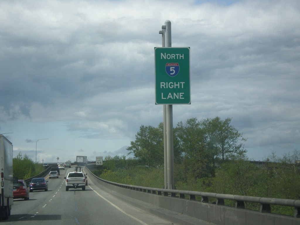
US-2 West Approaching I-5
US-2 west approaching I-5 in Everett.
Taken 04-28-2017
Everett
Snohomish County
Washington
United States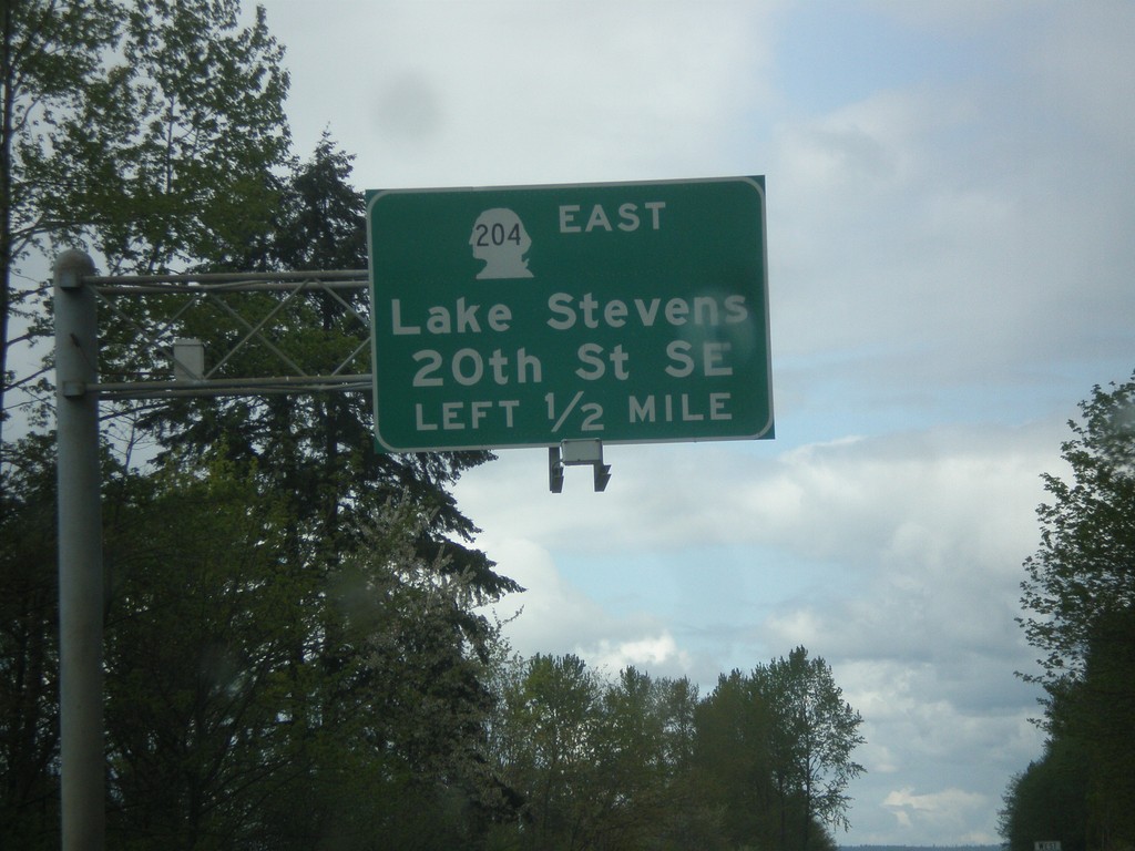
US-2 West - WA-204 East Interchange
US-2 West approaching WA-204 East/Lake Stevens/20th St SE interchange.
Taken 04-28-2017
 Lake Stevens
Snohomish County
Washington
United States
Lake Stevens
Snohomish County
Washington
United States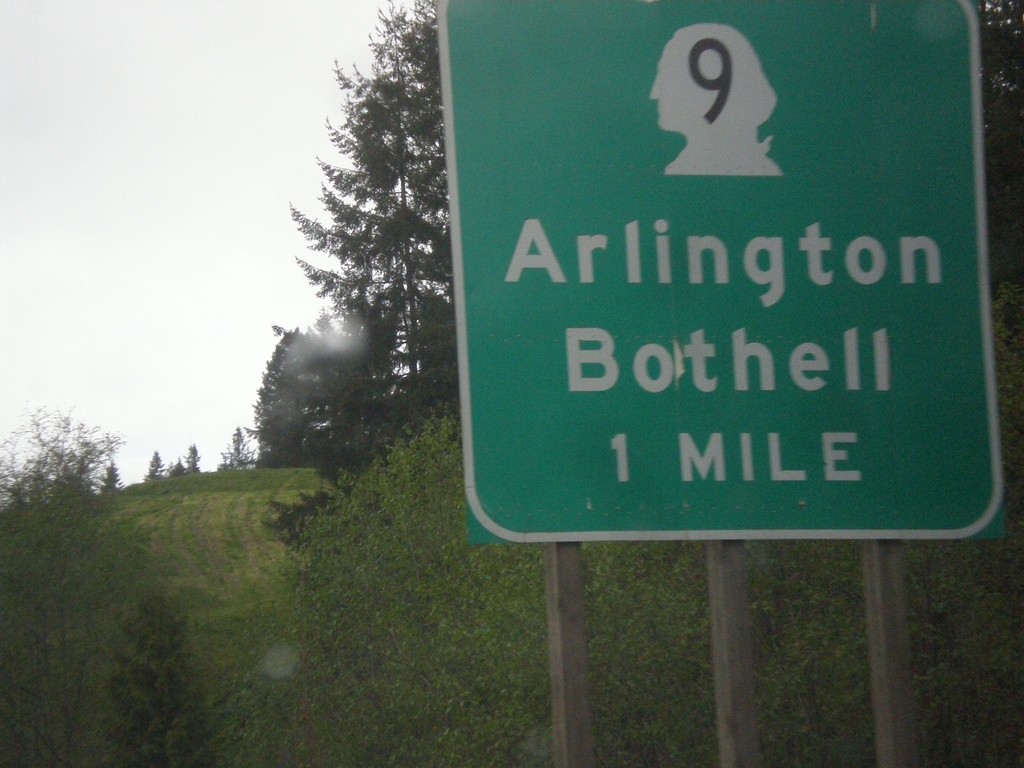
US-2 West - WA-9 Interchange
US-2 West approaching WA-9/Arlington/Bothell interchange.
Taken 04-28-2017
 Snohomish
 County
Washington
United States
Snohomish
Snohomish County
Washington
United States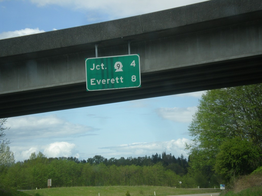
US-2 West - Distance Marker
Distance marker on US-2 west in Monroe. Distance to WA-9 and Everett.
Taken 04-28-2017
Monroe
Snohomish County
Washington
United States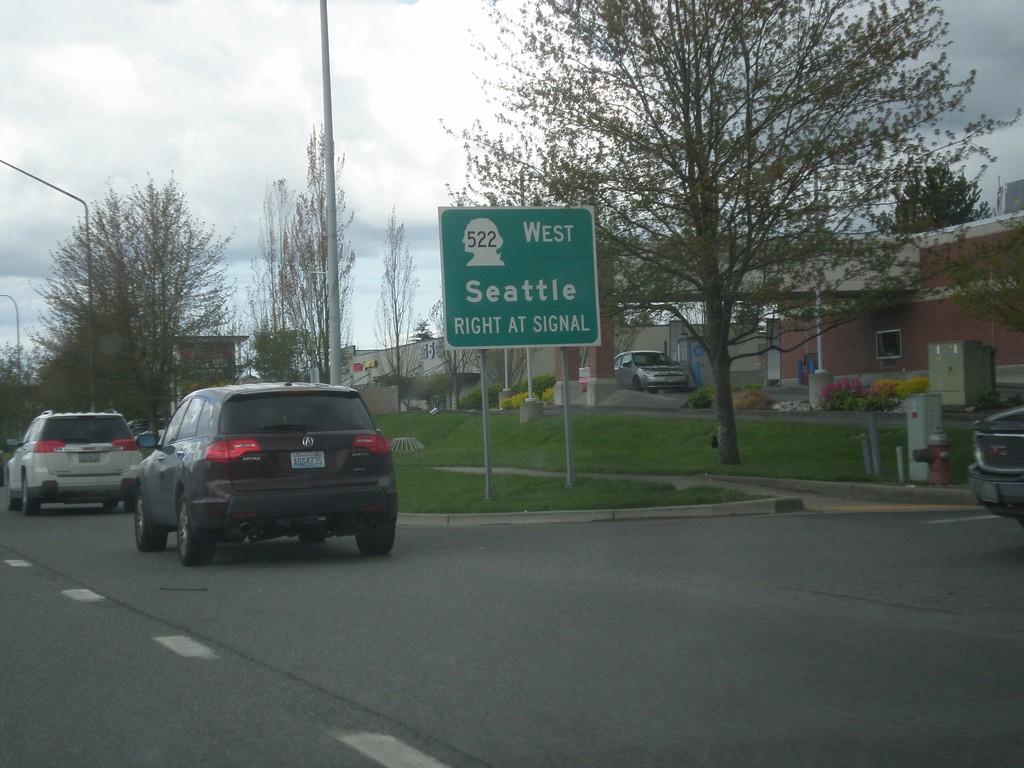
US-2 West at WA-522 West
US-2 West at WA-522 West to Seattle.
Taken 04-28-2017
 Monroe
Snohomish County
Washington
United States
Monroe
Snohomish County
Washington
United States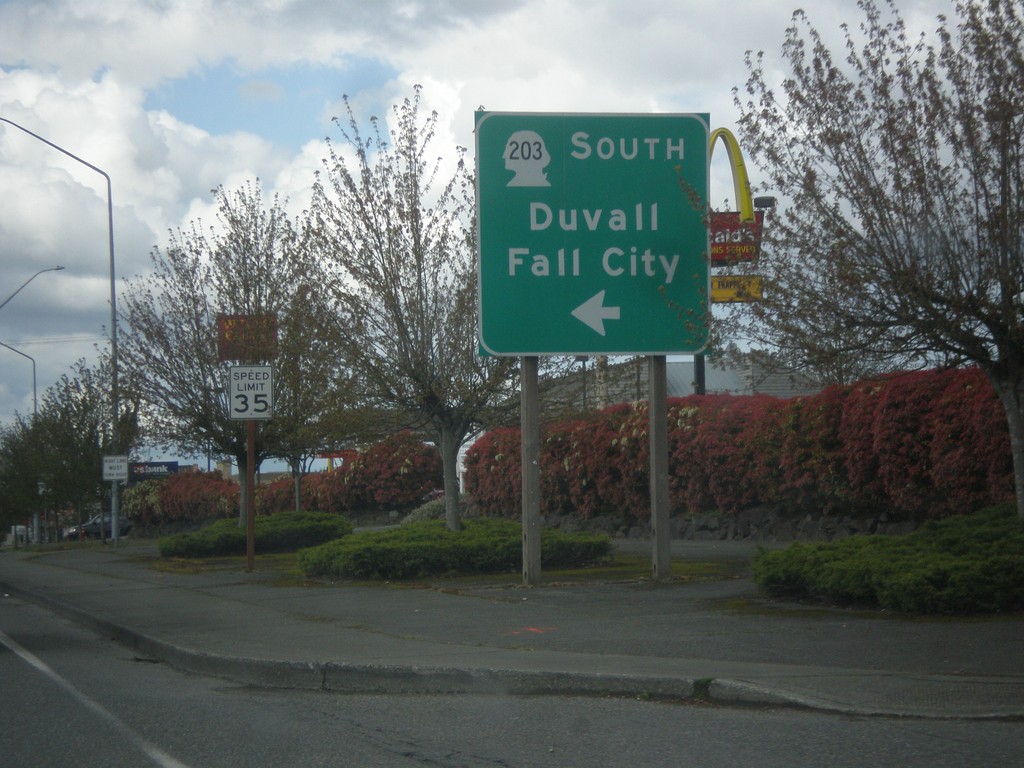
US-2 West at WA-203 South
US-2 West at WA-203 South to Duvall and Fall City.
Taken 04-28-2017
 Monroe
Snohomish County
Washington
United States
Monroe
Snohomish County
Washington
United States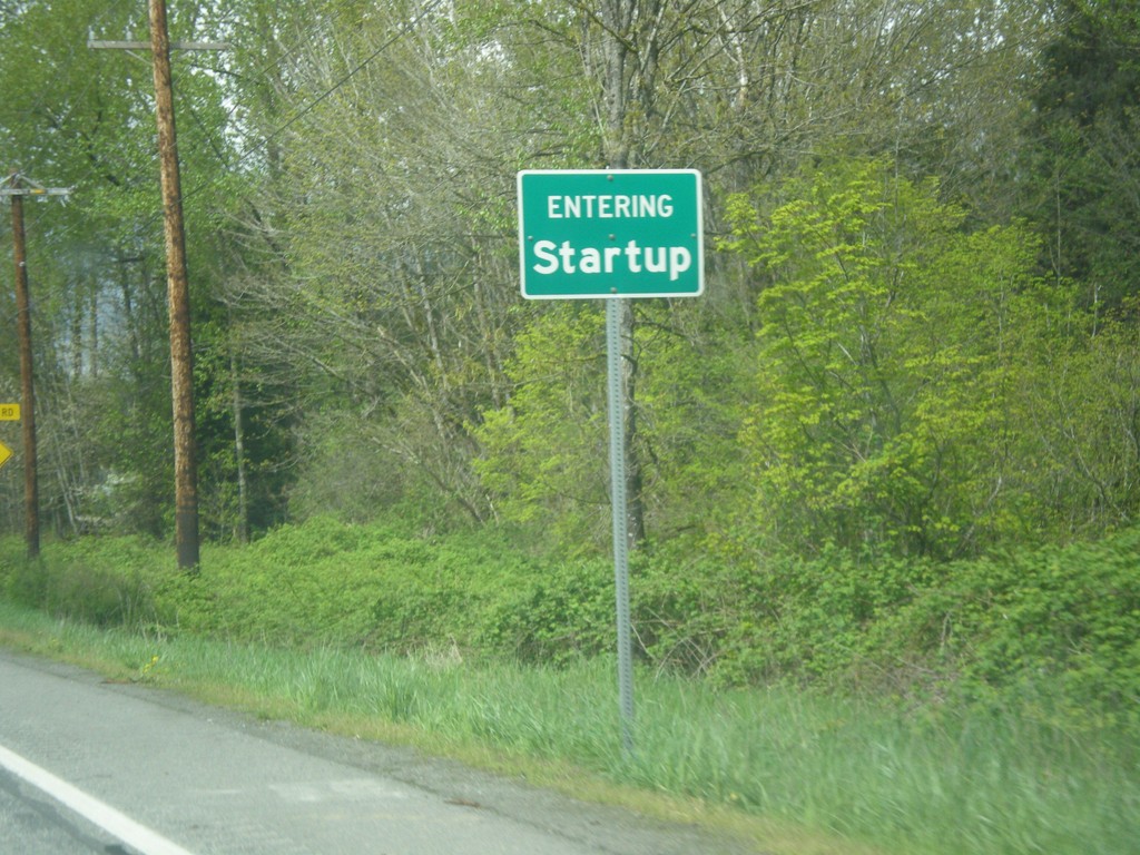
US-2 West - Startup
Entering Startup on US-2 west.
Taken 04-28-2017
Sultan
Snohomish County
Washington
United States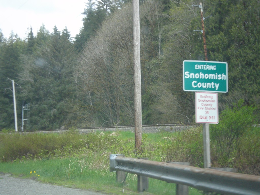
US-2 West - Snohomish County
Entering Snohomish County on US-2 west.
Taken 04-28-2017
Gold Bar
Snohomish County
Washington
United States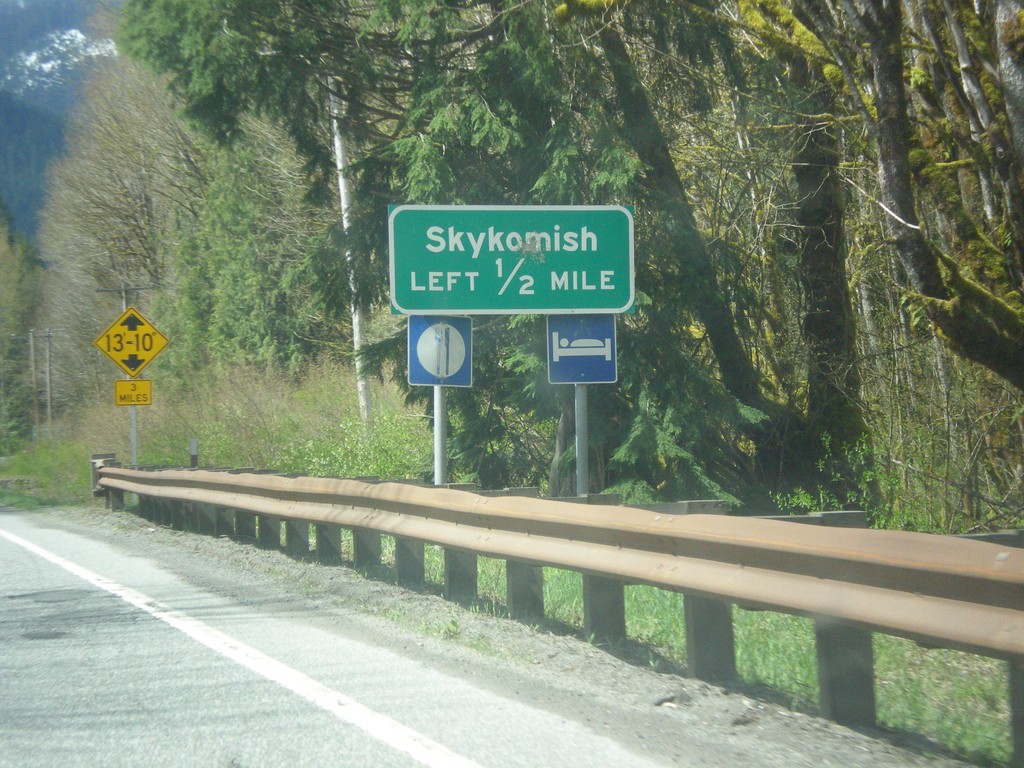
US-2 West - Skykomish Jct
US-2 West approaching Skykomish Jct
Taken 04-28-2017
Skykomish
King County
Washington
United States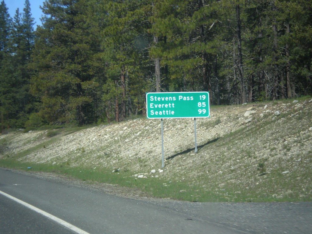
US-2 West - Distance Marker
Distance marker on US-2 west. Distance to Stevens Pass, Everett, and Seattle.
Taken 04-28-2017
Leavenworth
Chelan County
Washington
United States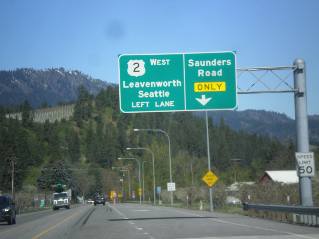
US-2 West Approaching Saunders Road
US-2 west approaching Saunders Road. Use right lane for Saunders Road. Continue west on US-2 for Leavenworth and Seattle.
Taken 04-28-2017
Peshastin
Chelan County
Washington
United States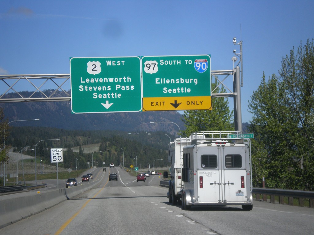
US-2 West/US-97 South Approaching US-2/US-97 Split
US-2 West/US-97 South approaching US-2/US-97 split. Use US-97 South to I-90/Ellensburg/Seattle (via Snoqualmie Pass). Use US-2 West to Leavenworth, Stevens Pass and Seattle (via Stevens Pass).
Taken 04-28-2017

 Dryden
Chelan County
Washington
United States
Dryden
Chelan County
Washington
United States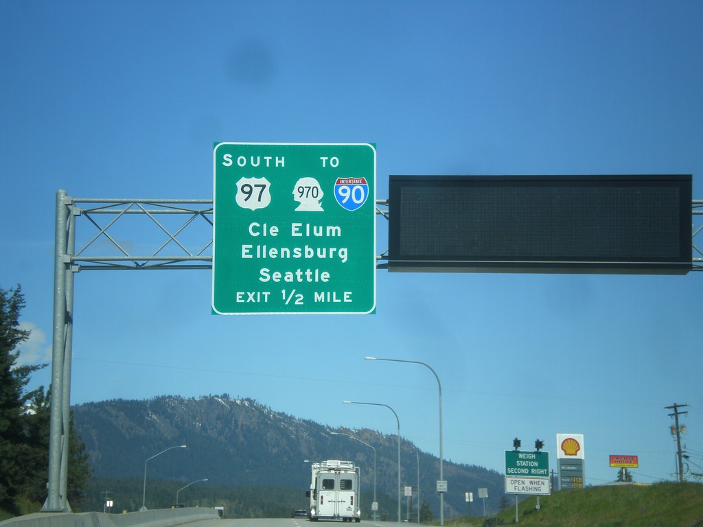
US-2 West/US-97 South Approaching US-2/US-97 Split
US-2 West/US-97 South Approaching US-2/US-97 Split. Use US-97 south for WA-970/I-90 to Cle Elum, Ellensburg, and Seattle.
Taken 04-28-2017
 Cashmere
Chelan County
Washington
United States
Cashmere
Chelan County
Washington
United States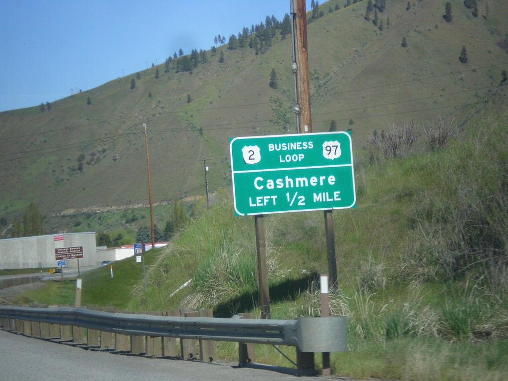
US-2 West/US-97 South - Bus. US-2/US-97
US-2 West/US-97 South - Bus. US-2/US-97 Junction to Cashmere.
Taken 04-28-2017

 Cashmere
Chelan County
Washington
United States
Cashmere
Chelan County
Washington
United States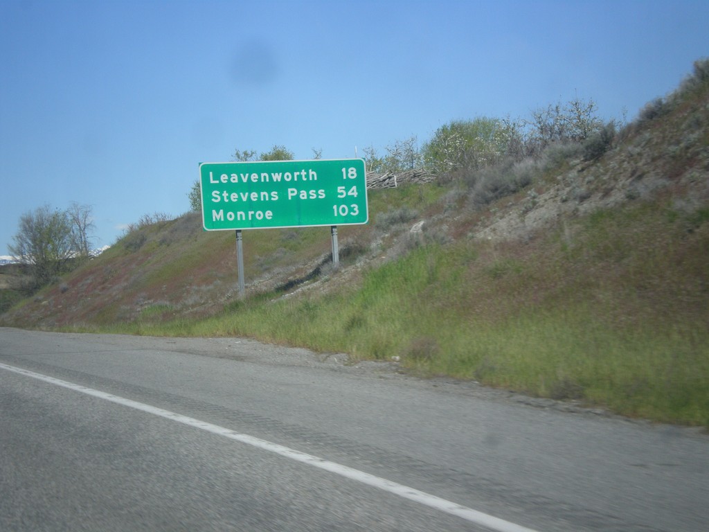
US-2 West/US-97 South - Distance Marker
Distance Marker on US-2 West/US-97 South. Distance to Leavenworth, Stevens Pass, and Monroe.
Taken 04-28-2017
Wenatchee
Chelan County
Washington
United States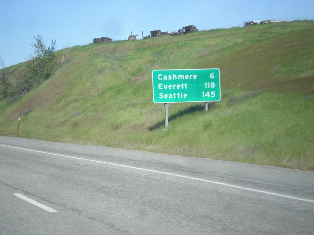
US-2 West/US-97 South - Distance Marker
Distance Marker on US-2 West/US-97 South. Distance to Cashmere, Everett, and Seattle.
Taken 04-28-2017
Wenatchee
Chelan County
Washington
United States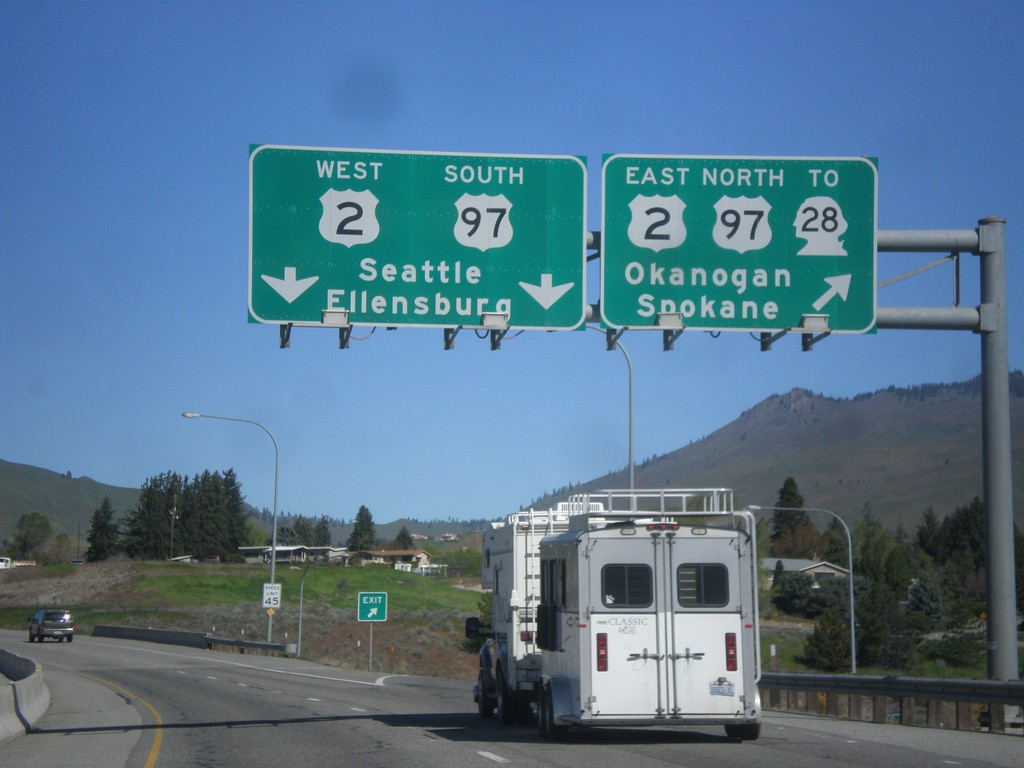
End WA-285 North at US-2/US-97/To WA-28
End WA-285 North at US-2/US-97/To WA-28. Use US-2 East/US-97 North/To WA-28 for Okanogan and Spokane. Use US-2 West/US-97 South for Seattle and Ellensburg.
Taken 04-28-2017

 Wenatchee
Chelan County
Washington
United States
Wenatchee
Chelan County
Washington
United States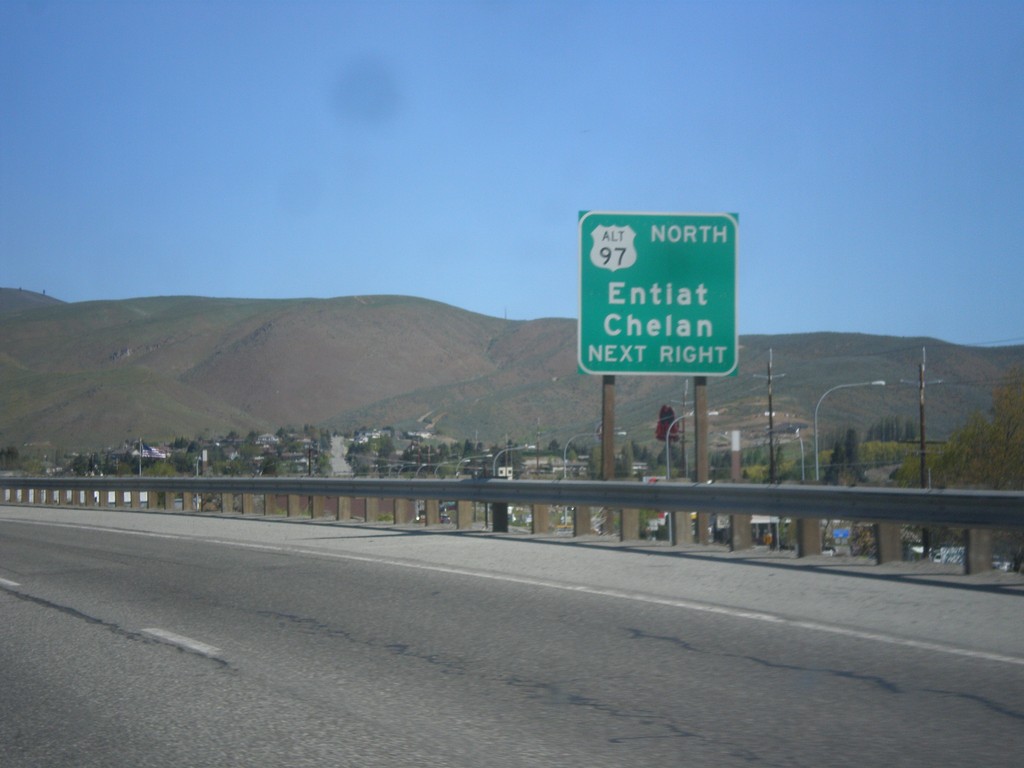
WA-285 North Approaching US-2/US-97 Jct.
WA-285 North Approaching US-2/US-97 Jct. Use right lane for access to Alt. US-97 to Chelan and Entiat.
Taken 04-28-2017
 Wenatchee
Chelan County
Washington
United States
Wenatchee
Chelan County
Washington
United States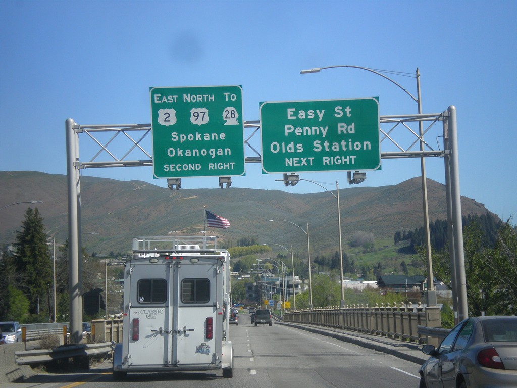
WA-285 North Approaching US-2/US-97/To WA-28
WA-285 North approaching US-2 East/US-97 North/To WA-28 to Spokane and Seattle. Also approaching Easy St., Penny Road, and Olds Station junction in Wenatchee.
Taken 04-28-2017
Wenatchee
Chelan County
Washington
United States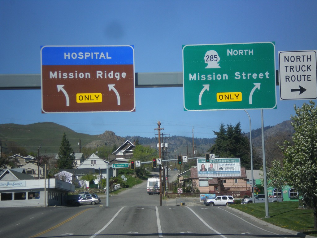
WA-285 North - Mission St. Jct.
WA-285 North (Stevens St.) at Mission St. junction. Turn right to continue north on WA-285. Turn left for Mission Ridge (Ski Area) and the hospital.
Taken 04-28-2017
Wenatchee
Chelan County
Washington
United States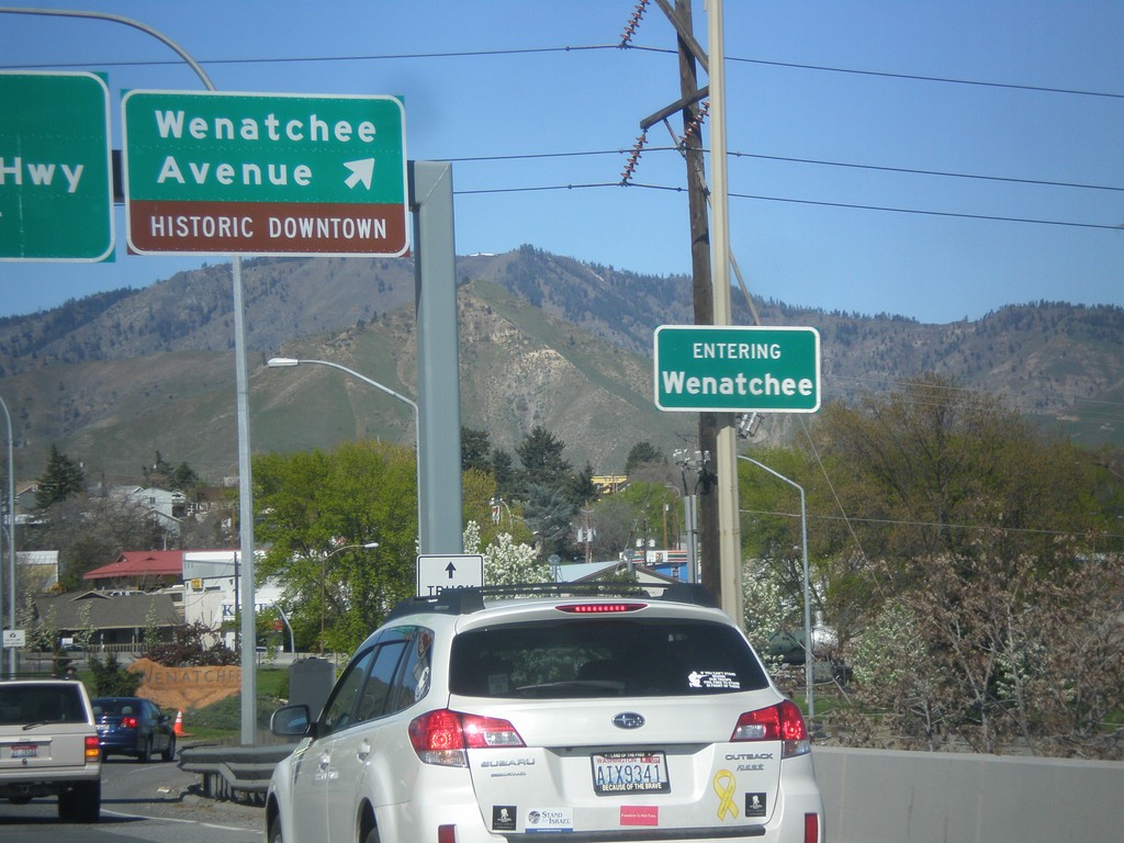
WA-285 North at Wenatchee Ave. interchange
WA-285 North at Wenatchee Ave./Historic Downtown interchange. Entering Wenatchee.
Taken 04-28-2017
Wenatchee
Chelan County
Washington
United States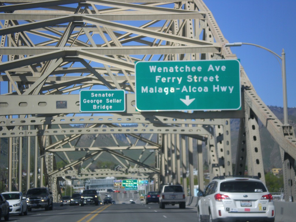
WA-285 North - Senator George Sellar Bridge
WA-285 North on the Senator George Sellar Bridge over the Columbia River. Approaching Wenatchee Ave./Ferry St./Malaga-Alcoa Highway.
Taken 04-28-2017
Wenatchee
Chelan County
Washington
United States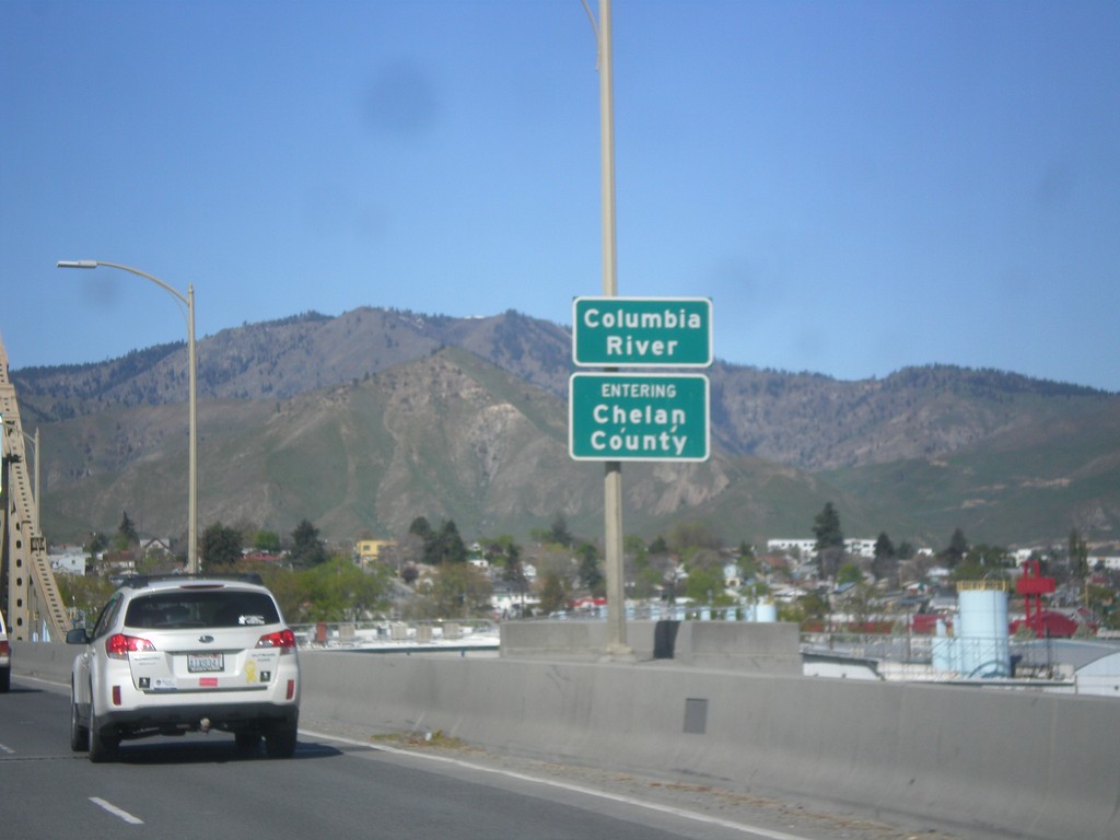
WA-285 North - Chelan County
Entering Chelan County on the Columbia River bridge on WA-285 north. Also entering Wenatchee, the county seat of Chelan County.
Taken 04-28-2017
Wenatchee
Chelan County
Washington
United States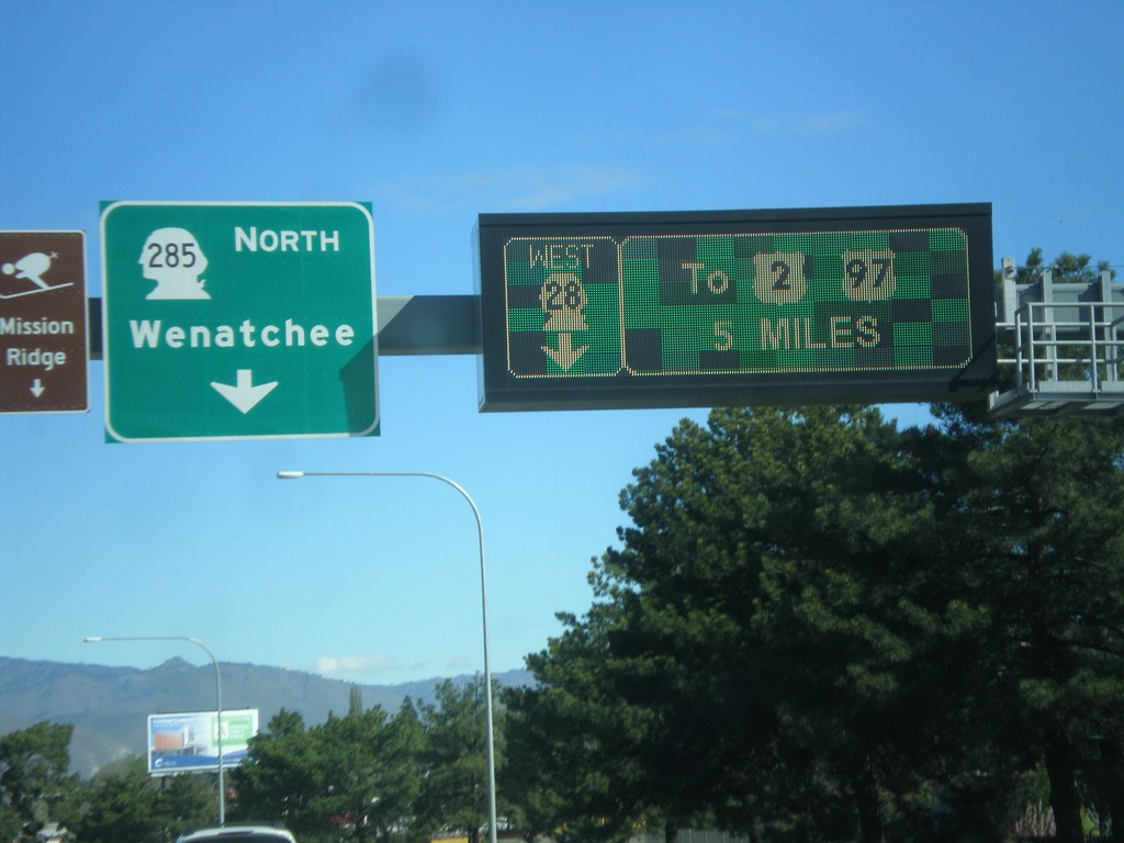
WA-28 West at WA-285 - East Wenatchee
WA-28 West at WA-285 in East Wenatchee. Turn left for WA-285 North to Wenatchee. Continue west on WA-28 to US-2 and US-97. The signs directing traffic on WA-28 are an electronic sign.
Taken 04-28-2017
East Wenatchee
Douglas County
Washington
United States