Signs Tagged With Big Green Sign
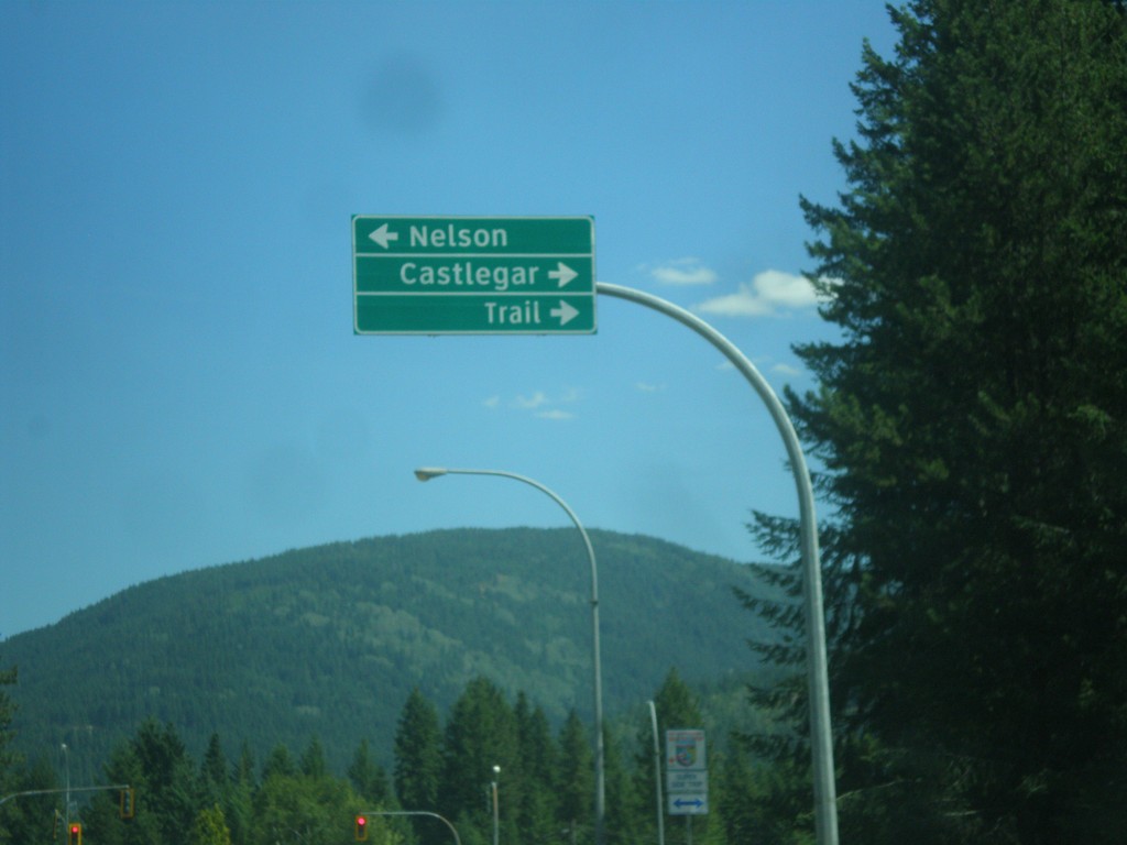
BC-6 South at BC-3A Junction
BC-6 South at BC-3A. Turn right for BC-3A west to Castlegar and Trail; turn left for BC-3A east and BC-6 south to Nelson. BC-6 south joins BC-3A east to Nelson.
Taken 07-26-2017

 South Slocan
Central Kootenay
British Columbia
Canada
South Slocan
Central Kootenay
British Columbia
Canada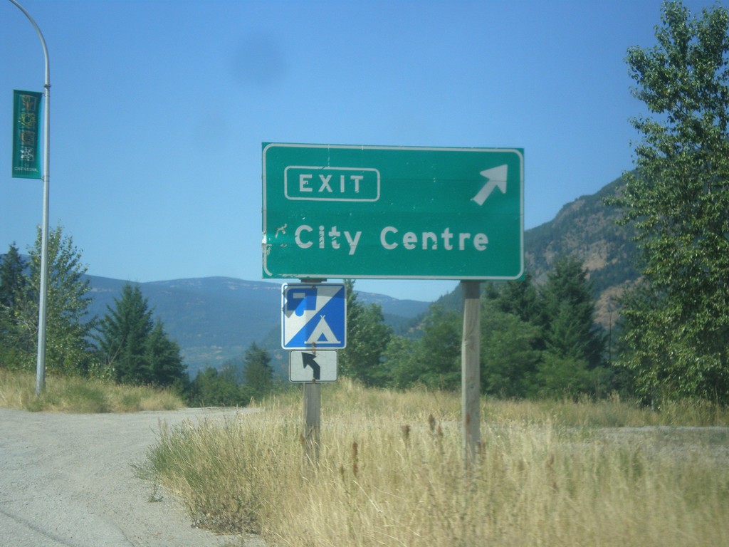
BC-3 West - Castlegar City Centre
BC-3 west at Castlegar City Centre interchange.
Taken 07-25-2017
 Castlegar
Central Kootenay
British Columbia
Canada
Castlegar
Central Kootenay
British Columbia
Canada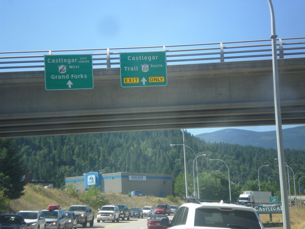
BC-3 West at BC-22 South - Castlegar
BC-3 West at BC-22 South in Castlegar. Use BC-22 south for Castlegar and Trail. Continue west on BC-3 for Castlegar City Centre and Grand Forks.
Taken 07-25-2017
 Castlegar
Central Kootenay
British Columbia
Canada
Castlegar
Central Kootenay
British Columbia
Canada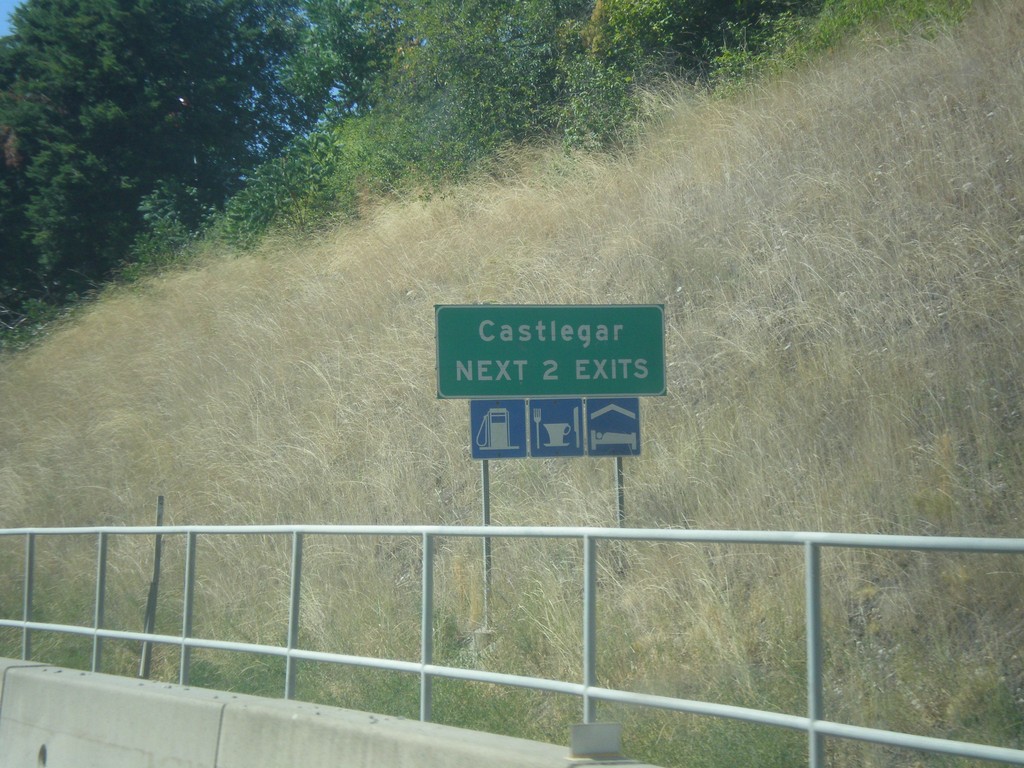
BC-3 West - Castlegar - Next 2 Exits
Castlegar - Next 2 Exits on BC-3 West
Taken 07-25-2017
Castlegar
Central Kootenay
British Columbia
Canada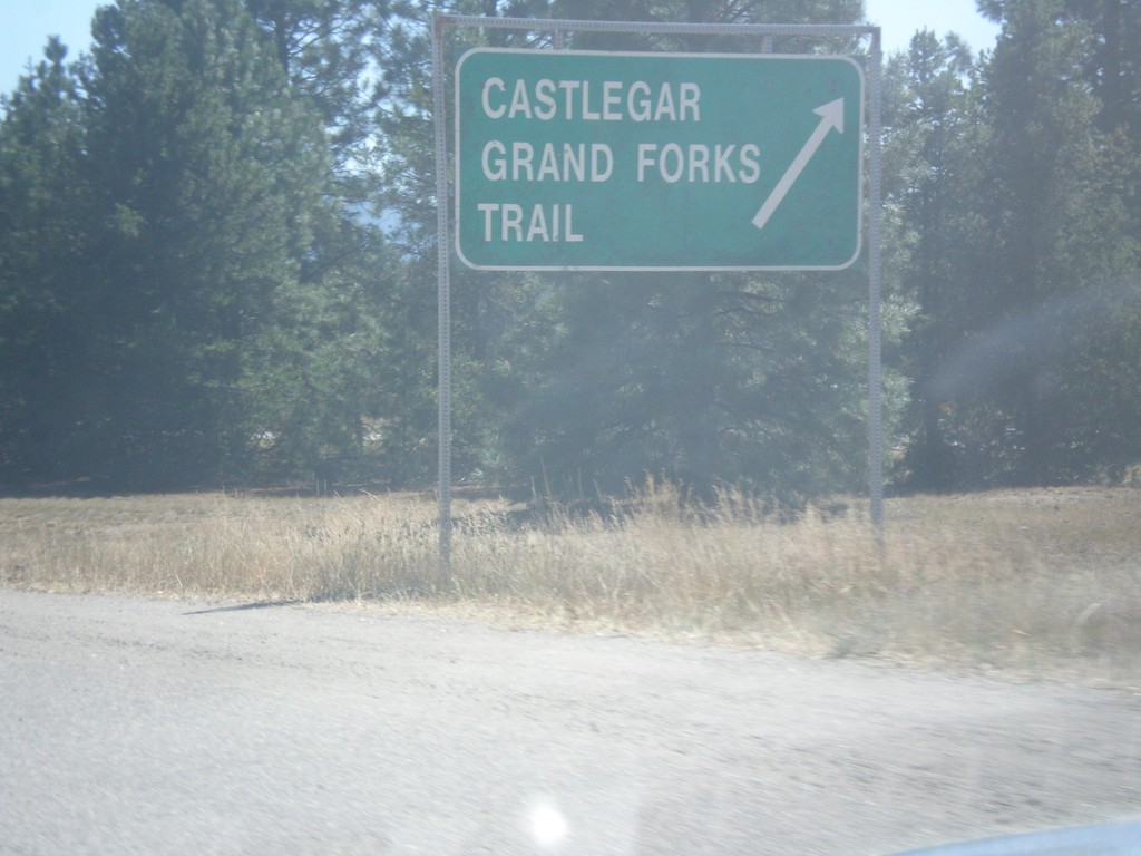
End BC-3A West at BC-3
End BC-3A West at BC-3. Use BC-3 West for Castlegar, Grand Forks, and Trail.
Taken 07-25-2017
Castlegar
Central Kootenay
British Columbia
Canada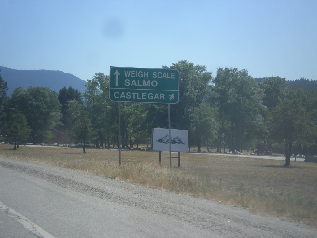
BC-3A West approaching BC-3
BC-3A West approaching BC-3. Use right lane for BC-3 West/Castlegar. Use left lane for BC-3 East/Weigh Station/Salmo.
Taken 07-25-2017
Castlegar
Central Kootenay
British Columbia
Canada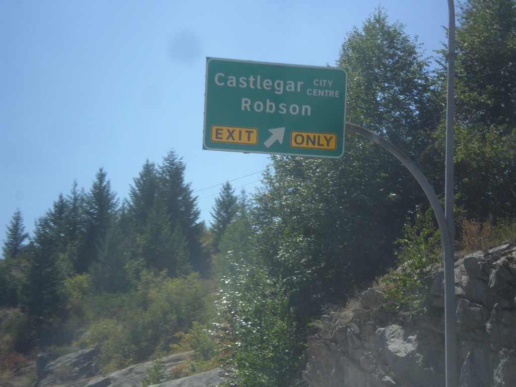
BC-3A West - Robson Interchange
BC-3A West at Castlegar City Centre/Robson interchange.
Taken 07-25-2017
Castlegar
Central Kootenay
British Columbia
Canada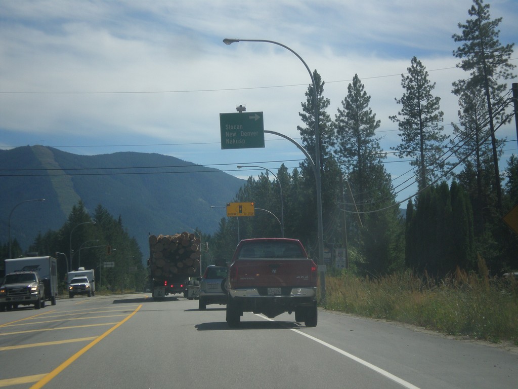
BC-3A West/BC-6 North Split
BC-3A West/BC-6 North split in South Slocan. Turn right for BC-6 north to Slocan, New Denver, and Nakusp.
Taken 07-24-2017
Castlegar
Central Kootenay
British Columbia
Canada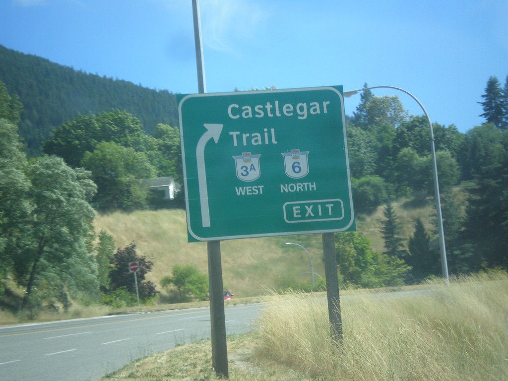
BC-3A West at BC-6 - Nelson
BC-3A West at BC-6 junction in Nelson. Exit right for BC-3A West/BC-6 North/Trail Castlegar.
Taken 07-24-2017
Nelson
Central Kootenay
British Columbia
Canada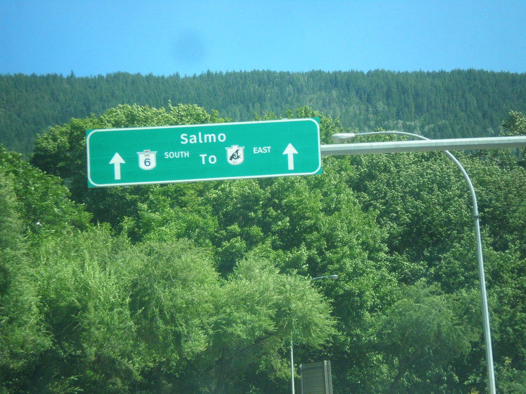
BC-3A West Approaching BC-6
BC-3A West approaching BC-6 To BC-3/Salmo in Nelson.
Taken 07-24-2017
Nelson
Central Kootenay
British Columbia
Canada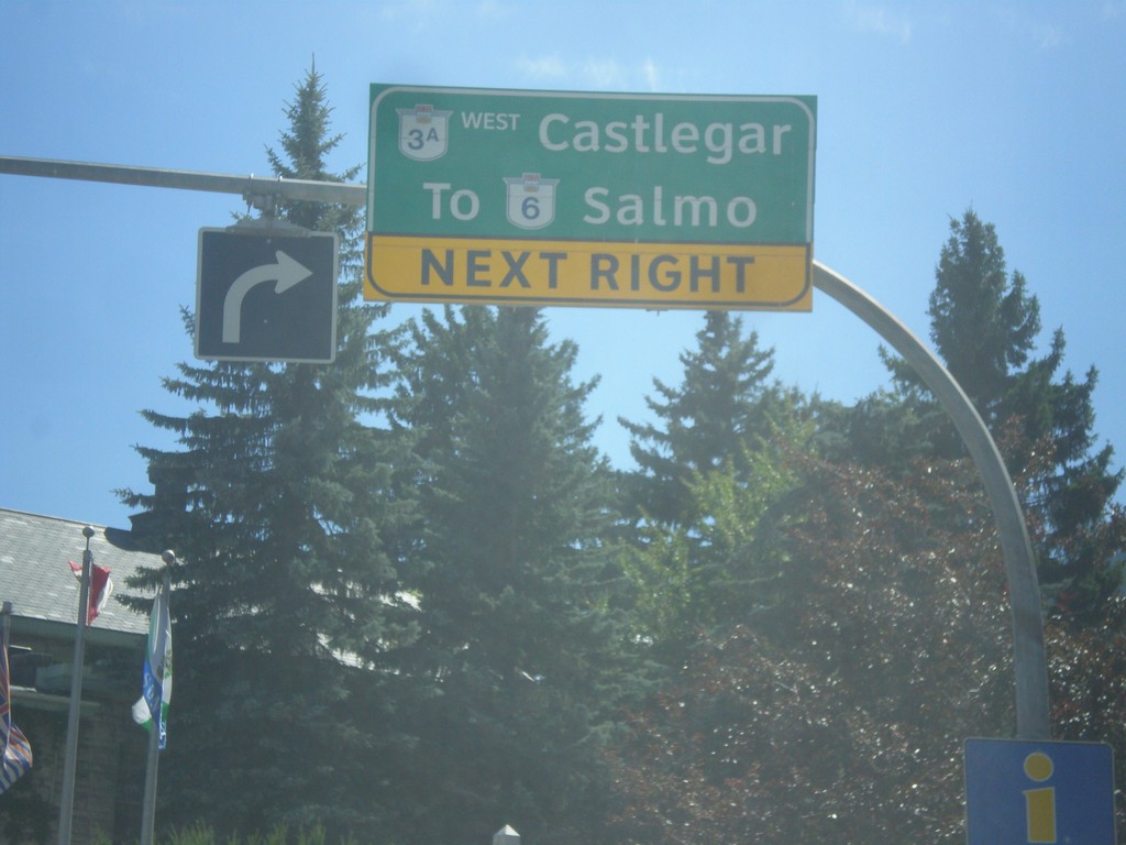
BC-3A - Downtown Nelson
BC-3A (Ward St.) at Vernon St. in Nelson. Turn right on Vernon St. for BC-3A West/Castlegar and To BC-6/Salmo.
Taken 07-24-2017
Nelson
Central Kootenay
British Columbia
Canada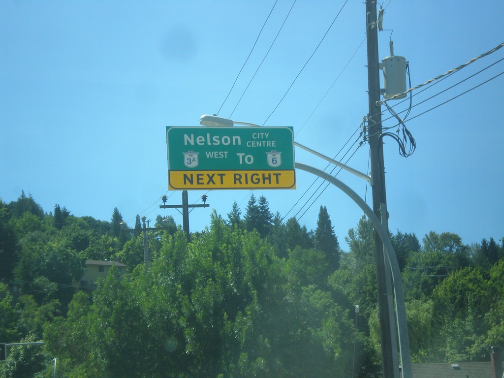
BC-3A/To BC-6 - Nelson St. Approaching Anderson St. in Nelson
BC-3A West/To BC-6/Nelson City Centre Next Right on Nelson St. approaching Anderson St. in Nelson.
Taken 07-24-2017
Nelson
Central Kootenay
British Columbia
Canada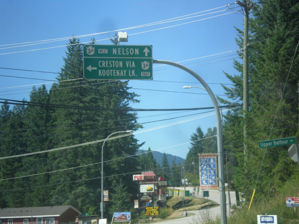
End BC-31 South at BC-3A
End BC-31 South at BC-3A in Balfour. Turn left for BC-3A East to Creston via Kootenay Lake (Ferry). Continue straight for BC-3A West to Nelson.
Taken 07-24-2017
 Nelson
Central Kootenay
British Columbia
Canada
Nelson
Central Kootenay
British Columbia
Canada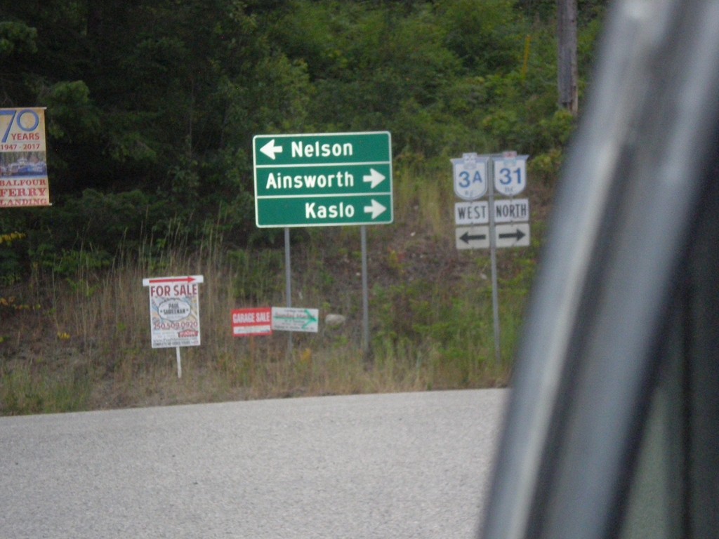
BC-3A West at BC-31
BC-3A West at BC-31 in Balfour, leaving the Kootenay Lake Ferry. Turn right for BC-31 north to Ainsworth and Kaslo. Turn left for BC-3A west to Nelson.
Taken 07-23-2017
Nelson
Central Kootenay
British Columbia
Canada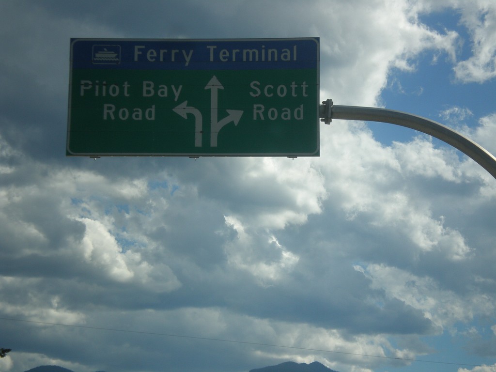
BC-3A West - Kootenay Lake Ferry
BC-3A West approaching Kootenay Lake Ferry. Use left lane for Pilot Bay Road; right lane for Scott Road. Continue in middle lane for the Kootenay Lake Ferry.
Taken 07-23-2017
Riondel
Central Kootenay
British Columbia
Canada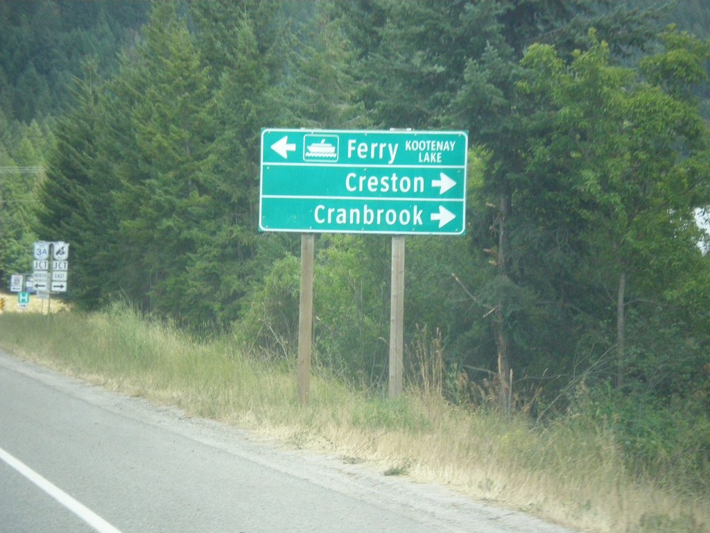
BC-3 East at BC-3A North
BC-3 East at BC-3A North in Creston. Turn left for BC-3A North to Kootenay Lake Ferry; turn right for BC-3 East to Creston and Cranbrook. BC-3A is an alternate route to BC-3 and follows Kootenay Lake and the Kootenay River west before re-joining BC-3 in Castlegar.
Taken 07-23-2017
Creston
Central Kootenay
British Columbia
Canada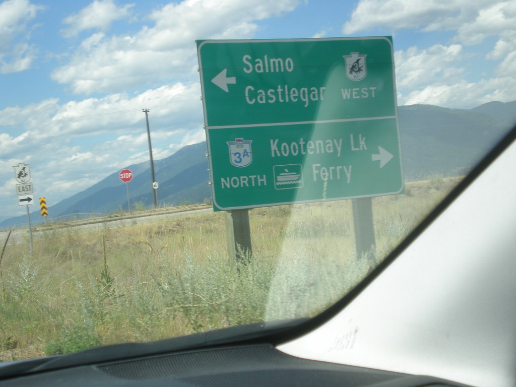
End BC-21 North at BC-3 (To BC-3A)
End BC-21 North at BC-3 (To BC-3A) in Creston. Turn left for BC-3 West to Salmo and Castlegar. Turn right for (BC-3 East), BC-3A North/Kootenay Lake Ferry.
Taken 07-23-2017
 Creston
Central Kootenay
British Columbia
Canada
Creston
Central Kootenay
British Columbia
Canada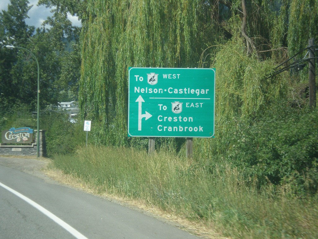
BC-21 North Approaching Erickson Road
BC-21 North approaching Erickson Road in Creston. Use Erickson Road west for BC-3 East/Creston/Cranbrook. Continue north on BC-21 for BC-3 East to Nelson and Castlegar.
Taken 07-23-2017
Creston
Central Kootenay
British Columbia
Canada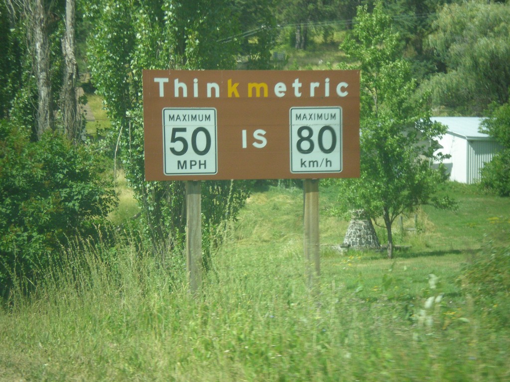
BC-21 North - Think Metric
Think Metric sign on BC-21 north, just past the Rykerts Port of Entry. 50 MPH = 80 km/h.
Taken 07-23-2017
Creston
Central Kootenay
British Columbia
Canada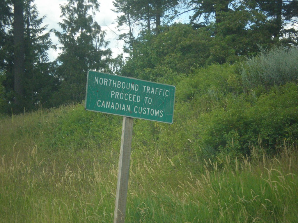
ID-1 North - Proceed To Canada Customs
ID-1 North - Northbound traffic proceed to Canada Customs.
Taken 07-23-2017
 Porthill
Boundary County
Idaho
United States
Porthill
Boundary County
Idaho
United States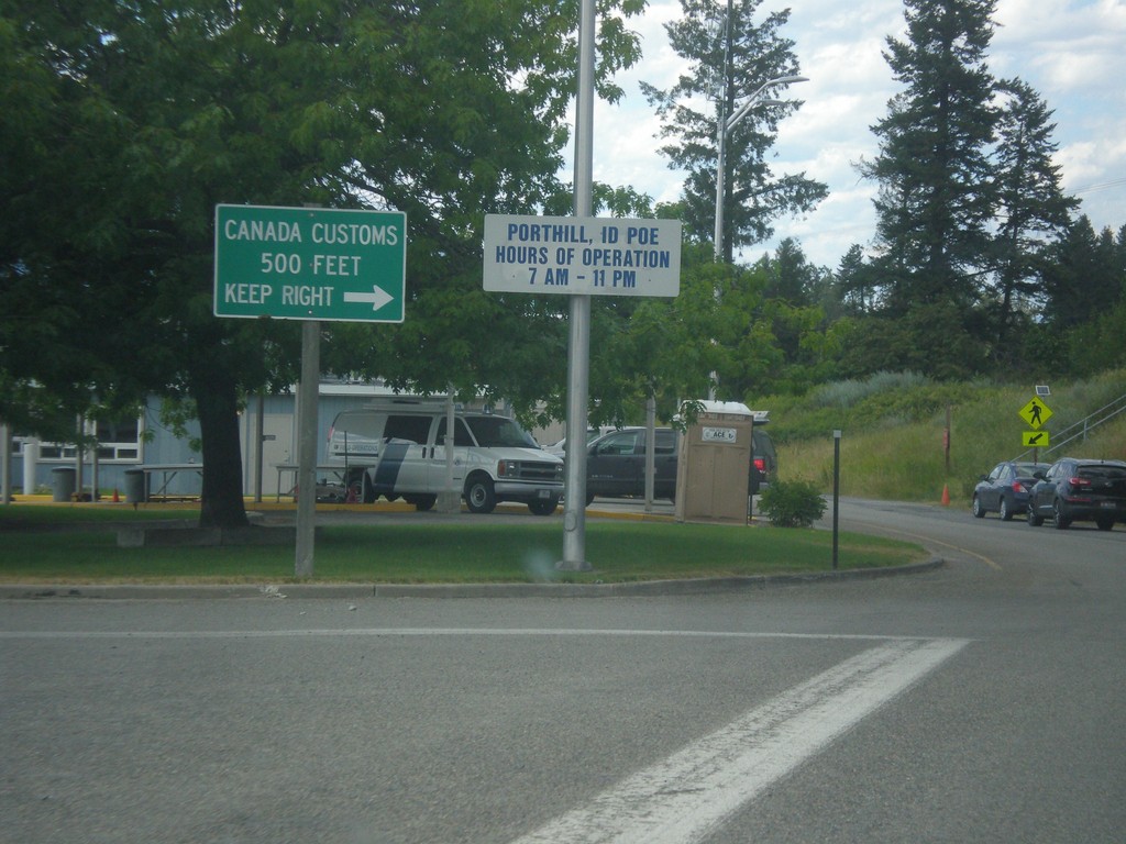
ID-1 North - Porthill Idaho Port of Entry
ID-1 North at Porthill Idaho Port of Entry. Merge right to continue into Canada.
Taken 07-23-2017
Porthill
Boundary County
Idaho
United States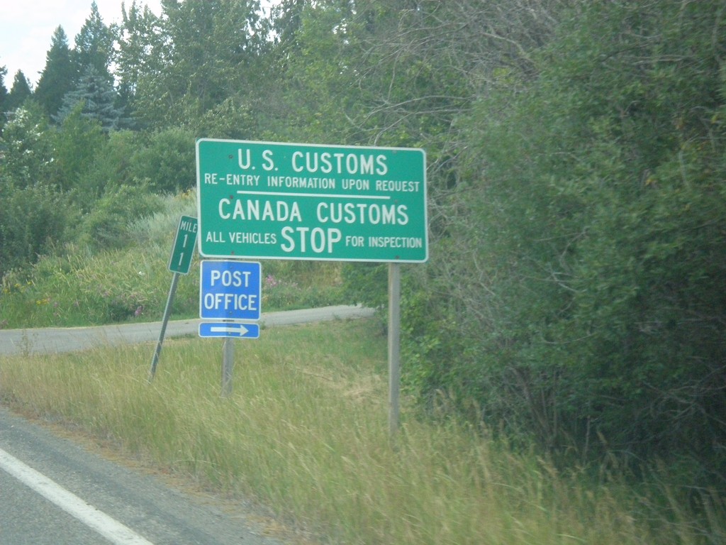
ID-1 North - Border Crossing
ID-1 north approaching US Customs and Canada Customs. Turn right for the Porthill Post Office.
Taken 07-23-2017
Bonners Ferry
Boundary County
Idaho
United States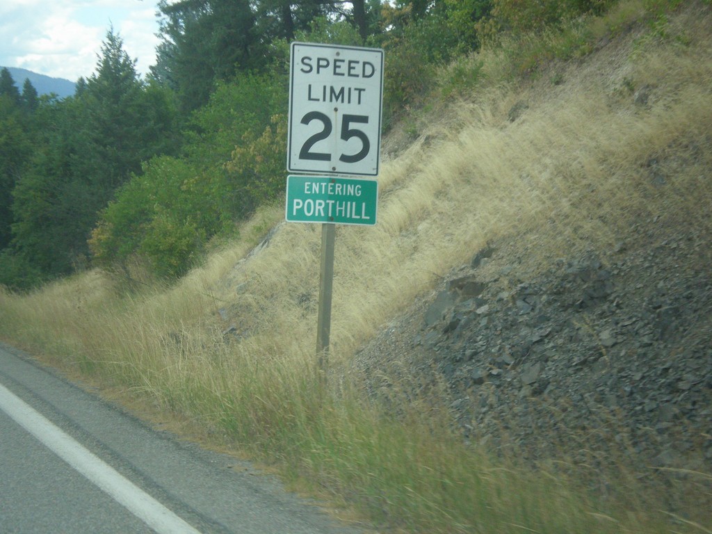
ID-1 North - Porthill
Entering Porthill on ID-1 north.
Taken 07-23-2017
Bonners Ferry
Boundary County
Idaho
United States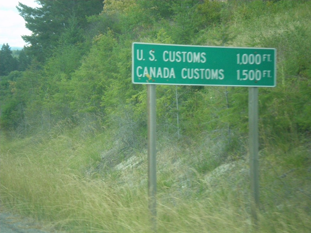
ID-1 North - Distance Marker
Distance Marker on ID-1 north at Porthill. Distance to US Customs and Canada Customs.
Taken 07-23-2017
Bonners Ferry
Boundary County
Idaho
United States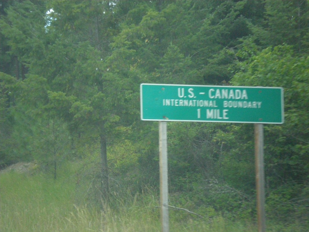
ID-1 North - US-Canada International Boundary
ID-1 North approaching US-Canada International Boundary at Porthill.
Taken 07-23-2017
Bonners Ferry
Boundary County
Idaho
United States