Signs Tagged With Big Green Sign
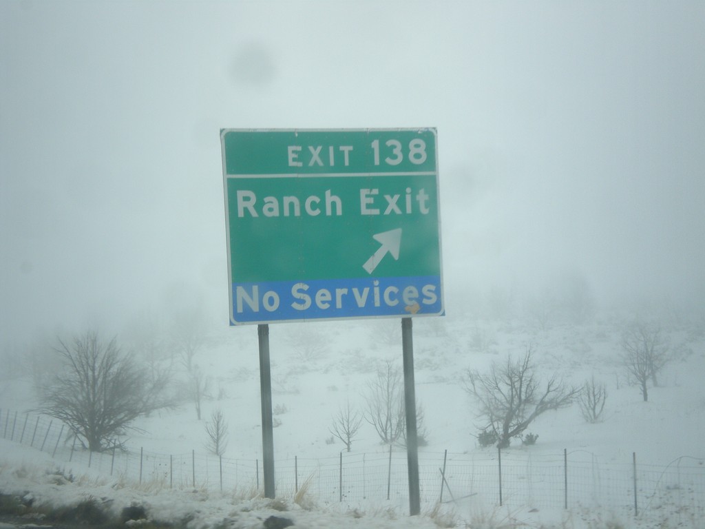
I-15 North - Exit 138
I-15 north at Exit 138 - Ranch Exit
Taken 03-31-2017
 Cove Fort
Millard County
Utah
United States
Cove Fort
Millard County
Utah
United States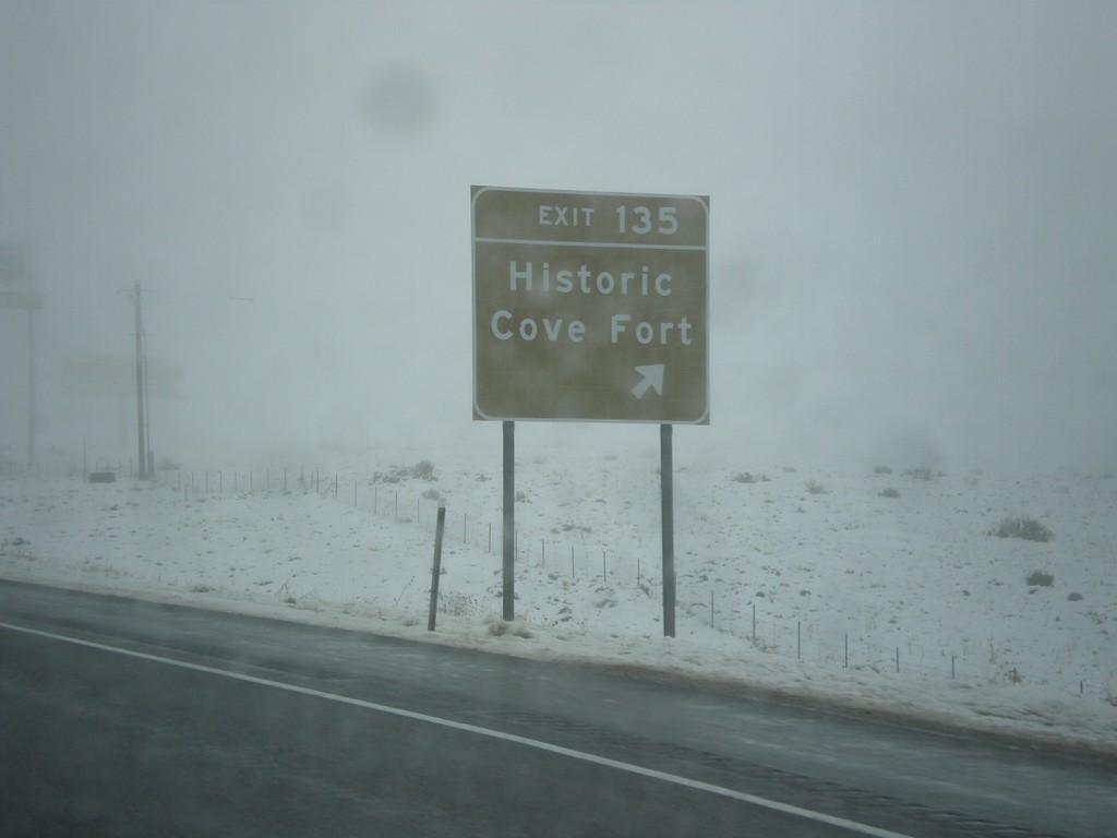
I-15 North - Exit 135
I-15 north at Exit 135 - Historic Cove Fort.
Taken 03-31-2017
Cove Fort
Millard County
Utah
United States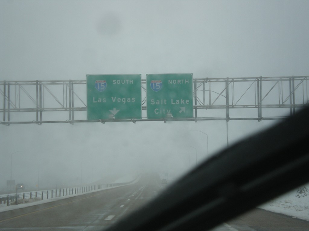
End I-70 West at I-15
End I-70 West at I-15. Use I-15 north for Salt Lake CIty; I-15 South for Las Vegas (Nevada).
Taken 03-31-2017
 Sulphurdale
Beaver County
Utah
United States
Sulphurdale
Beaver County
Utah
United States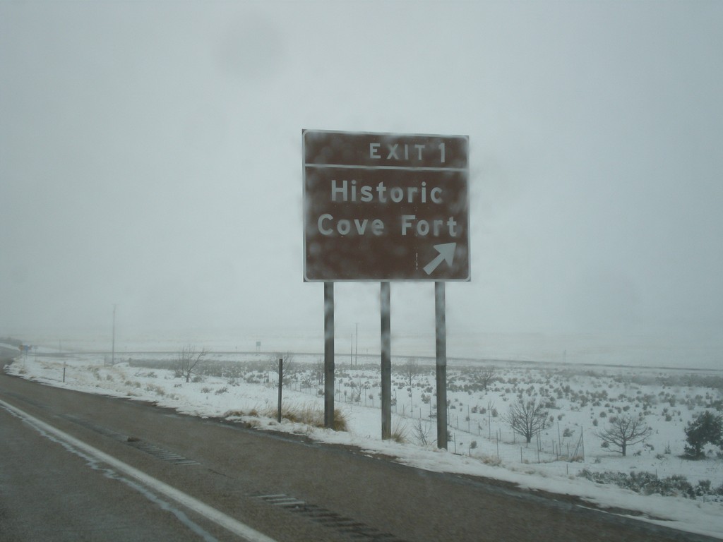
I-70 West - Exit 1
I-70 West at Exit 1 - Historic Cove Fort. This is the last exit westbound on I-70 before I-15.
Taken 03-31-2017
Beaver
Millard County
Utah
United States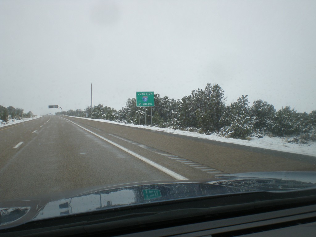
I-70 West Approaching I-15
I-70 West approaching I-15 in Millard County. This is the western end of I-70.
Taken 03-31-2017
Beaver
Millard County
Utah
United States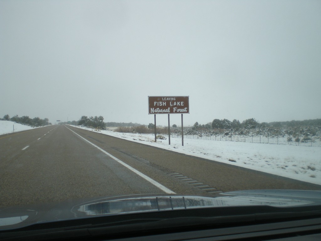
I-70 West - Leaving Fishlake National Forest
Leaving Fishlake National Forest on I-70 west.
Taken 03-31-2017
Cove Fort
Millard County
Utah
United States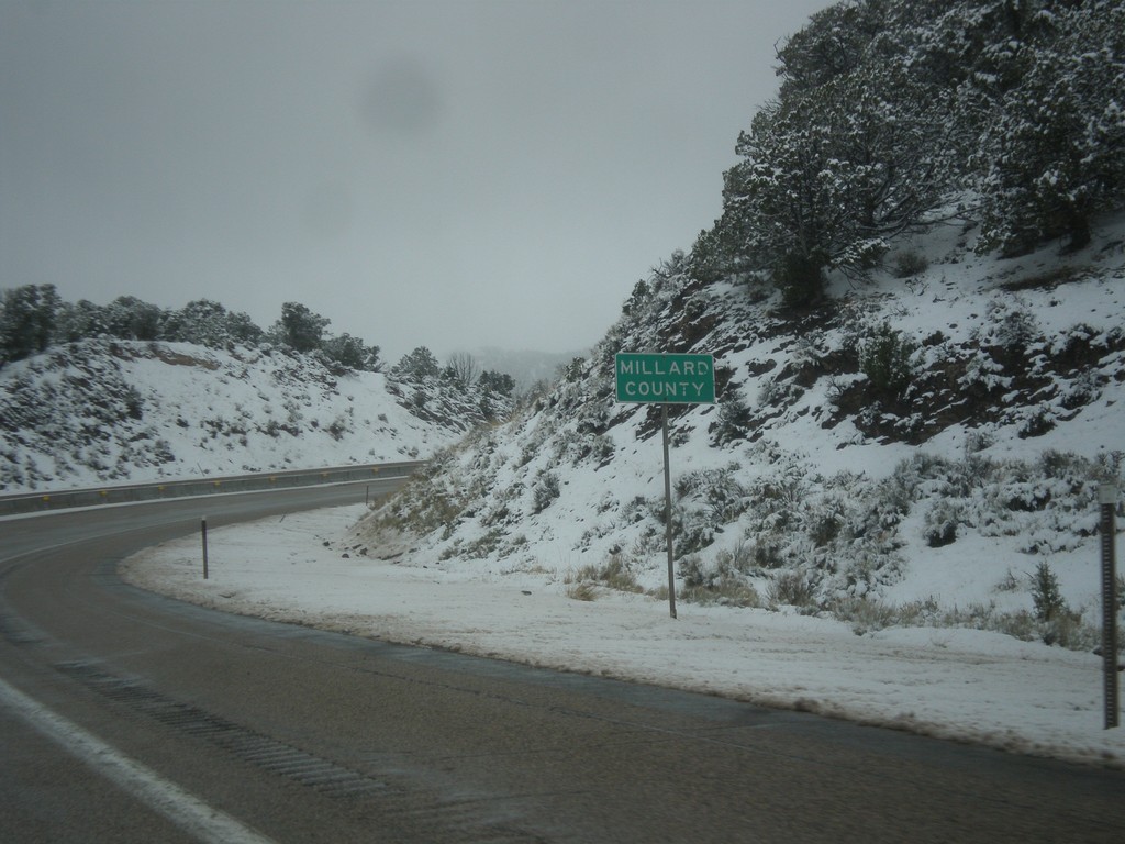
I-70 West - Millard County
Entering Millard County on I-70 west.
Taken 03-31-2017
Kanosh
Millard County
Utah
United States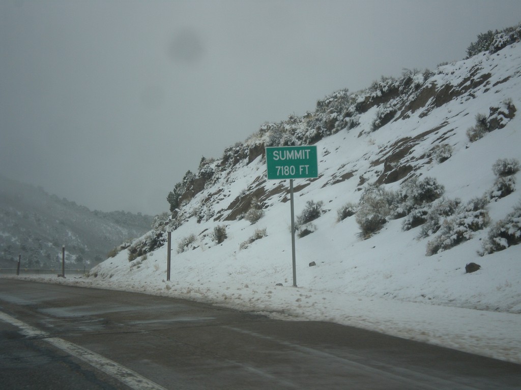
I-70 West - Summit
Summit Elevation 7180 Feet on I-70 west. This is the summit of the Pavant Range.
Taken 03-31-2017
Sevier
Sevier County
Utah
United States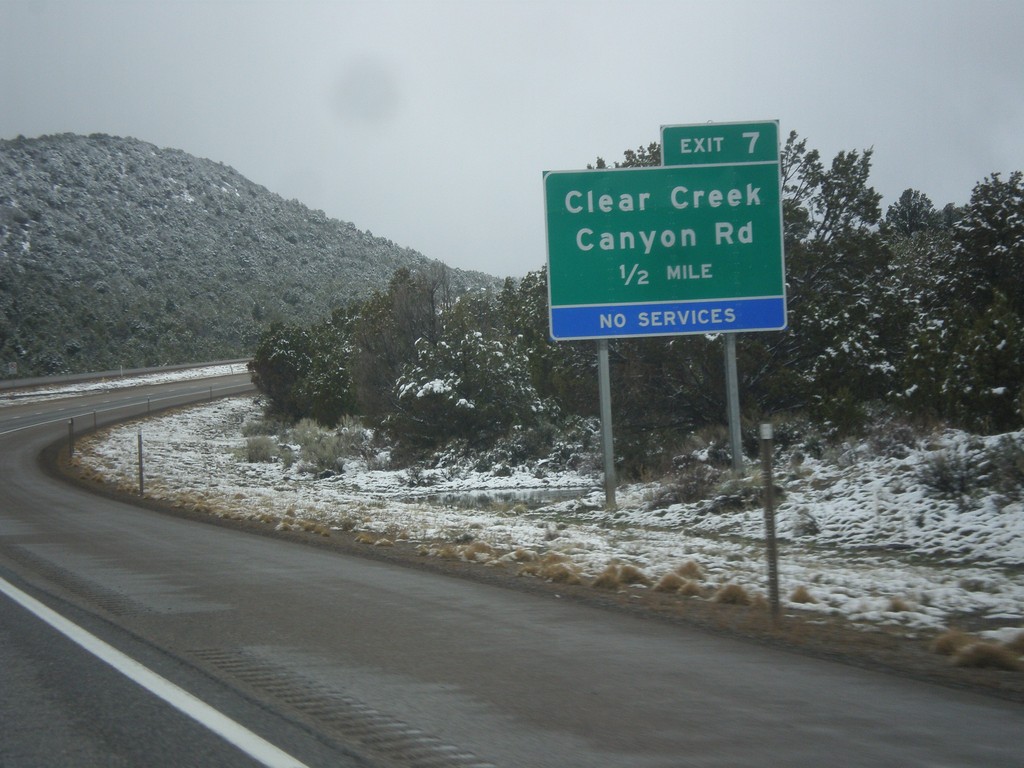
I-70 West - Exit 7
I-70 west approaching Exit 7 - Clear Creek Canyon Road.
Taken 03-31-2017
Sulphurdale
Beaver County
Utah
United States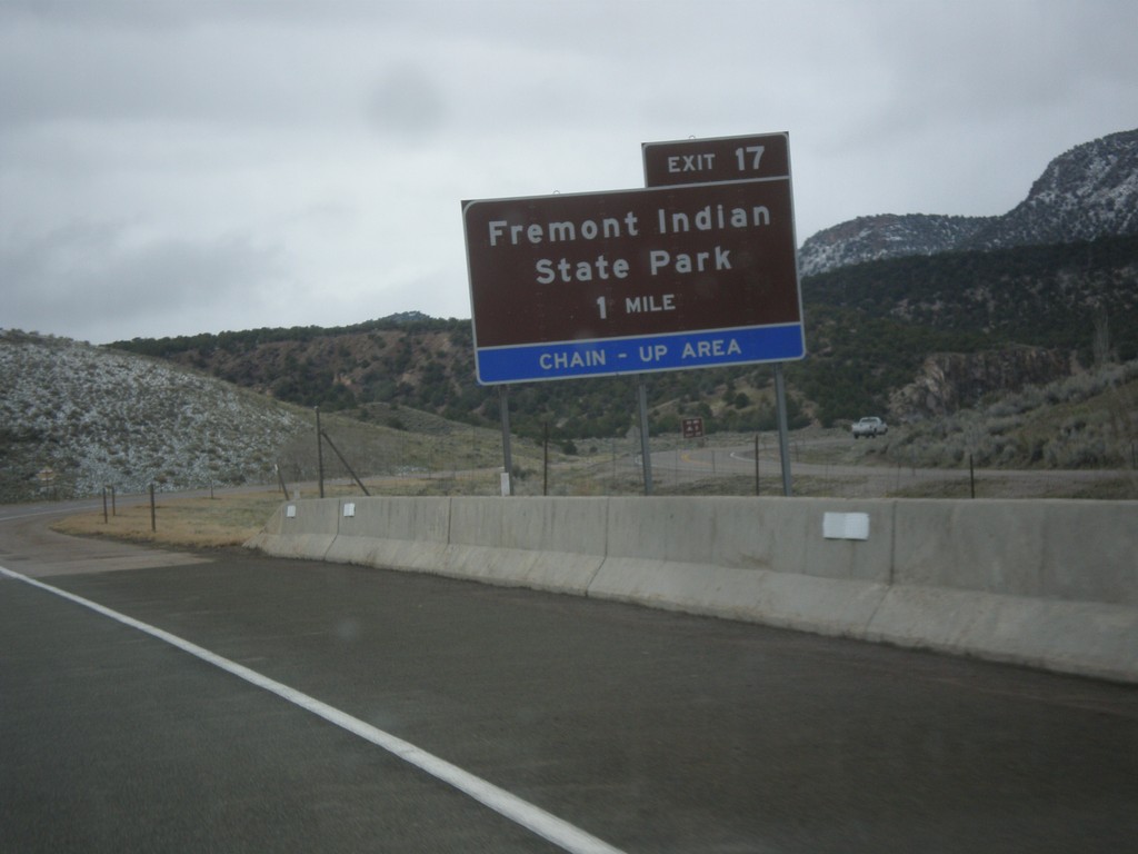
I-70 West - Exit 17
I-70 west approaching Exit 17 - Fremont Indian State Park.
Taken 03-31-2017
Sevier
Sevier County
Utah
United States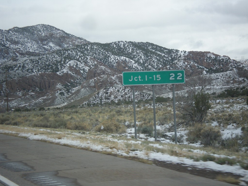
I-70 West - Distance Marker
Distance marker on I-70 west. Distance to Junction I-15.
Taken 03-31-2017
Sevier
Sevier County
Utah
United States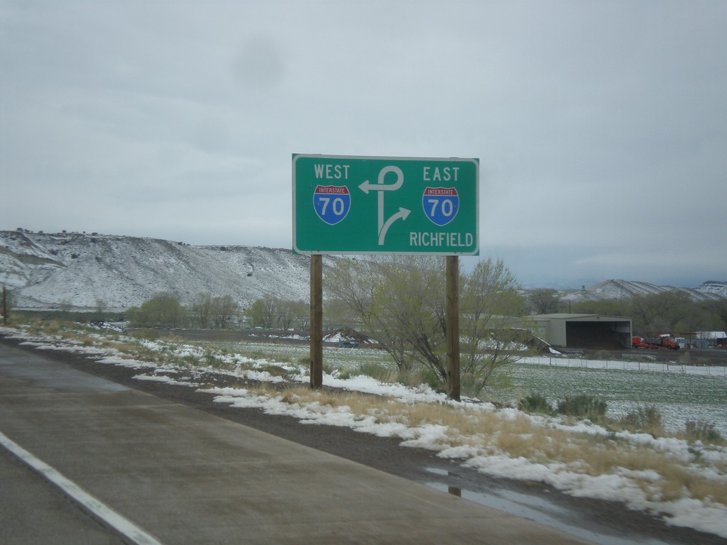
US-89 North Approaching I-70
US-89 North approaching I-70. Use I-70 east for Richfield.
Taken 03-31-2017
 Sevier
 County
Utah
United States
Sevier
Sevier County
Utah
United States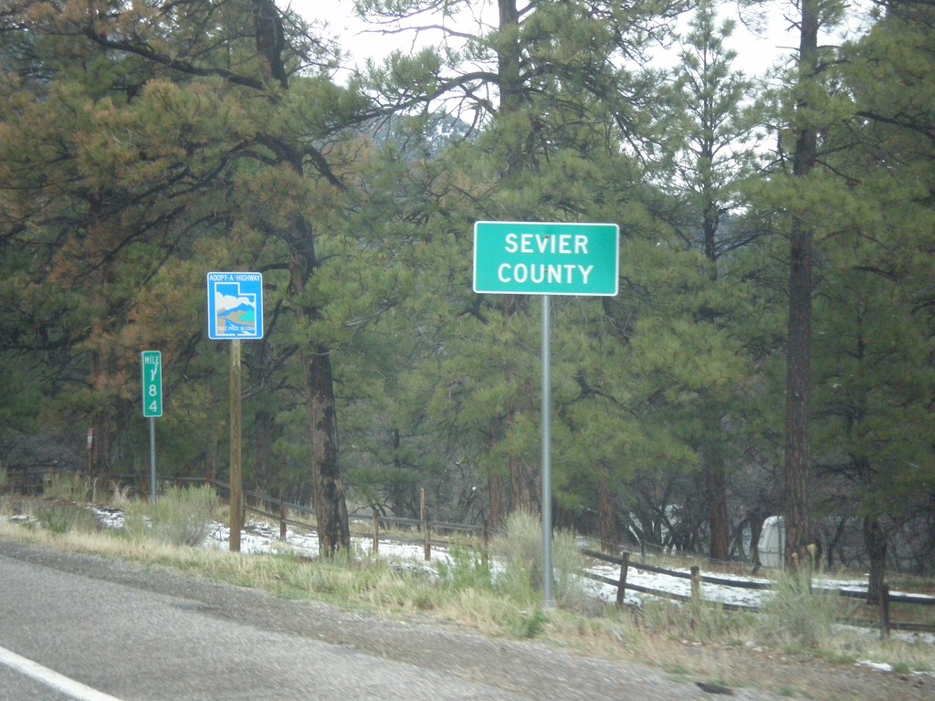
US-89 North - Sevier County
Entering Sevier County on US-89 north.
Taken 03-31-2017
Sevier
Sevier County
Utah
United States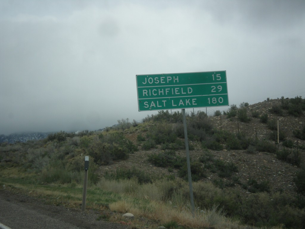
US-89 North - Distance Marker
Distance marker on US-89 north. Distance to Joseph, Richfield, and Salt Lake.
Taken 03-31-2017
Junction
Piute County
Utah
United States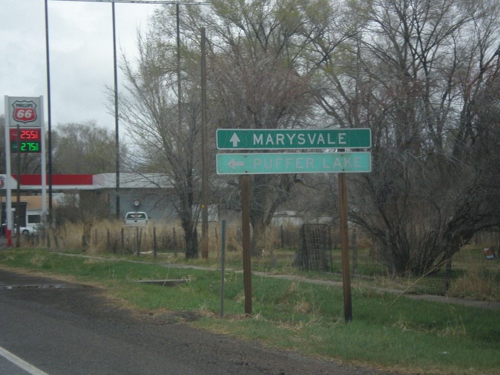
US-89 North at UT-153
US-89 North at UT-153 west to Puffer Lake. Continue north on US-89 north for Marysvale.
Taken 03-31-2017
 Junction
Piute County
Utah
United States
Junction
Piute County
Utah
United States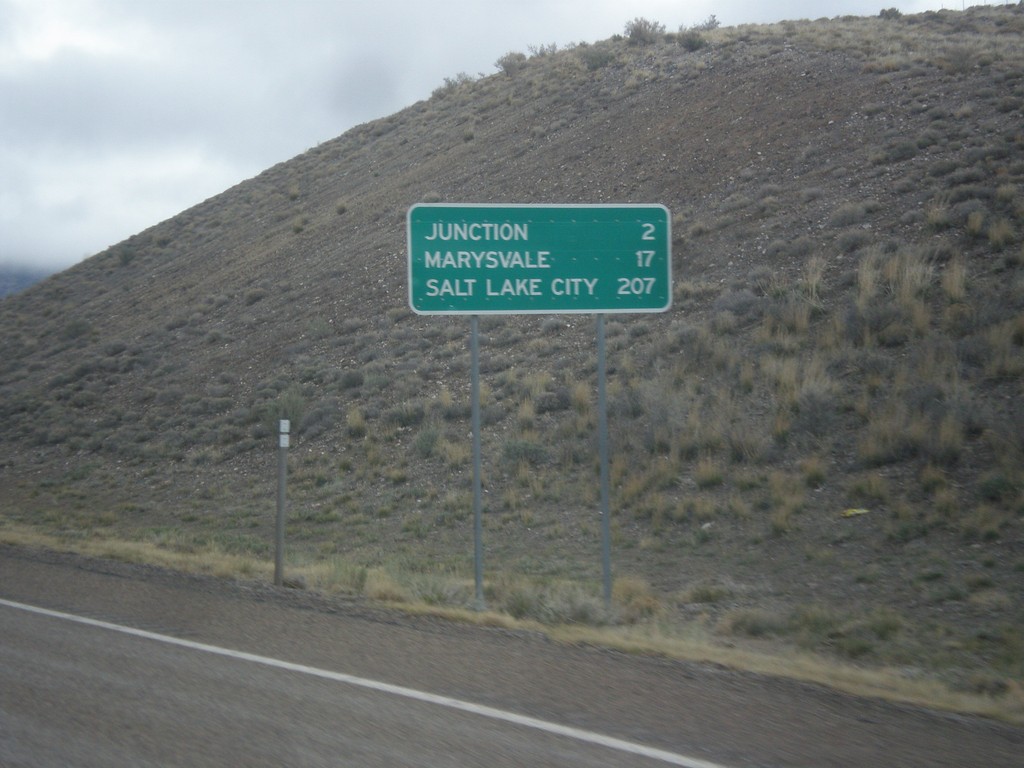
US-89 North - Distance Marker
Distance marker on US-89 north. Distance to Junction, Marysvale, and Salt Lake City.
Taken 03-31-2017
Junction
Piute County
Utah
United States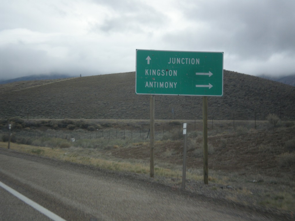
US-89 North Approaching UT-62
US-89 North approaching UT-62 east to Kingston and Antimony. Continue north on US-89 for Junction.
Taken 03-31-2017
 Junction
Piute County
Utah
United States
Junction
Piute County
Utah
United States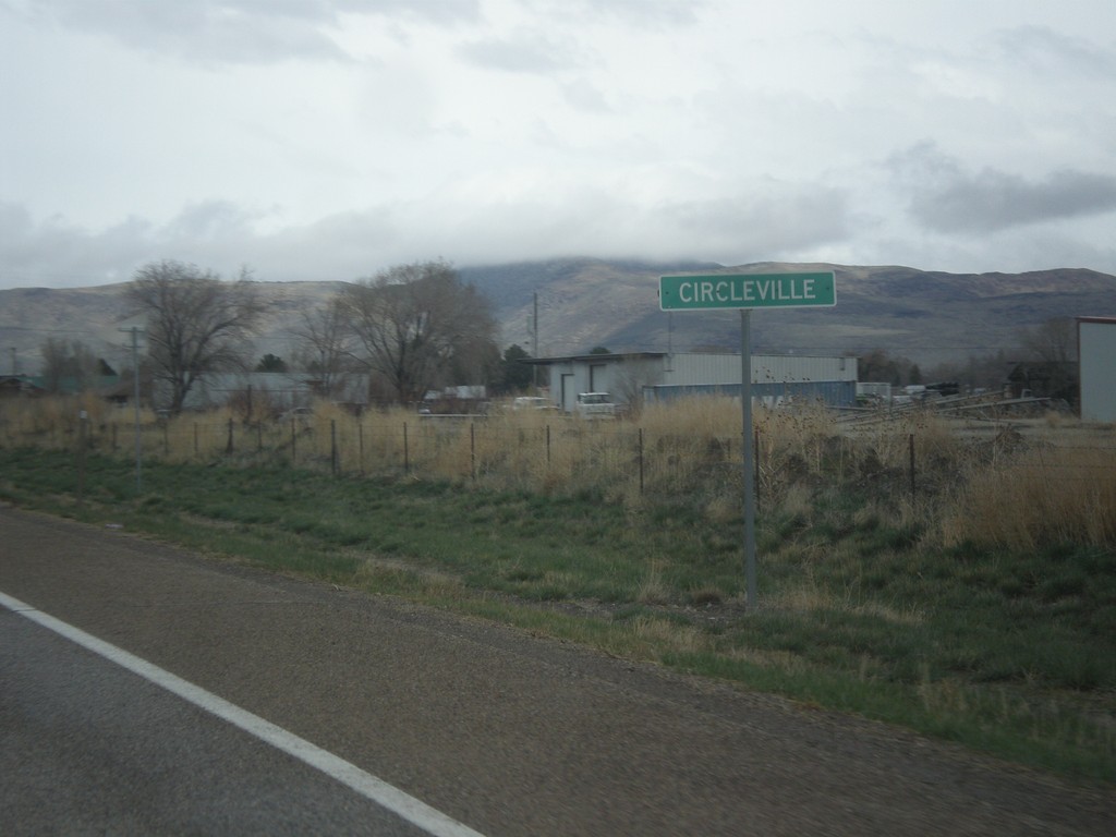
US-89 North - Circleville
Entering Circleville on US-89 north.
Taken 03-31-2017
Circleville
Piute County
Utah
United States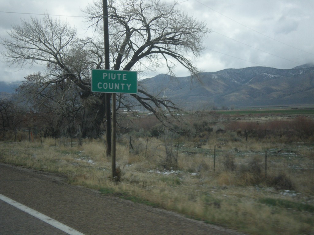
US-89 North - Paiute County
Entering Paiute County on US-89 north. Paiute County is the second least populated county in Utah, behind Daggett County.
Taken 03-31-2017
Circleville
Piute County
Utah
United States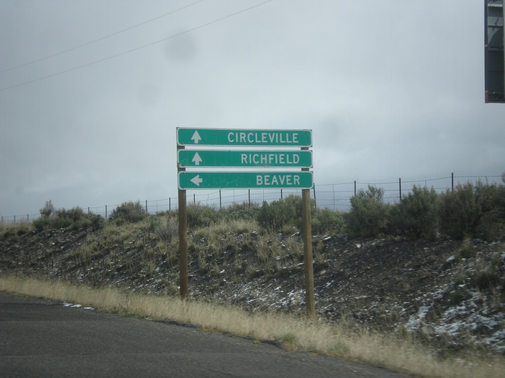
US-89 North at UT-20 West
US-89 North at UT-20 West to Beaver. Continue north on US-89 for Circleville and Richfield.
Taken 03-31-2017
 Spry
Garfield County
Utah
United States
Spry
Garfield County
Utah
United States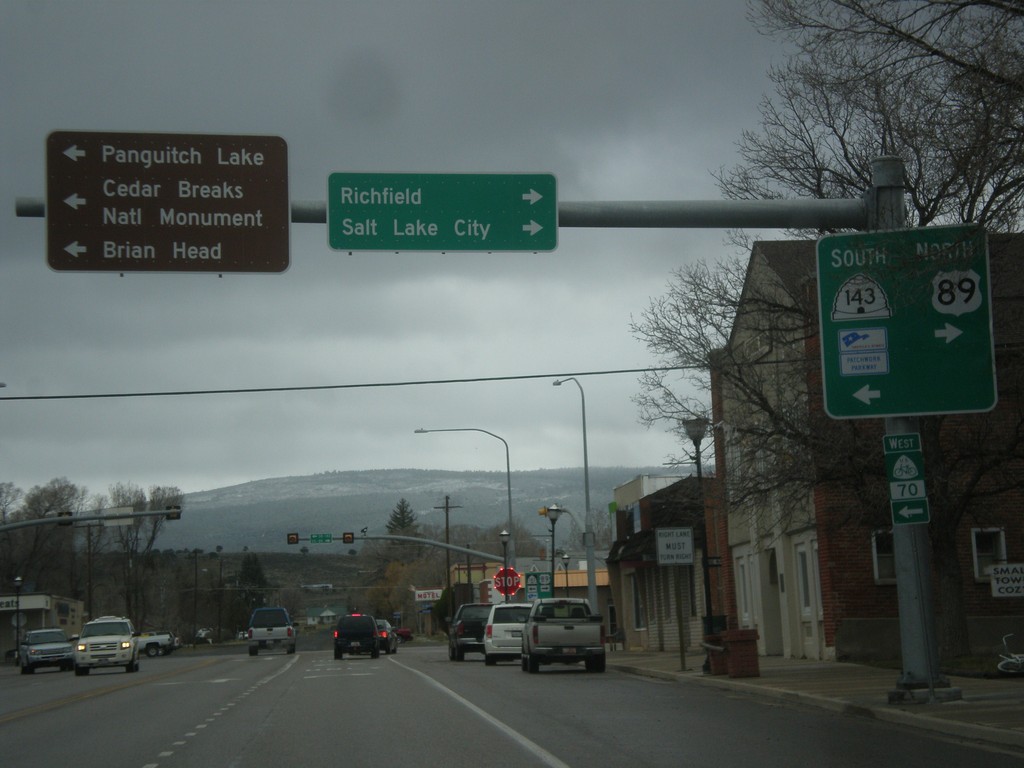
US-89 North at UT-143
US-89 north at UT-143 south. Turn left for UT-143 south to Cedar Breaks National Monument, Brian Head, and Panguitch Lake. Turn right to continue north on US-89 to Richfield and Salt Lake City. UT-143 is part of the Utah’s Patchwork Parkway National Scenic Byway.
Taken 03-31-2017
 Panguitch
Garfield County
Utah
United States
Panguitch
Garfield County
Utah
United States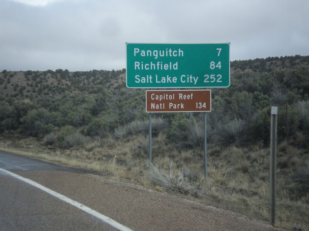
US-89 North - Distance Marker
Distance marker on US-89 north. Distance to Panguitch, Richfield, Salt Lake City, and Capitol Reef National Park.
Taken 03-31-2017
Panguitch
Garfield County
Utah
United States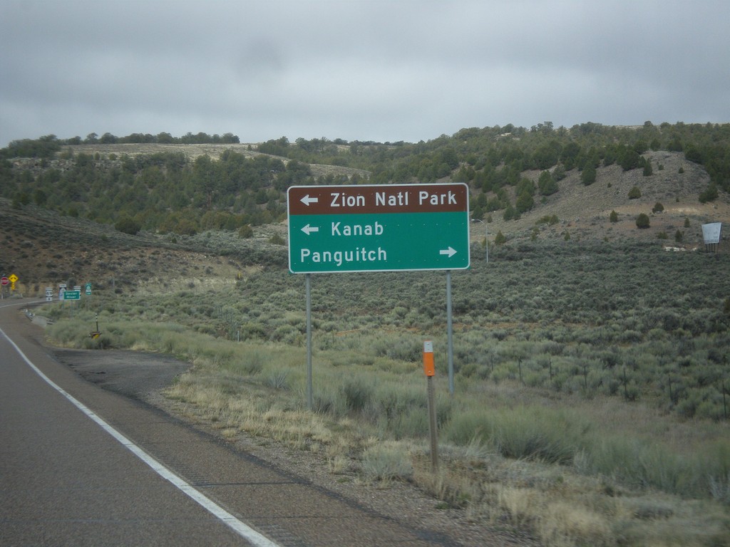
UT-12 West Approaching US-89
UT-12 west approaching US-89. Use US-89 south for Kanab and Zion National Park; use US-89 north for Panguitch.
Taken 03-31-2017
 Panguitch
Garfield County
Utah
United States
Panguitch
Garfield County
Utah
United States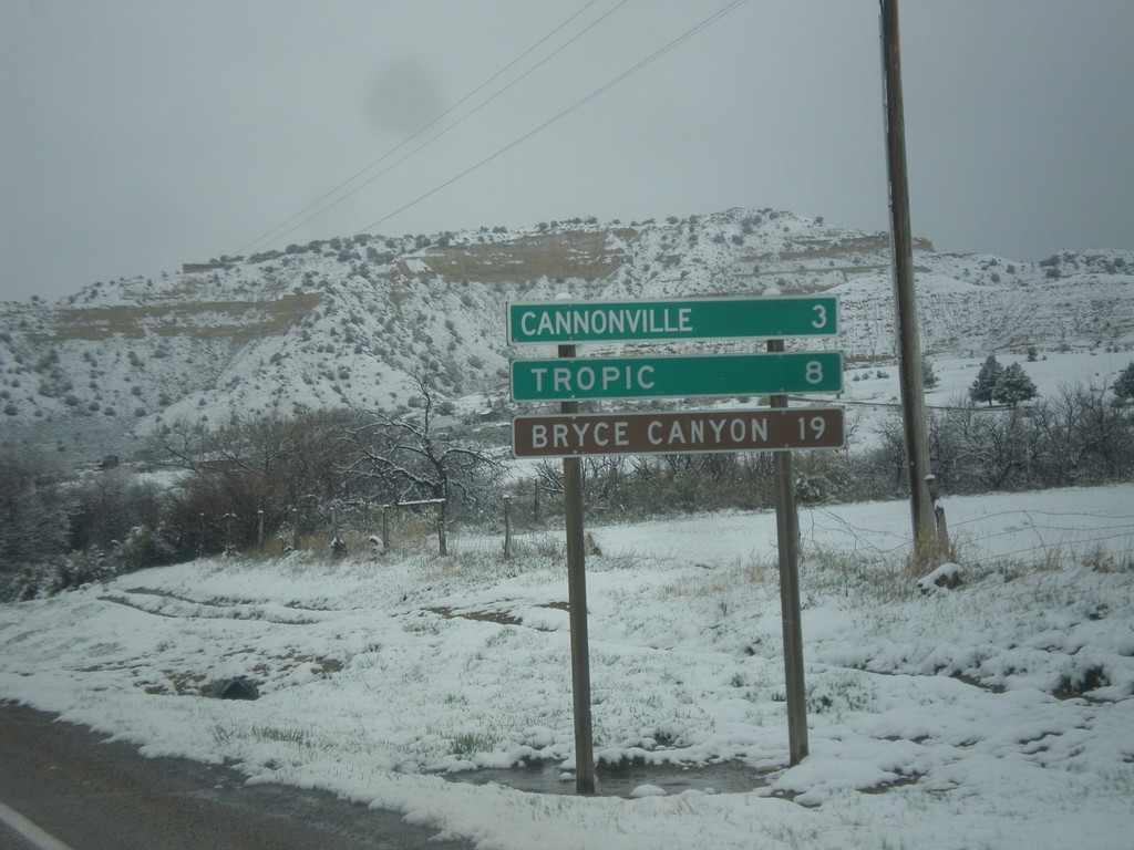
UT-12 West - Distance Marker
Distance marker on UT-12 west. Distance to Cannonville, Tropic, and Bryce Canyon (National Park).
Taken 03-31-2017
Henrieville
Garfield County
Utah
United States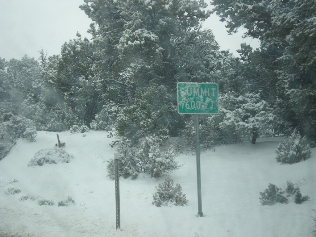
UT-12 West - Summit
Summit - Elevation 7600 Feet on UT-12 west in the Dixie National Forest.
Taken 03-31-2017
Henrieville
Garfield County
Utah
United States