Signs Tagged With Big Green Sign
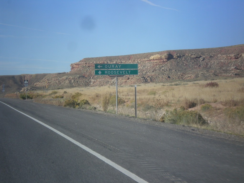
US-40 West Approaching UT-88
US-40 West approaching UT-88 south to Ouray in Uintah County. Continue west on US-40 for Roosevelt.
Taken 10-09-2016


 Vernal
Uintah County
Utah
United States
Vernal
Uintah County
Utah
United States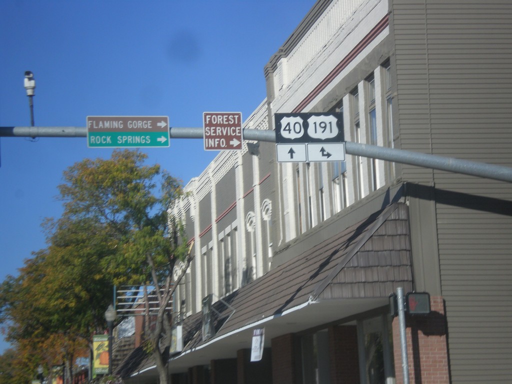
US-40 West at US-191
US-40 West at US-191 north to Rock Springs (Wyoming) and Flaming Gorge. US-191 joins US-40 West to Duchense.
Taken 10-09-2016
Vernal
Uintah County
Utah
United States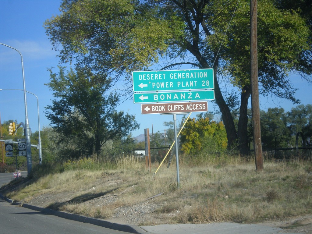
US-40 West at UT-45 Jct.
US-40 west at UT-45 south to Deseret Generation Power Plant, Bonanza, and Book Cliffs Access.
Taken 10-09-2016
 Naples
Uintah County
Utah
United States
Naples
Uintah County
Utah
United States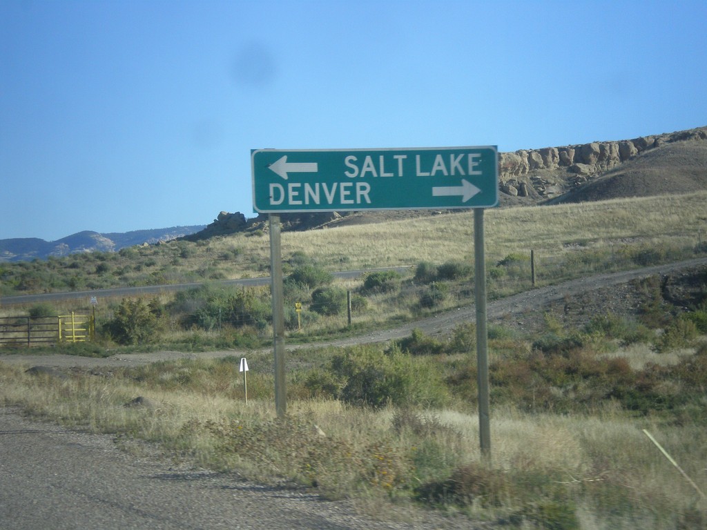
Redwash Road North at US-40
Redwash Road North at US-40 to Salt Lake City and Denver. This sign is odd in that destinations for far away locations are used on a county road.
Taken 10-09-2016
Jensen
Uintah County
Utah
United States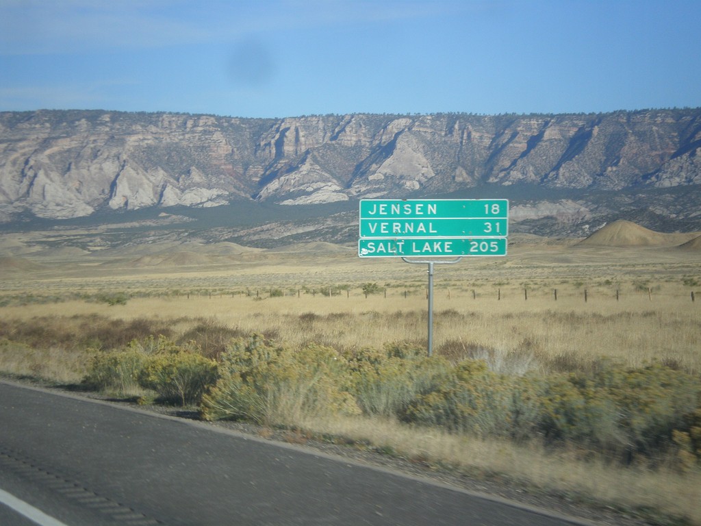
US-40 West - Distance Marker
Distance marker on US-40 west. Distance to Jensen, Vernal, and Salt Lake City. This is the first distance marker along US-40 in Utah.
Taken 10-09-2016
Uintah County
Utah
United States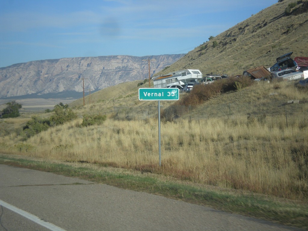
US-40 West - Distance Marker
Distance maker on US-40 west. Distance to Vernal (Utah).
Taken 10-09-2016
Dinosaur
Moffat County
Colorado
United States
CO-64 North Approaching US-40
End CO-64 at US-40 in Dinosaur. Turn left for US-40 west to Vernal (Utah). Turn right for US-40 east to Craig.
Taken 10-09-2016
 Dinosaur
Moffat County
Colorado
United States
Dinosaur
Moffat County
Colorado
United States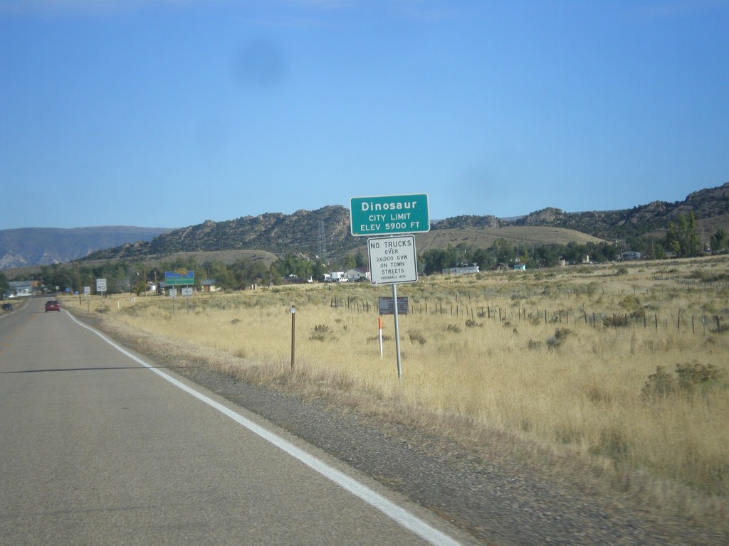
CO-64 West - Dinosaur
Entering Dinosaur, Colorado on CO-64 west.
Taken 10-09-2016
Dinosaur
Moffat County
Colorado
United States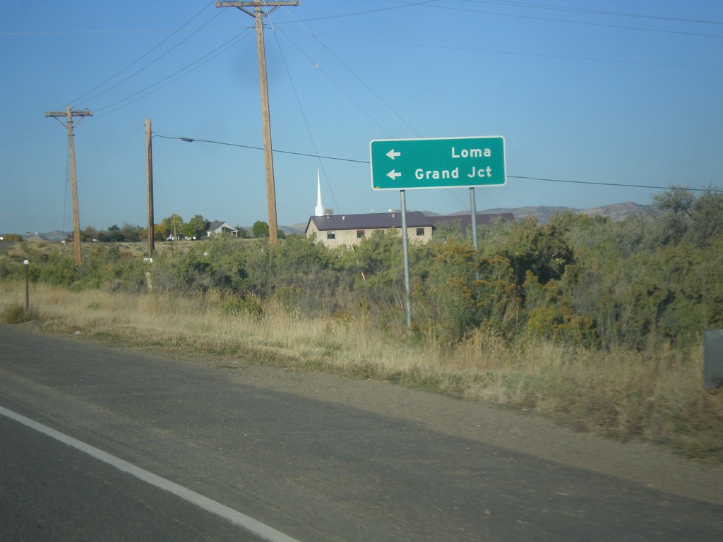
CO-64 West at CO-139 South
CO-64 West at CO-139 South to Loma and Grand Junction.
Taken 10-09-2016
 Rangely
Rio Blanco County
Colorado
United States
Rangely
Rio Blanco County
Colorado
United States
CO-64 West - Rangely
Entering Rangely, Colorado on CO-64 west.
Taken 10-09-2016
Rangely
Rio Blanco County
Colorado
United States
CO-13 North at CO-64 Junction
CO-13 North at CO-64 west to Rangely.
Taken 10-09-2016
 Meeker
Rio Blanco County
Colorado
United States
Meeker
Rio Blanco County
Colorado
United States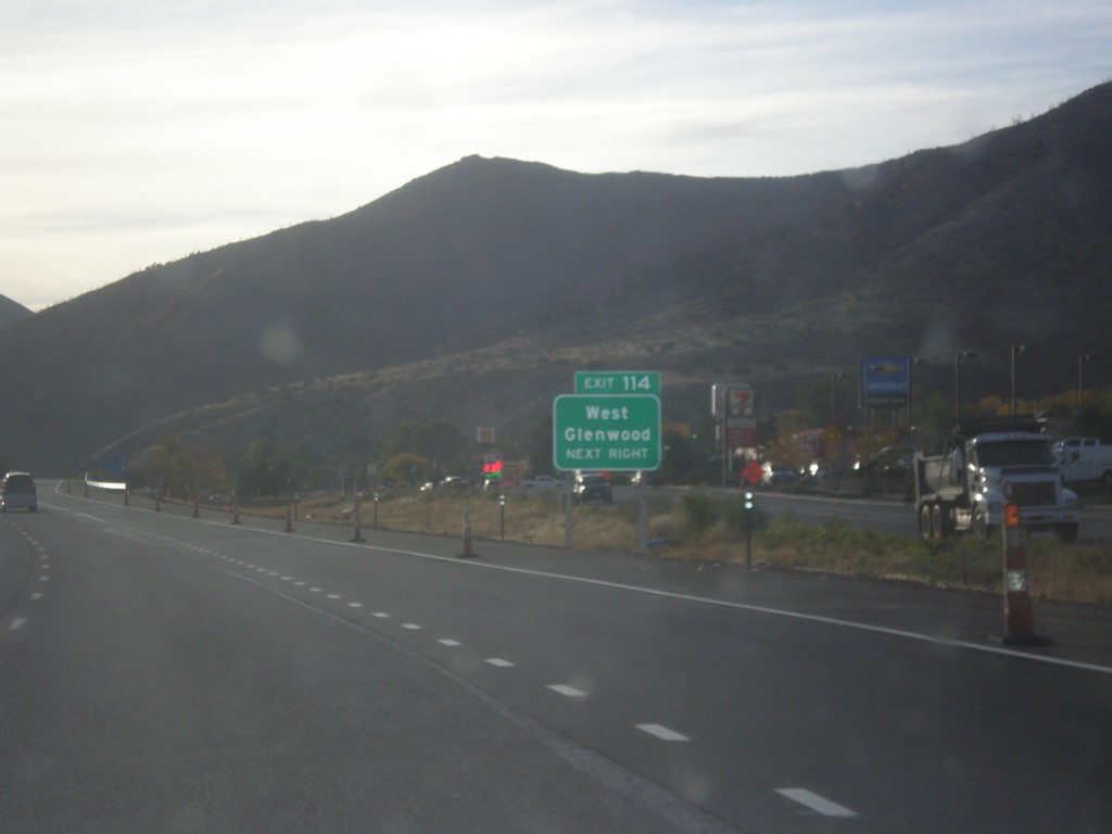
I-70 West - Exit 114
I-70 west at Exit 114 - West Glenwood.
Taken 10-08-2016

 Glenwood Springs
Garfield County
Colorado
United States
Glenwood Springs
Garfield County
Colorado
United States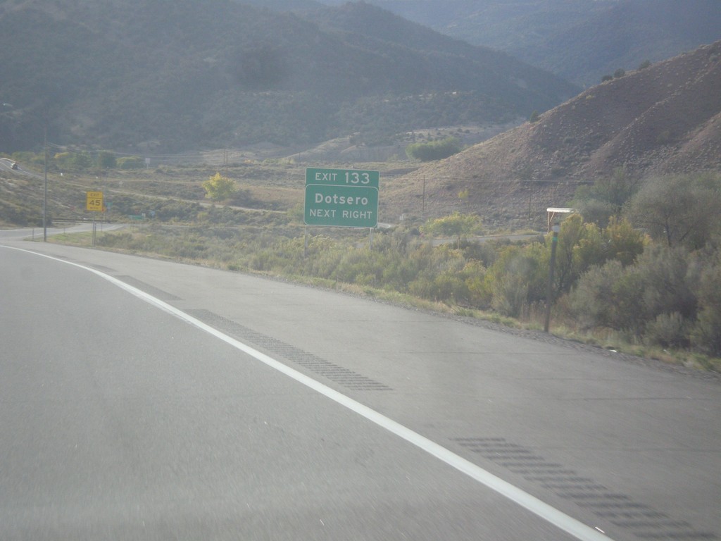
I-70 West - Exit 133
I-70 west at Exit 133 - Dotsero.
Taken 10-08-2016
Gypsum
Eagle County
Colorado
United States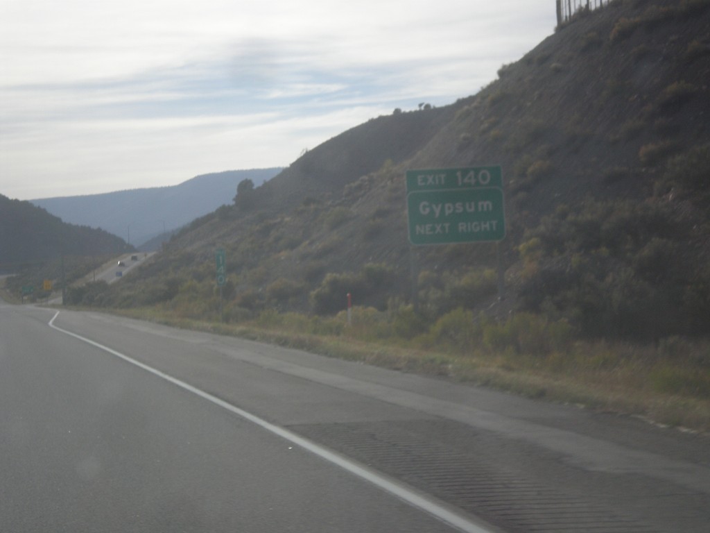
I-70 West - Exit 140
I-70 west approaching Exit 140 - Gypsum.
Taken 10-08-2016
Gypsum
Eagle County
Colorado
United States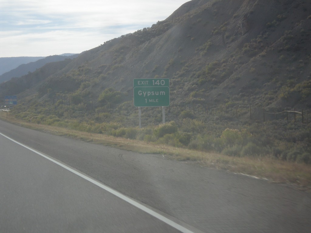
I-70 West - Exit 140
I-70 west approaching Exit 140 - Gypsum. US-6 joins I-70 westbound here.
Taken 10-08-2016
Gypsum
Eagle County
Colorado
United States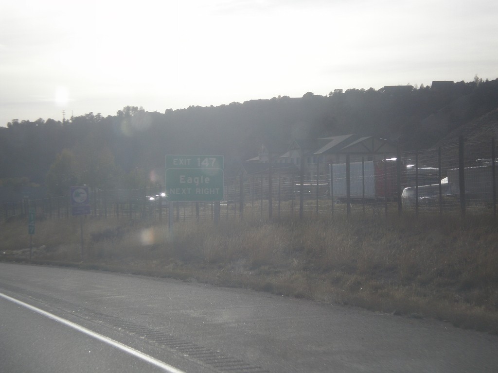
I-70 West - Exit 147
I-70 west approaching Exit 147 - Eagle.
Taken 10-08-2016
Eagle
Eagle County
Colorado
United States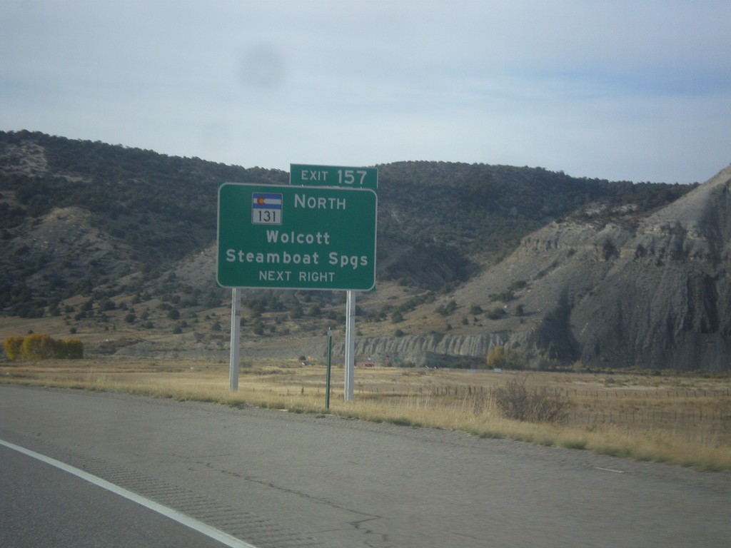
I-70 West - Exit 157
I-70 west approaching Exit 157 - CO-131 North/Wolcott/Steamboat Springs.
Taken 10-08-2016
 Wolcott
Eagle County
Colorado
United States
Wolcott
Eagle County
Colorado
United States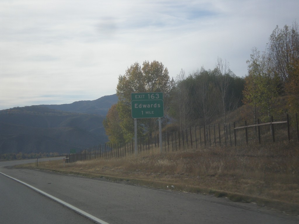
I-70 West - Exit 163
I-70 west approaching Exit 163 - Edwards.
Taken 10-08-2016
Edwards
Eagle County
Colorado
United States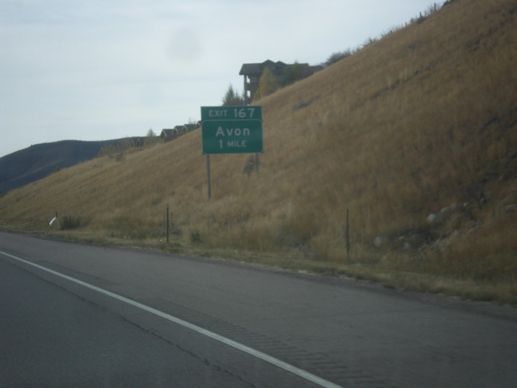
I-70 West - Exit 167
I-70 west approaching Exit 167 - Avon.
Taken 10-08-2016
Edwards
Eagle County
Colorado
United States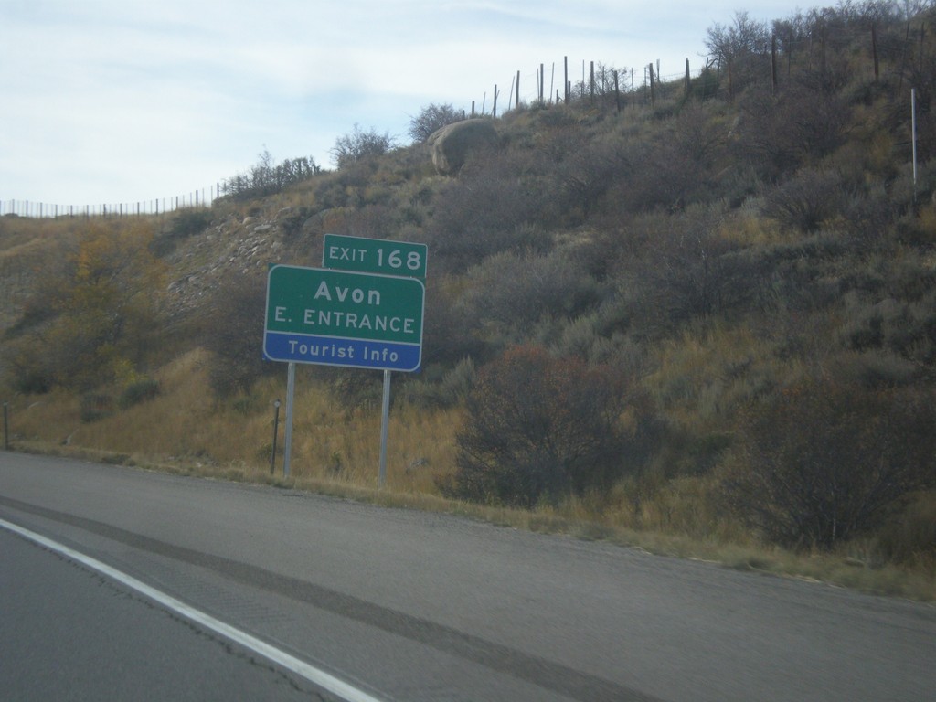
I-70 West - Exit 168
I-70 west at Exit 168 - Avon/East Entrance.
Taken 10-08-2016
Avon
Eagle County
Colorado
United States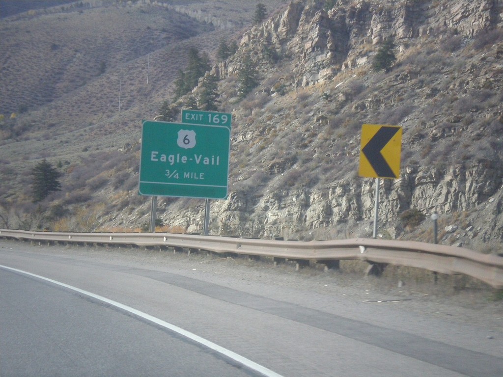
I-70 West - Exit 169
I-70 west approaching Exit 169 - US-6/Eagle - Vail
Taken 10-08-2016
Avon
Eagle County
Colorado
United States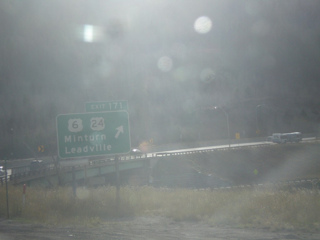
I-70 West - Exit 171
I-70 west at Exit 171 - US-6/US-24/Minturn/Leadville. This is the eastern end of US-24. US-6 leaves I-70 westbound here.
Taken 10-08-2016
 Vail
Eagle County
Colorado
United States
Vail
Eagle County
Colorado
United States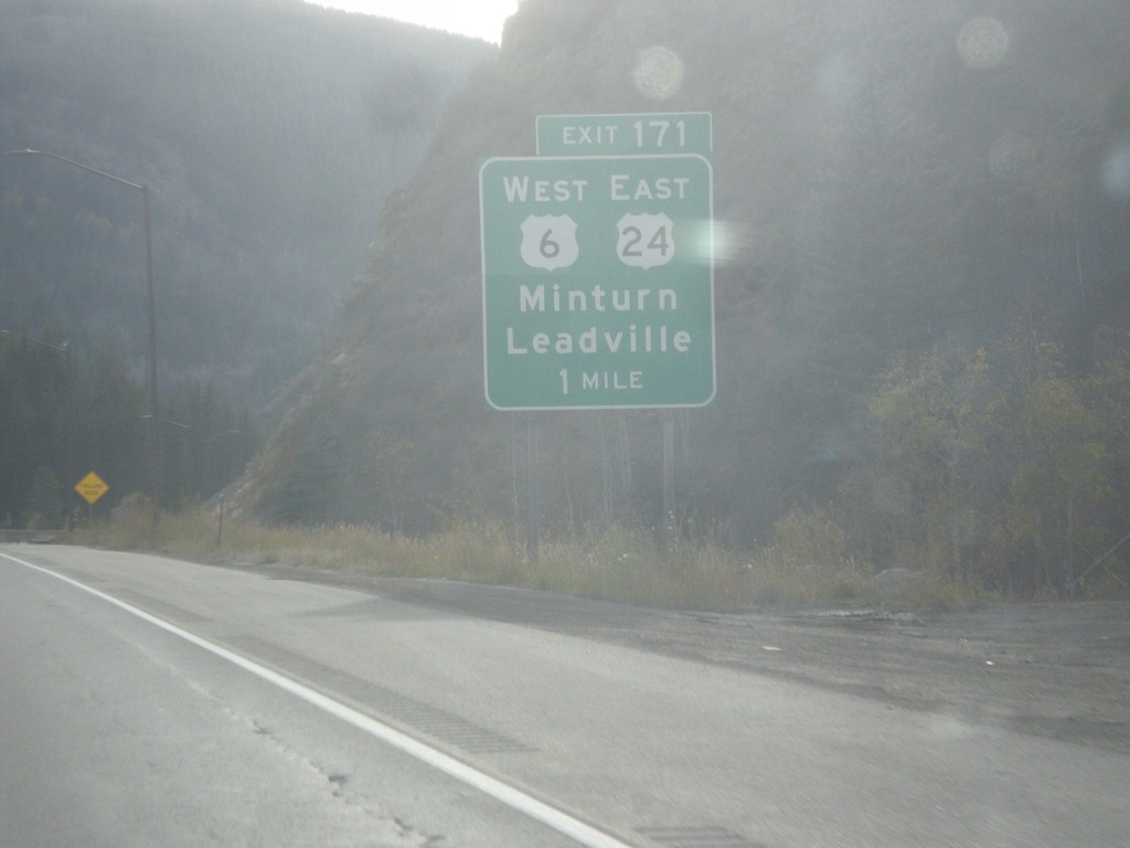
I-70 West - Exit 171
I-70 west approaching Exit 171 - US-6 West/US-24 East/Minturn/Leadville.
Taken 10-08-2016
Vail
Eagle County
Colorado
United States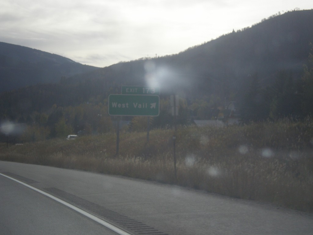
I-70 West - Exit 173
I-70 west at Exit 173 - West Vail.
Taken 10-08-2016
Vail
Eagle County
Colorado
United States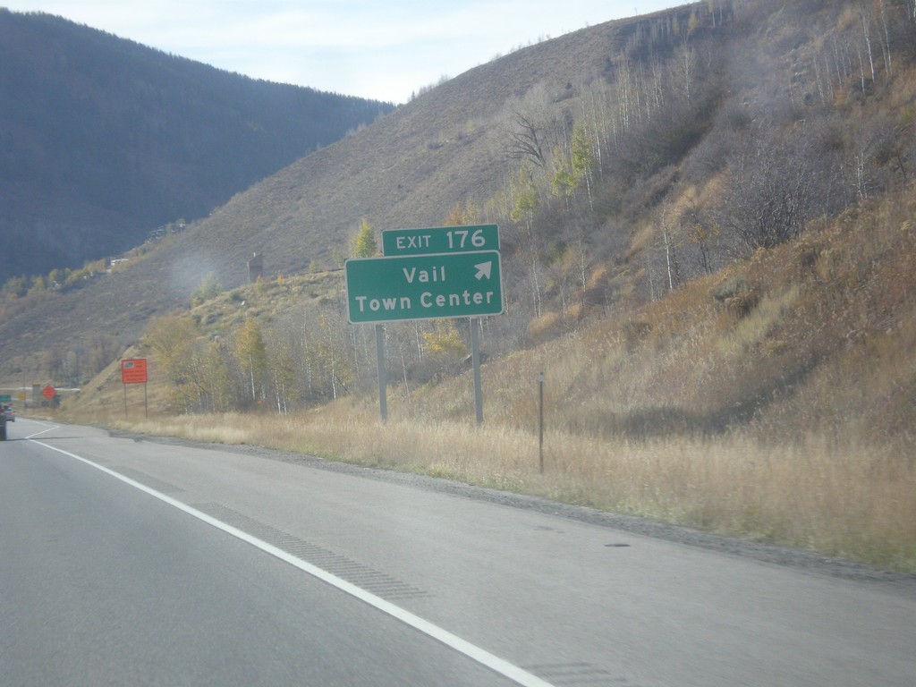
I-70 West - Exit 176
I-70 west at Exit 176 - Vail Town Center.
Taken 10-08-2016
Vail
Eagle County
Colorado
United States