Signs Tagged With Big Green Sign
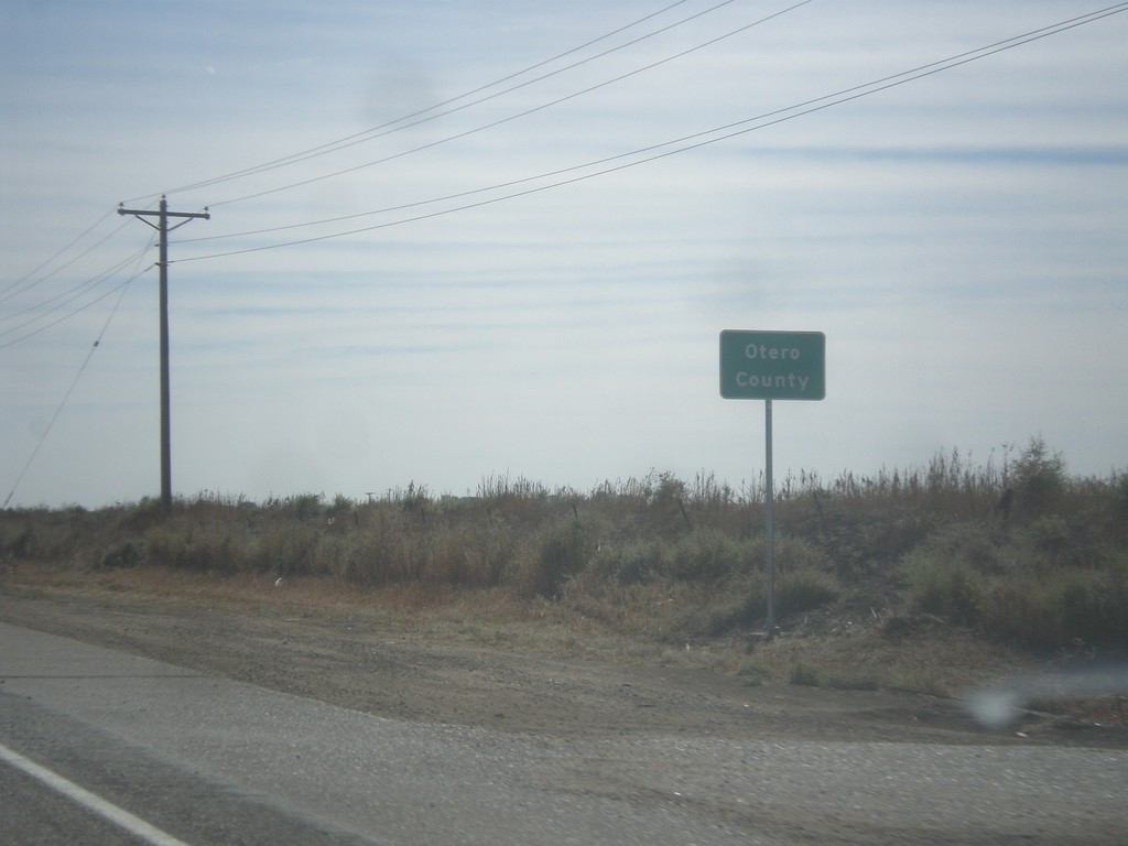
US-50 East - Otero County
Entering Otero County on US-50 east.
Taken 10-08-2016
 Fowler
Pueblo County
Colorado
United States
Fowler
Pueblo County
Colorado
United States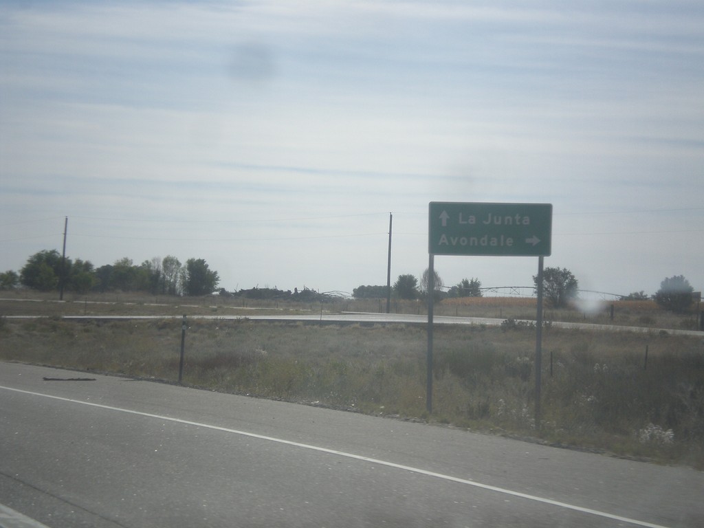
US-50 East at Bus. US-50 West
US-50 East at Bus. US-50 West to Avondale. This is the eastern end of the Pueblo business loop. Continue east on US-50 for La Junta.
Taken 10-08-2016
 Boone
Pueblo County
Colorado
United States
Boone
Pueblo County
Colorado
United States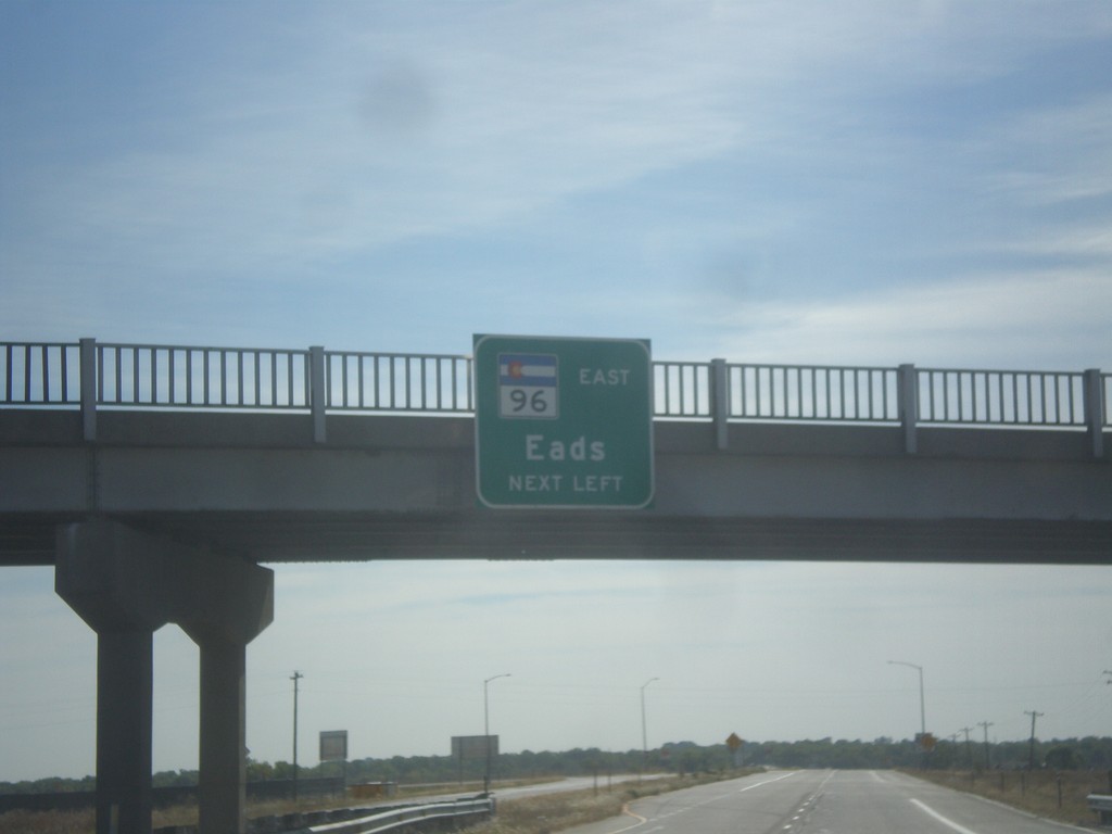
US-50 East/CO-96 East Approaching US-50/CO-96 Split
US-50 East/CO-96 East approaching US-50/CO-96 split. Use left lane for CO-96 East to Eads.
Taken 10-08-2016
 Pueblo
 County
Colorado
United States
Pueblo
Pueblo County
Colorado
United States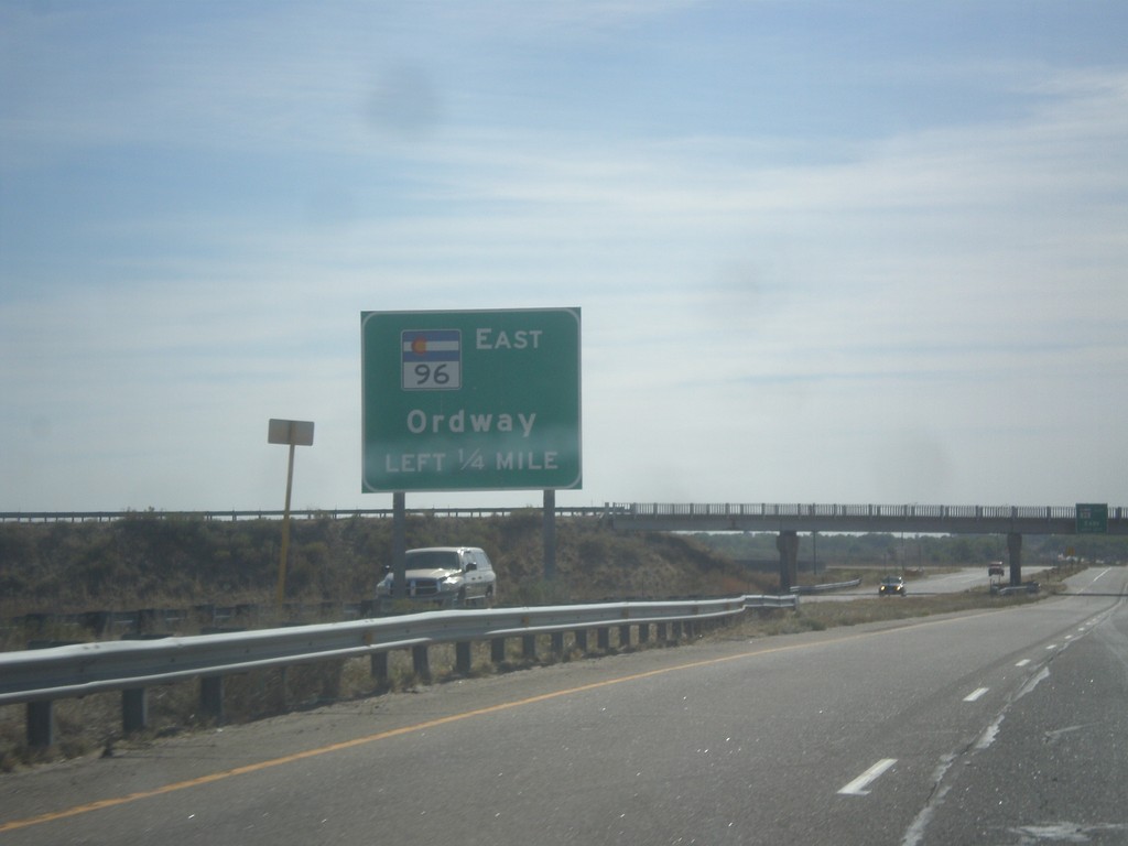
US-50 East/CO-96 East Approaching US-50/CO-96 Split
US-50 East/CO-96 East approaching US-50/CO-96 split. Use left lane for CO-96 East to Ordway.
Taken 10-08-2016
Avondale
Pueblo County
Colorado
United States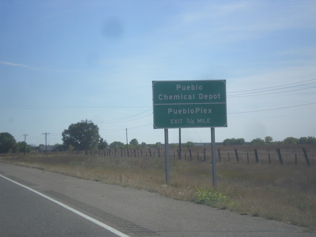
US-50 East - Pueblo Chemical Depot
US-50 East approaching Pueblo Chemical Depot/PuebloPlex interchange.
Taken 10-08-2016
Pueblo
Pueblo County
Colorado
United States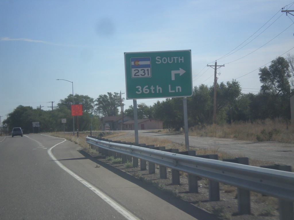
US-50 East at CO-231 South
US-50 East at CO-231 South/36th Lane.
Taken 10-08-2016
 Pueblo
 County
Colorado
United States
Pueblo
Pueblo County
Colorado
United States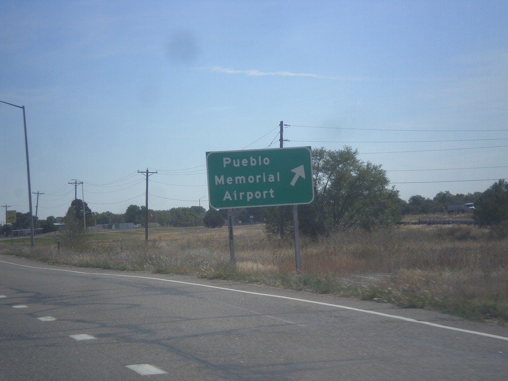
US-50 East - Pueblo Memorial Airport
US-50 East at Pueblo Memorial Airport interchange.
Taken 10-08-2016
Pueblo
Pueblo County
Colorado
United States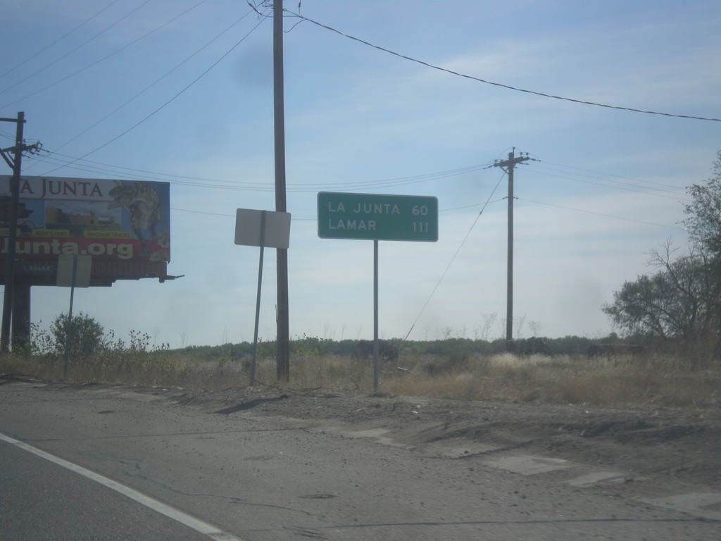
US-50 East - Distance Marker
Distance marker on US-50 east. Distance to La Junta, and Lamar.
Taken 10-08-2016
Pueblo
Pueblo County
Colorado
United States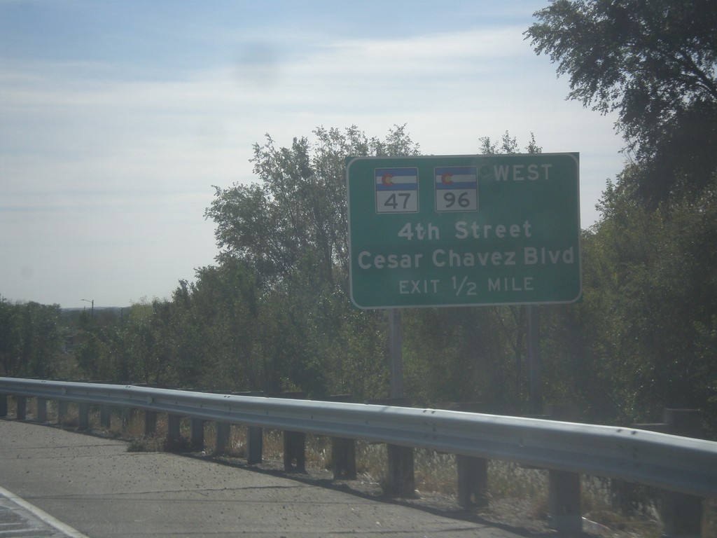
US-50 East Approaching CO-47/CO-96
US-50 East approaching CO-47/CO-96 West/4th St./Cesar Chavez Blvd. CO-96 joins US-50 eastbound to Avondale.
Taken 10-08-2016
 Pueblo
 County
Colorado
United States
Pueblo
Pueblo County
Colorado
United States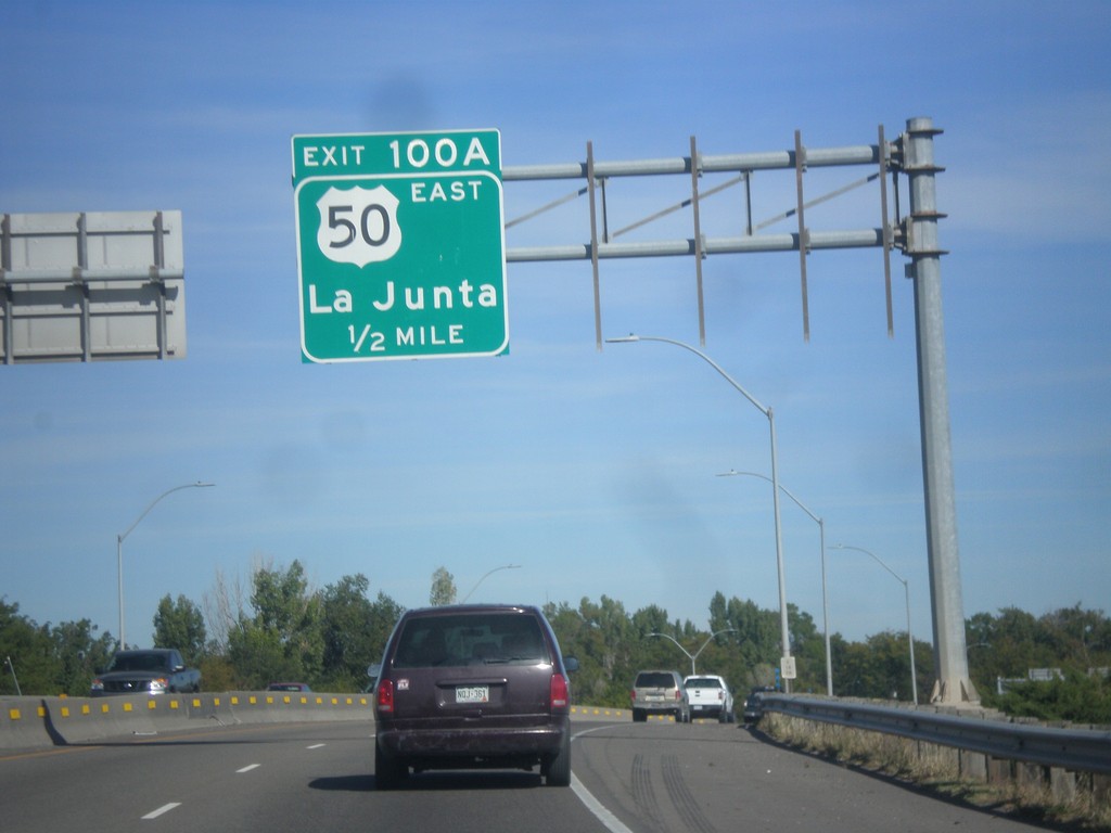
I-25 North - Exit 100A
I-25 north approaching Exit 100A - US-50 East/La Junta. US-50 joins I-25 northbound through Pueblo.
Taken 10-08-2016

 Pueblo
 County
Colorado
United States
Pueblo
Pueblo County
Colorado
United States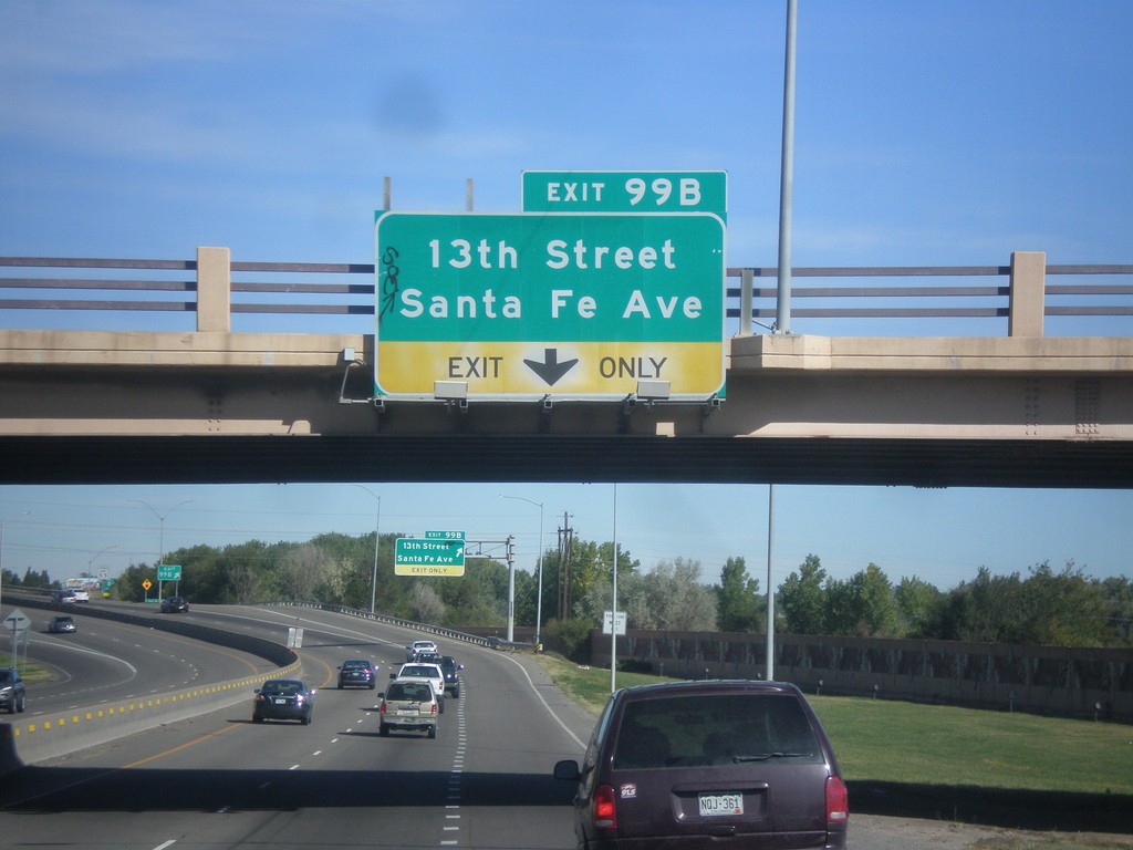
I-25 North - Exit 99B
I-25 north approaching Exit 99B - 13th St./Santa Fe Ave.
Taken 10-08-2016
Pueblo
Pueblo County
Colorado
United States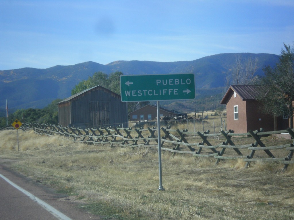
CO-67 South at CO-96
CO-67 South at CO-96 in Wetmore. Use CO-96 west to Westcliffe; CO-96 east to Pueblo.
Taken 10-08-2016
 Silver Cliff
Custer County
Colorado
United States
Silver Cliff
Custer County
Colorado
United States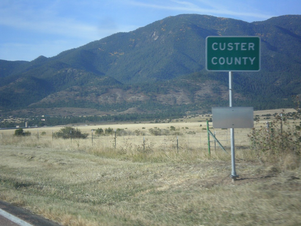
CO-67 South - Custer County
Entering Custer County on CO-67 south.
Taken 10-08-2016
Wetmore
Custer County
Colorado
United States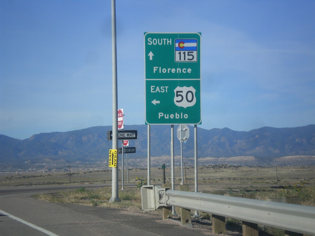
CO-115 South at US-50 East Onramp
CO-115 South at US-50 East onramp to Pueblo. Continue south on CO-115 for Florence.
Taken 10-08-2016
 Penrose
Fremont County
Colorado
United States
Penrose
Fremont County
Colorado
United States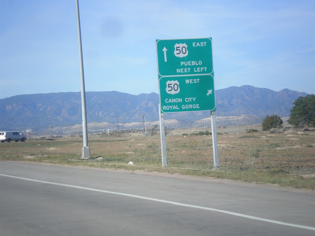
CO-115 South at US-50
CO-115 South at US-50. Use right lane for US-50 West to Canon City and Royal Gorge; continue over freeway for US-50 East to Pueblo.
Taken 10-08-2016
Penrose
Fremont County
Colorado
United States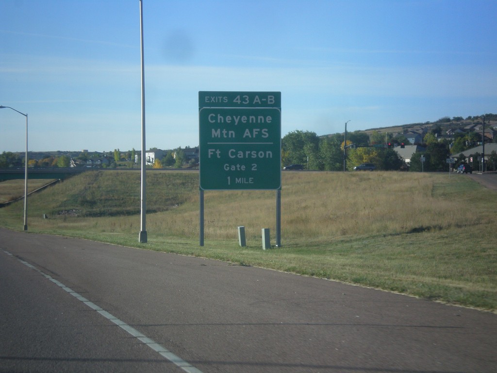
CO-115 South - Exits 43A-B
CO-115 south approaching Exits 43A-B - Cheyenne Mountain AFS/Fort Carson Gate 2.
Taken 10-08-2016
Colorado Springs
El Paso County
Colorado
United States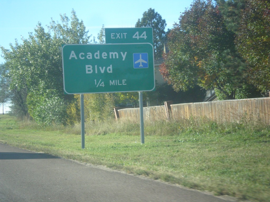
CO-115 South - Exit 44
CO-115 south approaching Exit 44 - Academy Blvd.
Taken 10-08-2016
Colorado Springs
El Paso County
Colorado
United States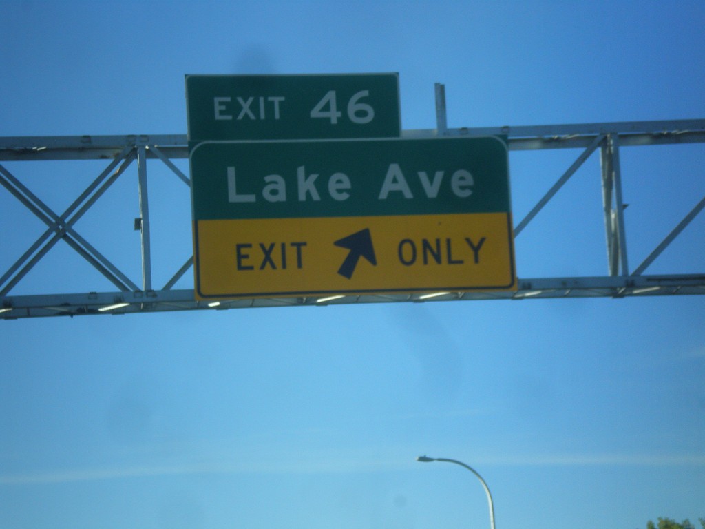
CO-115 South - Exit 46
CO-115 south at Exit 46 - Lake Ave.
Taken 10-08-2016
Colorado Springs
El Paso County
Colorado
United States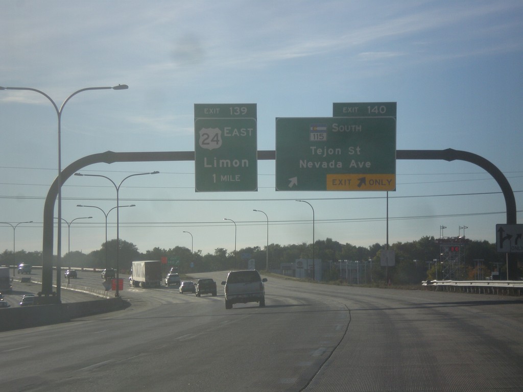
I-25 South/US-24 East - Exits 140 and 139
I-25 South/US-24 East at Exit 140 - CO-115 South/Tejon St./Nevada Ave. Approaching Exit 139 - US-24 East/Limon.
Taken 10-08-2016
 Colorado Springs
El Paso County
Colorado
United States
Colorado Springs
El Paso County
Colorado
United States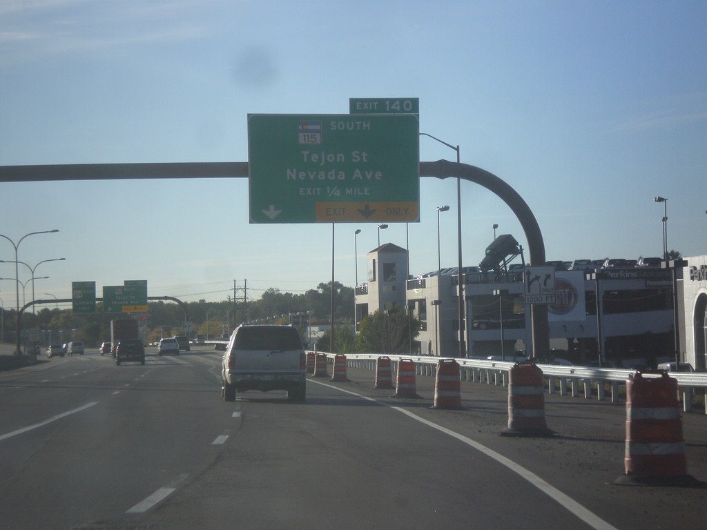
I-25 South - Exit 140
I-25 south approaching Exit 140 - CO-115 South/Tejon St./Nevada Ave.
Taken 10-08-2016
Colorado Springs
El Paso County
Colorado
United States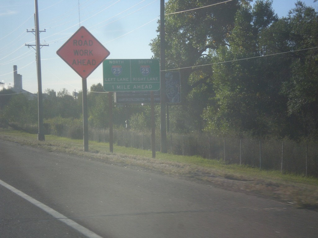
US-24 East Approaching I-25
US-24 East approaching I-25. Use right lane for I-25 south; left lane for I-25 north.
Taken 10-08-2016
Colorado Springs
El Paso County
Colorado
United States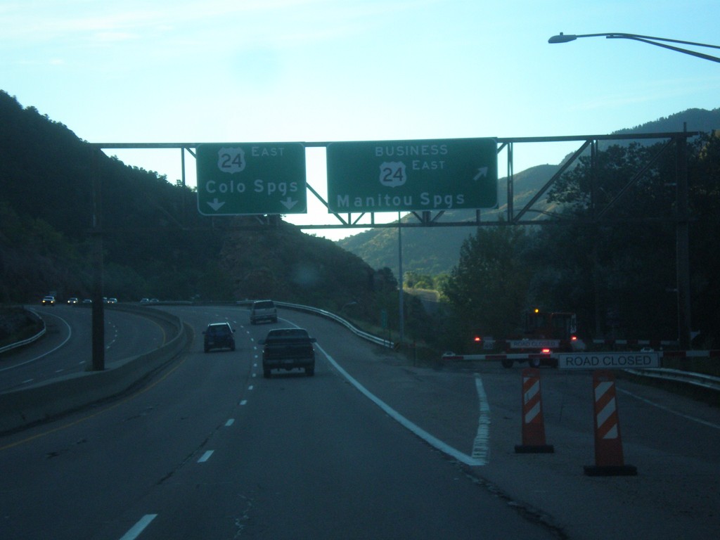
US-24 East - Manitou Springs Business Loop
US-24 East at Bus. US-24 East - Manitou Springs. US-24 continues eastbound to Colorado Springs.
Taken 10-08-2016
 El Paso County
Colorado
United States
El Paso County
Colorado
United States
US-24 East approaching Pikes Peak Highway
US-24 East approaching Pikes Peak Highway/North Pole. The Pikes Peak Highway is a toll road that ascends the summit of Pikes Peak.
Taken 10-08-2016
Cascade-Chipita Park
El Paso County
Colorado
United States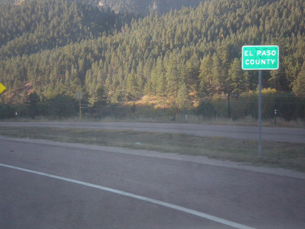
US-24 East - El Paso County
Entering El Paso County on US-24 east.
Taken 10-08-2016
Woodland Park
El Paso County
Colorado
United States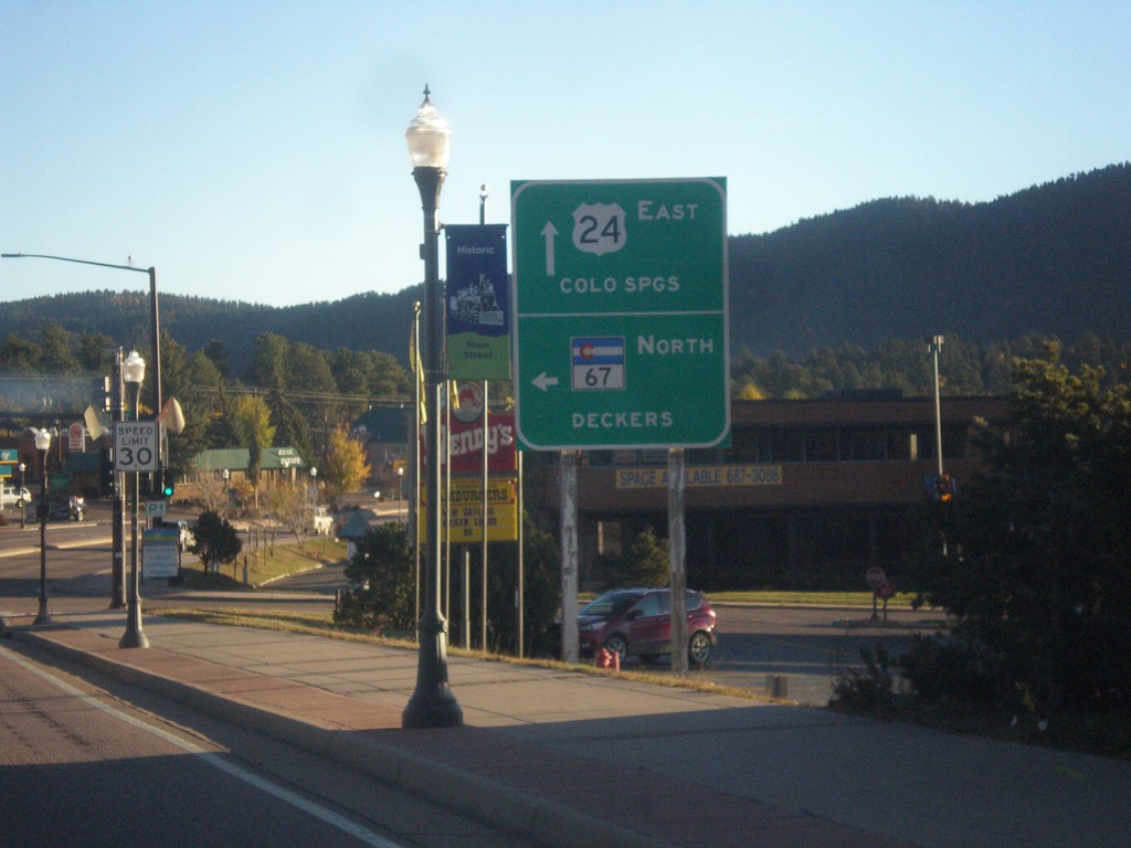
US-24 East/CO-67 North at CO-67 North
US-24 East/CO-67 North at CO-67 North to Deckers. Continue east on US-24 for Colorado Springs.
Taken 10-08-2016
Woodland Park
Teller County
Colorado
United States