Signs Tagged With Big Green Sign
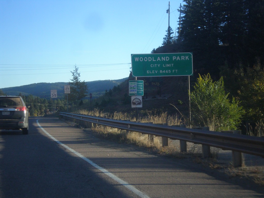
US-24 East - Woodland Park
Entering the city of Woodland Park on US-24 east.
Taken 10-08-2016
 Woodland Park
Teller County
Colorado
United States
Woodland Park
Teller County
Colorado
United States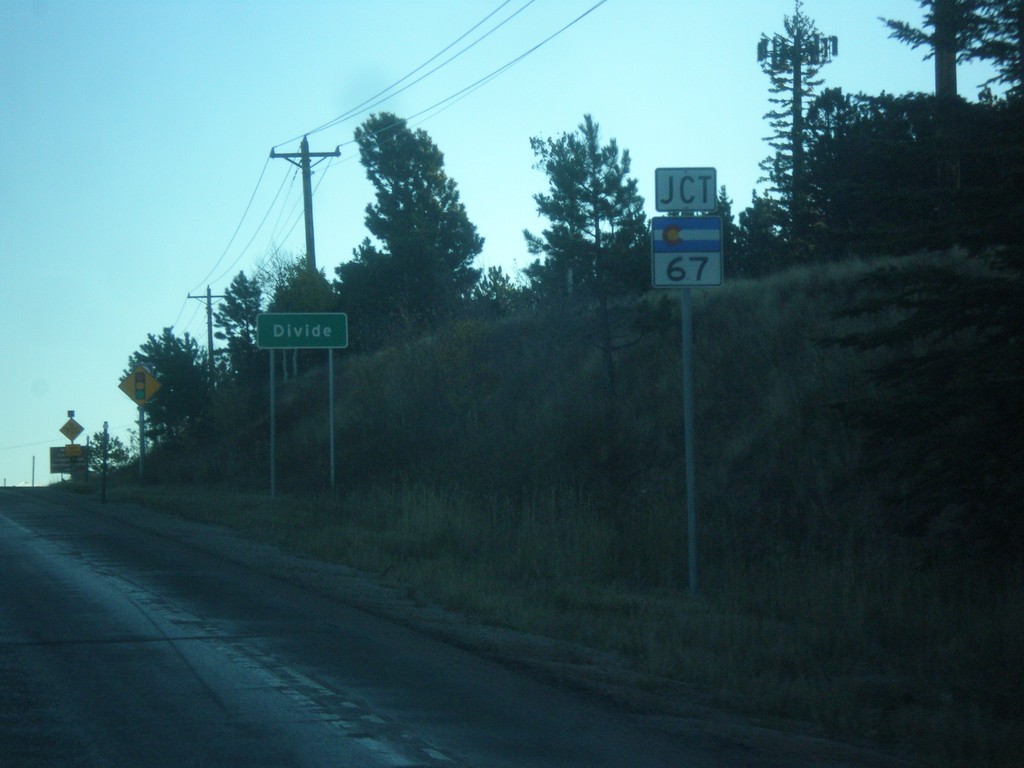
US-24 East - Divide and approaching CO-67
Entering Divide on US-24 east. Also approaching CO-67 south.
Taken 10-08-2016
 Divide
Teller County
Colorado
United States
Divide
Teller County
Colorado
United States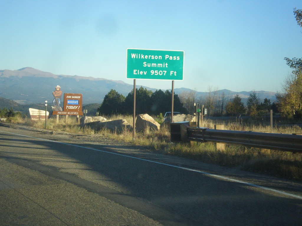
US-24 East - Wilkerson Pass
US-24 East at Wilkerson Pass Summit - Elevation 9507 Feet.
Taken 10-07-2016
Lake George
Park County
Colorado
United States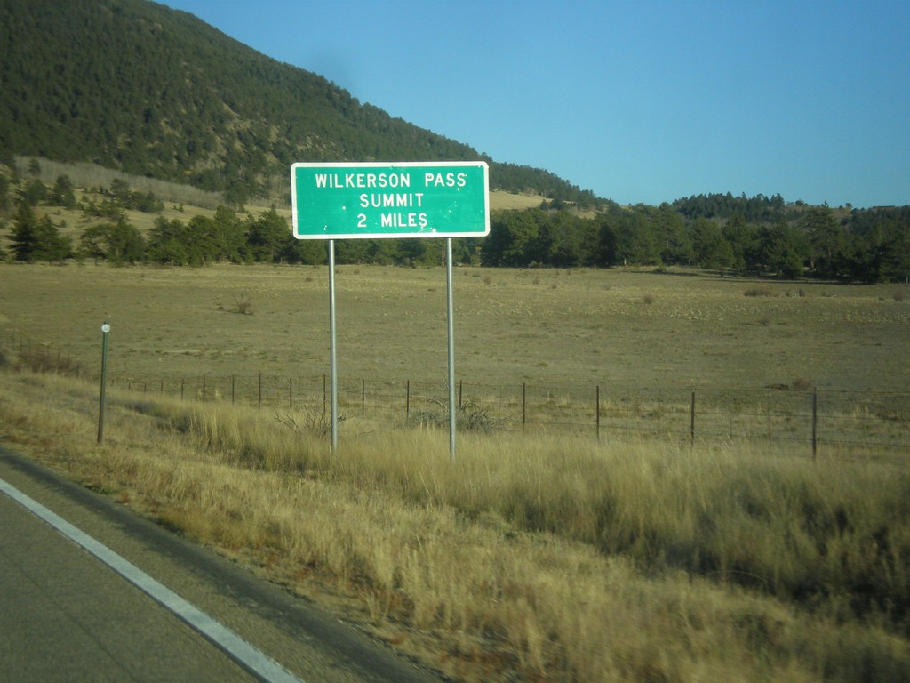
US-24 East - Wilkerson Pass 2 Miles
US-24 East begin climb of Wilkerson Pass. Wilkerson Pass Summit - 2 Miles.
Taken 10-07-2016
Hartsel
Park County
Colorado
United States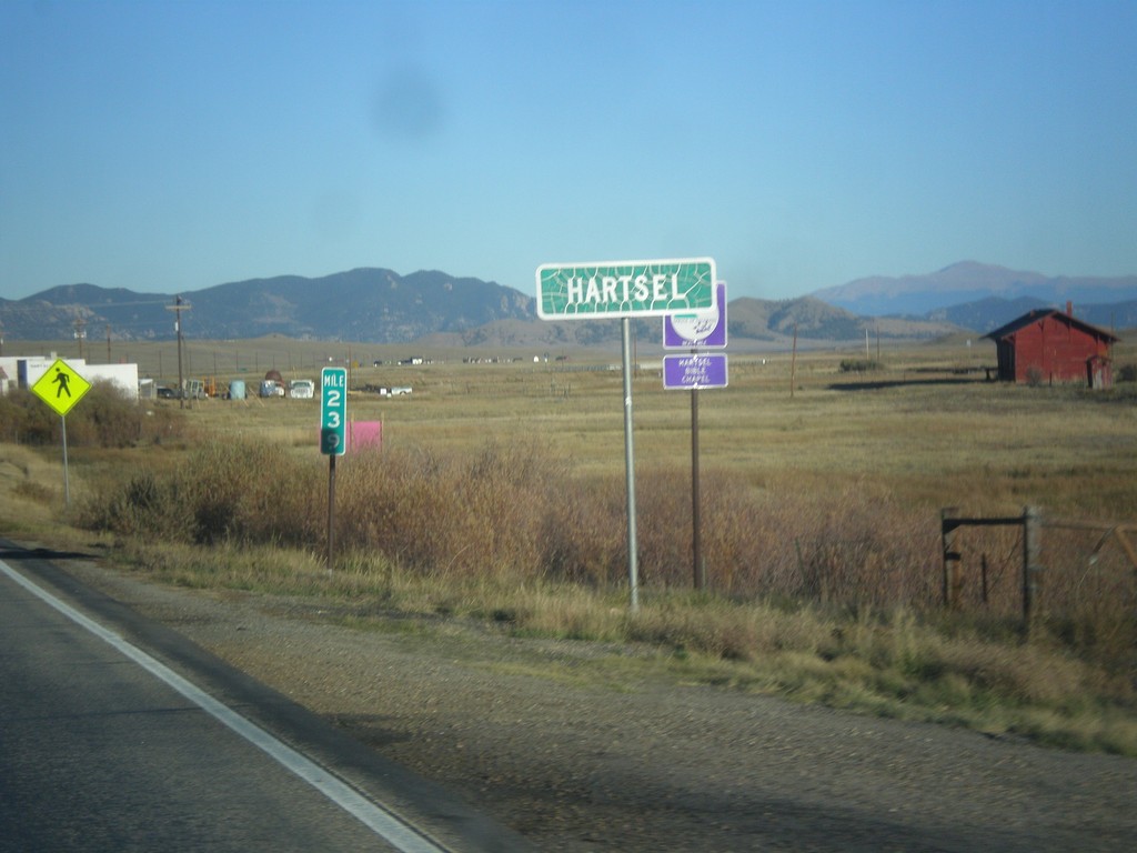
US-24 East/CO-9 South - Hartsel
Entering Hartsel on US-24 East/CO-9 South.
Taken 10-07-2016
 Hartsel
Park County
Colorado
United States
Hartsel
Park County
Colorado
United States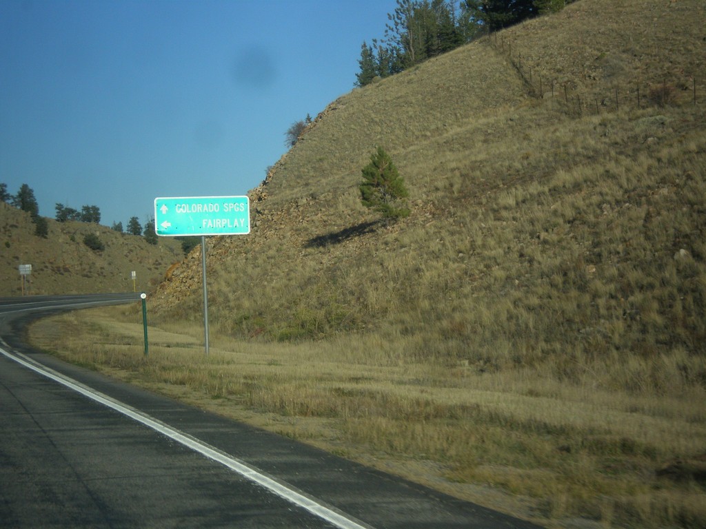
US-24 East at CO-9 North
US-24 East at CO-9 North to Fairplay. CO-9 South joins US-24 East to Hartsel.
Taken 10-07-2016
Hartsel
Park County
Colorado
United States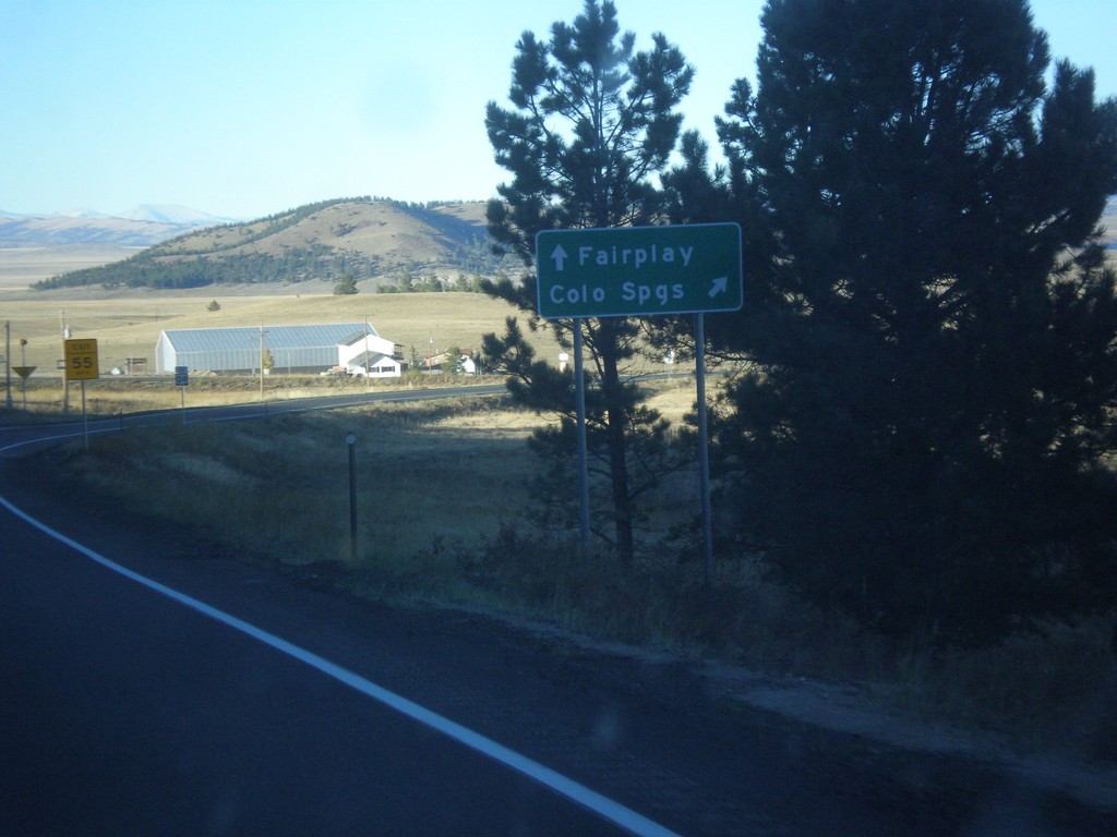
US-24 East/US-285 North at Antero Junction
US-24 East/US-285 North at Antero Junction. Merge right for US-24 East to Colorado Springs; continue straight for US-285 north to Fairplay.
Taken 10-07-2016
 Antero Junction
Park County
Colorado
United States
Antero Junction
Park County
Colorado
United States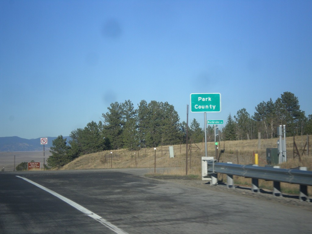
US-24 East/US-285 North - Park County
Entering Park County on US-24 East/US-285 North at Trout Creek Pass - 9,487 Feet.
Taken 10-07-2016
Hartsel
Park County
Colorado
United States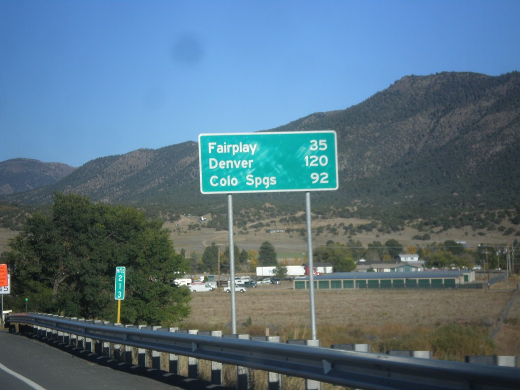
US-24 East/US-285 North - Distance Marker
Distance Marker on US-24 East/US-285 North. Distance to Fairplay and Denver (via US-285), and Colorado Springs (via US-24).
Taken 10-07-2016
Buena Vista
Chaffee County
Colorado
United States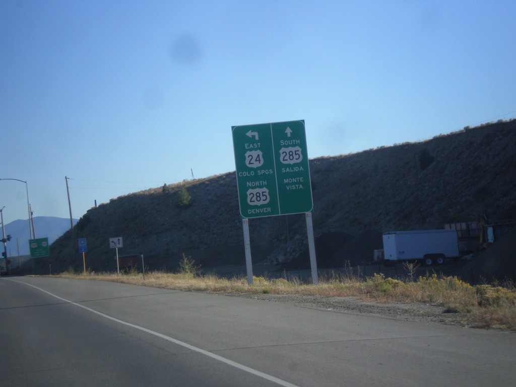
US-24 East at US-285 - Buena Vista
US-24 East at US-285 in Buena Vista. Continue straight for US-285 south to Salida and Monte Vista. Turn left to continue east on US-24 to Colorado Springs, and US-285 north to Denver.
Taken 10-07-2016
Buena Vista
Chaffee County
Colorado
United States
US-24 East - Distance Marker
Distance marker on US-24 east. Distance to Buena Vista and Poncha Springs (via US-285).
Taken 10-07-2016
Twin Lakes
Lake County
Colorado
United States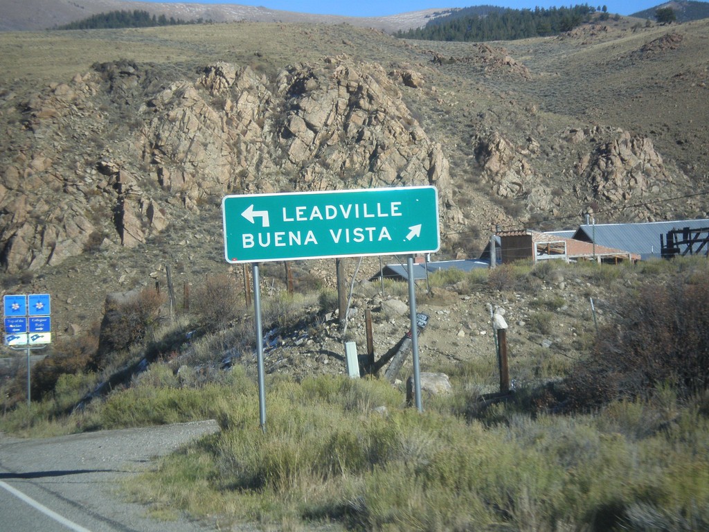
End CO-82 East at US-24
End CO-82 East at US-24. Use US-24 west to Leadville; US-24 east to Buena Vista.
Taken 10-07-2016
 Twin Lakes
Lake County
Colorado
United States
Twin Lakes
Lake County
Colorado
United States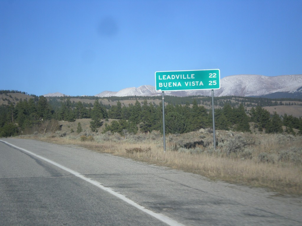
CO-82 East - Distance Marker
Distance marker on CO-82 east. Distance to Leadville (via US-24 west) and Buena Vista (via US-24 east).
Taken 10-07-2016
Twin Lakes
Lake County
Colorado
United States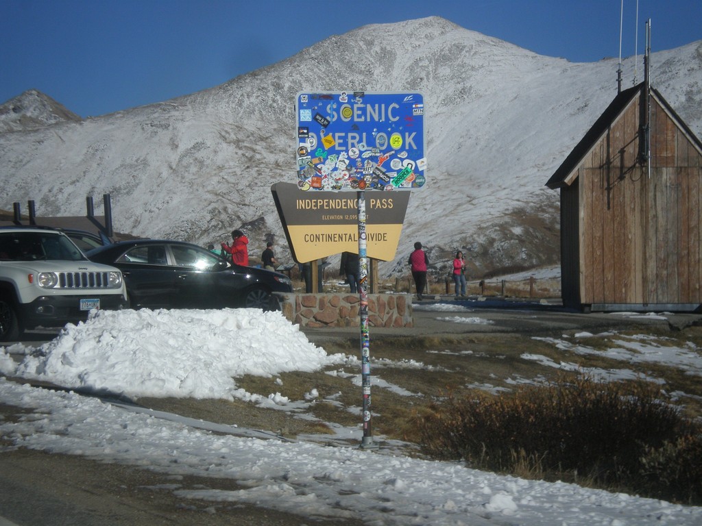
CO-82 East - Independence Pass
Independence Pass on CO-82 east. Independence Pass is 12,095 Feet and on the Continental Divide. Independence Pass is one of the highest mountain passes in Colorado on the state highway system. The only higher pass on the state highway system is US-34 in Rocky Mountain National Park. Independence Pass divides the Arkansas River watershed which flows into the Gulf of Mexico; and the Roaring Fork River which flows into the Colorado River and the Gulf of California.
Taken 10-07-2016
Pitkin County
Colorado
United States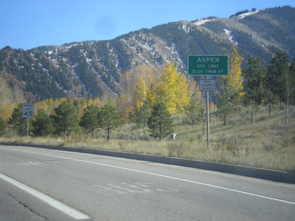
CO-82 East - Entering Aspen
Entering Aspen - Elevation 7908 Feet. Aspen is the county seat of Pitkin County.
Taken 10-07-2016
Aspen
Pitkin County
Colorado
United States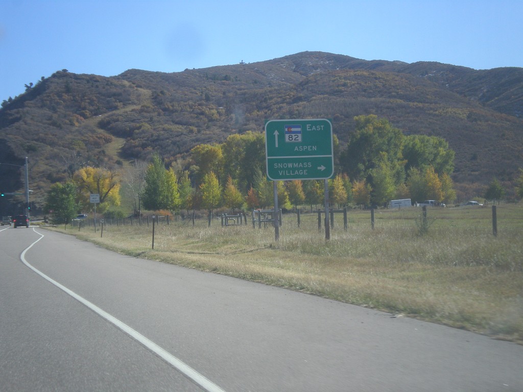
CO-82 East - Snowmass Village Jct.
CO-82 east at Brush Creek Road south to Snowmass Village. Continue east on CO-82 for Aspen.
Taken 10-07-2016
Aspen
Pitkin County
Colorado
United States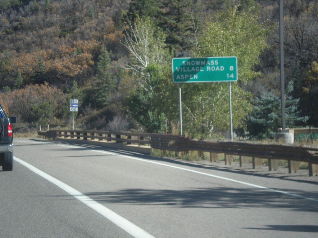
CO-82 East - Distance Marker
Distance marker on CO-82 east. Distance to Snowmass Village Road and Aspen.
Taken 10-07-2016
Snowmass
Pitkin County
Colorado
United States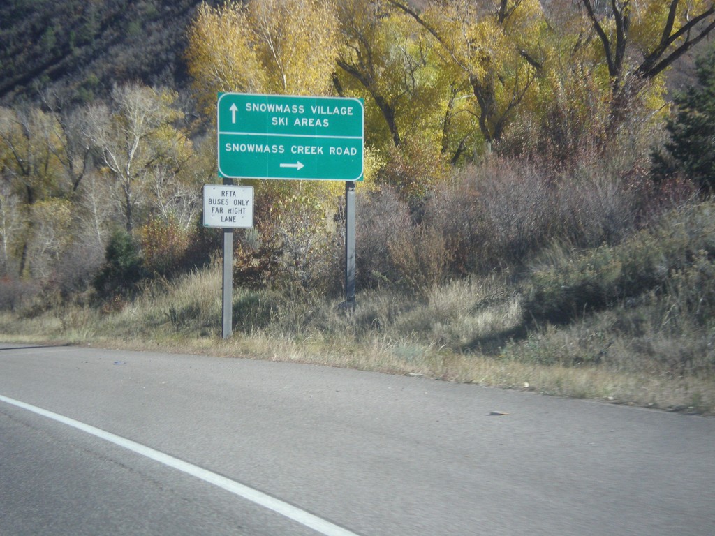
CO-82 East - Snowmass Creek Road Jct.
CO-82 east at Snowmass Creek Road. Continue east on CO-82 for Snowmass Village and Ski Areas.
Taken 10-07-2016
Snowmass
Pitkin County
Colorado
United States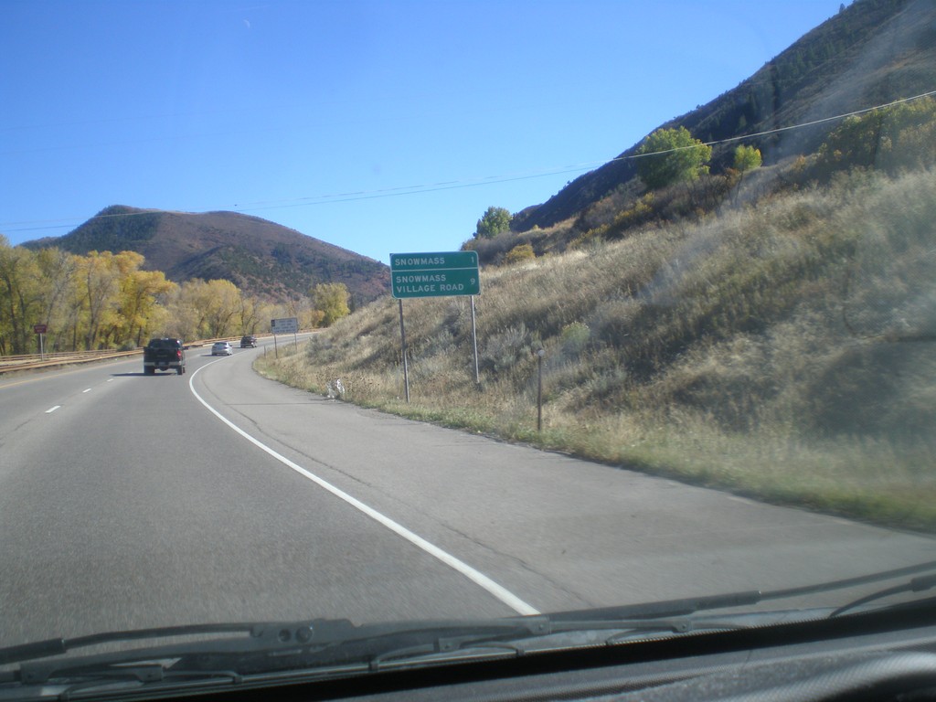
CO-82 East - Distance Marker
Distance marker on CO-82 east. Distance to Snowmass, and Snowmass Village Road.
Taken 10-07-2016
Snowmass
Pitkin County
Colorado
United States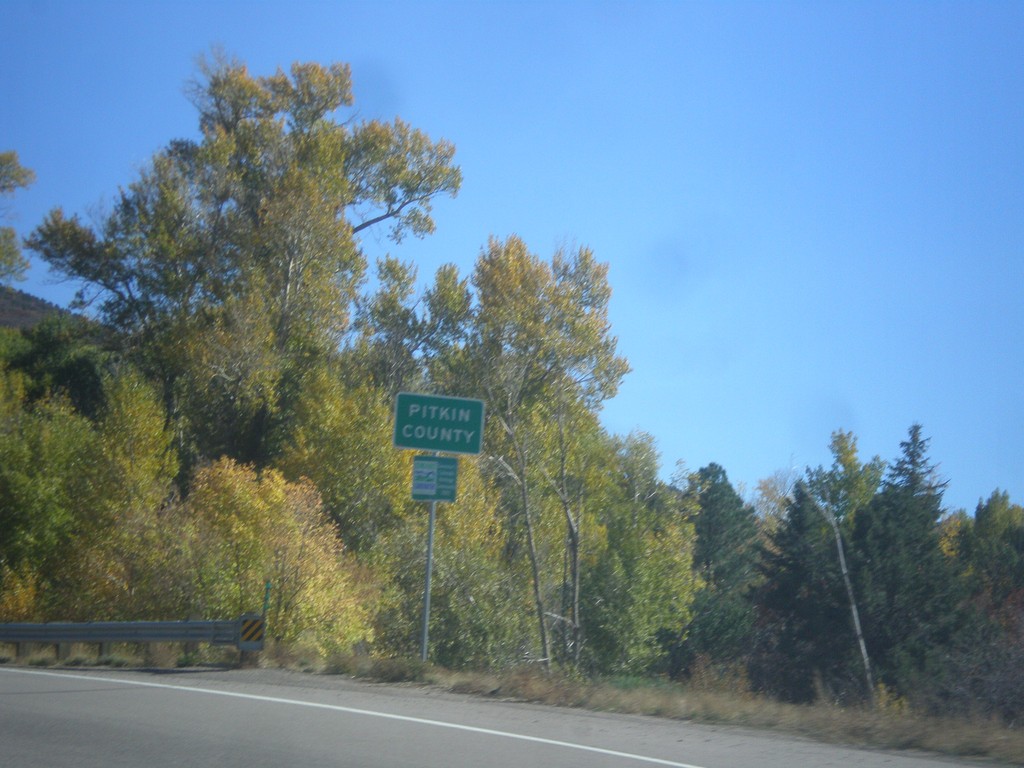
CO-82 East - Pitkin County
Entering Pitkin County on CO-82 east.
Taken 10-07-2016
Basalt
Pitkin County
Colorado
United States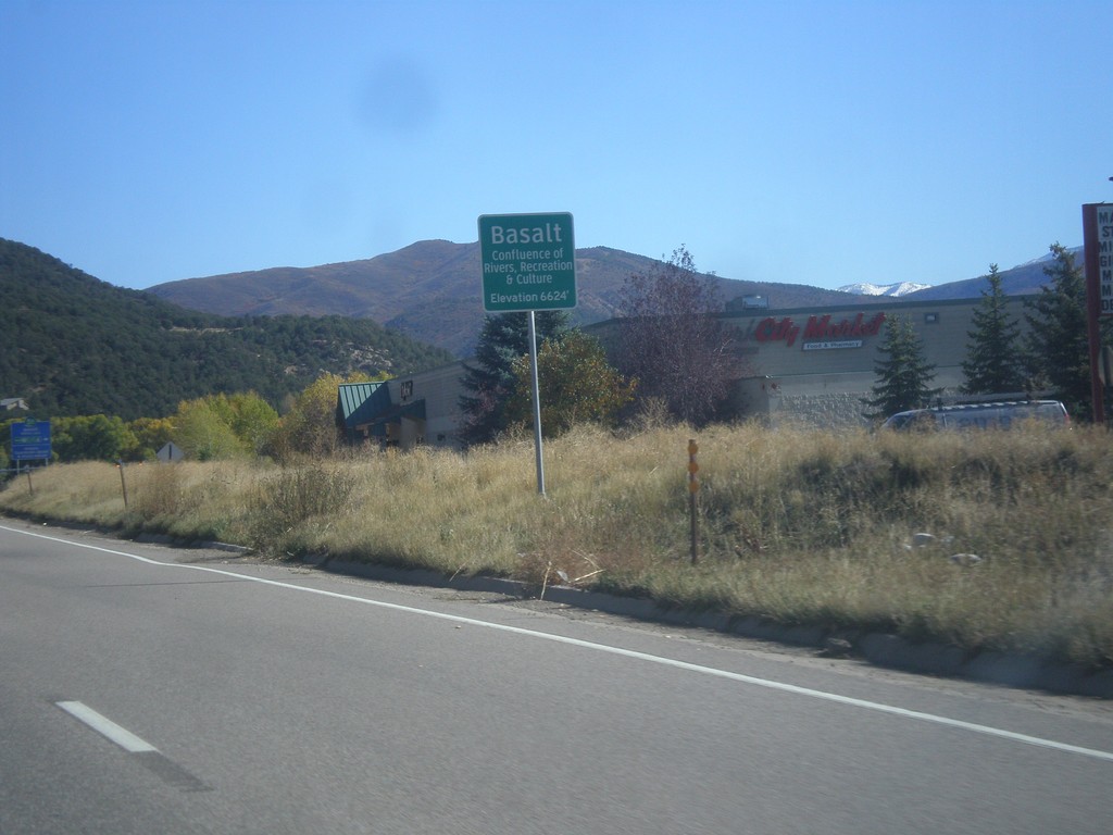
CO-82 East - Basalt
Entering Basalt on CO-82 east. Basalt is a town in the Roaring Fork Valley, located where the Frying Pan River meets the Roaring Fork.
Taken 10-07-2016
Carbondale
Eagle County
Colorado
United States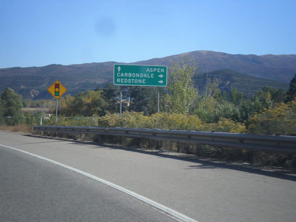
CO-82 East Approaching CO-133 South
CO-82 East approaching CO-133 South to Redstone and Carbondale. Continue east on CO-82 for Aspen.
Taken 10-07-2016
 Carbondale
Garfield County
Colorado
United States
Carbondale
Garfield County
Colorado
United States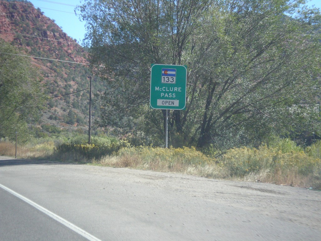
CO-82 East - McClure Pass Status
CO-82 East - CO-133/McClure Pass Status. McClure Pass is located on CO-133 between Redstone and Paonia.
Taken 10-07-2016
Glenwood Springs
Garfield County
Colorado
United States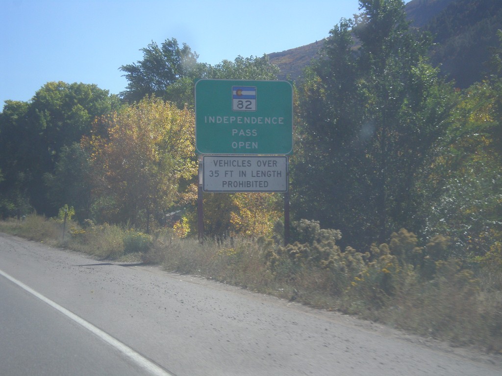
CO-82 East - Independence Pass Status
Independence Pass Status on CO-82 east leaving Glenwood Springs. Typically Independence Pass, just east of Aspen closes between November and May. Independence Pass is one of the highest highway passes in Colorado.
Taken 10-07-2016
Glenwood Springs
Garfield County
Colorado
United States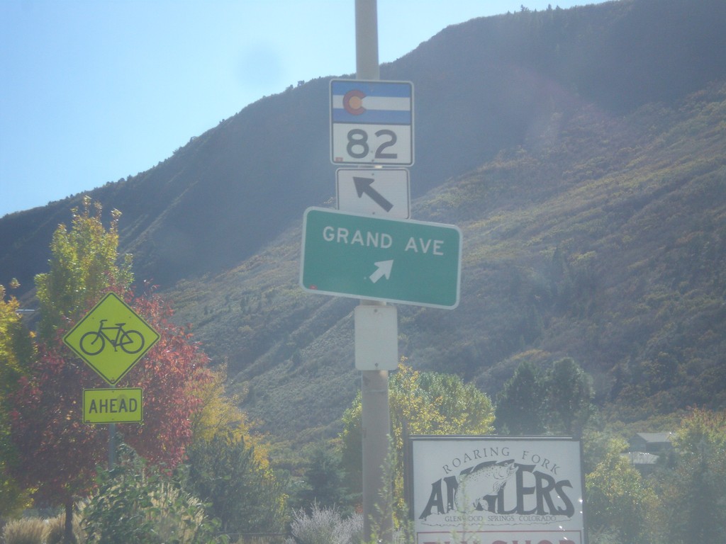
CO-82 East - Grand Ave. Junction
CO-82 east at Grand Ave. Junction in Glenwood Springs. Merge right to continue south on Grand Ave.
Taken 10-07-2016
Glenwood Springs
Garfield County
Colorado
United States