Signs Tagged With Big Green Sign
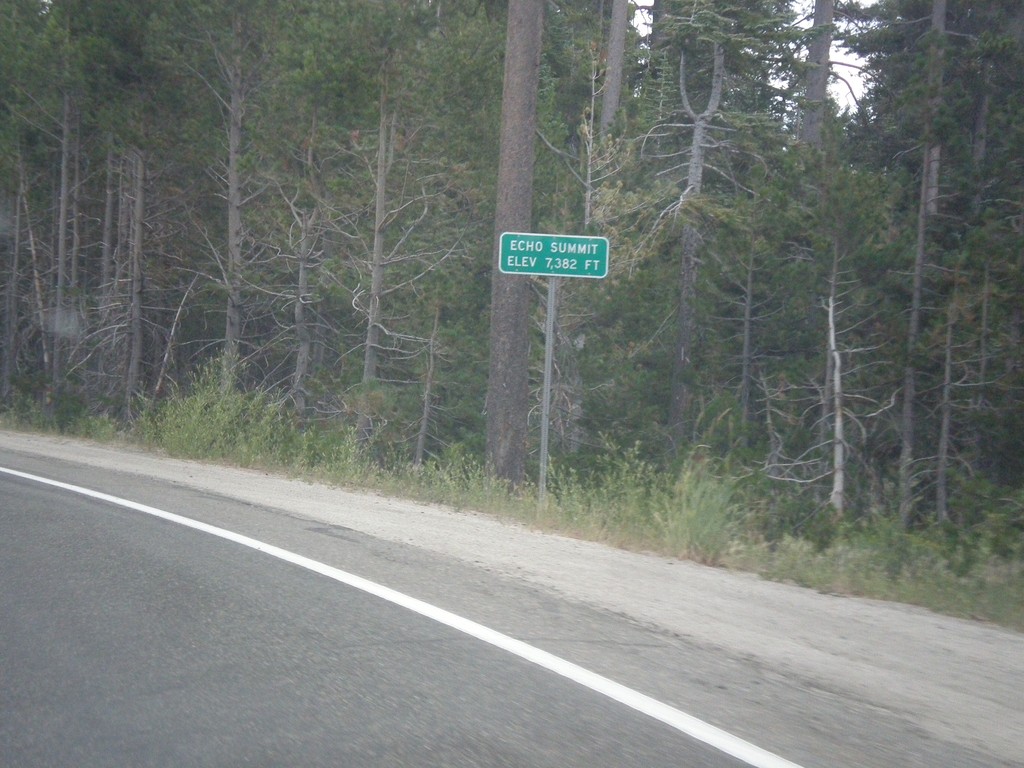
US-50 East - Echo Summit
US-50 each at Echo Summit -Elevation 7382 Feet. This is the summit of the Sierra Nevada on US-50 and the divide between the American River drainage and Lake Tahoe, which drains to the Truckee River.
Taken 08-15-2016
 Nebelhorn
El Dorado County
California
United States
Nebelhorn
El Dorado County
California
United States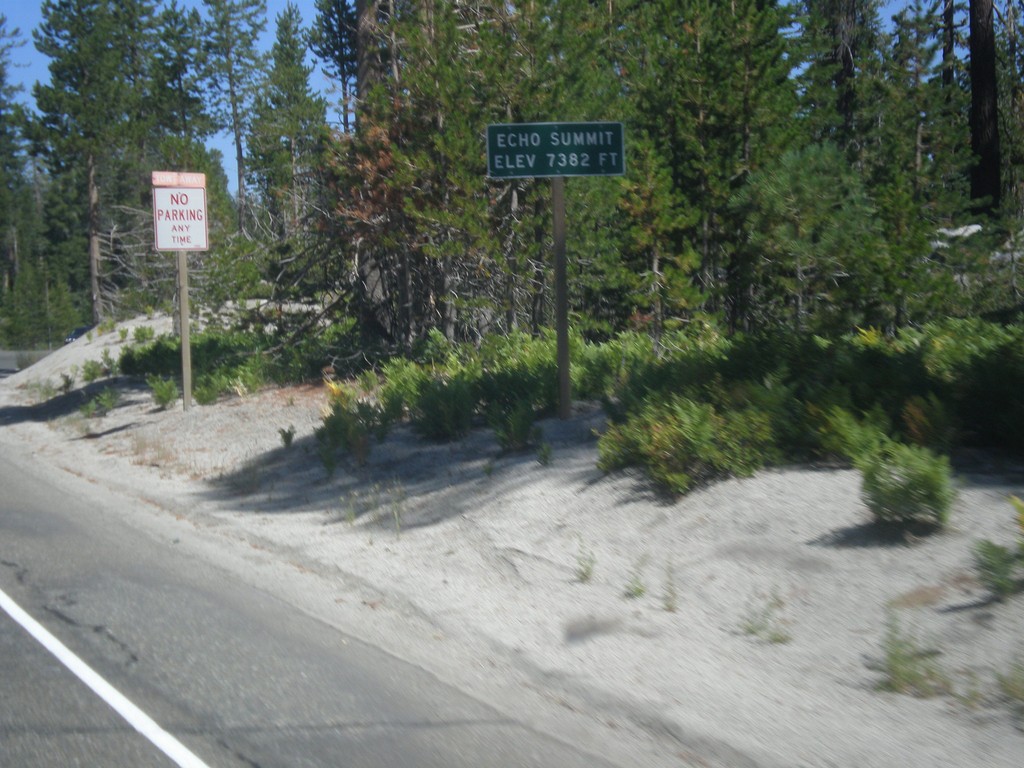
US-50 West - Echo Summit
US-50 west at Echo Summit -Elevation 7382 Feet. This is the summit of the Sierra Nevada on US-50 and the divide between the American River drainage and Lake Tahoe, which drains to the Truckee River.
Taken 08-12-2016
Nebelhorn
El Dorado County
California
United States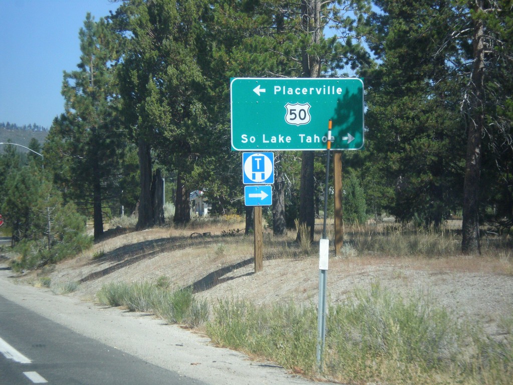
CA-89 North at US-50
CA-89 North at US-50 in Meyers. Turn left on US-50 west for Placerville; right for US-50 East/CA-89 North to South Lake Tahoe.
Taken 08-12-2016
 South Lake Tahoe
El Dorado County
California
United States
South Lake Tahoe
El Dorado County
California
United States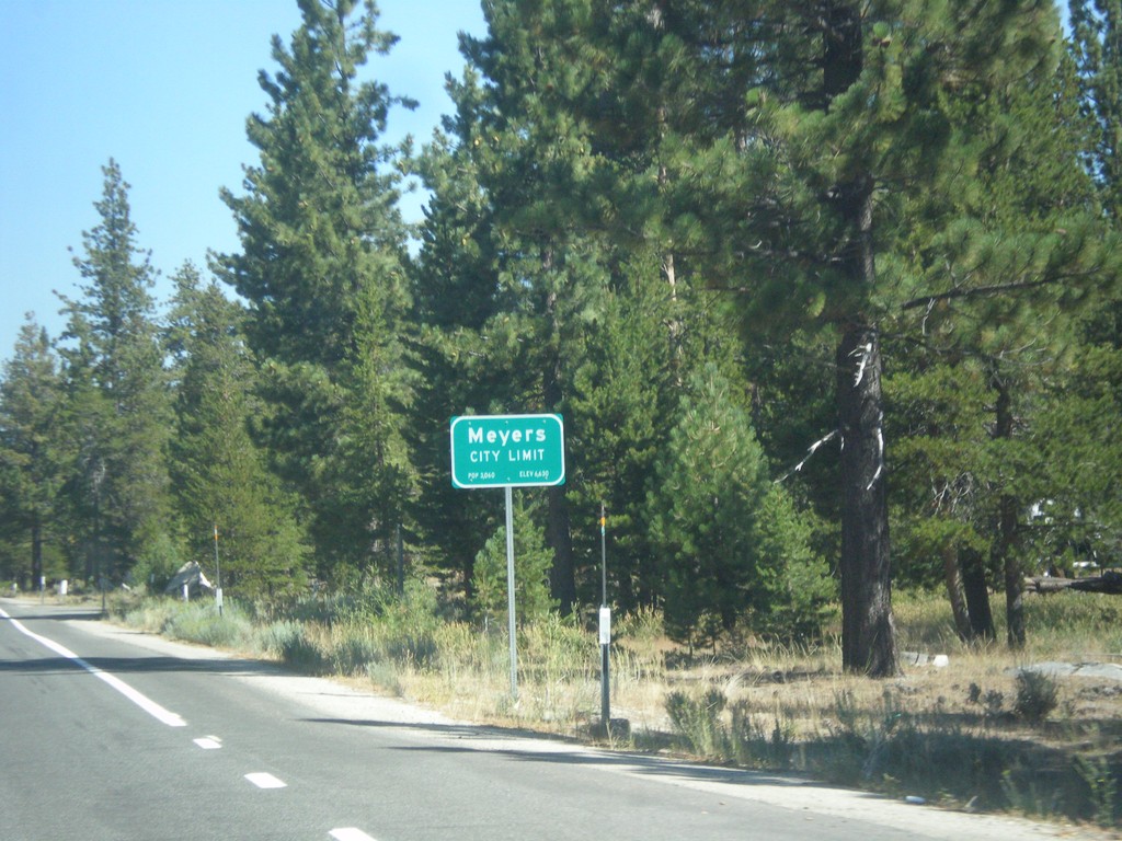
CA-89 North - Meyers City Limit
Meyers City Limit on CA-89 north.
Taken 08-12-2016
South Lake Tahoe
El Dorado County
California
United States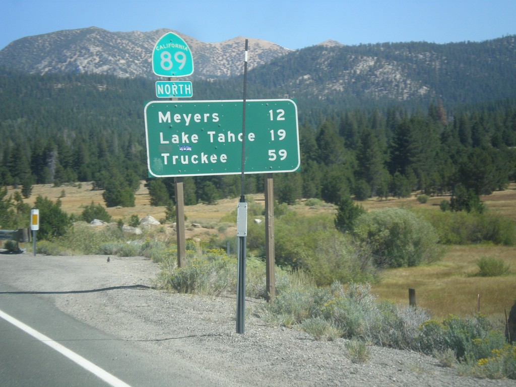
CA-89 North - Distance Marker
Distance marker on CA-89 north. Distance to Meyers, Lake Tahoe, and Truckee.
Taken 08-12-2016
Markleeville
Alpine County
California
United States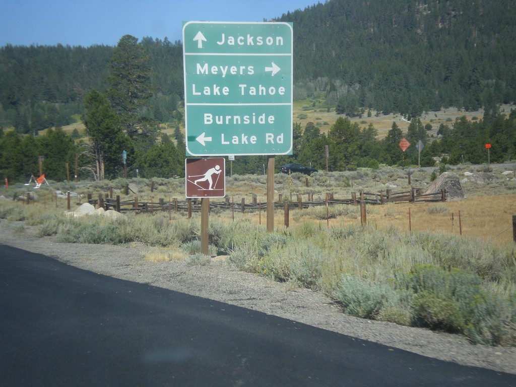
CA-88 West/CA-89 North at CA-88/CA-89 Split
CA-88 West/CA-89 North at CA-89 North. Turn right for CA-89 north to Meyers and Lake Tahoe. Continue west on CA-88 to Jackson. Turn right for Burnside Lake Road.
Taken 08-12-2016
 Markleeville
Alpine County
California
United States
Markleeville
Alpine County
California
United States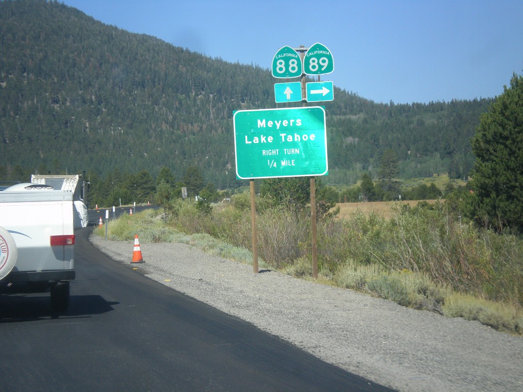
CA-89 North/CA-88 West approaching CA-89/CA-88 Split
CA-89 North/CA-88 West approaching CA-89 north. Use CA-89 north for Meyers and Lake Tahoe.
Taken 08-12-2016
Markleeville
Alpine County
California
United States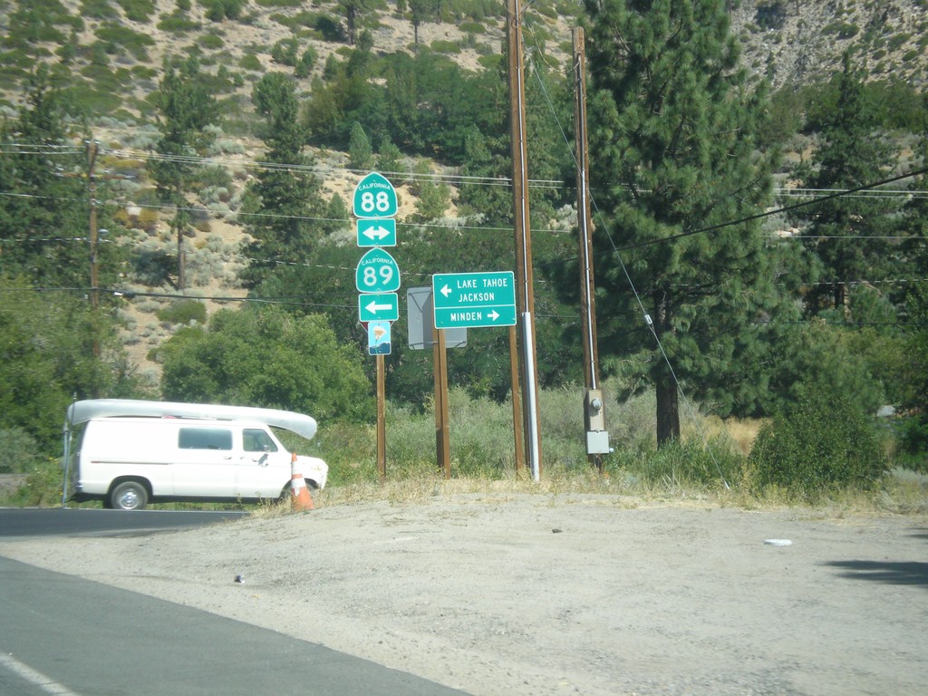
CA-89 North at CA-88
CA-89 North at CA-88 in Woodfords. Turn right for CA-88 east to Minden (Nevada). Turn left for CA-88 West/CA-89 North to Jackson (via CA-88) and Lake Tahoe (via CA-89). CA-89 joins CA-88 to Sorensens.
Taken 08-12-2016
Markleeville
Alpine County
California
United States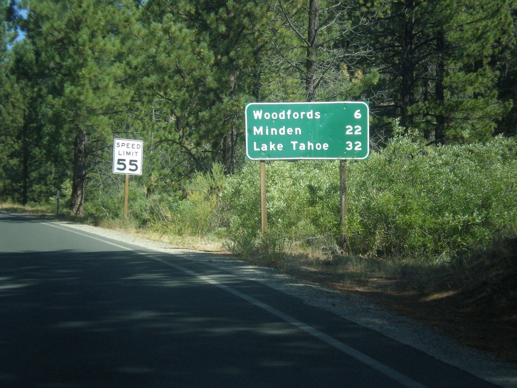
CA-89 North - Distance Marker
Distance marker on CA-89 north. Distance to Woodfords, Minden (Nevada), and Lake Tahoe.
Taken 08-12-2016
Markleeville
Alpine County
California
United States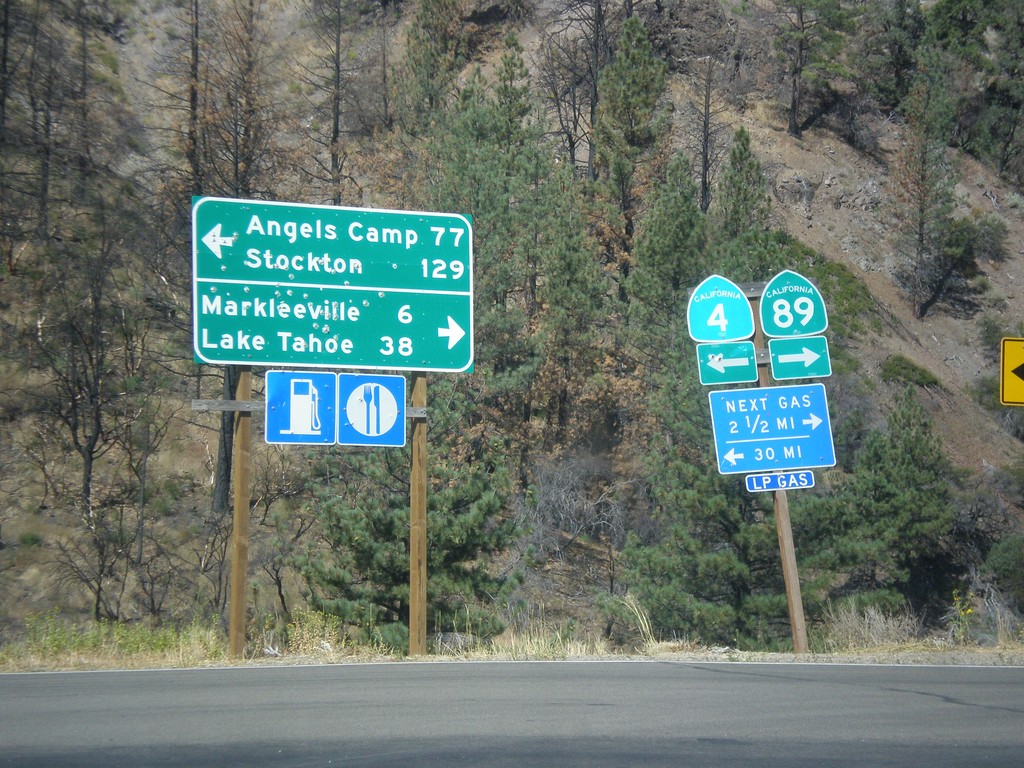
CA-89 North at CA-4
CA-89 North at CA-4. Turn left for CA-4 west to Angels Camp and Stockton (via Ebbetts Pass). Turn right for CA-89 north to Markleeville and Lake Tahoe.
Taken 08-12-2016
 Markleeville
Alpine County
California
United States
Markleeville
Alpine County
California
United States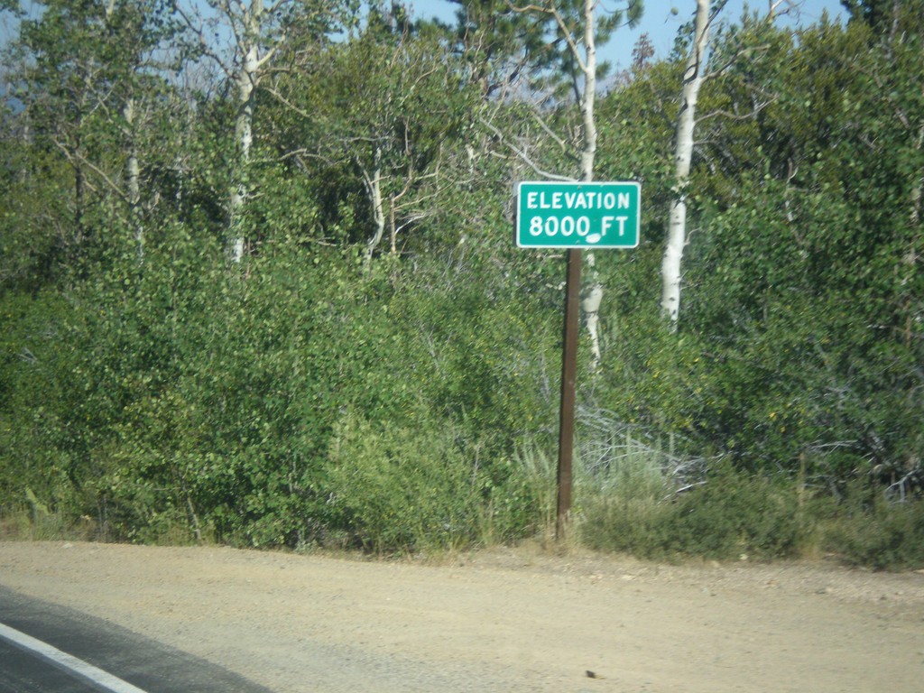
CA-89 North - Elevation 8000 Feet
Elevation 8000 Feet on CA-89 north. Taken on north descent from Monitor Pass.
Taken 08-12-2016
Markleeville
Alpine County
California
United States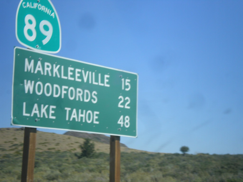
CA-89 North - Distance Marker
Distance marker on CA-89 north. Distance to Markleeville, Woodfords, and Lake Tahoe.
Taken 08-12-2016
Coleville
Mono County
California
United States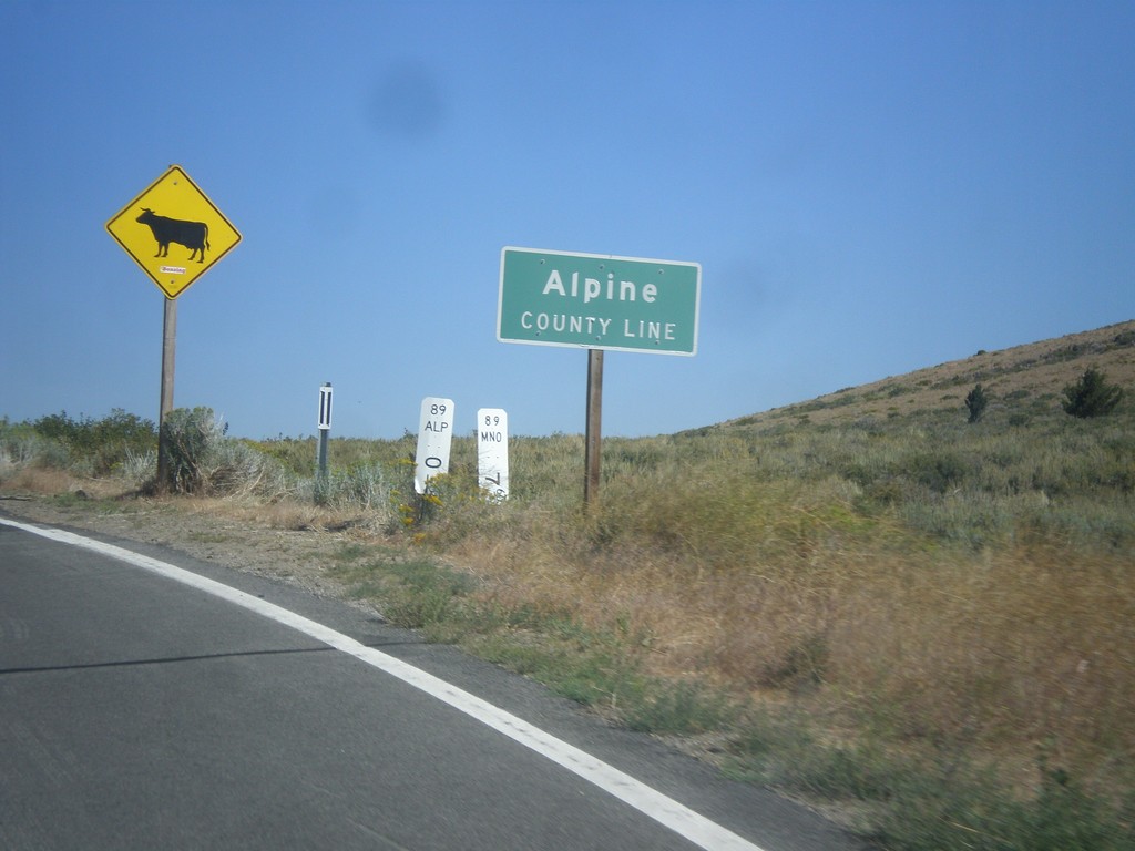
CA-89 North - Alpine County Line
Alpine County Line on CA-89 north. Open range.
Taken 08-12-2016
Coleville
Mono County
California
United States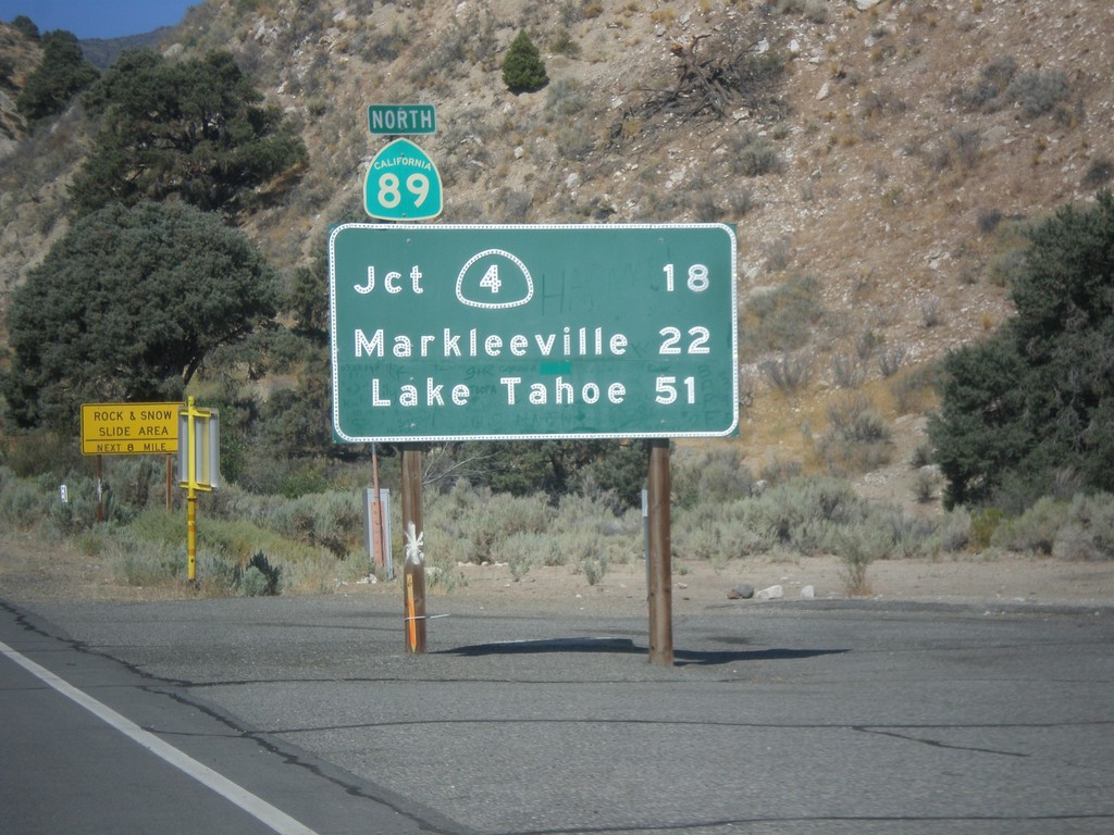
CA-89 North - Distance Marker
First distance marker on CA-89 north. Distance to CA-4 Jct., Markleeville, and Lake Tahoe.
Taken 08-12-2016
Coleville
Mono County
California
United States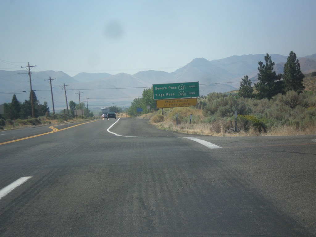
US-395 South - Sierra Pass Information
Sierra pass closure information on US-395 south. Information for Sonora Pass (CA-108) and Tioga Pass (CA-120). At the time this photo was taken both passes were open.
Taken 08-12-2016


 Coleville
Mono County
California
United States
Coleville
Mono County
California
United States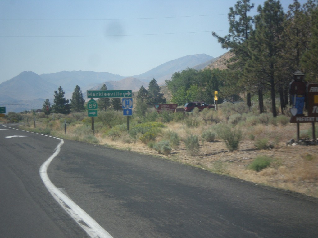
US-395 North at CA-89 North
US-395 south at CA-89 north to Markleeville. This is the southern end of CA-89.
Taken 08-12-2016
Coleville
Mono County
California
United States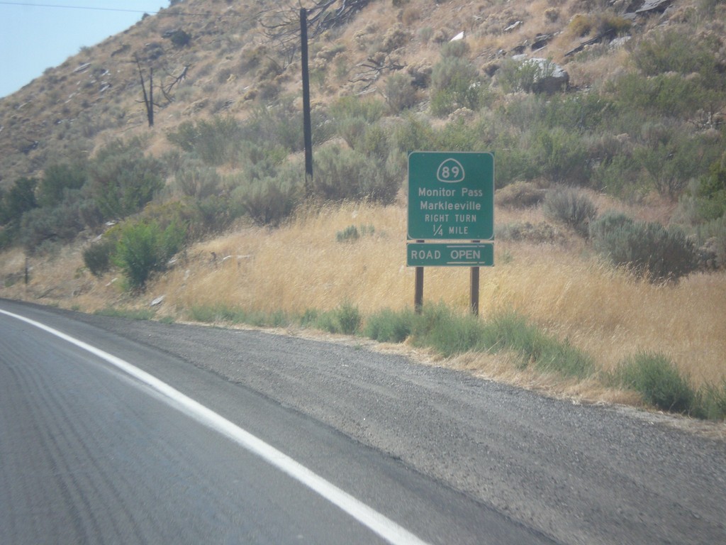
US-395 South at CA-89
US-395 south at CA-89 North to Markleeville and Monitor Pass. Monitor Pass was open when this was taken. This is the southern end of CA-89.
Taken 08-12-2016
Coleville
Mono County
California
United States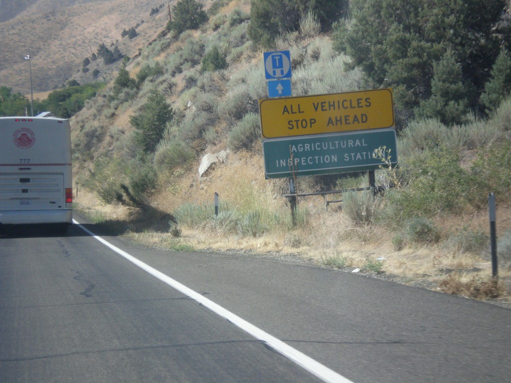
US-395 South - California Agricultural Inspection Station
US-395 South approaching California Agricultural Inspection - Topaz Border Station. All southbound traffic must stop for inspection.
Taken 08-12-2016
Coleville
Mono County
California
United States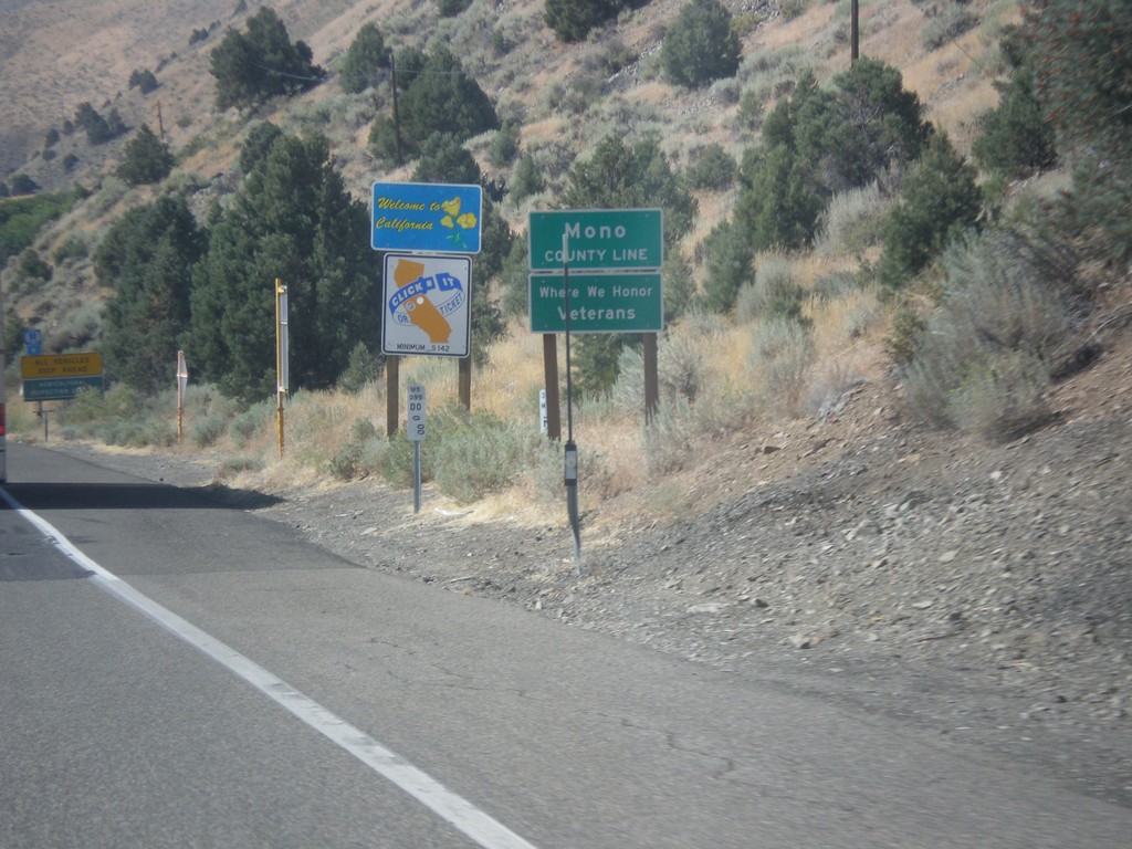
US-395 South - Welcome To California
Welcome to California / Mono County Line on US-395 south.
Taken 08-12-2016
Coleville
Mono County
California
United States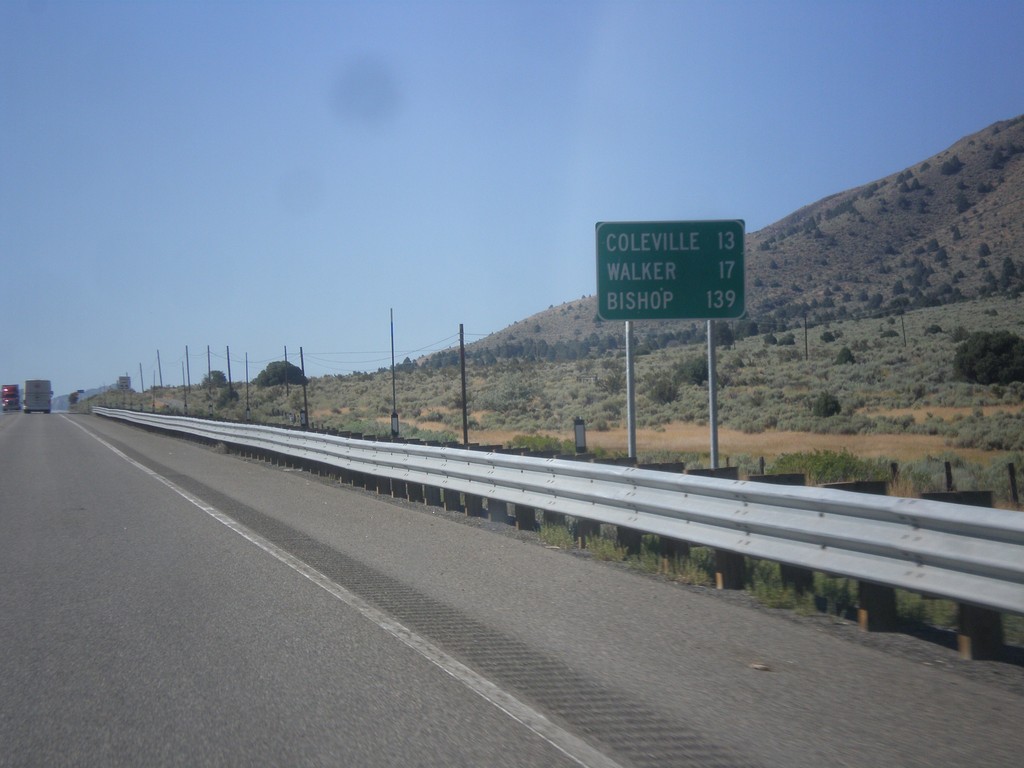
US-395 South - Distance Marker
Distance marker on US-395 south. Distance to Coleville, Walker, and Bishop. All three of these places are in California. This is the last distance marker on US-395 southbound.
Taken 08-12-2016
Gardnerville
Douglas County
Nevada
United States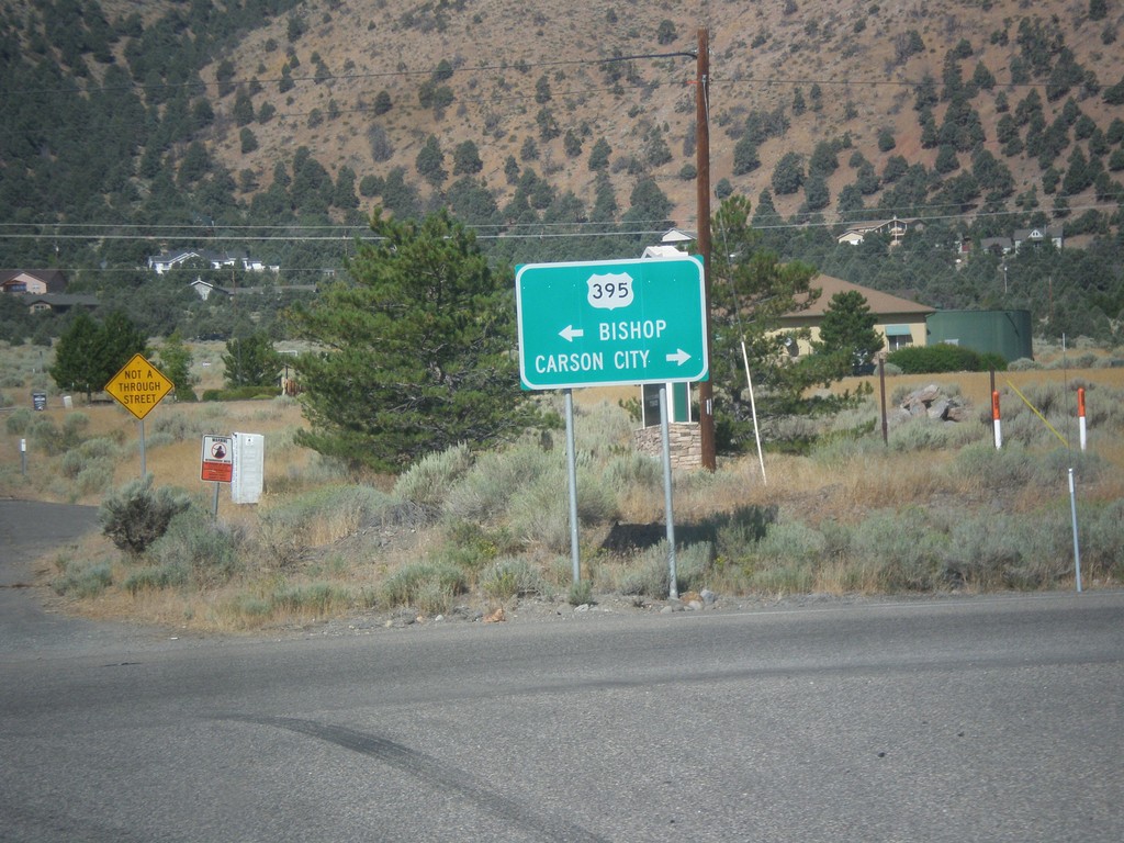
End NV-208 West at US-395
End NV-208 West at US-395. Turn right for US-395 north to Carson City; left for US-395 south to Bishop (California).
Taken 08-12-2016
 Gardnerville
Douglas County
Nevada
United States
Gardnerville
Douglas County
Nevada
United States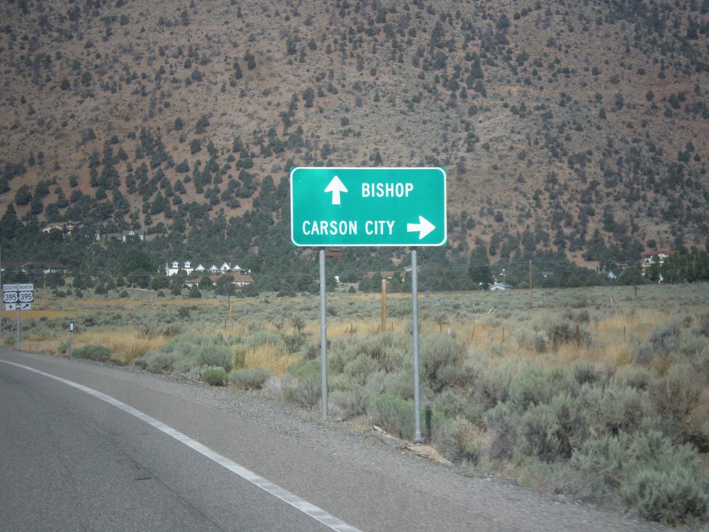
NV-208 West Approaching US-395
NV-208 West approaching US-395. Use US-395 north for Carson City; use US-395 south for Bishop (California).
Taken 08-12-2016
Gardnerville
Douglas County
Nevada
United States
NV-208 West Approaching US-395
NV-208 West approaching US-395 in Douglas County.
Taken 08-12-2016
Topaz Lake
Douglas County
Nevada
United States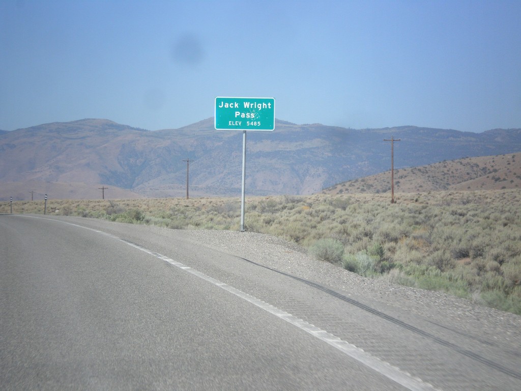
NV-208 West - Jack Wright Pass
Jack Wright Pass - Elevation 5484 Feet.
Taken 08-12-2016
Smith Valley
Lyon County
Nevada
United States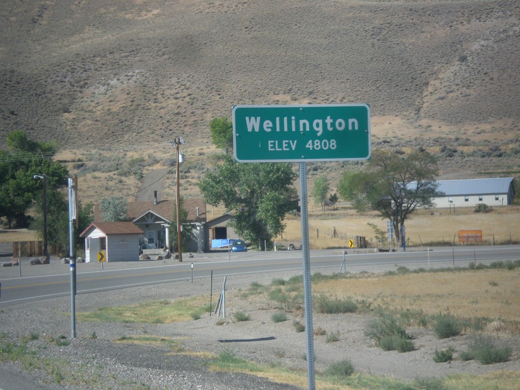
NV-208 West - Wellington
Entering Wellington on NV-208 west.
Taken 08-12-2016
Smith Valley
Lyon County
Nevada
United States