Signs Tagged With Big Green Sign
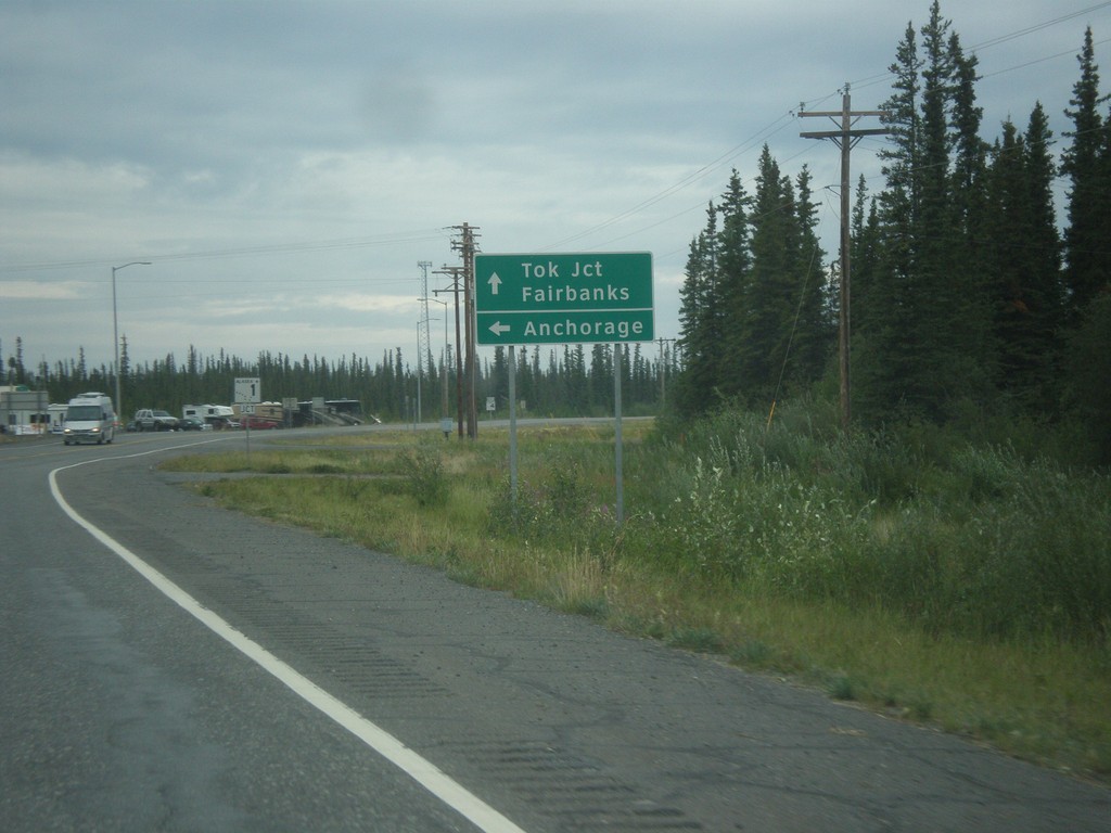
AK-4 North Approaching AK-1
AK-4 North (Richardson Highway) approaching AK-1 (Glenn Highway). AK-1 joins AK-4 northhbound to Gakona Junction. Use AK-1 south to Anchorage; use AK-1 North/AK-4 North to Tok Jct. and Fairbanks.
Taken 07-22-2016

 Glennallen
Copper River Census Area
Alaska
United States
Glennallen
Copper River Census Area
Alaska
United States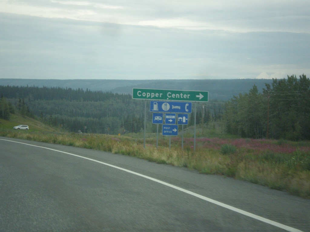
AK-4 North - Copper Center Jct.
AK-4 north at Copper Center Jct. This is the south end of the loop into the community of Copper Center.
Taken 07-22-2016
Copper Center
Copper River Census Area
Alaska
United States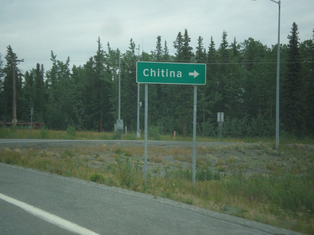
AK-4 North at AK-10 East
AK-4 North (Richardson Highway) at AK-10 East (Edgerton Highway) to Chitina.
Taken 07-22-2016
 Copper Center
Copper River Census Area
Alaska
United States
Copper Center
Copper River Census Area
Alaska
United States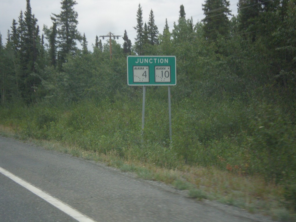
AK-4 North Approaching AK-10
AK-4 North (Richardson Highway) approaching AK-10 (Edgerton Highway).
Taken 07-22-2016
Copper Center
Copper River Census Area
Alaska
United States
AK-4 North - Distance Marker
Distance marker on AK-4 north (Richardson Highway). Distance to Copper Center and Glenallen.
Taken 07-22-2016
Copper Center
Copper River Census Area
Alaska
United States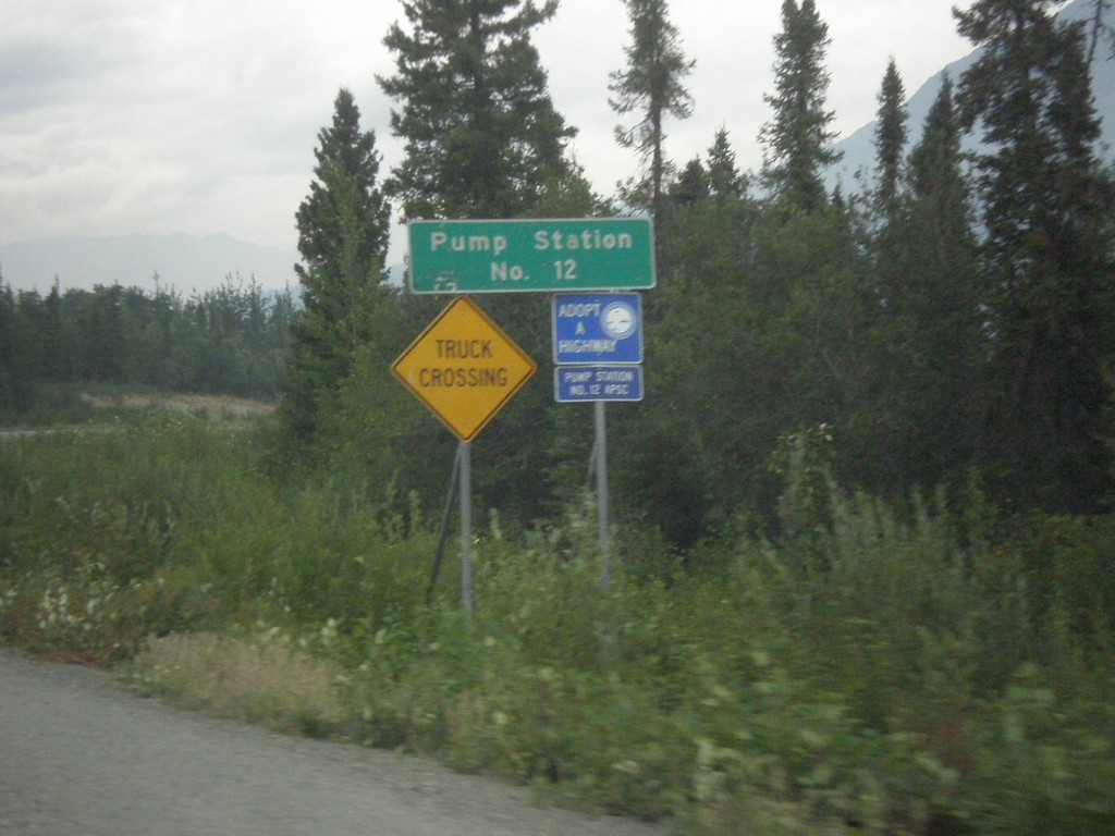
AK-4 North - Pump Station Number 12
AK-4 north (Richardson Highway) at Pump Station Number 12. This is a pump station for the Trans Alaska Pipeline.
Taken 07-22-2016
Copper Center
Copper River Census Area
Alaska
United States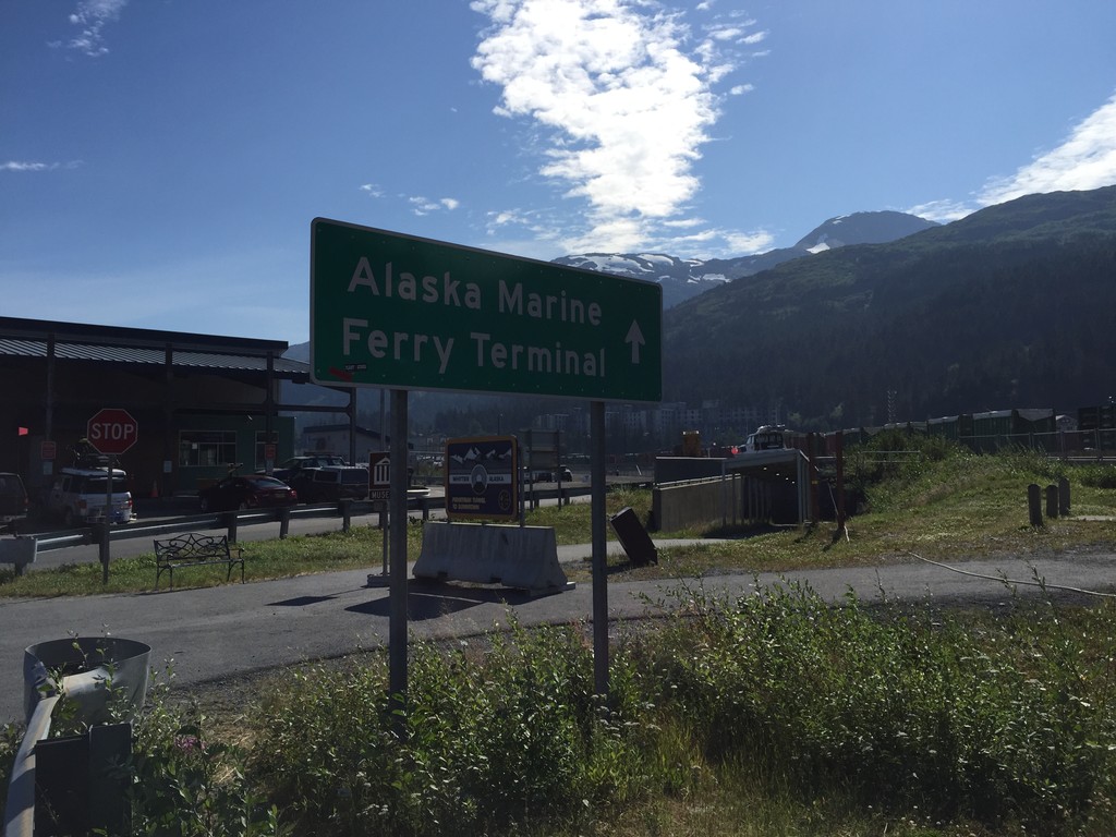
Portage Glacier Highway at Ferry Terminal
End Portage Glacier Highway at the Whittier Ferry Terminal for the Alaska Marine Highway system.
Taken 07-20-2016
Whittier Chugach Alaska United States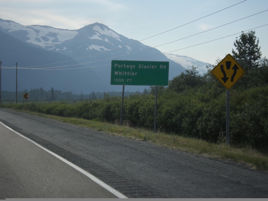
AK-1 North - Portage Glacier Jct.
AK-1 north (Seward Highway) approaching Portage Glacier Rd./Whittier Jct.
Taken 07-20-2016
Anchorage
Anchorage Municipality
Alaska
United States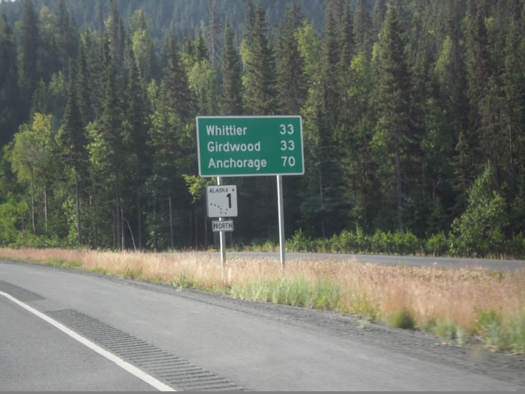
AK-1 North - Distance Marker
Distance marker and AK-1 shield along AK-1 (Seward Highway) north. Distance to Girdwood, Whittier (via Portage Glacier Highway), and Anchorage.
Taken 07-20-2016
Hope
Kenai Peninsula Borough
Alaska
United States
AK-1 North - Distance Marker
Distance marker on AK-1 north. Distance to Girdwood, Whittier (via Portage Glacier Hwy) and Anchorage.
Taken 07-20-2016
Moose Pass
Kenai Peninsula Borough
Alaska
United States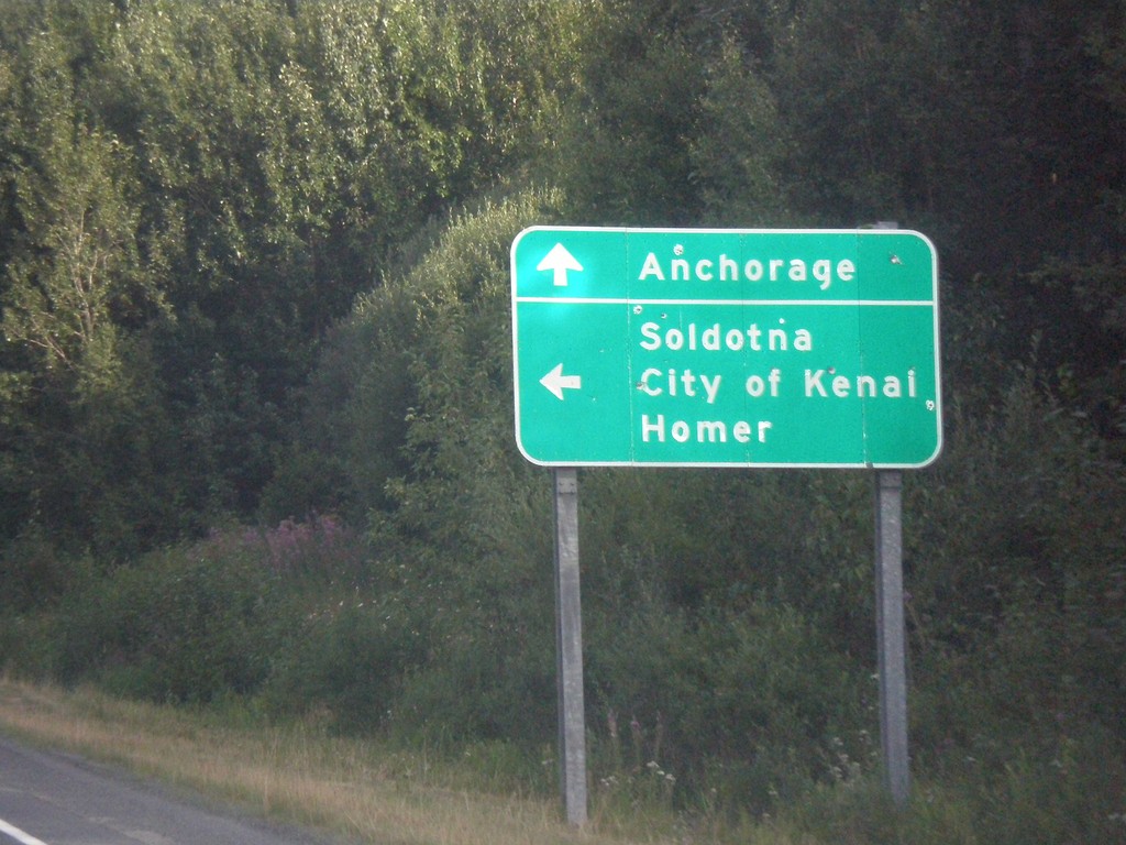
End AK-9 North at AK-1
End AK-9 north at AK-1. Turn left for AK-1 south for the Sterling Highway south to Soldotna, City of Kenai, and Homer. Continue north on AK-1 for the Seward Highway north to Anchorage.
Taken 07-20-2016
 Moose Pass
Kenai Peninsula Borough
Alaska
United States
Moose Pass
Kenai Peninsula Borough
Alaska
United States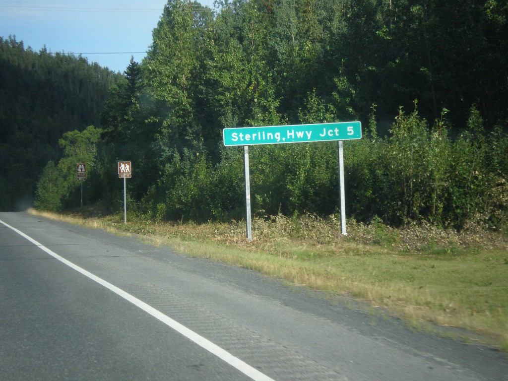
AK-9 North - Distance Marker
Distance marker on AK-9 (Seward Highway) north. Distance to Sterling Highway - 5 Miles.
Taken 07-20-2016
Moose Pass
Kenai Peninsula Borough
Alaska
United States
AK-9 North - Moose Pass
Entering the community of Moose Pass on AK-9 North (Seward Highway).
Taken 07-20-2016
Moose Pass
Kenai Peninsula Borough
Alaska
United States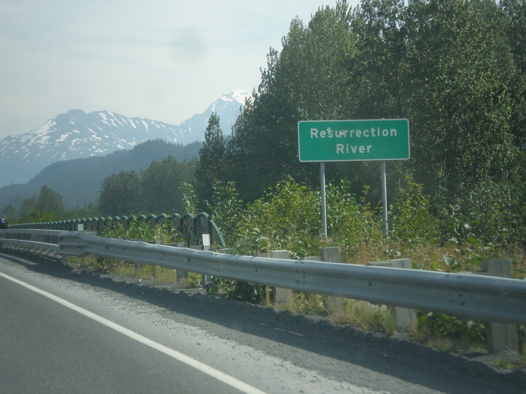
AK-9 North - Resurrection River
Resurrection River bridge on AK-9 north.
Taken 07-17-2016
Seward
Kenai Peninsula Borough
Alaska
United States
AK-9 South - Seward
Seward City Limits on AK-9 South (Seward Highway). Seward is the southern end of the Seward Highway, and is located on the Kenai Peninsula. It is also the southern end of the Alaska Railroad. Seward is named after Abraham Lincoln’s secretary of State - William H. Seward. Secretary Seward negotiated the sale of Alaska from Russia to the United States.
Taken 07-16-2016
Seward
Kenai Peninsula Borough
Alaska
United States
AK-9 South - Resurrection River
AK-9 south (Seward Highway) crossing the Resurrection River. The Resurrection River flows into the ocean at Resurrection Bay just south of this bridge.
Taken 07-16-2016
Seward
Kenai Peninsula Borough
Alaska
United States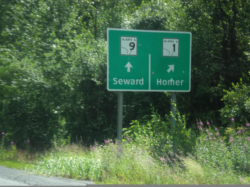
AK-1 South/AK-9 South Junction
AK-1 South at AK-9. Merge right to continue south on AK-1 as the Sterling Highway to Homer. Continue straight to continue south on the Seward Highway as AK-9.
Taken 07-16-2016
Moose Pass
Kenai Peninsula Borough
Alaska
United States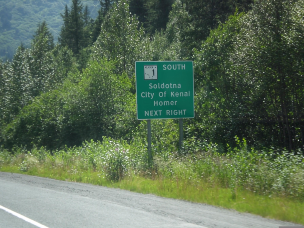
AK-1 South Approaching AK-9
AK-1 South (Seward Highway) approaching AK-9. Merge right to continue south on AK-1 as the Sterling Highway to Soldotna, City of Kenai, and Homer.
Taken 07-16-2016
Moose Pass
Kenai Peninsula Borough
Alaska
United States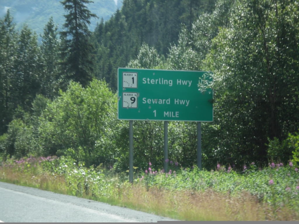
AK-1 South Approaching AK-9
AK-1 South (Seward Highway) approaching AK-9 (Seward Highway). AK-1 traffic will merge right at this junction and becomes the Sterling Highway. AK-9 continues south as the Seward Highway.
Taken 07-16-2016
Moose Pass
Kenai Peninsula Borough
Alaska
United States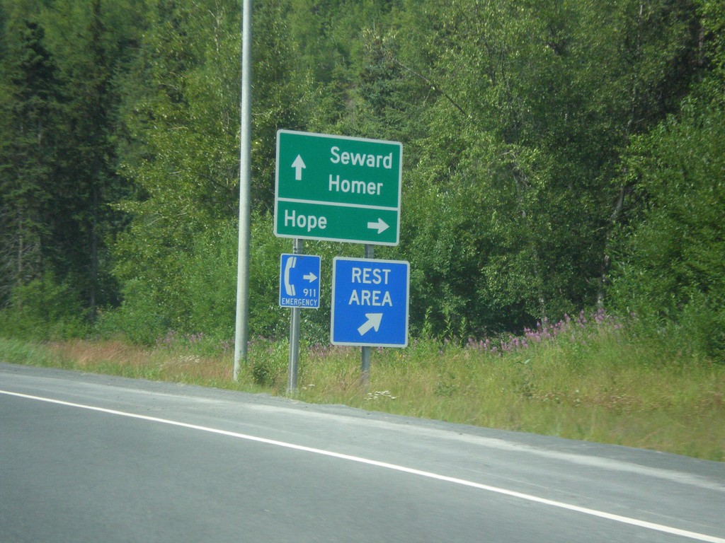
AK-1 South - Hope Jct.
AK-1 South at Hope Jct. Hope is 17 miles north of this junction. Continue south on AK-1 for Seward (via AK-9) and Homer (via AK-1 / Sterling Highway).
Taken 07-16-2016
Sunrise
Kenai Peninsula Borough
Alaska
United States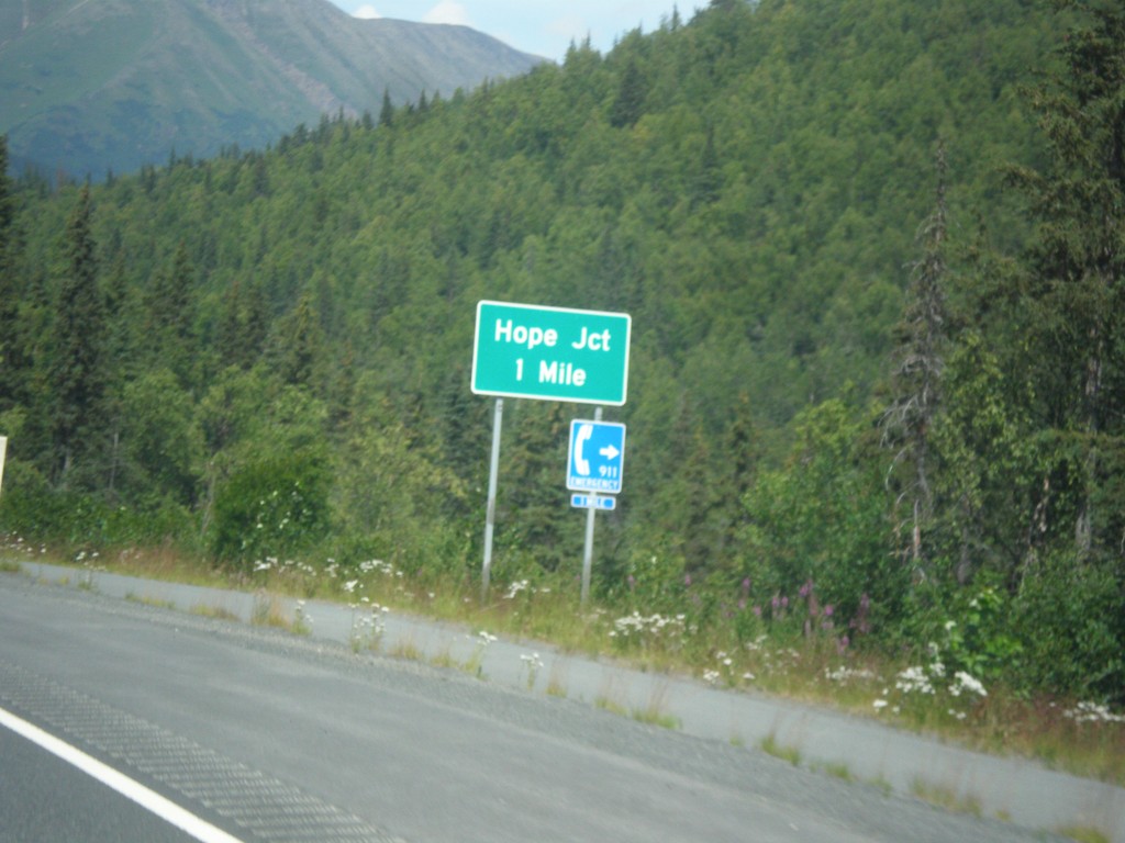
AK-1 South Approaching Hope Jct.
AK-1 South (Seward Highway) approaching Hope Jct.
Taken 07-16-2016
Hope
Kenai Peninsula Borough
Alaska
United States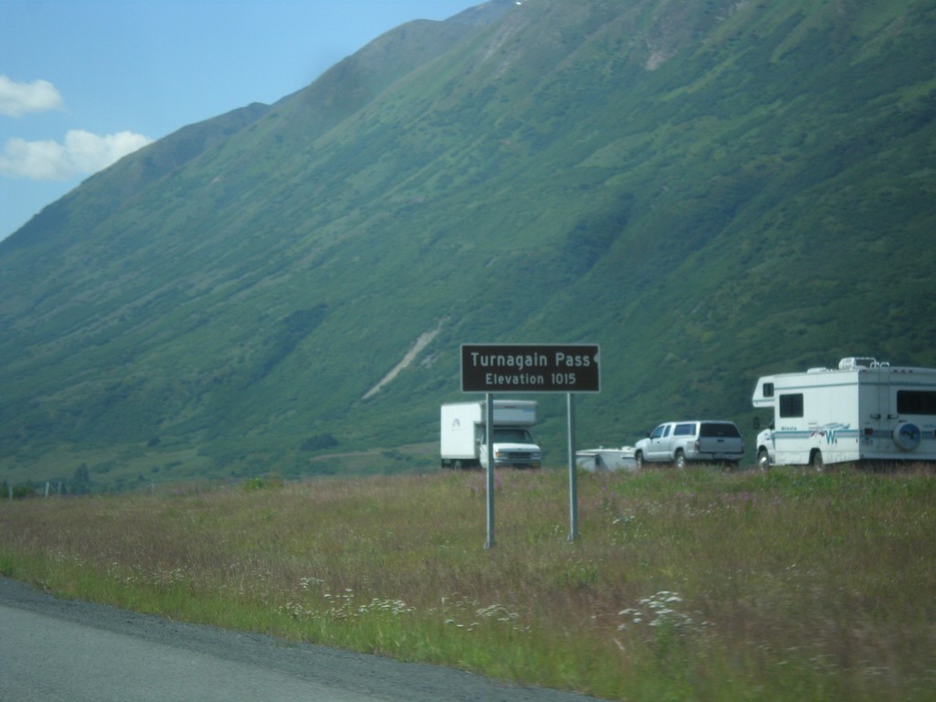
AK-1 South - Turnagain Pass
AK-1 south (Seward Highway) at Turnagain Pass - Elevation 1015 Feet. Turnagain Pass is the highest point on the Seward Highway.
Taken 07-16-2016
Moose Pass
Kenai Peninsula Borough
Alaska
United States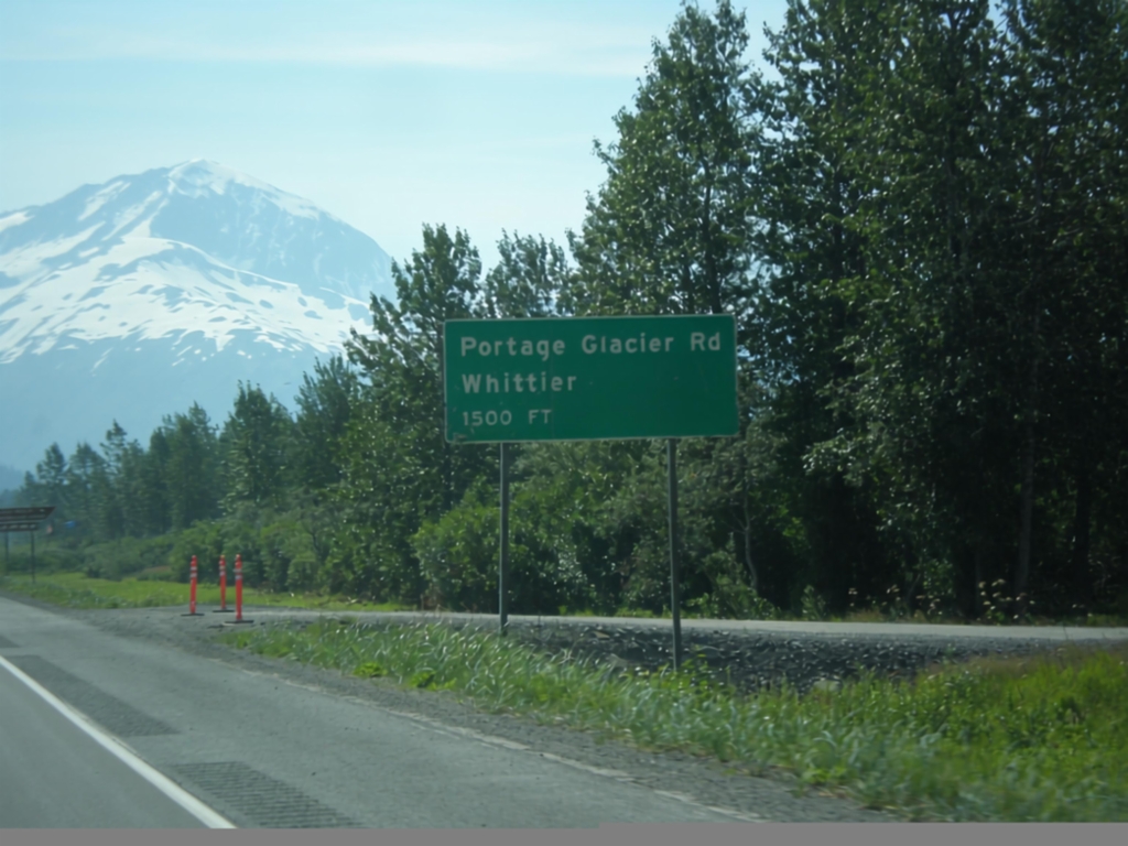
AK-1 South - Portage Glacier Jct.
AK-1 South (Seward Highway) approaching Portage Glacier/Whittier junction. Access to Whittier via the Anton Anderson Memorial Tunnel, which shares rail traffic with automobile traffic.
Taken 07-16-2016
Anchorage
Anchorage Municipality
Alaska
United States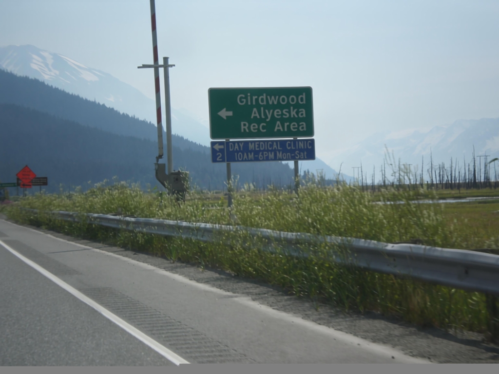
AK-1 South - Alyeska Highway
AK-1 south at Alyeska Highway junction. Turn left for Alyeska Ski Area and Girdwood.
Taken 07-16-2016
Anchorage
Anchorage Municipality
Alaska
United States
AK-1 South - Alyeska Highway
AK-1 South approaching Alyeska Highway junction. Use Alyeska Highway for Girdwood and the Alyeska Ski Resort.
Taken 07-16-2016
Anchorage
Anchorage Municipality
Alaska
United States