Signs Tagged With Big Green Sign
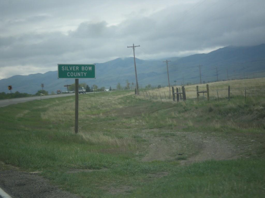
MT-55 South - Silver Bow County
Entering Silver Bow County on MT-55 south. MT-55 crosses a tiny sliver of Silver Bow County.
Taken 05-15-2016
 Whitehall
Silver Bow County
Montana
United States
Whitehall
Silver Bow County
Montana
United States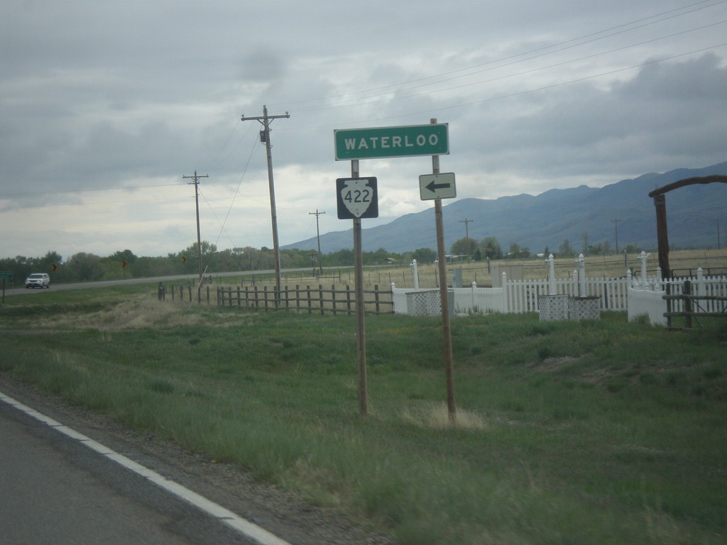
MT-55 South at MTS-422
MT-55 South at MTS-422 to Waterloo.
Taken 05-15-2016
 Whitehall
Jefferson County
Montana
United States
Whitehall
Jefferson County
Montana
United States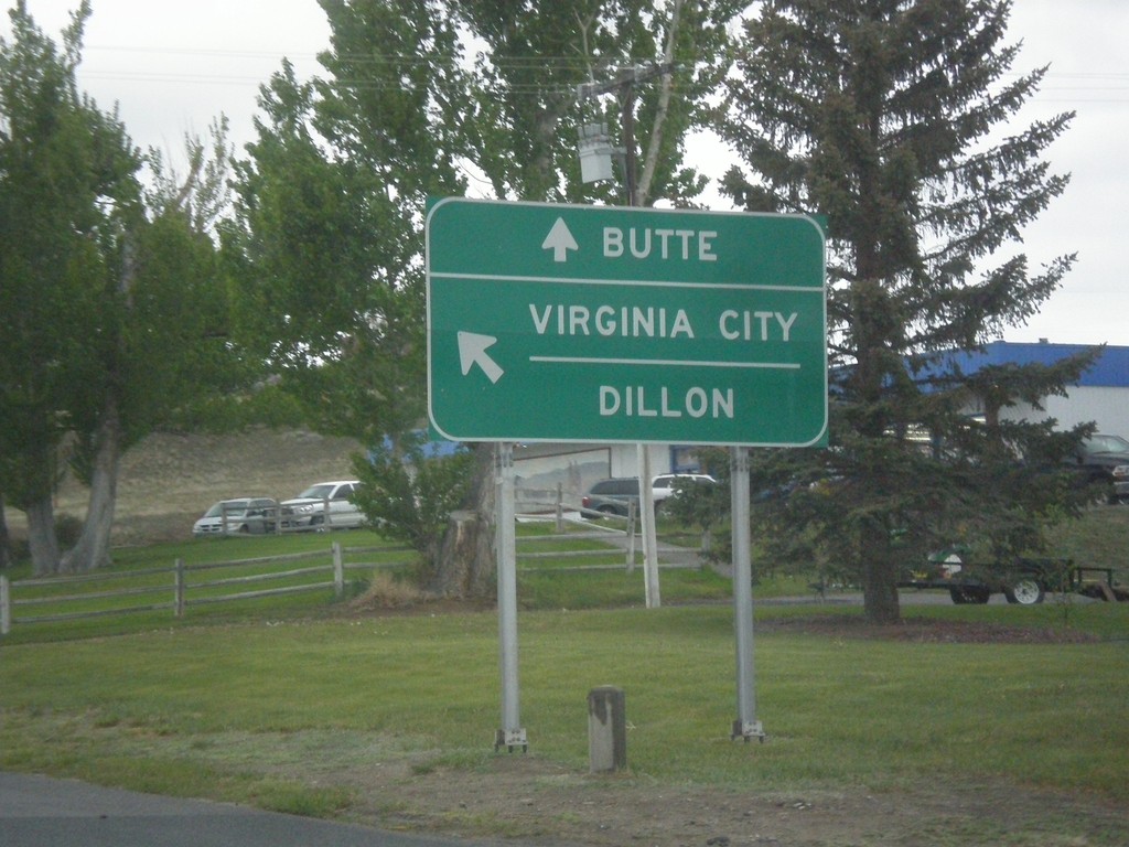
MT-2 West/MT-55 South at Split
MT-2 West/MT-55 South at MT-2/MT-55 Split. Use MT-2 west to Butte; MT-55 south to Virginia City and Dillon.
Taken 05-15-2016
 Whitehall
Jefferson County
Montana
United States
Whitehall
Jefferson County
Montana
United States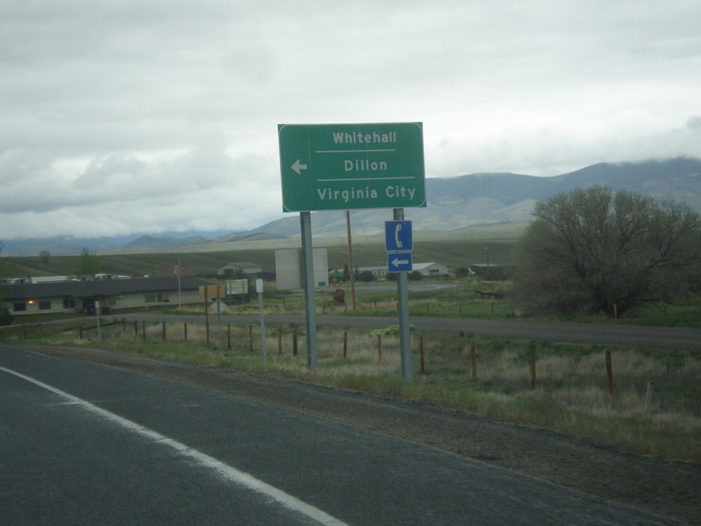
I-90 West Exit 249 Offramp at MT-55
I-90 West Exit 249 Offramp at MT-55 in Whitehall. Turn left for MT-55 south to Whitehall, Dillon (via MT-41) and Virginia City (via MT-287).
Taken 05-15-2016
 Whitehall
Jefferson County
Montana
United States
Whitehall
Jefferson County
Montana
United States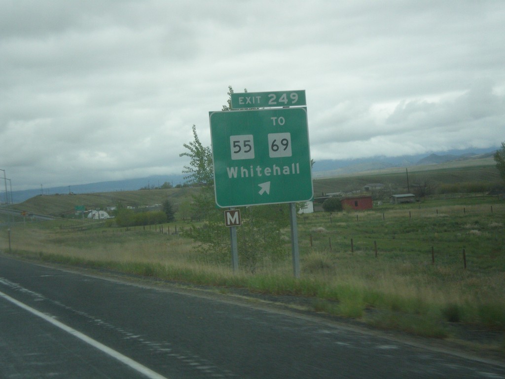
I-90 West - Exit 249
I-90 west at Exit 249 - MT-55/To MT-69/Whitehall.
Taken 05-15-2016
 Whitehall
Jefferson County
Montana
United States
Whitehall
Jefferson County
Montana
United States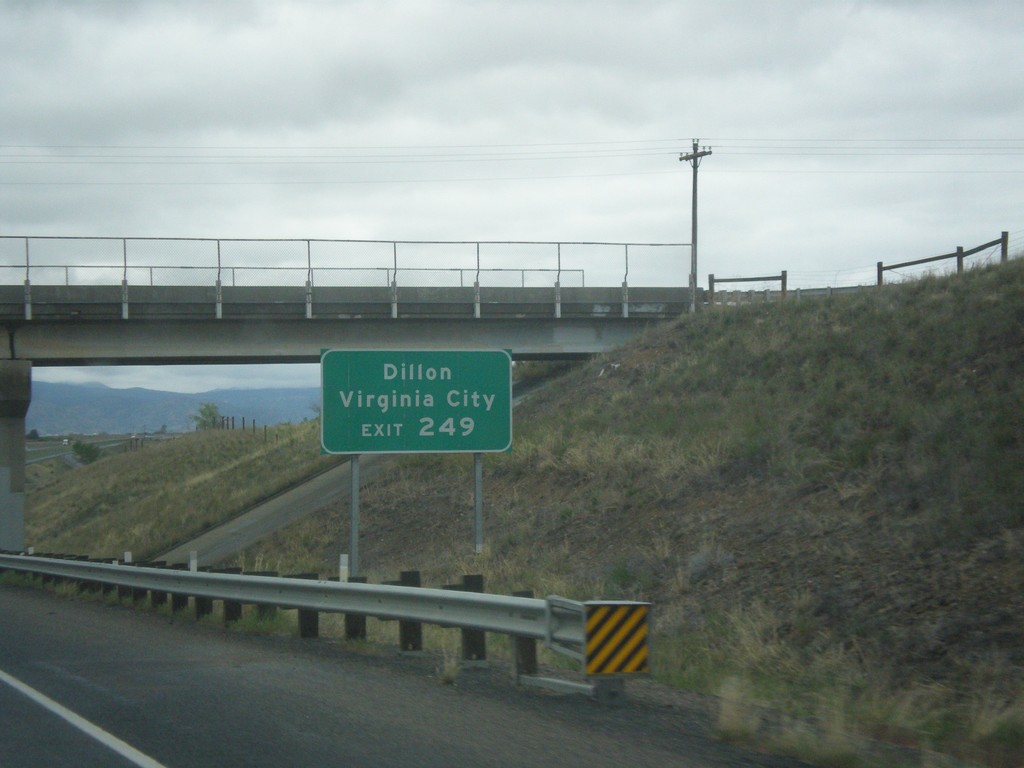
I-90 West - Exit 249
I-90 west approaching Exit 249. Use Exit 249 for MT-55 south to Virginia City (via MT-287) and Dillon (via MT-41). MT-55 and MT-41 to Dillon is often used as a shortcut to I-15 south into Idaho, instead of using I-90 west to Butte to connect to I-15.
Taken 05-15-2016
Whitehall
Jefferson County
Montana
United States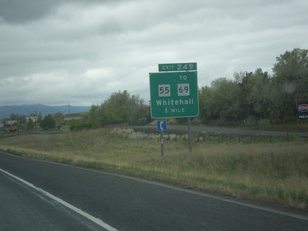
I-90 West - Exit 249
I-90 west approaching Exit 249 - MT-55/To MT-69/Whitehall.
Taken 05-15-2016
Whitehall
Jefferson County
Montana
United States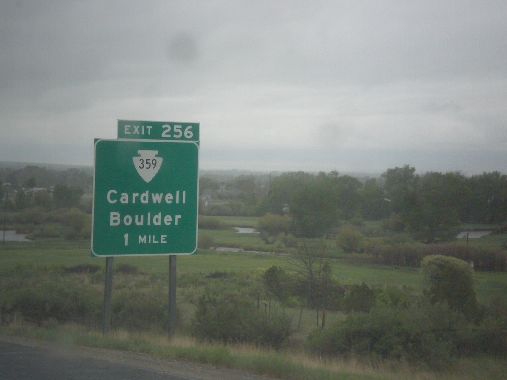
I-90 West - Exit 256
I-90 west approaching Exit 256 - MTS-359/Cardwell/Boulder.
Taken 05-15-2016
 Whitehall
Jefferson County
Montana
United States
Whitehall
Jefferson County
Montana
United States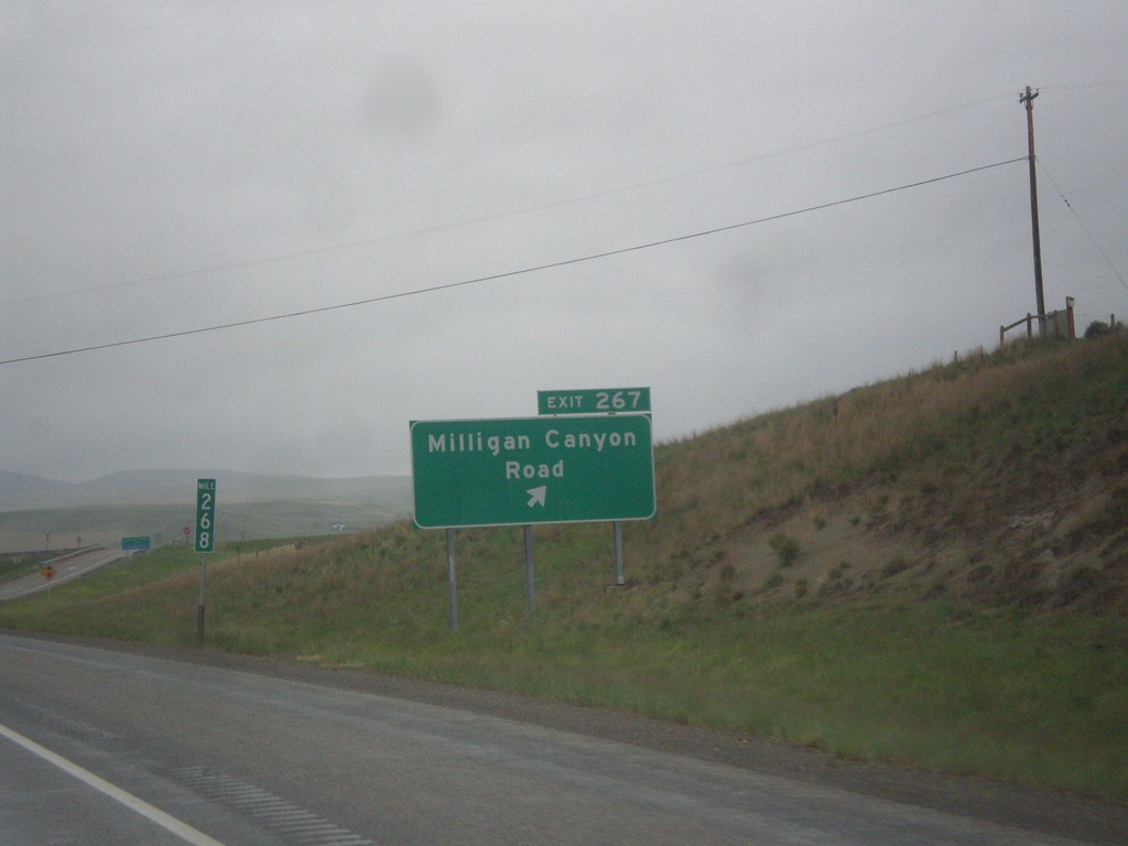
I-90 West - Exit 267
I-90 west at Exit 267 - Milligan Canyon Road.
Taken 05-15-2016
Cardwell
Jefferson County
Montana
United States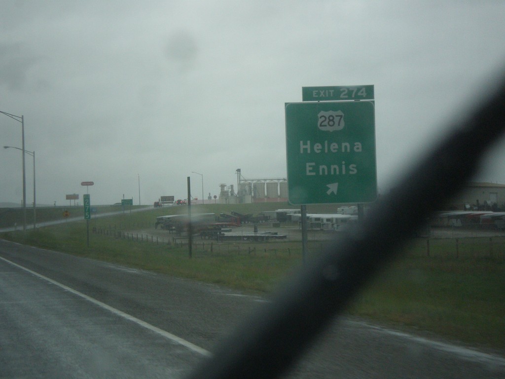
I-90 West - Exit 274
I-90 west at Exit 274 - US-287/Helena/Ennis.
Taken 05-15-2016
 Three Forks
Broadwater County
Montana
United States
Three Forks
Broadwater County
Montana
United States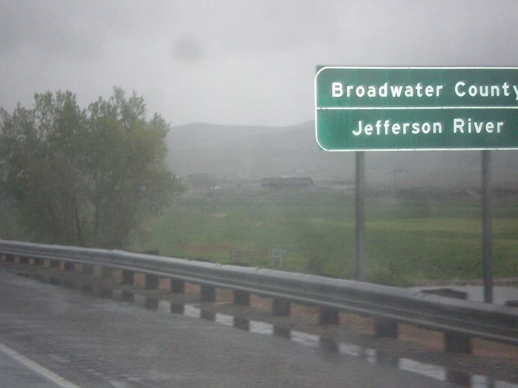
I-90 West - Broadwater County
Entering Broadwater County on I-90 east at the Jefferson River. The Jefferson River is one of the three forks of the Missouri River, the other two being the Madison and Gallatin Rivers.
Taken 05-15-2016
Three Forks
Broadwater County
Montana
United States
I-90 West - Exit 278
I-90 west approaching Exit 278 - MT-2/MTS-205/Three Forks.
Taken 05-15-2016
 Three Forks
Gallatin County
Montana
United States
Three Forks
Gallatin County
Montana
United States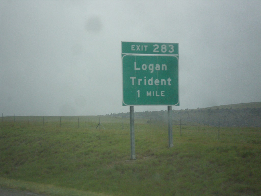
I-90 West - Exit 283
I-90 west approaching Exit 283 - Logan/Trident.
Taken 05-15-2016
Three Forks
Gallatin County
Montana
United States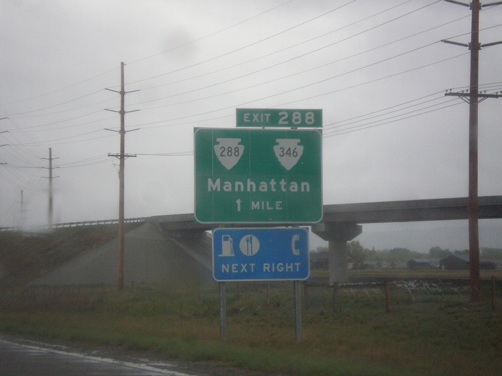
I-90 West - Exit 288
I-90 west approaching Exit 298 - MTS-288/MTS-346/Manhattan.
Taken 05-15-2016

 Manhattan
Gallatin County
Montana
United States
Manhattan
Gallatin County
Montana
United States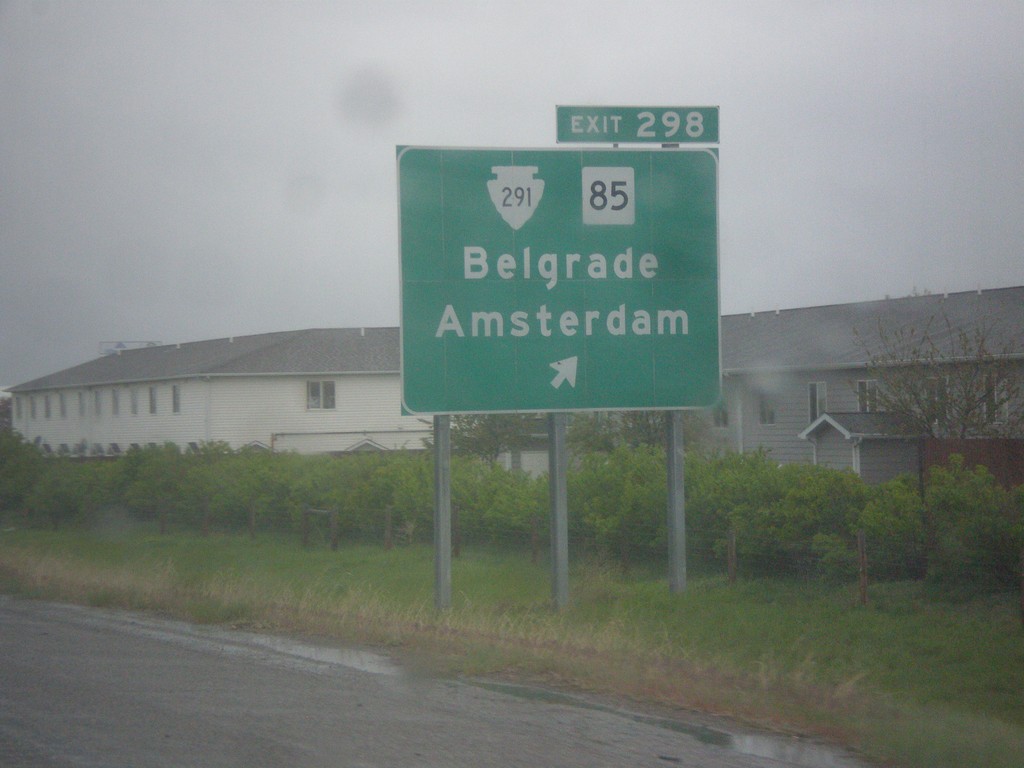
I-90 West - Exit 298
I-90 west at Exit 298 - MTS-291/MT-85/Belgrade/Amsterdam.
Taken 05-15-2016

 Belgrade
Gallatin County
Montana
United States
Belgrade
Gallatin County
Montana
United States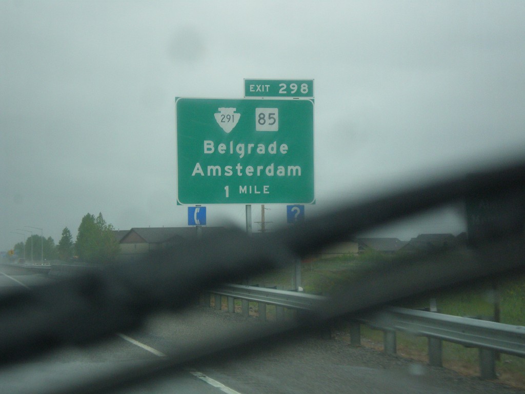
I-90 West - Exit 298
I-90 west approaching Exit 298 - MTS-291/MT-85/Belgrade/Amsterdam.
Taken 05-15-2016
Belgrade
Gallatin County
Montana
United States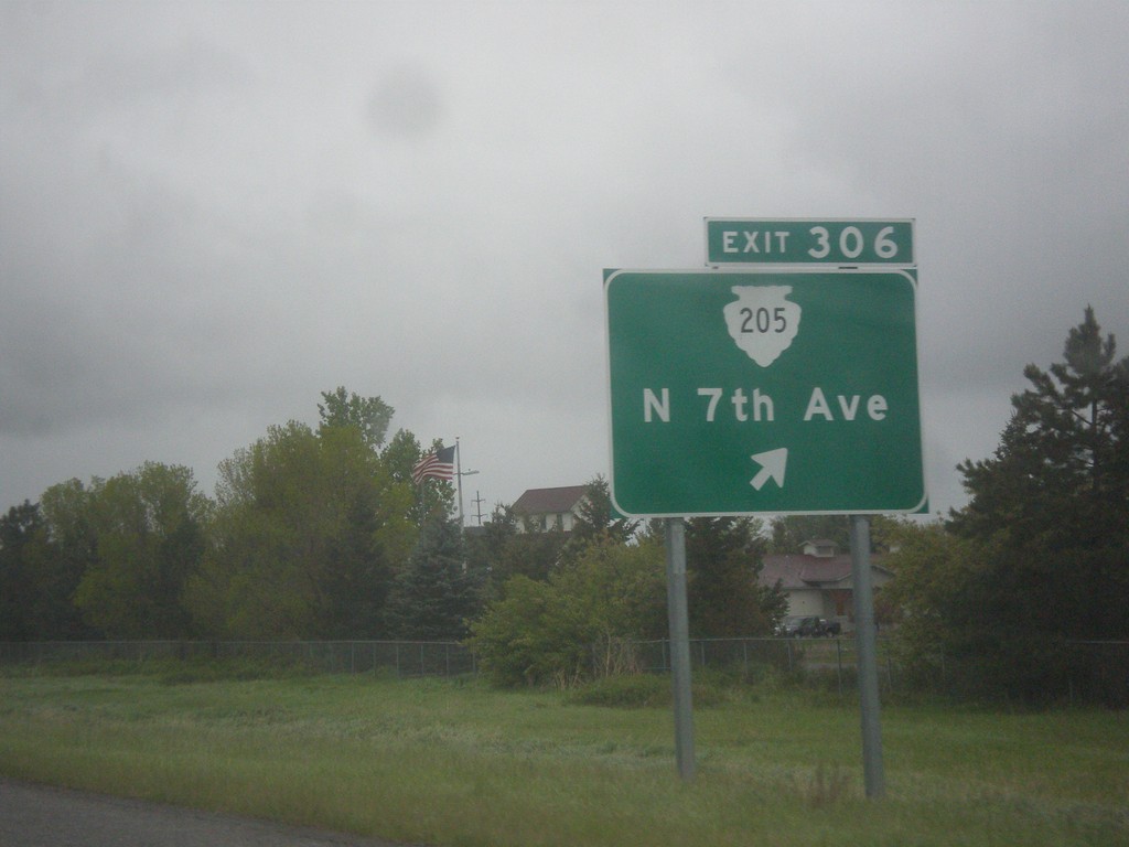
I-90 West - Exit 306
I-90 west approaching Exit 306 - MTS-205/N. 7th Ave. This is the west end of the Bozeman business loop.
Taken 05-15-2016
 Bozeman
Gallatin County
Montana
United States
Bozeman
Gallatin County
Montana
United States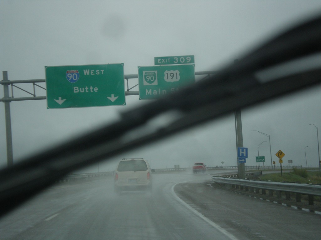
I-90 West - Exit 309
I-90 west at Exit 309 - BL-90/US-191/Main St. US-191 south leaves I-90 westbound here. I-90 continues west to Butte.
Taken 05-15-2016
 Bozeman
Gallatin County
Montana
United States
Bozeman
Gallatin County
Montana
United States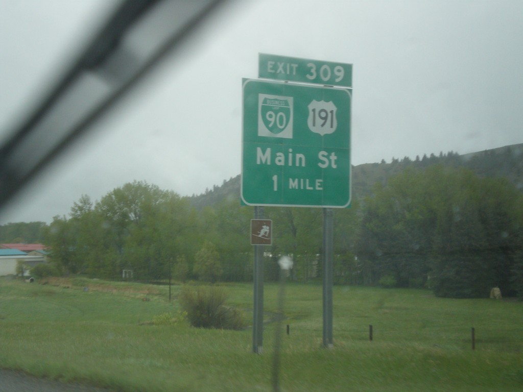
I-90 West - Exit 309
I-90 west approaching Exit 309 - BL-90/US-191/Main St. US-191 south leaves I-90 westbound here. Use US-191 south for the west entrance of Yellowstone National Park at West Yellowstone, Montana. This is the eastern end of the Bozeman business loop.
Taken 05-15-2016
Bozeman
Gallatin County
Montana
United States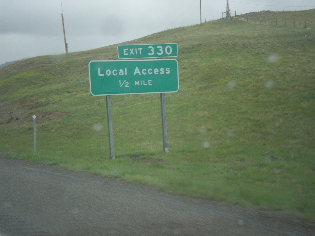
I-90 West - Exit 330
I-90 west approaching Exit 330 - Local Access. This is the western end of the Livingston business loop.
Taken 05-15-2016
Livingston
Park County
Montana
United States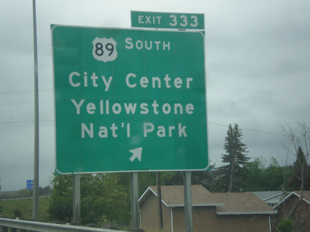
I-90 West - Exit 333
I-90 west at Exit 333 - US-89 South/(Livingston)City Center/Yellowstone National Park. US-89 south leaves I-90 westbound here. Use US-89 south for the north entrance of Yellowstone National Park at Gardiner, Montana.
Taken 05-15-2016
 Livingston
Park County
Montana
United States
Livingston
Park County
Montana
United States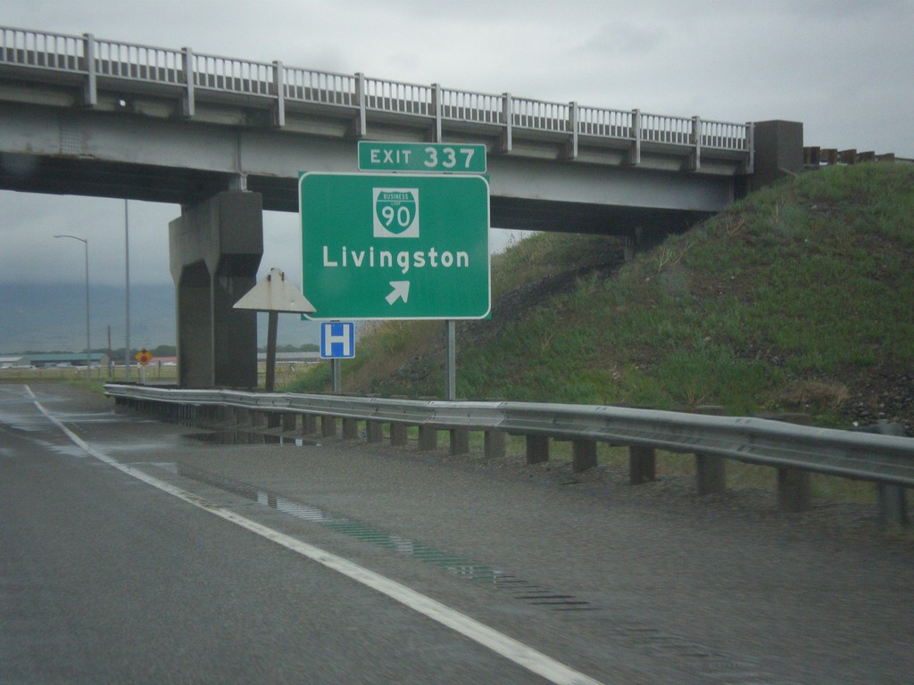
I-90 West - Exit 337
I-90 west at Exit 337 - BL-90/Livingston.
Taken 05-15-2016
Livingston
Park County
Montana
United States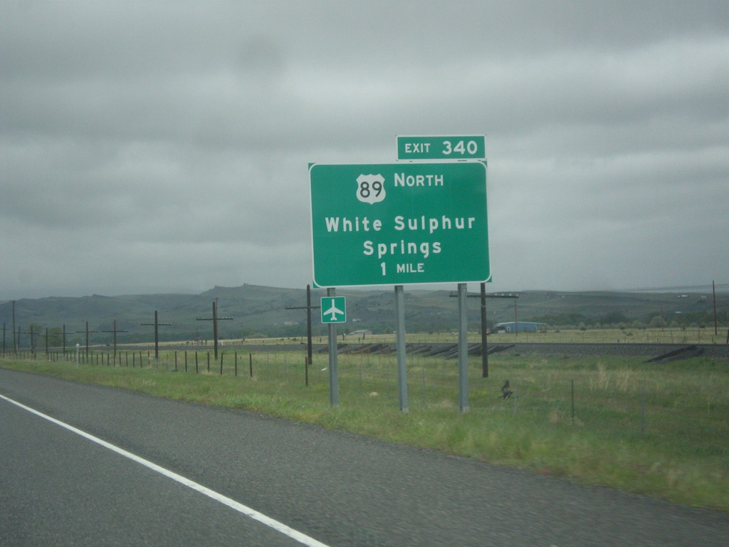
I-90 West - Exit 340
I-90 west approaching Exit 340 - US-89 North/White Sulphur Springs.
Taken 05-15-2016
Livingston
Park County
Montana
United States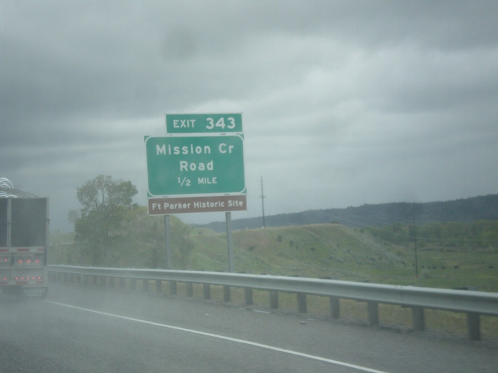
I-90 West - Exit 343
I-90 west approaching Exit 343 - Mission Creek Road.
Taken 05-15-2016
Livingston
Park County
Montana
United States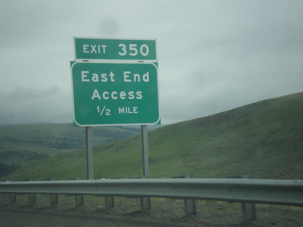
I-90 West - Exit 350
I-90 west approaching Exit 350 - East End Access.
Taken 05-15-2016
Big Timber
Park County
Montana
United States