Signs Tagged With Big Green Sign
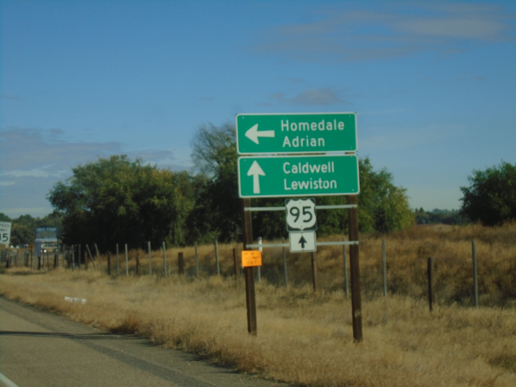
US-95 North - S Main St. (Homedale) Jct
US-95 North - S Main St. Junction. Use South Main St. for access to Homedale and Adrian (Oregon - via ID-19). Continue north on US-95 to Caldwell and Lewiston.
Taken 10-19-2024
 Homedale
Owyhee County
Idaho
United States
Homedale
Owyhee County
Idaho
United States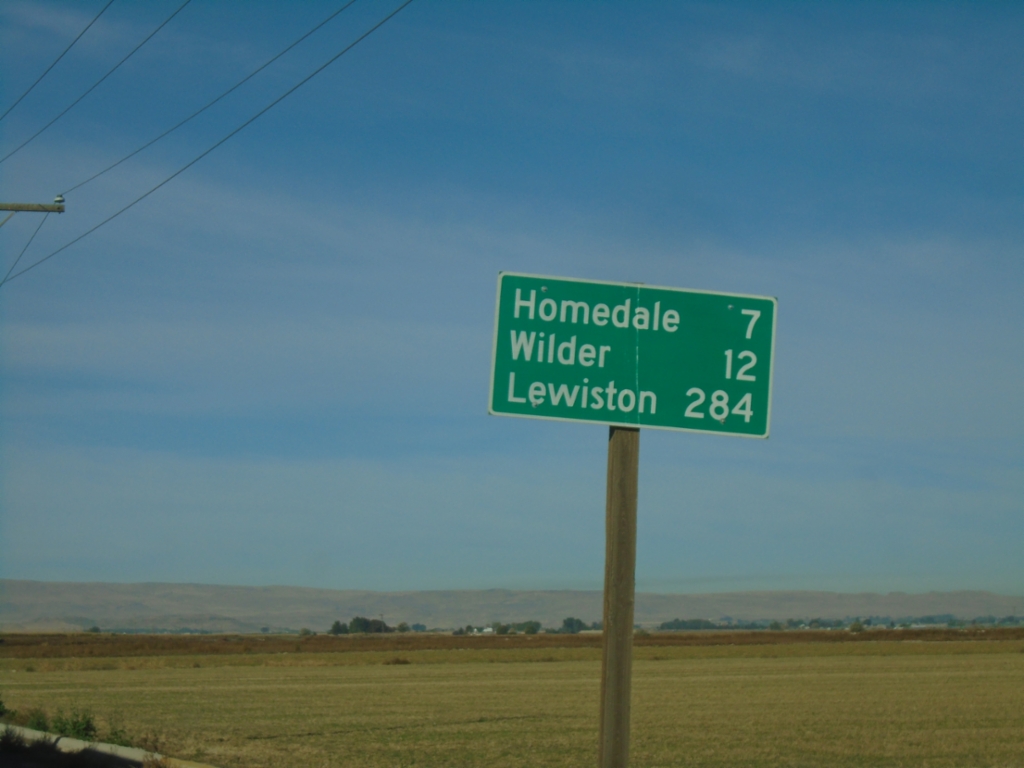
US-95 North - Distance Marker
Distance marker on US-95 north. Distance to Homedale, Wilder, and Lewiston.
Taken 10-19-2024
Marsing
Owyhee County
Idaho
United States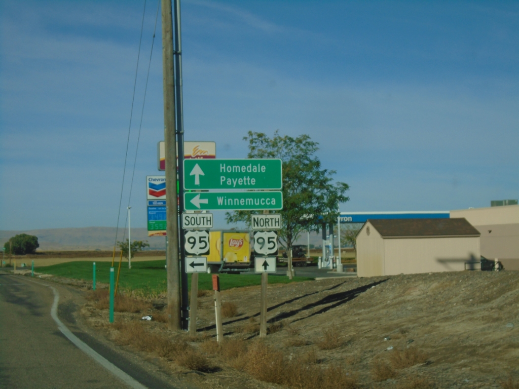
End ID-55 South at US-95
End ID-55 South at US-95. Use US-95 north to Homedale and Payette. Use US-95 south to Winnemucca (Nevada).
Taken 10-19-2024
 Marsing
Owyhee County
Idaho
United States
Marsing
Owyhee County
Idaho
United States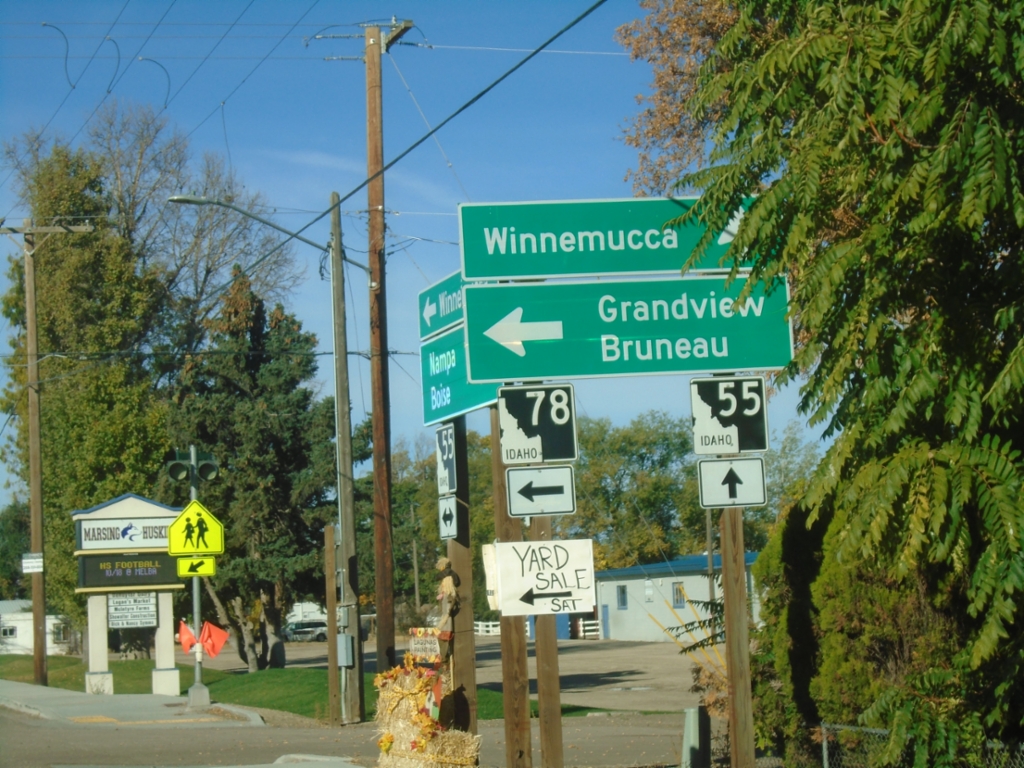
ID-55 South at ID-78
ID-55 south at ID-78 east to Grandview and Bruneau. Continue south on ID-55 for Winnemuuca (Nevada), via US-95 south.
Taken 10-19-2024
 Marsing
Owyhee County
Idaho
United States
Marsing
Owyhee County
Idaho
United States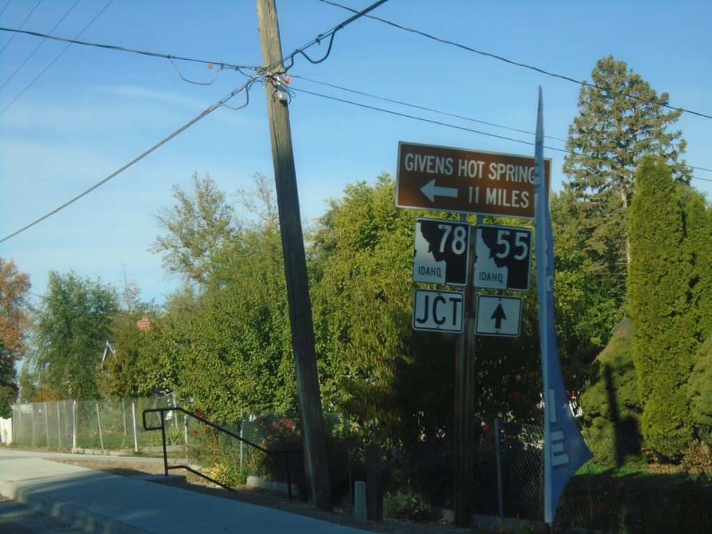
ID-55 South Approaching ID-78
ID-55 South approaching ID-78 east to Givens Hot Springs.
Taken 10-19-2024
Marsing
Owyhee County
Idaho
United States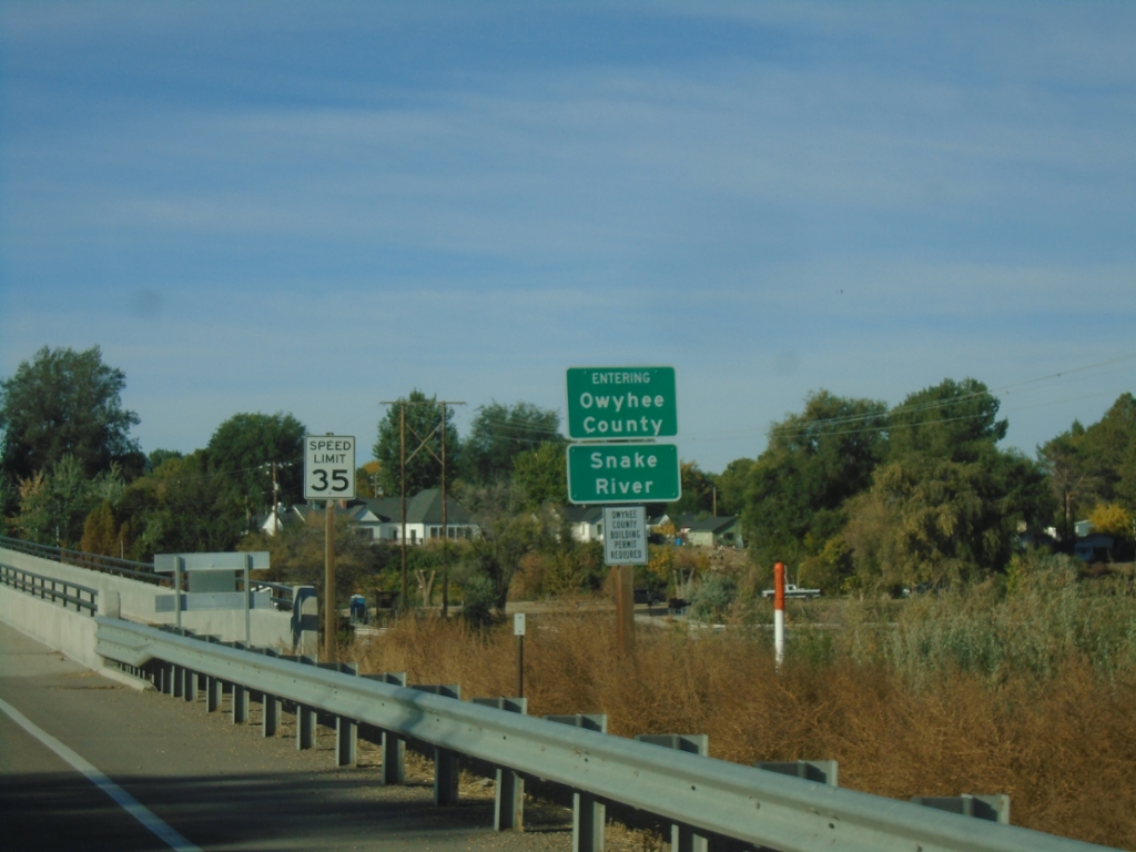
ID-55 South - Entering Owyhee County
ID-55 south - Entering Owyhee County/Snake River.
Taken 10-19-2024
Caldwell
Canyon County
Idaho
United States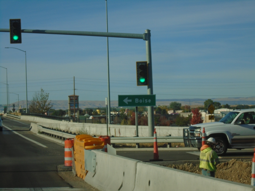
Karcher Road West at I-84/US-30 East/ID-55 North
Karcher Road West at I-84/US-30 East/ID-55 North (Exit 33) to Boise.
Taken 10-19-2024

 Nampa
Canyon County
Idaho
United States
Nampa
Canyon County
Idaho
United States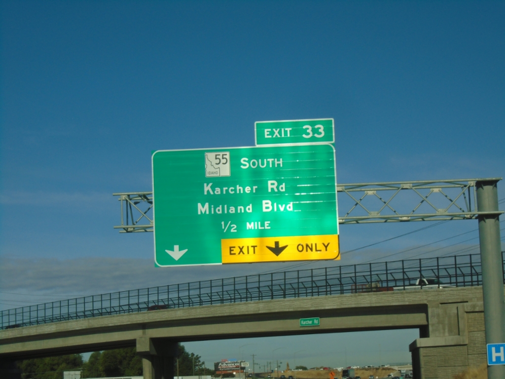
I-84 West - Exit 33
I-84 west approaching Exit 33 - ID-55 South/Karcher Road/Midland Blvd. ID-55 south leaves I-84/US-30 westbound.
Taken 10-19-2024
Nampa
Canyon County
Idaho
United States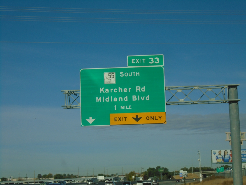
I-84 West - Exit 33
I-84 west approaching Exit 33 - ID-55 South/Karcher Road/Midland Blvd. ID-55 south leaves I-84 westbound.
Taken 10-19-2024
Nampa
Canyon County
Idaho
United States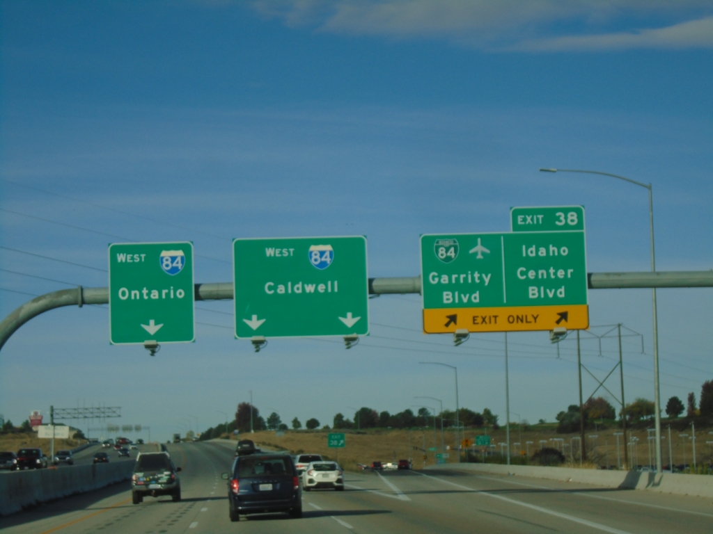
I-84 West - Exit 38
I-84 west at Exit 38 - BL-84/Garrity Blvd./Idaho Center Blvd. I-84 heads west towards Caldwell and Ontario (Oregon).
Taken 10-19-2024
 Nampa
Canyon County
Idaho
United States
Nampa
Canyon County
Idaho
United States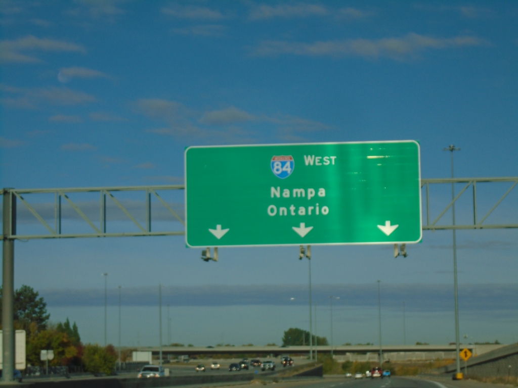
I-84 West - Nampa/Ontario
Overhead for I-84 West - Nampa/Ontario (Oregon) on I-84 just west of the I-84/I-184 junction.
Taken 10-19-2024
Boise
Ada County
Idaho
United States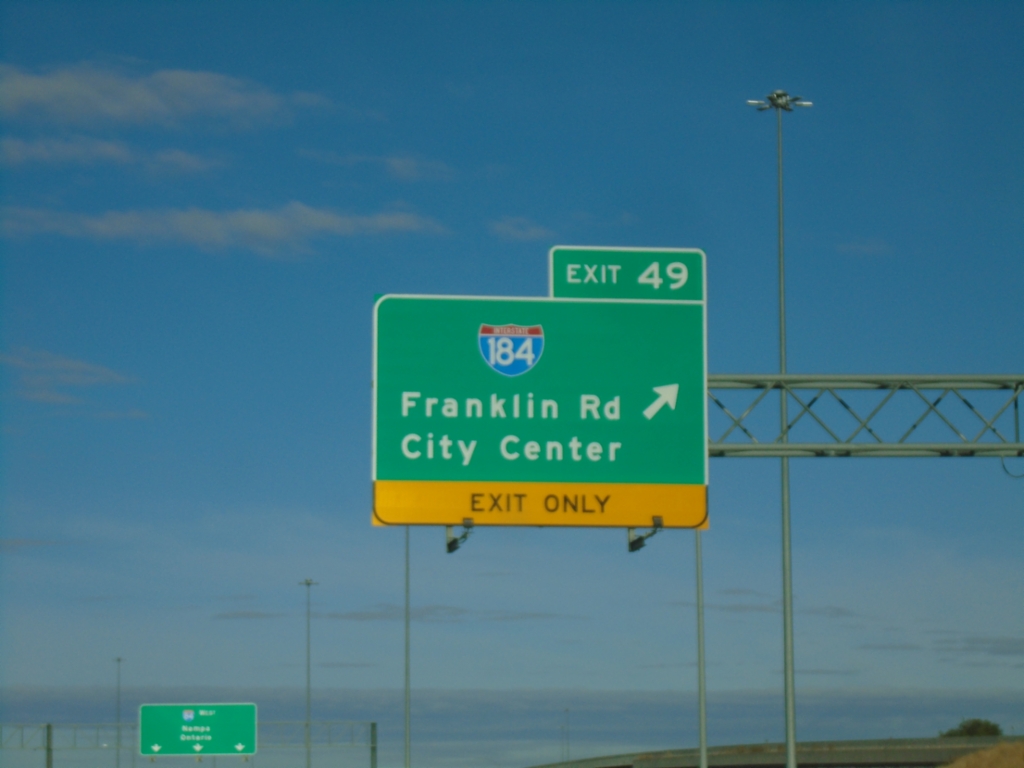
I-84 West - Exit 49
I-84 west at Exit 49 - I-184/Franklin Road/City Center.
Taken 10-19-2024
 Boise
Ada County
Idaho
United States
Boise
Ada County
Idaho
United States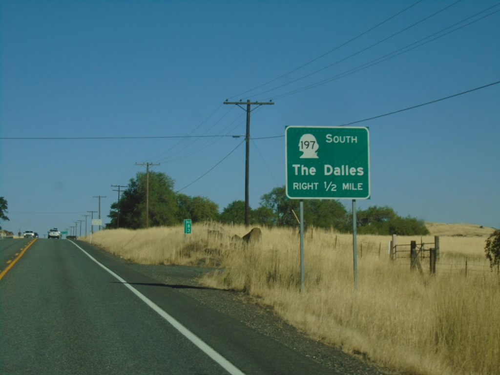
WA-14 East Approaching US-197
WA-14 East approaching US-197 south to The Dalles (OR). The US-197 shield is incorrectly displayed as a Washington state highway shield.
Taken 09-28-2024

 Lyle
Klickitat County
Washington
United States
Lyle
Klickitat County
Washington
United States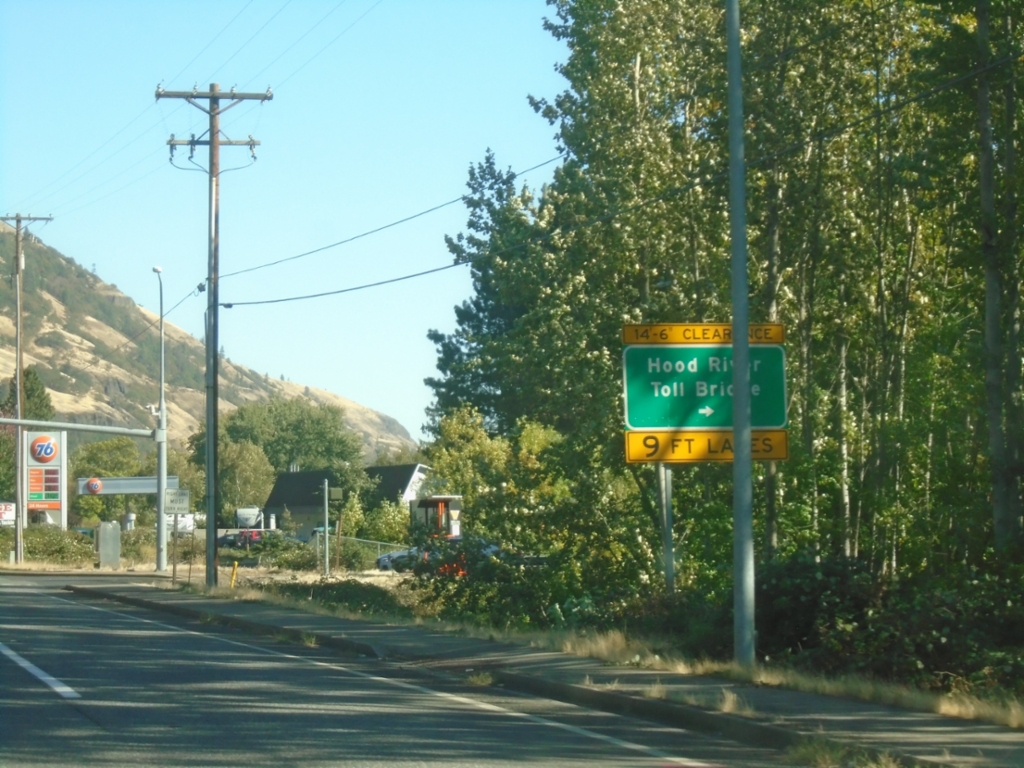
WA-14 East at Hood River Toll Bridge
WA-14 East at Hood River Toll Bridge over the Columbia River.
Taken 09-28-2024
White Salmon
Klickitat County
Washington
United States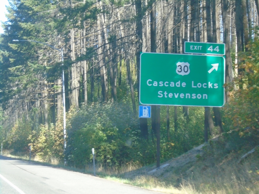
I-84 East - Exit 44
I-84 east at Exit 44 - US-30/Cascade Locks/Stevenson (WA). US-30 leaves I-84 eastbound here, and rejoins the freeway on the the east side of Cascade Locks.
Taken 09-28-2024
Cascade Locks
Hood River County
Oregon
United States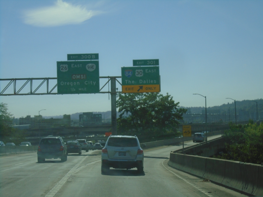
I-5 South - Exits 301 and 300B
I-5 south at Exit 301 - I-84/US-30 East/The Dalles. Approaching Exit 300B - US-26 East/OR-99E/OMSI/Oregon City. This is the western end of I-84.
Taken 09-28-2024


 Portland
Multnomah County
Oregon
United States
Portland
Multnomah County
Oregon
United States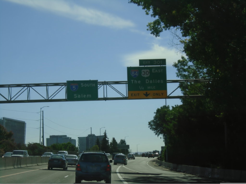
I-5 South Approaching Exit 301
I-5 South approaching Exit 301 - I-84/US-30 West/The Dalles. I-84 eastbound begins here, and ends in northeastern Utah. Continue on I-5 south for Salem.
Taken 09-28-2024
Portland
Multnomah County
Oregon
United States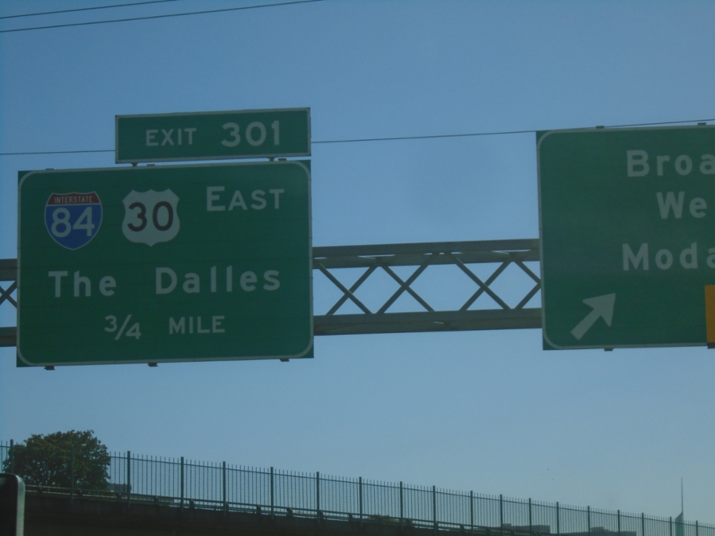
I-5 South - Exit 301
I-5 south approaching Exit 301 - I-84/US-30 East/The Dalles.
Taken 09-28-2024
Portland
Multnomah County
Oregon
United States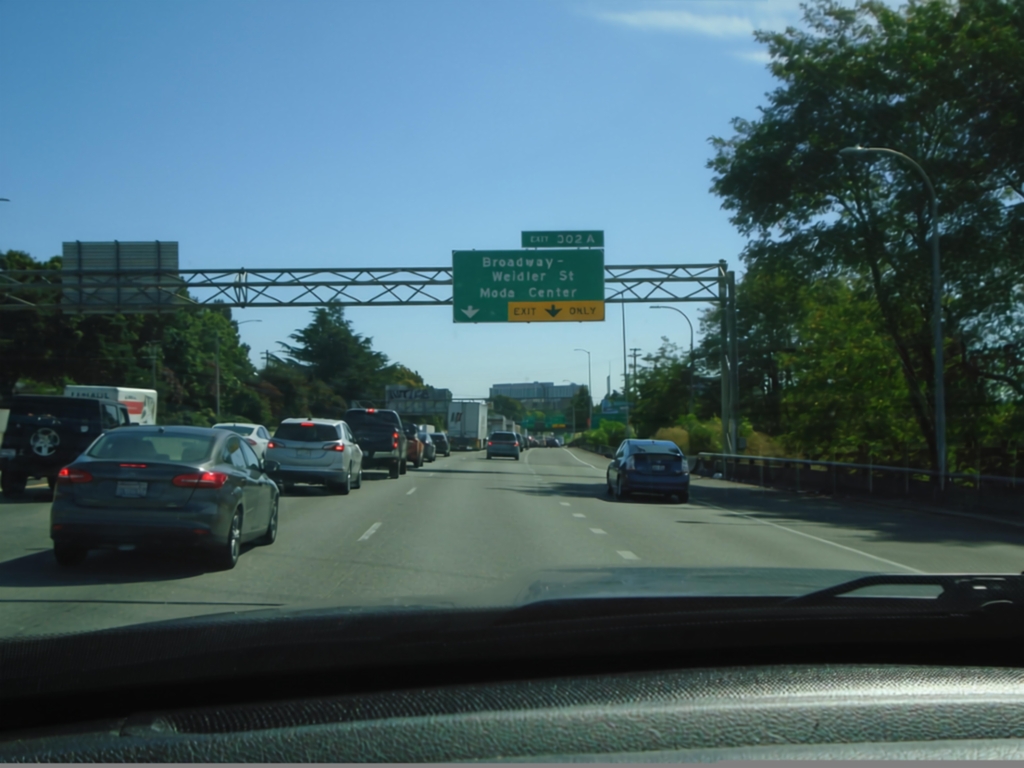
I-5 South - Exit 302A
I-5 south approaching Exit 302A - Broadway - Weidler St./Moda Center.
Taken 09-28-2024
Portland
Multnomah County
Oregon
United States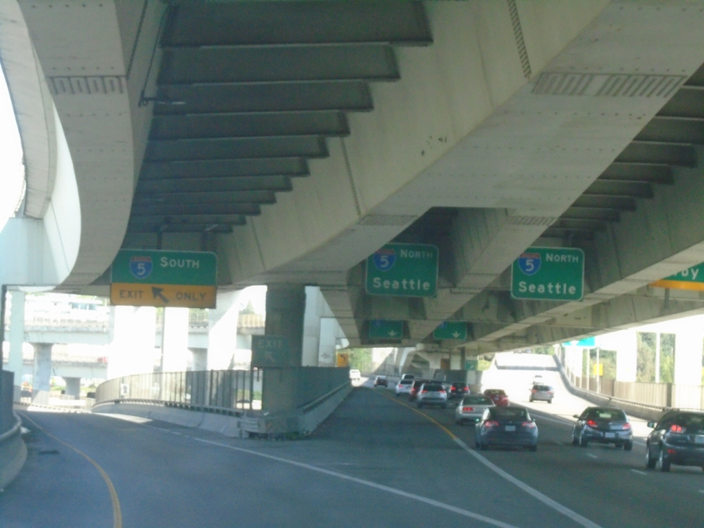
I-405 North at I-5
End I-405 North at I-5. Use left lane for I-5 South; middle lanes for I-5 North/Seattle.
Taken 09-28-2024
 Portland
Multnomah County
Oregon
United States
Portland
Multnomah County
Oregon
United States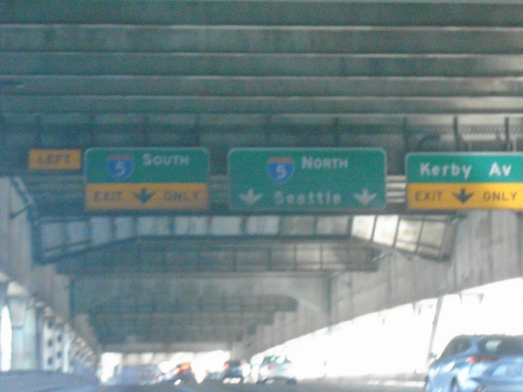
I-405 North Approaching I-5 and Kirby Ave.
I-405 North approaching I-5 and Kirby Ave. Taken on the lower deck of the Fremont Bridge.
Taken 09-28-2024
Portland
Multnomah County
Oregon
United States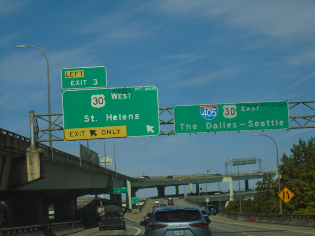
I-405 North Exit 3
I-405 north at Exit 3 - US-30 West/St. Helens. I-405 North/US-30 East continue to The Dalles-Seattle.
Taken 09-28-2024
Portland
Multnomah County
Oregon
United States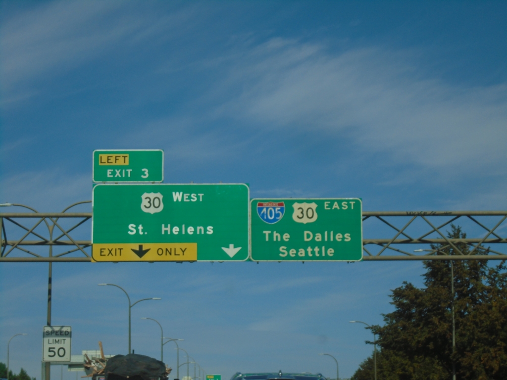
I-405 North - Exit 3
I-405 north approaching Exit 3 - US-30 West/St. Helens. Continue on I-405 North/US-30 West for Seattle (via I-5) and The Dalles (via US-30 and I-84).
Taken 09-28-2024
Portland
Multnomah County
Oregon
United States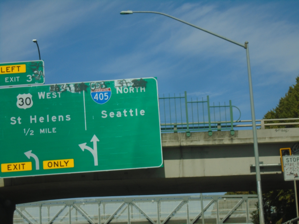
I-405 North - Exit 3
I-405 north approaching Exit 3 - US-30 West/St. Helens. Continue north on I-405 to Seattle.
Taken 09-28-2024
Portland
Multnomah County
Oregon
United States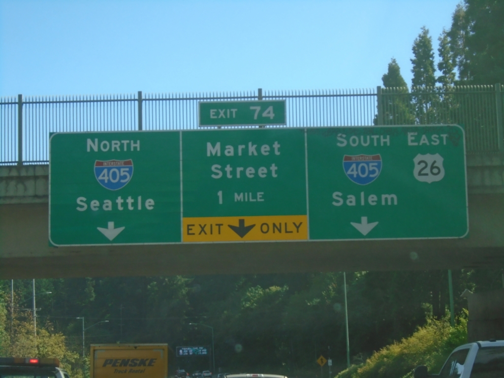
US-26 East- Exit 74
US-26 east approaching Exit 74 - I-405 North/Seattle, Market St., I-405 South/US-26 East/Salem.
Taken 09-28-2024
Portland
Multnomah County
Oregon
United States